Author: Robert Bruegmann

  • History, Landscape, Beauty on the American Freeway

    Freeways, particularly urban freeways, have had a bad press for several decades now.  They are accused of despoiling scenery, destroying habitat and causing urban sprawl.  Many observers report with glee on the latest news of a small segment of urban freeway being dismantled.

    This blanket condemnation makes it easy to overlook the remarkable contribution that these freeways have made to the American economy and to American culture.  It is hard to imagine the growth in productivity in the country during the postwar years without these roads, which vastly increased the mobility of goods and people and connected parts of the country together in ways that were unprecedented.

    The constant criticism also makes it difficult to appreciate these roads as cultural artifacts and a wonderful way to see the country.  This is all the more surprising since Americans in recent years have been discovering the rich legacy of our nation’s highways. There has been spate of books that celebrate travel on America’s pre-freeway-era highways. Many authors wax eloquent over the remaining motels, fast food restaurants and drive in theatres along US 66 or advise motorists on finding abandoned segments of roadway by passed by later highway alignments.   There has also been a remarkable surge of interest in America’s parkways, from the earliest parkways like the Bronx River Parkway in Westchester County New York, started in 1907, to parkways at the end of the parkway era in the years immediately before and after World War II when they gradually became more like freeways, for example the Arroyo Seco Parkway in Los Angeles, or the later segments of Lake Shore Drive in Chicago, the Taconic Parkway in New York State or the George Washington Parkway outside Washington.   

    America’s postwar freeways merit a similar rediscovery.   I think that one of the biggest obstacles to appreciating them has been a question of scale.  Driving along a two-lane roadway it is possible to pull off the pavement and look at an historic courthouse or a particularly interesting agricultural landscape or early gasoline station. That is not possible on a freeway. It is also true that the engineers who designed the nation’s postwar freeways were probably less conscious of the aesthetic dimensions of the roadways than the designers of the German autobahn, who set a standard for integration of landscape and roadway  never surpassed, or American designers like landscape architect Gilmore Clarke who played important role in designing the parkways of metropolitan New York.   There is, moreover, no doubt that the push to accommodate increasing traffic loads and to make freeways safer in this country has led to a certain uniformity of standards that some people find boring.  Finally, the proliferation of sound walls over the last few decades all too often makes driving through urban areas like driving through a tunnel. 

    Still, there is no better way to get a good view of the larger features of the American landscape or cityscape than looking through the windshield of an automobile rolling along a freeway at 65 miles per hour. At that speed it is often easier than on a slower road to appreciate the changes that occur in plant species as the highway climbs a steep ridge or to appreciate the way massive cuts to lower the grades on the climb over a hill that provide a graphic illustration of the underlying geology.  It might be difficult for many people to appreciate long stretches of flat country but, if a driver can put herself into the proper frame of mind, this experience can have its own rewards because of the way it accentuates the scale of the landscape. Even the billboards, which many drivers consider simply objectionable intrusions into the natural landscape, can, by their style and content, illustrate a great many regional differences.

    And fortunately, there has been over the last two decades a growing recognition of the aesthetic dimensions of freeways.   In some ways this marks a reversion to ideas that were common in the parkway era when there was almost always a conscious attempt to integrate road and landscape into a successful composition reflecting  the landscape and culture of the region through which it passed. 

    A pioneer postwar example of this push to bring conscious aesthetic design to the freeway can be seen in I-280, the Junipero Serra freeway, which runs between San Francisco and San Jose.  Here the engineers worked with Lawrence Halprin, the landscape architect, and architect Mario Ciampi to create a road that was widely considered the “most beautiful freeway in the world” when the initial segment was opened in the 1960s.  This highway, with its careful alignment, minimizing cut and fill, and the bold, sculptural concrete overpasses does little to diminish the spectacular landscape of the San Francisco Peninsula.  In fact it affords a wonderful way to experience the golden hills on one side of the roadway and the coastal range on the other, often seen in the morning or late afternoon with fog pouring over the crest.

    In recent years the highway departments in an increasing number of American states have attempted to be more attuned to the aesthetic dimensions of freeways and of the places through which the roads run.   Wildflowers now bloom in medians and margins of a great many American freeways.   In arid landscapes engineers and landscape architects have worked to preserve native plants and use them as elements in a kind of idealized desert landscape in the median and along the berms.    In one of the most impressive achievements, a twelve mile stretch of I-70 passing through the tortuously narrow Glenwood Canyon west of Denver, opened in 1992, the designers went to great length to fit the roadway into the landscape in the least obtrusive way possible.  They accomplished this by splitting the roadway alignments, reducing the section of the roadway structure to a minimum, cantilevering both alignments from the canyon walls to reduce their bulk, pushing tunnels through the most difficult spurs of land and even treating the rocks that were scarred by excavation so they would not produce jarring juxtapositions.

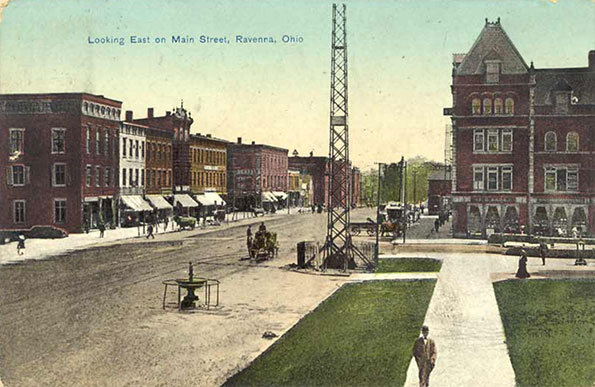
    Even the urban freeway, target of the most vociferous criticism, offers interesting perspectives for those willing to look.  Unlike the case in much of Europe, where planners have often attempted to create a parkway-like driving experience by providing a wide buffer between the roadway and nearby urban areas and tightly restricting new development along the highways, American freeways have become the new main streets of many cities.  Driving along the ring roads around American’s large cities can offer some of the most compelling views of these metropolitan areas. For the motorist driving along I-80, the Ohio Turnpike, there is the view from the giant viaduct crossing the Cuyahoga River.  There, 20 miles to the north, up the heavily wooded deep gash created by the river, the gleaming tip of the Key Bank Building peaks out  above the intervening ridges in clear weather, unfortunately all too rare in Northeast Ohio.  Likewise, very few urban views can compare with the panorama that suddenly unfolds for motorists as, emerging from I-376’s Fort Pitt Tunnel under Mount Washington, they suddenly burst out onto a bridge over the Monongahela River and a view of the Golden Triangle and the entire skyline of Pittsburgh. 

    A drive along a city’s freeways is often the best way to get a good grasp of a region’s economic geography.   It would be hard to miss the contrast between the view from the Indiana Toll Road across the grimy industrial landscape of steel mills and refineries just east of Chicago, on the one hand, with the landscape of heavily planted berms and expensive new houses along the Tri-State Expressway in the north suburbs.

    Many of the earliest freeways have crossed the 50 year threshold and deserve a closer look as some of the country’s most important historical and cultural artifacts.  And they provide a wonderful way to observe America’s landscape and cityscape.


    Taconic State Parkway north of New York City.  The New York area had the first and largest set of parkways in the nation.  The Taconic, running along the Taconic Mountains from the Kensico Dam in Westchester County to Chatham near Albany, was not finished until 1960, but it maintains the earlier parkway standards rather than those of the later freeway era.   Because of its careful alignment and roadway design by landscape architect Gilmore Clarke and the beauty of the rugged countryside which it runs, it remains one of the country’s great driving experiences.


    I-280, Junipero Serra freeway, south of San Francisco.  Although a much wider highway than the prewar parkways, this road, constructed in the 1960s, maintains much of the feel of the earlier parkways though the use of alignments carefully fitted into the rolling hills, integrating the road beautifully into the spectacular landscape of the San Francisco peninsula.    


    I-20 east of Birmingham Alabama.  The undulating line that marks the edge of the pine forest and the beginning of the mowed grass in the freeway margins recalls the long curving vistas of English 18th century picturesque landscape tradition. On an overcast morning the resemblance to the British landscape tradition is particularly striking.


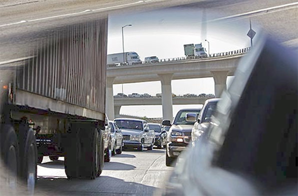
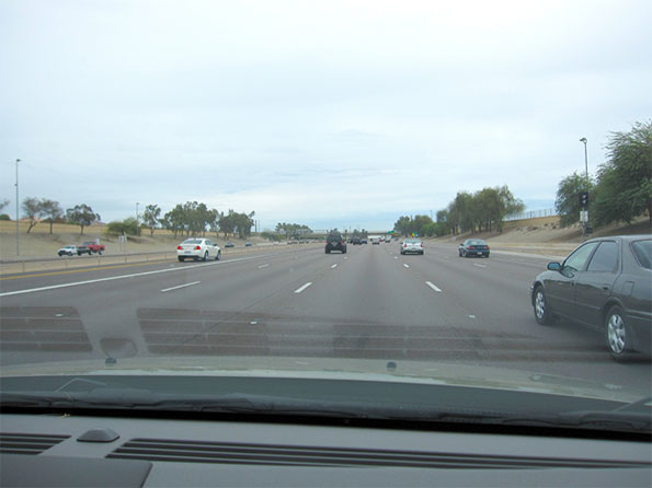
    I-10 and I-215 at Colton, California.   No place in the United States is so associated with freeways as the Los Angeles region, but actually this region has fewer lane miles of freeway than most large American metropolitan areas.  Because freeway construction pretty much stopped in the 1970s but the population continued to grow and the density rose, this region has some of the most congested roads in the country.  If there is any consolation, they offer some remarkable displays of engineering bravado and urban intensity.


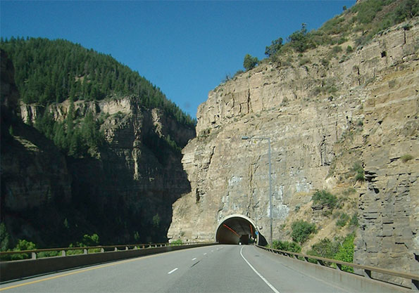
    I-70 west of Denver, Colorado.  The construction of this roadway through the Glenwood Canyon in the Rockies is both an engineering feat and an aesthetic tour de force.  By separating the alignments and cantilevering the roadway from the canyon wall, the designers were able to minimize the visual impact of the road and provide spectacular vistas for travelers.

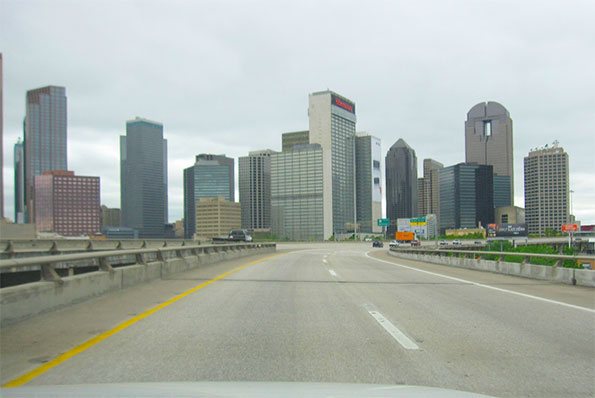
    US 75 approaching downtown Dallas.  This short piece of roadway completes a loop around downtown Dallas that allows two interstate roads to bypass downtown.  A drive around the loop provides a kaleidoscopic sequence of views of tall buildings and a highly effective orientation to downtown Dallas.


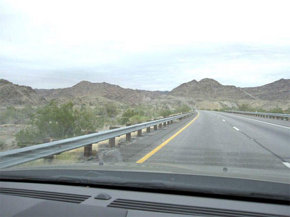
    I-10 east of Blythe Arizona.  Perhaps even more than in the East, the great distances of the American West make the freeway a lifeline for residents who live far from population centers.  The smooth roadway makes a striking contrast with the great rock outcrops and vast stretches of scrubland.


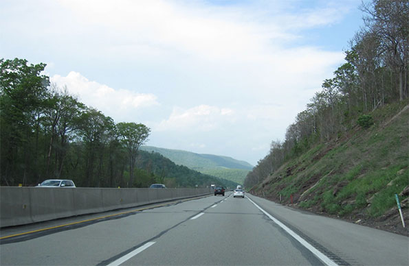
    I-80 and I-94 Pennsylvania Turnpike north of Pittsburgh.  The era of the parkway ended at about the time of the second world war as a new generation of freeways started to emerge.  One of the interesting features of the interstate system today is the way it provides testimony to the shifting ideals of roadway design.  Although large stretches of the Pennsylvania turnpike, whose initial segment opened in 1940, have been upgraded, the narrow right of ways and steep gradients of the older portions of the road as well as the streamlined design of the overpasses recall the transition from one age to the next.


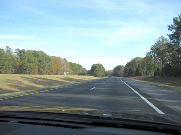
    I-20 between Covington and Augusta Georgia.  A classic piece of interstate road with the smooth ribbon of pavement gliding effortlessly through a landscape of low hills and dense forest.


    I-10 west of downtown Phoenix.  The state of Arizona has been particularly active in trying to create an appropriate landscape for the state’s highways.   They have pioneered techniques for saving cacti and other native species in the path of the roadway and then re-installing them alongside the new roads to create an idealized desert landscape.


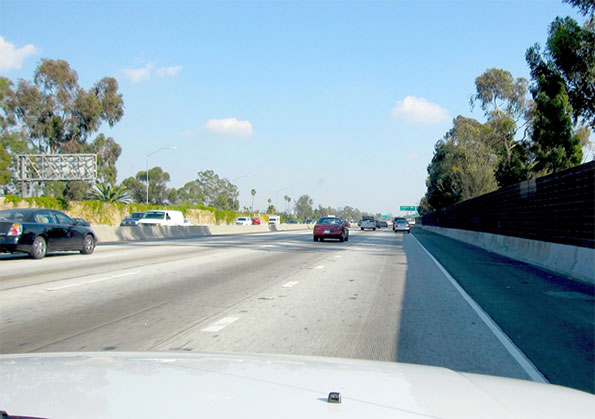
    I-10 approaching downtown Los Angeles, California.  The advent of sound walls has changed the driving experience in some profound ways.  In places it has severed the visual connection between the roadway and the city around it.  On the other hand, in some places, as here, when vines and other plants grow up over the walls and trees overtop them, the result is a curious but not entirely unpleasant sensation of floating through a city without being part of it.  Until the traffic backs up, of course.


    I-27 between Amarillo and Lubbock, Texas.  The long flat stretches of the Llano Estacado of northwest Texas produce an almost hypnotic effect.  Even highway signs and telephone poles take on a monumental character, and train elevators loom up in the distance like the skyline of a great city.


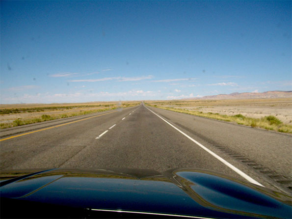
    I-70 in eastern Utah.   Although freeways can seem intrusive and over-scaled in the city, they are often dwarfed by the huge open spaces in states like Utah or Nevada.


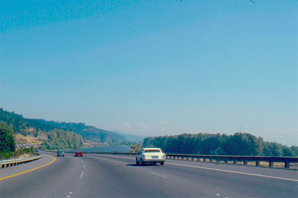
    I-5 south of Longview, Washington.   A trip across the country on the interstate roadway system allows for a panoramic view of the regional differences between, for example, the flat, semi-tropical landscape of central Florida and the deep green evergreen forests of the Pacific Northwest.


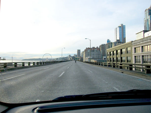
    State route 99, the Alaskan Way Viaduct, downtown Seattle.   Completed in 1953, this roadway, this roadway like a number of freeways built in the heart of American cities, created a barrier in the city.  Some of these highways, for example the Central Artery in Boston have been relocated underground. In other cases, like the Embarcadero Freeway in San Francisco the replacement was a surface boulevard.  In this case, after a considerable debate, officials made the decision to create a massive tunnel.  It is difficult to argue that a road like this should be preserved, given its structural problems and the way it cuts off Seattle from its waterfront.  Still, it is almost inevitable that some of the drivers navigating the new tunnel will keenly miss the spectacular urban spectacle that unfolds today as they sweep along the viaduct.

    Robert Bruegmann is professor emeritus of Art history, Architecture and Urban Planning at the University of Illinois at Chicago.

  • Historic Heritage of the Rust Belt

    I’ve been spending a lot of time in Ravenna recently. No, not the town in Italy with its early Christian buildings and glittering mosaics. I mean Ravenna, Ohio, a small industrial city of some 12,000 people near Akron. 

    Along with Akron and Cleveland, Ravenna flourished as an industrial center in the early 20th century.  In recent decades, however, its economy, like most of northeastern Ohio’s, has been sluggish at best, and the town hasn’t changed much physically for many years except for occasional demolitions at the center and new subdivisions at the periphery. News from Ravenna rarely makes it even into the Cleveland papers. It is certainly not known for its architecture.  It has some perfectly good late 19th and early 20th century houses and commercial buildings, but none of these is likely to draw tourists.

    One of the very few really remarkable things about Ravenna is a 150-foot high flagpole erected in 1893.  Almost absurdly high for the scale of the city, it is a fascinating product of late 19th century American engineering ingenuity and vernacular design as well as a reflection of patriotism and civic pride. Standing right in the center of the city, it is arguably the most notable monument not just of Ravenna but for miles around.

    Unfortunately, township trustees now plan to demolish it.


    Image:  Ravenna flagpole viewed from East Main Street, Ravenna Ohio.  Photo by Tom Riddle, 2012

    The battle over the Ravenna flagpole says a good deal about the fate of the great manufacturing belt that stretches along the southern edge of the Great Lakes. Once one of the greatest manufacturing regions of the world, it has struggled mightily since World War II as aging infrastructure, obsolete industrial facilities, a gap in educational attainment, and non-competitive wages have left it fighting to find its place in the late 20th, not to mention the 21st century economy.

    In many ways Ravenna is a microcosm of the larger region.  In Ravenna, as throughout the region, economic stagnation has taken a toll on the city’s built environment. Main Street has vacant storefronts and empty lots where stores used to stand. Some of the housing stock has started to deteriorate. 

    The biggest change in Ravenna, as in most Rust Belt cities, though, has been the transformation in the industrial landscape. In city after city from Duluth, Minnesota, to Rochester, New York, icons of American industry have vanished. The Homestead Steel works outside Pittsburgh has been largely demolished, replaced by a shopping mall. The same fate has befallen the LTV Steel plant in Cleveland and the great Western Electric complex on the boundary between Chicago and Cicero.


    Image:  Hawthorne Works Shopping Center in front of remaining tower of the Western Electric Hawthorne Works in Cicero Illinois

    Some of this demolition was necessary, even welcome, since many of these factories were located amidst densely populated neighborhoods and constituted a logistical and environmental nightmare. But much of the demolition has been motivated primarily by a desire to remove from sight embarrassing reminders of a previous era. Demolishing the factory, city fathers figure, better allows potential buyers of the site to appreciate a wonderful riverside location or proximity to downtown and the endless opportunities to build something new. 

    What has replaced those grand temples of industry, however, has usually been underwhelming, with late 19th century brick loft buildings reduced to rubble to make way for cheap one-story strip malls that neither employ a lot of workers nor generate a lot of tax revenue. The old urban identity has been destroyed, but there has been very little to take its place. 

    The process is akin to the efforts of men and women of a certain age who resort  to plastic surgery, hair implants and clothes more appropriate for a younger generation. These cosmetic efforts rarely fool anyone.  In fact, what they most clearly convey is a loss of confidence.  

    Fortunately there is a growing awareness that wholesale demolition of industrial fabric does not necessarily   prepare cities for their post-industrial future. This movement to save industrial heritage came into its own first in Britain, not surprisingly, since Britain was the cradle of the Industrial Revolution. For decades now important eighteenth and early nineteenth century industrial sites have been preserved, often as historic sites and tourist destinations.


    Image: Ironbridge in Coalbrookdale, Shropshire, England, named a World Heritage Site in 1986

    A similar thing has happened in the United States.


    Image:  Pawtucket, Rhode Island, Slater Mill, started 1793, now a National Historic Landmark.


     Old loft buildings have become residential condominiums, even in some rather unlikely places.

    Image: River Mill Condominiums along the Fox River in Oshkosh, Wisconsin, opened in 1986 in a building constructed for the Paine Lumber Company


    Image: Quaker Square, Akron, a hotel developed in 1980 in concrete silos built by the Quaker Oats Company in the 1930s and now owned by the University of Akron.

    The preservation of the industrial landscape that cannot be easily reused has been more problematic.   Even so, there has been a movement to preserve some of the most important examples both as testimony to the industrial heritage of their regions and as a way of showcasing the regions in which they are located, providing amenities for the citizens and attracting tourists.

    Germany has been a leader in this movement. The Voelklinger Huette outside Saarbrucken preserves an entire complex intact as a monument to the industrial heritage of the area.  Even more spectacular has been the transformation of large pieces of the Ruhrgebiet, the heart of Germany’s pre-World War II heavy industry, into a set of imaginative parks, museums and other institutions.


    Voelklingen Huette (Voelklingen Iron Works) near Saarbrucken, Germany. A UNESCO World Heritage site and museum.


    Duisburg Nord Landschaftspark (landscape park) in Duisburg, Germany, a coal and steel plant transformed into a public park according to designs done in 1991 by architect Peter Latz who retained as many of the old structures as possible.

    Of course, the Ravenna flagpole lacks the grandeur or the historical significance of these places. But it is an important historic relic in its own right and arguably as important for Ravenna as the great industrial complex at Duisburg is to the Ruhrgebiet.

    Erected in 1893 by the Van Dorn Iron Works of Cleveland, the flagpole was one of at least four similar or identical structures erected in the northeast of the United States. It appears that only the one at Palmyra, New York, still stands. Recently refurbished, the Palmyra pole seems to have been built as a mast for displaying banners of political candidates. 


    Image:  Post card of Main Street Ravenna showing the flagpole in front of the courthouse.


    Image:  Palmyra, New York, flagpole, fabricated, like the Ravenna pole, by the Van Dorn Iron Works of Cleveland. It has been recently restored.

    These flagpoles reflect late 19th century American engineering ingenuity. Earlier poles had usually been of wood. They frequently snapped in high winds and had to be replaced. When the Ravennans needed to replace their pole they used a new and improved technology available to them.

    The technology, involving the use of latticed steel boxes, was developed for the railroad and construction industry. The individual elements were not new. Steel had been replacing wrought and cast iron for a number of years. Truss bridges and other constructions using similar structural technologies had been well developed earlier in the century. Inexpensive steel and the techniques of constructing large structures out of it using rivets rather than bolts, however, was new. The technology was ideally suited to the construction of large structures of all kinds, notably bridges.


    The same qualities of strength and light weight that made it ideal for bridges also made it perfect for towers. All over Europe and America engineers used latticed towers not just for flagpoles, for but lighthouses, look-out stations, electric light towers and a host of other uses.


    Image:  Electric Light Tower, constructed in 1881 at the corner of Market and Santa Clara streets in San Jose, California to house arc lights intended to illuminate downtown.  It collapsed in December 1915.

     
    Image: A surviving “Moonlight Tower” in Austin, Texas.  Manufactured by the Fort Wayne Electrical Company for use in Detroit, 31 of the towers were purchased from the city of Detroit and re-erected in Austin.  In 1970 the remaining 17 towers were listed on the National Register of Historic Places. The city spent $1.3 million to dismantle and restore these towers in the early 1990s.  


    Image: Villingen, Germany, Aussichtsturm (Observation Tower) 1888. This 30 meter high tower, erected on a hill outside the village of Villingen, provided views over the surrounding countryside as far as the Alps.

    The grandest example of this structural technique is, of course, the Eiffel Tower, built for the Paris exposition of 1889. Although larger in scale than any of the other examples, it used many of the same materials and construction methods as the Ravenna flagpole. Initially heavily criticized by much of the artistic elite of the day as being essentially useless and much too big, the Eiffel Tower soon came to symbolize Paris to the world. No one would imagine demolishing it today.


    Image:  Paris, Eiffel Tower built for the 1889 Exposition. It reaches a height of  1015 feet using latticed steel elements and rivets similar to those used on the Ravenna flagpole

    The Ravenna pole, erected four years later was built as a monument to national pride and an affirmation of the place of the city of Ravenna in the larger American republic. The pole also had a more local significance. It would allow Ravennans for once to greatly outstrip their neighbors and rivals in Kent, 10 miles to the west. In fact, at the time of its completion, the pole must have been one of the taller flagpoles in America and one of the taller structures anywhere outside the largest cities.  Of course, by now it has been dwarfed, particularly in the last couple of decades when a new battle for flagpole superlatives has broken out, curiously enough this time in some of the most out-of-the-way corners of the globe.

    National Flagpole at Baku, Azerbaijan, at 545 ft. flagpole, briefly the world’s highest flagpole before being eclipsed by one in Tajikistan. Both were built by a company in San Diego.

    Even if now dwarfed by flagpoles in Azerbaijan, North Korea, and Tajikistan, the Ravenna flagpole still reflects the pride of a struggling industrial city. It has required periodic maintenance and has gotten into the news occasionally when some inebriated citizen has tried to climb it. However, for most Ravennans it has come to be so much taken for granted that citizens were stunned when they heard that the  Trustees of the Township of Ravenna, the body that has jurisdiction, decided that it was a legal liability, a drain on township resources and should be demolished. In response, a group of local citizens has stepped in and is fighting to maintain the pole, raising money toward its repair and trying to see if ownership can be transferred to a governmental entity or group of entities willing to maintain it.

    In one way, this is a fight about intangibles like local pride, patriotism, a desire to maintain historic heritage and a sense of place. Some people write off these sentiments as mere nostalgia. But preservation of this kind can have tangible consequences. No one is claiming that preserving the pole will generate vast new tourist revenues or solve basic economic problems. But the movement to save the flagpole rests on the notion that stewardship of historic heritage can play an important role in reminding everyone of the specific qualities of a place that made it successful in the past – and perhaps can be built upon to craft a better future.

    Robert Bruegmann is professor emeritus of Art history, Architecture and Urban Planning at the University of Illinois at Chicago.

  • Housing Affordability and Public Policy

    Nothing in the world today affects citizens more directly than the home in which they live.  And when it comes to housing no piece of recent research opens more interesting avenues of investigation than the Demographia International Housing Affordability Survey.

    Individuals and families across the economic and social spectrum all over the world are eager to gain as much control as they can over the place where they live.  They wish to make sure it cannot be taken away from them arbitrarily; they wish to control who has access to it and who can benefit from it; and, as much as possible, they wish to protect it against negative influences in the larger community around it.   

    This combination of goals sets up some inherent conflicts in every society.   What is good for a given individual or family is not necessarily good for a society as a whole, and what is good for society as a whole is not necessarily good for any given individual or family.  From this fundamental tension has sprung a bewildering set of arrangements for allocating and regulating land and residential structures on it.   At one end of the political spectrum have been societies in which land is owned in common and is supposed to be allocated to individuals and families on the basis of merit or need.  Such has been the case with many Utopian and Socialist societies.  At the other end of the spectrum have been societies where the individual ownership of land and homes is considered a bedrock condition of a democratic society, where ownership is widely dispersed, and individual rights and preferences have been zealously safeguarded from all but the most necessary intervention.   One of the best examples of this would have been the United States, Canada or Australia in the nineteenth century.  The trend over the last fifty years has been a convergence toward the middle of this spectrum as Socialist countries have abandoned the dream of complete common ownership and societies that traditionally were loath to interfere with individual property rights have adopted layer after layer of regulation intended to secure the health, safety and wellbeing of the larger society.

    Given the fundamental importance of housing in all societies, it is remarkable how little we know about the results of housing policies in various parts of the world.   In my own field of architectural and urban history, for example, if you were to ask even some of the greatest experts to compare what an average house or apartment unit in any two given cities looked like at some date in the past or even the present, what it would cost to buy and to operate them and what regulations would affect them, it is very unlikely that the individual would have more than rudimentary hunches.  Historians can tell you in great detail about the palaces, townhouses and country estates of the powerful and wealthy, then and now, and about some of the efforts at reform housing by the government or charitable organizations, but at least until recently, the lack of information about how and where ordinary individuals live has been remarkable. 

    Part of this neglect is due to a discredited but lingering attitude that history is made overwhelmingly by the rich and famous and not by the decisions of millions of ordinary citizens.  Part of it is simply that real estate ownership is now so dispersed and so intensely affected by local conditions that it is hard to quantify in ways that allow for comparative analysis.  Partly it has been due to a widespread belief that commerce and industry are the driving forces in the world economy and that housing is a by-product of the larger economy. This attitude is, of course, obviously wrong-headed, as the central role of residential real estate in the recent economic downturn has proved.  Residential real estate plays a huge and increasingly important role in the economy of every nation. 

    Given the obvious importance of housing, what should public policy be and the role of the individual, the developer, governmental agencies?  Is there an optimal size for cities, for housing units?  How much land should housing occupy?  Should housing be separated from or integrated with other uses?  Should government promote one kind of residential tenure over another, individual home ownership over rental or various kinds of collective ownership over individual property, for example?   Have the citizens of a given city or nation underinvested or overinvested in housing?  Are housing prices in line or out of line with individual and family incomes?   Unfortunately there has been very little data for anyone trying to find answers to questions like these. 

    It was against this backdrop that the appearance, in 2004, of the first international housing affordability survey by Wendell Cox and Hugh Pavletich was such a revelation.  It provided some of most reliable information ever compiled for those who wished to compare nations around the world with quite different housing policies.   Cox and Pavletich had their own point of view.  It is fair to say that both of them tend to favor market solutions to many of the most difficult questions about housing and how it is allocated and regulated, but their compilation of data, like the data found on Cox’s demographia.com website generally can stand on its own as one of the most impressive and reliable collections of comparative urban statistics to be found anywhere.

    The issue that appears to have been the principle motivation to compile this data was the rise of various forms of “Smart Growth” policies around the world.  Whether these policies were intended to enhance the environment or limit sprawl, they clearly had an effect on the price of housing, but what these effects were was very much in dispute.  In the United States, for example, the question of whether the growth boundary around Portland, Oregon, has had an effect in raising housing prices, as some observers claim, or that the dual focus on development at the center and regulation at the edge has kept housing prices reasonable, has raged for a number of years now.  The same debate has been joined in many other places, for example in Australia where the recent rise in prices has been particularly sharp and, given the vast extent of the country, the urban containment policies particularly contentious.

    Cox and Pavletich went out in search of the data they felt could answer questions of this kind.  Their conclusion, that the land use policies in places like coastal California, Vancouver, Britain and Australia, have dramatically driven up the cost of housing, and that the less intrusive policies of places like Atlanta and Houston has kept prices down has been controversial, but I think it is fair to say that a growing number of people who have looked at the figures have tended to agree that a good many well-meaning policies involving housing may be pushing up prices to such an extent that the negative side-effects are more harmful than the problems the policies were intended to correct.   These observers have also noted that measures that restrict land supply, slow growth in the immediate area where the policies are in place and push up housing prices can be very attractive to individuals who already own their own homes.

    In any case, the figures presented in this survey, like the collection of data on demographia.com more generally, are endlessly fascinating and very important.  They provide some basis for exploring issues that will figure importantly in discussions of housing policy for decades to come.

    Robert Bruegmann is professor emeritus of Art history, Architecture and Urban Planning at the University of Illinois at Chicago.
    ____

    Note: This article appeared as the Introduction of the 8th Annual Demographia International Housing Affordability Survey, released January 22, 2012

  • The Ambiguous Triumph of the “Urban Age”

    In its State of the Population report in 2007, the United Nations Population Fund made this ringing declaration:  “In 2008, the world reaches an invisible but momentous milestone: For the first time in history, more than half its human population, 3.3 billion people, will be living in urban areas.”

    The agency’s voice was one of many trumpeting an epoch-making event.  For the last several years, newspaper and magazine articles, television shows and scholarly papers have explored the premise that  because most of the world now lives in urban rather than in rural areas things are going to be, or at least should be, different.  Often the conclusion is that cities may finally get the attention they deserve from policy makers and governments.  This optimism dovetails nicely with a sizeable literature of urban advocacy chronicling the rejuvenation of central cities and extolling the supposed virtues of high-density city living, even predicting the withering away of the suburbs.

    This supposed triumph of the urban is fraught with ironies, however.   The first is that, rather than a simple rush of people from the hinterlands into the centers of high density cities, there has also been, within almost every urban area in the world, a significant move of the population outward, from dense city centers into peripheral suburban areas and beyond them into very low-density exurban regions.   

    We can use Paris as a typical example.  The city of Paris reached its peak population of nearly 3 million in the 1920s.  It has lost nearly a third of its population since then.  What remains in the city is a smaller and wealthier population.  At the same time the suburbs, accommodating both families of modest income forced out of the city as well as a burgeoning middle class,  have grown enormously, from two million to over eight million.  And this does not count a great deal of essentially urban population that that lives in a vast ring of exurban or “peri-urban” settlement.  Certainly the majority of “urban” dwellers in the Paris region do not live in the elegant apartment blocks along the great boulevards familiar to the tourist.   They live in houses or small apartment buildings in the suburbs and use the automobile for their daily transportation needs.

    In fact, Paris is a good example of an even more fundamental irony.  At the very moment when urban population has been reported to surpass the rural, this distinction has lost most of its significance, at least in many parts of the affluent world.  Two hundred years ago, before automobiles, telephones, the internet and express package services,  cities were much more compact and rural life was indeed very different from urban life.  Most inhabitants of rural areas were tied to agriculture or industries devoted to the extraction of natural resources. Their lives were fundamentally different from those of urban dwellers. 

    Today the situation has changed radically.  Most people living in areas classified as rural don’t farm or have any direct connection with agriculture.  They hold jobs similar to those in urban areas.  And although they might not have opera houses, upscale boutiques or specialized hospitals nearby, the activities that take place in these venues are available to them in ways that they never were before.

    I can confirm the way the distinction between urban and rural has broken down by looking out the window of the house in Omro, WI where I am staying this weekend.  Omro, population about 3000, is located 8 miles west of Oshkosh and is  legally a city under Wisconsin law.  It is also an “urban” place according to the Census Bureau which, like those of other countries, defines urban largely by density standards.   In the case of the US, this means, in simplest terms, a density of at least 1000 people per square mile or just under two people per acre. 

    At one time this 1000-people-per-square-mile figure did provide a logical demarcation line.  Above those densities were places that could afford urban services like public water and sewers, sidewalks, streetlights, municipal fire departments and libraries.  Below that level were places that either didn’t have these services or had to depend on faraway county governments.  Unless you were closely associated with agricultural production or other rural economic activities or you were wealthy enough to provide your own services, it was quite inconvenient to live in rural areas. 

    Today, the automobile, rural electrification, the internet and the rise of alternate and privatized services has transformed what it means to live in rural areas.  “Country living” today has few of the drawbacks that made it inconvenient for middle class residents as recently as fifty years ago, and the migration of so many urbanites into the country has blurred the distinction between urban and rural.

    The view out my window bears this out.  When I look one direction what I see are city streets and houses on land that is technically urban.  Of course, Omro, with a single main street, two traffic lights and only a handful of stores, is not at all the kind of place that most people associate with the words “city” or “urban.”  Like the majority of small urban places in this country, its densities are lower than those found in the suburbs of larger cities.   When I look out the other direction I see mostly fields beyond the city limit.  But, unlike the case in the past,  there is no sharp divide.  There has been a significant increase in the number of houses out in the area that is technically “rural.”  Some of these used to be farmhouses, but there are few farmers anywhere for miles around.  Most farming is now done under contract or  as a large industrial-scale operation.   

    Most of the houses in the “rural” area around Omro have been built in the last decade or two and never housed anyone with any direct connection to farming.  They are suburban in appearance and mostly inhabited by people who work at home, are retired or commute some distance to jobs spread across a vast swath of urban territory that stretches from Fond du Lac south of Lake Winnebago to Green Bay where the Fox River meets Lake Michigan. 

    The result is that today, as you drive outward from the center of Fond du Lac, Oshkosh, Appleton or Green Bay, the number of houses per square mile diminishes, but there is no clear break between city and country.  It is a crazy quilt of agricultural, residential and other uses.  Commuting patterns, if charted on a map, would form a giant matrix of lines running in all directions.  Whether one is in the center of Oshkosh or 50 miles away, however, one can still live an essentially urban existence.   

    This same diffused urban condition holds true for very large swaths of the United States wherever there is enough underground water to allow wells. It is particularly conspicuous in the older and more densely settled eastern part of the country.  A state like New Jersey exhibits a pattern of dense older cities, radiating suburbs, vast exurban territories and farmland and open space, overlapping in ways that confound traditional notions about what is urban and rural. In places like New Jersey, the census distinction has lost almost all of its meaning.

    I don’t mean to suggest that that the news that the majority of the world’s population is now urban has no significance.  In fact this move from the countryside to urban areas has been one of the defining events of world history over the last several centuries.  Although this process was mostly finished in Western Europe and the United States decades ago, it still continues in most of Latin America, Africa and Asia and accounts for a great deal of the dramatic upward surge in income throughout the world.

    Nor am I suggesting the demise of the great cities of Europe or America.  Far from it.  Many rich families in particular will probably continue to choose high-density neighborhoods like those on the Upper East Side of New York or the 16th arrondissement in Paris, although often with a rural retreat as well  As the world gets wealthier, more people may make a choice to live in this way.

    However, current trends give no reason to believe that places like Manhattan or central Paris are going to increase in population and density as part of a “back-to-the-city” movement.    As cities gentrify, they undoubtedly become more attractive, but increased demand leads to higher prices keeping out many families who might choose to live in them.  Furthermore, the gentrifiers tend to have smaller families than those they replace, and they also tend to demand  more room, larger and better equipped housing units, more parks and open spaces.  Because of this, the gentrifiers, citing the need to preserve existing neighborhoods, frequently put up all kinds of barriers to new development and increased population and density, particularly by less affluent citizens.  For all these reasons,  existing city centers in the affluent world are unlikely to accommodate a significantly larger percentage of the population.

    Even in the developing countries, as urbanist Shlomo Angel has shown, most cities are spreading outward at ever lower overall densities just as cities have been doing for many years in the affluent West. For those who don’t have a lot of affluence, and even some who do, low density suburban- and increasingly, even lower density exurban- living, remains alluring for many in both the affluent and the developing world.   In fact, we might even be seeing the initial stages of a major reversal of the kind of urbanization that characterized industrializing cities in the West in the 19th and early 20th centuries. The sharp increase in houses outside Omro may presage at least a partial return to a pre-industrial condition seen, for example, in nineteenth century America when people were more evenly spread across the landscape. 

    This continuing urban sprawl is, of course, deplored by many of those who celebrate the supposed triumph of the “urban age. “ Yet  as I have argued in my book Sprawl:  A Compact History, this phenomenon is by no means as bad as most anti-sprawl crusaders imagine it to be.  Continuing to spread the population could conceivably result in a more equitable, more sustainable pattern of living, particularly as renewable energy and other resources are harvested close to home with less need of the giant systems necessary to maintain our dense industrial-age cities.  In any case, despite all of the planning regulations put in place in cities throughout the affluent world to control growth at the edge, the periphery continues, inexorably, to expand almost everywhere. 

    Nowhere does the evidence suggest that we are witnessing the final triumph of the traditional high-density city.  In fact, the much-ballyhooed urban majority might be in great part a statistical artifact, a way of counting the population that over-emphasizes the move from country to city and fails to account for the powerful counter-movement from the city back toward the countryside.  Indeed the emerging reality of overlapping patterns of high density centers, lower-density peripheries and vast areas of very low density urban settlement, all of them interspersed with agricultural lands and protected open spaces, threatens to upend altogether the traditional notion of what it means to be urban.   

    Robert Bruegmann is professor emeritus of Art history, Architecture and Urban Planning at the University of Illinois at Chicago.

    Photo by urbanfeel.

  • The Housing Bubble and the Boomer Generation

    Much of the commentary on the current economic crisis has focused on symptoms. Sub-prime mortgages, credit default swaps and the loosening of financial regulations are not the root cause of the financial crisis. They are symptoms of what has recently become a surprisingly widespread belief that individuals, families and even entire nations could live indefinitely beyond their means.

    The crisis has reminded everyone that, in the end, market fundamentals like supply and demand still matter and that ignoring traditional virtues like thrift and long-term planning can lead to grief. But what does this have to do with boomers?

    Ultimately, this economic crisis shines some light on some of the most important yet unresolved and paradoxical aspects of American culture as it developed in the wake of the economic, social and political upheavals of the late 1960s and early 1970s.

    Children coming of age in the 1950s and 1960s were born into families that, on average, enjoyed the greatest material prosperity and the best housing the world had ever known. The security offered by an enormously expanded and comfortable middle class allowed these children to crusade on behalf of various causes. Those who called themselves “progressive” pushed to expand individual civil rights, sometimes at the expense of what others perceived as community rights or duties, but at the same time they were often deeply suspicious of capitalism and markets and for this reason pushed to restrict the rights of private property owners in order to expand on their own notions of community rights.

    The result was, on the one hand, a massive effort to empower racial and ethnic minorities, women, gay people and many others. This aspect of the revolutions of the 1960s era has always been highly controversial, with conservatives fighting the “reforms” every step of the way. On the other hand, starting about 1970, there was an explosion in regulations on the use of land including tighter zoning and building codes, regulations governing environmental matters, historic preservation and land conservation, growth and building caps and growth management schemes. It became harder to build at the urban edge because of the environmental rules and efforts to limit “sprawl.” It also became harder to build at the center because of substantial down-zoning and other regulations to “preserve neighborhood character,” particularly in affluent neighborhoods. This aspect of the 1960s progressive agenda has led to grumbling about NIMBYism but has otherwise generated surprisingly little negative commentary.

    Nevertheless, this movement has created one of the most paradoxical legacies of the 1960s as programs justified in the language and logic of “rights,” have turned into bulwarks for the status quo and a mechanism to transfer wealth from younger families of modest income to more affluent older families.

    In the 1950s and 1960s developers in America built a huge amount of housing, primarily on cheap land at the suburban edge of almost every city in the country. This housing was remarkably inexpensive and, together with liberal financing terms, allowed millions of Americans to enter into the ranks of home ownership and the middle class. It provided the underpinnings for the enormous wealth of the boomer generation.

    Starting in the 1970s, though, particularly in some of the most desirable markets in the country, the same people who most benefited from the developments of the early postwar years turned against those development practices. They advocated regulations for many things that most people, then as now, would agree were desirable – conserving scenic areas and wetlands, protecting coastlines and animal habitats and preserving open space, historic buildings and neighborhood character.

    Yet the net effect of all of these regulations was to limit severely the supply of land for urban uses. Even more important, existing homeowners, what I have elsewhere called the “Incumbents’ Club,” created a political system that allowed them to dictate how much growth and what kind of growth would be permitted in their cities.

    This shift of decision-making about development from private developers and individual property owners to public planning bodies, almost always controlled by homeowners, was hailed by many observers as a triumph of democratic process. The community rather than the developers, so this line of thinking went, would henceforth dictate the growth of the community. The problem with this equation was that it failed to consider who was speaking for the community and whose voices were not heard or to calculate the costs and benefits of these policies.

    For existing homeowners in affluent communities like Boulder Colorado, or Nantucket Island or San Francisco, this regulatory rush turned existing land ownership into pure gold. By limiting the supply of land for development and driving up the costs of development where the land was available, it pushed up the perceived value of all houses, including their own.

    Take the case of the Bay Area, where land prices were on par with urban areas elsewhere in the country up until 1970. Then, as the area pioneered in land use regulations of every kind, house prices started a steep climb. Where the rule of thumb had long been that the average American family in any given urban market would expect to pay about three times its annual salary for an average house, by the early years of the 21st century it had reached the point where that average house in the Bay Area would be the equivalent of ten, eleven or even twelve years of the average family’s income. At the same time, however, in lightly regulated urban areas, even extremely dynamic ones like those of Atlanta, Houston or Phoenix, house prices registered no comparable rise against incomes.

    Nor was this all. There was at the same time an increasing movement around the country to push the cost of what had been considered public goods, like new roads, street lights, sidewalks and sewers, even parks and schools, onto the developers who then passed these costs on to the eventual buyers. As a result, existing owners who enjoyed infrastructure paid for by previous generations no longer had to pay for the infrastructure of their children’s and grandchildren’s generation.

    Finally, this elaborate edifice of protection of the interests of existing landowners was capped by a series of tax revolts starting in the 1970s, particularly Proposition 13 in California. This made it possible for members of the incumbent’s club to enjoy the benefits of rapidly escalating house prices without paying a corresponding share of the property taxes that financed most municipal services.

    These land use regulations and real estate tax policies have made possible, at least in certain highly regulated markets, one of the greatest transfers of wealth in American history. The primary beneficiaries have been existing landowners including a very large percentage of affluent boomers. The ones who have paid have been less affluent renters, younger people and all future generations of prospective homeowners.

    The existing homeowner in the Bay Area could watch the value of his house soar from a few hundred thousand dollars up into the millions without lifting a finger. Meanwhile the dramatic rise in land prices, because it has not been accompanied by a corresponding increase in salaries, has devastated the prospects of young couples, many of whom were forced to either leave the area or obliged to take on huge mortgage debt just to afford an entry level house. These same people are now bearing the brunt of the steep decline in housing prices and the wave of foreclosures washing over the country.

    One of the most remarkable things about this enormous transfer of wealth has been how little most people were aware that it was happening or what caused it. A few people – notably Bernard J. Frieden in his book The Environmental Hustle from 1979 – had sounded the alarm. More recently Wendell Cox and Hugh Pavletich at Demographia.com have made a similar case using substantial data from cities in the English speaking world. Although all of these observers have been dismissed as free market enthusiasts, more mainstream commentators – like Edward Glaeser of Harvard and Joseph Gyourko of the University of Pennsylvania – have embraced this theme. Even the noted liberal economist Paul Krugman has joined the chorus, comparing the moderate land prices in the “flatlands,” meaning lightly regulated places like Texas, with the extremely high prices in the “zoned zone” or places like heavily regulated coastal California.

    This leads us to the great challenge we face now keeping families in their homes. The sad truth is that in areas where housing prices have vastly outstripped incomes there may no easy way to do this. In many markets either housing prices will need to fall quite a bit further or income will have to rise substantially, and there is little likelihood – particularly with this weak economy – of the latter happening any time in the near future.

    One good thing that might come out of the current crisis, though, is a recognition that regulations, however well-intentioned, can come at a price, sometimes a high one, for some parts of society. I doubt very much that the boomer generation ever intended to create the current housing bubble or enrich itself at the expense of less affluent families and generations to come. This was the unanticipated consequence of a genuine desire to create a better life for everyone by individuals who, probably inevitably, defined the good life as the kind of life they themselves wanted. In many ways they succeeded all too well. We can only hope this downturn will at least open up a new chapter in the discussion of the bittersweet story of a generation that set out to remake the world.

    Robert Bruegmann is a professor of Art History, Architecture and Urban Planning at the University of Illinois at Chicago. His most recent book, Sprawl: A Compact History, published by the University of Chicago Press in 2005, has generated a great deal of discussion worldwide.