Author: Wendell Cox

  • Why Intensification Will Not Solve the Housing Affordability Crisis

    Analyst Phil Hayward of Wellington, New Zealand provides a provocative perspective on why urban intensification (densification in the urban cores) is incapable of compensating for the huge house price increases attributable to urban containment boundaries. Writing on Making New Zealand for Urban Planning that Works, he notes that “planners and advocates and politicians and even economists, are making an assumption that urban intensification is a potential route to housing affordability.”

    The assumption involves changing zoning so that “X number of housing units” can be constructed in existing urban locations “instead of X number of housing units” on pristine ex-urban land. The latter is assumed to be an evil to be avoided, and that the former is a perfect substitute in terms of “sufficient housing supply to enable affordability.

    Hayward continues:

    Common sense tells us that there are quite a few potential problems with this assumption. For example, NIMBYs will obstruct the intensification and reduce the rate of housing supply so the policy will fail. Therefore, what we need is the removal of NIMBY rights of protest and appeal, and the policy will then work.

    Hayward’s analysis suggests that:

    And generally, the data runs in that direction – not only does intensification within a regulatory boundary "not restore affordability", it seems that the more density you “allow”, the higher your average housing unit price gets. The correlation runs the opposite way to the assumption.

    Indeed, “Paul Cheshire and his colleagues at the London School of Economics believe this is due to the ‘bidding war’ at the margins of each income-level cohort of society, for ‘slightly more space,’" according to Hayward. “But when a market is allowing people to consume "as much space as they want", which has only really occurred in the automobile era, the “bidding war” effect is absent.”

    Boston and Atlanta provide powerful examples.

    …(The) difference is that Boston has de facto growth boundaries / green belts while Atlanta does not. The ironic implication is that fringe growth containment pushes median multiples up less, when there are severe restrictions against density – otherwise Boston should be the most expensive city in the data, not Hong Kong. The evidence suggests that this is because there is a total absence of “bidding war for slightly more space” – everyone has "more than they want" already. The median multiple of 6 rather than 3, represents the effect of demand for "living in Boston", period, and they simply don’t provide enough houses to keep the median multiple down like Atlanta does (in the face of staggering population growth in Atlanta, by the way).

    Perhaps the most important conclusion is that “there is no evidence that any city anywhere in the world has ‘freed up intensification processes’ enough to result in floor space being built faster than site values inflate.

    The bottom line is a mistaken impression that high density housing “will remain available as a substitutable option to suburban family housing even if the latter is forced up in price deliberately by central planner’s policies. The lesson that needs to be learned urgently, is that this is impossible; the two things are inter-related.”    

    But when a market is allowing people to consume "as much space as they want", which has only really occurred in the automobile era, the “bidding war” effect is absent. The evidence supports this, with most median-multiple-3 cities being from 600 to 2500 people per square km. Another interesting case study would be Liverpool; it lost approximately 50% of its population from the 1950’s to the 2000’s (similar to Detroit) – yet its median multiple is over 7. And its density is still 4,400 per square km (presumably it would have been double this, or more, in 1950). This is prima facie evidence that 4,400 people per square km within a growth boundary, are still going to be dissatisfied with their living space, to the extent that they will be engaging in an unwitting bidding war against each other for a little more of it. Of course under these conditions, the lowest socio-economic cohort is denied all options other than crowding tighter and tighter in rented accommodation or even illegal “living space”. In UK cities, rental advertisements include options like a ¼ share in 2 rooms, with communal access to kitchen and bathroom shared by even more tenants in further rooms. In median-multiple-3 housing cities, the same real rent would apply to a whole house of reasonable size and standard. 

    There might be other policy mixes by which housing supply within a growth boundary could be made the means of keeping housing affordable, but publicly and politically, the debate is nowhere near tackling the complexities involved.

  • The Incompatibility of Forced Density and Housing Affordability

    New research supports the conclusion that anti-sprawl policy (urban containment policy) is incompatible with housing affordability. Build-zoom.com economist Issi Romem finds that: “Cities that have curbed their expansion have – with limited exception – failed to compensate with densification. As a result they have produced far less housing than they would otherwise, with severe national implications for housing affordability, geographic mobility and access to opportunity, all of which are keenly felt today as we approach the top of housing cycle.”

    Romem had previously produced stunningly innovative research, estimating the extent of urbanization in US cities every decade from 1940 to 2010. He provides maps that show the changing urban expanses in each census. Romem uses the larger metropolitan areas, the currently defined Combined Statistical Areas (CSAs). This combines metropolitan areas that are adjacent and significantly economically connected, such as San Francisco and San Jose, New York , southeastern Connecticut and Allentown, and Los Angeles and Riverside-San Bernardino.

    The new research is a similarly important addition to urban policy. Like most in urban planners, Romem strongly believes that the "ills of the urban sprawl must be curbed." However, importantly, Romem’s research is driven by data, rather than urban planning principles often disconnected from the aspirations of households. This article examines Romem’s most recent research in the context of middle-income housing affordability.

    Middle-Income Housing Affordability

    Housing affordability is much broader than “affordable housing” for lower income households. In markets regulated by urban containment, middle-income housing usually becomes too expensive for many middle-income households. In such markets, there is considerable discussion of housing affordability, but little that gets to the heart of the matter.

    Housing affordability is appropriately compared both between housing markets and  within markets over time. Perhaps the most effective tools are price-to-income ratios, such as the median multiple (median house price divided by median household income) used in the Demographia International Housing Affordability Survey. Now in its 12th edition, the Survey shows virtually all major metropolitan areas with seriously unaffordable housing to have urban containment policy.

    Development Limits: More Politics than Mountains or Water

    In covering Romem’s research, Richard Florida acknowledges describes the crucial role of role of land markets in maintaining housing affordability. Of course, housing affordability is a casualty of urban containment policy because it destroys the competitive market for land on the urban fringe. As a result house prices rise substantially relative to incomes (Figure 1).

    Romem and Florida, to their credit, have proposed means they think can preserve housing affordability within a framework of urban containment, such as by land use regulation that permits higher densities, including redevelopment of lower density areas. While wishing them luck, there is little cause for optimism. Near 50 years ago, legendary urbanologist Sir Peter Hall suggested that “soaring land prices …. certainly represent the biggest single failure of the system of planning introduced with the 1947 [Town and Country Planning] Act” (see: The Costs of Smart Growth Revisited: A 40 Year Perspective). Urban containment policy, the principal strategy of forced densification, cannot repeal the law of supply and demand. Seventy years of experience prove that.

    Florida and others have noted the challenges of cities running up against their development limits. However, in the United States, only the artificial political limits of regulation have been approached, rather than the natural barriers of topography or geography (see: A Question of Values: Middle-Income Housing Affordability and Urban Containment Policy). Where a binding urban growth boundary is imposed between the city and an impassible mountain range, the scarcity induced price increases result from the boundary, not the mountain.

    Politics, Topography & Geography in the San Francisco Bay Area

    Take, for example, the San Francisco Bay Area, which has often been cited as a place where natural barriers have left little land for development. This is an impression easily obtained observing the fairly narrow strips of urbanization on both sides of San Francisco Bay, hemmed in by hills.

    However the Bay Area’s urbanization long ago leapt over the most important water bodies and then the Berkeley Hills to the east. Not only is the San Francisco Bay Area CSA high density, but it is also spatially small. In 2016, the San Francisco built-up urban area was only the 23rd largest in land area in the world. New York, the world’s largest built-up urban area in geographical expanse is more than four times as large.

    There is plenty of developable land in the San Francisco Bay Area. Data in a 1997 state analysis indicated that another 1,500 to 4,300 square miles (3,900 to 11,000 square kilometers) could be developed in the Bay Area CSA. The lower bound assumed no farmland conversion and stringent environmental regulation. The report also found that in recent years, residential development had become marginally denser, yet not incompatible with the detached housing remains the preference in California (Figure 2). The state has more than enough developable land for future housing needs.

    Updating the data to account for the development that occurred through 2010, the developable land supply could support an urbanization of between 18 million and 37 million population, well above the 2010 urban population (Note on Method). At the most, there is capacity to accommodate the population of Tokyo – Yokohama, the world’s largest urban area. At a minimum, use of the available land would catapult the Bay Area CSA ahead of the Los Angeles-Riverside CSA, more than double its present population.

    Of course, the Bay Area is simply not growing fast enough to reach even the lower population figure any time soon. Even with its slower growth, however, the competitive market for land no longer works, in large measure because of land use regulation. The San Jose metropolitan area has the fourth worst housing affordability in the Demographia International Housing Affordability Survey and the San Francisco metropolitan area is 7th worst (both metropolitan areas are in the CSA).

    The decades old Bay Area housing affordability crisis, and that of other metropolitan areas seeking to force higher densities, is more the result of policy than nature.

    Urban Containment: Negative Externalities

    Moreover, planning authoritarianism cannot tell everyone where and how to live. For many, high density apartments (owned or rented) are not a substitute for the detached house. Indeed the substitute for the detached housing the Bay Area for many is often a detached house in Nashville or Kansas City or any of many other major metropolitan areas where housing is much less expensive. Last year’s (2014) IRS migration data shows that California is losing both younger households and middle income households.

    Higher than necessary house prices are, of course, an even greater problem for low-income households, who not only are excluded from homeownership but most pay unaffordable rents. The latest data shows that California again has the worst housing cost adjusted poverty rate among the 50 states. Even Mississippi, with its reputation for poverty, cannot compete with that.

    Romem expressed concern to The Wall Street Journal: “What you’ll get there is an exacerbation of the problems we already have in expensive cities. The distinction between homeowners and renters will become less and less a stage of life and more and more if your parents can help you.”

    The Economist came to a similar conclusion: “Suburbs rarely cease growing of their own accord. The only reliable way to stop them, it turns out, is to stop them forcefully. But the consequences of doing that are severe" (See: Cities: Better for the Great Suburbanization).

    Note on Method: Some of the CSA urban population is not in the continuous urbanization of San Francisco-San Jose built-up urban area, such as in the Santa Rosa, Stockton and Santa Cruz urban areas. This analysis is based on data from the California Department of Housing and Community Development and the U.S. Census Bureau. It is based on an estimate of additional development occurring from 1996 to 2010 and the land remaining after deduction of recently developed land. The population capacity assumes the “marginally higher” densities used by the California Department of Housing and Community Development, which it notes would not require substantial changes in the “current form of housing development” (1997).

    Wendell Cox is principal of Demographia, an international public policy and demographics firm. He is a Senior Fellow of the Center for Opportunity Urbanism (US), Senior Fellow for Housing Affordability and Municipal Policy for the Frontier Centre for Public Policy (Canada), and a member of the Board of Advisors of the Center for Demographics and Policy at Chapman University (California). He is co-author of the "Demographia International Housing Affordability Survey" and author of "Demographia World Urban Areas" and "War on the Dream: How Anti-Sprawl Policy Threatens the Quality of Life." He was appointed to three terms on the Los Angeles County Transportation Commission, where he served with the leading city and county leadership as the only non-elected member. He served as a visiting professor at the Conservatoire National des Arts et Metiers, a national university in Paris.

    Photo: San Mateo County on the San Francisco Peninsula (by author)

  • The Evolving American Central Business District

    After decades of serious economic decline, the inner cores in many of America’s largest metropolitan areas have experienced much improvement in recent years. This is indicated by the “City Sector Model,” (Image 9) which we developed to analyze the largest cities (metropolitan areas) using small functional areas, ZIP Code calculation areas (ZCTAs). The 2015 update to the City Sector Model added a fifth broad category of urbanization, when the Urban Core was divided into the Urban Core: CBD, and the Urban Core: Inner Ring (hereinafter referred to as CBD and Inner Ring).

    The CBDs have far higher densities of employment and population than the surrounding Inner Rings that surround them. The largest CBDs are nearly all products of the pre-World War II period, when metropolitan employment was more concentrated. Overall both the CBD and the Inner Ring are more similar than not, with higher densities than the suburban and exurban sectors and with greater use of transit, walking and bicycles in commuting. In contrast, the suburban and exurban areas have near universal use of automobiles.

    This article includes analysis of the Urban Core: CBD (CBD) using the latest data from the American Community Survey for 2010 to 2014 (Note 1), with a middle year of 2012. The defining feature of the CBD is high employment densities. The City Sector Model uses employment densities of 20,000 and greater for designation of the CBDs. There are other dense employment centers in metropolitan areas, such as the “edge cities,” but they tend to be characterized by less concentrated development with their buildings, including high-rises, separated by green spaces and parking lots (Image 1). CBDs, on the other hand, typically have their high-rise buildings adjacent to street oriented sidewalks, with less space between the buildings (Image 2).


    Population Trends

    Since 2000, the CBDs have added approximately nine percent to their population. The CBD population growth rate largely tracked the overall metropolitan area growth rate. Critically, these remain a very small part of the urban population. Some 1.3 percent of the metropolitan population lived in the CBD in 2000, a figure that remained virtually the same in 2012.

    This growth rate, however, was not sustained throughout the Urban Core, which includes the much larger Inner Ring. The Inner Ring, which includes 91 percent of the Urban Core population, grew only 0.3 percent. The much larger Inner Ring drops the Urban Core growth rate down to only 0.9 percent, far below the 9 percent in the CBD component.  The other functional sectors grew faster, from two percent in the Earlier Suburbs to 39 percent in the Later Suburbs.

    Becoming More Residential

    Historically largely business districts, CBDs are becoming much more residential. Old, largely abandoned commercial buildings have been converted to new apartments and condominiums. In some places, there is new residential construction. There are new restaurants and other amenities that are associated with vibrant residential areas. There is more of a look of prosperity.

    Indeed, it may be surprising, given these developments that CBDs have not grown more. The net effect is that of the nearly 20 million new major metropolitan area residents added since 2000, less than 0.1 percent have been in the CBDs. However, as some people have moved in, others have moved out (Note 2).

    The growth in CBD population has been dominated by higher income ethnicities (Image 3). While the CBDs were adding 175,000 residents, the growth in Asian and White-Non-Hispanic residents was 215,000. African-American population declined more than 50,000, while Hispanic population edged up less than 10,000.

    Astoundingly, the CBDs, with barely one percent of the population, have attracted 32 percent of the major metropolitan White-Non-Hispanic growth. The 135,000 growth in White-Non-Hispanics compared to their slow, overall growth of 435,000. The share of the population growth among African-Americans, Asians and Hispanics in the CBDs has been far less (Image 4).

    Trends in the Inner Ring have been much different. There has been an exodus of approximately 600,000 of both white non-Hispanics and African-Americans. This has been somewhat more than offset by increases in the Asian and Hispanic population. Since 2000, Inner Ring has gained approximately 150,000 residents, somewhat less than the 175,000 gain in the CBDs (Image 5).

    The CBD Employment Market

    Another defining feature of CBDs is a huge imbalance between employed residents and jobs. The most recent data indicates that the CBD boasts  nearly six jobs for every employed resident. Elsewhere in the metropolitan areas there was a much closer balance between jobs and resident workers (Image 6).

    This huge excess of jobs provides a rich employment market for residents. This and the growth in higher income ethnicities have combined to make the CBDs the most affluent sector in the major metropolitan areas by 2012, at nearly $77.300. This compares to the overall median household income of $64,800, the second ranking $74,900 in the Later Suburbs and the $51,600 in the Inner Ring. The median household income in the Inner Ring was by far the lowest (Image 7).

    Overall, as we speak about the core, the lower incomes of the Inner Ring dwarf the higher incomes in the CBD. Overall, the Urban Core (including the CBD and Inner Ring) median household income is $54,400, approximately 30 percent below that of the CBD (Image 8), and well below incomes in the suburbs, exurbs and metropolitan area as a whole.

    Assessing CBD Progress

    The CBDs have made significant progress. This is an important development because they, like other sectors of the city, best play their part as vibrant and healthy areas, rather than the depressed places that they used to be. They have attracted many younger people (Millennial age).

    In context, however, the progress in the CBD has been more symbolic than substantive. The CBD is not a model for what the rest of the metropolitan area. It cannot be. Metropolitan areas are labor markets. This means that they have a jobs to resident worker ratio of approximately 1.0. By definition, labor markets cannot have six times as many jobs as employees. Even with their impressive attraction of younger people, more than 97 percent of Millennial population growth since 2000 has been outside the CBDs.

    CBD population growth has been impressive, but small in relation to the metropolitan area. When combined with the much larger urban core component, the Inner Ring, its income advantage and demographic dynamism fades. Reviving the CBDs is a good thing. But the much larger Inner Ring needs revival as well.

    The bottom line:  the city is better off when all of its component parts are healthy, from the core to the exurbs.

    Note 1: This is the latest available data for small areas and was collected from 2010 to 2014. Thus, approximately one-fifth of the data was collected in each of the five years. For convenience, this article refers to the data as being reflective of 2012 (the middle year).

    Note 2: The ethnic analysis is based on one-race and Hispanic data. This represents 98 percent of the major metropolitan area population.

    Wendell Cox is principal of Demographia, an international public policy and demographics firm. He is a Senior Fellow of the Center for Opportunity Urbanism (US), Senior Fellow for Housing Affordability and Municipal Policy for the Frontier Centre for Public Policy (Canada), and a member of the Board of Advisors of the Center for Demographics and Policy at Chapman University (California). He is co-author of the "Demographia International Housing Affordability Survey" and author of "Demographia World Urban Areas" and "War on the Dream: How Anti-Sprawl Policy Threatens the Quality of Life." He was appointed to three terms on the Los Angeles County Transportation Commission, where he served with the leading city and county leadership as the only non-elected member. He served as a visiting professor at the Conservatoire National des Arts et Metiers, a national university in Paris.

    Photo: Kansas City CBD (by author)

  • Is it Time for MagLev?

    Maryland officials have announced that a proposal to build a maglev line from Washington to Baltimore has received a commitment for the feasibility study of $2 million from Japanese government. This is in addition to a much larger involvement by the Japanese government, which would include a $5 billion commitment from the government Japan Bank for International Cooperation. The private Central Japan Railway Company has also agreed to waive any licensing fees for using its maglev technology.

    The loan would finance one-half of the “somewhat north of “$10 billion cost, as characterized by Northeast Maglev, the developer of the proposed system.

    Surely that is a far better alternative than digging deeper into U.S. taxpayer pockets if combined with sufficient private investment. Otherwise any such system could require huge federal grants, or low interest loans through the Federal Railroad Administration Railroad Rehabilitation and Improvement (RRIF) loan guarantee program.  An RRIF loan could potentially expose taxpayers to a 100% loss, should the maglev system fail to pay for its capital and operating costs, as occurred with what the Washington Post characterized as the “Solyndra Scandal,” which cost taxpayers more than half a billion dollars due to a federal loan guarantee.

    The history of private investment in high speed rail around the world is considerably less than encouraging in this regard.

    What is Maglev?

    Maglev is magnetic levitation, a process by which magnetic forces are used to elevate and propel trains, without friction, at very high speed. The technology has long been favored by futurists and some transport professionals, but there is only one high-speed system in operation (Shanghai). That line has only been partially completed and the rest of the line has been suspended.

    “North of” Cost Estimates

    The evidence seems to be that the costs of maglev are “north of” high speed rail costs. This is of particular concern for taxpayers, since only two high speed rail lines of the many built in the world have “broken even.” There are recent reports that a third, Shanghai to Beijing is now making a profit Generally large rail project costs have been notoriously underestimated, as the Oxford University work led by Professor Bent Flyvbjerg has shown.

    As a result, there is always the risk that a venture proposed as commercial could run out of money during the construction phase, or generate insufficient revenues to its operating and capital costs. In either case, government subsidies would likely be sought by the operator.

     “North of” cost projections, such as suggested by Northeast Maglev, seem to be the rule in high speed rail, given that original cost projections for similar projects have been so routinely unreliable.

    The current $10 billion estimate for the Washington to Baltimore line is already well north of an earlier $8 billion estimate.

    The currently under construction Tokyo to Nagoya and later Osaka (Chuo Shinkansen maglev) has a construction cost in excess of ¥9 trillion (approximately $90 million). With 90 percent of the Tokyo to Nagoya section underground or in tunnels, cost escalation seems likely.

    Similarly, the cost of the California high-speed rail line, in its original full he high-speed configuration from Los Angeles San Francisco tripled (inflation adjusted)  to well “north of” its 1999 cost projection made. Officials cut the system back from full high-speed rail operation in the Los Angeles and San Francisco areas to reduce costs to a more politically acceptable level.

    High Speed Maglev: The One Partial Line

    Currently, the only partial high-speed maglev line in the world takes passengers only two-thirds of the way from its Pudong International Airport terminus to central Shanghai.

    It was planned to extend the Shanghai maglev line to the center and eventually to Hangzhou, an urban area of 7.6 million residents approximately 180 kilometers (110 miles) to the southwest. However, those extensions have been suspended and high-speed rail service is now available to Hangzhou.

    The developers of the Shanghai maglev hoped that China would adopt the technology for its high-speed intercity rail system. China, however, opted for conventional high-speed rail technology and will soon be operating at speeds of up to 350 kilometers per hour (220 miles per hour), the fastest in the world. The train sets are already operating in Manchuria.

    A Real Head Scratcher

    Significantly, the long and disappointing startup pains of maglev may be coming to an end.

    The Central Japan Railway has begun building the Tokyo to Nagoya and eventually Osaka Chuo Shinkansen maglev line. The currently planned completion date for the Nagoya section is 2027, with a package of financial incentives worth and a ¥3 trillion loan from the Japanese government intended to advance the completion date for the new going to Osaka section from 2045 to 2037. Thus, Japanese taxpayers are already potentially “on the hook” financially.

    There’s an element of the bizarre here.  How much additional transport infrastructure is required in the nation that is losing population at a faster rate than anywhere else in the world? By the earliest date the Osaka extension opens (2037), Japan’s population will have fallen 14 million (more than 10 percent) from today, according to projections of the National Institute for Population and Social Security Research. A quarter of a century later (2062), the population will have dropped another 27 million, to 85 million. That is 10 million fewer people than the 95 million who lived in Japan when the first high speed rail line opened just before the 1964 Olympics. In 2089, Japan is projected to have only 58 million people, fewer than almost 170 years (Figure).

    One economic development report noted that the line would “help alleviate the population overcrowding concentration in the Tokyo metropolitan area. Yet, by 2110, the entire country is projected to have not many more people than the Tokyo metropolitan region today.  

    The Chuo Shinkansen maglev is a part of Prime Minister Abe’s financial stimulus program, which has both supporters and critics. The government talks of the economic development the line will induce. Others, such as Edwin Merner of Atlantis Investment Research called the maglev line a misallocation of resources and that passenger demand will be limited.

    The line has also been justified as a means to promote tourism. Yet, the average tourist may find the scenery — much of it very appealing — from the above ground 1 hour 40 minute ride to Nagoya or the 2 hour 30 minute to Osaka on the conventional high speed rail line more satisfying  (such as Mount Fuji) than the hundreds of miles of tunnel on the faster maglev line (Photo).


    By Alpsdake (Own work) [CC BY-SA 3.0], via Wikimedia Commons

    Protecting US and Northeastern Taxpayers

    But, back to the Washington to Baltimore maglev line. A privately financed and commercially viable maglev line would improve transportation in both the Washington to Baltimore corridor and the extension to New York. However, taxpayers need guarantees to ensure that they are not left “holding the bag.”

    For example, before any permits for proceeding are issued, the investors should be required to post a bond to ensure that the private funding will be sufficient to complete the system, thus avoiding public subsidy. Further, a performance bond should guarantee that no operating subsidies are required for at least a minimum number of years (perhaps 10 or 25).

    A Chance for Success?

    With sufficient taxpayer safeguards, there may be a chance for it to succeed. And surely, we wish Japan, the Japan Bank for International Development, the Central of Japan Railway and Northeast Maglev the best, hoping that they can provide a fully commercial venture. On the other hand, like Ford’s “Nucleon” nuclear powered automobile (proposed in the 1950s), the time for maglev may never come.

    Wendell Cox is principal of Demographia, an international public policy and demographics firm. He is a Senior Fellow of the Center for Opportunity Urbanism (US), Senior Fellow for Housing Affordability and Municipal Policy for the Frontier Centre for Public Policy (Canada), and a member of the Board of Advisors of the Center for Demographics and Policy at Chapman University (California). He is co-author of the "Demographia International Housing Affordability Survey" and author of "Demographia World Urban Areas" and "War on the Dream: How Anti-Sprawl Policy Threatens the Quality of Life." He was appointed to three terms on the Los Angeles County Transportation Commission, where he served with the leading city and county leadership as the only non-elected member. He served as a visiting professor at the Conservatoire National des Arts et Metiers, a national university in Paris.

    Lead photo: Chuo Shinkansen maglev by Saruno HirobanoOwn work, CC BY-SA 3.0, https://commons.wikimedia.org/w/index.php?curid=30917648

  • Asia Dominates Largest World Seaports

    The Port of Shanghai is by far the largest seaport in the world, according to the authoritative 2014 figures published by the American Association of Port Authorities. AAPA is an "alliance of the ports of Canada, the Caribbean, Latin America and the United States."

    Ranking seaports is no simple matter. There are two fundamental rankings, Cargo tonnage and containers. Containers are measured in "20 foot equivalent units," or TEU’s. Cargo tonnage, for example, includes bulk commodities, such as copper or oil. Cargo tonnage is unloaded at ship side and transferred to another mode of transport (such as freight rail or truck) to continue toward its destination. Containers are intermodal, meaning that they can be directly transferred from the ship to other modes of transport without being emptied.

    Shanghai leads the world in both cargo tonnage and container volume. This supremacy was achieved only recently. Singapore had been the premier world port in both tonnage and containers during the much of the 2000s. Shanghai became dominant in cargo in the middle 2000’s and overtook Singapore in containers by 2010.

    Container Volumes

    All of the largest container ports are in Asia with Rotterdam being the largest non-Asian port at number 11. Seven of the top 10 are in China.

    Top ranking Shanghai handles more than 36 million TEUs annually. The port of Shanghai includes facilities on the Huangpu River (Graphic 1), which flows through the city and the Bund, the Yangtze River and the new offshore Yangshan Deepwater port in the mouth of Hangzhou Bay (Photo above). This facility was opened in the middle 2000’s for container traffic and is connected to the mainland by the 33 kilometer (20 mile) long Donghai bridge.

    Singapore is the second largest container port, handling nearly 34 million TEUs (Graphic 2). Shenzhen, just across the border from Hong Kong is the world’s third largest port, well behind Singapore, with 24 million TEUs. Hong Kong ranks fifth, and was the largest in the container port in the world until displaced by Singapore in the early 2000’s (Graphic 3).

    Ningbo, less than 80 kilometers (50 miles ) across Hangzhou Bay from the port of Shanghai is the world’s fifth largest container port.

    Busan, in South Korea ranks sixth. Qingdao, on China’s Shandong peninsula is the seventh largest (Graphic 4). Guangzhou ranks 8th (Graphic 5) and Dubai ranks 9th. Tianjin, located in China’s fourth largest urban area, is approximately 160 kilometers (100 miles) from Beijing.

    Graphic 6 shows the 10 largest container points in the world and selected additional ports.


    Cargo Volumes

    Twelve of the largest cargo ports in the world are in Asia, with the exception of Port Hedland, in the state of Western Australia’s resource-rich Pilbara region. This is the  largest non-Asian port (#5). Eight of the top 12 ports are in China.

    In 2014, the port of Shanghai handled approximately 680 million tons of cargo (Note). Singapore was ranked second with approximately 580 million tons. Guangzhou and Qingdao were the third and fourth largest cargo ports. Port Hedland, was the fifth largest cargo port. Three of the second five were located in China, including #6 Tianjin, #8 Ningbo and #9 Dalian (Graphic 7), Manchuria’s largest cargo port.

    Rotterdam was the seventh largest cargo port and the largest port in Europe, though had dropped from being the largest in the early 2000’s, before it was overtaken by Singapore. Busan was the 10th largest cargo port.

    Graphic 8  shows the 10 largest cargo points in the world and selected additional ports.


    Large Port Regions

    China, with most of the world’s largest ports has considerable regional port concentrations. The two Yangtze Delta ports (Shanghai and Ningbo) had approximately 1.1 billion tons of cargo and 52 million TEU’s. The Pearl River Delta ports (Guangzhou, Hong Kong and Shenzhen) handle nearly 1.0 million tons of cargo and 57 million TEU’s. The Bohai Bay ports (Tianjin and Qinhuangdao), to the east of Beijing account for more than 700 million annual tons of cargo and a much more modest 14 million TEUs.

    The adjacent Los Angeles and Long Beach ports also handled 14 million TEU’s in 2014. The Tokyo Bay ports (Tokyo, Yokohama and Chiba) processed 7 million TEU’s while the port of New York and New Jersey handled 6 million.

    Other large regional cargo port concentrations lie along Louisiana’s lower Mississippi River (the ports of South Louisiana, New Orleans, Baton Rouge and Plaquemines), with cargo tonnage of 430 million, The Tokyo Bay ports handle 370 million tons annually. The adjacent ports of Los Angeles and Long Beach process 130 million tons of cargo annually. Historically prominent ports, such as New York and London have smaller volumes (115 million and 45 million respectively).

    The Ascendance of Asia

    The big story in port statistics is the ascendance of Asia, especially China. It was not a long time ago that European ports were the largest. Recently published research indicates that Asian container shipments between China and Europe/North America  in 2012 were five times their 1990 rate. This compares to an approximate doubling between Europe and North America over the period. The result is that European and North American ports no longer dominate the statistics.

    In 2014, East Asia accounted for 60 percent of the container volume among the 100 largest ports. This is four times the volume of European ports (14 percent) and six times that of North American ports. All of the rest of the world accounts for only 16 percent of the total (Graphic 9).

    The distribution of cargo traffic is similar. East Asia accounts for 56 percent of the top 100 port volume, four times the volume of Europe (14 percent) and five times that of North America (11 percent). Australia accounts for 8 percent, 60 percent of which is attributable to the Western Australian terminals of Port Hedland and Dampier, with their substantial commodity shipments to China. The rest of the world accounts for 11 percent of volumes (Graphic 10).


    The world of ports is by no means static. With the expanded Panama Canal now in operation, the maximum capacity of container ships has been nearly tripled. This means that US Gulf of Mexico and Atlantic ports are more competitively positioned by being able to berth the larger ships originating from Asia. This permits substitution, for example, of longer and less costly ocean voyages for intermodal truck and rail shipment across the United States,

    According to China DailyMaersk, the largest container ship company in the world, is routing its Asia to US East Coast traffic through the Panama Canal. A Maersk press release said ”Using the new Panama Canal locks, Maersk Line is able to significantly reduce the transit days from Asian to North American ports. The transit times from Shanghai and Ningbo to Newark, Norfolk and Baltimore are now five to 10 days faster,." James Newsome of the South Carolina Ports Authority described to China Daily the economics that now favor Atlantic ports: "…if Asian cargo bound for Charlotte, North Carolina, landed in Los Angeles, it would cost $2,000 to send it across the US by rail. If it landed in Charleston, it would cost only $600 by truck."

    Gulf of Mexico ports as US shippers become more competitive from lower costs. A natural gas shipment from the Gulf Coast would save 5,000 nautical miles (5,750 miles) and nine days using the canal, according to Martin Houston of Tellurian Investments.

    A number of Gulf and Atlantic ports are investing in improved infrastructure to accommodate the new traffic and larger ships. This includes ports like Houston, Savannah, Charleston (South Carolina), Miami and others. Perhaps the most impressive investment is raising the historic Bayonne Bridge so that the Port of New York and New Jersey can accommodate the larger ships.

    Of course the winners in this changing world will be consumers, who can expect lower prices as shipping becomes less expensive.

    Note: AAPA urges caution in interpreting cargo tonnage figures, because of differing tonnage definitions.

    Wendell Cox is principal of Demographia, an international pubilc policy and demographics firm. He is a Senior Fellow of the Center for Opportunity Urbanism (US), Senior Fellow for Housing Affordability and Municipal Policy for the Frontier Centre for Public Policy (Canada), and a member of the Board of Advisors of the Center for Demographics and Policy at Chapman University (California). He is co-author of the "Demographia International Housing Affordability Survey" and author of "Demographia World Urban Areas" and "War on the Dream: How Anti-Sprawl Policy Threatens the Quality of Life." He was appointed to three terms on the Los Angeles County Transportation Commission, where he served with the leading city and county leadership as the only non-elected member. He served as a visiting professor at the Conservatoire National des Arts et Metiers, a national university in Paris.

    Photo: Yanghsan Intermodal Port, Shanghai (All photos by author)

  • Robert Gordon’s Notable History of Economics and Living Standards

    Professor Robert J. Gordon’s The Rise and Fall of American Growth: The U.S. Standard of Living Since the Civil War is a magisterial volume that will benefit any serious student of economics, demographics or history. I took the opportunity of the 28 hours of sunlight on a round trip from Detroit to Shanghai to read it, which was a productive and delightful way to make the time go faster.

    Gordon is the Stanley G. Harris Professor in the Social Sciences and Professor of Economics at Northwestern University, in Evanston, Illinois. This review will summarize the basic thesis of the nearly 800 page book, and refers to Gordon’s comments on urbanization and transport, which are of particular interest to newgeography.com readers.

    The principal value of The Rise and Fall of American Growth, lies in its comprehensive history of the standard of living. Professor Gordon dedicates about 80 percent of the text to this issue, while using the last 20 percent for his prognostications. He uses a passage from Steven Landsberg, the University of Rochester (NY) economist to remind of the substantial and historically recent improvement in the standard of living.

    Modern humans first emerged about 100,000 years ago. For the next 99,800 years or so, nothing happened. Well, not quite nothing. There were wars, political intrigue, the invention of agriculture—but none of that stuff had much effect on the quality of people’s lives. Almost everyone lived on the modern equivalent of $400 to $600 a year, just above the subsistence level…. Then—just a couple of hundred years ago—people started getting richer. And richer and richer still.

    The bad news, according to Gordon, is that most of the real progress in the standard of living took place between 1870 and the early 20th century — sparked by groundbreaking advances, such as electricity, the telephone, improved sanitation, and the internal combustion engine. 

    Progress, productivity and economic growth have been slower since 1970, according to Gordon, in part because subsequent technological improvements have tended to be incremental rather than transformational. For example, Gordon suggests that: "Leaving aside audio, visual, and computer-related equipment…  the only new piece of household equipment introduced after 1950 was the microwave oven."

    Gordon notes that improvements to information technology have not restored the earlier stronger growth rates. He quotes Nobel Prize winning economist, Robert J. Solow, “You can see the computer age everywhere but in the productivity statistics." Gordon laments the fact that primary and secondary education has made large investments in information technology without any evident improvement in test scores: "Colleges spend vast sums on smart classrooms that require ubiquitous handholding by support staff, without any apparent benefit to educational outcomes."

    There are a number of interesting videos on the Internet featuring Gordon. In some he uses an interesting illustration, asking participants what they would rather have the sanitary improvements of the three decades following the Civil War (such as sewers and flush toilets) or the advancements of the Internet and the smart phone? I suspect any choosing information technology over sanitation have not seriously considered what life was like with chamber pots, outhouses, open sewers (if there were sewers at all), water drawn from a remote communal pump and streets covered by horse droppings.

    Suburbs  

    Gordon has his criticisms of post-World War II suburbanization, but graciously points out their advantages without any of the all too familiar polemic.

    The distinction between the city and the suburb can be overdone. Adjectives to describe each exaggerate the differences. Cities can be described as bad (dangerous, polluted, concrete) or good (diverse, dense, stimulating), and so can suburbs (homogeneous, sprawling, and dull vs. safe, healthy, and green).

    Gordon recognizes that:  

    Artists and intellectuals were disdainful of suburbs from the start. They were repulsed by the portrayal of suburbs as “brainless utopias” in the television sitcoms of the 1950s and 1960s. Much of the negativism reflected class divisions—those leaving the cities for the new suburbs of the 1950s were the former working class who were in the process of becoming middle class, including factory workers, retail store employees, and school teachers."  

    Gordon describes the economic advantages of US suburbanization:

    The suburban sprawl in the United States compared to that in Europe has advantages in productivity that help to explain why the core western European countries never caught up to the U.S. productivity level and have been falling behind since 1995.

    One reason for this is that:

    The European land use regulations that contain suburban sprawl and protect inner-city pedestrian districts have substantial costs in reducing economy-wide productivity and real output per capita.

    He also cites a factor often missed in comparing the greater suburbanization of the US compared to Europe: "An important contributor to sprawl was arithmetic—the U.S. population more than doubled between 1950 and 2010, whereas population growth in countries such as Germany, Italy, and the United Kingdom was less than 20 percent.Even so, European suburban growth has dwarfed that of urban core sectors over the past half century.

    He also decries the land use regulations that "create artificial scarcity."

    Urban Transport

    Gordon says that" "Much of the enthusiastic transition away from urban mass transit to automobiles reflected the inherent flexibility of the internal combustion engine—it could take you directly from your origin point to your destination with no need to walk to a streetcar stop, board a streetcar, often change to another streetcar line (which required more waiting), and then walk to your final destination." To this day, this advantage virtually bars any serious increase in transit’s importance in the city. Even a more than doubling of gasoline prices and the largest economic decline since the Great Depression were not enough to attract drivers to transit, with the major metropolitan drive-alone market share rising from 73.2 percent in 2000 to 73.6 percent in 2013.

    Gordon quotes automobile historian James J. Flink on the benefits of automobility, such as "an antiseptic city, the end of rural isolation, improved roads, better medical care, consolidated schools, expanded recreational opportunities, the decentralization of business and residential patterns, a suburban real estate boom, and the creation of a standardized middle-class national culture."

    Further, he says that "One of the benefits of the automobile … was the freedom it gave to farmers and small-town residents to escape the monopoly grip of the local merchant and travel to the nearest large town or small city." This appropriately stresses the point that the standard of living is not based rising incomes alone, but also requires keeping the prices of goods and services   low through competitive pressures.

    The Future?

    The only really controversial part of the book concentrates on the future. Here, Gordon indicates the likelihood that future growth will be more modest. George Mason University economist Tyler Cowen is more optimistic in  a Foreign Affairs review. Yet of his standard of living history, Cowan says, “Gordon’s analysis here is mostly correct, extremely important, and at times brilliant—the book is worth buying and reading for this part alone."

    Gordon also suggests policies he thinks would help spur additional growth, such as raising the minimum wage. Harvard economist Edward Glaeser disagrees on the minimum wage, but is less critical than Cowan about Gordon’s view of the economic future.

    The latest data (2014) shows real median household incomes to be lower than 1998 and economic growth to be glacial. My fear is that history might be on Gordon’s side.

    Wendell Cox is principal of Demographia, an international pubilc policy and demographics firm. He is a Senior Fellow of the Center for Opportunity Urbanism (US), Senior Fellow for Housing Affordability and Municipal Policy for the Frontier Centre for Public Policy (Canada), and a member of the Board of Advisors of the Center for Demographics and Policy at Chapman University (California). He is co-author of the "Demographia International Housing Affordability Survey" and author of "Demographia World Urban Areas" and "War on the Dream: How Anti-Sprawl Policy Threatens the Quality of Life." He was appointed to three terms on the Los Angeles County Transportation Commission, where he served with the leading city and county leadership as the only non-elected member. He served as a visiting professor at the Conservatoire National des Arts et Metiers, a national university in Paris.

    Photo: The Rise and Fall of American Growth: The U.S. Standard of Living Since the Civil War(http://press.princeton.edu/images/k10544.gif)

  • Still Migrating to Texas and Florida: 2013-2014 IRS Data

    The Internal Revenue Service (IRS) has released its 2013 to 2014 migration data. This data provides estimates of residential movement between counties and states based on the number of claimed exemptions on IRS income tax forms. According to IRS, this "approximates the number of individuals" who moved between jurisdictions. Of course, not all people are covered by filed income tax returns, yet this covers   approximately 80 percent of the population, and unlike Census Bureau annual data, this is counts of actual people (and incomes). As such, the IRS data is probably the best approximation of domestic migration available. This article outlines data relating to state to state (and District of Columbia) domestic migration.

    Net Domestic Migration: Gainers

    Net domestic migration, calculated by subtracting the number of people moving out of state from the number of people moving into a state, was by far the greatest in Texas and Florida. This is not surprising, since these states have routinely been at the top of the domestic migration league tables for virtually all of the new century. The once exception was for a brief period during the housing bubble when the Florida numbers were depressed. During that period, Florida’s reached levels only exceeded by California but have since been moderated. That, plus a severe local recession, were associated with the drop in net domestic migration.

    This year’s champion was Texas. The Lone Star State had net domestic migration of 229,300. This is more than double the net domestic migration of second ranking Florida and exceeds the total net domestic migration of the other 16 states that gained. The District of Columbia and 30 states experienced net domestic losses between 2013 and 2014.

    Florida added 114,400 net domestic migrants, which is nearly 4 times as large as third ranking South Carolina (30,100). Colorado followed closely, at 29,500 net domestic migrants, with Washington placing fifth (Figure 1)

    Net Domestic Migration: Losers

    The states with the largest net domestic migration losses are no surprise. New York, which has led net domestic out-migration in most recent years, did so again, with the loss of 126,800. Illinois lost the second greatest number of domestic migrants at 82,000. California ranked third, with a loss of 57,900. New Jersey had the fourth largest loss at 46,000, followed by Pennsylvania at 27,500 (Figure 2).


    State Attraction Ratio

    A state attraction ratio was developed, by dividing out-migration by in-migration (stated in out-migrants per 100 in-migrants). Not surprisingly, the highest state attraction ratio was in Texas, at 156.3, South Carolina ranked second, with 127.3 in-migrants per 100 out-migrants, with Florida close behind at 126.7. The fourth and fifth highest state attraction rates were in Oregon, at 122.3 and North Dakota at 120.2 (Figure 3).

    The lowest state attractions ratio — those places were leavers most outpaced in-migrants — was in New York, where 65.4 people moved into the state for every 100 who moved out. Illinois was close behind at 67.1. In New Jersey, the ratio was 75.9, in Connecticut 78.3 and Alaska had the fifth lowest state attraction ratio at 80.1 (Figure 4)


    Income per Capita: In-migrants

    In 17 states, the per capita income of people moving from other states exceeded that of their new state’s overall average income. The biggest differences was in Florida, where in-migrant incomes were 30.5 percent higher than average. Migrants to South Carolina averaged 18.6 percent more than the state average income, while migrants to Maine had 18.3 percent higher incomes. The top five was rounded out by New Hampshire, where in-migrants had average incomes 14.0 percent greater than average and Arizona where the differential was 9.8 percent (Figure 5)

    The lowest in-migrant incomes relative to state averages were in states with large resource industries. The biggest difference was in North Dakota, where the average new resident had an income 33.5 percent below average. In Alaska, the difference was 30.7 percent, while in Wyoming it was 23.0 percent. Newcomers to Nebraska averaged 22.6 percent below the state average, while the fifth lowest figure was registered in Oklahoma at -21.3 percent (Figure 6)


    Income per Capita: Out-migrants

    In 17 states, people heading for other states had higher incomes per capita than the average in their former states. The biggest differential was in Maine, where out-migrants had average incomes 20.1 percent higher than the overall state average. The second largest differential was in California where out-migrants had 19.7 percent higher incomes than California residents who remained, followed by Connecticut at 16.8 percent. The average income of people leaving was 14.6 percent greater than the Illinois average. In New Jersey, the average income of levers was 13.4 percent greater than the state average (Figure 7).

    Wyoming residents had the largest income differential relative to newcomers, at 32.6 percent. In Alaska, new migrants had average incomes 25.9 percent below the state average and in Hawaii, new migrants had average incomes 22.0 percent below the state average. The fourth and fifth lowest newcomer incomes were in South Dakota, 21.9 percent below the state average and North Dakota, 21.1 percent below the state average (Figure 8)


    New Results Track Old

    There is a striking similarity between the domestic migration results for 2013-4 and those reported by the Census Bureau population estimates program from 2000 to 2013 (no data for 2010). Among the top 10 gainers in net domestic migration in 2013 to 2014, nine were also among the top 10 gainers between 2000 and 2013. These included Texas, Florida, South Carolina, Colorado, Washington, Arizona, North Carolina, Oregon and Nevada. Georgia was replaced by Oregon in the IRS 2013 to 2014 list.

    However in the earlier period, Florida was the leading importer of people, while Texas, now number one, ranked second. However, Florida could challenge Texas in the future, if that state’s in-migration numbers suffer substantially from the oil bust. Net domestic migration continues to focus on the South and West, with each region accounting for five of the top 10 states.

    There is also similarity among the largest exporters of people, though somewhat less so. Among the top five domestic migrant exporters, four ranked in the top five between 2000 and 2013. New York, California, Illinois and New Jersey appeared in both lists, while Pennsylvania replaced Texas in the 2013-2014 IRS data.

    Among the 10 greatest losers in net domestic migration, five were in the Northeast, three were in the Midwest, one was in the South and one in the West.

    RESIDENTS & DOMESTIC MIGRANTS: ANNUAL INCOME: 2014
    State  All Out-Migrants In-Migrants Net Domestic Migration State Attraction Ratio (In-migrants per 100 out-migrants)
    Alabama $26.0 $23.3 $23.1           (3,800)                     96.1
    Alaska $35.8 $26.5 $24.8           (7,800)                     80.1
    Arizona $28.7 $28.3 $31.4          22,900                   113.8
    Arkansas $26.0 $22.0 $22.3           (4,400)                     93.2
    California $36.1 $43.2 $38.8         (57,900)                     88.5
    Colorado $36.0 $32.7 $33.3          29,500                   119.9
    Connecticut $50.1 $56.0 $53.7         (17,500)                     78.3
    Delaware $32.9 $33.9 $34.4            1,700                   106.2
    District of Columbia $56.9 $53.9 $46.7           (4,400)                     89.7
    Florida $32.9 $28.7 $42.9        114,400                   126.7
    Georgia $28.0 $25.4 $25.2          13,900                   105.6
    Hawaii $31.0 $24.1 $27.8           (4,000)                     93.0
    Idaho $25.3 $22.1 $25.3            6,000                   112.8
    Illinois $34.8 $39.8 $34.3         (82,000)                     67.2
    Indiana $27.3 $27.1 $25.0           (6,000)                     94.8
    Iowa $30.5 $27.4 $24.4           (2,500)                     95.7
    Kansas $31.1 $25.2 $27.1         (11,000)                     87.3
    Kentucky $26.1 $24.3 $23.2           (7,800)                     91.5
    Louisiana $28.9 $25.8 $25.2           (8,000)                     90.9
    Maine $29.6 $35.5 $35.0            1,500                   106.3
    Maryland $38.9 $38.5 $31.2           (3,000)                     98.0
    Massachusetts $46.3 $45.3 $45.7         (19,200)                     84.3
    Michigan $29.9 $30.8 $30.8         (24,200)                     82.6
    Minnesota $35.8 $39.8 $32.0           (9,000)                     89.9
    Mississippi $23.0 $20.8 $20.3           (8,200)                     87.6
    Missouri $29.4 $27.5 $26.7           (7,200)                     94.2
    Montana $29.5 $26.0 $28.8            3,300                   111.9
    Nebraska $30.6 $28.0 $23.7           (2,400)                     94.2
    Nevada $30.9 $27.6 $33.2          15,700                   117.0
    New Hampshire $38.0 $38.2 $43.3            1,000                   102.9
    New Jersey $42.6 $48.3 $42.0         (46,000)                     75.9
    New Mexico $25.9 $25.4 $25.7           (9,800)                     84.6
    New York $42.7 $44.6 $45.0       (126,800)                     65.4
    North Carolina $28.1 $26.4 $29.3          20,900                   108.9
    North Dakota $38.8 $30.6 $25.8            5,600                   120.2
    Ohio $29.9 $32.3 $28.8         (18,300)                     89.2
    Oklahoma $29.1 $24.7 $22.9            3,300                   104.1
    Oregon $31.2 $28.7 $30.4          18,700                   122.3
    Pennsylvania $33.7 $37.2 $34.1         (27,500)                     86.4
    Rhode Island $34.8 $35.5 $34.5           (3,900)                     85.1
    South Carolina $26.8 $24.9 $31.8          30,100                   127.3
    South Dakota $31.5 $24.6 $28.3              (400)                     98.5
    Tennessee $27.5 $25.0 $27.9          16,400                   111.2
    Texas $31.7 $30.6 $27.4        229,300                   156.3
    Utah $26.4 $23.2 $27.1           (2,800)                     96.1
    Vermont $32.2 $37.6 $33.6           (1,200)                     92.4
    Virginia $37.0 $34.4 $32.5         (25,300)                     90.1
    Washington $36.0 $30.5 $32.6          27,000                   116.4
    West Virginia $25.6 $24.8 $23.7           (3,700)                     90.0
    Wisconsin $31.5 $32.0 $29.8         (10,300)                     88.6
    Wyoming $40.2 $27.1 $30.9           (1,400)                     94.9
    United States $33.4 $33.0 $32.4
    Income in 000s
    Data from IRS Gross Migration File (https://www.irs.gov/uac/soi-tax-stats-migration-data-2013-2014)

    Wendell Cox is principal of Demographia, an international pubilc policy and demographics firm. He is a Senior Fellow of the Center for Opportunity Urbanism (US), Senior Fellow for Housing Affordability and Municipal Policy for the Frontier Centre for Public Policy (Canada), and a member of the Board of Advisors of the Center for Demographics and Policy at Chapman University (California). He is co-author of the “Demographia International Housing Affordability Survey” and author of “Demographia World Urban Areas” and “War on the Dream: How Anti-Sprawl Policy Threatens the Quality of Life.” He was appointed to three terms on the Los Angeles County Transportation Commission, where he served with the leading city and county leadership as the only non-elected member. He served as a visiting professor at the Conservatoire National des Arts et Metiers, a national university in Paris.

  • Resurrecting the New York Subway

    The subway is crucial to mobility in the city of New York. Over the last 10 years, ridership increases on the subway have been more than that of all other transit services in the United States combined. It was not always this way.

    In  New York Post article entitled "How Bratton’s NYPD Saved the Subway System,"the Manhattan Institute’s Nicole Gelinas describes the depths of the problem in 1990, when there were 26 homicides on the subway. Of course, there is nothing more important to civil society than order, and the threat to life and limb on the subway led to a significant ridership loss after 1980.

    Gelinas notes that the murder of a Utah youth that year "would help propel Rudy Giuliani into the mayor’s office three years later, as Democratic voters turned to a Republican prosecutor to get a seemingly ungovernable city under control." Gelinas tells the story of how new transit police chief William Bratton brought the subway under control and helped to make possible the highest ridership levels since World War II. Gelninas notes that " Policing played a huge role in making Gotham’s subways safe, as it did in reducing crime throughout the city. In fact, the New York crime turnaround began in the subways, and what the police discovered about violence underground would prove essential to the broader battle for the city’s streets."

    Bratton played an important role in this city-wide progress, after he was appointed as New York City’s police commissioner by Mayor Rudy Giuliani. His success and is widely considered to have been influencial in the more effective policing strategies that have been, at least in part, credited with much lower urban crime rates in the last century. Indeed, the urban core (downtown) residential renaissance evident in many cities would not have been possible otherwise.

  • Shanghai to Manchuria and Central China by Train

    There is no better way to see China than by train. This is especially true because foreigners are not allowed to drive rental cars without first obtaining a Chinese drivers license. China has developed the world’s largest high-speed rail system, which includes one of only three profitable routes in the world, along with Tokyo to Osaka and Paris to Lyon.

    Travel by train in China is now more convenient for people who do not speak Mandarin. Tickets may now be purchased over the internet. Details of the trains and ticketing are provided at the end of the article.

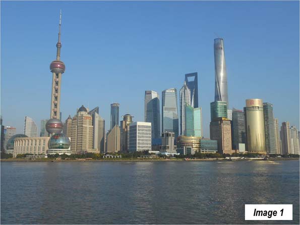
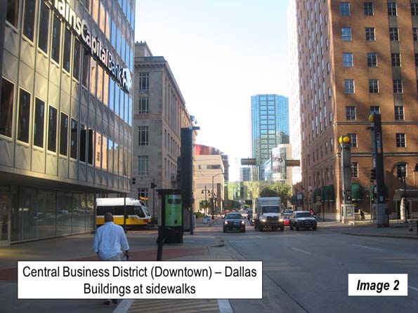
    Last month I traveled from Shanghai (Image 1 from a previous trip) to Changchun and Jilin, in Manchuria’s Jilin Province (Manchuria includes the northeastern provinces of Liaoning, Jilin and Heliongjiang, and is called the "Dong Bei" or the "east north") and then to Beijing and on to Nanchang, in Jiangxi Province, finally returning to Shanghai.

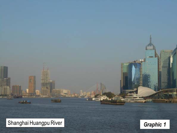
    Shanghai is China’s largest urban area, with 22.7 million residents (Note). I started out from Shanghai’s Hongqiao Railway Station, which is one of the most important rail hubs in the country. It is located across the runways from Hongqiao International Airport, from which most domestic flights operate. Most international flights operate from Pudong International Airport, which is 34 miles (55 kilometers) to the east.

    The train used the main Shanghai to Beijing line as far as Tianjin, where the train continues along Bohai Bay toward Manchuria, while the main line turns left toward Beijing.

    It is not long before the train reaches speeds above 300 kilometers per hour (186 miles per hour). For at least the first 135 miles (220 kilometers), to the far edge of Changzhou, there is a mix of primarily urban development with some rural development. There are also many high-rise residential developments and "peri-urban" developments, with rural areas transitioning to urbanization.

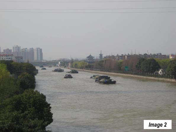
    The train travels west through Kunshan, an urban area of 1.9 million residents, part of Suzhou municipality, which also contains the Suzhou urban area (5.4 million). There are particularly good views of the Grand Canal in Suzhou (Image 2, from a previous visit). The Grand Canal was completed approximately 1,400 years ago and for centuries has provided a means for water transport between Hangzhou, to the south of Shanghai, across the Yangtze River and to Tianjin, near Beijing. It is the longest canal in the world, at 1,100 miles (1,800 kilometers).

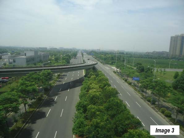
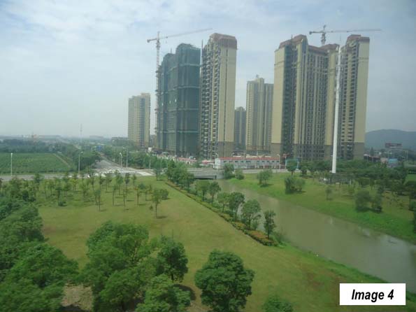
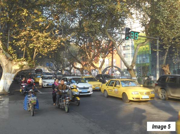
    From Suzhou, the train continues into Wuxi, an urban area of 3.7 million population (Images 3 and 4). The route continues into Changzhou (urban area population 3.7 million). Finally, is some open country, as the main route travels through a valley to the south of Zhenjiang to Nanjing, an urban area of 6.4 million population, which serves as the capital of Jiangsu. Nanjing was the former capital of China and its streets are lined and cooled in the summer by its "French trees" (Image 5, from a previous visit).

    Leaving Nanjing, the train crosses the Yangtze River and travel through largely agricultural country. It passes through the smaller Suzhou (Anhui province) of Nobel Literature Prize winner Pearl S. Buck, and then through Xuzhou, Jiangsu (1.3 million). In Xuzhou, I noted the elevated connections for the new rail line to Zhengzhou (and also saw them in Zhengzhou). Service will begin in September, cutting three hours off the Shanghai to Zhengzhou travel time, and placing historic tourist attraction Xi’an, with its Terracotta Army, within seven hours of Shanghai.

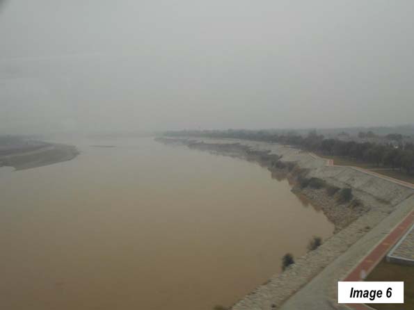
    The farmland continues to Jinan (3.9 million), the capital of Shandong province, which largely consists of the peninsula of the same name that forms the southern boundary of Bohai Bay. Just north of Jinan, the train crosses the second of China’s great rivers, the Yellow River (Image 6), which is again crossed north of Zhengzhou (below).

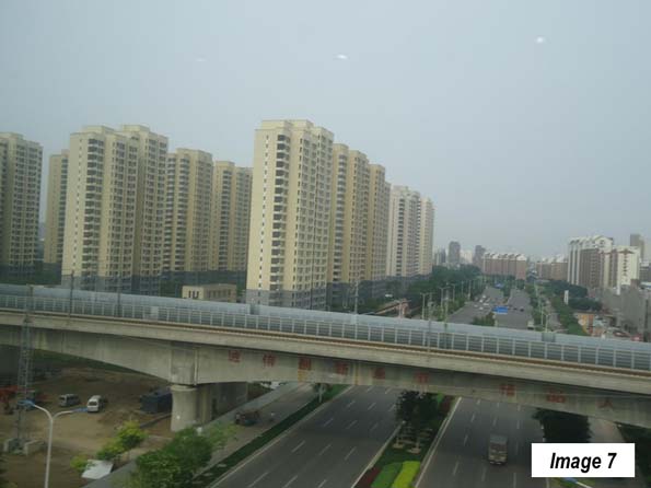
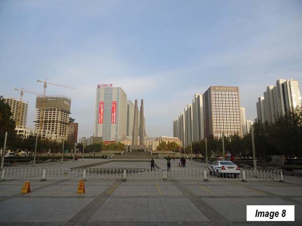
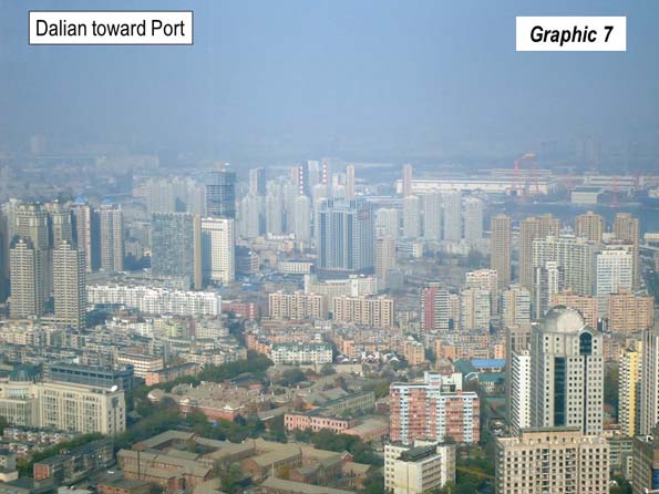
    Then there follows the longest stretch of agriculture between Shanghai and Beijing, most of the way to Tianjin (Image 7), an urban area of 11.3 million residents and is now the fastest growing large municipality in China, at more than four percent per year. Soon, we passed through Tangshan (2.4 million) which suffered a disastrous earthquake in 1976 but has been rebuilt (Image 8).

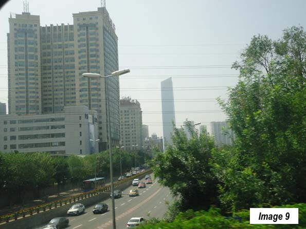
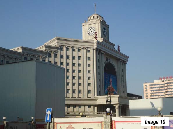
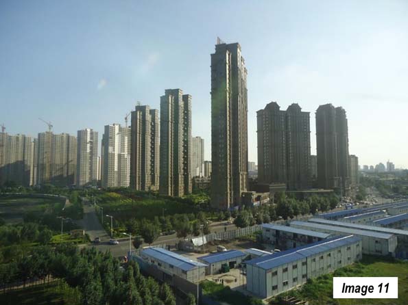
    The train continued northward to Shenyang (3.4 million), the capital of Liaoning (Image 9). Finally, the train reached the destination of Changchun Railway Station (Image 10), 1,500 miles (2,400 kilometers) and 11 hours from Shanghai. Changchun (Image 11) is the capital of Jilin province and has 3.4 million residents.

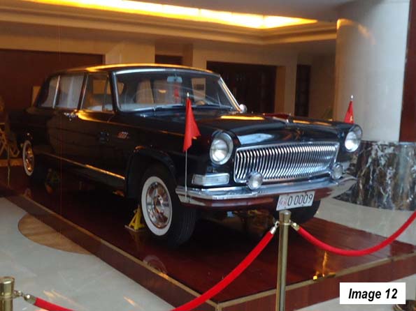
    Changchun is called the "automobile city," because the government placed the first automobile manufacturing plant here in the late 1950s. This was where the Red Flag limousine was built, favorite of government ministers and which carried President Richard Nixon around Beijing in his 1972 visit. My hotel in Ordos had a classic Red Flag on exhibition (Image 12). Now, automobile manufacturing is spread around the country and includes virtually all of the world’s leading brands. Last year, Chinese bought 21.1 million cars, compared to 17.5 million in the United States, both records.

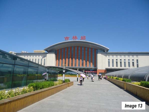
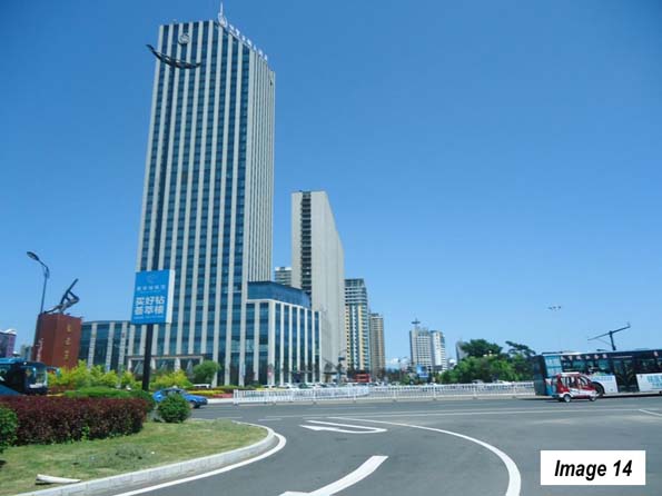
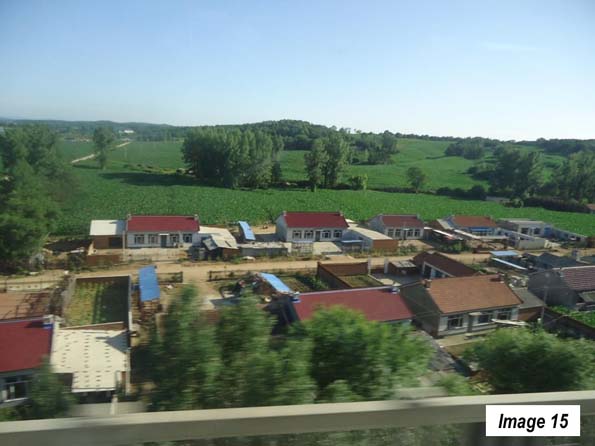
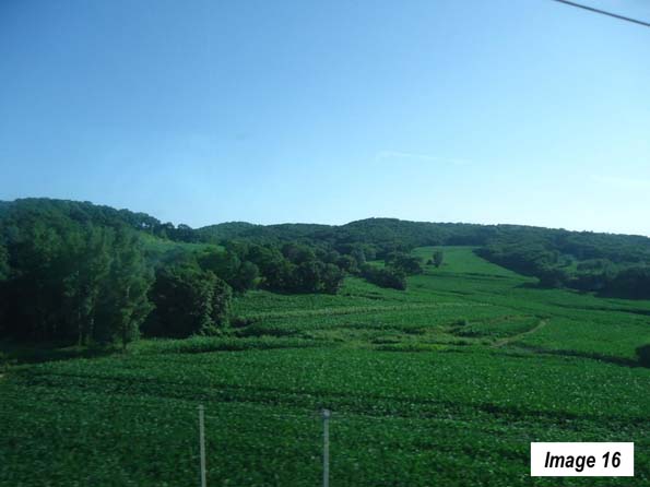
    Jilin, an urban area with 1.7 million residents,(Images 13, Jilin Railway Station & 14) is only 45 minutes away by train, separated by picturesque rolling agricultural country from Changchun (Images 15 & 16). The corn looks at least as good in Jilin as it does now in Illinois.

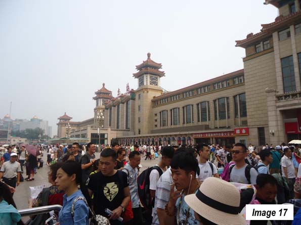
    A few days later I took the train from Changchun to Beijing South Railway Station (Image 17) to connect for the flight to Ordos, Inner Mongolia (See: Surprising Ordos: The Evolving Urban Form). Beijing is the nation’s second largest urban area, with 20.4 million residents.

    Flying back from Ordos, my next train trip was from Beijing West Railway Station. I could have traveled by subway, but since the view underground is not as good, traveled by taxi. Early Sunday morning, the traffic on the Third Ring Road from my hotel near the CCTV Tower (across town) was horrific.

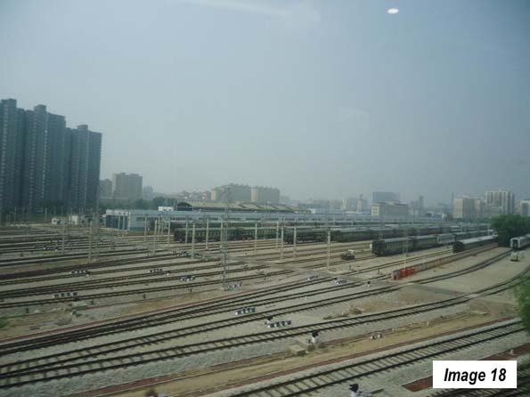
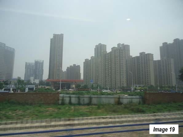
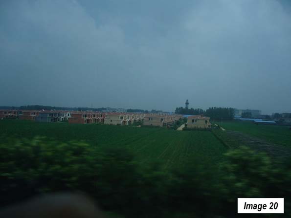
    The next train ride was to Nanchang, along the Beijing to Guangzhou line. This is the other principal north-south route though its traffic appears to be light compared to the Shanghai to Being route. The train traveled (Image 18) toward, Shijiazhuang, an urban area of 3.5 million residents and the capital of Hebei province (Images 19 and 20).

    Parts of these first three trips coursed through the planned Jin-Jing-Ji megacity, which will better integrate the urban areas between Beijing, Tangshan, Tianjin and Shijiazhuang.

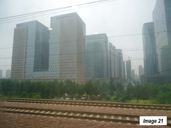
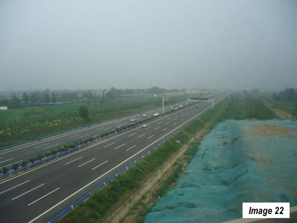
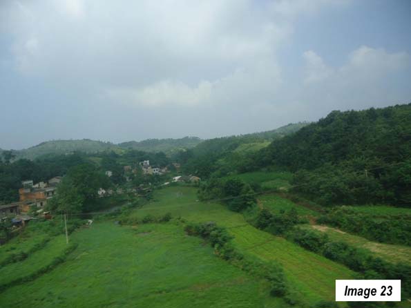
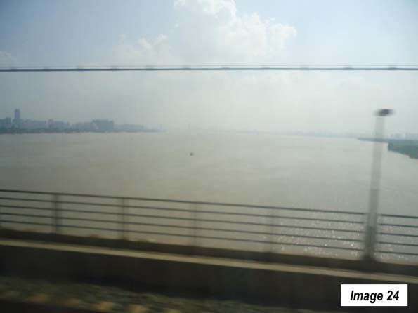
    Continuing south, the train stopped at Zhengzhou, the capital of Henan (5.8 million), with its impressive extension of the Zhengzhou new area and the new railway station (Images 21 & 22). The train then headed south toward Wuhan, (7.6 million residents), the capital of Hubei and  a heavy industrial area that is been called the "Chicago" of China. Before reaching Wuhan, there was attractive rolling scenery in northern Hubei (Image 23), then the Yangtze River crossing in Wuhan (Image 24). Just a few miles upriver (the direction of the camera shot), Chairman Mao, at 72 years old, is reputed to have swam across the Yangtze in 1966.

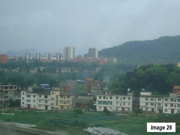
    The July greenery of central China was impressive. It continued into northern Hunan province (Image 25) and its capital of Changsha, an urban area of 3.8 million. In Changsha, the train diverted from the Beijing to Guangzhou line and turned eastward toward Nanchang. Along the way, the "peri-urban" development seemed to get more intense (Image 26). 

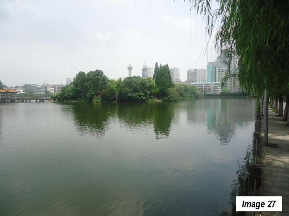
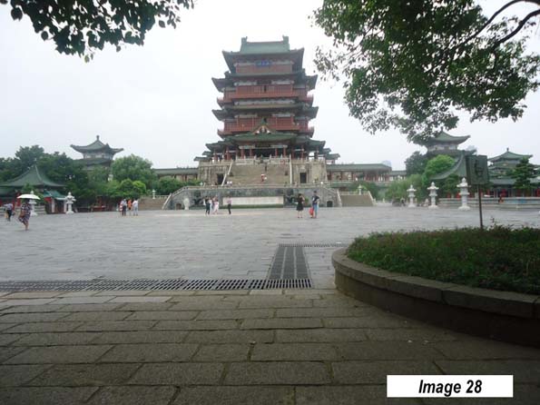
    The Nanchang urban area (Image 27) has a population of 2.8 million and sits on the Gan River, which eventually flows into the Yangtze, to the north. It is home of the Pavilion of Prince Teng, on the older east bank city, across from the newer development on the west bank (Image 28).

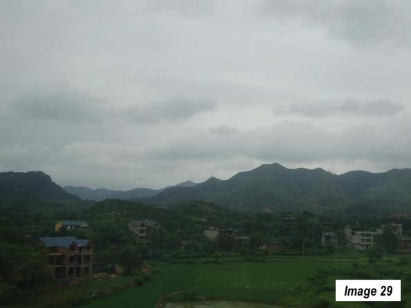
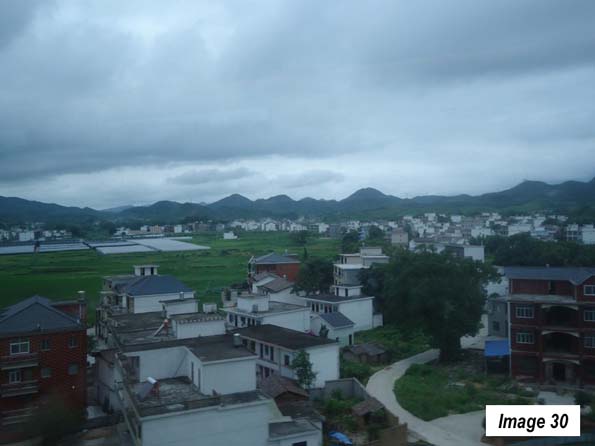
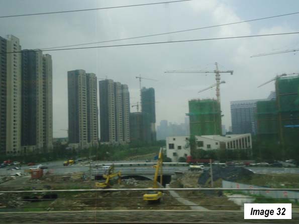
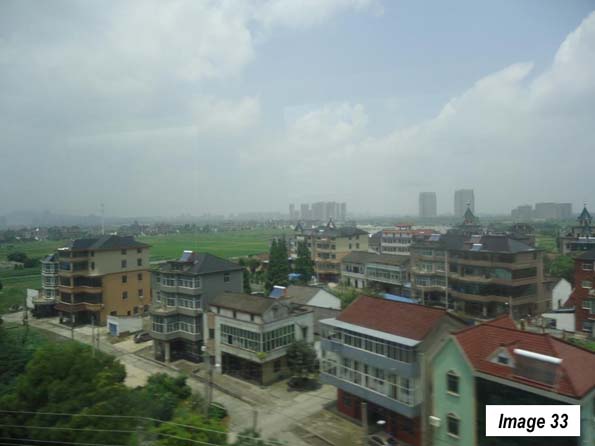
    A few days later, the last leg of the trip from Nanchang to Shanghai Hongqiao took less than four hours. Between Nanchang and Hangzhou, (7.6 million), the capital of Zhejiang, there was more greenery, rolling and mountain country and intense peri-urban development (Images 29-31). Hangzhou has been undergoing a huge construction boom (Image 32). It was less than one hour to Shanghai, and the peri-urban development continued to intensify (Image 33).

    All in all, the five train trips had covered more than 3,700 miles (6,000 kilometers) and passed through 14 provincial level jurisdictions.

    Trains

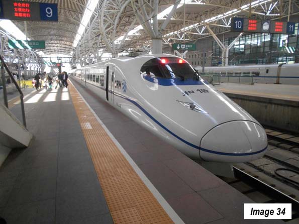
    The best trains in China are the "G" trains, the "D" trains, and the "C" trains, all of which are of European high-speed rail quality. The "G" trains have a top speed of more than 300 kilometers per hour. The "D" trains have a top speed of 250 kilometers per hour, while the "C" trains are shuttles, such as those operating between Tianjin and Beijing or Changchun and Jilin and tend to operate at 250 kilometers per hour or more.

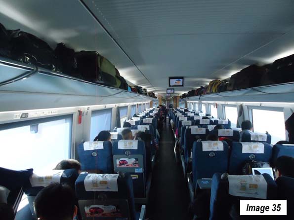
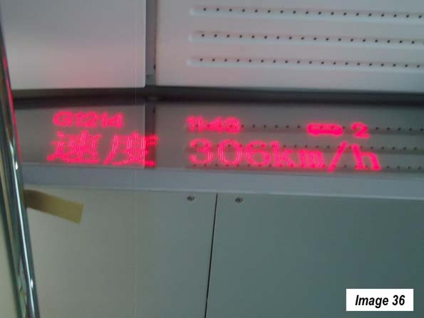
    All of these trains use similar equipment (Image 34). Image 35 is the inside of a 2nd class coach, which have with reclining seats and snack service. All of the trains have information displays in each car indicating train speed, time, etc. (Image 36). Stations may be central as in Tianjin or near-airport distances from the urban core, as in Jilin and Wuhan.

    Tickets

    Ticket purchase has become simple. Tickets can now be booked from virtually anywhere and paid for by credit card. US residents will pay a service fee of up to $6 per ticket. Confirmation documents are provided over the internet and can be presented at any station in China to receive the tickets all at once. My ticket pickup took no more than 10 minutes at the downtown Shanghai Railway Station.

    I would recommend using a travel agency that is located in China, has a toll-free 24 hour number from one’s home country, has agents with good English skills, and a local China number for use when there. I was very happy with travelchinaguide (https://www.travelchinaguide.com/), which meets this description. Train schedules can be accessed at https://www.travelchinaguide.com/china-trains/.

    Note: The urban area populations are as estimated in 2016, taken from Demographia World Urban Areas: 12th Annual Edition (2016).

    Wendell Cox is principal of Demographia, an international pubilc policy and demographics firm. He is a Senior Fellow of the Center for Opportunity Urbanism (US), Senior Fellow for Housing Affordability and Municipal Policy for the Frontier Centre for Public Policy (Canada), and a member of the Board of Advisors of the Center for Demographics and Policy at Chapman University (California). He is co-author of the "Demographia International Housing Affordability Survey" and author of "Demographia World Urban Areas" and "War on the Dream: How Anti-Sprawl Policy Threatens the Quality of Life." He was appointed to three terms on the Los Angeles County Transportation Commission, where he served with the leading city and county leadership as the only non-elected member. He served as a visiting professor at the Conservatoire National des Arts et Metiers, a national university in Paris.

    Photo: Changchun, Jilin, China: urban core (by author)

  • Ireland Adopts Plan to Increase Housing Supply and Improve Housing Affordability

    The government of Ireland has adopted a new policy (Rebuilding Ireland: Action Plan for Housing and Homelessness) intended to improve the quality of life and the national economy by making housing more affordable. In this regard, Ireland joins New Zealand (and Florida) in having recognized the disadvantages of overpriced housing and signaling reforms to alleviate the problem.

    Background: The Great Recession in Ireland

    Probably no nation suffered more during the housing bust induced Great Recession than Ireland. By 2007, the Irish economy had reached its peak, having achieved a gross domestic product (GDP) per capita, purchasing power adjusted, only 2.8 percent below that of the United States. This was an incredible accomplishment, given that as late as 1990 Ireland’s GDP per capita was approximately 45 percent below that of the United States, Australia, Canada, the United Kingdom, New Zealand and Spain, which are shown on Figure 1.  .

    However, as the overheated housing market tanked, Ireland’s GDP per capita dropped 8.4 percent relative to that of the United States, despite own housing bust economic losses. Things were so bad that Ireland was forced to take a large loan from the European Union and the International Monetary Fund to help stabilize its economy.

    Ireland’s economic losses were even greater than that of Spain, which had a particularly severe housing bust and whose economy continues to languish. But Ireland has done much better. The EU loan has been repaid. According to World Bank data, Ireland has reached a new peak, reaching within 2.1 percent of the US GDP per capita (Figure 1).

    The Housing Bubble and Bust

    During the housing bubble,   Dublin and Cork became severely unaffordable, where the median multiples (median house price divided by median household income) reached 6.0 and 5.4, respectively. This was to be expected as demand increased, well beyond the supply permitted by Ireland’s urban containment land-use regulations. As Dublin economist Colm McCarthy of  University College, put it: "Ireland passed its first major piece of land-use planning legislation in 1963, modeled on the UK’s Town and Country Planning Act of 1947. The intentions were laudable, to restrict the construction of unwelcome developments and to empower local authorities to take a more active role in shaping the built environment. There was no desire to screw up the residential housing market, but that is eventually what happened."

    As the economy get began to recover, house prices again began their rise simply because the reforms in   that would have prevented it were not implemented.

    Rebuilding Ireland

    The new housing policy announced July 20  is comprehensive, with strategies to reduce homelessness, improve the rental market and supply sufficient owned housing at affordable prices. Ireland has a high homeownership rate, at 68.6 percent and is important to the national economy.

    As has occurred in the United Kingdom, Australia, New Zealand and some markets in Canada and the United States, large  house price increases relative to incomes were   experienced where urban containment policies were in effect. This is because urban fringe development prohibitions are associated with higher land prices inside urban containment boundaries (Figure 2). Indeed, this type of urban fringe regulation is present in virtually all major markets rated as severely unaffordable in the Demographia International Housing Affordability Survey, which rates 87 such markets in nine nations.

    Rebuilding Ireland policy acknowledges the importance of the housing market the national economy. As has been typical under urban containment planning regimes, house construction has fallen significantly short of demand. Under this policy, the government intends to accelerate the release of land for new development, especially in making government owned land available for development.

    Rebuilding Ireland is intended to double the rate of home building in Ireland over the period of 2017 to 2021. This will be aided by "Opening up land supply and low-cost State lands." This is important not only to meet the needs of Irish households, but also to diminish the potential for a highly volatile housing market that led to Ireland’s financial distress in the Great Recession.

    The government also intends to take action to support infrastructure development for new housing projects. A €200 million "Local Infrastructure Housing Activation Fund" will assist in "enabling infrastructure that opens up large sites for early development."

    As in California, virtually all large new housing projects today are appealed on various grounds. In recognition of this, Ireland intends to speed up the development process by allowing larger developments to proceed directly to the national planning appeals board ("An Bord Pleanála") for approval. The intention is to "jumpstart" the development of new housing.

    Defining Affordability

    Unlike most governments, the government of Ireland has supplied a definition of housing affordability. Rebuilding Ireland will hold a competition to develop new housing that can be delivered for than €200,000 in construction costs.

    Rebuilding Ireland also notes that land costs must be kept affordable and should add no more than €30,000 to €50,000 to the price of a new home. This would result in a "development ratio" of 15 percent to 20 percent (land price divided by total price including land). This development ratio is similar to US development ratios where urban containment policy has not been implemented and similar to development ratios in Australia and New Zealand before urban containment policy was adopted across those nations.

    Moreover, based on Irish household incomes, housing that costs between €230,000 and €250,000 would be generally consistent with the median multiple of 3.0 or less that is rated by the Demographia International Housing Affordability Survey as affordable (new house prices are generally more expensive than those of existing housing).

    Enforcement

    The government is signaling the seriousness of its intentions, indicating that local authorities must strive in their statutory development plans for “affordable prices to meet the housing needs of each local authority area, across tenures and types as well as the social housing requirement."

    This is a unique requirement in view of the fact that there has been virtually no serious attention to the issue of delivering housing affordability in other markets that have had strong urban containment policies.

    Implementation will not be without challenges. In the longer run, the inertia of currently in vogue planning philosophy could well prevent achievement of the housing affordability goals of Rebuilding Ireland. Yet, as Rebuilding Ireland indicates, the stakes are high. Rebuilding Ireland notes that "Excessive housing costs have demographic impacts, including a tendency for households to defer important lifecycle choices in order to prioritise home purchase" (such as having children).

    Further, as Rebuilding Ireland indicates: "Rising prices for residential accommodation impact adversely on competitiveness. The attractiveness of Ireland as a potential investment location and, of course, the cost base for existing businesses will be impaired should price inflation continue, as rising prices place upward pressure on wages, deter inward migration and impede the labour market."

    This could be particularly important in light of Brexit (the exit of the United Kingdom from the European Union). To the extent that international businesses may decide to leave the United Kingdom to stay within the European Union, Ireland and especially Dublin could be attractive for relocation because of the dominance in the nation of the English language, which would be made more attractive by improved housing affordability.

    Wendell Cox is principal of Demographia, an international pubilc policy and demographics firm. He is a Senior Fellow of the Center for Opportunity Urbanism (US), Senior Fellow for Housing Affordability and Municipal Policy for the Frontier Centre for Public Policy (Canada), and a member of the Board of Advisors of the Center for Demographics and Policy at Chapman University (California). He is co-author of the "Demographia International Housing Affordability Survey" and author of "Demographia World Urban Areas" and "War on the Dream: How Anti-Sprawl Policy Threatens the Quality of Life." He was appointed to three terms on the Los Angeles County Transportation Commission, where he served with the leading city and county leadership as the only non-elected member. He served as a visiting professor at the Conservatoire National des Arts et Metiers, a national university in Paris.

    Photo: Custom House, Dublin by Peter Brown from Dublin, Ireland (The Custom House, Dublin) [CC BY 2.0], via Wikimedia Commons