Category: housing

  • How to Take Advantage of the Retail Apocalypse

    Amazon’s stunning acquisition last week of Whole Foods signaled an inflection point in the development of retail, notably the $800 billion supermarket sector. The massive shift of retail to the web is beginning to claw into the last remaining bastions of physical space. In the last year alone, 50,000 positions were lost in the retail sector, and as many as 6 million jobs could be vulnerable nationwide in the long term. Store closings are running at a rate higher than during the Great Recession.

    Yet, there’s an opportunity opening for cities and regions to take advantage of new space for churches, colleges, warehouse space and, most importantly, housing. Nationally, an estimated 15 percent of all mall space will need to find new uses within the next decade. As many as 275 malls, according to Credit Suisse, will close in the next five years — roughly a quarter of the total. America already has four to five times as much retail space per capita as countries such as the United Kingdom or Japan.

    The infill opportunity

    The biggest opportunity for Southern California lies in the production of new housing, which would help to make up for providing less than half the needed supply for the past decade. To date, misguided state policy has created a raft of poor outcomes — rising prices, low inventory, declining affordability, the second-lowest homeownership rate in the nation — in effect, chasing middle-class, younger families out of the state.

    State policy has made things worse by putting ever more regulatory burdens on housing, particularly for those who build single-family homes on the peripheral areas, where lower-cost residences have historically been built. But the state’s policy of pushing “infill” development has also foundered, as the price of new apartments has shot up, in part due to the limited land for developments.

    These policies understandably upset residents of many urban neighborhoods, who feel that developers are seeking carte blanche to make their areas ever more congested and uniform. In contrast, a strategy of focusing on redundant retail properties — think attached townhomes or detached townhouses — would actually produce fewer cars than even a poor-performing mall, and would appeal to such key demographics as first-time homebuyers, immigrants, minorities and downshifting baby boomers.

    Read the entire piece at The Orange County Register.

    Joel Kotkin is executive editor of NewGeography.com. He is the Roger Hobbs Distinguished Fellow in Urban Studies at Chapman University and executive director of the Houston-based Center for Opportunity Urbanism. His newest book is The Human City: Urbanism for the rest of us. He is also author of The New Class ConflictThe City: A Global History, and The Next Hundred Million: America in 2050. He lives in Orange County, CA.

    Photo by Mike Mozart, via Flickr, using CC License.

  • Las Vegas Lessons, Part II

    A couple weeks ago I wrote some thoughts after a recent visit to Las Vegas. Most of what I wrote about concerned the Strip and downtown areas of the city, without question the two most recognizable and most frequently visited parts of the region. But in a rapidly growing region of nearly 2.2 million people (the Las Vegas Valley held only 273,000 residents in 1970, meaning it has increased its population by 8 times since then), clearly there’s much more to the region than its most iconic and visible parts. Here I’ll offer some thoughts on the broader region, its built environment, its economy, and thoughts on its future.

    First, for those tl;dr readers who won’t click through to read Part I, here’s a quick summary of it:

    • The Strip and Las Vegas are two entirely different entities.
    • Strip is a great pedestrian experience.
    • The Strip is an exclusively private space.
    • Downtown Las Vegas is quite different from the Strip.
    • There are poor linkages between Downtown Las Vegas and the Strip.
    • The north end of the Strip is plagued with high-profile failed projects.

    Again, as someone who’s “part urbanist, part sociologist, and part economist,” I offer some observations and thoughts on the rest of the city and region.

    The balance of the city and region consists of unremarkable suburbia. This is probably evident to anyone who puts any amount of thought into it, but it does bear repeating. Step away from the Strip and downtown, and Las Vegas’s built environment is amazingly consistent: according to the U.S. Census Bureau American Community Survey in 2015, the metro area is about 60% single family detached homes, with about 4,000-6,000 people per square mile throughout. There’s no sudden or even slight gradation in density as one commonly finds in many eastern cities; the city quickly establishes its suburban character and spits it out relentlessly. And, I’ve been struck on this visit and previous ones at how similar Vegas looks to suburbia in other places. Yes, there are newer, upscale areas that stand out (Summerlin comes to mind), but if you replace Vegas’s palm trees with oaks and elms, it looks a lot like suburbia anywhere else in America, except with Spanish tile roofs. Similarly…

    Nothing in the region is old; the region will have to learn the art and skills of redevelopment. Fifteen years ago when I did some consulting work in Las Vegas, I thought it was weird when city officials referred to West Las Vegas, just northwest of downtown, as “historic”. Most of the homes and businesses there were built in the ’50s and through the ’70s, and in my mind they were the kind of structures that were just beginning to establish some character. But when the median year of structure built in the region is 1995 (the same for Chicago’s metro is 1967), you simply won’t find the pre-WWII type of development that is called historic in other places. There will come a time when the structures of the Las Vegas Valley will be viewed as obsolete and inconsistent with modern living (whatever that is), and the region will have to undergo one of the more difficult transitions for municipalities — shifting from easy greenfield development to complex redevelopment.

    Low wage and low skill jobs proliferate in the region. Like the unremarkable nature of the suburban pattern, here’s another conventional observation that bears repeating. As one would expect, the accommodations/food services employment sector dominates in Las Vegas — nearly one-third of all Las Vegas workers work in hospitality. Those have traditionally been low-paying jobs, and that’s true of the region today. Overall, 44% of Vegas workers earn less than $40,000 a year. Contrast that with Austin, a similarly-sized and similarly-fast-growth metro, where only 9% of workers are employed in accommodations/food services, and just 34% of workers earn less than $40,000 a year (and consider that Austin is a college town that has many recent grads, possibly pushing incomes downward). My concern for Vegas in this regard is that there is growing research that suggests that the kind of work automation that decimated much of the Rust Belt’s manufacturing jobs may now enter a phase that targets food services, administration and office support, sales and even retail jobs — precisely the kinds of jobs that many new Las Vegas residents moved there to occupy. Las Vegas workers could be quite vulnerable to the kinds of challenges that reshaped the Rust Belt.

    The Las Vegas Valley is nearing its physical limits. According to Wikipedia, the Las Vegas Valley is a 600 sq. mi. basin surrounded on all sides by mountains. I don’t know the precise delineations between flat and inclined topography, but a look at Google Earth tells me the region is near its limit:

    I could be wrong, but it looks as if Vegas has available land to the north and southwest, and the Valley might be approaching 90% developed. It could be that the region hits the wall (literally) within the next 10 years. What will that mean for a region that is as low-density suburban as this one? Will the Valley’s communities have the ability to shift their focus inward? Time will tell.

    What happens to the region if tourism… changes? Wikipedia’s Atlantic City page has a good explanation for the decline of tourism there after World War II. It connects its decline with the car; prior to the war, people generally traveled to Atlantic City by train and stayed for a week or two. Cars made people more mobile and they made shorter visits. Suburbanization and its creature comforts, like backyards and air conditioning, also took visitors away from AC. The final nail in the coffin was affordable jet service, opening up vacation spots like Miami, Havana, and the Bahamas (and Vegas) in the 50’s and onward. I don’t know what challenge is out there for Vegas now, but what will be crucial to the region’s survival is how it responds.

    What impact will climate change have on a desert resort city? When flying into Las Vegas I couldn’t help but notice the low level of Lake Mead, just southeast of the city. It was clear from the air; bleached rock that had once been under water now exposed. Las Vegas is blessed to have one of the largest reservoirs in the nation at its back door, but could continued drought and increased demand for water undermine everything? The Strip’s casinos tout themselves as leaders in water conservation, but whether their efforts will be enough as conditions worsen is an open question.

    Las Vegas is truly a unique place. It’s a place that seems to serve a certain time and space, and is concerned about now more than its future. But I’m sure if the region squints its eyes and looks, it will see the future is getting closer. It will need to figure out how it will be sustainable as that future approaches.

    This piece originally appeared on The Corner Side Yard.

    Pete Saunders is a Detroit native who has worked as a public and private sector urban planner in the Chicago area for more than twenty years.  He is also the author of “The Corner Side Yard,” an urban planning blog that focuses on the redevelopment and revitalization of Rust Belt cities.

    Photo by Stan Shebs [GFDL, CC BY-SA 3.0 or CC BY-SA 2.5], via Wikimedia Commons

  • Grenfell External Fire Erupts After Flat Fire Extinguished?

    The Daily Telegraph reported (June 20) that:

    "Crews believed they had put out the fire at the London high-rise and were astonished to see flames rising up the side of the building, new reports have claimed."

    "But, soon after, the 24-storey building was consumed by flames in one of Britain’s biggest ever tower block fires that left at least 79 people dead."

    The paper continued that: " Those reports will add weight to claims that it was the cladding on the exterior of Grenfell Tower that caused the fire to spread so rapidly."

    The entire Telegraph article can be read at: http://www.telegraph.co.uk/news/2017/06/20/grenfell-tower-firefighters-put-fridge-blaze-just-leaving-flats/

    The fire’s death toll is now at 79. Newgeography.com covered the fire ("The Grenfell Fire: A Litany of Failures?").

  • Connecticut’s Future is Suburban, Not Urban

    Connecticut is now grappling with a fiscal and economic crisis that, according to some leading Democrats, has been caused by ineffective urban policy. In late May, Hartford-based insurer Aetna confirmed long-discussed rumors that it will be moving its headquarters from Connecticut. General Electric announced plans to move from Fairfield, Connecticut to Boston in January 2016. Though the Great Recession officially ended eight years ago, state budget forecasters are projecting a $2 billion deficit for next fiscal year, or 11 percent of the budget. One policy report published in March, when rosier estimates pegged Connecticut’s deficit at only 9 percent, ranked Connecticut as having the 8th largest shortfall among American states. Hartford, the state capital, is on the verge of bankruptcy.

    What course should Connecticut take to stabilize government budgets and stimulate the economy? Gov. Dannel Malloy and Hartford mayor Luke Bronin believe that stronger cities are the answer. As Malloy said recently, explaining why his budget increases state aid for cities, “I think there is a body of people who don’t understand urban environments, and I think Connecticut has too long pursued a public policy of insufficient support for our urban environments.”

    But there are many questions to raise about just how vital urban Connecticut is to the state’s future. Connecticut’s major cities have their charms, especially Hartford and New Haven. But in terms of meeting the enormous fiscal and economic challenges with which the state is now faced, they are and will remain less important than its suburban regions.

    With all due respect to Gov. Malloy and Mayor Bronin, there’s a certain glibness in how they presume that Connecticut’s poor urban areas can be revitalized. It’s not as if their predecessors haven’t been trying. Any visitor to downtown Hartford and New Haven will be struck by several imposing works of mid-20th century modern architecture. Examples include Constitution and Bushnell plazas in Hartford and New Haven’s Temple Street Garage. These projects date back to the “urban renewal” era of the 1950s and 1960s, when massive government resources were devoted towards breathing new life into tired central cities.

    New Haven was nationally-renowned for its urban renewal efforts, both because it focused just as much on rehabbing old buildings as demolishing them . Mayor Richard Lee’s “human renewal” social service programs anticipated criticisms that poverty can’t be cured through real estate development alone. But the widely celebrated Mayor Lee failed to hit the mark. New Haven, the “Model City,” was rocked by a race riot in 1967, as was Hartford in 1969.

    Despite growing evidence that Connecticut cities were not coming back, urban renewal in modified forms would continue throughout the decades. In 1974, Hartford gained the “Hartford Civic Center,” (now known as the XL Center), a sports and entertainment venue where the NHL’s Hartford Whalers played from 1980 to 1997. The state’s convention center opened in Hartford in 2005, and a minor league baseball park just came online in April. And yet, among American cities with a population above 100,000, Hartford’s poverty rate is 8th highest in the nation. Mayor Bronin himself describes the current fiscal state of affairs in Hartford as “the largest budget crisis in our city’s history.”

    State government is not much better off. Connecticut’s budget deficit is driven by escalating costs for public pensions, which powerful government unions have balked at reforming, and weak tax receipts despite—or perhaps because of—a series of recent income tax hikes. Gov. Malloy, a progressive Democrat, has recently taken the position that trying to further increase the tax burden on the state’s 1 percent would be counterproductive.

    Urban revitalization is an unsound strategy for addressing budget deficits because creating strong cities is the work of generations. The secret of Boston’s success is reflected in a famous saying attributed to Daniel Patrick Moynihan: “If you want to build a world-class city, build a great university and wait 200 years.” Cities like New York that are now envied as talent magnets have had that reputation going back many years. Even in the 1970s, when New York was plagued by high crime and the threat of insolvency, it was still a national leader in finance, media and the arts.

    Bronin and Malloy have said that they understand Hartford can’t become New York or Boston. But among Hartford’s true peers—formerly industrial small and mid-sized cities throughout the northeast and Midwest—it is very difficult to find any examples of an authentic comeback city. In an analysis I recently wrote about Hartford, New Haven, Waterbury and Bridgeport, I found that, since 1970, the number of poor people living in these cities had increased by 56.1%, 40.8%, 153.6% and 86.3%, respectively. Over the same span, all have seen their total populations decline with the exception of Waterbury, which has grown by 1.7%.

    Despite all the hype over America’s urban renaissance, cities remain a tough sell for the middle class. However magnetic a city may be in attracting young millennials, as studies by William Sander of DePaul University and William Testa of the Chicago Fed have demonstrated, the more educated you are, the more likely you are to opt for suburbs when you settle down. If, 20 years ago, a given city had an underperforming school system that was unattractive to middle class families, it most likely remains unattractive to them now. According to the most up-to-date Census data we have, within most major metros, suburban areas are growing more rapidly than central cities.

    Connecticut is often associated with suburban blandness. But it happens to boast one of the most talented labor forces in the nation. A 2016 McKinsey report ranked Connecticut second among states in productivity (GDP per worker). Statewide, 16.6 percent of adults have advanced degrees, a rate which trails only Massachusetts and Maryland. (Only 6.7 percent of adults in Hartford have advanced degrees.) In coming years, the high levels of productivity and educational attainment among Connecticut’s suburban residents will be essential to any growth the state manages to achieve. Fairfield County Connecticut boasts some of the strongest public schools in the nation, whereas the state’s urban school districts remain troubled.

    As Connecticut officials contemplate a policy response to Aetna’s exit, it is crucial that they not lose sight of the following. We don’t know how to revitalize poor old industrial cities, especially small and mid-sized ones. Middle class families with children are opting for the suburbs just as reliably as in prior generations. One of the soundest economic development strategies is for a state to offer potential employers a productive and educated workforce, which Connecticut plainly does. State officials should build on current virtues, avoid chasing fads, focus more on budget discipline, and by all means stop trying to make Connecticut into something it’s not.

    Stephen Eide is a Senior Fellow at the Manhattan Institute.

    Photo by Doug Kerr, via Flickr, using CC License.

  • How Does Housing Stock Affect Urban Revitalization?

    The second of Pete Saunders’ nine reasons why Detroit failed is “poor housing stock,” particularly its overweighting towards small, early postwar cottages. Here’s a sample:


    Here’s what Pete had to say:

    Detroit may be well-known for its so-called ruins, but much of the city is relentlessly covered with small, Cape Cod-style, 3-bedroom and one-bath single family homes on slabs that are not in keeping with contemporary standards for size and quality…..The truth, however, is that Detroit may have one of the greatest concentrations of post-World War II tract housing of any major U.S. city….True, Detroit has more than its share of abandoned ruins that negatively impact housing prices. But it also has many more homes that simply don’t generate the demand that higher quality housing would. That is a major contributor to the city’s abundance of very cheap housing.

    I have often been struck by the same thing in Philadelphia. There are some districts of great buildings, but most of the city is made up of mile after mile of two-story, very small row houses. Here’s a snap I took in the Kensington neighborhood that provides a sample.

    This is decent density of these to be sure. However, keep in mind that most of these row houses contain a single unit. The Upper West Side brownstone I live in has been converted into ten units. Also, many of these rowhouse units are extremely shallow. Here’s a picture I found online that illustrates a typical depth.

    Photo credit: Flickr/pwbaker CC BY-NC 2.0

    As it happens, there has been some redevelopment activity in Kensington, both in residential and industrial spaces. (Some neighborhoods nearby are seeing significant redevelopment).

    Someone I know recently bought and renovated a rowhouse in the neighborhood, so I got to tour it. It’s a two-bedroom unit, but very small. It’s barely bigger than your average one bedroom apartment. Unsurprisingly, the person who bought it is in her 20s and single.

    As nice as this unit was, it’s basically a starter home, much like those Detroit Cape Cods. Cities need to have housing like that, but if it is overwhelmingly dominant, that’s not healthy.

    It’s similar to how so many downtowns are seeing tons of Millennial targeting apartment construction. Older families can have trouble finding housing in these areas because there isn’t great housing to take you through your full lifecycle.

    Philadelphia should be fine in the near term. The city has great bones and I really find it compelling in a lot of ways. But I wonder if this type of housing stock is one reason the city has seen less demand than other old major tier one urban centers with great transit.

    I put out a poll on Twitter about this and most people didn’t seem to agree with me on the potential negative of being overweight very small rowhouses. We will see how this plays out for Philly.

    Aaron M. Renn is a senior fellow at the Manhattan Institute, a contributing editor of City Journal, and an economic development columnist for Governing magazine. He focuses on ways to help America’s cities thrive in an ever more complex, competitive, globalized, and diverse twenty-first century. During Renn’s 15-year career in management and technology consulting, he was a partner at Accenture and held several technology strategy roles and directed multimillion-dollar global technology implementations. He has contributed to The Guardian, Forbes.com, and numerous other publications. Renn holds a B.S. from Indiana University, where he coauthored an early social-networking platform in 1991.

    This piece originally appeared on Urbanophile.

    Top photo by Aaron M. Renn.

  • The Evolving Urban Form: Prague

    Prague is the capital of Czechia, a nation most readers have probably never heard of. Last year, the Czech Republic adopted a new name that does not reveal its governance structure (republic). The new name has not enjoyed widespread acclaim. The union of Czechoslovakia, which dates from the end of World War I, split peacefully in 1993, resulting in the creation of Czech Republic and Slovakia.

    Prague, like its central and eastern European cousins, Warsaw, Budapest and Bucharest, has experienced substantial decentralization of its population following the collapse of communism. As economies improved and more housing choices opened up, many residents opted to move to outer parts of the core cities or even beyond to suburban and exurban areas.

    Today, the municipality of Prague has approximately 100,000 more residents than in 1980. Yet, the distribution of the population is quite different than before. Then, the central and inner districts of the city had a population of approximately 980,000, while the outer districts were home to 200,000. The latest Czech Statistical Office estimates (for January 1, 2017) show the center and inner districts have declined to approximately 785,000 residents. The city’s outer districts have experienced all of the population increase, more than doubling to above 460,000.

    Meanwhile, two-thirds of the growth (Graphic 1) has been in the suburbs of the Středočeský region (Central Bohemia), which surrounds Prague (Graphic 2).

    The Historic Inner District

    Prague’s central district (District 1) comprises the pre-transit walking core of the city. It stretches across the Vltava River (Smetana’s “The Moldau”) from Wenceslaus Square across the Charles Bridge to Prague Castle, the site of St. Vitus Cathedral. The district also includes the Old Town Square. The population of District 1 dropped from 53,000 in 1980 to 29,000 in 2017, a decline of 44 percent.

    The most recent historic events have virtually all taken place in District 1. The 1968 revolt against Soviet control occurred in Wenceslaus Square and was put down by Warsaw Pact military action and tanks, with a loss of 500 Czechoslovakian citizens.

    This was the end of Alexander Dubček’s “Prague Spring” attempt to liberalize communism. Dubček rose from head of the Slovak communist party to leader of the Czechoslovakian communist government. Dubček, however, was luckier than Imre Nagy of Hungary, the communist leader who paid for his liberalizing tendencies by being executed after the 1956 rebellion.

    Wenceslaus Square, named after St. Wenceslaus, Duke of Bohemia, was also the center of the “Velvet Revolution”. Led by Václav Havel, he became Czechoslovakia’s first president following the fall of communism. The communist parliament building (Graphic 3) played a major role, as described by prague-stay.com:

    “This Communist eyesore, loathed by many, loved by few was built after the old Exchange building was destroyed from 1966 – 1973. This glass monstrosity with its two giant pillars is still complete with nuclear shelters. The demands of the Velvet Revolution were accepted here in 1989 and the building was once home to Radio Free Europe who rented the location from former president Vaclav Havel for a very small fee per year (rumor has it that the fee was 1 CZK).”

    I watched Dubček, an unsurprising supporter of the Velvet Revolution, from the building’s gallery in his role as chairman of the national parliament in 1991. Soon after, the national parliament relocated from the building, which is now part of the National Museum. The main building is shown in the top photograph (my photo was not used because of the present scaffolding being used in its refurbishment).

    There is a memorial to victims of the 1968 Warsaw Pact action in front of the main building (Graphic 4), with a barbed wire wreath. Graphics 5 to 7 are also of Wenceslaus Square, which some travel guide books point out is more of a boulevard than a square.

    Old Town Square is shown in Graphics 8 to 12. Charles Bridge is illustrated in Graphics 13 to 16. This historic bridge was built between 1357 and 1402. The approach to Prague Castle and related views are in Graphics 17 to 21. Other views of the inner district are in Graphic 22 (the National Theatre) and Graphic 23.

    Inner and Outer Districts of Prague

    The inner districts (2 through 10) were mainly developed during the mass transit area. The outer districts, where all the city’s growth has occurred, have generally lower population densities. There are some detached houses in the outer districts. Besides the historical buildings, Prague, like other European cities, is in many ways spatially dominated by the automobile, with its narrow, crowded streets and parking on sidewalks. (Graphics 24 to 27).

    The Suburbs

    The Středočeský region surrounds Prague and contains both suburban and exurban development (Graphics 28 to 36), including new construction (Graphics 30 to 36). The Středočeský suburbs exhibit a high quality of suburban infrastructure for eastern Europe, including sidewalks in most cases and curbs. However, the quality of the visible suburban infrastructure falls considerably short of that enjoyed by suburban residents of the United States, Canada, Australia, and New Zealand, where for decades nearly all suburban development has included these features, as well as streets wide enough for parking and cars to pass one-another in opposite directions.

    The Prague Area: Dominating Czechia’s Population Growth

    As is occurring in Tokyo-Yokohama and Budapest, the Prague area is capturing nearly all the national growth, at 86 percent. This includes 58 percent in the suburbs and 28 percent in the outer districts. This is a far greater percentage than Prague’s 25 percent of the population in 1980. (Graphic 37).

    Prague’s Popularity

    For nearly three decades, Prague has been the capital of a nation free to set its own course, the longest period since the 1918 establishment of Czechoslovakia. Prague has become particularly popular among foreign tourists. Trip Advisor ranked Prague 5th among the cities of Europe last year, trailing London, Paris, Rome and Barcelona and ninth in the world. It is no minor accomplishment to edge out cities like Vienna, Amsterdam, and Budapest.

    Wendell Cox is principal of Demographia, an international public policy and demographics firm. He is a Senior Fellow of the Center for Opportunity Urbanism (US), Senior Fellow for Housing Affordability and Municipal Policy for the Frontier Centre for Public Policy (Canada), and a member of the Board of Advisors of the Center for Demographics and Policy at Chapman University (California). He is co-author of the “Demographia International Housing Affordability Survey” and author of “Demographia World Urban Areas” and “War on the Dream: How Anti-Sprawl Policy Threatens the Quality of Life.” He was appointed to three terms on the Los Angeles County Transportation Commission, where he served with the leading city and county leadership as the only non-elected member. He served as a visiting professor at the Conservatoire National des Arts et Metiers, a national university in Paris.

    Top photograph: National Museum. Main building. By Jorge Láscar [CC BY-SA 2.0], via Wikimedia Commons

  • The Best Small and Medium-Size Cities For Jobs 2017

    Much of the U.S. media tends to see smaller cities as backwaters, inevitably left behind as the “best and brightest” head to the country’s mega-regions. The new economy, insists the Washington Post, favors large cities for start-ups and new businesses. Richard Florida has posited the emergence of a “winner take all urbanism” that tends to favor the richest cities, such as New York and San Francisco.

    However this paradigm may reflect cosmopolitan attitudes and rivalries between large cities more than reality, with its complications and nuances. Smaller cities have long been disadvantaged in their ability to attract the most elite companies and Americans on the move, but that may well be changing. Following a post-financial crisis period in which many domestic migrants headed to the big cities, the latest Census data suggests that the flow is now going the other way, with the native born moving to smaller places with between 500,000 and a million people. The new trend in migration, notes the Atlantic’s Derek Thompson, a confirmed big city booster, has been a “great hollowing out,” with Americans leaving places like New York, Los Angeles and San Francisco for the suburbs and less costly, usually smaller cities. (Note that at least in New York’s case, foreign immigrants have been taking their places.)

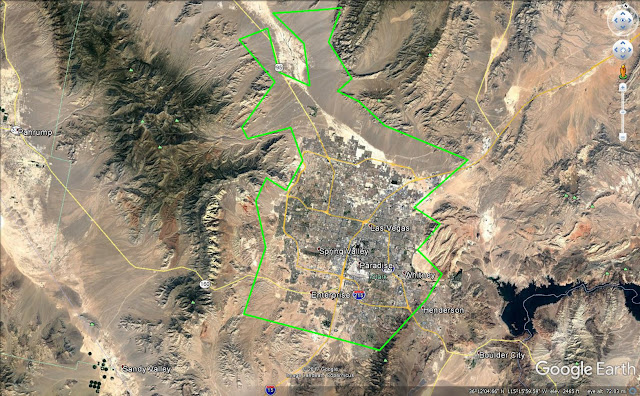
    To be sure, many smaller towns are suffering, and the bottom of our annual survey of employment trends in America’s 421 metro areas is dominated by them, starting with last place Beckley, W.V.; followed by Johnstown, Pa.; Charleston, W.V.; Weirton-Steubenville, Ohio; and Peoria, Illinois. Yet at the same time small city America — which we define as metro areas with less than 150,000 jobs — accounted for seven of the 10 cities where job growth has been the strongest.

    2017 Best Cities Rankings Lists

    Methodology

    Our rankings are based on short-, medium- and long-term job creation, going back to 2005, and factor in momentum — whether growth is slowing or accelerating. We have compiled separate rankings for America’s 70 largest metropolitan statistical areas (those with nonfarm employment over 450,000), as well as medium-size metro areas (between 150,000 and 450,000 nonfarm jobs) and small ones (less than 150,000 nonfarm jobs), the latter two of which are our focus this week, in order to make the comparisons more relevant to each category. (For a detailed description of our methodology, click here).

    The Utah Model

    What makes for successful smaller cities? There’s no simple formula, but several characteristics loom prominently. One is the extent and quality of its amenities: Many of our top cities are in attractive locations near mountains or the ocean, and tend to be home to colleges and universities. And, almost without exception, they are located in less costly, lower-tax states. Finally, it doesn’t hurt to be relatively close to a bigger urban area and a large airport.

    All these characteristics apply to the best metro area for jobs in 2017 — Provo-Orem, Utah. Located an hour south of Salt Lake City and its big airport, the Provo-Orem area has a population of 603,000 and sits alongside the scenic Wasatch Mountains. It’s home to the well-regarded Brigham Young University. Last year the metro area’s job count expanded an impressive 4.4%, and employment is up 29.2% since 2011. As one might suspect in a college-oriented area, the biggest growth has been in fields that tend to hire educated people, such as business and professional services, in which employment grew 5.8% last year, financial services (up 6.7%) and the information sector (plus 5.8%).

    But Provo is not alone in outstanding job growth in the Beehive State. In addition to its largest metro area, Salt Lake City, which ranks 13th, the small city of Saint George ranks third. Also benefiting from a scenic location in the state’s rugged southwestern corner, it’s less of a college town than a retirement and tourism magnet, which explains much of its 5.7% job growth last year. This was driven in large part by big expansions in health and education, with employment in those sectors up 4.6% last year and some 31.8% since 2011.

    Another Utah superstar is 18th-ranked Ogden-Clearfield. Its 2.9% job growth last year was driven in large part by financial services, with employment up 5.7%, and education and health, up 5.9%.

    So what accounts for one relatively small state that’s home to only 3.1% of the U.S. population placing four cities in the top 20? Among the factors: the nation’s fastest population growth, a highly favorable business climate (Gov. Gary Herbert has made cutting red tape a priority of his administration), a burgeoning tech sector and a Mormon-influenced social culture that seems to encourage citizen engagement in local affairs.

    Other Hot Spots

    The other smaller boom towns are a varied lot, although all share locations in low tax, light regulation states. Some bigger cities — San Francisco, Seattle, San Jose — seem to have found a way to keep growing in higher cost environments, but this does not seem to be the case for smaller cities. Virtually all the small communities in our top 20 — with the exception of No. 8 Fort Collins, Colo., — come from such reddish states as the Carolinas, Texas, Idaho and, of course, Utah.

    Most of the fastest-growing metro areas tend to be in what some have called “amenity regions.” This is certainly the case for Ft. Collins, No. 9 Gainesville, Ga., No. 10 The Villages, Fla., and No. 17 Boise, Idaho. Many of these places, notably the Villages, are attractive to retirees and downshifting boomers while others may also lure young families.

    Yet there are some wide differences among our top small cities. Smaller cities often have very distinctive economies dominated by one or two industries. Sixth-ranked Fayetteville-Springdale-Rogers, a metropolitan area that sprawls between Missouri and Arkansas, is dominated by two forces, Bentonville-based Walmart, and a burgeoning retirement/tourism sector tied to its location in the scenic Ozarks. The area which enjoyed 3.3% job growth last year, and 20.4% since 2011, was paced by an expanding professional and business services sector, up a sizzling 8.0% last year; other dynamic sectors include financial services, up 4.5% last year, as well as the education and health, which grew 4.0%.

    Charleston-North Charleston, which ranked 4th on our list with a 3.2% job growth rate last year and 17.6% since 2011, epitomizes the new dynamic small cities. Not only does the area boast a charming ante-bellum urban core, and some of the country’s best food, it has also become attractive to companies seeking to lower costs. The city is home to Boeing’s 787 Dreamliner assembly plant and to Mercedes-Benz’s $500 million Charleston plant, which will add 1,300 jobs over the next few years. It is also about to house Volvo’s first North American manufacturing plant – a $500 million investment that could add up to 4,000 jobs home. Charleston has also emerged as something of a millennial draw as well, with the largest percentage of residents aged 25 to 34 of any midsized city.

    2017 Best Cities Rankings Lists

    The Future of Smaller Cities

    In contrast to the conventional wisdom, smaller cities may have a brighter future than many expect. Of course, it’s hard to see a rapid turnaround in some deindustrialized cities, particularly in the Midwest. Many energy-dependent cities are down sharply in our ranking from a year ago, including Baton Rouge, La., which dropped 97 places to 191st, and Bismarck, N.D., which plummeted 119 places to 221st. The Trump administration certainly has made noise about helping the energy industry, but the cold reality of the current global oversupply of oil suggests these places won’t be rebounding much in the near term.

    Right now, prospects seem best for amenity rich areas, in part because they appeal to both aging boomer and younger families. The scenic Pacific Northwest is home to many gainers this year, including Olympia-Tumwater, Wash., which gained as impressive 64 places from last year to 21st, Wenatchee, which rose seven spots to 22nd, and Bellingham, which jumped 100 places to 63rd.

    In the South, the attractive coastal city Wilmington, N.C., rose 76 places to 54th, and the Florida beach towns Northport-Sarasota-Bradenton, climbed 28 spots to 35th while Punta Gorda gained 26 places to 39th.

    The future of smaller American cities, in some senses, parallels that of their larger counterparts. Some areas seem positioned for further growth, while many others are stagnating or even dropping. The small city is far from obsolete, with a good number of them poised to expand strongly in the years ahead.

    This piece originally appeared on Forbes.

    Joel Kotkin is executive editor of NewGeography.com. He is the Roger Hobbs Distinguished Fellow in Urban Studies at Chapman University and executive director of the Houston-based Center for Opportunity Urbanism. His newest book is The Human City: Urbanism for the rest of us. He is also author of The New Class ConflictThe City: A Global History, and The Next Hundred Million: America in 2050. He lives in Orange County, CA.

    Dr. Michael Shires primary areas of teaching and research include state, regional and local policy; technology and democracy; higher education policy; strategic, political and organizational issues in public policy; and quantitative analysis. He often serves as a consultant to local and state government on issues related to finance, education policy and governance. Dr. Shires has been quoted as an expert in various publications including USA TodayNewsweekThe EconomistThe Sacramento Bee, San Francisco Chronicle, and LA Times. He has also appeared as a guest commentator on CNN, KTLA and KCAL to name a few.

    Photo by City of St. George (City of St. George) [CC0], via Wikimedia Commons

  • The Evolving Urban Form: Budapest

    The Budapest area has lost population overall since 1980, having fallen from 3.03 million to 2.99 million in 2016, according to Hungarian Central Statistical Office data as reported by citypopulation.de (Graphic 1). This 1.3 percent loss is smaller than the national population loss over the same period of 8.2 percent. Moreover, during the last five years, the Budapest area is estimated to have gained 1.7 percent, even as Hungary lost 1.1 percent. In this regard, the trend in Budapest has been similar to that of Warsaw, with stronger population growth than in the nation as a whole, but at the same time greater population growth outside the urban core.

    The Budapest area described in this article includes two of Hungary’s county level jurisdictions (megyék), the core municipality of Budapest and Pest, which surrounds Budapest with inner and outer suburbs. Each of the county level jurisdictions is further divided into districts.

    Urban Core Districts

    Budapest’s center spans the Danube River and includes District I (former Pest) and District V (former Buda). These districts largely encompassed the “walking city” that existed before the coming of transit in the 18th century. Walking cities have especially high densities, and were subject to huge population losses when after transit and the automobile arrive. For example, from 1860 to 2010, core walking arrondissements (I through IV) of the ville de Paris have lost nearly 75 percent of their population (earlier comparisons are not readily available because new arrondissement boundaries were adopted in 1860).

    Similarly, since 1980, the former walking center of Budapest has lost 44 percent of its population. The largest loss occurred in the decade following the exit of Soviet influence, between 1990 and 2001. Over the past five years, these two districts have experienced a small population reversal, having increased approximately four percent.

    On the east side of the Danube, there are a number of high density districts adjacent to District V (Districts VI, VII, VIII, IX, X and XIII). These largely developed in the mass transit era and have suffered less serious losses. Since 1980, these districts have loss 29 percent of their population. Again, the greatest declines were between 1990 and 2001. However, modest losses continue and the most recent five year loss more than offset the gains noted above in the inner core districts.

    Budapest’s urban core is renowned for its magnificent buildings, largely from the 19th century. Its core is a feast of architecture rivaling such urban showpieces as Paris, Barcelona and Buenos Aires.

    The urban core of Budapest includes the Royal Palace (Graphic 2) on the west side of the river and Parliament on the east side. There is the notable ‘Chain Bridge,” which opened in 1848 and still handles pedestrian, transit and highway traffic (Graphic 3).

    Parliament was completed in 1904, when Budapest was one of the two capitals of the Austrian-Hungarian Empire, under the dual monarchy (top photograph and Graphics 4 and 5). It is, in my view, one of the most distinctive seats of government in the world, having features that resemble those of the Palace of Westminster in London and a dome resembling that of the U.S. Capitol. Its distinctive reddish roofs are seen in current river cruise PBS television commercials.

    The Parliament is in Kussuth Square (Graphics 6 and 7), which was at the heart of the 1956 rebellion against Soviet rule, which resulted in a death toll of 2,500, followed by the loss of 200,000 refugees. There is now a memorial to the event below Kussuth Square, with exhibits tied together by a lighted red line symbolizing the bloody event (Graphic 8).

    The urban core also includes the Opera House that reminds one of the Garnier Opera in Paris. There are many more examples of ornate architecture, principally from the 19th century (Graphics 9 to 17), extending to “Heroes Square,” where Imre Nagy, Chairman of the Council of Ministers of the Hungarian People’s Republic (the national leader) was reburied, after having been executed for leadership of the 1956 rebellion.

    Other City Districts

    The other 15 districts of Budapest have lost six percent of their population since 1980. These districts are newer, have lower population densities and are more automobile oriented (Graphic 18). However, since 2011, these districts experienced a three percent increase. The other districts have more than 70 percent of Budapest’s population, and this increase was enough to produce an overall two percent increase for Budapest county between 2011 and 2016. Even so, Budapest county has lost 15 percent of its population since 1980.

    The Suburbs (Pest County)

    The only part of the Budapest area that has grown since 1980 is Pest County, with its inner and outer suburbs (Graphics 19 and 20). Overall, Pest County has grown 27 percent. The eight inner suburban counties experienced the bulk of the growth, adding 50 percent, while the 10 outer suburban counties added four percent to their population.

    In the Soviet era, high rise apartment blocks were the rule, while there was little construction of detached housing. Following the Soviet exit, suburbanization developed rapidly, with considerable single family detached housing construction (Graphics 21 to 22). Houses continue to be under construction, both in existing suburban areas and in greenfield areas (Graphics 23 to 28), some in the Buda Hills, with stunning views of the city. This greenfield development appears to have stronger infrastructure regulations, illustrated by unusually wide (for Europe) suburban roadways and complete sidewalk development, even before house construction begins (Graphic 29).

    Progress in Budapest

    Hungary faces serious challenges, particularly due to its substantial population losses. Yet, as in the case of Tokyo-Yokohama, a national capital in a nation losing population can prosper by capturing nearly all of the nation’s growth. This is also the reality in the Budapest region, where recent modest population gains have been achieved, even as the nation continued to lose population. Over the last three decades, Budapest has moved quickly from the excessive political and economic controls to a new future of people-centered modernity that the more fortunate cities in North America, Europe and Oceania were able to embrace much earlier.

    Wendell Cox is principal of Demographia, an international public policy and demographics firm. He is a Senior Fellow of the Center for Opportunity Urbanism (US), Senior Fellow for Housing Affordability and Municipal Policy for the Frontier Centre for Public Policy (Canada), and a member of the Board of Advisors of the Center for Demographics and Policy at Chapman University (California). He is co-author of the “Demographia International Housing Affordability Survey” and author of “Demographia World Urban Areas” and “War on the Dream: How Anti-Sprawl Policy Threatens the Quality of Life.” He was appointed to three terms on the Los Angeles County Transportation Commission, where he served with the leading city and county leadership as the only non-elected member. He served as a visiting professor at the Conservatoire National des Arts et Metiers, a national university in Paris.

    Top photograph: Parliament from across the Danube (by author).

  • America’s Heartland is Critical to Our Future

    The results of the 2016 presidential election have been ascribed — by the winner’s critics — to racism, hysteria, stupidity, or nostalgia. But what the results most reflected was a looming economic divide. Essentially, Donald Trump won in the parts of the country that grow most of the food, drill for oil and gas, and produce palpable things. The places that went for Hillary Clinton are where intangibles such as media, software, and financial transactions drive the economy.

    Blue America elites denigrate, and even pity, the vast American heartland for its lack of hipness and  dependence on more traditional industries. Inconveniently, however, the vast region located between the Appalachians and the Rockies — and from the Gulf of Mexico to the Canadian border — is also home to roughly half the country’s population and electoral votes.

    Not content merely to attack Trump at every turn, frustrated liberal elites compete with each other to heap scorn on those who voted for him. “These are the folks who think intellectualism is a sign of weakness,” scolds  Gentleman’s Quarterly in a recent piece that calls Trump voters “bigoted morons … who stay willfully ignorant as a point of cultural pride.” Trump voters, adds Salon, should not hope for an industrial revival, since these jobs “are never coming back.” Rather than hope that jobs created by industry will return, one Berkeley economist suggests these voters pack up and move to San Francisco — notwithstanding median housing price approaching $1.2 million.

    Stuff Still Matters

    Yet despite these attitudes, the heartland may yet prove the key to restoring a prosperous and more egalitarian future. As Michael Lind and I show in our new report for the Center for Opportunity Urbanism, heartland-centered industries provide far wider and better-paid work for those without a four-year degree. They also provide more opportunities to blacks and Hispanics, who account for  less than 5 percent of workers in Silicon Valley’s top firms while accounting for 25 percent of those in manufacturing and over 20 percent in the energy sector.   

    Nor are these opportunities disappearing as rapidly as either blue state pundits (or Trump himself) would have us believe. Since 2011, all but 18 of the country’s 70 largest regions, according to Pepperdine University economist Michael Shires, have seen an uptick in industrial jobs. Nor does this trend seem to be fading; openings for new industrial jobs are at the highest level since the onset of the Great Recession.

    Since 2011, nine of the fastest growing industrial areas in the U.S. are in red states, notes Shires. Between 2010 and 2016, the top four – Michigan, Indiana, Ohio, and Tennessee – have accounted for nearly 40 percent of the nation’s new manufacturing jobs.  

    These regions once were fertile ground for Democrats, and could again with a shift in attitude. Allied with trade unions, Democratic candidates took tough stands on international trade and openly promoted expanding manufacturing and energy jobs. Yet, increasingly, the Democratic Party has abandoned these concerns, preferring to talk about putting “coal miners out work,” imposing strict regulation of oil and gas industry growth, and curbing the auto sector. This explains, at least in part, why such states voted against Hillary Clinton in 2016 (while supporting the more populist-themed candidacy of her husband two decades earlier).

    Why the Heartland Matters to the Economy

    Although the industrial workforce has fallen from 10.5 percent to 8.5 percent of all nonfarm employment since 2005, manufacturing contributes to the economy far out of proportion to its shrinking share of employment. In 2013, notes economic historian Lind, the manufacturing sector employed 12 million workers, but generated an additional 17.1 million indirect jobs.  

    Far from being technically regressive, manufacturers also employ most of the nation’s scientists and engineers. Regions in Trump states associated with basic industries — Houston, Dallas-Fort Worth, Detroit, Salt Lake City, Dayton — enjoy among the heaviest concentrations of STEM workers and engineers in the country, far above New York, Chicago and Los Angeles.

    For many communities, manufacturing matters because it creates so much additional output in the rest of the country. Overall, according to the Bureau of Economic Analysis, the multiplier effect for manufactured goods is more than twice that generated by retail, trade, or the professional and business services sector. 

    The contribution of manufacturing to U.S. productivity growth is also disproportionate. From 1997-2012, labor productivity growth in manufacturing — 3.3 percent per year — was a third higher than productivity growth in the private economy as a whole. Manufactured goods also accounted for 50 percent of all exports. By way of contrast, intellectual property payments for services such as royalties to Silicon Valley tech companies and entrepreneurs amounted to $126.5 billion in 2015, which represents less than 6 percent of the $2.23 trillion in total exports that year.

    Finally, there are the natural resource industries, to which the blue state punditry — and unfortunately much of the political class — are largely indifferent, if not openly hostile.

    The Mississippi Basin produces 92 percent of the nation’s agricultural exports by value, as well as most of the feed grains, soybeans, and livestock and hogs produced nationally. Sixty percent of all grain exported from the U.S. is shipped via the Mississippi River through the Port of New Orleans and the Port of South Louisiana.

    The most rapid gains, however, stem from the upsurge in American-produced energy. Now that fracking appears to have turned the corner, the U.S. is on its way to becoming a major exporter of natural gas and petroleum-refined products. And energy jobs pay as well or better than those in the heralded occupations, such as finance, business services and information. Although down from its peak, energy sector employment remains at 2.2 million, well above 2010 levels. Low energy prices and stable sources of supply are among the reasons that industrial firms, including those from abroad, have flocked to large parts of the heartland, notably Texas and Ohio, where energy is a primary generator of high-paying manufacturing employment.

    Last Hope for America’s Middle Class?

    The heartland’s most important contribution may be in providing a new opportunity for the country’s diminishing middle class. An array of scholarship, including a recent study by James Galbraith, a progressive University of Texas economist, has shown that the coastal states have the dubious honor of leading the way in increasing income inequality over the past 15 years. For all their progressive fulminations, cities such as San Francisco, New York and Los Angeles are now the most economically imbalanced in the nation.

    Increasingly, people seeking opportunity are leaving in large numbers from New York or California and heading to places such as Tennessee or Texas. Even traditional large losers of domestic migrants, such as Michigan and Ohio, have seen their out-migration rates drop since 2000. The migration trend has now tipped in favor of the region’s resurgent cities, including Midwestern cities such Des Moines, Indianapolis, Louisville (pictured), and Columbus.

    A critical factor here is the cost of living, particularly housing. In most cities, the price-to-income ratio, called the “median multiple,” is around 3 to 1. This ratio is two or three times higher in the prime regions of California or the Northeast.   

    Perhaps most revealing of the future are changes in youth migration, notably those with college degrees. Research conducted by Cleveland State University suggests a sea change since 2010 in the migration patterns of educated millennials towards heartland cities. In earlier periods the strongest growth did indeed go to hip locals such as San Francisco, San Jose, Washington D.C., Los Angeles and New York. More recently, the big growth has been in such Rustbelt redoubts like Pittsburgh and Cleveland, as well as Sunbelt standouts San Antonio, Houston, and Austin. These trends foreshadow likely migration patterns, and may become more pronounced when the younger cohort begins to start families and seek out homes.  

    These trends suggest that, rather than remaining a hopeless backwater, the heartland could increasingly provide a major contribution to the country’s economic future. These regions may not replace Silicon Valley or Manhattan as generators of hyper-wealth, but seem more likely to offer opportunities for the next American middle class. So, don’t cry for the heartland, or hold it in contempt. Rather than detritus of a fading economy, the middle of America may well hold the key to the future prosperity and American opportunity for the coming decades.

    This piece originally appeared on Real Clear Politics.

    Joel Kotkin is executive editor of NewGeography.com. He is the Roger Hobbs Distinguished Fellow in Urban Studies at Chapman University and executive director of the Houston-based Center for Opportunity Urbanism. His newest book is The Human City: Urbanism for the rest of us. He is also author of The New Class ConflictThe City: A Global History, and The Next Hundred Million: America in 2050. He lives in Orange County, CA.

    Photo by David Grant, obtained via Flickr, using the CC License.

  • California’s War on the Emerging Generation

    It should be the obligation of older citizens to try to improve the prospects for their successors. But, here in California, as seen in a new report issued by the Chapman Center for Demographics and Policy, we seem to have adopted an agenda designed to make things tougher for them.

    Millennials everywhere face many challenges. The U.S. Census Bureau estimates that, even when working full-time, they earn $2,000 less than the same age group made in 1980. Nationwide, a millennial with a college degree and college debt, according to a recent analysis of Federal Reserve data, earns about the same as someone of the baby boomer generation did at the same age without a degree.

    Generational crisis

    But California millennials face an even greater challenge than most. Despite the anecdotes of youthful fortunes emanating from Silicon Valley, California’s millennials, on average, do not earn more than their counterparts elsewhere. Yet, they confront the highest housing prices in the nation, now 230 percent of the national average.

    These prices hit the newest and youngest buyers hardest. California boomers have rates of homeownership close to the national average, but people aged 25 to 34 suffered the third-worst homeownership rate (25.3 percent) among the 50 states. In San Francisco, Los Angeles and San Diego, the 25-34 homeownership rates range from 19.6 percent to 22.6 percent — approximately 40 percent or more below the national average. That is no surprise here, given that in Los Angeles and the Bay Area a monthly mortgage takes, on average, are close to 40 percent of income, compared to 15 percent nationally.

    California’s young people are also staying with their parents more than their counterparts elsewhere. Overall, approximately 47 percent of 18-34s lived with parents or other relatives in 2015, according to the American Community Survey. In California, the figure was 54 percent.

    Long-term implications

    These soaring prices could have severe demographic consequences. For every two homebuyers who have come to the state, five homeowners left, the research firm Core Logic has found. If millennials continue their current rate of savings, notes one study, it would take them 28 years to qualify for a median-priced house in the San Francisco area, but only five years in Charlotte, N.C., or three years in Atlanta. A recent ULI report found that 74 percent of all Bay Area millennials are considering a move out of the region in the next five years.

    This exodus could accelerate over the next decade, as most millennials reach their 30s, marry, settle down, start families and consider a home purchase. We have already passed, in the words of USC demographer Dowell Myers, “peak urban millennial.”

    The future market demand for affordable single-family homes seems likely to continue expanding. Nationally, among home purchases made by those under 35, four-fifths choose single-family detached houses, a form that is increasingly out of reach. This is not due to preference. Indeed, according to a California Association of Realtors survey, 82 percent of millennial renters in the state believe that purchasing a home is a clever idea and a safe investment.

    Some assume that building more high-density housing will solve California’s severe housing affordability crisis. Unfortunately, construction costs for higher-density housing range up to 7.5 times the cost of building detached housing. Equally important, the clear majority of new households generally prefer single-family residences by a wide margin.

    Read the entire piece at The Orange County Register.

    Click here to see the video on millennial prospects in California.

    Joel Kotkin is executive editor of NewGeography.com. He is the Roger Hobbs Distinguished Fellow in Urban Studies at Chapman University and executive director of the Houston-based Center for Opportunity Urbanism. His newest book is The Human City: Urbanism for the rest of us. He is also author of The New Class ConflictThe City: A Global History, and The Next Hundred Million: America in 2050. He lives in Orange County, CA.

    Photo by American Advisors Group, obtained via flickr using a CC License