Category: planning

  • How We Are Kluging the World’s Growth Process

    The quirks of software and operating systems that we seem to experience on a daily basis are the result of Kluges – almost all software is written with fixes that work for a particular problem, often without knowing exactly why that fix works. As both a land planner and developer of high level precision design and engineering software, I do not allow kluged fixes – for either business.

    Why do kluges exist?

    Kluges are rampant in software and hardware development.


    A kluge is a quick and easy fix to one problem, but hardware and software design is very complex, so what might fix one problem can have dramatic negative effects elsewhere. The potential of a larger problem occurring with a kluged fix is very real, and everyone suffers because what ‘seems to work’ on a particular problem may have a domino effect for things that could not be foreseen in normal testing.

    What other industry has rampant kluges?

    Subdividing land!

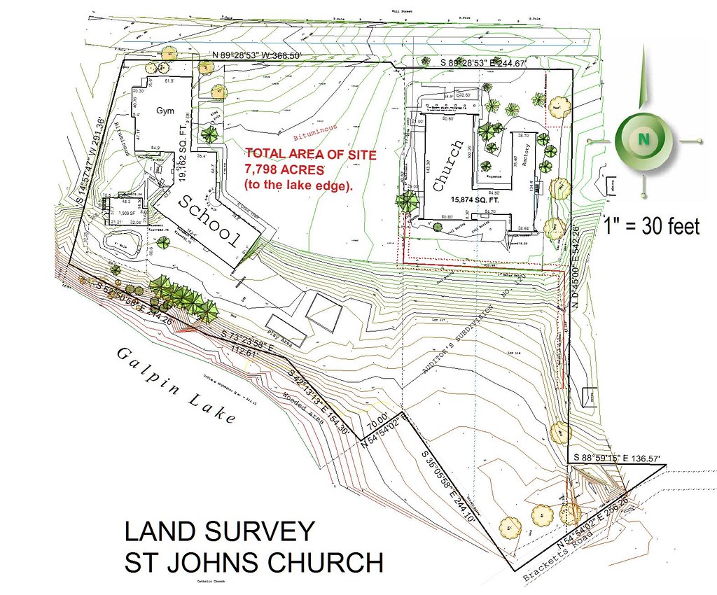
    Kluge #1: A new subdivision is more than likely designed by the local civil engineer who is unlikely to possess a strong neighborhood design background. This is because the firm who plans the development will also get the lucrative engineering and surveying work. For that reason, every engineering firm, and most land surveying firms boast of their land planning abilities, even if there are no qualified and experienced ‘neighborhood’ designers on staff.

    Kluge #2: Assuming the local consultants relationship with the staff, council, and planning commission will result in a better development for the developer and builder – and a better city. The local consultant will likely have a familiarity with the people involved in the approval process, but may be far too easy compliant with every demand and change – no matter how absurd, than to argue a valid point with the city. They may know the design or idea is superior to the same old way things are done, but will try to convince the developer (who is paying for their services) the good idea is a bad idea. Progress stagnates – and this a major reason many new subdivisions looks the same (or worse) than one designed in the 1960’s.

    Kluge #3: The cities’ regulations. Cities have in-house staff or hire outside consultants to maintain and update their regulations which are essentially a boiler-plate document of the adjacent city. Nothing in the regulations reward developers for doing a better job. Will the development be an asset or an instant slum? If it meets the minimums – it must be approved! That’s it.

    Smart Code? There is nothing smart about this dumb idea – it only guarantees the consultant pushing these incredibly complex and restrictive codes is forever retained to consult at every city meeting. Overly restrictive code guarantees mindless replication and places a roadblock to progress and innovation.

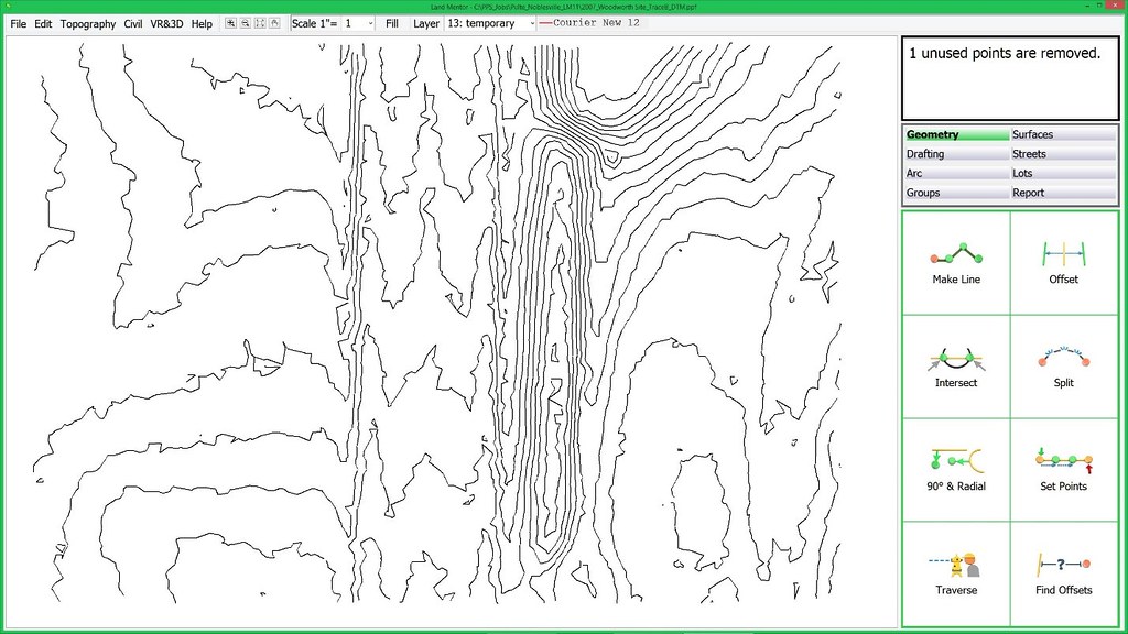
    Kluge# 4: Technology used to develop land. I’ve been developing and marketing civil engineering, surveying, and design software for almost four decades. On a sales call – what do you think is the first question? How much faster can we get our work out? What’s the question I’ve never heard? How much better can we design our neighborhoods for our clients and those that will live within? The billions of dollars spent on CAD and GIS technology, training, updates, hardware, and support has resulted in zero difference in the actual pattern of growth! City planning commissions and councils are presented the same 2D plans that nobody can understand and visualize. Virtually unchanged since 1960, but presented in PowerPoint instead of transparency slides on an overhead projector.

    Kluge #5: The land development consulting industry itself. I know of no other industry where the main design professionals (architects, planners, engineers, surveyors, etc.) are less likely to collaborate and communicate to assure the end user (the resident or business owner) is best served. There are many reasons why this is such a dysfunctional industry. The professionals involved have completely different skillsets. They often conflict with the others’ skillsets. All this can be solved with a new era of consulting industry where all involved have a common knowledge base to begin with – somewhat like the medical industry. This leads us to the next kluge…

    Kluge #6: The universities only teach a narrow focus on an isolated aspect of the development process. With a ‘common knowledge base’ where a student will learn all aspects with technology and systems that can advance the industry we can tear down the barriers of communication and build collaboration. One major problem: the professors. They will need to harness better technologies and re-learn themselves – making an effort and need to communicate and collaborate among themselves.

    Kluge #7: What happened to teaching – design? The world has morphed down to only a few major players in the software industry who have done nothing to advance the growth and redevelopment process through research and innovation. Over generations, gradually the world loses skillsets that were commonplace before computers existed. This is why all those new apartment projects and commercial buildings look the same, and that new subdivision is more mundane and cookie-cutter than in the past.

    Kluge #8: Traffic regulations and trendy roundabouts. Don’t even try to convince me that roundabouts are a good idea, they are not. Of the well over 1,000 neighborhoods I’ve designed this past 26 years I’ve included a total of 3 roundabouts. There are much better alternatives that are safer and maintain flow, reducing time and energy while increasing safety.

    Have you ever passed a restaurant thinking you are a bit hungry, but then decide to pass it up because you are routed a ridiculously long distance of multiple intersections to the place and instead pass it by? We all have. Instead of making access more efficient and convenient, often these rules do quite the opposite. As a pedestrian or on your bike have you ever tried to cross at a roundabout? Did you feel safer than at a signalized intersection? Progress? No. Kluge? Yes. Thus roundabouts are safer for pedestrians because most go far out of their way to avoid crossing them!

    Kluge #9: Streets as the pedestrian route. Subdividing land is all about density – little about function. The pattern assures the most units (housing or commercial square footage) are sardined into a site. This pattern sets the street first – lots second. Nothing else. Pretty simple and quick with the latest technology (kluge #4). What of the streetscape (curb appeal, monotony)? What’s the views from within the home to adjacent open space? What open space? How easy is it to walk through the neighborhood to destinations you would want to walk or ride a bike to? Walks that simply follow the internal streets are highly unlikely to make a stroll convenient, thus the mindless walks designed automatically in CAD will discourage a stroll. To fix this deficiency, the vehicular and the pedestrian routes should be two different systems, merging where it makes sense.

    Kluge #10: Revisions along the approval process. Suppose, an experienced and talented land planner carefully thought through the design of the neighborhood. The traffic entering maintains flow along streets void of monotony. There is a separate and connective pedestrian system, and the site plan follows the natural terrain honoring natures design, while reducing run-off and earthwork – which in turn saves the trees. At the first public meeting, the neighbors complain about traffic and the city planner demands you not connect at the proposed locations and add some new connections. You make small changes and as a result your traffic no longer flows as the planner designed. The engineer simply complies (see kluge #2). The length of the cul-de-sac is 70 feet longer than allowed, and will need to be adjusted, but that destroys the placement on top of a knoll which makes more sense, and the main trail connecting through the cul-de-sac is rerouted which destroys the pedestrian connectivity.

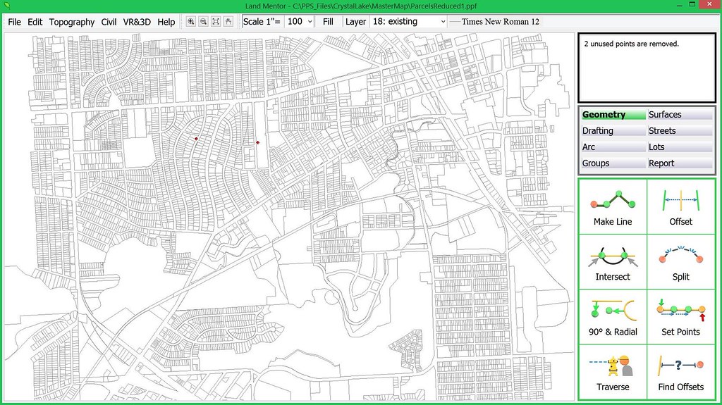
    As a software developer and president of my company I do not allow kluges. The LandMentor system we developed has taken 12 years, mostly because it’s kluge free. I seriously doubt there is any software of any type that exists that has a 12 year initial development process. What we learned from the software business applies to land development and home design (single family and multifamily) – when problems arise or revisions are demanded, it’s most often better to start afresh than force an older ‘invested’ idea to work, the very definition of a kluge.

    There is no quick fix to sustainable development, and no place for kluges.

    Rick Harrison is President of Rick Harrison Site Design Studio and Neighborhood Innovations, LLC. He is author of Prefurbia: Reinventing The Suburbs From Disdainable To Sustainable and creator of LandMentor. His websites are rhsdplanning.com and LandMentor.com

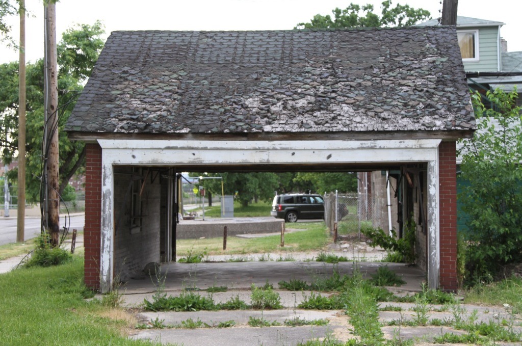
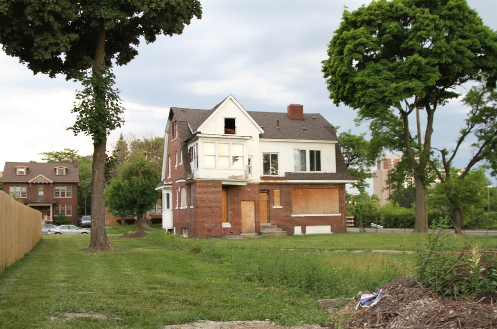
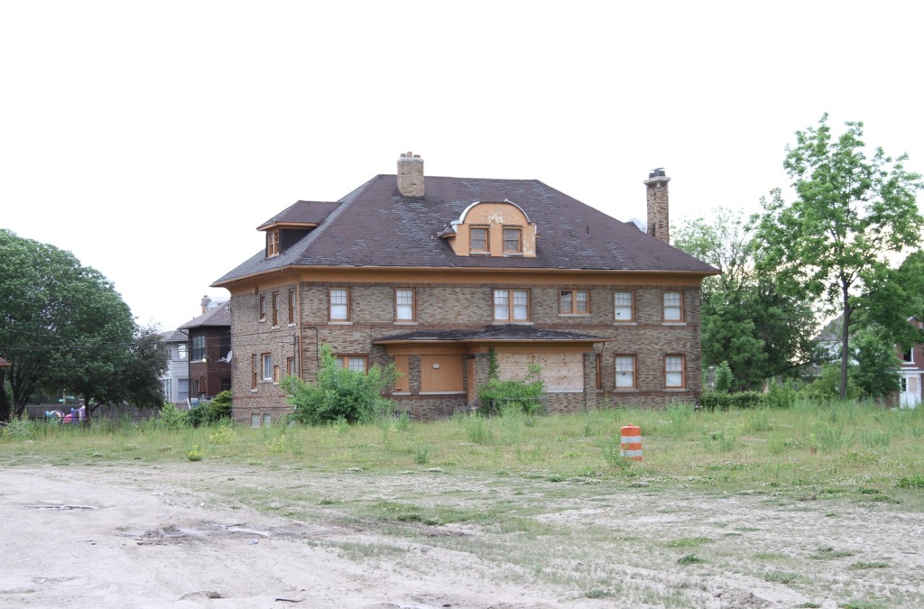
    Photo: Zoedovemany (Own work) [CC BY-SA 4.0], via Wikimedia Commons

  • Bringing Soviet Planning to New York City

    New York City Mayor Bill de Blasio wants to bring the same policies that worked so well in the Soviet Union, and more recently in Venezuela, to New York City. “If I had my druthers, the city government would determine every single plot of land, how development would proceed,” he says. “And there would be very stringent requirements around income levels and rents.”

    As shown in the urban planning classic, The Ideal Communist City, soviet planners also believed they were smart enough to know how every single plot of land in their cities should be used. The cities built on their planning principles were appallingly ugly and unlivable. They were environmentally sustainable only so long as communism kept people too poor to afford cars and larger homes.

    If de Blasio believes in this planning system so much, why doesn’t he implement it in New York City? The biggest obstacle, he says, is “the way our legal system is structured to favor private property.” He blames housing affordability problems on greedy developers who only build for millionaires.

    The reality is that, under the control of private property owners, New York City housing was quite affordable in 1969. It was only when planners began to interfere with private property rights that housing prices spiraled out of control.

    In 1969, New York City median family incomes were $,9692 and median home prices were $25,700, for a value-to-income ratio of 2.7. This was affordable because, at 5 percent interest, someone could devote 25 percent of their income to a mortgage that is 2.7 times their income and pay off the loan in 15 years. Housing was even more affordable in the suburbs, as value-to-income ratios in the New York metropolitan area were 2.6.

    By comparison, value-to-income ratios in 2015 were 8.8 for the city and 5.1 for the metropolitan area. Even at today’s 3 percent interest rates, someone buying a home that is 8.8 times their income could devote a third of their income to the mortgage and not be able to pay it off in 40 years.

    What happened since 1969 to make housing so much less affordable? Contrary to de Blasio, one thing that didn’t happen is that developers got greedier. While there is no accurate measure, I am sure that people were just as greedy in 1969 as they are today. The human desire to accumulate wealth hasn’t changed in thousands of years, which is one reason why the kind of socialism that de Blasio favors never works.

    Instead, one thing that happened was rent control. New York state first imposed rent control in 1950, but the law exempted rental housing built after 1947, and other housing was gradually deregulated through 1969. But in 1969, New York passed a new law that applied rent control to all housing, thus discouraging anyone from building new rental housing.

    Another thing that happened was the city’s historic preservation ordinance, which was passed in 1965 and which has gradually restricted more and more of the city from redevelopment. More recently, New York City responded to unaffordable housing by passing an inclusionary zoning ordinance which provides affordable housing for a tiny number of people at the expense of making it less affordable for everyone else.

    New Jersey and Connecticut did their part by passing statewide growth management laws, thus restricting people’s ability to escape New York City’s high housing prices by moving to the suburbs. Connecticut first passed its law in 1974 and New Jersey in 1986.

    All of these actions are examples of the kind of government control that de Blasio supports, and all of them contributed to the high housing costs that de Blasio objects to. The next time he wants to find a greedy person to blame for unaffordable housing, he should look in a mirror.

    This piece first appeared on The Antiplanner.

    Randal O’Toole is a senior fellow with the Cato Institute specializing in land use and transportation policy. He has written several books demonstrating the futility of government planning. Prior to working for Cato, he taught environmental economics at Yale, UC Berkeley, and Utah State University.

    Photo: Kevin Case from Bronx, NY, USA (Bill de Blasio) [CC BY 2.0], via Wikimedia Commons

  • A Layman’s Guide To Houston After Harvey: Don’t Throw The Opportunity Baby Out With The Stormwater

    In the aftermath of Hurricane Harvey, and the disastrous flooding, Houston has come under extreme scrutiny. Some in the global, national as well as local media assaulted the area’s flood control system and its development model, criticisms that were echoed by some in the local area.

    Much of the current debate starts from a firm misunderstanding of the region’s realities. This could lead to policies that ultimately undermine the keys that have propelled the region’s success. Below is a primer to inform future discussions of Houston’s future trajectory.

    Click here to read more or download the full paper.

    Photo: Michael Coppens, via Flickr, using CC License.

  • Neighborfest: Building a Stronger, More Connected World from the Block Up

    As we write this piece, the whole world is watching in disbelief as rain and flooding wreak devastation again along the Gulf Coast and Florida. Upwards of 50 inches of rain fell in parts of Southern Texas, thousands have been displaced from their homes in Miami and Houston, and some residents may never fully recover their livelihoods and homes. The Mayor of Houston called upon neighbors to help each other while first responders did their best to respond to the thousands of calls for help. It is in the shadow of their heroism and grace that we offer the following approach to mitigating the impact of future events in your communities.

    “All disasters are local” is a phrase we hear often in the emergency management field. While the initial coverage of large events is often framed at the city level, the narrative soon shifts to the neighborhoods that experience heightened levels of damage and stress. The 9th Ward, Red Hook, and the Rockaways have all become household names due to major disasters which unfolded there. In San Francisco, the Marina district became the center of the world as the media covered the events that followed the famous “World Series” Earthquake of 1989. As the helicopters flew overhead, firefighters desperately tried to stop flames from leaping from house to house but were hampered by broken water pipes. Residents in the area leapt to action. They started guiding their vulnerable neighbors out of harm’s way and took the lead on running fire hoses from the fire boats on the bay up to the fire scene so the fire teams could do their job.

    That day, every resident became a first responder.

    Role of Social Capital in Emergency Preparedness

    Fast-forward almost 30 years, and the field of emergency management has evolved in the face of mountains of evidence that shows that, while professional personnel and gear are essential, well-connected communities that work together on both challenges and opportunities every day are better positioned to respond to times of stress, experience lower levels of impact, and recover faster to a more improved condition. In other words, they are resilient.

    Connections, also known as social cohesion or social capital, serve as the invisible fabric that connects us with our family, neighbors, and friends. These ties make up a critical but underappreciated component of strong neighborhoods and thriving cities. Having more connections and trust makes collective action more likely. We can solve problems more easily and are more likely to engage in planning meetings, attend PTA bake sales, and tackle crime and blight.

    When it comes to preparing for large disasters, we may imagine that building better roads, ports, and buildings will be enough to give our society resilience to future shocks. Unfortunately, traditional investments in the built environment to mitigate risks are important but not adequate. Research from communities around the world shows that social, not physical, infrastructure is the key to building resilient neighborhoods and cities. These neighborhoods and towns can recover from any kind of shock to residents, whether they’re extreme weather events or terrorism.

    Knowing the importance of social ties, we still must help our residents and their surrounding community get ready to meet the immediate needs of their loved ones and vulnerable neighbors. Social cohesion is great, but they still need to feed and care for each other under intense circumstances — so how do we get them to prepare for that mission without using fear based messaging?

    In San Francisco, we’ve developed an easy solution: “Throw a Block Party!”

    Introducing Neighborfest

    Preparedness messaging to date has been presented as an almost arduous checklist of things that you have to do above and beyond your existing list of tasks. While all would agree these investments make sense, they appear to be more like “homework” than anything else.

    When we unpack the phrase “All disasters are local,” it can be either perceived as a clinical assessment of what happened, or a roadmap for an approach that will ensure the health and safety of residents. And there is nothing more local than a block party.

    In 2015, the San Francisco’s Neighborhood Empowerment Network partnered with the Red Cross, SF SAFE (a community policing NGO), NERT (our local version of CERT) and the Department of Emergency Management to pilot a new community capacity building initiative that would advance a variety of capacities to increase a neighborhood’s ability to respond to a disaster with little or no support from professional first responders.

    The program was called “Neighborfest — the World’s Greatest Block Party”, and eight neighborhood watches signed up to participate. The underlying goal was to create an experiential learning event that would advance the following capabilities:

    1. Build a team of volunteers around a unifying mission.

    When our hosts come together to organize their block party, we provide them with a framework that builds on the first responder’s Incident Command System (ICS). ICS sets goals, objectives, roles, and responsibilities for times of stress. It’s a simple framework and works perfectly for pulling off a great block party.

    2. Develop an asset registry for critical resources in the immediate neighborhood.

    Block parties need a lot of different resources, including tables, chairs, bounce houses, charcoal for BBQs, and food. Neighborfest hosts learn to identify needs as a team and then crowdsource each resource from their neighbors, buy it, or get it donated. Practicing this form of asset mining will be an invaluable investment when residents need to work quickly to meet needs — and Home Depot and Safeway aren’t open, the likely situation in a large-scale disaster.

    3. Become effective conveners and generate social capital throughout their community.

    Humans have amazing potential to come together during times of stress and to help each other overcome overwhelming challenges. The critical factor for magnitude and comprehensiveness of that support is the level of connection that people have among themselves pre-event. In other words, you are more likely to offer or accept help from someone you already know. The Neighborfest program generates social capital from the moment the host committee is formed to the actual event when people are celebrating with old friends and strengthening their connection or meeting new neighbors for the first time.

    In order to onboard communities the Neighborfest Program offers the following benefits and resources to hosts:

         • A toolkit that provides them with step-by-step guidance for everything from organizing a Host     Committee to cleaning up after the event

         • A suite of tools such as a custom website that they can use to promote their event, door     hangers to reach out to nearby neighbors, and free barricades to manage traffic

         • Technical support on how to navigate the City’s permitting system and to remove fees

         • Coordination of first responder resources, police and fire, to arrive the day of the event and     engage residents

         • A professionally facilitated “Map Your Resilientville” exercise and preparedness information

         • A bin of disaster supplies comprised of gloves, helmets, vests, and first aid kits to help     neighbors help each other in the hours after an event

    The first round of pilots were a smashing success and the decision was made to run a second round of pilots in 2016. In 2017, the program was opened up to a wider range of engaged networks and over 35 neighborhoods were enrolled.

    Beyond the fantastic food that is a hallmark of a great block party, a real highlight from the last three years is the amazing range of activities that hosts created for their guests. From pinball machine competitions to belly dancing flash mobs, the residents always seem to find a way to build on the foundation of a classic neighborhood street party and add a unique cultural twist that makes it all their own. For the City, we have our own layer that advances our mission in a manner that generates deep impact with very little of the traditional logistics associated with community engagement.

    A key requirement of participating in the Neighborfest Program is that hosts allow the City, and its partners, to join the event to table and raise awareness of our programs and initiatives. A very popular activity that complements the provision of the bin of disaster supplies is the “Map Your Resilientville” exercise. This fun and easy game offers participants an opportunity to asset map their community for sources of food, water, power, medical, sheltering, and open spaces resources in their community so they can survive for 72 hours. Once the resident has written their answers on the sheet, they are offered a wide range of culturally competent preparedness information resources which they overwhelming accept. As the event winds down, the hosts bring their guests together for a group photo with their new disaster resources map and bin of supplies. The map is then rolled up and put in the bin to be retrieved at a moment’s notice to guide their response activity should times of stress arrive.

         • For cities considering adopting this program, the process for its implementation is fairly     simple. Determine what systems are in place for residents to secure permission to close a street     and engage the managing agencies to join the program as partners. (NOTE: Neighborfests are     also held in parks, plazas and parking lots)

         • Convene any and all agencies that offer programs and resources to communities and invite     them to join the initiative.

         • Use the current Neighborfest toolkit or develop your own.

         • Launch a pilot and secure the participation of reasonable number of neighborhoods that will     afford partner agencies enough activations to fine tune planning, operations and logistics     responsibilities.

         • Make any necessary adjustments to your Neighborfest strategy and open a second round of     block parties. Continue to increase the number of events in reflection of your staffing and     budgeting capacities.

    Over time, you’ll most likely develop a team of committed volunteers who enjoy engaging people about this important issue as well as being in a joyful environment where people from all walks of life come together and celebrate what they have in common — their neighborhood.

    The intent of the Neighborfest program is to be prepared for times of stress that may arrive at any time. However, the social dividends generated literally from the moment the Host Committee is convened are immediate and tangible. Almost everybody wants to live in a community surrounded by people they know and trust, and the Neighborfest program is valuable resource for achieving that goal.

    So let’s get local and have a party.

    This piece originally appeared on Medium.

    Daniel Homsey is the Director of The Neighborhood Empowerment Network (NEN) for the City Administrator’s Office of the City and County of San Francisco. A fourth generation San Franciscan who has a degree in Political Science from San Francisco State University, Mr. Homsey has spent the last 25 years as a communications professional in both the private and public sector. After a long stint in the tech sector, Mr. Homsey joined the City in 2004 and in January 2008 became the Director of the NEN which is a coalition of residents, community supported organizations, non-profits, academic institutions, and government agencies whose mission it is to empower residents with the capacity and resources to build and steward stronger more resilient communities. For more information about the NEN, please visit www.empowersf.org.

    Daniel Aldrich is professor and director of the Security and Resilience Program at Northeastern University. He has published four books, more than forty peer reviewed articles, and written op-eds for The New York Times, CNN, and Asahi Shinbun. He has appeared on popular media outlets such as CNBC, MSNBC, NPR, and HuffPost, and has a PhD in political science from Harvard. His research has been funded by the Fulbright Foundation, the Abe Foundation, and the National Science Foundation. Hee has carried out more than five years of fieldwork in Japan, India, Africa, and the Gulf Coast. His newest book, Black Wave: Connections and Governance in Japan’s 3.11 Disasters, is under review, and his articles and OpEds can be downloaded for free from http://daldrich.weebly.com/. For more on Prof. Daniel Aldrich’s work — please visit https://www.amazon.com/author/danielpaldrich. Daniel can also be reached on Twitter: @DanielPAldrich.

  • How To Deal With An Age of Disasters

    When Hurricane Harvey flooded Houston, followed by a strong hurricane in Florida, much of the media response indicated that the severe weather was a sign of catastrophic climate change, payback for mass suburbanization — and even a backlash by Mother Nature against the election of President Donald Trump.

    Yet, these assumptions are often exaggerated. Although climate change could well worsen these incidents, this recent surge of hurricanes followed a decade of relative quiescence. Hurricanes, like droughts and heavy rains, are part of the reality along the Gulf Coast and the South Atlantic, just as droughts and earthquakes plague those of us who live in Southern California.

    The best response to disasters is not to advance hysterical claims about impending doom, but rather resilience. This means placing primary attention on bolstering our defenses against catastrophic events, whether in protecting against floods, ice storms, earthquakes or droughts.

    The limits of original sin

    Days after Hurricane Harvey hit, Quartz opined that “Houston’s flooding shows what happens when you ignore science and let developers run rampant.” The Guardian’s climate columnist, George Monbiot, even portrayed the event as a kind of payback for being the world capital of planet-destroying climate change.

    In ascribing every disaster — even the Syrian civil war — to human-caused warming, we may be venturing into something more akin to the religious notion of original sin than to rational science. We should want to reduce greenhouse gases, but, as both rational skeptics like Bjorn Lomborg and true believers like NASA’s James Hansen agree, such things as the Paris climate accord are unlikely to make much of an impact on the actual climate in the near term — or even in the medium term.

    In the short run, then, who sits in the White House is pretty irrelevant. Having Barack Obama, or even Bill Nye, the “Science Guy,” in the White House would not make an appreciable difference in addressing nature’s fury.

    Read the entire piece at The Orange County Register.

    Joel Kotkin is executive editor of NewGeography.com. He is the Roger Hobbs Distinguished Fellow in Urban Studies at Chapman University and executive director of the Houston-based Center for Opportunity Urbanism. His newest book is The Human City: Urbanism for the rest of us. He is also author of The New Class ConflictThe City: A Global History, and The Next Hundred Million: America in 2050. He lives in Orange County, CA.

    Photo: Jill Carlson (jillcarlson.org) from Roman Forest, Texas, USA (Hurricane Harvey Flooding and Damage) [CC BY 2.0], via Wikimedia Commons

  • The South’s Big Cities Moment

    August’s tragic events in Charlottesville kickstarted a somber debate about the appropriate way to commemorate the war that gave all Americans their freedom. It also triggered a conversation about whether the south’s legacy of rebellion and independence – with slavery a painful and regretful part of its past – is a legacy worth remembering.

    These discomforting conversations are a reminder that the south’s antebellum past continues to affect it in the present. Beyond civil rights, these impacts are profoundly felt in the south’s continuing urbanization, which is among the most rapid in the country despite occurring largely within the frameworks of cities whose prewar, pre-industrial bones were never suited for the “big city” qualities filled by their northern cousins. Today’s globally-connected southern cities grew largely from antebellum-era towns that were not the commercial or industrial powerhouses of the past, and yet they are growing dramatically anyway.

    The result is a murmuring culture war about the future of southern cities. The media may be fixated on statues, but the real issue is how these cities – thanks to a variety of historical and developmental factors that differentiate them from those in the north – are growing in ways that may not appeal to many planners and local boosters.

    Many of the south’s transformations have been enviable and measurable: between 2000 and 2012 most large southern metro grew by at least 20 percent, with some like Charlotte and Austin growing at more than twice that rate. Since air conditioning became a norm rather than an exception, growth has trended toward warmer climates, with half of America’s population growth in the last 50 years going to the eight states with the warmest climates. Southern cities have been particularly successful in attracting black families, a declining demographic in nearly every large northern city. They have by and large remained affordable, and continue to be attractive relocation destinations for big companies: metro Atlanta, for instance, is now home to more Fortune 1000 companies than vaunted San Francisco.

    The result is a set of increasingly economically significant and connected large cities with ever-larger suburbs and de-centralized economic gravity. Compared to northern cities, southern ones are less urban, less clustered, and less tall, on average with about half the number of skyscrapers per capita as major northern cities, based on data available from Emporis.com. This dispersion reflects their expanding ethnic diversity. Counties that were once entirely rural are now increasingly suburban, and attractive to minorities and immigrants. Georgia’s recent 6th District election in 2017 and Hillary Clinton’s victory in Fort Bend outside Houston reflects this unpredictable new southern political world.

    Planners have celebrated the urban revitalization in many large existing cities in the north, but largely have been less enthusiastic about this continued growth of sprawling cities in the south. In turn, they have sought increasingly to steer their growth in a more traditional northern pattern. Foremost among the goals of these planners is to densify and re-orient these cities around downtowns that have generally never embodied a strong urban character. This has created a number of awkward dualities: the push for walkability in places that have never before been walkable; the push for rail in cities where the density doesn’t support it; and the push for outdoor living in cities where being outside is uncomfortable for much of the year. This push for glassy Chicago-style downtowns does not always come naturally to cities whose strongest urban legacy is that of sleepy tree-lined Georgian mansions, and it has forced cities from Charlotte to Charleston to contemplate what kind of cities they want to be in the future.

    Conventional urban planning is simply not well-suited to the south’s dynamic new urban environments. New urbanism, for instance, while influential in the south, has made its name through quaint town making largely in the suburbs. Typical urban approaches like the repurposing of downtowns back into modern reinventions of what they once were – do not reflect the development, demographic, infrastructural, or character-driven challenges of cites without urban or industrial legacies.

    Now, the south has begun inventing its own new brand of experimental urban development, often heavily fueled by the private sector. In Atlanta, for instance, the public-private development of the Battery and Sun Trust Park is a public-private typology virtually unimaginable in the north. Boldly, the Atlanta Braves major league baseball team uprooted from its perfectly acceptable downtown home to move closer to its suburban fan base; a county without a discernible center delivered on much of the financing, and worked with the Braves to develop, from scratch, an entire new ballpark-oriented urban district to compete with downtown Atlanta and help fund both the cultural evolution and the cash flows needed to sustain the ballpark.

    The Battery was a form of urbanization and regional re-positioning delivered through a single project. Rather than a renewed focus on the urban core through adaptive reuse and infill, all gospel to planners in the north, metro Atlanta has shaped its own new downtown at a convenient juncture in the sprawl. These kinds of large-format development projects that create their own energy and introduce their own anchors are a hallmark of southern city-making, and build upon the “edge cities” idea first extensively written about by Joel Garreau in the early 1990s.

    The most impressive forms of project-driven development have been those where private developers have taken on urbanization efforts too massive for governments. In Florida and Texas, for instance, private developers are trying to implement high-speed rail lines by leveraging potential profits from real estate development around stations as part of the funding package. And Sandy Springs, Georgia received abundant attention in 2012 when it became a “contract city”, the ultimate privatization experiment when it bid out nearly all of its city services to outside contractors. By relying on private industry to take on these kinds of complex development and governance projects, southern cities are trying to avoid the government boondoggles as well as budget and debt ceiling shortfalls many northern cities face. In turn, however, those delivering on the projects have tremendous power over the formation of these cities, while urbanization is rarely happening according to plan.

    Acknowledging the power of these leaps and bounds innovations, some cities are trying to better channel the urbanization through example projects designed to inspire the private sector to develop in a more organized way. In Raleigh, for instance, the development market has been slow to deliver on high-quality urban projects, so in response the City is taking on the challenge itself: its own new City Hall campus may end up being the most powerful piece of modern architecture in the city. In turn, it is hoped to have catalytic potential to induce dramatic change across a downtown smattered with low-rise buildings. In many such cities, there is an underlying belief that channeling the pent-up private development market toward areas where land values are already the highest will maximize tax revenues and fiscal stability, and improve those cities’ urban qualities. Whether it’s a strategy with staying power is yet to be seen.

    There is no rulebook for how urban change is occurring in the south, but there is no doubt it is occurring more rapidly there. The universal themes in southern city-making today are diversification and creativity, ideas imbuing innovation that would be unlikely if they borrowed conventional approaches verbatim from the north. This new creativity on behalf of big steps and bold visions belies many recommendations from nationally-focused planners toward government consolidation and the belief that all new good things must happen through incremental steps in traditional downtowns. Perhaps this new form of southern rebellion will have staying power; much better, and better for its citizens, than the last one.

    Roger Weber is a city planner specializing in global urban and industrial strategies, urban design, zoning, and real estate. He leads the Urban Policy Practice Area for Skidmore, Owings & Merrill’s City Design Practice and holds a Master’s degree from the Harvard Graduate School of Design. Research interests include urban finance, demographics, architecture, housing, and land use.

    Photo: Thomson200 [CC0], via Wikimedia Commons

  • Spotlight on Infrastructure After Harvey

    The recent tragic events in Houston and across the Gulf Coast once again demonstrated the woeful inadequacy of our infrastructure. Hopefully, some good will come of Hurricane Harvey. Hopefully, it will jump-start the long-awaited Trump initiative on infrastructure, which may be the one issue that could unite this country.

    Northeastern University’s post-disaster resiliency expert Daniel Aldrich notes the need for better storm water drainage systems and for fortifying existing infrastructure — and not just in Houston. Helping promote such investments represents perhaps the last best chance for creating a significant Trump legacy.

    Once a leader in world infrastructure, the United States now ranks 11th in the overall quality of its infrastructure, according to the latest World Economic Forum Global Competitiveness Index. This decline has consequences. In California, for example, the lack of investment in water storage both worsened the recent drought and reduced the state’s ability to take advantage of heavy rains when they arrived.

    A concerted effort to restore our nation’s bridges, roads, harbors and other critical infrastructure would also mark a significant break from the Obama era stimulus which focused more on propping up renewable energy and often underused mass transit systems. Meanwhile, our overall infrastructure continued to deteriorate during the Great Recession, even with the stimulus, with spending in decline from over $300 billion in 2008 to under $250 billion in 2013.

    Spending Smartly

    “Efficiency is doing things right,” legendary management guru Peter F. Drucker once proclaimed. “Effectiveness is doing the right things.” In the context of infrastructure, being effective means placing our bets on things that are really needed, and could reward our society with greater productivity, wealth and new employment.

    At Newgeography.com, where I serve as executive editor, we recently carried a report from the Houston-based Center for Opportunity Urbanism,Doing the Right Things Right,” which lays out what an infrastructure strategy would look like given current budget constraints. The United States faces a national debt of $20 trillion, while the federal government deficit was projected to reach $693 billion for fiscal year 2017.

    A strong U.S. transportation infrastructure system facilitates economic growth, job creation, a better standard of living and less poverty by minimizing travel times and improving labor market efficiency. Yet, as “Doing the Right Things Right” makes clear, not all investments are the same, or should receive federal subsidies, whether for direct expenditures or to issue infrastructure bonds to support private investment. There have been too many examples of spending on lower priority infrastructure because politicians were more interested in securing pork, or votes, than accelerating economic growth or reducing constituents’ travel times.

    To be sure, America’s infrastructure has performed well enough to provide the highest standard of living for the largest number of people in the world. The legacy of earlier infrastructure decisions, such as the completion of the interstate highway system, is still evident. Overall, the amount of time America’s commuters spend in peak period traffic congestion is generally better than that of international competitors.

    Yet traffic problems are increasing in the nation’s largest metropolitan areas. A recent study found that traffic congestion imposed $132 billion in excess fuel and time costs for automobile drivers and $28 billion in freight costs annually — all ultimately absorbed by consumers.

    The key question is how we meet these challenges. One proposed solution is to increase spending on traditional mass transit. This works well largely in “legacy cities” such as Washington, Chicago, Boston, Philadelphia, San Francisco and New York. The city of New York alone represents a remarkable 36 percent of all U.S. transit commuting, yet has only 3 percent of the jobs. Outside of these cities, the new transit projects, principally rail lines, have done little or nothing, as a recent report on transit from Chapman University demonstrates, to slow congestion or attract significant ridership.

    Among 19 metropolitan areas that added high-capacity transit systems since 1980, both bus and rail, transit’s market share has fallen from 4.7 to 4.6 percent compared to the last data before the systems opened. Transit has not, on balance, reduced solo driving, which increased from an average of 73.0 percent to 76.6 percent.

    The cities with rail systems opening after the 1990 Census experienced a modest decline in transit work trip market share, from 3.8 percent in 1990 to 3.7 percent in 2013.

    Take the absurd example of Los Angeles, which has spent over $15 billion trying to become what some mass transit enthusiasts call the “next great transit city.” Yet, Los Angeles County Metropolitan Transportation Authority system ridership stands at least 15 percent below 1985 levels, when there was only bus service, at a time when the population of Los Angeles County was 20 percent lower. Since 1990, transit’s work trip market share in the Los Angeles metropolitan area has dropped from 5.6 percent to 5.1 percent. No surprise, then, that according to a recent USC study, the new lines have done little or nothing to lessen congestion.

    Doing Your Homework

    The irony is that billions are being spent on these ineffective systems, when the places that depend on transit, like New York and Washington, are seeing their systems become less reliable and even dangerous. We are dumping money in some locations that don’t work all that well, but can’t find funds to fix systems that remain essential to “legacy cities” with large downtowns ideal for transit ridership.

    With the expense and ineffectiveness of new rail systems, it seems that the time has arrived for transit services that focus on less expensive bus systems, including those run by private companies, which can carry so many more riders for so much less in taxpayer subsidies. There are also opportunities to make lightly used but highly subsidized services more cost-effective by adding ride-hailing systems, like Uber and Lyft, cited as a factor in recent ridership declines in Los Angeles and even New York. In suburban San Francisco, a local transit operator has established a pilot program to extend service through ride-hailing and cancelled a lightly patronized bus route, reducing costs while providing quicker door-to-door service.

    One of the most promising alternatives, virtually ignored by transit advocates, is to encourage options for working at home. In many metropolitan areas, more people already telecommute than take transit. Since 1980, the number of people working at home has grown three times that of transit riders. All this, at virtually no cost to taxpayers.

    In the future, rapidly evolving autonomous technologies could make our present transit systems archaic in most cities. Under any circumstance, these advances seem likely to further weaken conventional transit. Given these trends, why base our transit policy on 19th century technologies when we are about to enter the third decade of the 21st?

    Back to the Gulf: Resiliency, not Hysteria

    “Smart growth” advocates have been quick to argue that Hurricane Harvey’s unprecedented damage can be traced to Houston’s freewheeling, free-market approach to real estate development. Sure, the area got 50 inches of rain, but it fell both on communities that eschew strict zoning and those which embrace it. They somehow forget that a lesser storm, Hurricane Sandy, devastated the highly planned communities of greater New York just a few years ago, causing $19 billion in damage in the city alone – and with far less rain.

    Rather than imitate Portland or San Francisco, Houston and other Gulf communities need to maintain policies that have allowed it to avoid the kind of insane price hikes one sees on the West Coast and some Northeastern housing markets. To force Houston to act like San Francisco would kill its economy. If Texas real estate prices approach California’s, people will simply move elsewhere, where prices are lower.

    Some changes may be necessary, including “coastal restoration” efforts that limit the impact of storms like Harvey. Major engineering challenges, like building more water storage facilities and improved drainage, need to be imposed, as well.

    What Houston needs, and would naturally adopt, is a kind of enlightened free market approach. After the devastation of Galveston in 1900 hurricane, Houston famously built a ship channel while Galveston built an elaborate sea wall; Houston is no less a creation of private innovation and government than New York or Los Angeles. Like America itself, Houston thrives by combining good public investment with a maximum of economic flexibility.

    The more these decisions are made locally, by people who are directly impacted, the better. My colleague Tory Gattis, based in Houston, suggests that new developments and older ones “should be required to have adequate rainwater retention, either with ponds, tanks, or permeable surfaces.” There are already examples of some of this kind of planning, particularly in exurban communities such as the Woodlands. This may mitigate the ill effects of such storms, but not likely to prevent disasters like Harvey from inflicting huge damage.

    These policies could mean, over time, that Houston and other Gulf communities might build an infrastructure more reminiscent of Frank Lloyd Wright’s Broadacre City, scattered communities with ample open land around them. But the vision must be a localized one, not drawn from example of generally slower-growing, older regions facing very different natural challenges. The benefits to customizing local infrastructure is go beyond economic reality and even disaster mitigation. With enough focus on local needs, we need not wait for natural disasters to witness the heartwarming sights of multi-cultural first responders – and ordinary citizens – all pulling together. “Social networks and cohesion are an important part of recovery and survival,” professor Aldrich suggests. “Houston should be investing in bringing neighborhoods together.”

    This is the real secret sauce for resiliency, as Houston has been showing throughout this crisis. The more that people who are impacted control the till, whether repairing levees, imposing regulations or planning transit systems, the better. Rather than let Leviathan rule and impose conformity, we should let regions — whether in Texas or elsewhere — figure out how to meet infrastructure challenges that effect every community differently.

    This piece originally appeared on Real Clear Politics.com.

    Joel Kotkin is executive editor of NewGeography.com. He is the Roger Hobbs Distinguished Fellow in Urban Studies at Chapman University and executive director of the Houston-based Center for Opportunity Urbanism. His newest book is The Human City: Urbanism for the rest of us. He is also author of The New Class ConflictThe City: A Global History, and The Next Hundred Million: America in 2050. He lives in Orange County, CA.

    Wendell Cox is principal of Demographia, an international public policy and demographics firm. He is a Senior Fellow of the Center for Opportunity Urbanism (US), Senior Fellow for Housing Affordability and Municipal Policy for the Frontier Centre for Public Policy (Canada), and a member of the Board of Advisors of the Center for Demographics and Policy at Chapman University (California). He is co-author of the “Demographia International Housing Affordability Survey” and author of “Demographia World Urban Areas” and “War on the Dream: How Anti-Sprawl Policy Threatens the Quality of Life.” He was appointed to three terms on the Los Angeles County Transportation Commission, where he served with the leading city and county leadership as the only non-elected member. He served as a visiting professor at the Conservatoire National des Arts et Metiers, a national university in Paris.

    Photo: Hurricane Harvey flooding by Jill Carlson, via Flickr, using CC License.

  • Postcards From the Zombie Apocalypse

    I’m regularly accused of being a doomer whenever I point out the obvious – that many aspects of how we’ve organized our affairs over the last several decades aren’t meant to last. So they won’t. The end of Jiffy Lube and Lean Cuisine isn’t The End. Civilization will carry on without them, I assure you. But when it’s suggested that our current set of arrangements won’t last forever people immediately imagine Mad Max, as if no other alternative exists. Things are going to change. They always have and they always will. The future will just be different. That’s absolutely not the same as saying the world is coming to an end. Clear eyed individuals who are paying attention can start to get a feel for who the new winners and losers are likely to be and place themselves in the best possible situation ahead of the curve. That’s a pragmatist’s view – not a doomer’s.

    It helps to explore previous versions of these regularly occurring historical shifts. Think of them as postcards from the last few rounds of the Zombie Apocalypse. Here’s a small farm town in rural Nebraska. Its population peaked in the 1920s. The period between World War I and the Great Depression was an especially prosperous time for such towns as commodity prices were high and technological innovation (the telephone, radio, automobiles, tractors, etc.) created an enormous amount of new wealth and opportunity. The 1920s was also an era of rampant unsustainable practices of all kinds that lead to the ruined soils and draughts of the Dustbowl and the collapse of speculative credit based financial institutions. The population of this town began to decline in the 1930s and is currently down to a few dozen souls.

    Remnants of some of that early twentieth century technology still litter pastures on the edge of town. One resourceful farmer organized these old car carcasses into a makeshift corral for his livestock.

    It’s possible to connect the dots from rural Nebraska to Detroit where those very same vintage vehicles were manufactured all those decades ago. Detroit peaked in population, economic power, and political influence in 1950. Today huge swaths of Motown look remarkably similar to the abandoned farms and small towns of the prairie. Entire city blocks are now cleared of people and buildings. The Zombie Apocalypse arrived there too. If small scale agriculture was made redundant by mechanization and industrial scale production, then industry itself was hammered by other equally powerful forces. Everything has a beginning, middle, and end.

    The most recent iteration of the Zombie Apocalypse has already begun to unfold in some places. Suburbia was exactly the right thing for a particular period of time. But that era is winding down. The modest tract homes and strip malls built after World War II  are not holding up well in an increasing number of marginal landscapes. I have been accused of cherry picking my photo ops, particularly by people who engage in their own cherry picking when discussing the enduring value of prosperous suburbs. But there’s too much decay in far too many places to ignore the larger trend. The best pockets of suburbia will carry on just fine. But the majority of fair-to-middling stuff on the periphery is going down hard.

    The desire to push farther out and build ever more upscale suburban developments in increasingly remote locations is palpable. That’s what a significant proportion of the population desires on some level. But in the same spots – often next to each other – is ample evidence that there’s something profoundly wrong.

    Not all farm towns died. Not all industrial cities collapsed into ruin. Not all suburbs will fail… But the external forces at work are going to favor some places much more than others moving forward. The trick is to understand what those forces are before everyone else does and position yourself to benefit instead of getting whacked by the shifts. Would you have rather sold your house in Detroit in 1958 when things were still pretty good, or wait until 1967 when the panicked herd began to stampede? Would it have been better to buy property in the desert in 1970 and take advantage of a wave of growth for a few decades, or buy now at the top of that cycle and slide down from here on out?

    The future drivers of change will be the same as the previous century – only in reverse. The great industrial cities of the early twentieth century as well as the massive suburban megaplexes that came after them were only possible because of an underlaying high tide of cheap abundant resources, easy financing, complex national infrastructure, and highly organized and cohesive organizational structures. Those are the elements of expansion.

    But once the peak has been reached there’s a relentless contraction. The marginal return on investment goes negative as the cost of maintaining all the aging structures and wildly inefficient attenuated systems becomes overwhelming. The places that do best in a prolonged retreat from complexity are the ones with the greatest underlying local resource base and most cohesive social structures relative to their populations. The most complex places with the most critical dependencies will fail first as the tide recedes.

    The next Zombie Apocalypse will relentlessly dismantle superficial decorative landscapes and highly leveraged economies of scale. Take away the twelve thousand mile just-in-time supply chains, heavy debt loads, and limitless cheap resources and you get a very different world. Over the long haul Main Street has a pretty good chance of coming back along with the family farm. But the shorter term in-between period of adjustment to contraction is going to be rough as existing institutions attempt to maintain themselves at all costs.

    This piece first appeared on Granola Shotgun.

    John Sanphillippo lives in San Francisco and blogs about urbanism, adaptation, and resilience at granolashotgun.com. He’s a member of the Congress for New Urbanism, films videos for faircompanies.com, and is a regular contributor to Strongtowns.org. He earns his living by buying, renovating, and renting undervalued properties in places that have good long term prospects. He is a graduate of Rutgers University.

  • Deep Ellum

    I recently wrote about the need to embrace reality when it comes to land use regulation, culture, politics, and economics. My interpretation can seem a bit… dark. It’s not my intention to discourage people looking to make a positive difference in their communities. I’ve just seen how things tend to play out and the process doesn’t exactly favor mom and pop operations that are juggling day jobs, raising kids, and working on limited budgets. Telling motivated individuals to go out into the world and build great new small scale walkable mixed use urbanism of the kind once found on every Main Street in North America is disingenuous. Yes, it’s “possible.” But it’s also incredibly unlikely in most places. Building from scratch or even modifying existing properties isn’t the answer for these folks. We need to be honest about that.

    I’ll use the Deep Ellum neighborhood in Dallas as an example. A few years ago I was in Dallas to attend a series of overlapping city planning conferences. Deep Ellum was a recurring theme and a number of events were held there as demonstration projects. Back in 1973 city officials bulldozed most of the neighborhood to make way for a massive elevated highway. Urban removal killed two birds with one stone. State and federal money provided commuter infrastructure that supported the ever growing new middle class suburbs on the edge of town while simultaneously wiping away blight near downtown. What’s not to love? (Anyone want to guess who lived in Deep Ellum before it was razed?)

    Dallas locals like Jason Roberts of Build a Better Block as well as fellow participants from out of state like Street Plans Collaborative advocate fast, cheap, temporary, and iterative programming for neglected neighborhoods. Potted plants, inexpensive outdoor furniture, food trucks, street vendors, bicycle accommodations, string lights, outdoor movie nights, and live music can reactivate otherwise dead streets, vacant lots, and disused storefronts. If done sensitively with the active participation of the people who already live in the neighborhood these techniques can be transformative. The goal is to discover what works and build upon those successes incrementally over time. It’s bootstrap urban revival on a shoestring budget.

    These days market demand for urban living is strong and there’s money to be made in redeveloping what’s left of these old neighborhoods. They have “authenticity” and “texture” that can’t be duplicated in new construction. Deep Ellum is well located within walking and biking distance of the central business district as well as Baylor University Medical Center. There’s a spread between what these buildings are now and what they could be with new investment and institutional support.

    While I was in town conference hopping I attended a side presentation organized by a group of prominent business leaders who advocate pulling down the highway that cuts through Deep Ellum. This meeting was held at the behest of the American Conservative and D Magazine populated by a lot of old white guys in suits, not crunchy hippie treehuggers.

    The business argument is simple. The aging highway is at the end of its design life and neither the city of Dallas nor the Texas Department of Transportation has the money to rebuild it since both are functionally insolvent. Dismantling the highway would liberate a huge amount of downtown land that could be redeveloped by the private sector. Construction jobs would be created up front, market demand for urban living would be satisfied, and substantial tax revenue would be generated for the city for many decades into the future. In other words, a cost center would become a profit center.

    And let’s not forget there’s a tremendous amount of money to be made for well placed developers with deep pockets. Hence all the wine and cheese gatherings and thought leaders with their PowerPoints. I hasten to add this isn’t corruption per se. The cost in time, money, and political wrangling is enormous. Only exceptionally well funded organizations can work their way through these endless processes and achieve any kind of worthwhile goal. Why would anyone bother if there wasn’t an equally massive payoff at the end?

    The reality of how land is redeveloped in this context is simple. The cost of buying distressed property, site remediation, upgrading the infrastructure, accommodating all the requirements of multiple bureaucracies from the fire marshal to institutional investors – all while still creating a product the market wants and can actually afford to pay for… leads to this. It’s referred to as the Texas Doughnut. It’s an entire city block of multi-storied parking garages wrapped in a skin of apartments. Sometimes they’re rentals, sometimes they’re condos for sale. If your goal is to recreate the fine grained individually owned mom and pop buildings of a previous century that’s just not going to happen. Again, it’s not impossible. It’s just highly unlikely to pan out for a dozen reasons having to do with the fact that the society that build Main Street no longer exists.

    So let’s go back to the smaller older existing buildings in Deep Ellum. These are at a scale an average family can wrap its mind around. Lots of people dream of owning an independent business and living upstairs. It’s a great arrangement that’s been used successfully for eons all around the world. But there are complications here. The most pragmatic way to purchase and renovate buildings like these is with cash. Some people have it. Most don’t. Private equity (A.K.A. asking your father-in-law or a collection of dentists and chiropractors from the country club for money) works if you have that kind of personal situation and charisma…

    Don’t expect to go to just any random bank and get a thirty year mortgage for one of these places. Almost all banks see such properties as “non-conforming.” They’re used to writing loans for four bedroom two bath homes on cul-de-sacs and then bundling them off at the end of the month to pension funds that require consistency in the product profile. If these were ten thousand square foot strip malls with fifty seven parking spaces on a road with forty thousand cars driving by each weekday there’d be an institutional bundle for that. Same with a two hundred unit garden apartment complex. But a fifteen hundred square foot bakery or barber shop with an apartment upstairs? What kind of freaky platypus is that?

    Some people will sit you down and calmly explain that the guidelines for plain vanilla federally insured mortgages technically include buildings with up to four units and up to 25% commercial space in an otherwise residential building. On paper it’s no different than a single family home. That’s absolutely true. But many older buildings are closer to fifty/fifty residential/commercial. Even if you find a building that does conform you still need to find a banker who will grant that loan in this neighborhood. Again, it’s absolutely possible. But it’s not easy. And if a building is too cheap – generally under $50,000 – no bank will write a mortgage either.

    A commercial loan with a short term – typically eight years – and a significantly higher interest rate might be offered instead of a standard thirty year mortgage. Maybe. As part of the due diligence process the right bank will make you prove that the building is structurally sound, conforms to modern codes, and has a pro forma that can cash flow properly. And then there’s the cost of renovations, complying with the Americans With Disabilities Act, the fire code, and existing zoning regulations… It can be done. But something as basic as installing fire sprinklers or an elevator can easily kill a proposed project. It’s just too expensive in a building with too little value. Sorting out all this stuff takes real skill and experience. I know several seasoned mid-size property developers who lost everything to bankruptcy because their high quality projects came on line just in time for a big market correction and they couldn’t service their debts. And these folks were light years ahead of an ordinary person looking to invest in a modest property.

    The scenario I see all over the country is formulaic. Older buildings in formerly derelict neighborhoods are bought and renovated by well funded and skilled firms who specialize in this kind of development. Shops and apartments are then rented to individuals. These legacy districts become amenity centers that add value to new large scale infill development of the Texas Doughnut variety. There are exceptions, but that’s mostly what I see. It’s neither good nor bad. People sometimes complain about gentrification, but the alternative is for these neighborhoods to continue to decline until they can’t be saved at all. It might be nice if every aspect of society changed to allow other options, but I’m not holding my breath. At the end of the day we live in the world we live in. We have the rules and procedures we have. Shrug. Mom and Pop need to find a new gig.

    This piece first appeared on Granola Shotgun.

    John Sanphillippo lives in San Francisco and blogs about urbanism, adaptation, and resilience at granolashotgun.com. He’s a member of the Congress for New Urbanism, films videos for faircompanies.com, and is a regular contributor to Strongtowns.org. He earns his living by buying, renovating, and renting undervalued properties in places that have good long term prospects. He is a graduate of Rutgers University.

  • The ‘Not Good’, Bad & Ugly of Mapping

    Today, useful demographic, real estate, and economic information is instantly accessed from your bedroom laptop. A few decades ago you would have to make a trip to city hall and wait for someone to go through hundreds of files.

    Information (data) is only as good as the source, hand entered from someone – subject to human error. Yet in reality, after 3 decades of use, mapping software — used by virtually every city and county agency — is actually getting worse not better.

    What is occurring

    To understand the decline of mapping data, let’s go back in time – three decades ago when GIS was first introduced. There were many players competing to be the leader in the industry, however, the graphic capability and speed of computers was pitiful back then. Yet even today, with much faster computers and infinitely more storage, the quality of mapping programs has declined.

    Today’s GIS industry leader, ESRI, a company from Redlands, California, overcame speed limitations by defining parcel of land into a single ‘polyline’ which is a series of straight lines along a boundary bypassing the need to draw curves. They coined these parcels (or lots): ‘shapes’, thus a GIS ‘shape map’ is essentially the parcel information of a city.

    How can a curve be represented by straight lines? By having a series of itsy-bitsy lines drawn along an arc so that it appears as a curve, requiring a massive number of additional points to be generated.

    The problem is that in the typical city with many curved streets, a shape map would add hundreds of thousands (likely millions) of inaccurate traced points.

    Take for example this small area in Pontiac, Michigan which took over 160,000 lines to define – none of which are precise:

    Today, ESRI pretty much controls the multi-billion dollar GIS industry. There’s no intent in this article to say ESRI provides bad or good software, but to hopefully reverse a very disturbing trend in the data in which maps are based upon and why it’s counter-productive to sustainable growth.

    Ask yourself:

    • With multiple billions of dollars invested in GIS technology and mapping – most by you – the tax payer, why is the very fabric of today’s growth worse, than that of the 1960’s – before any digital technology existed?

    • Why is it that at every city council and planning commission meeting are presentations and submittals materially no different today than in the past 6 decades?

    • Why is it that the regulatory system continues to produce (actually promote) the cookie-cutter mundaneness that plagues every city?

    Why we need to go back to surveying

    At this point to understand the problem in GIS mapping, you need a short lesson on land surveying. The person in blue jeans standing on the roadside looking into the scope of the transit is a land surveyor.

    Land surveying is more art than science. A proper boundary survey requires those in the field to find the corners along the streets and nearby. The land surveyor looks for differences between adjacent site dimensions of what is recorded, if any. Using judgments based upon extensive knowledge, the land surveyor can adjust the inconsistencies and set new corners.

    Why Accuracy is Critical

    Once the actual corners of a boundary are known, the land surveyor collects all man-made improvements (stuff) on the site to determine if fences overlaps onto the neighbor’s property, or their shed encroaches within the parcels boundary. Is the home set the required minimum 10’ from the side yard or is it less? This would be a violation. This is stuff lawsuits are made of.

    How can bad data be fixed?

    Those purchasing the GIS are told that they could quickly put a map in and then later on collect accurate control points which cold be ‘rubber sheeted’ (stretched). In other words, an inaccurate map that was traced decades ago, then rubber sheeted 10 or 20 feet (or more) to be made ‘accurate’, produces results in 4 good points and hundreds of thousand bad ones. Those GIS purchasers with no knowledge of surveying somehow saw logic in this false premise.

    Are there any accurate base maps?

    Yes! For example, decades ago, Gary Stevenson the County Surveyor in Dakota County, Minnesota decided to hand key in the plat dimensions of deeds and recorded plats (site plans of developments) into a coordinated geometry system upon which land surveying and civil engineering is based upon.

    The Dakota County Surveyors office created a map, complete with parcels of land and subdivision plats that conflict with each other showing overlaps and void areas. This precision map using recorded information adjusts each parcel and plat to a common angle basis (rotation). This way a land surveyor can use the information to determine problems in the adjoining property and can make an attempt to adjust conflicts and solve them ultimately fixing the map and creating a geometrically perfect city.

    Technology that changed land surveying

    Today’s Global Positioning Systems (GPS) has a much higher degree of accuracy for land surveying applications and has made exact measurements of control points along great distances without error possible. However, with all the technology, the skill and knowledge of the land surveyor is required to work the puzzle pieces of creating an accurate base map, as well as correctly defining any property – even yours!

    Can an inaccurate map be fixed over time?

    Absolutely, but only if a city or county wanted to pay far more to fix a bad map than starting over with a good map from scratch. Today, there are far better software technologies, based upon the future of mapping without data structures designed in the past when speed was the ball and chain.

    The ‘not good’, bad & ugly of today’s mapping

    The software our firm develops is designed the same way as we did nearly four decades ago – extremely efficient with data to let the lightning fast processor work, needing very little disk space for storage and access.

    The problem in particular with the leading CAD and GIS software developers is that they have access to a massive amount of memory and disk space. This allows programmers to work with less effort.

    Throwing excessive amount of information to the disk is a quick way to write software code – why not? – you got the space.

    Efficient coding is painfully long and expensive.

    The problem with monopoly

    Today’s mapping systems have essentially the same data structure as four decades ago because they have almost no competition that forces change. This is an increasingly common problem in a tech world increasingly dominated by an ever smaller group of increasingly giant companies.

    One thing about inefficiency: For those with overwhelming market share, it’s also potentially very profitable, as Microsoft, Google, Apple and Facebook can tell us.

    Back to Basics

    It was just few decades ago that contours showing the varied organic shape of the land surface was somewhat efficient and accurate.

    With just a few hundred points collected on the ground by a land surveyor an accurate representation of the ground surface could quickly be computed and drawn by software. You could clearly see where the elevation of the ground changed direction and where walls, curb lines, or drainage ditches were.

    In other words, in general, from a physical data structure perspective, there was little to be concerned with working with contours of the land. Below is an example from decades ago of an on the ground survey with all the boundary and improvements, created from a total 640 field collected points:


    The depiction above is the exact land surface essential for reconstruction and earthwork calculations. Note the contours along the street which show the fine detail of the center of the street along with contour lines that adjust at the street curb line. Because of the digital terrain model is created with only 640 total data points, all calculations such as earthwork and street redesign will be instant.

    Modern laser-based remote sensing technology allows the creation of complete topographic maps without requiring any manual labor to create as was the case in the past, or at least in theory – but not in the real world use for using the data for design and 3D application.

    Essentially the industry was really efficient until modern computers effectively threw topographic efficiency into the garbage, and producing what can be best described as ‘spastic’ jiggly contour lines as shown on this typical LiDAR map:

    The Mayors and Administrators in charge of tax payer funded contracts approving contours such as the above are not aware that this information is pure garbage, because they, nor did their staff (who should have known better) did not have this knowledge.

    With all the information and technological abilities we have today, why are these contours so awful? Because software cannot think – it can only use math. When the land is relatively flat, as most land, streets, and parking areas are, to draw a contour line when points exist within a few feet of each other, it will need to create a short line a particular direction, a few feet in length. Then it needs to determine a direction for the next short line, and ignores a trend or path and simply goes ‘to and fro’ not ‘knowing’ where to go. This of course, is because software cannot ‘know’ anything – only a person can make such judgments.

    You take the person out of the equation, and bad things like this happen.

    Can this excess data be filtered?

    Why has nobody brought this up as a key issue?

    Well, the consultants serving cities – why should they give up all that continual updating of a map to reinvent their services offering accurate consulting requiring the services of a Professional Land Surveyor instead of CAD and GIS technicians? Virtually every convention, periodical, and blog that serves government agencies depend heavily of the advertising dollars of the current GIS and CAD leaders – they would never print a series like this which could damage their relationships with the enormous companies and cut their income stream.

    We can reverse the damage, but it will take key decision makers in government to stop writing tax payer funded checks for substandard, wasteful, and just plain bad – mapping data.

    Rick Harrison is President of Rick Harrison Site Design Studio and Neighborhood Innovations, LLC. He is author of Prefurbia: Reinventing The Suburbs From Disdainable To Sustainable and creator of LandMentor. His websites are rhsdplanning.com and LandMentor.com

    By Karen Capria (esri.com) [Public domain], via Wikimedia Commons