Category: planning

  • Job Dispersion in Major US Metropolitan Areas: 1960-2010

    The continuing dispersion of employment in the nation’s major metropolitan areas has received attention in two recent reports. The Brookings Institution has published research showing that employment dispersion continued between 2000 and 2010, finding job growth was greater outside a three mile radius from central business districts between 2000 and 2010 in 100 metropolitan areas Note 1). This assessment probably underestimates the extent of job dispersion, since it includes some suburban centers as central business districts (such as West Palm Beach, FL and Palo Alto, CA).

    Recently I showed that employment dispersion has reached a point that there is a virtual balance of jobs and housing in suburban areas, which contrasts with the continuing excess of jobs in core municipalities relative to resident workers. After that article was published, Richard L. Forstall forwarded me research he presented to the Southern Demographic Association in the 1990s that examined employment trends in core municipalities and suburban areas between 1960 and 1990. At the time, Forstall was at the United States Bureau of the Census. He also spent years supervising Rand McNally international metropolitan area population estimates (Note 2).

    Major Metropolitan Job Dispersion: 1950 to 2010 and

    Forstall provides detailed information for the 35 major metropolitan areas as of 1990 (over 1,000,000 population). This article augments the Forstall research with data from the 2010 census (Note 3).

    Consistent with both national and international trends, the half century between 1960 and 2010 indicated significant dispersion in metropolitan areas. This, of course, was a continuation of a trend that accelerated from the first quarter of the 19th century, when early mass transit systems allowed people to live in larger spaces, farther away from their work.

    The movement of residents from the urban core to the suburbs followed the even greater exodus from small towns and rural areas. But it was not long before residents of the homogeneous bedroom suburbs of the 1950s began to find more nearby employment opportunities.

    In 1960, 54% of the employment in the 35 major metropolitan areas was in the historical core municipalities, with the balance of 46% of the jobs in suburban and exurban areas. By 2010, the corner municipality share had dropped to 30%, while suburban and exurban areas contained 70% of the employment (Figure 1). Between 1960 and 2010, 88% of the new jobs were in the suburbs and exurbs, leaving only 12% of the growth in the core municipalities (Figure 2).

    Dispersion Greater in Metropolitan Areas with Pre-War Non-Suburban Cores

    However, even this distribution appears to mask an even greater dispersion. Among the metropolitan areas with "Pre-war non-suburban core municipalities," (such as San Francisco, Baltimore, Providence, New York, etc.) a full 102% of job growth was in suburban and exurban areas. Core city employment accounted for a minus two percent of employment growth (in other words, it declined). These are metropolitan areas with core cities that were virtually fully developed before World War II and which have added little to their land areas by annexation.

    The other metropolitan areas have core cities with large swaths of suburbanization and some, like Phoenix and Sacramento are virtually all suburban. In these metropolitan areas, approximately 25% of the job growth since 1960 has been in the core cities (Figure 3).

    Pre-War Non-Suburban Core Municipalities Losses and Gains

    Among the 18 metropolitan areas with "Prewar non-suburban" core municipalities, two thirds experienced losses in their core cities. The Rust Belt "ground zero" core cities of Detroit, Cleveland, and Buffalo all lost 40 percent or more of their employment, and were joined by second tier Rust Belter St. Louis. The core city of Pittsburgh, typically one of the Rust Belt’s big four, did much better, losing only five percent of its employment. Across the state, however, the core city of Philadelphia did much worse, dropping 23 percent of its employment. The core city of Chicago lost 20 percent of its employment.

    Perhaps most notable was the core city of Hartford, which lost 9 percent of its employment between 1960 and 2010. According to data in the Brookings Institution Global Metro Monitor, Hartford has emerged as the world’s most affluent major metropolitan area (measured by gross domestic product per capita) over the same period. All of Hartford’s job growth was in the suburbs and exurbs.

    The core city of New York did the best among the metropolitan areas with "Pre-War non-suburban" cores, attracting 16 percent of the employment growth over the half-century. Washington (DC) also did well, with a 12 percent share of new employment.

    Urban Dispersion and the Quality of Life

    The dispersed metropolitan area, along with its comprehensive roadway networks, has served the US well, especially in two important measures of the quality of life — housing affordability and mobility. Major metropolitan areas in the United States have some of the most affordable housing in the high-income world. The US has shorter work trip travel times than Canada or Western Europe and much shorter than the major metropolitan areas of Japan (with the most comprehensive rail systems in the world) and East Asia.

    This advantage was reiterated with the recent release of the Tom Tom Congestion Index, which showed traffic congestion in the metropolitan areas of Australia and New Zealand to be far worse than in US metropolitan areas of similar size. For example, Sydney is as congested as Los Angeles, despite having only one-third the population. Auckland (New Zealand) has worse traffic congestion than any US metropolitan area of similar size.

    Peter Gordon and Harry W. Richardson spotted this advantage nearly two decades ago (See Are Compact Cities a Desirable Planning Goal?), before there was international traffic congestion comparison data. Based upon their review of national travel surveys, they concluded:

    Suburbanization has been the dominant and successful mechanism for reducing congestion. It has shifted road and highway demand to less congested routes and away from core areas.

    Wendell Cox is a Visiting Professor, Conservatoire National des Arts et Metiers, Paris and the author of “War on the Dream: How Anti-Sprawl Policy Threatens the Quality of Life.

    ——-
    Note 1: The Brookings Institution report indicates that employment within a 3 mile radius of downtown (the central business district) increased in number and share only in the Washington, DC metropolitan area. However, this may not indicate an increase in central business district (downtown) employment. The large, nearby, but suburban employment centers of Rosslyn, Crystal City and downtown Alexandria may be located within the three mile radius (the report does not indicate the point from which the radius is drawn). The three mile radius used in the report is useful and represents the best reported data. However, it may not be representative of central business district employment encloses a huge area (28 square miles), which is more than 25 times the typical central business district geographical size and larger than the land areas of the core cities of Providence and Hartford and nearly two-thirds the size of the core city of San Francisco. Transit commuting to such nearby employment centers is routinely far lower than the share that ride transit to downtown.

    Note 2: Forstall is co-author (with Richard P. Greene and James B. Pick of seminal research that estimated the population densities of the largest metropolitan areas in the world (Which Are the Largest: Why Lists of Metropolitan Areas Vary So Greatly). Normally, metropolitan area densities cannot be validly compared because of widely varying criteria between nations. Further, in the United States, metropolitan area densities are nonsensical, because their building blocks vary in size too much. With its County-based definitions, US metropolitan areas include building blocks ranging from half the size of Orlando’s Walt Disney World (New York County, or Manhattan borough) to the size of the nation of Costa Rica (San Bernardino County). The use of such a crude building block results in the inclusion of huge amounts of rural territory that is outside the labor market or the commuting shed (metropolitan areas are typically defined as labor markets). Forstall and his coauthors applied criteria that was both consistent and rational. This exhaustive process limited the number of metropolitan areas for which they were able to make estimates to 28.

    Note 3: This analysis differs from Forstall’s approach in defining core cities using the historical core municipality classification. It should be noted that there have been changes in metropolitan definitions over the 50 years.

    Photo: Suburban employment in Chicago (by author)

  • US Suburbs Approaching Jobs-Housing Balance

    Suburban areas in the US metropolitan areas with more than 1 million total regional population, once largely seen as bedroom communities, are nearing parity between jobs and resident employees. The jobs housing balance, which measures the number of jobs per resident employee in a geographical area has reached 0.89 (jobs per resident workers) in these 51 major metropolitan areas, according to data in the 2011 one-year American Community Survey. This is well below the 1.39 ratio of jobs to resident employees in the historical core municipalities (Figure 1).

    The historical core municipalities still have a larger share of metropolitan employment than they have of resident workers. However, 65 percent of major metropolitan area jobs are now in the suburbs, where 74 percent of workers live (Figure 2). The 0.89 jobs housing balance index indicates that there are only 11 percent fewer jobs in the suburbs than resident workers. Overall, the jobs housing balance of metropolitan areas (a synonym for labor markets) is at or near 1.00.

    From Monocentric to Polycentric to Dispersed Cities
    The data indicates the extent to which the classical monocentric city has been left behind by the evolution of the modern metropolitan area. Before the near universal extension of automobile ownership, cities were necessarily much more monocentric. Transit lines tended to converge on downtown, which made downtowns far more dominant in their share of metropolitan employment than they are today.

    For example, in 1926, according to historian Robert M. Fogelson writing in Downtown: Its Rise and Fall: 1880-1950, in 1926 41 percent of Los Angeles residents went to downtown every day, a figure that had dropped to 15 percent by 1953, principally for work and shopping. Today, in a much larger metropolitan area that also includes Orange County, 3 to 5 percent of jobs are located downtown (depending on the geographical definition). The area not only lost a significant share of metropolitan employment, but saw its share of retail sales drop as regional shopping centers were built throughout the area. Similar trends occurred in virtually every metropolitan area of the United States.

    All of this occured as the automobile facilitated access to virtually everywhere in the metropolitan area, not just downtown.

    The emerging polycentricity of the city long was obvious to many analysts, but it was Joel Garreau who brought the issue to popular attention in his classic Edge City: Life on the New Frontier. Garreau documented the development of large suburban employment centers throughout the major metropolitan areas and provided a list. Later, Robert Lang of the University of Nevada Las Vegas took the issue further in his Edgeless Cities: Exploring the Elusive Metropolis, which examined office space outside downtown areas and edge cities in 1999. Gross office space was greatest outside both the downtowns and edge cities, according to Lang’s data (Note 1).

    Lang’s analysis is limited to office space, which is more concentrated in downtown areas than employment. On average, 2000 data indicates that downtown areas had approximately 10 percent of employment, well below downtown’s 36 percent share of office space (Figure 3).

    Even so, there remains a misconception today that cities remain monocentric. Yet as the figures show we are progressing toward a distribution of jobs that nearly matches its distribution of housing, with the exception of downtown (where there is the greatest imbalance, see below).

    Historical Core Municipalities: Where the Jobs-Housing Imbalance is the Greatest

    The excess of jobs in relation to residential workers is greatest in the historical core municipalities. It is driven by the downtown areas (central business districts or CBDs), which have by far the highest employment densities in the metropolitan areas. For example, in 2000, the downtown areas of the nation’s 50 largest urban areas had an average job density 92,000 per square mile. This is approximately 70 times the average non-downtown urban area employment densities (1,300 per square mile). Downtown residential densities, if they were readily available, would doubtless be a small fraction of the downtown employment figures.

    Largest Historical Core Municipality Jobs-Housing Imbalances

    The imbalance between jobs and housing is highest among the historical core municipalities of Washington (2.63), Salt Lake City (2.61), Orlando (2.48), Miami (2.44) and Atlanta (2.31). Yet, these large historical core municipality imbalances co-exist with generally near average suburban jobs housing balances. For example, in Washington there are 0.87 jobs per resident worker in the suburbs, or only 13 percent fewer jobs than workers who reside in the suburbs. In the other four metropolitan areas, the suburban jobs housing balance is above 0.80 (Figure 4).

    Smallest Historical Core Municipality Jobs-Housing Imbalances

    The smallest historical core municipality jobs housing imbalance is in San Jose (0.84), which is the only major metropolitan area in which has fewer jobs than resident workers (Figure 5). However, the municipality of San Jose is a "Post War Suburban" core municipality, having experienced virtually all of its growth since 1940. This is despite the fact that San Jose’s corresponding urban area is the third most dense (following Los Angeles and San Francisco). Generally higher suburban housing densities were built in San Jose compared to less dense urban areas – which extend over vast distances – such as New York, Philadelphia and Boston. San Jose is also the only metropolitan area in which there are more suburban jobs than suburban resident workers (1.41 jobs per worker).

    The other historical core municipalities with the least imbalance between employment and resident workers are Los Angeles (1.10), Chicago (1.17), Milwaukee (1.17) and New York (1.17). The surprising inclusion of New York is discussed below.

    Each of the historical core municipalities with the fewest jobs per resident worker has a higher than average jobs housing balance in its suburban areas. Los Angeles has 1.02 jobs per suburban resident worker, principally the result of importing workers from the adjacent Riverside-San Bernardino metropolitan area. Milwaukee also has more suburban jobs than suburban resident workers (1.01).

    New York

    New York has the second largest central business district in the world, following Tokyo. It therefore seems odd that the municipality of New York should have such a low ratio of jobs per resident worker. The borough of Manhattan, where the central business district is located, has 2.76 jobs per resident workers, higher than that of top ranked Washington, DC (above). There are 1,450,000 more jobs than resident workers in Manhattan.

    New York’s low ratio is the result of a huge shortage of jobs relative to workers the outer boroughs (the Bronx, Brooklyn, Queens and Staten Island). There are 830,000 fewer jobs than resident workers in the four outer boroughs. Their ratio of jobs per resident, at 0.71 is lower than all but five suburban areas in the other 50 major metropolitan areas (Figure 6).

    The suburbs of New York, ironically, are more job-rich than the outer boroughs. They boast an 0.91 jobs per resident worker, ranking 17th out of the 51 metropolitan areas.

    The New Normal

    The former assumption that "everyone works downtown" is a thing of the past. Dispersion of jobs throughout the metropolitan area has become the rule. The "old normal" was that of the bedroom community – people living in the suburbs and working in the core cities. The "new normal" is about downtown and the core city. To the extent that there is a distortion in the jobs housing balance throughout the modern metropolitan area, it is the result of a larger number of jobs than residents in the core cities (and especially downtown).

    Wendell Cox is a Visiting Professor, Conservatoire National des Arts et Metiers, Paris and the author of “War on the Dream: How Anti-Sprawl Policy Threatens the Quality of Life.

    ———————-

    Photo: Houston downtown (to the left), edge city (Texas Medical Center in the middle) and dispersed employment (rest of photo). Photo by author.

    Note 1: The total office space outside the primary downtowns, secondary downtowns and edge cities was 37.0 percent in reviewed 13 metropolitan areas. Primary downtowns accounted for 36.5 percent, secondary downtown for 6.5 percent and edge cities for 19.8 percent (this analysis classifies Beverly Hills, Mid-Wilshire and Santa Monica in Los Angeles  as secondary downtowns, rather than as primary as in the book. See tables 4-2 and 4-10).

    Note 2: The historical core municipalities are the largest municipalities in each metropolitan area, with the following exceptions.
    (a) Oakland and St. Paul are also historical core municipalities.
    (b) Norfolk is the historical core municipality in the Virginia Beach metropolitan area.
    (c) San Bernardino is the historical core municipality in Riverside San Bernardino
    (see Classification of Historical Core Municipalities)

  • Density Boondoggles

    Is it density or migration? Venture capitalist Brad Feld weighs in:

    The cities that have the most movement in and out of them are the most vibrant.

    The densest city in the world won’t be as vibrant as the city with the most talent churn. Yet planners and urbanists tout the former over the latter. We’ve reached the point of density for the sake of density. It is an end instead of a means to an end. The art of the density boondoggle:

    The following is the conversation held at every regional summit on Long Island:

    Advocate: Let’s keep our young people from leaving! There’s a…brain drain!

    Public: How do we stop it?

    Developer: Build denser housing! Let’s make it…affordable! Walkable! Let’s make it…mixed-use sustainable smart growth…with a downtown, pedestrian-friendly feel.

    Municipality: Development approved!

    What’s the question? Greater density is the answer. It will plug the brain drain. I promise. But plugging the brain drain will reduce talent churn. Long Island will be less vibrant.

    There is a name for the Cult of Density. It now has its very own -ism. All hail Vancouverism:

    Vancouverism is, at the root, a movement to go from low density, to higher density, to make Canadian and North American cities about people once again.

    Making cities all about people sounds great. All I hear is the chant of the Underpants Gnomes:

    Phase 1: Create a cool city.
    Phase 2: ?
    Phase 3: Retain talent.

    That will be $500,000. Thank you for your patronage, Memphis. Consulting is fun!

    Development approved. That’s the story line playing out in downtown Las Vegas with Zappos. Density is king. Don’t listen to Brad Feld. Talent churn doesn’t matter.

    If Vancouverism were harmless, then I wouldn’t blog about it. The misplaced emphasis on density has negative impacts. Vancouver is more about people, those who are young, single and college-educated:

    ‘Revitalizing,’ but leaving seniors behind

    Last July, Vancouver city council unanimously approved a three-year Chinatown Neighbourhood Plan and Economic Revitalization Strategy. More than a decade in the making, the plan focused on economic revitalization, after two-thirds of businesses surveyed in Vancouver’s original Chinatown reported declining revenues between 2008 and 2011 — blamed mainly on losses to newer Chinese-language communities in suburbs like Richmond.

    The revitalization plan envisions new residential development, "to connect with younger generations and reach out to people of all backgrounds to ensure Chinatown is increasingly relevant to a more multi-cultural Vancouver." At the same time, it acknowledged that in a neighborhood where 67 per cent of households are low-income — more than twice the City of Vancouver average — such redevelopment "can displace low-income residents." What is good for old Chinatown’s businesses, in short, may be less so for its poor and isolated elderly.

    S.U.C.C.E.S.S., Vancouver’s primary provider of culturally- and linguistically-supportive housing and services for Chinese seniors, is providing a partial answer. It operates a single multi-level care facility in old Chinatown for people with cognitive impairments or who require round-the-clock nursing. But its 103 beds, soon to be 113, are about one-tenth of what the UBC Centre for Urban Economics anticipates will be needed over the next 15 years to house Chinese seniors.

    Meanwhile, the support it offers seem a world away from Rosesari and her neighbours living in privately operated SROs like the May Wah Hotel. Yet the women are spirited and resilient. "I’m happy and I’m healthy," Rosesari told me through Pang’s interpretation. Both she and Lin say they like living in Chinatown. They feel at home here, where the language spoken is the one they know.

    They are also in their 90s. As time goes on, they and others may no longer be able to manage the May Wah’s staircases, its lack of mobility aids, and its communal bathing facilities. The alternatives available to them then are in terribly short supply.

    Welcome to the dark side of the obsession with wants and needs of the Creative Class. Vancouverism is boutique urbanism, catering to a specific demographic at the exclusion of all others. People are either displaced or fall into the cracks. Bike lanes and food trucks trump the needs of seniors.

    Jim Russell is a talent geographer with particular interest in the Rust Belt. Read his blog at Burgh Diaspora, where this piece originally appeared.

    Downtown Vancouver photo by runningclouds

  • Green Office Towers Cast Shadow Over Sydney

    Known for her spiky hair, studded-collar and heels, Sydney’s Lord Mayor is the epitome of progressive chic. For a green activist, though, Clover Moore attracts some surprising company. Landlords owning 58 per cent of the CBD’s office space have rushed to join her Better Buildings Partnership, an alliance “to improve the sustainability performance of existing commercial and public sector buildings”. At first glance, the property industry’s enthusiasm for ‘green building’ seems strange.  Shouldn’t they be insisting on less costly design and materials?  Or despite their hard-nosed reputation, are they out to save the planet after all?

    As it turns out, the lure of green building has more to do with cash than climate. By virtue of the soft economy and creeping “sustainability” measures, green-rated office towers are a gilt-edged opportunity for investors fleeing stocks and bonds. The wave of change rolling over central Sydney displays a certain logic. Meddling officials get to wrap themselves in virtue while big landlords – local and global investment trusts and fund managers – get a new premium grade rating for their properties. How better to protect asset values in an unsettled world? It’s a cosy, CBD-boosting deal, even if it distorts job and investment flows in outlying parts of the city.

    The floor-space revolution

    Even before the crash of 2008, banks, insurance companies and other financial services were under pressure to extract higher value out of every inch of floor-space. The global debt meltdown only accelerated the process. Aggressive cost-cutting saw Australian banks reduce their cost-to-income ratios from around 60 per cent in the late 1980s to around 45 per cent today. This priority is turning Sydney CBD’s office core inside-out, a trend reinforced by pay-offs from the green-rating of building stock.

    One recent headline summed it up neatly: “Martin Place exodus”. The article describes how major banks like Westpac, ANZ and Commonwealth are all vacating large office blocks in stately Martin Place, “the heart of Sydney’s financial centre”. Linking George Street, the CBD’s commercial “spine”, to the city’s government office sector along Macquarie Street, near state Parliament House, Martin Place has hosted the cream of Australia’s banking and insurance houses since the nineteenth century. The Reserve Bank is based there as well.   

    Sydney’s traditional office core enclosed Martin Place within Clarence, King and Macquarie Streets and the waterfront at Circular Quay. In line with conventional CBD morphology, this lies just north of the longstanding, but expanding, retail core bounded by York, Park, Elizabeth and King Streets, where large department stores are concentrated around the conjunction of George and Market Streets, the CBD’s peak land value intersection (PLVI).  

    Driven to economise on floor-space, larger financial and professional services firms are leaving the traditional office core for outer blocks, which until recently were, in the parlance of CBD theory, “zones in transition”, low-grade areas on the periphery of the office and retail cores with potential for higher value functions. Some “see the axis of the Sydney central business district changing.” Typically, landlords are now expected “to work with Sydney tenants to address their concerns around relocating or redesigning … and help minimise costs and increase efficiencies in their work environment.”  Lest this be dismissed as penny-pinching, a new “workplace philosophy” has been invented to sell the floor-space revolution, and, predictably, that old chestnut “sustainability” has been pressed into service.

    Spreading from banks to insurance companies to professional services and other large white-collar workplaces, “activity-based working” (ABW) has been treated to rapturous media coverage. “Gen Y shuts door on open-plan century”, is how one headline put it. In progressive outlets, ABW is depicted more as a reaction than an initiative, a revolution forced on employers – and indirectly on property developers – by green, socially aware, tech-savvy Gen Y office workers. As the narrative goes, they reject confinement in the “assigned desks” of open-plan workstations or offices. 

    At one prominent bank, staff are “free to roam and work where and how the mood takes them.” Usually, we are told, “they start the day at an ‘anchor point’ where their locker is and which they share with about 100 other workers … they might stay around that area for the day, with a choice of work situations ranging from quiet spaces to conversation areas, or they may set up somewhere else depending on who they need to see.” Equipped with laptops, i-pads, mobile phones and wi-fi, they “can move from space to space and hardware isn’t an inhibitor.” Some organisations “have been … expanding a whole range of tools from [their] internal social-media platform to crowd-sourcing …” Spaces come in all varieties, including meeting rooms, “hush” rooms, discussion pods, team tables, cafes, “floor hubs”, “touch-and-go area[s] for short stays”, even “funky kitchens”.

    And topping off the semblance of a white-collar wonderland, ABW adapted buildings often have glass lifts and “a central atrium allowing views to other floors”, so “you really do feel part of a bigger whole, you can see everybody.”

    Touted in near-utopian language, ABW unites the high-end circle of developers, architects, interior designers, building managers, real estate agents and progressive media. Most of all, we are assured, it’s about values, lifestyles and the coming generation, invariably presented as model progressives. According to a Colliers International report, Generation Y “prefer to work for an organisation with a commitment to social causes than one without … [i]n relation to the built environment, being green as an office occupier will become more of a ‘must have’ than a ‘nice to have’ in order to attract and retain staff.” Amongst other things, this means “creating less hierarchical workplaces, which facilitate collaboration, personal accountability and flexibility.”

    Such are the times, that if a business announced ABW-type reforms to improve its bottom line, raise productivity or increase returns to investors, it would be damned as a “slave to neo-liberal dogma”. But if the very same measures were dressed-up in the garb of “sustainability”, it would be showered with awards and accolades.

    Notwithstanding the pushy New Age rhetoric, ABW is more an economic-cum-technological opportunity for employers, than a revolt by the young and restless. Focus on costs is inevitable when economic conditions are so tight, and information and communications devices so ubiquitous and portable. A popular measure of office space efficiency is the workspace ratio, explains a researcher at Jones Lang Lasalle, or the number of square metres occupied by each office worker. The typical ratio is 15 square metres per person, but technology is freeing up workers to leave the office, so occupancy is typically now between 40 and 50 per cent, which translates, on average, to each worker occupying 37.5 square metres. “That’s expensive space”, he says.

    Other research found that in a traditional office, between 55 and 85 per cent of desks are not used at any given time. Yet other studies indicate that “trading off individual territory for shared areas” can reduce floor space requirements by 20 to 40 per cent. This all leads directly to the bottom line. By cutting the amounts paid for rent and outgoings, says a Colliers researcher, ABW could reduce a firm’s total cost by up to 30 per cent.

    That’s reason enough to drive large organisations out of their digs in Martin Place and the old office core, mostly for state-of-the-art towers designed to accommodate ABW floor-plans and facilities. “Macquarie Bank was an early mover (to Shelley Street), as was Westpac to its vertical campus in the western central business district”, report Jones Lang Lasalle on the major banks, and “[m]ore recently, the Commonwealth Bank has moved to Darling Quarter and ANZ will soon move to Pitt Street.” One way or another, the larger financial institutions, whose head-office functions were scattered throughout the CBD, have “implemented strategies to consolidate their space requirements and build in [ABW] flexibility.”

    This isn’t happening to satisfy worker demands for “sustainability”, but recourse to “green ethics” no doubt helped prise the sceptical from their desks.

    Green-star trek

    Nor have landlords failed to gain from the floor-space revolution. Large and institutional players like real estate investment trusts and fund managers profited from a wave of demand for innovative, capital-intensive building stock. More unexpectedly, they encountered a rising class of green-tinged activists, designers and architects, whose obsessions with energy-saving and natural power came in useful. As climate change crept up the political agenda, progressives across all tiers of government soon turned to the built environment, churning out laws and regulations that defined and mandated ‘green building’ standards. The property industry’s peak bodies embraced the concept.    

    This is somewhat paradoxical. Despite its obsession with all sorts of metrics, ratios and indices, the property sector doesn’t seem to care that the object of these standards is unmeasurable. Their effect on the global climate system can never be known (it was always fanciful to suggest that Australian building styles would affect the climate, but anyone who believes it after Copenhagen, Cancun, Durban and Rio is deluded).

    On the other hand, the financial benefits are rather more tangible. The key is NABERS, the National Australian Built Environment Rating System. Administered nationally by the New South Wales Office of Environment and Heritage, NABERS is a rating scale from a low of 1 to a high of 6 stars (the “Green Star”) applicable to buildings or tenancies, based on criteria like energy efficiency, water usage, waste management and indoor environment quality. The federal and some state governments have mandated at least a 4.5 star rating for public sector offices, and 4.5 has generally become the minimum for image-conscious corporates. A building or suite designed or refurbished for ABW will naturally score well.

    The Commonwealth Bank’s new campus-style headquarters at Darling Quarter is in the CBD’s “western corridor”, formerly a “zone in transition” near the disused docks and freight yards of Darling Harbour. It achieved a coveted 6 star rating. Coming up with two curved-roof buildings of six and eight stories, “the designers have emphasised the natural light, air quality and water recycling … with features including a full-height atrium, single-pass ventilation, blackwater recycling, trigeneration power and passive chill beam air-conditioning.” Westpac’s new campus further up the corridor at 275 Kent Street achieved 4 stars, and the three towers underway at Barangaroo, a futuristic, mixed-use precinct at the corridor’s northern end, meet 6 star specifications. ANZ’s new headquarters at 242 Pitt Street (161 Castlereagh), towering over the CBD’s “mid-town” south of the retail core, also aims for 6 stars.

    The most vaunted 6 star tower is the oval-shaped, “flagship” tower at 1 Bligh Street. Using 3D software called Building Information Modelling or BIM, the designers conceived an edifice with “gas and solar panels reduc[ing] electricity consumption by as much as 25 per cent, while water recycling reduces mains water by up to 90 per cent …” But its “principal sustainability feature is a fully glazed doubleskin façade made from clear glass panels … allow[ing] for automated sunshading that dramatically reduces the heat load on the building, which means [it needs] less airconditioning and can have … better natural light.” First-tier law firm Clayton Utz is the building’s anchor tenant.

    To the extent that creative designers, developers and landlords have combined to meet a demand in the market, these buildings are impressive enough. That’s how markets should work. But on the pretext of “sustainability”, activist politicians and officials have, effectively, codified the product and marketing strategies of the most powerful players. NABERS does that by granting official recognition to a system mirroring the star scale long used in the hotel industry. Overnight, hundreds of thousands of square metres of non-rated office space was downgraded. Rent-seeking opportunities for the owners of rated space proliferated, to the detriment of smaller, more marginal players, their tenants and peripheral regions. “While the NABERS rating of a building is not the sole factor for corporate tenants”, said a CBRE director, “it is playing a significant role in selecting suitable office space.”

    Clover Moore, whose jurisdiction covers capital-rich Sydney CBD and surrounds, has actively boosted the interests of large and institutional landlords with a grab-bag of lucrative benefits. There’s the CitySwitch Green Office program, which assists landlords leasing more than 2000 square metres of office space to achieve a mandatory NABERS rating; there are “green loans” for “sustainable retrofits” to be repaid as a levy on council rates; there’s a scheme under the Better Buildings Partnership that enables commercial property owners to enter Environmental Upgrade Agreements (EUAs) and share the cost of green building upgrades with tenants; and there are exemptions from a levy on new construction for green initiatives. 

    All in all, NABERS effects have proven a boon to the high-end property industry. Particularly for listed real estate investment trusts (REITs) and fund managers, but also many unlisted investors, which value stable capital growth as much as income, and continually trade or “recycle” assets to manage their portfolios. By allocating capital efficiently for market-oriented purposes, these investors can play a positive role in urban development, as long as green distortions (amongst others) don’t get in the way.

    An Australian Property Institute study at the end of 2011 found that office buildings with a 6 star NABERS rating enjoyed a premium in value of 12 per cent, those with a 5 star rating 9 per cent, those with 4.5 stars 3 per cent, and those with 3 stars 2 per cent. In May 2012, the IPD green property survey found that “prime office buildings with high NABERS ratings – from 4 stars to 6 stars – outperformed the broader prime office market over the past year … the greener buildings delivered an 11.3 per cent total return compared with the overall CBD office return of 10.8 per cent.” Further, buildings with a high NABERS rating “significantly outperformed assets as having a NABERS rating of 3.5 stars or less … better-rated assets delivered 11.8 per cent compared with 8.7 per cent for the lower-rated properties.”

    Capital growth conscious REITs and funds must have been pleased to hear, from a principal of the IPD Green Property Investment Index, that “owners who improve the sustainability attributes of their buildings are more likely to experience relatively stronger growth in capital values and will mitigate downside risk in asset values.” That’s a bonus for such local and global investors who have poured billions into the “safe haven” of Australian – especially Sydney – commercial real estate for other reasons, like the diminished standing of other asset classes, stock market volatility, a relatively sound economy, a reputable legal system and links to the booming Asia-Pacific region. Sydney was the world’s fourth most popular destination for cross-border property investment in the 18 months to June 2010, while the spreading use of NABERS culiminated in November 2011, when a rating became mandatory for space above 2000 square metres.   

    This is how a mayor can spend her life cultivating a progressive persona, only to end up the unwitting tool of some canny fund managers.

    Regressive recentralisation

    Green building is promising to be a goldmine for the well-placed, and a dead weight for almost everyone else. In an April 2012 Market Overview for Parramatta, a second-tier CBD servicing Sydney’s western region, Knight Frank explain that “the gap between economic rents and market rents remains a constraint on new [office] supply.” In other words the cost of land acquisition, planning and building processes, construction and fitting out, and a profit margin, on a square metre basis (economic rent) exceeds the rent obtainable from prospective tenants (market rent). Not all the gap between economic and market rents can be pinned on green standards, now essential for investor interest. But they are an undeniable factor. On one estimate, by consultants Davis Langdon, achievement of a 4 to 6 star NABERS rating can add between 3 and more than 11 per cent to construction costs.

    If supply constraints are serious in Parramatta, where the federal and NSW governments have relocated several agencies and departments, apparently they are acute in more suburban locations. According to a newspaper report in April 2011, “the trend across the Sydney metropolitan markets is falling [office] supply … this is evident across all key markets including North Sydney, St Leonards, Parramatta, North Ryde, Rhodes and Homebush … at present there is no speculative development across these suburbs, so the problem of reduced A-grade space will only increase during the next couple of years, putting pressure on rents and incentives.” The only speculative office block started at the time was at Norwest, says the report, a specialised business park in north-west Sydney. The building was designed for a 4.5 star NABERS rating.

    These weak conditions have various causes, but green standards shouldn’t be underestimated. Investors have lost interest in non-rated projects, and the economics of rated projects are trickier beyond high-rent centres like the CBD or business parks. According to a CBRE director, as of June 2011 there was “more capital looking to invest in the office sector than was evident before the global financial crisis … however, the majority of this capital is only chasing prime assets with very few groups willing to consider smaller secondary assets and non-central business locations.” For their part, more demanding tenants are also retreating to the green citadels and ABW theme-parks of Sydney CBD. Noting the CBD’s low office vacancy rate, Jones Lang Lasalle explain that “any downsizing that has occurred in the financial services sector has been offset by tenant centralisation … [a]s companies continue to look to improve the environment and amenity for staff as a means of attracting and retaining the best talent.” They detect a “trend to centralisation”.  Similarly, a Colliers director observed that “tenants were being driven out of metro markets by tight vacancy rates for quality space and are attracted by a greater ability to attract and retain staff if located in the CBD.”

    Phrases like “attract and retain staff”, of course, suggest NABERS rated buildings adapted for ABW. The portability of communications devices should be liberating workers from fixed locations, not just assigned desks. ABW advocates love phrases like “work is a thing you do not a place you go” and “work is becoming a process not a place”. But green imposts are having a countervailing effect.

    This withdrawal of capital and tenants is bound to choke-off a range of suburban and peripheral businesses, the small to medium sized service operators, start-ups, microbusinesses, consultants, franchisees and sole traders which rely on freely-available space and low rents.  

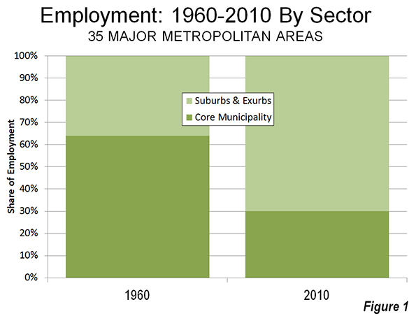
    To all but the greenest ideologues, it should be clear that the decentralisation of offices – as well as factories and warehouses – over recent decades has fuelled Sydney’s prosperity, enabling the city to absorb an extra 1.5 million people since the mid-1980s. Equally, it should be clear that decentralisation offers better outcomes on access to affordable housing, traffic congestion and employment dispersion. On average, peripheral Local Government Areas (LGAs) still experience higher unemployment rates than central LGAs. That’s why the centralising forces unleashed by green planning and building codes pose serious dangers to economic vitality across the greater metropolitan region. Plenty of attention has been lavished on the pampered few in their ABW playgrounds. Some should be spared for the vast majority who seek to make a life in Sydney.

    John Muscat is a co-editor of The New City, where this piece originally appeared. 

    Photo by Christopher Schoenbohm.

  • Does the Post Office Deliver in Today’s Urban Culture?

    The postal service has been ravaged by enormous deficits and massive layoffs. It will inevitably see the closing of thousands of buildings. Planners have taken notice. Countless journalists have lamented the loss of post-office buildings, praised their often remarkable architecture and called for pressure to save them. These buildings are catalysts of “community”, the authors have suggested, citing the chance encounters of townspeople. Something is profoundly wrong, we are told, when community incubators are eradicated.

    Certainly, the loss of these buildings signals the decline of an economic sector and inevitable job losses. Is it possible, though, that the focus on post office buildings overlooks contemporary urbanism? Could it signal inattention to the evolution of “community,” and an obsession with the 19th century?

    The Evolving PO: The post office building pictured at the opening of this article began its life in a traditional Canadian village of the 1860s. The 1800s was an era of the small entrepreneur and family business; fewer than 20% of families relied on a paycheque, compared to 80% today. The timber-merchant owner of this enterprise lived in a sprawling, classical style house that boasted status and refinement. By contrast, his 650 square foot store was a humble wood building. Even though its sign advertized dry goods groceries, it provided much more — it was a virtual mini-department store — including a postal service. It also supplied credit for up to a year, because farmers paid all their bills in the fall, after harvest. A similar pragmatic and profitable strategy of blending services now prevails in the K-mart, Wall-Mart and Target superstores.

    The idea is simple: a single service means only one source of revenue for the owner and single purpose trips for his customers. Neither is efficient, particularly in a small, walkable town. The store’s role as a community catalyst in comparison to the local tavern or church remains a matter of speculation.

    This 1891 example (below), is a stylish, elaborate 2000 square feet building in a town of 3,000 people, during the era of government-run postal service. Nearly four times larger than the first, it retails no other goods. Railway expansion, a bustling regional economy and a total reliance on postal delivery for communication, boosted business in Canada to annual revenues of $4,600 by the time this building surpassed its predecessor; a venerable sum when average daily wages were $1.50. The vast difference in building quality, size, civic importance and services, can be easily explained by the brisk business, the revenue size and, importantly, government ownership. Status and state symbolism could be financed with pride.

    Not for long. By the late 1960s only half of the 33 ornamented buildings in Ontario were still standing and none were owned by the government. The loss and shift in ownership had little to do with planning. A new urban culture of instant, and distant, paperless exchange had emerged that forced the transition to the next “building”.

    The Village Option: Today, it is not uncommon to see locations where the postal service counter occupies a miniscule portion of a small drugstore on the ground floor of a 20-storey apartment building. It resides on a principal artery, but without street facade, not even a sign announcing it. As in the village example, the service is only one of many the building houses: habitation, car park and a chain drugstore that offers the gamut of goods including convenience foods and drinks. Management’s “building” choice has reinvented the village option, where the PO is not housed in a separate building.

    In his turn, the retailer, opting to rent space for a postal service, knew the benefit of luring customers by mixing services on the same premises. The new urban condition, by now in full swing, puts the postal service in an appropriate symbiotic niche, reflecting its cultural status and economic value. The uncertain “community” incubator role that it might have played in the 1800s cannot be discerned in its current form.

    The postal service trajectory is not unique. The 20th century saw the decline of the church, the pub, live theatres and classic movie theatres.

    Of all the buildings that are presumed to play a catalytic community role, none rivals the church. Historically, innumerable towns sprang up through faith groups. Church buildings were their focus and intellectual well-spring. Nonetheless, the 20th century treated the church no differently than it did the pub and the post office.

    By 2005, of the 60% of US citizens who said they were religious, less than 20% attended church regularly. Attendance among US Roman Catholics fell from 75% to 45% in the last 60 years. In the UK, annual church attendance stands at 12%, in Sweden at 5%, and in Denmark at 3%. These are striking figures for an institution that has been a cornerstone of “community”. The outcome of this abstention is inevitable: churches are demolished or converted.

    Should the Pub Get a Sub? Pubs in Britain were closing at the rate of 27 a week in 2007 and 2008, continuing a downward trend that affected their small town numbers disproportionately. The media lamented the loss of a celebrated social tradition and, with it, exquisite examples of architecture and interior design.

    This loss of building-and-function raises the question of preservation, which leads to the question of subsidization. Should the pub get a sub to support its important value as social cement? Should other such buildings and their functions be subsidized? Some planners think so, in sharp contrast to the historic Protestant ethic of self-reliance.

    In a 2002 Urban Land article we read: “… In any case, the main street in a new urbanist community should not necessarily be considered a profit center; instead, it plays the role of the principal amenity.” And further on, “…However, had the [main street] shops been located there [where traffic is heavy], the regional traffic may have overwhelmed the small main street and undermined its role as a social condenser of the community.”

    This view permeates the pro-preservation articles on post offices and pubs. It implies that social incubator functions may well deserve a subsidy, and may function better when protected from heavy traffic. In contrast to this view is the vast array of traditional village and towns of exemplar urbanism, where a thriving Main Street is also a main thoroughfare through the town.

    A New Era: The loss of post office, church and pub buildings does not stem from some wrongheaded, antisocial planning philosophy that needs to be debunked, denigrated and disposed of. It is simply symptomatic of cultural, technological and economic shifts that go way beyond the realm of urban planning. To stop the loss of post offices, for example, it would be imperative to rescind the use of e-mail, fax and phone, an absurd proposition. For the salvation of the church, it might mean a new wave of proselytizing that would result in commitment to attendance, also a bizarre projection.

    Subsidies, protestations and benevolent planning decrees are hardly the answer for either existing or new communities. The urbanist’s “community” dilemma dissolves when the transition to a new era is recognized and embraced. Rather than compulsively hold on to “community’s” past loci, let’s stir the imagination toward its emergent places.

    Fanis Grammenos is the founder of Urban Pattern Associates (UPA), and was a Senior Researcher at Canada Mortgage and Housing Corporation for over 20 years, focused on housing affordability, building adaptability, municipal regulations and sustainable planning. Research on street network patterns produced the innovative Fused Grid. He holds a degree in Architecture from the U of Waterloo.

    Photos by the author.

  • What Killed Downtown?

    What Killed Downtown?: Norristown, Pennsylvania, from Main Street to the Malls
    by Michael E. Tolle

    For those of us who have grown dyspeptic on the over-indulged topic of the collapse of the American city center, Michael Tolle’s What Killed Downtown? Norristown, Pennsylvania, from Main Street to the Malls earns much of its anodyne appeal by straying from a commonly accepted convention in urban studies—that an analysis of the socioeconomic decline of a community should draw heavily upon socioeconomic variables. Isn’t there another way to get the point across? And more importantly, aren’t there other contributing factors?

    This compassionate narrative of the 20th century rise and fall of an older Philadelphia suburb avoids graphs and charts for the most part, becoming much more engaging for its alternative approach. And likeability is exactly what it will need to win over skeptics, or the merely apathetic, because most people in the US probably have never heard of Norristown. In fact, it’s likely that quite a few people on the other side of the Keystone State aren’t familiar with it either. After all, the borough at its 1960 peak only had 39,000 inhabitants (the 2010 Census records a population of 34,000). But Norristown merits further observation, not so much because its downtown has declined in the mid-20th century—that happened everywhere, in municipalities of all sizes—but because Norristown sits squarely in the middle of Montgomery County, an expansive bedroom community of Philadelphia with 800,000 people and a median household income of over $78,000, placing it within the top 100 wealthiest counties in the nation. Meanwhile, Norristown’s median household income, according to the latest Census, is approximately $43,000 and its poverty level of 16.4% is almost triple that of the county’s 5.7%, and still a fair amount higher than the state’s rate of 12.6%. While Montgomery County boomed over the last half century, Norristown has not shared in that prosperity. It is by no means a devastated town—many old neighborhoods remain charming and fully intact—but the commercial heart of Norristown has never healed.

    The above paragraph contains a higher concentration of raw data than one should ever expect to encounter in Tolle’s new book. Rather than delving into the Bureau of Labor Statistics, the US Census Bureau, or rankings from Urban Land Institute or the Brookings Institution, Tolle manages to chronicle the rapid ascent of this suburban outpost, its 75-year dominion over commercial activity within the county, and its precipitous decline shortly after the Second World War—and he achieves it through a diligent perusal of old city directories, interviews with almost two dozen of Norristown’s older citizenry, and a vigorous exploration of the internal machinations of the Borough Council. He applies an anthropologist’s lens to a subject that sociologists have long overcrowded.

    While Norristown’s early history—first as a manor under one of William Penn’s initial surveys, followed by a subdivision into smaller farms by Isaac Norris in 1712—is clearly never the focal point for Tolle’s methodical dissection of downtown, he avoids glossing over it. Not surprisingly, Norristown emerged as the most desirable plot of land in the sprawling manor because of its accessibility: it abutted the “canoeable part of the Schuylkill” and the interconnected American Indian trails that allowed for easy fording of the river. By 1784, the Pennsylvania Assembly carved Montgomery County out of the existing Philadelphia County, and a subsequent deed conveyed lots reserved for county buildings at the intersection of two of the only extant roads at the time. Due to its advantageous location, it became a nearly self-sufficient Town of Norris within a few years, abiding by Penn’s “Town Model” for Philadelphia and other Pennsylvania cities, employing tightly organized, gridded streets that maximized uses of available space. The construction of some of the earliest turnpikes helped to stimulate the town’s steady growth and prepare it for its incorporation as a borough of 520 acres in 1812, followed shortly thereafter by the rail networks that galvanized further expansion.


    Swede Street just north of Main Street, known by some as Lawyers’ Row. Photo from Spring 2011, courtesy of Matthew Edmond.

    The early chapters of the book may only provide a backdrop for Norristown’s 20th century rise and fall, but Tolle chronologically accounts for the factors that helped Norristown emerge as the primary urban center in Montgomery County. And unlike neighboring 19th century boomtowns that dot both the Delaware and Schuylkill Valleys, Norristown “lacked the characteristics that define similar towns of sufficient size and influence that could easily explain the downtown’s decline. . . [It] was never a one-company town. It was never dependent on [a] single employer whose corporate fate might have led it to a catastrophic domino effect; rather Norristown’s workforce has always been distributed among many workplaces.” It owed much of its steady growth to its fortuitous location 17 miles northwest of Philadelphia, the convergence of several modes of transportation, and its role as the administrative center of a large and increasingly prominent county.

    By the book’s twentieth page, Tolle reveals the real heart of his study: the bustling commercial core of Norristown’s six-block Main Street. At the borough’s Centennial Celebration, population approached 30,000, swelling largely from immigrants who arrived to work in various industries: first the northern European Protestants, then the Irish, then, in by far the highest concentration, the Italians, overwhelmingly from Sicily. Mennonites, Amish, and Jews (predominantly of German heritage) along with African Americans arrived in smaller numbers. While the population self-segregated along largely ethnic and economic lines (working and lower-middle class Protestants on the West End; the wealthy, Northern European original settlers in the North End and DeKalb Street; Italians and African Americans in the blue-collar East End), all the strata converged along Main Street’s densely commercialized blocks. Tolle explores the full week’s worth of celebratory activities, from the details of the floats in the Industrial Day parade to overhead weave of flags, bunting, and electrical wires. The pace of the narrative slows at this point, but Tolle employs a humanism that he retains across the ensuing pages. When he intermittently bogs down in relentless detail, he’s easily forgivable—even a little admirable for not shying away from his obsessions.


    A view of DeKalb Street, Norristown’s most affluent residential address, from its southern junction with Main Street. This was once the center of commercial activity in the borough. Tolle details the controversy of the implementation of the Comprehensive Plan to make DeKalb Street one-way northbound in 1951, a restriction which remains today. Photo from Spring 2011, courtesy of Matthew Edmond.

    The Directory of the Boroughs of Norristown and Bridgeport, Montgomery County, Pa, for the years 1860-1861 serves as the bedrock for his chronological exploration of the commercial health of downtown Norristown. For some of the most resilient businesses—Chatlin’s Department Store, Egolf’s Furniture, Zummo’s Hardware—Tolle offers vignettes on their immigrant backgrounds and the financial maneuvering necessary to start their trades. Interspersed with these brief accounts are updates from subsequent City Directories, chronicling the change in business composition over time. But Tolle generally eschews tables and charts—with few exceptions, he narrates the changing commercial landscape of Norristown by integrating the livelihoods of the proprietors with the demands of the consumers. Because the authorial voice depends so heavily on firsthand accounts of the business climate—articles from the Norristown Times Herald, advertisements (including misspellings and solecisms), and, in the later years, eyewitness accounts—the routine references to City Directory data never grow stuffy or monotonous.


    What Killed Downtown? is a concatenation of anecdotes. While such an indulgence in human-interest nostalgia could take a maudlin turn, Tolle again counterbalances these episodes with moments of acerbic subjectivity, as any conscientious anthropologist cannot help but do. My two favorite anecdotes feature a building and a person. The Valley Forge Hotel emerged in the roaring 1920s, purely driven by the local business community, who felt that the proud city demanded a first-class hotel. A stock subscription campaign raised enough to complete the massive six-story brick structure by November of 1925. Though it rarely made a profit, its size and relative opulence made it an icon for the city, and as an emblem of civic pride, it succeeded. The other great anecdote involves the detailed account of the life of the city’s most colorful politician, the recalcitrant Paul Santangelo. Lacking greater aspirations than borough administration, Santangelo earns more ink on these pages than any other civic leader, including the mayors. He fiercely defended the interests of the poorer Sicilian immigrants who comprised much of his district, voting ferociously in their favor but often—in Tolle’s opinion—at the expense of city progress as a whole.


    Norristown Main Street, west of Swede Street and looking westward. Photo from Spring 2011, courtesy of Matthew Edmond.

    Tolle’s account of Norristown’s Main Street after its 1950 apex avoids mind-numbing predictability even has he identifies the usual culprits contributing to its decline: growing dependence on the automobile, competition from suburban shopping plazas like the now-mammoth King of Prussia, shift of the population center toward the far-southern part of Montgomery County, construction of limited access highways outside of the borough’s limits. And of course, all these factors converge with the suburban amenity that wounds Norristown the most: “free, ample parking”—a mantra which Tolle repeats enough that it tacitly answers the question to his book’s title. Anyone with a scintilla of knowledge of American urbanism will know where this is headed. But by the1950s, Tolle reaches a point in time where procures firsthand accounts of Main Street’s changes. The worm’s-eye view continues, imbuing the narrative of Norristown’s saddest days—by the 1970s it is not safe to walk Main Street at night—with empathy and hope.


    Courthouse Plaza along Main Street, one of many mid-century projects that removed commercial buildings and replaced them with staid, largely unused civic space. Photo from Spring 2011, courtesy of Matthew Edmond.

    For a person as enamored by details as me, Tolle’s worm’s-eye view never really grows old, even when he’s a fussbudget over counts of shuttered storefronts from year to year. At the same time, this intricate approach to an already small subject could easily undermine the ability for What Killed Downtown? to find a broad audience. What happens to a little-known suburban city can hardly resonate as much as if he had explored the devolution of downtown Philadelphia—or even Allentown or Erie. The fixation on downtown storefronts—at the expense of geographic context—firmly ensconces the book in the “local interest” category. His 250-page narrative rarely explores impacts on Norristown Main Street outside of Montgomery County. From an early point in the book, he describes street intersections with specificity that would only mean anything to a local; then he only provides two referential maps.

    None of these cavils really amount to an inherent weakness of the book—after all, it might prove just the right medicine for Tolle’s fellow Norristowners. But the narrowness of scope does foretell an oversight as to the broader implications for this city’s decline, which could have made for a much bolder peroration than the one the book currently provides. The only atypical bogeyman contributing to downtown Norristown’s precipitous decline is the persistent political gridlock and resultant incompetence of the Borough Council, which he relates with the same humanist eye he applies to his wonderful vignettes of immigrant entrepreneurialism. But Tolle had the chance to make this story matter on a scale that could mean something to someone from Ashtabula or Waukegan, and he spurned the opportunity.

    My knowledge of Philadelphia, having lived there for a time, gives me an unfair advantage, but I can’t help but ask a few questions. Norristown, the seat of wealthy Montgomery County, declined and its main street is moribund to this day. But Media, the much smaller seat of neighboring Delaware County, boasts a flourishing main street of local shops and restaurants—all despite the fact that Delaware County, while equally urbanized, is much less affluent than Montgomery County. Meanwhile, cities like Chester (also in Delaware County) and Camden, New Jersey can claim a similar lifespan to Norristown, strong transportation access, and an industrial boom. But today these two cities are not only among the most devastated municipalities in their respective states, Chester and Camden are among the poorest cities in the country. Perhaps most interestingly, after several decades of population decline, Norristown began to trend upward again in the 2000 census, and by the 2010 Census the city grew virtually 10%–an unprecedented occurrence for a city that still has the reputation of being the poorest place in its respective county.

    What Killed Downtown? remains a welcome contrast to countless other chronicles of downtown decline whose narratives depend on sociological detachment. Recognizing that true objectivity is impossible, Tolle instead depicts the Norristown transformation from the perspective of people who experienced it. Because its vision is geographically precise and obscure to people outside southeast Pennsylvania, I suspect our author felt driven to write it even if it enjoyed a readership of zero. Such an endeavor could reek of self-indulgence, but Michael Tolle’s opus has way too much empathy for that. Hopefully Norristown’s coterie of model train owners and newspaper collectors will put this book on their to-do lists—and then recommend it to others.

    Eric McAfee is a licensed urban planner currently working in emergency management. Though he hails from Indianapolis, his professional field grants him a certain degree of itinerancy, which he uses to his advantage to write about and photograph landscapes across the country in his blog, American Dirt. He lived and worked as a military planner in northern Afghanistan from 2010 to 2012, letting him fudge on the “American” aspect of his blog a little bit. In the past, Eric’s writing has won him Outstanding Paper in Real Estate at the University of Pennsylvania, as well as an outstanding research on housing award from the Joint Center for Housing Studies at Harvard University.  Aside from American Dirt, he has featured his writing on Urban Indy.com, Streetsblog.net, and Urbanophile.com. 

  • Sydney to Abandon Radical Urban Containment Policy

    The New South Wales government has proposed a new Metropolitan Strategy for the Sydney area which would significantly weaken the urban containment policy (also called urban consolidation, smart growth, livability, growth management, densification, etc.) that has driven if house prices to among the highest in the affluent New World (Australia, Canada, New Zealand and the United States) relative to household incomes.

    According to the Australian Financial Review, the state’s Liberal-National government plans to allow the building of more than 170,000 new homes, with the vast majority being on greenfield sites, largely beyond the current urban footprint. Premier Barry O’Farrell and his party had promised in their electoral campaign in 2011 to liberalize land-use regulation and to moderate the previous Labor government’s quota that required 70% of new houses to be built within the current urban footprint and 30% on greenfield sites. In fact, however, under the Labor government’s administration, new house building had been produced at a well below demand level.

    Among the major New World metropolitan areas rated in annual Demographia International Housing Affordability Surveys, Sydney has been the most unaffordable, along with Vancouver, in recent years. Sydney and Vancouver have had among the most stringent urban containment policies in the New World, and the resulting unaffordable house prices under such circumstances are consistent with economic principle.

    Premier O’Farrell told the Sydney Morning Herald that the government wanted to "make home ownership a reality again." He continued, "The more blocks of land (lots) we can release, the greater downward pressure we can put on housing because it’s been so high for so long." In a press release issued by his office, the Premier recalled that “Before the election, I said I wanted to ensure owning a home wasn’t a fading dream for young families" and noted that the massive housing package "will go a long way to delivering on that commitment."

    In the longer run (by 2031), the government intends to provide for a total of 545,000 new homes, while abandoning the practice of allocating locations based upon planning theory. Planning and Infrastructure Minister Bradley Hazzard told the Sydney Morning Herald that the government intended to “look further afield” than the presently planned greenfield suburban growth centers. He continued: "We’re trying to [be] less constrictive and restrictive and what we’re saying is the marketplace should have far more of a say in what the mix of housing is and where it should be,” adding that ”it doesn’t matter” what percentage was delivered in greenfield and established suburbs. He concluded: ”No one should be preoccupied by particular prescriptive formulas.”

    The government also indicated its intention to encourage one half of employment growth over the next 20 years to be in Western Sydney. Western Sydney is virtually across the urban area from the central business district. This dispersion of employment, along with roadway improvements in the area, is likely to improve the metropolitan balance between jobs and housing.

    The plan for greater job dispersion would, if successful, bring Sydney more into line with urban best practices, which are exhibited by the location of most new jobs in edge cities, as well as throughout the entire urban area. Sydney has among the longest work trip travel times in the New World. The one-way work trip travel time is newly reported in the Metropolitan Strategy to have reached 35 minutes. Work trip travel times are worse only in Melbourne, at 36 minutes. By comparison, Dallas-Fort Worth, with a larger population, a much lower urban area density and a mere fraction of the Melbourne or Sydney transit work trip market share has a far shorter one-way work trip travel time (26 minutes).

    The Sydney developments are the latest in a trend toward liberalizing urban land use in four nations.

    In October, the New Zealand government announced plans to liberalize land-use amid growing concern about the extent to which that nation’s urban containment policies have destroyed housing affordability. In the introduction to the 9th Annual Demographia International Housing Affordability Survey, Deputy Premier Bill English said:

    Land has been made artificially scarce by regulation that locks up land for development. This regulation has made land supply unresponsive to demand. When demand shocks occur, as they did in the mid-2000s in New Zealand and around the world, much of that shock translates to higher prices rather than more houses.

    Recent polling has shown support, by an almost 2 to 1 margin for government action to improve housing affordability, with even higher stronger support in the 18 to 34 age group, where the margin was more than 3 to 1.

    The United Kingdom Cameron government is also embarked on a program to liberalize that nation’s restrictive land use policies, which former Bank of England Monetary Policy Committee member Kate Barker found to be the cause of severe housing unaffordability in a report commissioned by the Blair Labour government. Planning Minister Nick Boles has characterized the unaffordability of housing as "the biggest social justice problem we have."

    In 2011, Florida repealed its statewide smart growth mandate and closed the administrative bureaucracy that had overseen the program. Before that, the government of the Australian state of Victoria substantially expanded the urban growth boundary of the Melbourne urban area.

  • The Beauty of Urban Planning from the Ground

    In a piece called The Beauty of Urban Planning from Space, the Sustainable Cities Collective highlights views from space of uniquely designed street pattern designs in various cities around the world. There are ten examples that illustrate the zenith of urban planning.

    As attractive as the street patterns are, they highlight the inevitable inability of designers, or anyone else for that matter, to influence much more than small changes in the overall urban form.

    The Incomplete Street Patterns

    This point is evident in eight of the 10 urban areas illustrated, where the unique street pattern comprise only part of a much bigger city. The eight are Belo Horizonte, Brazil; Brasilia, Brazil, Washington, DC; New Haven, CT; La Plata, Argentina; Jaipur, India; Adelaide, Australia; and Canberra, Australia.

    The best known example may be Washington, DC, where L’Enfant’s street pattern served most of the city for more than a century, which is probably a world record for a growing urban area. Yet, today, L’Enfant’s design covers less than five percent of the urban area that today has more people than the nation at the time L’Enfant received his position.

    In La Plata (See end note on La Plata) the street design comes the closest to covering the whole urban area (Figure 1, from Google Maps). Taking design a bit further, every street is numbered in this city that was planned to be the capital of Argentina’s largest province (Buenos Aires, which is separate from the provincial equivalent city of Buenos Aires). Three other of the examples were also new cities planned as capitals, including Brasilia, Canberra and, of course, Washington.

    Stagnant Cities

    The other two examples are a dying mining town (El Salvador, Chile), which has lost more than two thirds of its population and an Italian medieval fortress town, Palmanova. The latter is more a museum than a dynamic urban area. It is confined to its original area and its population could fit into London’s Royal Albert Hall (approximately 5,000).

    Belo Horizonte, Brazil

    The Belo Horizonte Centro (Note on Belo Horizonte) street pattern is unique. It was part of the inspiration for my Urban Tours by Rental Car website (rentalcartours.net) and a map of Centro was incorporated into the logo (Figure 2).


    Figure 2

    In Centro, diagonals are superimposed on a conventional north-south/east-west street pattern (Figure 3, from Google Earth). However Centro’s street pattern covers less than one percent of the Belo Horizonte urban area, three square miles out of more than 400 (five square kilometers out of 650). Figure 4 shows Centro in red, engulfed by the much larger urban area, outlined in yellow.

    The first rental car tour described the Belo Horizonte Centro street pattern:

    Belo Horizonte represents both the best and worst in urban planning. The core has, at least from map inspection, a pleasing street layout. In a flair that outdid L’Enfant’s Washington diagonals, Belo Horizonte Centro has a grid of streets on which is superimposed a grid of diagonals. Of course, the resulting eight street intersections make traffic more of a difficulty than with the four that are usual or the grade separations of Brasilia. Centro has a number of wide boulevards, many with green, treed medians and, in the Brazilian style, some with four roadways — center express lanes and outside local lanes. These “three median” streets, give a pleasing feeling. The overall result is an impression similar to that of Barcelona, and a particularly attractive core that would do most European cities proud. 

    But, not far from Centro the randomness begins. To the north is the river, and clearly no attempt
    was made to continue the pattern beyond that. To the south are hills that would have precluded expansion of the plan. Nor does the pattern extend far to the less challenging east or west

    Unscrambling Means and Ends

    Street patterns from space provide no indication of urban planning’s effectiveness, nor of urban policy of which planning is a part. Planning is a means, not the end of cities.

    Over the past two centuries, billions of people have moved to cities. They did not move for the fountains, architecture, or museums (otherwise they would all live in the ville de Paris or Manhattan). In short, urban planning principles of any era have had little impact in the growth of cities.

    Urban planning’s current "top-down" genre is rather new. Until the British Town and Country Planning Act of 1947 and similar measures, planners contented themselves to design street networks (which the Sustainable Cities Coalition highlights so well) and other necessary infrastructure, such as water and sewer networks. Their handiwork is obvious in the 19th century designed street grid of Manhattan, the straight streets of Phoenix and the modified grid of the Toronto metropolitan area. These are the broad functions emphasized by New York University Professor Shlomo Angel in his Planet of Cities.

    Now, urban planning can work against the very justification of cities, the prosperity of its residents.

    Successful Cities

    The success of urban policy (and urban planning) can be judged by how well the purpose of the city is served – the reason people moved there in the first place. The purpose of the city was well articulated by former World Bank principal planner Alain Bertaud:  Large labor markets are the only raison d’être of large cities. Cities are much more about economics than aesthetics. (See end note on Sustainability).

    The successful city will facilitate greater affluence – higher discretionary incomes – among its residents.

    Regrettably, there are notable failures in this regard. For example, the urban containment policies of smart growth, which ration land and raise the price of housing relative to incomes, have been adopted in cities from Sydney to Toronto and Portland. As a result, residents have less money to spend after taxes and paying for necessities and are less affluent than they would be without such policies. In his introduction to the 9th Annual Demographia Housing Affordability Survey, New Zealand’s Deputy Prime Minister Bill English pointed out that higher house prices that occur when land is "made artificially scarce by regulation that locks up land for development."

    Another problem is evident in excessive traffic congestion and slower travel times. Getting around town quickly contributes to greater economic growth and discretionary incomes. Public policy must facilitate mobility throughout the urban area. The mode — the means — is not important, the access is. Transit services are appropriate where time competitive with the automobile, such as to the largest downtowns (See Transit Legacy Cities). However, because of its unparalleled ability to provide rapid mobility throughout the urban area, public policy must also ensure a minimum of traffic congestion and effective access by cars and commercial trucks. The evidence is clear that the higher densities preferred by modern urban planning impede rapid mobility throughout the urban area (see Urban Travel and Urban Population Density).

    Finally, by facilitating housing affordability and more free-flowing traffic, the important objective of alleviating poverty is served (an objective that cannot sustainably be served without economic growth)

    The Beauty of Urban Planning from the Ground

    The "beauty of urban planning" is reliably appreciated from the ground, not from space. The test is how well people live, not what the city looks like. The subject is people, not architecture or urban form (see Toward More Prosperous Cities: A Framing Essay on Urban Policy, Planning, Transport and the Dimensions of Sustainability).

    Wendell Cox is a Visiting Professor, Conservatoire National des Arts et Metiers, Paris and the author of “War on the Dream: How Anti-Sprawl Policy Threatens the Quality of Life.

    —–

    Note on La Plata: La Plata is in the Buenos Aires metropolitan area, approximately 35 miles (60 kilometers) south of Centro in Buenos Aires. However, it is a separate urban area because of a comparatively break in the continuous urbanization between La Plata and Buenos Aires. Buenos Aires province is by far the nation’s largest provincial level jurisdiction, with a population five times as great as the city of Buenos Aires. Much of the population is concentrated near the city of Buenos Aires, with which it forms one of the world’s megacities. The Buenos Aires also has the largest land area and would rank 6th if it were in the United States (nearly as large as New Mexico).

    Note on Belo Horizonte: Belo Horizonte is capital of the state of Minas Gerais. Belo Horizonte is Brazil’s third largest urban area, after Sao Paulo and Rio de Janeiro, with a population of more than 5 million — approximately the population of the Miami urban area (which stretches from southern Dade County to northern Palm Beach County)

    Note on Sustainability: Urban policies that would artificially constrain urban expansion (such as with urban growth boundaries) and discourage automobile travel have often been cited as principal strategies for reducing greenhouse gas emissions. However, important reports indicate little potential for greenhouse gas reductions from these policies, with the overwhelming share resulting from improved fuel economy. Moreover, recent research in England suggested that such policies should not "automatically be associated with the preferred growth strategy" (see Questioning the Messianic Conception of Smart Growth).

    Photo: Belo Horizonte Centro from Nova Lima (by author)

  • Gentrification and its Discontents: Notes from New Orleans

    Readers of this forum have probably heard rumors of gentrification in post-Katrina New Orleans. Residential shifts playing out in the Crescent City share many commonalities with those elsewhere, but also bear some distinctions and paradoxes. I offer these observations from the so-called Williamsburg of the South, a neighborhood called Bywater.

    Gentrification arrived rather early to New Orleans, a generation before the term was coined. Writers and artists settled in the French Quarter in the 1920s and 1930s, drawn by the appeal of its expatriated Mediterranean atmosphere, not to mention its cheap rent, good food, and abundant alcohol despite Prohibition. Initial restorations of historic structures ensued, although it was not until after World War II that wealthier, educated newcomers began steadily supplanting working-class Sicilian and black Creole natives.

    By the 1970s, the French Quarter was largely gentrified, and the process continued downriver into the adjacent Faubourg Marigny (a historical moniker revived by Francophile preservationists and savvy real estate agents) and upriver into the Lower Garden District (also a new toponym: gentrification has a vocabulary as well as a geography). It progressed through the 1980s-2000s but only modestly, slowed by the city’s abundant social problems and limited economic opportunity. New Orleans in this era ranked as the Sun Belt’s premier shrinking city, losing 170,000 residents between 1960 and 2005. The relatively few newcomers tended to be gentrifiers, and gentrifiers today are overwhelmingly transplants. I, for example, am both, and I use the terms interchangeably in this piece.

    One Storm, Two Waves

    Everything changed after August-September 2005, when the Hurricane Katrina deluge, amid all the tragedy, unexpectedly positioned New Orleans as a cause célèbre for a generation of idealistic millennials. A few thousand urbanists, environmentalists, and social workers—we called them “the brain gain;” they called themselves YURPS, or Young Urban Rebuilding Professionals—took leave from their graduate studies and nascent careers and headed South to be a part of something important.

    Many landed positions in planning and recovery efforts, or in an alphabet soup of new nonprofits; some parlayed their experiences into Ph.D. dissertations, many of which are coming out now in book form. This cohort, which I estimate in the low- to mid-four digits, largely moved on around 2008-2009, as recovery moneys petered out. Then a second wave began arriving, enticed by the relatively robust regional economy compared to the rest of the nation. These newcomers were greater in number (I estimate 15,000-20,000 and continuing), more specially skilled, and serious about planting domestic and economic roots here. Some today are new-media entrepreneurs; others work with Teach for America or within the highly charter-ized public school system (infused recently with a billion federal dollars), or in the booming tax-incentivized Louisiana film industry and other cultural-economy niches.

    Brushing shoulders with them are a fair number of newly arrived artists, musicians, and creative types who turned their backs on the Great Recession woes and resettled in what they perceived to be an undiscovered bohemia in the lower faubourgs of New Orleans—just as their predecessors did in the French Quarter 80 years prior. It is primarily these second-wave transplants who have accelerated gentrification patterns.

    Spatial and Social Structure of New Orleans Gentrification

    Gentrification in New Orleans is spatially regularized and predictable. Two underlying geographies must be in place before better-educated, more-moneyed transplants start to move into neighborhoods of working-class natives. First, the area must be historic. Most people who opt to move to New Orleans envision living in Creole quaintness or Classical splendor amidst nineteen-century cityscapes; they are not seeking mundane ranch houses or split-levels in subdivisions. That distinctive housing stock exists only in about half of New Orleans proper and one-quarter of the conurbation, mostly upon the higher terrain closer to the Mississippi River. The second factor is physical proximity to a neighborhood that has already gentrified, or that never economically declined in the first place, like the Garden District.

    Gentrification hot-spots today may be found along the fringes of what I have (somewhat jokingly) dubbed the “white teapot,” a relatively wealthy and well-educated majority-white area shaped like a kettle (see Figure 1) in uptown New Orleans, around Audubon Park and Tulane and Loyola universities, with a curving spout along the St. Charles Avenue/Magazine Street corridor through the French Quarter and into the Faubourg Marigny and Bywater. Comparing 2000 to 2010 census data, the teapot has broadened and internally whitened, and the changes mostly involve gentrification. The process has also progressed into the Faubourg Tremé (not coincidentally the subject of the HBO drama Tremé) and up Esplanade Avenue into Mid-City, which ranks just behind Bywater as a favored spot for post-Katrina transplants. All these areas were originally urbanized on higher terrain before 1900, all have historic housing stock, and all are coterminous to some degree.


    Figure 1. Hot spots (marked with red stars) of post-Katrina gentrification in New Orleans, shown with circa-2000 demographic data and a delineation of the “white teapot.” Bywater appears at right. Map and analysis by Richard Campanella.

    The frontiers of gentrification are “pioneered” by certain social cohorts who settle sequentially, usually over a period of five to twenty years. The four-phase cycle often begins with—forgive my tongue-in-cheek use of vernacular stereotypes: (1) “gutter punks” (their term), young transients with troubled backgrounds who bitterly reject societal norms and settle, squatter-like, in the roughest neighborhoods bordering bohemian or tourist districts, where they busk or beg in tattered attire.

    On their unshod heels come (2) hipsters, who, also fixated upon dissing the mainstream but better educated and obsessively self-aware, see these punk-infused neighborhoods as bastions of coolness.

    Their presence generates a certain funky vibe that appeals to the third phase of the gentrification sequence: (3) “bourgeois bohemians,” to use David Brooks’ term. Free-spirited but well-educated and willing to strike a bargain with middle-class normalcy, this group is skillfully employed, buys old houses and lovingly restores them, engages tirelessly in civic affairs, and can reliably be found at the Saturday morning farmers’ market. Usually childless, they often convert doubles to singles, which removes rentable housing stock from the neighborhood even as property values rise and lower-class renters find themselves priced out their own neighborhoods. (Gentrification in New Orleans tends to be more house-based than in northeastern cities, where renovated industrial or commercial buildings dominate the transformation).

    After the area attains full-blown “revived” status, the final cohort arrives: (4) bona fide gentry, including lawyers, doctors, moneyed retirees, and alpha-professionals from places like Manhattan or San Francisco. Real estate agents and developers are involved at every phase transition, sometimes leading, sometimes following, always profiting.

    Native tenants fare the worst in the process, often finding themselves unable to afford the rising rent and facing eviction. Those who own, however, might experience a windfall, their abodes now worth ten to fifty times more than their grandparents paid. Of the four-phase process, a neighborhood like St. Roch is currently between phases 1 and 2; the Irish Channel is 3-to-4 in the blocks closer to Magazine and 2-to-3 closer to Tchoupitoulas; Bywater is swiftly moving from 2 to 3 to 4; Marigny is nearing 4; and the French Quarter is post-4.

    Locavores in a Kiddie Wilderness

    Tensions abound among the four cohorts. The phase-1 and -2 folks openly regret their role in paving the way for phases 3 and 4, and see themselves as sharing the victimhood of their mostly black working-class renter neighbors. Skeptical of proposed amenities such as riverfront parks or the removal of an elevated expressway, they fear such “improvements” may foretell further rent hikes and threaten their claim to edgy urban authenticity. They decry phase-3 and -4 folks through “Die Yuppie Scum” graffiti, or via pasted denunciations of Pres Kabacoff (see Figure 2), a local developer specializing in historic restoration and mixed-income public housing.

    Phase-3 and -4 folks, meanwhile, look askance at the hipsters and the gutter punks, but otherwise wax ambivalent about gentrification and its effect on deep-rooted mostly African-American natives. They lament their role in ousting the very vessels of localism they came to savor, but also take pride in their spirited civic engagement and rescue of architectural treasures.

    Gentrifiers seem to stew in irreconcilable philosophical disequilibrium. Fortunately, they’ve created plenty of nice spaces to stew in. Bywater in the past few years has seen the opening of nearly ten retro-chic foodie/locavore-type restaurants, two new art-loft colonies, guerrilla galleries and performance spaces on grungy St. Claude Avenue, a “healing center” affiliated with Kabacoff and his Maine-born voodoo-priestess partner, yoga studios, a vinyl records store, and a smattering of coffee shops where one can overhear conversations about bioswales, tactical urbanism, the klezmer music scene, and every conceivable permutation of “sustainability” and “resilience.”

    It’s increasingly like living in a city of graduate students. Nothing wrong with that—except, what happens when they, well, graduate? Will a subsequent wave take their place? Or will the neighborhood be too pricey by then?

    Bywater’s elders, families, and inter-generational households, meanwhile, have gone from the norm to the exception. Racially, the black population, which tended to be highly family-based, declined by 64 percent between 2000 and 2010, while the white population increased by 22 percent, regaining the majority status it had prior to the white flight of the 1960s-1970s. It was the Katrina disruption and the accompanying closure of schools that initially drove out the mostly black households with children, more so than gentrification per se.1  Bywater ever since has become a kiddie wilderness; the 968 youngsters who lived here in 2000 numbered only 285 in 2010. When our son was born in 2012, he was the very first post-Katrina birth on our street, the sole child on a block that had eleven when we first arrived (as category-3 types, I suppose, sans the “bohemian”) from Mississippi in 2000.2

    Impact on New Orleans Culture

    Many predicted that the 2005 deluge would wash away New Orleans’ sui generis character. Paradoxically, post-Katrina gentrifiers are simultaneously distinguishing and homogenizing local culture vis-à-vis American norms, depending on how one defines culture. By the humanist’s notion, the newcomers are actually breathing new life into local customs and traditions. Transplants arrive endeavoring to be a part of the epic adventure of living here; thus, through the process of self-selection, they tend to be Orleaneophilic “super-natives.” They embrace Mardi Gras enthusiastically, going so far as to form their own krewes and walking clubs (though always with irony, winking in gentle mockery at old-line uptown krewes). They celebrate the city’s culinary legacy, though their tastes generally run away from fried okra and toward “house-made beet ravioli w/ goat cheese ricotta mint stuffing” (I’m citing a chalkboard menu at a new Bywater restaurant, revealingly named Suis Generis, “Fine Dining for the People;” see Figure 2). And they are universally enamored with local music and public festivity, to the point of enrolling in second-line dancing classes and taking it upon themselves to organize jazz funerals whenever a local icon dies.

    By the anthropologist’s notion, however, transplants are definitely changing New Orleans culture. They are much more secular, less fertile, more liberal, and less parochial than native-born New Orleanians. They see local conservatism as a problem calling for enlightenment rather than an opinion to be respected, and view the importation of national and global values as imperative to a sustainable and equitable recovery. Indeed, the entire scene in the new Bywater eateries—from the artisanal food on the menus to the statement art on the walls to the progressive worldview of the patrons—can be picked up and dropped seamlessly into Austin, Burlington, Portland, or Brooklyn.


    Figure 2. “Fine Dining for the People:” streetscapes of gentrification in Bywater. Montage by Richard Campanella.

    A Precedent and a Hobgoblin

    How will this all play out? History offers a precedent. After the Louisiana Purchase in 1803, better-educated English-speaking Anglos moved in large numbers into the parochial, mostly Catholic and Francophone Creole society of New Orleans. “The Americans [are] swarming in from the northern states,” lamented one departing French official, “invading Louisiana as the holy tribes invaded the land of Canaan, [each turning] over in his mind a little plan of speculation”—sentiments that might echo those of displaced natives today.3 What resulted from the Creole/Anglo intermingling was not gentrification—the two groups lived separately—but rather a complex, gradual cultural hybridization. Native Creoles and Anglo transplants intermarried, blended their legal systems, their architectural tastes and surveying methods, their civic traditions and foodways, and to some degree their languages. What resulted was the fascinating mélange that is modern-day Louisiana.

    Gentrifier culture is already hybridizing with native ways; post-Katrina transplants are opening restaurants, writing books, starting businesses and hiring natives, organizing festivals, and even running for public office, all the while introducing external ideas into local canon. What differs in the analogy is the fact that the nineteenth-century newcomers planted familial roots here and spawned multiple subsequent generations, each bringing new vitality to the city. Gentrifiers, on the other hand, usually have very low birth rates, and those few that do become parents oftentimes find themselves reluctantly departing the very inner-city neighborhoods they helped revive, for want of playmates and decent schools. By that time, exorbitant real estate precludes the next wave of dynamic twenty-somethings from moving in, and the same neighborhood that once flourished gradually grows gray, empty, and frozen in historically renovated time. Unless gentrified neighborhoods make themselves into affordable and agreeable places to raise and educate the next generation, they will morph into dour historical theme parks with price tags only aging one-percenters can afford.

    Lack of age diversity and a paucity of “kiddie capital”—good local schools, playmates next door, child-friendly services—are the hobgoblins of gentrification in a historically familial city like New Orleans. Yet their impacts seem to be lost on many gentrifiers. Some earthy contingents even expresses mock disgust at the sight of baby carriages—the height of uncool—not realizing that the infant inside might represent the neighborhood’s best hope of remaining down-to-earth.

    Need evidence of those impacts? Take a walk on a sunny Saturday through the lower French Quarter, the residential section of New Orleans’ original gentrified neighborhood. You will see spectacular architecture, dazzling cast-iron filigree, flowering gardens—and hardly a resident in sight, much less the next generation playing in the streets. Many of the antebellum townhouses have been subdivided into pied-à-terre condominiums vacant most of the year; others are home to peripatetic professionals or aging couples living in guarded privacy behind bolted-shut French doors. The historic streetscapes bear a museum-like stillness that would be eerie if they weren’t so beautiful.

    Richard Campanella, a geographer with the Tulane School of Architecture, is the author of Bienville’s Dilemma, Geographies of New Orleans, Delta Urbanism, Lincoln in New Orleans, and other books. He may be reached through richcampanella.com, rcampane@tulane.edu, and nolacampanella on Twitter.

    ——–

    1 The years-long displacement opened up time and space for the ensuing racial and socio-economic transformations to gain momentum, which thence increased housing prices and impeded working-class households with families from resettling, or settling anew.

    2 These Census Bureau race and age figures are drawn from what most residents perceive to be the main section of Bywater, from St. Claude Avenue to the Mississippi River, and from Press Street to the Industrial Canal. Other definitions of neighborhood boundaries exist, and needless to say, each would yield differing statistics.

    3 Pierre Clément de Laussat, Memoirs of My Life (Louisiana State University Press: Baton Rouge and New Orleans, 1978 translation of 1831 memoir), 103.

  • In California, Don’t Bash the ‘Burbs

    For the past century, California, particularly Southern California, nurtured and invented the suburban dream. The sun-drenched single-family house, often with a pool, on a tree-lined street was an image lovingly projected by television and the movies. Places like the San Fernando Valley – actual home to the "Brady Bunch" and scores of other TV family sitcoms – became, in author Kevin Roderick’s phrase, "America’s suburb."

    This dream, even a modernized, multicultural version of it, now is passé to California’s governing class. Even in his first administration, 1975-83, Gov. Jerry Brown disdained suburbs, promoting a city-first, pro-density policy. His feelings hardened during eight years (1999-2007) as mayor of Oakland, a city that, since he left, has fallen on hard times, although it has been treated with some love recently in the blue media.

    As state attorney general (2007-11) Brown took advantage of the state’s 2006 climate change legislation to move against suburban growth everywhere from Pleasanton to San Bernardino. Now back as governor, he can give full rein to his determination to limit access to the old California dream, curbing suburbia and forcing more of us and, even more so our successors, into small apartments nearby bus and rail stops. His successor as attorney general, former San Francisco D.A. Kamala Harris, is, if anything, more theologically committed to curbing suburban growth.

    Sadly, much of the state’s development "community" has enlisted itself into the densification jihad. An influential recent report from the Urban Land Institute, for example, sees a "new California dream," which predicts huge growth in high-density development based on underlying demographic trends – like shifts in housing tastes among millennials or empty-nesters rushing to downtown condos.

    Yet it’s not enough for the planners, and their developer allies, to watch the market shift and take advantage of it. That would be both logical and justified. But the planning clerisy are not content to leave suburbia die; it must, instead, be cauterized and prevented, like some plague, from spreading.

    Ironically, it turns out that the "new California dream" is more widely shared by planners and rent-seeking developers than by the consuming public. During the past decade, when pro-density sentiment has supposedly building, some 80 percent of the new construction in the state was single-family, a rate slightly above the national average. Over time, Californians continue to buy single-family houses, mostly in the suburban and exurban periphery. They do it because they are like most Americans, roughly four of five of whom prefer single-family houses, preferably closer to work but, if that proves unaffordable, further out.

    This includes both working-class and upper middle-class markets. The more-affluent, including many largely Asian immigrants, have been willing to buy high-priced homes closer to employment centers in places like Irvine or Cupertino, near San Jose. Meanwhile, the less-affluent of all ethnicities continue to move further out, to places like the Inland Empire or the further reaches of the Bay Area. These peripheral areas have continued to represent the vast majority of growth in both greater Los Angeles and around the Bay Area.

    Meanwhile, some of the urban-centric residential construction now being put up will, as occurred in the housing bust, may be fashionable but, in some cases, not so profitable over time. Construction is being driven mostly by tax breaks, Uncle Ben’s essentially ultralow-interest money for wealthy investors and, in some cases, subsidies. Overall, the Wall Street Journal notes, the rental market is beginning to "lose steam," as people again start looking into buying homes. This may suggest that new speculative building in places like downtown Los Angeles – where there’s good evidence that rents and occupancy levels are, if anything, getting weaker – may end up in tears.

    To date, the anti-suburb jihad has been somewhat constrained by the recession and the collapse of the housing bubble about five years ago. But now that there’s an incipient housing recovery in parts of the state, including Orange County, the constraints could be problematical, particularly for younger buyers about to start a family or for people migrating into the state.

    The impact may be felt first in Silicon Valley and its environs. The planners now dominating the Bay Area want only highly dense bus-stop- or train-oriented development in the valley. Yet, notes real estate consultant John Burns, this does not reflect market realities marked by what they describe "as a resilient and ongoing preference for single-family homes."

    Even more fanciful, they are promoting high density in areas, far distant from current employment centers, in dreary locales like Newark, south of Oakland, claiming workers there will take public transit to jobs in the Valley. The belief among planners and some gullible developers that aging millennials will choose to live in high density, far from costly San Francisco or Palo Alto, and commute to work by transit is somewhat north of absurd; today, a bare 3 percent of workers in Silicon Valley get to work by transit, and downtown San Jose, the logical terminus of any transit strategy, is home to barely 26,000 of the region’s 860,000 workers.

    Some tech workers may put up with a few years of high rents and shared apartments in San Francisco or Palo Alto, but not many will want to live in expensive towers far from both Silicon Valley’s primary employers and the amenities of the big city. Apple’s plans for a new headquarters in Cupertino has drawn criticism from green-minded urbanists precisely because they rest on the sensible presumption that Apple’s workforce will remain largely suburban and car-oriented. One can also wonder the effect on the start-up culture when workers have been forced to live in places lacking the proverbial garage or extra bedroom that historically have nurtured new firms.

    More important still, forced densification, by denying single-family alternatives, is likely, and in some places, already is, spiking prices, which are up $85,000 in Silicon Valley in a year. This, over time, will force millennials, as they age, to look for other locales to meet their longtime aspirations. Generational chroniclers Morley Winograd and Mike Hais, in their surveys, have found more than twice as many millennials prefer suburbs over dense cities as their "ideal place to live." The vast majority of 18-to-34-year-olds do not want to spend their lives as apartment renters; a study by TD Bank found that 84 percent of them hope to own a home.

    Much the same can be said of Asian immigrants, who are now driving much of the new-home sales, particularly in desirable places like Orange County or Silicon Valley. Nationwide, over the past decade, the Asian population in suburbs grew by almost 2.8 million, or 53 percent, while the Asian population of core cities grew 770,000, 28 percent. In greater Los Angeles, there are now three times as many Asian suburbanites as their inner-city counterparts.

    If California is not willing to meet the needs of its own emerging middle class, there’s no doubt that other states, from Arizona and Texas to Tennessee – although not as fundamentally alluring – will be, and are already, more than happy to oblige.

    Rather than seeking to destroy our suburbs, California leaders should expend their energy figuring out how to make them better. Rather than some retro-1900s urbanist vision, they need to embrace the multipolarity of our urban agglomerations. They could look to preserve open space nearby, when possible, or cultivate natural areas, parks, walking and biking trails that would appeal to families as well as to singles.

    Instead of attempting to force employment into the center city, it would make more sense to expand home-based and dispersed work in order to cut down or eliminate commuting times. These moves would create both healthier suburbs and reduce carbon emissions without devastating the natural aspirations of most California families.

    Joel Kotkin is executive editor of NewGeography.com and a distinguished presidential fellow in urban futures at Chapman University, and a member of the editorial board of the Orange County Register. He is author of The City: A Global History and The Next Hundred Million: America in 2050. His most recent study, The Rise of Postfamilialism, has been widely discussed and distributed internationally. He lives in Los Angeles, CA.

    This piece originally appeared in the Orange County Register.

    Suburb photo by BigStockPhoto.com.