Category: planning

  • Housing: How Capitalism and Planning Can Co-Habit

    Did Britain’s New Labour party conspire against land development? Is it responsible for outdated, “socialist” land planning policies?

    The British Conservative Party’s favourite think tank, Policy Exchange, would have us think so. Its latest report aims to demonstrate that the British planning system is socialist rather than capitalist. Why Aren’t We Building Enough Attractive Homes? – Myths, misunderstandings and solutions, by Alex Morton takes on the British planning system that dates from the 1947 Town and Country Planning Act.

    That law was enacted in 1948, when farmers gave up their right to build on their own land in exchange for a continuation of guaranteed food prices. In a genuine legal innovation, government cancelled the right of landowners to build freely on their own property, without nationalising the property itself. By 1954, Prime Minister Winston Churchill had made sure that the owners of land given permission to build by the State, through the agency of a Local Planning Authority, would be able to profit from the “betterment” or planning gain in land value. While land limited to agricultural uses was of low value, the artificial scarcity of land that was granted permission for development was then worth many times that value. Local Planning Authorities negotiated a share of that gain.

    It is significant that this post-war measure survives today. The negotiation over planning gain between landowner, developer, and Local Planning Authority is big business still. Farmland in proximity to urban areas can be turned from £4,047 an acre (£10,000 a hectare) to be worth 100 times that in a development deal. Much land within the planning-approved area of Britain is worth over 1000 times the value of land without any planning approval prospect.

    Nevertheless, for Alex Morton, the Senior Research Fellow for Housing and Planning at Policy Exchange, ‘… the 1940s system is “socialist” as it requires councils create a “socially optimal” plan then impose it on everyone. But we know in reality such changes impose clear costs and benefits on specific individual existing residents.’ Seeing this as a misunderstanding of Churchill’s creation of an artificial scarcity of land that could be selectively inflated in value for profitable development after a negiotiation over the share of the gain, I wrote to Morton and suggested the obvious: that the existing planning system was capitalist rather than socialist. He wrote back, a bit huffed:

    ‘The current system is nothing to do with capitalism. Possibly corporatism (the use of state power to enrich a small business elite through involuntary confiscation of property rights), definitely socialism (at least in original intent given how land uplift was originally to be taken by the state).’

    “Nothing to do with capitalism” … This is a myth from the self-proclaimed “myth-buster” think-tank. The 1947 Act made an entirely new beginning for post-war capitalism by repealing all previous town planning legislation, re-enacting some important provisions salvaged from previous law, and innovating significant legal principles.

    His is a propagandist’s mistake, made before in his 2011 report, Cities for Growth – Solutions to our Planning Problems. At no point does Morton on behalf of Policy Exchange call for the repeal of the 1947 planning law. He knows that no British Planning Minister in any government will argue for repeal of the 1947 law. The Treasury could never allow it, and the members of the Council of Mortgage Lenders would probably have such a Minister hung over the Thames under Westminster Bridge for even thinking about it. To repeal the Churchillian planning law would mean financial disturbance on a scale far more disturbing than events in 2008.

    Fresh-faced Nicholas Edward Coleridge Boles was appointed Planning Minister on September 6th, 2012, and was expected to tear up the planning law. Nick Boles knows the planning system through his time with and close links to Policy Exchange, but he will no doubt conclude that the 1947 planning law must be sustained. He has the Planning Minister’s job now. In contrast, Morton’s inspiration and predecessor, Oliver Marc Hartwich, has imagined a New Labour conspiracy against development:

    ‘The planning system in the UK has been intended to restrict physical development, reducing economic growth as a result. In particular, Labour have made it a matter of policy that 60% of any new housing should be built on so-called “brown field sites”. This policy depends on, and results in, both high house prices and higher land prices.’

    New Labour did not conspire against development. Yes they rejected “sprawl” and planned to contain development. Urban compaction reinforces the effect of the planning law. However, it is the law that planning relies upon that is having unintended consequences since it was innovated in 1947.

    Planning facilitated the New Labour expansion of the fund of mortgage lending up to 2008, so that even in 2012 there is £1,200,000,000,000 of live mortgage debt generating interest. This is a volume of lending made possible by, rather than causing, house price inflation. Inflation caused by the fact that the planning system explicitly prevents people from buying a field cheaply and building a house on it, with a rate of planned new house building lower than at any time since the First World War, not the Second. The effect, by Morton’s own measure, is that in England a median priced home now costs seven times the median salary. Averages conceal other realities, but the general trend is clear. House price inflation, highest in the South and deflating unevenly in parts of the North, is inextricably linked to the planning law. Planning equals mortgage security in housing equity. For that £1.2 trillion of debt there is at least £2.4 trillion of equity variously distributed among households.

    Rather than question how the planning system intersects with the contemporary character of the desperate attempt to augment low household income, or look closely at the capitalist activities of a development sector consolidated around Local Planning Authorities, Morton sees only “socialism”. In our view, the British predicament is a triangulation, characterised as:

    A) Social dependence on substantial house price inflation in Britain’s political economy
    B) Securitisation of mortgage lending by government through the planning system
    C) Public acceptance of the low quality of an ageing and dilapidated housing stock

    Capitalism in Britain depends on this being a stable triangulation, what we have called the Housing Trilemma. It is not a socialist conspiracy, as Policy Exchange imagines. It is a predicament for British capitalism that is having serious consequences for the population.

    Ian Abley is a Project Manager for audacity, an experienced site Architect. He has produced a discussion paper for the 250 New Towns Club to argue the obvious: that planning is capitalist. It can be downloaded from www.audacity.org/IA-20-09-12.htm. He is also co-author of Why is construction so backward? (2004) and co-editor of Manmade Modular Megastructures (2006). He is planning 250 new British towns.

    Flickr Photo by Green Alliance: Nick Boles, Conservative Party MP and brand new Planning Minister

  • The Answer Is Urban Consolidation – What Was The Question?

    The New Zealand Green Party is perpetuating the claim that development beyond Auckland’s “city limits” imposes a high cost on ratepayers.  A spokesperson claims that the current Auckland plan, which allows for some new development outside the current urban area, “will cost ratepayers $42b billion to 2042, an annual levy of $200 per ratepayer” according to a report in the New Zealand Herald.   

    But is just so happens that study on which these calculations are based is a flawed commissioned report[1] rather than a peer reviewed academic study. 

    Oops – Contradictory Claims
    The authors of the Curtin report acknowledged at the outset that

    "The challenge …  is that infrastructure costs are so heavily dependent on area-specific values.  For instance, road costs among different prospective development areas may vary based on the necessity for major arterial roads, costs for sewerage and water infrastructure could vary immensely depending on terrain and trenching conditions, and many infrastructure components will differ depending on the level and degree of excess capacity” (p.4)

    So why did they try to develop a generic tool for estimating the cost of urban development in Australiancities based on a mishmash of evidence from different cities and suburbs in Australia and the United States?  And why would anyone even contemplate applying such “findings” to Auckland with its distinctive physical geography, so different from its Australian counterparts? 

    A Quick Critique
    The Productivity Commission actually considered the study, among others, in a brief review of housing costs and urban form (Appendix B of the final report).  It noted substantive differences in the physical and social settings behind the data assembled to support the study’s claim to some sort of universal cost relationship between development and distance from the city centre.

    And there are glaring methodological deficiencies:

    An obvious one is mixing discount rates (zero for infrastructure capital costs, 7% for transport-related costs, and 3% for health and emission costs), and omitting operating costs for some items (non-transport infrastructure) and not others (pp. 295-296)

    To these flaws can added the assumption of a cost of Aus$170/tonne for carbon emissions when the carbon floor price set by the Australian government (of $15) has since been rescinded and figures at or below $10.00 may be more appropriate based on today’s European prices.  So the environmental argument is seriously overstated.

    And the analysis fails to deal with the costs of expanding the capacity of ageing infrastructure in long-established urban areas, of remediating services designed for far lower loadings than they are now expected to sustain, of the health impacts of apartment living in an increasingly brown – not green – environment, and of reductions in the physical and social resilience of high density and often congested urban areas in the face of possible natural disasters or infrastructure failures.

    Penalizing the Household – is that Socially Sustainable, or Politically Justified? 
    Even if it can be proven that the balance of public benefits favours medium or high density living, is there any evidence that such savings will not be offset by the better affordability of traditional suburban housing and the benefits residents derive from living into it?

    Putting aside the flawed data and methodology for the moment, the results indicate that 70% of the differences in costs between decentralized and central locations is attributable to travel and transport.  Over half of these comprise travel costs and time carried by households.  If we take these private costs out of the equation the authors’ estimate of the difference between centralized and decentralized development falls by 40%.  

    The resulting "present cost" for the average household (whatever that might be) of A$22,000 is easily  justified by savings on land and housing in “outer” areas, the benefits households get  from  additional space, greater choice over housing style, and the security and community benefits of suburban environments.

    So who pays if we deny people the choice of living in medium to low density housing?  It’s new households due to exclusion from household ownership, or commitment to punitive mortgages, or through the insidious extension of housing poverty through ever higher income brackets. 

    So what about the Auckland case: where does the evidence really lie?
    Surprisingly, given the obstinacy of the planners and politicians pushing the consolidation barrow, no-one has actually done the analysis required to determine the relative economic benefits of different urban development paths for Auckland.  

    A technical analysis of the gaps in the Auckland Regional Growth Strategy made the point that the planning model that informed it was hardly up to the task.  The principal conclusion that came from using the Regional Councils land use and transport model was that there is “little [identified] economic difference between growth options”.[2]  

    The failure of the model to demonstrate economic differences between alternative urban forms was used to suggest that intensification imposes no additional costs than traditional decentralized development.  Of course, the converse is true – although it has been conveniently ignored – there were no demonstrable economic benefits from consolidation or net cost penalties to decentralization.  This suggests that it would make most sense to let the market prevail, subject to broad environmental standards and fiscal constraints.   

    The conclusion  that consolidation was the best option for Auckland ignores other shortcomings  in the  model that could  tip the balance  in favour of strategic decentralisation:

    • The failure to actually define realistic alternatives that would  clearly demonstrate economic differences;
    • A failure to the marginal rather than average impacts of differences in urban form;
    • Ambiguous measurement (both omissions and double counting);
    • The failure to identify the costs of implementation.

    To this list we can add underestimation of the high infrastructure and development costs associated with brownfield development and urban consolidation.  These are turning up today in high financial and development contributions for inner city projects.

    Calling for Consolidation – a Case of Artificial Intelligence
    So why is the Auckland Spatial Plan so fixated on consolidation –despite the begrudging lip service the final version pays to decentralization (and even that appears to have  upset so upsets the Green spokesperson)?

    I can only think it is "artificial intelligence": if enough people say the same thing, it must be right.  Consensus becomes an excuse for lack of evidence, critical analysis, or even common sense.  Groupthink prevails: a phenomenon defined by psychologist Irving Janis as:
    A mode of thinking that people engage in when they are deeply involved in a cohesive in-group, when the members’ strivings for unanimity override their motivation to realistically appraise alternative courses of action [3]

    Contrary evidence is dismissed while reports favouring an emerging consensus, such as the Curtin one, obtain a degree of currency which, while unjustified,  plays into the hands of policy makers looking for easy (or ideologically comfortable) answers to difficult problems.

    And so we blunder on, potentially building our cities on myth and misconception and reinforcing the gap between generations as we do it.

    Phil McDermott is a Director of CityScope Consultants in Auckland, New Zealand, and Adjunct Professor of Regional and Urban Development at Auckland University of Technology.  He works in urban, economic and transport development throughout New Zealand and in Australia, Asia, and the Pacific.  He was formerly Head of the School of Resource and Environmental Planning at Massey University and General Manager of the Centre for Asia Pacific Aviation in Sydney. This piece originally appeared at is blog: Cities Matter.

    Aukland harbour photo by Bigstockphoto.com.


    [1]         Roman Trubka, Peter Newman and Darren Bilsborough  (2008) Assessing the Costs of Alternative Development Paths in Australian Cities, Curtin University Sustainability Policy Institute, Fremantle, Report commissioned by Parsons Brinckerhoff Australia
    [2]         McDermott Fairgray Ltd (1999) Gap Analysis, Review and Recommendations: Auckland Regional Growth Strategy, Technical Report, Auckland Regional Growth Forum

    [3]        Janis, I L (1972). Victims of Groupthink Houghton Mifflin p.  9

  • Obama Fuel Economy Rules Trump Smart Growth

    The Environmental Protection Agency (EPA) has just finalized its regulation requiring that new cars and light trucks (light vehicles) achieve average fuel efficiency of 54.5 miles per gallon (MPG) by 2025 (4.3 liters per 100 kilometers). This increase in the "CAFE" standard (Corporate Average Fuel Efficiency) is the second major step in the Obama Administration’s program to improve light vehicle fuel efficiency. In 2010, EPA adopted regulations requiring 35.5 MPG average by 2016 (6.6 liters per 100 kilometers).

    The EPA standard is based upon carbon dioxide (CO2) grams emitted per mile of light vehicle travel, with an average of 163 grams per mile (101 per kilometer) to be achieved in 2025. This is slightly above the 2020 European Union standard of 152 grams per mile (95 grams per kilometer). Of course, the regulations have both supporters and detractors, with the automobile manufacturers being among the supporters.  

    Assuming the objectives are met, the reductions in CO2 emissions will dwarf the modest gains forecast from anti-suburban smart growth policies. For decades, this powerful movement has sought to limit or prohibit suburban expansion and even outlaw the detached housing that most people prefer. This includes railing against automobile use and seeking to coerce people out of their cars (as expressed by Secretary of Transportation Ray LaHood).

    The anti-suburban movement has many labels in addition to "smart growth," such as “densification policy," "compact cities," "growth management," "urban consolidation," etc. The origins can be traced back to just after World War II, with the enactment of the British Town and Country Planning Act. The policy origins of smart growth in the United States date from the 1960s (the state of Hawaii) and 1970s (the state of Oregon and California local jurisdictions).

    Forecast CO2 Emission Reductions from Smart Growth

    With concerns about greenhouse gas (GHG) emissions (principally carbon dioxide, or CO2), proponents saw the opportunity to force people back into the cities (from which most did not come) and turn smart growth into an imperative for "saving the planet." This is no exaggeration. As late as last month, this was claimed by fellow panelists at a Maryland Association of Counties conference. As is indicated below, the data shows no such association.

    Even forecasts by proponents fall short of demonstrating an apocalyptic necessity for smart growth. The Cambridge Systematics and Urban Land Institute Moving Cooler report attributed only modest reductions in CO2 emissions to smart growth’s land use and mass transit policies (Moving Cooler was criticized on this site by Alan Pisarski. See ULI Moving Cooler Report: Greenhouse Gases, Exaggerations and Misdirections). The data in Moving Cooler suggests an approximately 50 million ton reduction in CO2 emissions from these smart growth strategies by 2035 (interpolating between 2030 and 2050 figures).

    The more balanced Transportation Research Board Driving and the Built Environment: The Effects of Compact Development on Motorized Travel, Energy Use, and CO2 Emissions  produced similar figures, however it indicated skepticism about whether their higher range projections were "plausible."

    Comparing Smart Growth to the Previous Fuel Economy Standard

    At the 2005 fuel economy rate and the projected driving increase rate in the US Department of Energy Annual Energy Outlook:2008 (AEO), CO2 emissions from light vehicles would have increased 64 percent from 2005 to 2035 (Note 1). This could be called the "baseline" case or the "business as usual" case. This would have resulted in a CO2 emissions increase from light vehicles of approximately 0.75 billion tons.

    Using the more aggressive Moving Cooler forecast, the smart growth transport and land use strategies would only minimally reduce CO2 emissions from the baseline case (64 percent above 2005 levels) to 60 percent. This is "chicken feed" (Figure 1).

    Forecast CO2 Emission Reductions from the 54.5 MPG Standard

    Under the previous 35.5 MPG standard, AEO:2008 and AEO:2012,  a 19 percent reduction in CO2 emissions from cars and light trucks would occur from 2005 to 2035. We modeled the new regulations based upon AEO:2012 forecasts for the earlier regulation. This yielded a 2035 CO2 emission reduction of 35 percent from 2005 (Figure 2), despite a healthy one-third increase in driving volumes over the period. The calculation also includes an upward adjustment for the rebound effect, as lower costs of driving encourage people to drive more, which EPA estimates at 10 percent ("induced traffic"), which is indicated in Figure 3.


    Achievement of the 54.5 MPG standard would reduce CO2 emissions from light vehicles from 1.9 billion annual tons in 2035 under the 2005 baseline to approximately 0.750 billion metric tons in 2035. Approximately 70 percent of the decline in CO2 emissions would be from improved fuel economy, while 30 percent would be from slower annual increase in vehicle travel that has been adopted in AEO:2012 (Figure 4). The increase in driving is now forecast at 33 percent from 2005.

    The contrast between the potential CO2 emissions from smart growth and fuel economy is stark. By comparison, the annual overall reduction in CO2 emissions (from the 2005 baseline) would be virtually equal to the 30 year impact of smart growth (Figure 5).

    Comparison with Transit

    The 35.5 MPG standard would make cars and light trucks less CO2 intensive than transit. At work trip vehicle occupancy rates, the average new light vehicle would emit less in CO2 per passenger mile in 2016 than transit in all but eight of the nation’s 51 metropolitan areas over 1,000,000 population. The 2025 54.5 MPG standard would drop that number to two (Note 2). Even before these developments, there was only scant potential for replacing automobile use with transit (much less walking or cycling) because of its long travel times. According to data in a Brookings Institution report, less than 10 percent of jobs in the largest metropolitan areas can be reached by the average resident in 45 minutes on transit (Note 3).

    Smart Growth: Not Needed to "Save the Planet"

    Smart growth is an exceedingly intrusive policy that would attempt to enforce personal behaviors,    counter to people’s preferences, by attempting to dictate where people live and how they travel. This is expensive as well as intrusive. It is also detrimental to the economy, which is already taking a toll in lower household discretionary income (especially from higher house prices) and stunted economic growth.

    A report by The McKinsey Corporation and The Conference Board  indicated that sufficient CO2 emissions could be achieved with "…no downsizing of vehicles, home or commercial space and traveling the same mileage" and "…no shift to denser housing." Or, more directly, smart growth is unnecessary, in addition to producing little "gain" for the "pain."

    Wendell Cox is a Visiting Professor, Conservatoire National des Arts et Metiers, Paris and the author of “War on the Dream: How Anti-Sprawl Policy Threatens the Quality of Life.”

    —-

    Note 1: The 2030 to 2035 driving volume is estimated using the annual percentage increase from 2025 to 2030 in AEO: 2008, which has data through 2030.

    Note 2: Calculated from 2010 National Transit Database summary by Randal O’Toole of the Cato Institute. These calculations assume the 250 gram per mile standard for new light vehicles in 2016 and the vehicle occupancy ratio of 1.13 for work trips from the 2009 National Household Travel Survey.

    Note 3: Limited transit access is not just an American problem. In Paris, with arguably the best transit system in the western world, the average resident of a suburban new town on the regional metro (RER) can reach twice as many jobs by car as by transit in an hour, according to Fouchier and Michelon.

    Prius photo by Bigstock.

  • Evolving Urban Form: São Paulo

    São Paulo is Brazil’s largest urban area and ranks among the top 10 most populous in the world. Between 1950 and 1975, São Paulo was also among the globe’s fastest growing urban areas. For two decades starting in 1980 São Paulo ranked fourth in population among the world’s urban areas, but has been displaced by much faster growing urban areas like Manila and Delhi.

    São Paulo became Brazil’s largest urban area, displacing Rio de Janeiro, in the middle 1960s. There has been no looking back. By 2025, the United Nations forecasts that São Paulo will have 10 million more people than Rio (Figure 1).

    São Paulo is the capital of Brazil’s largest state, also called São Paulo. The 2010 census counted more than 41 million people in the state, more than live in California. The state of São Paulo is substantially more densely populated than California, occupying only two thirds of the land area (approximately the size of Oregon).

    There are other large urban areas in the vicinity of São Paulo. Campinas, an urban area of 2.5 million people, is located 60 miles (100 kilometers) north and San Jose dos Campos, an urban area of 600,000 is located 60 miles (100 kilometers) to the west.

    A 20th Century City

    Like many developing world megacities, São Paulo is a creation of the 20th century. In 1900, the population was 240,000. By 1950, the population had reached two million and now is approximately 20,200,000.

    São Paulo is located on a small plateau, over the mountains from the Atlantic Ocean 2500 feet (750 meters) above sea level, approximately the same elevation as Madrid. São Paulo is the world’s second largest urban area not located on an ocean or sea coast (Delhi is the largest).

    São Paulo is located 50 miles (80 kilometers) from the seaport of Santos, which is an urban area of 1.7 million. Santos is reached by one of the world’s most spectacular freeways, the Rodovia dos Imigrantes, which winds down the mountainside, with the southbound lanes crossing over the northbound lanes like the Interstate 5 Grapevine north of   Los Angeles, the grade down from Puebla (Mexico) to the city of Orizaba on Autopista 150D and a section of the N205 approaching Chamonix-Mont-Blanc in France.

    São Paulo’s Urban Expanse

    São Paulo is a comparatively dense urban area, at 16,500 persons per square mile, or 6400 per square kilometer. This makes São Paulo somewhat less than double the density of Paris, but still one quarter the density of Hong Kong or Mumbai and one seventh the density of Dhaka. The urban area covers 1,225 square miles (3,175 square kilometers), similar in size to the Miami and Washington DC urban areas.

    São Paulo is hardly a "compact city." The urban area stretches nearly 60 miles/100 kilometers east to west and more than 30 miles/50 kilometers north to south. The core city covers nearly as much area as the core city of Houston.

    Recent Growth and Suburbanization

    The central city (municipio) of São Paulo continues to grow. In the last 10 years, São Paulo  has grown from 10.4 million to 11.2 million. A majority of the urban area population, 57 percent, continue to live in the central city. However there is much stronger growth in the suburbs, reflecting the trends in nearly all other major urban areas of the world. Since 1950, São Paulo’s suburbs have experienced an explosive   growth, rising from under 200,000 residents to 8.4 million. This exceeds the core city’s growth over the same period of 7.46 million (Figure 2).

    In the last 10 years, suburban São Paulo has grown from 6.7 million to 8.4 million people, capturing   more than two thirds of the population growth. Since 1950, when the suburbs had approximately 5 percent of the population, they have increased their share in every census. However, if the strong growth of the city and the suburbs continues at the rates of the last 10 years, it could be 30 years before a majority of the population lives in the suburbs.

    Deficient Transport

    Like most nations, Brazil has a freeway or motorway system. There is a freeway between São Paulo and Rio de Janeiro and a freeway from São Paulo to the nation’s third largest urban area, Belo Horizonte. These and other freeways emerge from the urban periphery, without traversing the core.

    Yet, there is no way for trucks to traverse the São Paulo urban area from East to West without getting tied up in São Paulo’s monumental central area traffic. Nor is there a freeway for port traffic to cross the urban area south to north toward Campinas. Thus, truck traffic from the affluent urban areas of the South, such as Curitiba and Porto Alegre and the port at Santos is forced on to the Avenida Marginal Tiete and Avenida Marginal Pinheiros, forging an overused route adjacent to the urban core on both the west and north sides. East-west and north-south commercial traffic is combined on this roadway.

    However, São Paulo is building a long overdue ring road, the Mario Covas Beltway. Less than one half of this route is now in operation and the whole circle will not be completed until 2015.

    São Paulo is also on the trouble fraught high speed rail route proposed to run from Rio de Janeiro to Campinas. The route was roundly criticized by The Economist, which noted the low-balled costs, the astronomical ridership projections and the likelihood that Brazilian taxpayers would have to foot quite a bill to make it happen. This line was covered in more detail in Private Investors Shun Brazil High Speed Rail and High Speed Rail in Brazil: The Need for Guarantees.

    From Monocentricity to Polycentricity

    A number of other megacities in the developing world have added new commercial cores, becoming more polycentric, as the old central business district becomes comparatively less important. This is evident in Istanbul, Mexico City and Manila. In recent decades, most of the core-type commercial development has occurred along Avenida Paulista (two miles/three kilometers west of Centro) and then later, Luis Berrini (another 6 miles/10 kilometers further to the southwest).

    The Shantytowns

    As drivers travel on the Avenidas Marginal and the Mario Covas Beltway, they pass many shantytowns (favelas) close to the roadways. This can be a shocking site for North American rental car tourists. In more recent decades, favelas have developed not only on the urban fringe, but adjacent to affluent areas in the core (Photo). There are also corticos, which tend to be old subdivided houses and more centrally located. Both of these are increasingly interspersed through the urban area. A mid 1990s estimate placed the number of people living in this sub-standard housing at one quarter of the people in the central city of São Paulo.

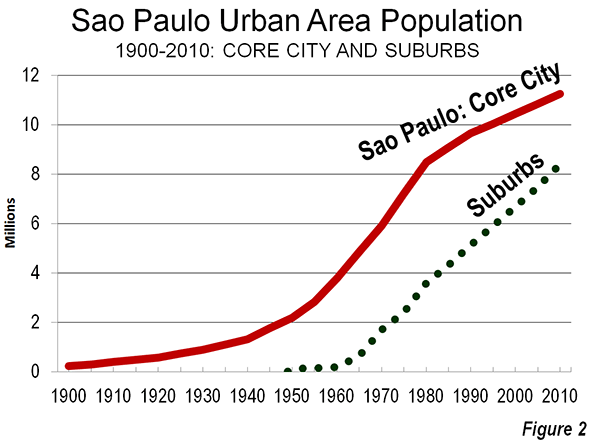
    Favela and Affluence, core city of São Paulo

    City of Hope

    The origins of this movement to Sao Paulo are clear. People moved from the poor countryside, often from the sugar plantations of the Northeast. As bad as life may look to affluent northerners, things are much better here than back in the countryside. Otherwise they would go home, which occurs with no material frequency. São Paulo, like all big metropolitan areas, is a city of hope.


    Wendell Cox is a Visiting Professor, Conservatoire National des Arts et Metiers, Paris and the author of “War on the Dream: How Anti-Sprawl Policy Threatens the Quality of Life.”

    Lead Photo: Paulista Avenue (by author)

  • Form Follows Zoning

    When Louis Sullivan, purveyor of modern American high-rise architecture, said more than 100 years ago that ‘Form Follows Function’, he perhaps didn’t realize the extent to which building form would not be determined only by building type and the laws of physics, but by zoning laws, building safety codes, real estate developer balance sheets and even vocal neighborhood groups.

    For every new building project, an architect’s role is to balance these opposing forces, while also delivering a scheme that is aesthetically pleasing and appropriate for its surroundings. This can be a challenge, but also an opportunity for designers to find creative solutions working within constraints.

    Following are just a few of the many parameters an architect must work with when designing this type of project:

    Form Follows Zoning

    Zoning is a term with broad implications, used to describe the set of regulations put forth by local governments that dictate what type of building can be built where. For each land plot, zoning laws also indicate floor area ratio (FAR, or how much area of building can be constructed), allowable building height, bulk limits, site density, setbacks, and parking requirements, among other constraints.

    The FAR number is of paramount importance: it is the magic number used as a multiplier of a site’s area, resulting in the allowable gross floor area. The higher the FAR number, the more area is allowed to be built on a given plot. In most U.S. cities FAR numbers are difficult to amend except through cumbersome political and legal processes. On the other hand, in developing countries such as China, FAR numbers change on an almost daily basis as zoning regulations remain malleable in order to meet of the moment economic growth needs.

    For high-density commercial and multi-family residential buildings, real estate developers typically seek to maximize FAR to get the highest return on investment. For tall buildings, that means building to the height limit, and then asking for a variance to exceed the height limit if it does not max out the FAR.

    Bulk limits deal with the ascending bulk of skyscrapers, mandating setbacks in the building form as the tower rises up to mitigate shadow impact. That is how you end up with ‘wedding cake’ buildings like the Chrysler Building and the GE Building at Rockefeller Center, both of which were a result of setback mandates in New York City’s 1916 Zoning Resolution. These Art Deco masterpieces are prime examples of how architects cleverly worked within zoning laws to design handsome buildings.

    Form Follows Parking Requirements

    While parking requirements are indicated in zoning laws, this constraint warrants its own category. It is remarkable how much influence the personal automobile has in shaping the modern city, not only in terms of road infrastructure but also in the space required for parking when cars are stopped. Parking requirements are responsible for urban design situations like the ubiquitous linear strip mall setback a great distant from the street, separated by a sea of parking spaces.

    Even in dense urban environments, parking is usually a requirement for new buildings. This means that when designing a multi-story building, the parking layout is what sets the structural column grid that stacks vertically throughout the entire height of the building. A typical 30 ft. column bay (measured from center to center) will accommodate 3 parking spaces, which then results in the building’s entire structure being based on the 30’ column grid.

    Parking garages are either below grade or above grade (above lobby level), and usually do not count towards FAR. There are various reasons (including geological/topographical) for placing a parking garage either below or above grade, but in either case, structure is ultimately designed to accommodate the needs of automobiles.

    Form Follows Rentable/Saleable Area

    In addition to zoning requirements, architects must also meet the needs of their developer clients. This entails realizing in form what real estate bean counters calculate to be the appropriate mix of area for what is to be built.

    If it is commercial office space, developers follow the Building Owners and Managers Association (BOMA) standards of measurement to calculate how much ‘rentable area’ can be squeezed out of a building’s floor given a building’s envelope. Of utmost importance in this calculation is the ‘load factor’ or ratio of rentable area to usable area, determining how much building owners can charge their tenants.

    Also important is the ‘lease span’, with a 45 ft. clear span from service core to exterior wall being the ideal. This allows flexibility in office layout and also ensures enough natural light penetrates deep enough into the office space.

    In residential buildings, saleable are is what developers are after and that determines the mix of unit types (studios, 1 bedrooms, 2 bedrooms, etc…) in a given market. This can frequently change during the design process based on changing market conditions

    For towers with a mix of uses, designing a functional building places tremendous onus on the architect to balance competing forces of different building types consolidated into one vertical structure. With financial rewards ultimately more important than aesthetic outcome, architects have to struggle to create a beautiful building within these constraints.

    Form Follows NIMBY Demands

    In the U.S., and other democratic countries with strong property rights, new building projects are subject to the scrutiny of local neighborhood and vocal environmental groups. Often derided as NIMBYs (Not-In-My-Back-Yard) by those on the pro-development side of a new project, these groups usually have predictable objections, the most common being    increases in traffic. Yet if these NIMBYs, especially in urban settings, have objections to traffic, rather than protest individual projects, they should write their local city councilman suggesting a change in zoning to modify parking requirements.

    Even after the approval of extensive traffic and environmental studies, NIMBYs may criticize a building’s appearance in a last ditch effort to prevent construction. Objections include obscure criticisms such as a design does not fit in with ‘neighborhood character’. This criticism reflects a fundamental misunderstanding that even in historic neighborhoods, a well designed counterpoint or contrast can be a suitable proposal. After all, cities are not static museums frozen in time but dynamic and evolving organisms.

    Unfortunately, the NIMBY victory can often be a final blow to what would’ve otherwise been a successful, beautiful design.

    Conclusion

    For architects, designing a building is more like solving a puzzle rather than an exercise in unrestrained creativity. Surprisingly, there is little discussion of the real world constraints in architecture schools. This is perhaps due in part to the fact that regulations vary greatly from place to place, but the fundamental importance of planning and zoning should be emphasized more often.

    For all stakeholders involved in new building projects (developers, local officials and planning departments, the design team, concerned neighbors) what is written in the local zoning code provides the basis for every decision made. For those interested in making better, more informed planning decisions, individuals and governments should focus less on singular building projects and more on easing the process of making changes to local zoning codes.

    Adam Nathaniel Mayer is an architectural design professional from California. In addition to his job designing buildings he writes the China Urban Development Blog.

    Follow him on Twitter: AdamNMayer

    Chicago skyline photo by Bigstockphoto.com.

  • Vermont’s ‘New Agriculture’: Mini-Farms and the Urban Boundary

    The “new agriculture” is typically small-acreage, intensively-managed, organic (in contemporary terms) in that it avoids both chemical use and genetic modification, and uniquely adaptable to such practices as niche-market services, consumer associations (community-sharing) and pick-your-own. One could argue that it won’t supplant present-day large-scale commercial generic-commodity agriculture any time soon. But one should also recognize that, if industry observers are correct in gauging the size of this producer-to-consumer sector at 20% of the total, then, logically, rural land-use planning ought to be moving to recognize this “new normal” and providing for it in statute and regulation.

    Just the opposite seems to be happening. The so-called “Smart-Growth” doctrine, opposed to traditional low-density suburban development for both residential and commercial land use, now seems to favor smaller lots for residential and commercial use. No more wooded and lawned exurban campuses for business, manufacturing, or research; no more large-lot trophy-house-or-less subdivisions, but very large indeed minimum lot sizes in beyond-the-new-city-wall farmland.

    In Oregon, for example, the minimum farm-lot size is 80 to 160 acres, and is described in various studies of Oregon’s land use laws as the smallest presently acceptable to the State Land Conservation and Development Commission. The same regulatory body calls for a minimum residential lot size of 20 acres for areas beyond the adopted Urban Growth Boundaries, “…to help contain Oregon’s growing urban population inside the growth boundaries”. Similar regulations in Illinois and Pennsylvania call for 40 and 50-acre minimum farm-lot sizes. And these lots come with residential prohibitions. In Oregon, for example according to The Cascade Policy Institute, there’s a State regulation “…requiring a piece of property zoned as high-value farmland to generate $80,000 in annual sales before a dwelling can be built for the farmer.”

    Translated this to a generic-commodity crop like corn, more typically associated with large-scale commercial farming than with small-acreage mini-farms. The 80 acres, if farmed to match the recent new-high national average yield of 160 bushels per acre, and selling at a recent $6 per bushel,, would be generating 160 x $6 x 80, or $76,800.

    This means that a typical Midwestern Corn Belt corn-grower wouldn’t be welcome as a new resident in Oregon’s Willamette Valley, a notably gentrified rural district comparable in size and population (not counting the urban populations) to such enclaves as Virginia’s Shenandoah Valley and, some would argue, the entire State of Vermont. The Willamette Valley is well-known in oenophile circles for its more-valuable-than-corn bottled product. A vineyard operator with an 80-acre operation there would easily meet the $80,000 (that’s a gross of $1,000/acre) threshold benchmark and be permitted (literally) to build a house for the owner.

    Whether operators of mini-farms in the ¼ to 10-acre range (as defined by the titles of advisory books which offer author advice on “X Acres and Independence”) can generate $1,000 per acre depends on, among other factors, production choice. Pastured beef is certainly less likely than row-crop broccoli.

    Judging by the percent of all farms, large to small, which are reported by the USDA to derive some 90% of household income from off-farm non-farm jobs, a safe guess for mini-farmers as a sub-group would be “not likely”. And even if they could gross $1,000 per acre, doing so on, say, five acres (a guessed-at average; we have no official stats, although the USDA tells the that the 0-50 acre category is increasing) doesn’t suggest economic “independence” in comparison to recent Bureau of Labor Statistics stats for median US household income in the $50,000 range.

    And, of course, if there are any mini-farms in the 80-acre size, they would be extremely few in number and far off on the right-hand side of the size-distribution bell curve. That’s for another reason: labor.

    All the qualities associated with “the new agriculture” indicate more intensive management time and effort than for more traditional, large-lot commodity agriculture, with its dependence on 10- and 12-row equipment to enable a single operator with minimal help to produce at large scale, The typical mini-farm operator-plus-household simply couldn’t apply the same level of intensive management at an 80+acre level as they can at the ever-more-widely-practiced 5-acre level. With the exception of some designed-specifically-for-small-operations equipment like cultivators and harvesters (and sold mostly to Third World operators), there’s no equipment yet invented to replace the grower touch in dealing with any produce from flowers and table crops.

    Oregon’s farm-zoning requirements — not less than 80 acres in farm size, not less than $80,000 in annual gross revenues; add in the built-in labor question — all seem specifically designed to prevent mini-farm-based rural land use practices, and to encourage instead a more limited range of larger-scale choices. These range from commercial-scale vineyards, to mechanizeable operations like sod and organic wheat, and relatively low-labor-requirements-per-acre operations like beef grazing, All of the above are hardly do-able, economically, at the typical small-acreage scale of the usual mini-farm. The question then becomes the reasoning behind the State government’s land-use-management decision.

    Two possibilities, seemingly improbable but both historically based, come to mind.

    One posits the competition-prevention scenario; the concern over loss of control of any part of the eventual consumer dollar. “New Ag” and its mini-farms have, over the last two or three decades, raised their “market share” from insignificant to, some observers claim, as much as 20%.In this view, any new farm-stand just outside the “urban growth boundary” is a dollar-for-dollar challenge to the established retailers, distributors, and processors, and even the commodity brokers and buyers in the business chain that ends at the already-established retail check-out counter well within the “urban growth boundary”.

    In recent history, this concern first showed up in Vermont in the ‘70s, when grocery-chain lobbyists attended a raw-milk-ban proposal hearing in force to proclaim that their only concern was “public health” and that, for consumer safety, all milk should be legally required to move from farm to home through their channels alone. Across the nation now, as do-it-yourself or sell-to-neighbors enterprises such as urban poultry flocks or home-baked pies at farmers markets show, legal attempts at prevention (supposedly on behalf of consumer health, but more evidently on behalf of food retailers, almost universally) now take place. For states to respond to industry lobbying pressures for new rural-land-use planning supposedly for preservation of farmland, but actually for preservation of market share, would not be an unreasonable speculation.

    The other posits a tilt towards favoring land acquisition by a wealthier and more gentrified sector of society, as opposed to the sorts of folks who established small-acreage live-off-the-land communes and collectives in the ‘60s. Setting the cost-of-entry and cost-of-stay high enough encourages the former and discourages the latter, precisely as large-lot residential zoning (and even minimum-house-size requirements) did in the more self-consciously exclusive Northeastern suburbs in the ’70s.

    Seen in that light, an 80-acre rule which works well for private-label vineyards and not well for self-sufficiency home-steaders, organic or otherwise, makes some logical sense. Just as different jurisdictions adopt different residential lot (and housing) sizes, it’s probable that some States will pursue the Oregon 80-acre farm-lot model and some won’t. But the economic purchasing power of the consuming 20% now eager to buy organic veggies at farmers’ markets won’t go away.

    Expect some insufficiently-successful vineyard operator near Portland to sub-divide his eighth-section (a little archaic surveyor’s lingo, there; the Homestead Act of 1862 prescribed operation of 160-acre quarter-sections) into 15 little 5-acre leased farmettes, at a total ground rent high enough for the $80,000 annual-revenue permit to build his own mini-mansion on the 16th.

    Flickr Photo by Rick Skully: Uphill view of Four Springs Farm, Windsor County, Vermont. At the top of the photo is the outdoor kitchen.

    Martin Harris is a Princeton graduate in architecture and urban planning with a range of experience in fields ranging from urban renewal and air-industrial parks to the trajectory of small-town planning and zoning in states like Vermont.

  • Why I Don’t Live In Indianapolis

    It’s no secret that Indianapolis has been a huge focus of my blog over the years. One of the biggest criticisms I get here, especially when I ding some other city, is that I’m nothing more than a mindless booster for Indy. While I like to think I’ve given the city a lot of tough love over the years, it’s definitely true that I’ve had many, many good things to say, and I have no problem saying that I’m a big fan of the city overall.

    Why then, might one ask, don’t I actually live in Indianapolis?

    The answer is multifaceted, but without a doubt one key reason is that I simply can’t sign up to what the city is doing in its urban environment. Indy is going one direction, I’m going another. It’s as simple as that.

    Let me give you an example of what I’m talking about. The city recently announced a plan to subsidize a mixed used development on a parcel in the core of downtown, a project called “Block 400.” It would include apartments, retail, etc – all good. While the concept is great, the design is another matter. I could go into depth on the monotony of the structure and other matters, but what I want to show you instead is a parking garage that will house employees from One America insurance. Here was an initial rendering of the garage:

    It’s about as boring a garage as can be imagined. It’s on a prime block just steps from Monument Circle, but has no street level retail or other interest. It’s just a dead parking garage.

    Various folks took umbrage at this, so the developer decided to tack on some awnings, which got them approved by the city’s hearing examiner. Here’s their updated design:

    Let’s be honest: this isn’t a garage, it’s urban design garbage. And guess what? The city of Indianapolis itself is paying to build it.

    I don’t want to let the perfect be the enemy of the good. I can certainly understand that there are economic constraints, tradeoffs to be made, etc. And not every project can be a home run.

    But this isn’t unusual at all – this is standard operating procedure for Indianapolis. This is par for the course. This is just what Indianapolis builds. I cannot name another major city in the United States where the city’s own developer community (including Flaherty and Collins, the developer of this property), own architectural firms (including CSO Architects, who designed this) and own city government so consistently produce subpar development.

    I’m not exaggerating at all. And this isn’t even the worst offender. For example, here’s another downtown development that not only sucks out loud, but the state fire marshal condemned it and forced residents to move out:

    While I’ve named the names of the folks involved in the parking garage and they certainly deserve it, let’s not focus overly on them. This trend goes back a really long way, and is pervasive. The previous city administration, which was of a different political party, behaved no differently. Partially it’s a result of a lack of good urban history of the type that exists in other places. So there isn’t a good template ingrained in the city to follow.

    But ultimately, as I’ve written before, it’s a crisis of values.

    Indianapolis is the place where, as a rule, not good enough is more than good enough for most people, even community leadership.

    That’s why I don’t live there. Because that’s not good enough for me. I may not be perfect, but I aspire to more than mediocrity. I don’t expect any city to be perfect or all the way there yet. You can inspire people, including me, to join your army to take hamburger hill or to get behind the rock and push, if you provide a vision of what can be. That’s one reason people are planting their flag in Detroit. It’s the hope of the possible.

    But when it’s clear that the city itself – and I mean that in the broadest sense – has decided it wants to go march off in a different direction, it’s a lot harder to enlist in that army, no matter how much you might want to.

    Alas, it seems lots of people agree with me – on the actions if not the reasons – as Center Township (the urban core) lost another 24,000 people in the 2000s. They voted with their feet – just like tens of thousands of others have been continuously voting with their feet since 1950 – to go build a better life for themselves somewhere else.

    And in a decade where downtowns made strong residential comebacks, with young people streaming in to live in them, Indianapolis was an exception. Its downtown* added less than a 1000 residents, and their distribution suggests that almost all of that might be a result of jail population expansion. Even downtown Cleveland did better.

    I’m sure Indy’s boosters will be happy to talk about world class parts of downtown like Monument Circle, the Cultural Trail, Georgia St., etc. And these are legitimately first rate. Actually, that makes it worse. It shows that Indianapolis can compete with the best if it wants to, but most of the time it just doesn’t care to. It’s not ignorance. The city knows that to do, it just doesn’t want to do it.

    For some reason locals seem to think that doing it right should be reserved for a handful of special places and occasions. But the mark of at great city isn’t how it treats its special places – everybody does that right – but how it treats its ordinary ones. Indy is like the guy who thinks he can get away with wearing the same old dirty clothes fives days in a row and not taking showers, as long he slaps on a little top shelf cologne before he leaves the house. I’ve got news for you, people are going to notice.

    Indianapolis retains a very compelling regional story to tell. There are tons of reasons for people to come to or build a business in, metropolitan Indianapolis. But the real story there is mostly in the suburbs.

    Yet I believe even the urban core of this not very historically urban city could be compelling as well – if it wanted to be. Indianapolis has all the potential in the world. Indy is like the up and coming star at a company whose boss pulls him aside one day and says, “You’ve got all the potential in the world, but if you want to get that big promotion, you need to stop doing/start doing X, Y, or Z.” Anybody who has made it to the top was fortunately enough to have somebody give them one or more of those good kicks in the pants along the way.

    Indy, unfortunately, has heard the message many times before from many different people, and has elected not to do anything about it.

    Locals love to make excuses for why things can’t be better. F&C’s development director for the project said of the garage, “Some things aren’t achievable.” What is so different about Indianapolis that makes that true there but no where else? What miracle of economics allowed similar cities like Nashville or Cincinnati or Columbus to build many urbanistically correct new developments in those places while somehow it is impossible in Indianapolis? Maybe it’s time to recruit some out of town developers and architectural firms who have a different attitude towards the possible.

    I would encourage Indy’s leaders to take a short hour and a half drive to downtown Cincinnati and take a look around what’s there. Not the old buildings, but the new ones. Most of them are candidly quite bland architecturally, but from an urbanism perspective – and be sure to take someone with you know what’s what they are talking about on this so that they can point it all out – even the bottom quartile of new buildings in downtown Cincinnati beat most of the top 5% of what’s been build in downtown Indy.

    I’ve listened to various civic leaders of late talk about how rebuilding the urban core is now a big priority of the city. If that’s true, and business as usual has been leading to a catastrophic population collapse for some time, wouldn’t you think that you might, you know, try something different? Apparently not.

    When people in Indy want to do something, they can. That’s why they built an amazing franchise in events hosting, particularly sports. They understand what world class is there, they understand the competitive marketplace, and they do what it takes to succeed – including building world class venues, districts, and capabilities to make it happen. So why hasn’t it happened elsewhere?

    I was involved in a discussion about building a high tech industry in Indianapolis a few years ago. Someone boldly said that since Indy had been able to pull off building the sports cluster, it should be very capable of equally pulling off a high tech cluster to rival top hubs in the country. A friend of mine was very dubious about this, and said insightfully, “Sports succeeded because sports is consistent with the state of mind (i.e, the culture, values, and patterns of life) of Indiana. But high tech is more consistent with the state of mind of other places and not so much with Indiana.” Indianapolis is #1 in sports. And while it’s done well in some parts of tech, I don’t see how you could really rate it as more than the middle of the pack nationally on that.

    “State of mind” makes a big difference. That’s ultimately a question people ask themselves these days, whether it is a company and a prospective employee sizing each other up, a consultant and client, or a city and a prospective resident or business. The most important question is always, “Is there a cultural fit?”

    In an era where an ability to attract talent is perhaps the defining characteristic of urban success over the long term, Indy needs to ask itself the hard questions. How competitive is it? I’d have to say right now that it does a great job for people who want to live in a suburban environment like Carmel or Fishers. That’s very, very important and not to be minimized.

    But there are people out there that want more, who prefer different types of environments. Right now Indy is simply not very competitive in that market. And if it keeps on its current path, it never will be. Convince yourself otherwise by finding the exceptions to the rule and getting them to gush about how great things are. But the numbers don’t lie.

    Like that young up and coming employee who’s got the goods but has a few problem areas that will, if not fixed, hold him back, Indy needs to take a serious gut check about the things that hold it back – and an embrace of mediocrity and lack of seriousness in its approach to urban core development are chief among them.

    Ultimately as I said it’s a question a values. There’s nothing wrong with being happy about where you are. Most people don’t have that burning ambition to make it higher, nor a passion for excellence. In this competitive world a lax attitude will probably undermine your performance in the end, but if that’s what you want be, go for it. I won’t judge a place for that. Just don’t expect those who want better for themselves to sign up for it.

    In any choice a city makes, somebody is going to be unhappy. Any branding choice is, in a sense, a choice to exclude by focusing on something rather than something else. There’s nothing wrong with setting down a marker of what you’re going after – and being comfortable with fall out from that.

    Ultimately it’s not about me or any other specific individual. I’m under no illusion that I’m someone who is personally important to future of any city I might find myself. But it about people generally, and being able to attract enough of them – particular of those that are critical to the 21st century economy – to make the city successful and indeed sustainable over the long term.

    Just remember, talented, ambitious people – those with big dreams and hopes for themselves and their societies – want to live in a place where the civic aspiration matches their personal aspiration.

    What do you aspire to, Indianapolis?

    * Downtown defined as the area inside the inner freeway loop and the White River.

    Aaron M. Renn is an independent writer on urban affairs and the founder of Telestrian, a data analysis and mapping tool. He writes at The Urbanophile, where this piece originally appeared.

  • Let L.A. Be L.A.

    Victor’s Restaurant, a nondescript coffee shop on a Hollywood side street, seems an odd place to meet for a movement challenging many of Los Angeles’s most powerful, well-heeled forces. Yet amid the uniformed service workers, budding actors, and retirees enjoying coffee and French toast, unlikely revolutionaries plot the next major battle over the city’s future. Driving their rebellion is a proposal from the L.A. planning department that would allow greater density in the heart of Hollywood, a scruffy district that includes swaths of classic California bungalows and charming 1930s-era garden apartments. The proposal—which calls for residential towers of 50 stories or more along Hollywood Boulevard, where no building currently tops 20 stories—has been approved unanimously by the city council and will now probably be challenged in court.

    That proposal isn’t the only densification plan making its way through city hall. Another is a “wholesale revision” of L.A.’s planning code that would strip single-family districts of their present status and approve the construction of rental units in backyards and of high-density housing close to what are now quiet residential neighborhoods. “We are going to remake what the city looks like,” Mayor Antonio Villaraigosa told the New York Times in March. Richard Abrams, a 40-year Hollywood resident and a leader of SaveHollywood.Org, puts it differently: “They want to turn this into something like East Germany. This is all part of an attempt to worsen the quality of life—to leave us without backyards and with monumental traffic.” The rebels gathered at Victor’s note that many of the density scheme’s most tenacious advocates, such as councilman and mayoral aspirant Eric Garcetti, live in leafy residential areas removed from the traffic nightmare that the new development would bring.

    Despite public outcry, Los Angeles’s political, labor, and real-estate elites almost unanimously support what Villaraigosa calls “elegant density,” pushing for the transformation of the city’s low-rise, multipolar, and moderate urban form into something more like vertical, transit-oriented New York. Dissenters from this view are often called “antiurban.” But to activists like Susan Swan, who leads the Hollywood Neighborhood Council, it’s really about letting L.A. remain L.A. As she notes, New York and Los Angeles have evolved in radically different ways. New York, particularly its urban core, was built largely before the automobile age. Manhattan and the surrounding boroughs are transit-dependent: 56 percent of commuters take public transportation. By contrast, L.A. remains overwhelmingly car-oriented, with only 11 percent of commuters using public transit, despite the $8 billion invested in rail lines over the past two decades. Los Angeles’s downtown is nowhere near as important as New York’s; just over 2 percent of L.A. metropolitan-area employment is downtown, compared with about 20 percent in greater New York. Instead of revolving around one mega-center, L.A. boasts commercial centers in each of its major neighborhoods, many of which are close to single-family homes and low-rise apartments.

    This dispersion creates an aesthetic rarely appreciated by density boosters, enabling residents to enjoy fully L.A.’s unique ambience—its superb Mediterranean climate, lush foliage, tall trees, and, most of all, magnificent light. Even when you walk down Hollywood Boulevard, what’s most striking is not the skyline but the steep hills, framed by palms, rising toward a clear blue sky. For a glimpse of the Hollywood imagined by Villaraigosa and his confederates, take a look at the much-reviled Hollywood and Highland Center, home of the Dolby Theatre, which hosts the Academy Awards. Instead of brilliant light and blue sky, visitors confront a boxy hulk that obscures the hillside views.

    Swan and other activists deny that opposing mass densification is synonymous with opposing development. With many nearly abandoned blocks and downscale businesses around its core, Hollywood certainly could use a face-lift. But local community activists want development to be congruent with the area’s architectural traditions. “There is real dismay in our community that the opportunity to make Hollywood a world-class destination is slipping away to these ‘Manhattanization’ fantasies,” says Swan, a retired bookbinder. “We have always said that we love Manhattan—in New York.”

    Demographics also make a mockery of the densification argument. With the exception of downtown, most of the central parts of Los Angeles have either stagnated or lost population over the last 20 years. Hollywood, for example, shrank from 213,000 residents in 1990 to 198,000 today. Within the last decade, Los Angeles County’s growth slowed to barely 3 percent—roughly one-fifth the rate that it enjoyed during the go-go 1980s, a period of extraordinary prosperity in the region. Yet Garcetti, Villaraigosa, and their allies continue to base their grands projets, as the French would call them, on outmoded assumptions of exploding economic and population growth. Particularly revealing is the experience of the Residences at W Hollywood, a luxury-condo project located a stone’s throw from the proposed new high-rise towers in Hollywood. According to recent reports, only 29 out of 143 units have sold since the project opened in May 2010, despite prices that have been slashed by more than half. The market, in short, is unwilling to embrace density here, “elegant” or otherwise.

    Yet the city keeps planning big, as though hordes of the well-heeled were eager to move to L.A. It has offered massive subsidies, accounting for nearly $640 million in tax breaks, to three hotel projects. Public bonds are also underwriting expansion of L.A.’s convention center and a new football stadium, which received unheard-of exemptions from state and local environmental laws even though the city currently has no football team. “Everything we are doing, like the mass build-out of transit and density, provides an excuse for creating things people don’t want,” says Cary Brazeman, founder and president of L.A. Neighbors, a citywide alliance of neighborhoods, and a candidate for city controller in 2013. “To build this city back, you have to approach things in ways that enhance the gloriousness of L.A. Sunshine, it’s transcendental. You take away the sun, hell, I’m leaving my condo.”

    Without backing from rent-seekers or unions, Brazeman’s campaign runs on a shoestring. His better-funded opponent, former police officer Dennis Zine, epitomizes L.A.’s dysfunctional political system, drawing both his generous police pension and a city council salary of $178,000, the highest in the nation. Though he represents a largely residential area in the San Fernando Valley, Zine has proved a reliable vote for the elaborate “incentives” that encourage large, often uneconomic, building and ever-greater spending on transit projects. A more serious challenge to the existing order could come from Zev Yaroslavsky, a member of the Los Angeles County Board of Supervisors. Yaroslavsky hasn’t declared his candidacy for mayor yet, but he is known to be skeptical of the proposed remake of L.A. The question is whether he’s too comfortable with the status quo to take on the “elegant density” agenda.

    For now, the best hope for Los Angeles resides with the activists who meet at Victor’s. They may not scare the political incumbents or the real-estate developers, but they do represent a motivated opposition to the effort to recast the city. “Los Angeles started because people want to live here,” Abrams says. “We are not a cut-rate New York and don’t want to be. The developers and the politicians want to take away all that makes us unique and get rid of us tomorrow. It won’t be so easy.”

    Joel Kotkin is executive editor of NewGeography.com and is a distinguished presidential fellow in urban futures at Chapman University, and contributing editor to the City Journal in New York. He is author of The City: A Global History. His newest book is The Next Hundred Million: America in 2050, released in February, 2010.

    This piece originally appeared in The City Journal.

  • America’s Future Is Taking Shape In The Suburbs

    For nearly a generation, pundits, academics and journalists have written off suburbia. They predict that the future lies in the cities, with more Americans living in smaller spaces such as the micro-apartments of 300 square feet or less that New York and San Francisco are considering changing their building laws to allow. Even traditionally spread out cities, such as Los Angeles, are laying out plans to create greater population density, threatening the continued existence of some neighborhoods of single-family homes.

    Yet wishing something dead does not make it so. Indeed, the suburbanization of America is likely to continue over the next decade. The 2010 Census — by far the most accurate recent accounting — showed that over 90% of all metropolitan growth over the past decade took place in the suburbs.

    Some central cities, notably New York, enjoyed decent population growth, but their increases were still below the national average. The Joint Center for Housing at Harvard notes that, only five metro areas —Boston, San Diego, San Jose, Calif., and the Florida cities of Cape Coral and Palm Bay — saw an increase in the share of households living in core cities relative to their suburbs and exurbs.

    To be sure, the Great Recession slowed the growth of suburbs, as many Americans lost the ability to achieve their dream of owning a single-family house. “Back to the city” advocates have seized on Census estimates for the past year that suggested that urban core growth has actually been a tad faster than that of suburbs.

    However, the Census Bureau numbers may be less accurate, and certainly less predictive, than many suggest. University of Pittsburgh urban analyst Chris Briem points out that in the last decade, some Census Bureau city estimates turned out to be vastly exaggerated compared to the actual 2010 Census. This was particularly true in Chicago and New York, where constant lobbying by city officials — after all, federal aid is distributed based on population estimates — meant that optimistic urban estimates turned out to be hundreds of thousands of people off.

    More amazing still, the Census Bureau essentially assumed that growth was even in all municipalities in a county. This bizarre practice projects that growth, say, in the city of Los Angeles, is equal to that of newer communities like Santa Clarita, or that suburbs of Alleghany County grew at the same rate as the city of Pittsburgh. This surely can’t be the case.

    Reporters concentrated in Manhattan and the District of Columbia didn’t look seriously at these numbers. They repeated the assumption that this was the result of mass migration, particularly among the young, out of suburbs and into cities.

    Yet in reality, there was no evidence of that trend. In fact, the Census Bureau’s core county estimates (which are demonstrably more accurate than the municipal estimates) showed a slight core county loss in domestic migration over the past year. The real story of the estimates has to do with the recession, which has led to record-low levels of mobility. Inter-county migration has fallen almost half from its 2006 level. Essentially, a historically weak economy has boosted the city share of population growth.

    So what can we expect in the future? Some cities will grow, but the vast majority of metropolitan growth will continue to take place in what are still car-dominated suburbs like areas areas. This can occur only the economy again get on a full-fledged growth cycle. Here some basic reasons not to write off suburbia.

    Inter-Regional Growth Patterns

    All 15 of the fastest-growing metropolitan areas of the past decade — led by places like Las Vegas, Raleigh, Phoenix, Houston and Dallas-Fort Worth — are sprawling and have low-density cores. Metropolitan areas with far denser cores, such as New York, Boston, Chicago, and San Francisco, tended to display below-average growth.

    These fast-growing cities tend to be suburban in form, dominated by single-family homes, automobile commuters and with dispersed economic centers. The growing central cities of Phoenix or Houston look more like places such as Long Island or Santa Clara than Manhattan or Chicago.

    Economic Shifts

    Many urban boosters cite a Santa Fe Institute study claiming that density creates productivity and economic growth. However, the study clearly dissociated itself from this argument, claiming that it did not matter if a region was shaped like Los Angeles, Atlanta or Houston, or New York or Boston. The source of productivity lay simply in a growing metropolitan population, the authors claimed.

    Overall, it’s questionable whether city economies perform better over time than the suburbs. Indeed, over the last decade, 81 percent of the population growth of core cities was among the poor, compared to 32 percent in suburbs. Poverty anywhere is a bad thing, but the claim, made repeatedly by some pundits that it is worsening more in suburbs turns out to be, well, just another urban legend. Overall poverty accounts for nearly one in four urban residents, twice the rate for suburbs.

    Energy Costs

    Ever since the energy crisis of the 1970s, pundits have predicted suburbanites would be forced to give up their cars. But higher energy prices have not slowed the suburban trend. With the current growth in new energy finds both here and abroad, the much heralded dawn of “peak oil” appears to be about as imminent as a balanced federal budget.

    Some terrified urbanists, like Bruce Fisher, director of the Center for Economic and Policy Studies at Buffalo State College, fear the new oil rush means “suburban real estate development will once again enjoy a comparative advantage over center city development.” In what some see as a catastrophe for both planet and urbanity, the car will remain dominant for the foreseeable future, despite three decades of massive spending on new transit systems across the country.

    Demographic Trends

    The advocates of a dense urban future usually point to demographics. Yet the formerly fashionable theory that retiring boomers would head en masse to cities turned out to be largely false. The last census showed the vast majority of aging boomers remained in the suburbs or moved further out into the periphery. “Back to the country” actually far outweighed “back to the city” in terms of boomer migration.

    Then there’s the other large generation of Americans, millennials, who are said to prefer an urban lifestyle. Yet surveys of millennials show a strong, often even more marked, preference for homeownership and suburban living than their parents.

    This will prove critical as many now urban millennials begin to enter their 30s and 40s over the next decade. Once they marry and start to have families, they will emerge, as the Harvard housing study notes as “the primary driver of new household formations over the next two decades.” Along with the other powerful force, immigrants, most seem likely to end up in suburban locales, if they can.

    Preferences Matter

    This does not counteract the fact that many young people will chose to settle in dense urban areas for their 20s and early 30s. Some urban cores, notably New York, Boston and San Francisco, will likely grow and get denser. But most others will see only modest, often fitful growth; despite massive public investment, for example, downtown Los Angeles, according to Zillow.com, has foreclosure rates worse than virtually anywhere else in the region.

    Preferences are the key here, particularly paying attention to what people want as they age. The 2011 Community Preference Survey, commissioned jointly by the National Association of Realtors and Smart Growth America, found that only a small minority — less than 10 percent — favored a dense urban location. Some 80 percent expressed preference for a single-family home.

    Over time, in a market-based economy, consumer preferences matter far more than those of pundits, professors or, for that matter, rent-seeking real estate developers. The only things that can kill off future suburban development would be forced densification by government edict or a continued miserable economy that entraps millions of the unwilling in dense urban areas.

    Joel Kotkin is executive editor of NewGeography.com and is a distinguished presidential fellow in urban futures at Chapman University, and contributing editor to the City Journal in New York. He is author of The City: A Global History. His newest book is The Next Hundred Million: America in 2050, released in February, 2010.

    This piece originally appeared in Forbes.

    Suburbs photo courtesy of BigStockPhoto.com.

  • Density is Not the Issue: The Urban Scaling Research

    The "urban scaling" research of Geoffrey West, Luis Bettencourt, Jose Lobo, Deborah Strumsky, Dirk Helbing and Christian Kuhnert on cities has attracted considerable attention (references below). They have provided strong quantitative evidence, based upon voluminous econometric analysis that cities tend to become more efficient as they grow in population.

    Specifically, West, a theoretical physicist, and his team show that measures such as gross domestic product per capita and income per capita rise, on average, 15 percent with each doubling of city population. They draw parallels with the animal kingdom, noting that larger animals tend to be more efficient than smaller ones, and comparing elephants, efficient because of their size, to cities.

    This is all very attractive, especially the elephant analogy, which appropriately suggests that cities are organisms.

    The Urban Organism

    Yet the research has been widely reported to suggest that density as opposed to size is the key to urban productivity. West et al look at cities as "integrated economic and social units," at the "level of metropolitan statistical areas (MSAs); in the European Union, larger urban zones (LUZs); and in China, urban administrative units." This is the economic, or functional manifestation of the urban organism (the urban area, the area of continuous urbanization, is the physical manifestation). In so doing, West, et al demonstrate a familiarity with urban geography that is all too rare, even among analysts who have studied cities for far longer.

    The key issue here is what constitutes a “city”.  New York is a good, example, as headquarters to the national media, a world class city and as urban as it gets in the United States. But the New York metropolitan area, the "integrated economic and social unit" is not Manhattan or even five boroughs. It stretches from a bit west of Blooming Grove Township, in Pike County 25 miles west of Port Jervis, a city 90 miles from Manhattan located in western Orange County, NY, to Montauk Point in Suffolk County and from north of West Point, in Putnam County to Egg Harbor Township, in Ocean County, New Jersey (that’s nearly 30 miles south of Toms River). Suffice it to say most of this vast region is not dense at all.

    Divining Density

    Yet, some analysts have characterized the West, et al research as being about higher densities, Richard Florida wrote in The Wall Street Journal:

    Researchers at the Santa Fe Institute have been able to demonstrate that bigger, denser cities literally speed up the metabolism of daily life.

    That’s only half right. The research was about city size, not density, as the authors indicate (below).

    All too typical of the way that suburbanized America is disparaged by the media, Jonah Lehrer, of The New York Times sputtered that:

    In recent decades, though, many of the fastest-growing cities in America, like Phoenix and Riverside, Calif., have given us a very different urban model. These places have traded away public spaces for affordable single-family homes, attracting working-class families who want their own white picket fences.

    In reality, the kind of suburbs found in Phoenix and Riverside-San Bernardino will be found surrounding every one of the nation’s core cities, including New York, an urban area that covers  more land area than any urban area in the world at 3,450 square miles (8,935 square kilometers), according to the Census Bureau. That’s twice the expanse of the Los Angeles urban area. Granted, New York’s Hudson Valley suburbs are greener and more affluent than most in Phoenix, but their population density is nearly the same. Moreover, neither Phoenix nor New York (think Staten Island or much of Long Island) should be ashamed of attracting "working class families who want their own white picket fences." Why demean aspiration?

    Urban blogger James Withow refers to their "remarkable findings" that "raise interesting policy issues on density." Another analyst wrote "West offers data that shows cities create economies of scale that suburbs and small towns cannot match." This is patently absurd since, as noted above, West did not study any part of the urban organism below the metropolitan area. There was no attempt to make a distinction between the productivity of say, Manhattan or Brooklyn, to White Plains or even Blooming Spring Township. No core city or suburb is an "integrated economic and social unit."

    West et al on Density

    Indeed, West et al make it very clear that their findings have nothing to do with urban population density. They tested for correlations population growth and income, patents and violent crimes, and found "no significant trend exists between residuals for income, patents and violent crime and population growth or density." They further note their equations showed an "R2 consistent with zero" (in every day English, that means they found no relationship between density and the other variables).

    This conclusion was correct, though comparing metropolitan area densities is less than ideal. Just to check, we reran the equations with urban density data and found that this approach too produced an "R2 consistent with zero," not only for income, patents and violent crimes, but also gross metropolitan product.

    West et al pointed out that:

    The shape of the city in space, including for example its residential density, matter much less than (and are mostly accounted for by) population size in predicting indicators of urban performance. Said more explicitly, whether a city looks more like New York or Boston or instead like Los Angeles or Atlanta has a vanishing effect in predicting its socio-economic performance. (emphasis by author)

    In other words, the same improvement in urban performance would be predicted from doubling the population of Atlanta, with an urban density of 1,700 per square mile (700 per square kilometer) as in New York, with more than three times Atlanta’s density or Los Angeles’ with more than four (Los Angeles is highest density large urban area in the United States).

     It turns out – counter the misunderstandings of some urbanists – that higher or lower density simply does not matter according to the West, et al research.

    It’s About Density Thresholds and Efficient Labor Markets

    Cities (integrated economic and social units) are created by reaching urban density thresholds. They tend to become more productive as they grow, so long as they are not too large to function as a labor market. Density doesn’t matter particularly. Indeed, the general tendency is for cities to become more dispersed (less dense) as they grow, as indicated by longer term data in the US, Canada and around the world.

    For example, the Seattle and Houston urban areas have population densities much lower than those of Paris, London, Hong Kong and even Los Angeles – yet they still rank higher among the most productive metropolitan areas in the world, according to the Brookings Institution Global Metropolitan Monitor 2011. Brookings rates Hartford as the most productive metropolitan area in the world, yet its urban population density is nearly as low as Atlanta’s.

    Finally, the Brookings list excludes the world’s most dense major city, Dhaka. That’s because the economic output of its 15 million people is insufficient to make a list that includes cities one-tenth its size. Dhaka combines the highest population density in the world with perhaps the lowest per capita economic output of any megacity in the world.

    Allowing Organisms to Grow

    As West et al suggests, cities, like elephants, are organisms. Both expand (dare we say "sprawl") as they grow. This should be cause for concern, given planning dictates that would restrain urban organism, such as urban growth boundaries. These restraints are akin to depriving a large mammal of sufficient space to roam and feed. That’s no way to treat a productive organism, or a great city.

    ——-

    Reference Materials:
    Growth, innovation, scaling, and the pace of life in cities
    Urban Scaling and Its Deviations: Revealing the Structure of Wealth, Innovation and Crime across Cities
    2010 US Urban Area Data

    ——-

    African Bush Elephant photo by flickr user nickandmel2006.

    Wendell Cox is a Visiting Professor, Conservatoire National des Arts et Metiers, Paris and the author of “War on the Dream: How Anti-Sprawl Policy Threatens the Quality of Life.”