Category: planning

  • Were Urban Freeways a Good Idea?

    It’s almost a truism in urbanist circles that construction of urban freeways was a bad idea.

    Indianapolis Monthly magazine takes a somewhat more charitable view in its retrospective on the 40th anniversary of the completion of the downtown “inner loop” freeway.

    “But even before its grand opening, the inner loop—31 miles of interstate within I-465, built at a cost of nearly $300 million—had begun paying downtown dividends. Real estate values around the superhighway increased in the early 1970s, reversing a 35-year decline, and Mayor Hudnut also credited the road with stimulating such projects as the Hilton Hotel, the Indiana National Bank building, and the $150 million expansion of Eli Lilly & Co.

    Hudnut predicted the new freeway would spur 20,000 new jobs, and state legislators embraced the spirit: In 1973, when a federal reimbursement slowdown threatened to add 10 years to its completion date, they fronted the money for the last leg of I-65/I-70.”

    The conventional wisdom is that downtown freeways were unmitigated disasters. It says they destroyed vast tracts of urban neighborhoods, with a racist targeting of black ones, then remained as huge barriers to redevelopment.

    The Indy Monthly article acknowledges the downsides of the construction:

    “But little relief awaited the neighborhoods that were carved up for the inner loop. The project displaced a total of 17,000 residents, including 6,000 from Fountain Square (one-fourth of the population).

    Linda Osborne, owner of Arthur’s Music Store, remembers Fountain Square as a vibrant full-service community during the 1950s and early ’60s. “There were theaters, grocery stores, shoe stores—all the things you have in a small town,” says Osborne, whose family business opened in 1952. Interstate construction, however, dug a wide channel that isolated Fountain Square from downtown. Then as now, a Virginia Avenue bridge carried traffic over the chasm, but the commercial district soon tanked, Osborne says.”

    I previously posted an article documenting the destruction in Fountain Square. It features pictures from Historic Indianapolis, including this one showing the scale of the destruction.

    historic indianpolis

    I don’t have Fountain Square’s demographics at the time, but what evidence I do have suggests it was a largely white community, which it remains to this day. So in this case the place with the most destruction wasn’t a minority area.

    Indy Monthly also points out the example of downtown Ft. Wayne. That city decided to go with a bypass option rather than a downtown alignment. The result was that they did indeed prevent neighborhoods from being destroyed, but those neighborhoods and the city’s downtown severely declined anyway. While there are some interesting things going on downtown Ft. Wayne to be sure, it’s unarguable that Indy’s downtown is on a completely different plane of development, though to be sure Indy is a much larger city.

    In fact, this is the pattern we see. Urban decline happened pretty much everywhere, urban freeway or no. When there’s a downtown freeway to blame, people do that. Where there’s not, people blame the bypass. Hence most attributing of blame for decline to urban freeways is simply incorrect.

    Indy Monthly argues that the freeway system provided for convenient access to downtown. Without that access. businesses would have fled, it would be impossible to host large events, etc.

    There is something to this, I think. If there were no freeway access to downtown Indianapolis, it seems likely it would be a much diminished urban center. Keep in mind, there was limited transit access and no real prospect of creating it.

    But we should separate two things, the freeways that provide access to downtown and the ones that run through it. It’s certainly possible that freeway spurs could have been built into the center of the city without building them as through-routes. This is the idea behind much of the boulevarding advocacy movement.

    Twice within the last decade, the state implemented multi-month closures of the Indianapolis inner loop to through traffic. This was a good real world test of whether it was needed at all.

    I wasn’t living there at the time but did do some driving around rush hour during one of the closures. The best alternate route for through traffic is to use I-465 to the south. This did get heavily congested, suggesting that this road would need to be widened prior to removing the inner loop. Some folks did say some surface routes near downtown were more congested during rush hour. But there didn’t seem to be any show-stoppers to permanent closure.

    In my view, removal of the inner loop is feasible, though highly unlikely to ever occur. But it goes to show that the benefits of freeway access to downtown could have been implemented in ways that were less invasive, using freeway spurs and boulevard distributors. In this scenario, the inner loop itself would no longer be a barrier, and the demolition associated with its construction could have been largely avoided. The freeway spurs could have been build with lower capacity, since no through traffic need be designed for. Some interchange complexes would have been eliminated.

    Removing or never building the inner loop would indeed likely add to peak of the peak congestion. The extent to which this dominates local thinking is hard to overstate. It’s revealing that the biggest source Indy Monthly used for quotes was Bill Benner, a sports columnist, and sports and events loom large.

    “To fully appreciate Indy’s middle-aged expressway, imagine 65,000-plus NFL fans spilling out of Lucas Oil Stadium and heading home on the stoplight-laden likes of Meridian Street, Washington Street, Kentucky Avenue, and other prime thoroughfares of yesteryear. Or don’t imagine it—because without this key piece of infrastructure, there might never have been a Lucas Oil Stadium.

    “It was a series of dominoes,” Benner recalls. “Without the interstate, it would have really held back downtown development. So maybe you don’t have the Hoosier Dome, or the Indianapolis Colts, or the Super Bowl. And maybe you don’t have Circle Centre or Victory Field.”

    Designing a transport system around sports event peaks, particularly low-frequency ones like NFL home games, illustrates the Faustian bargain Indianapolis made to revive its downtown.

    Indianapolis made its downtown America’s most friendly to major events. So you can get people to and from the Super Bowl the one time the city hosts it. (I would suspect getting people to and from the Indianapolis Motor Speedway for so many decades powerfully shaped this mode of thinking).

    But the design of the transport system is very hostile to almost everything else, whether that be residential uses or pedestrian access. This has changed somewhat with the Cultural Trail, Georgia St. and others. But to truly change the game would require a major change in psychological orientation to be able to care less about peak of the peak congestion after Colts games and more about the average ordinary experience of the city. I suspect a similar dynamic is at play in many other places.

    Aaron M. Renn is a senior fellow at the Manhattan Institute, a contributing editor of City Journal, and an economic development columnist for Governing magazine. He focuses on ways to help America’s cities thrive in an ever more complex, competitive, globalized, and diverse twenty-first century. During Renn’s 15-year career in management and technology consulting, he was a partner at Accenture and held several technology strategy roles and directed multimillion-dollar global technology implementations. He has contributed to The Guardian, Forbes.com, and numerous other publications. Renn holds a B.S. from Indiana University, where he coauthored an early social-networking platform in 1991.

    Photo: By reddit user MikeSanborn. Cf. https://www.reddit.com/r/indianapolis/comments/3jx7n5/my_favorite_view_of_indianapolis/cut6n4k?context=3 (https://imgur.com/oJLlvTS) [CC BY 4.0], via Wikimedia Commons

  • Suburban. Comma. Transit.

    I explored the Orange Line Bus Rapid Transit (BRT) system that runs for eighteen miles across the San Fernando Valley in Los Angeles. The Valley is a profoundly suburban city-within-a-city and home to 1.8 million people spread out over 260 square miles. Attempts to upgrade public transit by the central authorities in LA proper have been fought tooth and nail by folks in the Valley and illustrate why transit just doesn’t work when the local culture doesn’t want it. I’m not sure why LA keeps pushing on this particular string.

    Screen Shot 2016-09-04 at 7.29.48 AM

    screen-shot-2016-09-06-at-1-33-01-pm

    screen-shot-2016-09-06-at-1-37-08-pm

    Transit works best when one compact highly productive walkable neighborhood is connected to another compact highly productive walkable neighborhood. Manhattan or Hong Kong isn’t required. A plain vanilla Main Street with two and three story buildings works just fine.

    Suburbia is the exact opposite. Everything is spread out and oriented around private space, leisure, and consumption. Public space is an afterthought and any hint of density is anathema. Transit is believed to attract “the wrong element.” If this is the kind of world these folks want to inhabit… I say walk away and let them all enjoy the Jiffy Lubes and drive-thru burger joints without transit.

    Screen Shot 2016-09-04 at 7.44.46 AM

    Screen Shot 2016-09-04 at 7.45.15 AM

    Screen Shot 2016-09-04 at 7.29.12 AM

    Screen Shot 2016-09-04 at 8.36.14 AM

    This is the standard suburban environment with its sad begrudging crumbs of half assed bus service. It’s a monumental waste of scarce public funds to attempt to operate public transit here. The land use pattern and culture are in direct conflict with efficient cost-effective transit. And it’s punishing for the people who have no choice but to walk or take the bus: the young, the elderly, the infirm, and the poor.

    Screen Shot 2016-09-04 at 8.35.25 AM

    Screen Shot 2016-09-04 at 8.36.39 AM

    Screen Shot 2016-09-04 at 8.37.30 AM

    Screen Shot 2016-09-04 at 8.35.04 AM

    Screen Shot 2016-09-05 at 3.14.34 AM

    Screen Shot 2016-09-05 at 3.13.22 AM

    Here’s how suburban communities typically deal with transit. To the extent that it’s tolerated at all the transit station is hidden away behind a row of self storage facilities and plumbing supply warehouses. The entrance is treated as if it were an office park. There’s an enormous amount of surface parking. The assumption is that people will drive to the bus or train station since transit is a bridge between the comforts of the private automobile and the necessary evil of commuting to a more congested urban destination.

    Screen Shot 2016-09-04 at 8.32.46 AM

    Screen Shot 2016-09-04 at 8.32.12 AM

    Screen Shot 2016-09-05 at 3.14.07 AM

    Screen Shot 2016-09-04 at 8.31.57 AM

    Screen Shot 2016-09-04 at 8.33.55 AM

    The Park and Ride model of transit like this Metro stop in Chatsworth (the terminus of the Orange Line) is moderately acceptable to middle class suburbanites so long as the station is properly landscaped. Absolutely nothing can be built anywhere near the station. Loitering must be prevented at all costs. Theoretically it’s possible to walk to and from the station, but the location and design of the place ensure it isn’t a common practice.

    Screen Shot 2016-09-05 at 4.07.31 AM

    Screen Shot 2016-09-05 at 4.06.35 AM

    Screen Shot 2016-09-04 at 9.04.15 AM

    Screen Shot 2016-09-04 at 9.03.57 AM

    Screen Shot 2016-09-04 at 9.04.53 AM

    I followed the entire route of the Orange Line and found the stations themselves are well designed, convenient, and efficient. The fully segregated busway disguised in a tunnel of greenery mean buses are never stuck in the same traffic that afflicts cars and trucks. The buses come frequently and predictably and travel is comfortable and fast. BRT simulates the benefits of a light rail system, but at a tenth the cost.

    Screen Shot 2016-09-04 at 9.06.44 AM

    Screen Shot 2016-09-04 at 11.53.30 PM

    Screen Shot 2016-09-04 at 9.05.59 AM

    Screen Shot 2016-09-04 at 9.06.25 AM

    Screen Shot 2016-09-04 at 9.07.05 AM

    But each station was built in a spot that makes it unlikely that transit will live up to its full potential. This is the De Soto stop. The buses do a great job of getting passengers from one isolated station to another. This isn’t an accident. It’s the only set of arrangements the locals would tolerate – and the locals have a lot of lawyers. Transit is associated with the lower class and home owners here want no part of it. So they litigated for years until the proposed rail line was beaten back to a bus route and some decorative shrubbery that didn’t go anywhere too offensive.

    Screen Shot 2016-09-05 at 12.37.57 AM

    screen-shot-2016-09-06-at-9-41-43-am

    screen-shot-2016-09-06-at-9-40-09-am

    screen-shot-2016-09-06-at-9-41-24-am

    screen-shot-2016-09-06-at-9-40-35-am

    screen-shot-2016-09-06-at-9-46-41-am

    Here’s the Balboa station. Abundant surface parking, plenty of landscaped strips, and a location that doesn’t infringe on nearby private property lets people drive to the bus. Unfortunately the effectiveness of good transit is negated by the barren surroundings. If you had access to a car and could drive to the bus… you wouldn’t really need the bus.

    Screen Shot 2016-09-04 at 11.57.48 PM

    Screen Shot 2016-09-04 at 11.54.47 PM

    Screen Shot 2016-09-05 at 12.09.34 AM

    Screen Shot 2016-09-04 at 11.51.50 PM

    Screen Shot 2016-09-04 at 11.52.09 PM

    Here’s the Sepulveda station. Notice how the pattern repeats. In the Valley it’s now possible to take a highly effective bus trip from the Costco parking lot in Van Nuys to a strip mall a dozen miles away in Canoga Park. That’s progress of a sort since the BRT is so much better than traditional suburban bus service. But the public investment in infrastructure isn’t being complimented by the required private investment near any of the stations. That’s because the culture rejects the kind of infill development that would make the stations economically meaningful.

    Screen Shot 2016-09-04 at 11.55.42 PM

    Screen Shot 2016-09-04 at 11.50.02 PM

    Screen Shot 2016-09-04 at 7.25.03 AM

    Screen Shot 2016-09-04 at 7.31.10 AM

    Screen Shot 2016-09-04 at 7.23.44 AM

    Screen Shot 2016-09-04 at 7.24.28 AM

    Bicycle and pedestrian paths parallel the BRT busway along many miles of the system. This allows people to get from Point A to Point B in a way that doesn’t rile up the locals quite as much as the proposed light rail did. Fenced in landscaped bike paths follow the suburban “Sunday in the park” model of leisure that’s at least borderline socially acceptable in the Valley. The fact that low income people also use the paths to peddle to work is an unfortunate and much lamented side effect. I noticed more than a few Spandexed guys on $4,000 bikes yelling at slow moving folks to get out of the way.

    screen-shot-2016-09-06-at-10-40-38-am

    The eighteen miles of Bus Rapid Transit in the Valley cost $324 million dollars to construct. That’s $18 million per mile. Compare that to the recent $1.1 billion road improvement project on a ten mile stretch of freeway in the Valley. The freeway was already ten lanes wide so adding slightly better on and off ramps and tweaking the car pool lanes did exactly nothing to relieve traffic congestion. That’s $110 million dollars per mile. The same people who lament the waste of taxpayer money on transit think the city should be spending more to upgrade the roads.

    Over the years community groups and their elected representatives in the Valley have created legislation that forbids the construction of light rail or the use of sales tax revenue to fund a subway. Other local groups created rules that mandated a fully underground subway system because they objected to surface or elevated rail lines in their neighborhoods. And the ubiquitous anti-infill and anti-density brigades continue as always.

    Personally, I don’t see the point of fighting locals who don’t value transit. I say give this part of the city no transit at all. But also require the locals to fund their own road projects from their own immediate tax base as well. Actually, I would love to see things taken a step farther. Cut the Valley loose from the City of Los Angeles altogether as so many folks in the Valley have attempted to do for decades. Let the Valley keep its own tax revenue and pay for its own services and infrastructure as an independent city. And let Los Angeles be free to focus on projects that actually make sense in the coastal communities that actively want transit and more intensive development. If that means the region is less integrated as a result… I don’t see how things could be worse.

    John Sanphillippo lives in San Francisco and blogs about urbanism, adaptation, and resilience at granolashotgun.com. He’s a member of the Congress for New Urbanism, films videos for faircompanies.com, and is a regular contributor to Strongtowns.org. He earns his living by buying, renovating, and renting undervalued properties in places that have good long term prospects. He is a graduate of Rutgers University.

  • Zoning and Urban Containment: The Need for Clarity

    It is a terrible mistake to be confusing ALL zoning rules with the single true determinant of inequity in housing and economic mobility.

    That is, can rural land at rural land prices, be converted to urban use?

    This suppresses the price of all urban land to the extent that it is such a small input into “housing costs” relative to the cost of structures, it is very hard to push “house prices” up into unaffordable territory.

    There is absolutely no city in the UK that does not have “house prices” at least double the price of the affordable, median-multiple-3 cities of the USA, in spite of the UK cities being 4 to 10 times denser than the US examples.

    As long as you have urban planning or proxies for it, that rations the overall land supply, site values are highly elastic to allowed density, so much so that density correlates the wrong way with “affordability”.

    This is a very important lesson that needs to be understood, fast, or there will be years or even decades of wrong policy made.

  • A Capital Improvement and Revitalization Idea for Detroit

    You may have heard that Detroit is in the midst of a modest but enduring revival in and around its downtown. Residents and businesses are returning to the city, filling long-vacant skyscrapers, prompting new commercial development and revitalizing adjacent old neighborhoods. As a former Detroiter I’m excited to see the turnaround. After so many false starts, Detroit’s post-bankruptcy rebound seems very real.

    However, there seems to be a growing awareness that the city’s current revival has its limits. On one hand, what’s happening now in Detroit could be considered a rather elongated recovery for the city instead of growth, as the city races to catch up with cities that have had a 20-year head start on urban revitalization. One could argue that the Motor City is slowing losing its taint, and the investment that’s coming to the city now is investment that never left, or never left at such a scale, in other cities. Maybe its reclamation rather than revitalization.

    But more broadly speaking, there’s a sentiment that the city’s revival hasn’t been inclusive. In a majority-black city, startlingly few African-Americans appear to be involved in the rebound, either as developers, homebuyers or even consumers of new amenities. Because of this, two vastly different kinds of fears seem to trouble much of the city’s black community — the revitalization could burn through the city like a wildfire and lead to widespread displacement, or the rebound could peter out before it has a chance to transform even more of the city.

    How can that be? Maybe because people and businesses are coming back not because of an economic change in the city, but a socio/cultural one. Detroit is still the Motor City, and that won’t change anytime soon. Detroit will remain the headquarters of American auto production and be a key manufacturing center for generations to come, and it will continue to ride the wave of manufacturing ebbs and flows. That’s why I say the economy is driving little of what’s happening in Detroit today. The Big Three are only eight years away from a true existential threat, and are still in the process of righting the ship. By my eyes, Detroit still hasn’t found a new economic raison d’etre that could vault it into the next phase of its development.

    As the fears that drove white and middle-class flight from the city from the 1960’s onward recede into the distant memory, many people are willing to reconsider Detroit and return.

    Detroit is at an interesting juncture in its history. After 125 years of focusing on its national and global economic prominence and leaving city-building behind, maybe now Detroit can focus on being a thriving, livable city. For everyone. There is an opportunity for Detroit to build on its rich urban design legacy to include more of the city, and more of its people, in its revival. There is an opportunity to set the stage for good — even innovative — urban development in the Motor City as the city continues to search for a new economic catalyst.

    I believe the city should undertake a capital improvement/revitalization plan that utilizes its grand arterial streets — Gratiot, Woodward Grand River and Michigan avenues — and Grand Boulevard, the parkway necklace around the city’s inner core, as assets and foundations for growth. After that, the city could extend similar improvements to the locations where the arterial streets intersect with the defunct Detroit Terminal Railroad, further out from the city center. Finally, the improvements could be extended even further outward to Detroit’s other boulevard necklace, Outer Drive, near the city limits. Just as interstate highway development had the net impact of opening up outer bands of suburbia to city residents, this plan could open up languishing parts of the city for revitalization.

    Here’s the five-phase process:

    • Transform Gratiot, Woodward, Grand River and Michigan avenues into true boulevards — landscaped medians, streetscaping, wide sidewalks, bike lanes, etc. — from their sources in downtown Detroit to their intersections with Grand Boulevard.

    • Establish public squares where each new boulevard intersects with Grand Boulevard.

    • Develop a connected greenway along the path of the former Detroit Terminal Railroad.

    • Extend boulevard treatment along Gratiot, Woodward, Grand River and Michigan avenues to a new terminus at Outer Drive.

    • Complete and connect Outer Drive where necessary, and establish new public squares where the boulevards intersect with Outer Drive.

    Each step of the plan would include zoning changes along the affected areas with the intent of increasing residential and commercial development choice, and send a signal that the city is ready for transformation.

    Here’s how this project would look conceptually, looking at the entirety of Detroit:

    image of detroit

    First, please excuse my crude Microsoft Paint illustration. Hey, it serves its purpose. Second, let’s consider the broad areas of the city highlighted in various colors. The green areas are the downtown and downtown-adjacent areas that have been experiencing a pretty significant rebound over the last 5-10 years. In fact, you could say that revitalization took hold there with the opening of the Comerica Park baseball stadium in 2000 and the Ford Field football stadium in 2002. This area also includes the Midtown area north of downtown that includes Wayne State University and a host of city cultural institutions. The orange areas are the parts of the city that capture the dystopian imagination of Detroit. This area is quite — but not totally — abandoned, where much of the city’s older residential and industrial treasures have been lost. There’s still some intact neighborhoods that have a solid walkable foundation, but they’re often disconnected from each other by some serious abandonment. The yellow areas are the areas that might be described as imperiled; they could soon look like the orange zone if action isn’t taken, and in fact some parts of it (like the Brightmoor neighborhood, on the far west side, are quite abandoned already). The gray or uncolored areas on the far northeast and northwest edges of the city represent the most stable residential neighborhoods of the city, but they, too, are threatened by the challenges experienced by the rest of the city.

    When you hear Detroiters expressing concern that downtown revitalization isn’t reaching the neighborhoods, they often come from the yellow and gray/uncolored areas, with fewer and fewer voices coming from the relatively open orange areas. Viewed this way it can be understood that people see the city’s rebound as having a low ceiling; there is a half-empty quarter that sits between them and the promise of revitalization.

    My idea is to utilize strategic infrastructure investment and zoning reform to attract new development to key corridors, utilizing the city’s radial network. The radial blue lines on the map emanating from their intersection downtown represent (clockwise, from the left) Michigan, Grand River, Woodward and Gratiot avenues. The blue line that connects them, just outside the green revitalization area, is Grand Boulevard. The blue line that connects the radial streets further out is Outer Drive. The green stars represent public squares or plazas that could be built, and the light green circles indicate an approximate extent of impact outward from the squares or plazas. The green line that serves as the dividing line between the yellow and orange areas is the Detroit Terminal Railroad, and it would become a connecting trail.

    Detroit was blessed early on with an excellent radial street system, but it quickly abandoned it as growth took hold in the early 20th century. Detroit missed an opportunity for grand public spaces at the same time that other cities were incorporating them into their urban fabric — and those public spaces became the foundation for their rebound. Consider this image, where Grand River Avenue intersects with Grand Boulevard:

    google image of grand river avenue intersecting with Grand Boulevard

    Or, worse yet, where Gratiot Avenue and Grand Boulevard meet:

    google image of Gratiot Avenue and Grand Boulevard

    This was a missed opportunity for Detroit to have majestic entryways into neighborhoods beyond the city center. This was also a missed opportunity to develop areas that could become more mixed use and multifamily in character, as opposed to the dominant single-family home city that Detroit is today.

    If Detroit had the foresight 100 years ago to make strategic infrastructure investments, it could have put in place something like Chicago’s Logan Square, located at Milwaukee Avenue and Logan Boulevard (also a radial street and boulevard intersection):

    google image of Chicago's Logan Square

    Or Logan Circle, in Washington, DC:

    google image of Logan Circle

    The public squares on the radial avenues could have the effect of drawing development and revitalization outward from the city center, as has happened in Chicago and DC. This could continue outward to the DTR trail and Outer Drive, if the city sees success in such a measure, finds the appropriate resources and desires to extend it further.

    Detroit should certainly see the merits of such an investment. The city renovated and rededicated a new Campus Martius Park in 2004, and it has become a focal point for downtown revitalization.

    Without a doubt, this would be a costly measure, maybe even a folly for a city just out of municipal bankruptcy and still struggling to provide basic city services. that’s why I would envision this as a long term proposal, perhaps a 10-year project.

    That’s the basis of the idea. I’ll follow up with more details soon.

    Top photo: detroit.curbed.com

    Pete Saunders is a Detroit native who has worked as a public and private sector urban planner in the Chicago area for more than twenty years.  He is also the author of “The Corner Side Yard,” an urban planning blog that focuses on the redevelopment and revitalization of Rust Belt cities.

  • Two Cheers for NIMBYism

    Politicians, housing advocates, planners and developers often blame the NIMBY — “not in my backyard” — lobby for the state’s housing crisis. And it’s true that some locals overreact with unrealistic growth limits that cut off any new housing supply and have blocked reasonable ways to boost supply.

    But the biggest impediment to solving our housing crisis lies not principally with neighbors protecting their local neighborhoods, but rather with central governments determined to limit, and make ever more expensive, single-family housing. Economist Issi Romem notes that, based on the past, “failing to expand cities [to allow sprawl] will come at a cost” to the housing market.

    A density-only policy tends to raise prices, turning California into the burial ground for the aspirations of the young and minorities. This reflects an utter disregard for most people’s preferences for a single-family home — including millennials, particularly as they enter their 30s.

    In California, these policies are pushed as penance for climate change, although analyses from McKinsey & Company and others suggest that the connection between “sprawl” and global warming is dubious at best, and could be could be mitigated much more cost-effectively through increased work at home, tough fuel standards and the dispersion of employment.

    Read the entire piece at The Orange County Register.

    Joel Kotkin is executive editor of NewGeography.com. He is the Roger Hobbs Distinguished Fellow in Urban Studies at Chapman University and executive director of the Houston-based Center for Opportunity Urbanism. His newest book, The Human City: Urbanism for the rest of us, will be published in April by Agate. He is also author of The New Class ConflictThe City: A Global History, and The Next Hundred Million: America in 2050. He lives in Orange County, CA.

  • Welcome to Rosemont, IL

    Millions of people pass through O’Hare, settle into the adjacent hotels, go to conferences and meetings in the nearby convention centers, shop in the nearby stores or drink and eat in the nearby bars and restaurants, and believe they’re in Chicago.  But they’re not.  In most cases, they’re in the small village of Rosemont, the tiny town that’s done more than any community I know to capitalize on its location.

    Last week my wife and son flew out of town for a quick vacation on the West Coast.  As for me, duty called and I was unable to join them.  But I did drop them off and pick them up from Chicago’s main international airport, O’Hare.  While I waited for their arrival, I drove around the area surrounding the airport. For reference, here’s Rosemont’s boundaries, courtesy of Google Maps.  Rosemont is the area shaded in faint red (click on the map if you need to make it larger):

    Here’s what many people don’t know.  Yes, O’Hare International Airport is technically within the City of Chicago.  The airport is owned and operated by the City; Chicago Transit Authority (CTA) “L” lines can take you directly from downtown Chicago to the airport within 30-40 minutes.  But the airport is connected to the rest of Chicago by a sliver of property that follows the parcels fronting Foster Avenue for about a half mile, before connecting with the broad tarmac that is the airport.  Immediately east of the airport, where all the highways meet that connect the airport to the region, stands little Rosemont.

    But “little” hardly applies in any sense to Rosemont.  The village is a dizzying mix of hotels, convention centers, restaurants, large and small-scale entertainment venues, tightly packed against the interstates that wind their way through the community.  Those familiar with the area know that the area has almost a Vegas Strip feel to it, with a scale that can overwhelm.  Here’s some screenshots from Google Earth:

    What you see above are hotels, a convention center, office complexes, an outlet mall, and Allstate Arena, a venue for professional and collegiate sports teams.  What have I not included?  Myriad bars and restaurants, a performing arts center, even a field for a professional women’s softball team.  There’s even a casino, but it’s in yet another suburb, Des Plaines, just feet from the Rosemont boundary.  All of this within a 1.8 square mile area that holds only 4,200 residents.

    How did this happen?  Two words, one man — Donald Stephens.

    Airplane construction had taken place on the site that is now O’Hare for many years prior to the airport’s official opening in 1963.  The City of Chicago annexed the property for manufacturing uses in the 1940s, using the Foster Avenue sliver mentioned earlier to reach the site.  Chicago, as well as neighboring suburbs Des Plaines, Park Ridge and Schiller Park, all passed on annexing the land just east of what was a major manufacturing hub.  However, the Interstate Highway Act, which initiated the construction of the Interstate Highway system, was passed in 1956.  That act opened up possibilities for the development of an airport and changed how the empty lands would be viewed.  Donald Stephens, an insurance underwriter, led the effort to incorporate the community that same year.

    Rosemont’s boom as a commercial center paralleled the growth and expansion of O’Hare.  First came the hotels, and then smaller commercial uses like bars and restaurants.  The Donald Stephens Convention Center and Allstate Arena opened in 1975 and 1980, respectively, and throughout much of the ’80s the entertainment district also grew and expanded.  The airport-driven uses continue to gather in the community; the Rosemont Theater for the Performing Arts opened in 1995.  The Fashion Outlet Mall of Chicago opened in 2013.

    This extreme concentration of commercial, recreational and entertainment uses led to a unique development in Rosemont.  In 1995, residents living within the small residential core of the community voted to enclose all portions of residential Rosemont as a gated community.  Rosemont residents may fight major traffic when going to or coming home from work, but they have a sense of security that usually comes with living in upper class enclaves.

    Rosemont’s growth didn’t come without controversy.  Stephens, who was the only mayor of Rosemont from its founding in 1956 until his death in 2007, was often dogged with accusations of associations with Chicago organized crime.  Twice he was brought up on political corruption charges, for tax fraud and bribery, but was acquitted.  After Stephens’ death, his son Bradley assumed the position of mayor.

    Rosemont’s unique location has led to a unique set of statistics about the community. The community’s residents are firmly middle- and working-class: the median household income for residents is about $46,000, just below the metro area’s median of $55,000.  Demographically speaking, the community is about 57% non-Hispanic white and 35% Hispanic/Latino.  Rosemont residents lag behind the metro area in terms of educational attainment by one measure 13.1% of residents over age 25 have a bachelor’s degree or more, compared to 35.3% in the metro area.

    But none of that matters when the community has outsized economic numbers related to its location.  In a region that averages about 1.1 jobs per household, Rosemont has 11.3.  In a region that averages about $14,500 in general merchandise retail sales per capita, Rosemont has over $163,000.  In 2014, Rosemont had an equalized assessed value, or a value for all property in the community, of nearly $260 million.  Schiller Park, just to the south of Rosemont and nearly three times its size in terms of residents, had an equalized assessed value of $290 million.

    So, in many respects Rosemont is less a community than a state-chartered commercial and entertainment district.  Its successes cannot be replicated.  But that doesn’t mean that its successes are enduring.  On my brief visit there, I saw many pedestrians walking across Rosemont from one commercial or entertainment venue to another, in what is a challenging walkable environment.  The network of interstates that meet in the village means that it is an environment for cars, and there’s currently no way around that.  If Rosemont wishes to maintain its position as a commercial and entertainment venue, it may really need to consider improved walkability as a way to reach new and younger demographics travelling through Chicago.

    As for me, I often wonder how the area would look if Chicago had the foresight and vision to annex the property prior to the development of O’Hare,  If it had, the uses may have been quite similar but the look very different.

    Top photo: The Hyatt Regency O’Hare, located in Rosemont, IL.  Source: totsandtravel.com

    Pete Saunders is a Detroit native who has worked as a public and private sector urban planner in the Chicago area for more than twenty years.  He is also the author of “The Corner Side Yard,” an urban planning blog that focuses on the redevelopment and revitalization of Rust Belt cities.

  • How to Make Post-Suburbanism Work

    Are you ready to become a “real” city yet, Southern California? Being “truly livable,” our betters suggest, means being “infatuated” with spending more billions of dollars on outdated streetcars (trolleys) and other rail lines, packing people into ever small spaces and looking toward downtown Los Angeles as our regional center.

    Our cognitive elites dislike the very idea that Los Angeles, as Dorothy Parker once supposedly described, has long been “72 suburbs in search of a city.” Yet, Southern California, as I discuss in a new Chapman University report, has from its early emergence grown around a “post-suburban” model of dynamic, smaller clusters. This urban form has become common in many major metropolitan areas as automobiles have replaced transit as the primary means of getting around.

    This model worked here brilliantly for most of the last half century — until planners, real estate speculators and California bureaucrats decided that we needed to emulate New York City and other older monocentric core cities. Like the provincials they consistently prove themselves to be, our leaders have generally complied.

    So, after nearly 15 years spent in pushing this direction, what have we accomplished? A transit system that barely serves as many people as it did before we started building trains, housing prices among the highest in the nation, super-high poverty rates and a population that continues to seek to go somewhere else, including some 1.6 million net domestic migrants who have left the L.A. and Orange County area since 2000.

    The density mirage

    Some see densification as necessary to meet the demands of an expanding population. Yet, both L.A. and O.C.’s populations are growing slower than both the state and national average. Nor has the pro-density regime relieved any of the pressure on housing and rent. For one thing, high-density housing is far more expensive on a per-square-foot basis, either for townhouses or detached housing. It can only accommodate the poor at the cost of massive subsidies.

    The drive to re-engineer our post-suburban form assumes that downtown Los Angeles can become like the more historic central business districts of New York, Chicago and San Francisco. These CBDs have from nearly double to 10 times the employment levels as downtown L.A. Suffice it to say, downtowns in New York, Chicago and San Francisco have retained regional significance, as others, including Los Angles, have declined in relative influence, with little growth in their share of regional employment. Even the most generous definition of downtown Los Angeles encompasses considerably less than 5 percent of the metropolitan area’s employment, and that share has not grown appreciably since 2000. All the net job growth has been in newer suburbs and exurbs.

    Fundamentally, in “post suburban” regions like southern California, the “sell” is a different one than in places like New York. It is based on a largely suburban quality of life. This does not mean we need to lag economically. Many of the most successful high-tech regions — notably, Silicon Valley; Austin, Texas; Raleigh-Durham, N.C., and the northern reaches of Dallas —– are largely suburban and less dense than the L.A. area. Certainly, densification policies so far have not turned Los Angeles County into a high-tech haven. The county suffers from below-average tech employment, while more suburban Orange County remains 20 percent above average. The fastest increases, albeit from a low base, are occurring in the Inland Empire.

    Read the entire piece at The Orange County Register.

    Joel Kotkin is executive editor of NewGeography.com. He is the Roger Hobbs Distinguished Fellow in Urban Studies at Chapman University and executive director of the Houston-based Center for Opportunity Urbanism. His newest book, The Human City: Urbanism for the rest of us, will be published in April by Agate. He is also author of The New Class ConflictThe City: A Global History, and The Next Hundred Million: America in 2050. He lives in Orange County, CA.

    Photo by Thomas Pintaric (Pintaric) [GFDL or CC-BY-SA-3.0], via Wikimedia Commons

  • A Better Way

    My recent post at Granola Shotgun described how a town in Georgia spent an enormous amount of public money on a new civic center and road expansions, but somehow managed to devalue nearby private property in the process. Here’s an example of a neighborhood in Nashville, Tennessee that took a different approach that cost a lot less and achieved a radically better set of outcomes.


    Screen Shot 2016-08-25 at 6.01.50 PM

    Screen Shot 2016-08-25 at 5.49.18 PM

    The McCabe Park Community Center was designed by a local firm rather than an international starchitect. Municipal funds were recirculated right in town and used to foster native talent and professional employment. And while the facilities are available to everyone in Nashville this center is scaled and programmed primarily to serve the immediate neighborhood.

    Screen Shot 2016-08-25 at 9.25.20 PMGoogle

    Screen Shot 2016-08-25 at 6.41.04 PM

    A conscious decision was made to accommodate pedestrians rather than provide the usual endless automobile infrastructure. There are the required handicap accessible parking spaces close to the entrance at the rear. There are a few dozen off street parking spots along the baseball diamond. But that’s it. It’s absolutely possible to arrive by motor vehicle, but the cars don’t dominate the landscape.

    Screen Shot 2016-08-25 at 11.08.02 PM

    Screen Shot 2016-08-25 at 5.48.42 PM

    Screen Shot 2016-08-25 at 6.01.06 PM

    Bicycle and pedestrian infrastructure make it clear that it’s safe, pleasant, convenient, and dignified to arrive without a car. One of the goals of this community center is to facilitate a more active and healthy lifestyle.

    Screen Shot 2016-08-25 at 11.40.11 PMGoogle from 2009

    Screen Shot 2016-08-26 at 1.07.16 AMGoogle Street View from 2009

    Screen Shot 2016-08-26 at 1.05.07 AMGoogle Street View from 2009

    Screen Shot 2016-08-26 at 1.06.32 AMGoogle Street View form 2009

    Screen Shot 2016-08-26 at 1.48.03 AMGoogle Street View form 2009

    The road out front was a standard suburban affair of wide lanes, fast moving vehicles, no distinction between the road surface and adjacent parking lots, and no sidewalks. This landscape made it very clear that if you weren’t in a car you just weren’t important. It was also brutally ugly and lined with aging low value buildings and struggling businesses.

    Screen Shot 2016-08-26 at 1.29.53 AM


    Screen Shot 2016-08-25 at 5.46.54 PM

    Screen Shot 2016-08-25 at 6.00.19 PM

    Screen Shot 2016-08-25 at 5.49.32 PM

    Screen Shot 2016-08-25 at 5.59.23 PM

    Screen Shot 2016-08-26 at 2.04.37 AM

    The new traffic roundabout has transformed the intersection in several crucial ways. First, instead of stopping at a light cars now slow down a bit, but continue on. This means more cars move through the space in less time so traffic congestion has actually been reduced.

    Screen Shot 2016-08-26 at 1.35.08 AM

    Screen Shot 2016-08-26 at 1.35.18 AM

    Screen Shot 2016-08-26 at 1.35.55 AM

    Second, there are significantly fewer accidents because cars are moving at slower speeds and drivers are made to pay more attention to their surroundings as the street narrows. Cars are still welcomed here, but they’ve been disciplined to share the space with humans.

    Screen Shot 2016-08-26 at 1.36.39 AM

    Screen Shot 2016-08-26 at 2.04.12 AM

    Screen Shot 2016-08-26 at 1.39.18 AM

    Third, pedestrians and cyclists can now traverse the area safely so more people are willing to arrive without a car. With more foot traffic shops are able to repurpose some of the asphalt in front for outdoor seating. That translates to more sales, more employment, more profit, and more tax revenue.

    Screen Shot 2016-08-26 at 1.53.49 AM

    Screen Shot 2016-08-26 at 1.52.05 AM

    Screen Shot 2016-08-26 at 2.01.46 AM

    Screen Shot 2016-08-26 at 2.02.54 AM

    Screen Shot 2016-08-26 at 1.52.51 AM

    Screen Shot 2016-08-26 at 1.59.23 AM

    Screen Shot 2016-08-26 at 2.00.44 AM

    Fourth, land values have improved and older buildings are now seeing major improvements that also boost employment and generate new tax revenue. People don’t like paying taxes, but that money is what funds everything people expect the city to provide. The alternative is the slow death of deferred maintenance, budget cuts, and even higher fees and stealth charges on existing low value properties.

    Screen Shot 2016-08-26 at 2.58.33 AM

    Screen Shot 2016-08-25 at 11.07.40 PM

    Parking hasn’t been eliminated as much as redistributed. As sidewalks were installed on-street parking was added. The parked cars create a physical as well as emotional buffer between pedestrians and moving vehicles.

    Screen Shot 2016-08-25 at 5.50.59 PM

    Screen Shot 2016-08-25 at 5.51.14 PM

    Screen Shot 2016-08-25 at 5.52.40 PM

    Screen Shot 2016-08-25 at 5.52.56 PM

    Screen Shot 2016-08-25 at 5.51.36 PM

    The reorganized street supports smaller locally owned shops that keep money circulating in the community. This is the opposite of typical road widening projects that devalue small businesses in older neighborhoods while subsidizing big box corporate chains way out on the edge of town.

    Screen Shot 2016-08-26 at 3.16.43 AM

    Screen Shot 2016-08-26 at 3.17.03 AM

    Screen Shot 2016-08-26 at 3.16.12 AM

    Screen Shot 2016-08-26 at 3.16.26 AM

    Screen Shot 2016-08-26 at 3.15.58 AM

    Here’s something that breaks all the rules of suburban development. It’s supposed to be the kiss of death to have a business situated right next to a fully detached single family home. Yet in this location the shops and the properly designed street actually make these houses more desirable. The usual amenity of residential isolation has been exchanged for the amenity of good walkable urbanism. This kind of arrangement is so incredibly rare in America today that people are willing to pay a premium for such properties.

    Screen Shot 2016-08-25 at 6.02.46 PM

    Screen Shot 2016-08-25 at 6.03.00 PM

    Finally, we have the 1950’s tract homes that could have started the long slide into low rent crappiness as is so often the case when suburban roads are widened in a hopeless attempt to ease traffic congestion. Here, the road diet and nearby improved commercial district  have inspired property owners to invest in substantial renovations and improvements to otherwise outdated homes.

    The future of most suburbs is to change from what they are now to something else. That “something” could be relentless decline or steady incremental rejuvenation. I don’t believe most places understand how to reinvent themselves in a cost effective yet culturally acceptable manner. The politics of inertia, fear, and vested interests are awfully powerful. That means the few places that can successfully pull it off will be miles ahead of the competition. Look around wherever you live. Then think long and hard about how your town will manage in the years ahead.

    John Sanphillippo lives in San Francisco and blogs about urbanism, adaptation, and resilience at granolashotgun.com. He’s a member of the Congress for New Urbanism, films videos for faircompanies.com, and is a regular contributor to Strongtowns.org. He earns his living by buying, renovating, and renting undervalued properties in places that have good long term prospects. He is a graduate of Rutgers University.

  • Urban Containment, Endangered Working Families and Beleaguered Minorities

    Working families and the middle class are becoming an increasingly endangered species in   many parts of United States. Median household income remains below its 1999 peak (inflation adjusted). But the problem is not just stagnant incomes. Expenses are also rising, especially the costs of housing in some cities. As a result, it is becoming more and more difficult to make ends meet.

    Much of this has to do, as explained below, with attempts to stop development on the urban periphery which is indispensable to keeping housing affordable. Such prohibitions have been widely advocated by the  planning establishment. Moreover, a new White House Housing Development Toolkit,  rightly identifies housing unaffordability as an important issue but does not mention the important role of greenfield development in keeping costs down.

    Housing Affordability Problem

    Housing costs are generally responsible for the difference in cost of living between US cities (metropolitan areas). The range between cities in the Bureau of Economic Analysis (BEA) cost of living index (Regional Price Parities) in housing cost is far greater than that of its other two elements — 13 times goods and eight times services other than rents. It is no wonder that households are moving to affordable markets.

    Excessive land use regulation is a major cause of seriously unaffordable housing. Usually, these regulations include urban containment policy, which restricts or even prohibits building middle income detached housing on the urban fringe. As sure as OPEC cutbacks drive up the price of gasoline, urban planning land cutbacks drive up house prices. There is plenty of evidence that the law of supply and demand operates in urban land markets — that restricting the availability of land for development pushes land (Figure 1) and house prices up (See: A Question of Values: Middle-Income Housing Affordability).

    By definition, housing affordability must be measured in relation to incomes. It should also be compared to trends over time both within the metropolitan area (housing market) and between metropolitan areas (See Canada’s Middle-Income Housing Affordability Crisis).

    The most acute problem is in California, where house prices are up to four times those in liberally regulated US metropolitan areas. Before excessive land use regulations were imposed, housing affordability in California, prices relative to incomes, were similar to the rest of the nation, rarely exceeding 3.0 (measured by the “median multiple,” the median house price divided by the median household income).

    There is little comprehension of the seriousness of the housing affordability problem. With serious concerns being raised about income inequality, housing affordability represents one of the most important threats both to the well-being of middle-income households and poverty reduction. More than anywhere in the country, the price of middle income housing is beyond the reach of most middle income California households, including  those who would easily qualify in liberally regulated markets.

    At the same time, middle-income households in other excessively regulated markets, like Seattle, Portland, Denver, Miami, Boston and New York have seen their house prices double (or more) as regulations have been stiffened.  Finally, all of this increases the demand for subsidized housing. While there is plenty of rhetoric about affordable housing for lower income households, there is not and there is not likely to ever be enough money.

    The key issue is the cost of residential land under the house. Average residential land values are at least 75 percent of the house and land value in San Jose and San Francisco (Note 1), 70 percent in Los Angeles and 65 percent in San Diego. Our analysis of Lincoln Institute of Land Policy data indicates that the average house structure in the four California metropolitan areas had an average value is only 25 percent higher than that of the other major metropolitan areas. By contrast, the land value was more than 650 percent higher. It would be too expensive for middle income households to buy vacant residential lots, even if they intended living in tents.

    With such expensive land, there is virtually no hope to restore housing affordability without tackling the issue of land head on. In the meantime, house prices weigh heavily on all households, and many are leaving California, particularly in their mid-thirties and above.

    Lower Income Minorities: African Americans and Hispanics

    The situation for housing is far worse for ethnic groups with lower incomes. The maximum housing affordability disadvantage faced by African Americans and Hispanics is illustrated in the following examples. In the San Francisco MSA, the median value house would cost the equivalent of 9 more years of median African-American income than for Asian or White-Non-Hispanics. This has escalated from 1.3 years before regulations were strengthened. An Hispanic household would need six more years of median income to pay for the median valued house in the San Jose MSA. There also large spreads, both for African-American and Hispanic households in other highly regulated metropolitan areas, such as Los Angeles, San Diego, Portland, Boston and New York (See Figure 2 and Table: Housing Affordability: Overall and by Ethnicity).

    Planning’s “Killer App”

    It is popular to contend that housing affordability can be restored through   building higher densities. There are no examples of restoring metropolitan area housing affordability through intensification. A principal problem is higher prices. A City Sector Model (Figure 3) analysis indicates that the urban core rents per room are well above that of the suburbs (Figure 4). The differences are even greater in cities with the more aggressive intensification programs, such as Portland, Seattle and Los Angeles (Note 3).  Housing units are also smaller (Figure 5). “Granny flats,” basements and apartments are too small for many middle-income households. Forced intensification impairs the quality of life for many people, particularly families (Note 4)

    These policies also have the effect of widening economic divisions. Matthew Rognlie of the Massachusetts Institute of Technology examined French economist Thomas Piketty’s research on rising inequality and concluded that much of the observed inequality stems from housing. He went on to suggest re-examining the land use regulations that create scarcity, toward the end of increasing housing supply. My colleague Hugh Pavletich, co-author of Demographia International Housing Affordability Survey argues that without the “safety valve” of greenfield development, because housing cannot be kept affordable since urban containment destroys the competitive market for land.

    New Zealand consultant Phil Hayward observes: “There might be other policy mixes by which housing supply within a growth boundary could be made the means of keeping housing affordable, but publicly and politically, the debate is nowhere near tackling the complexities involved” (See The Myth of Affordable Intensification).

    Further, large lot or rural zoning is frequently cited as an impediment to housing affordability. This is consistent with economic theory, but its influence is miniscule compared to urban containment (Note 5). The metropolitan areas with substantial large lot zoning had an average price-to-income ratio of 3.0 in 2014, at the upper bound of affordability. This is in contrast with the seriously unaffordable price-to-income ratios (from 5.1 to 9.7) that have urban containment policy . The highest price-to-income ratios are in California’s large metropolitan areas, where there are smaller lot sizes.

    Based on the unparalleled damage they do to housing affordability, urban containment boundaries may be planning’s “killer app.” A principal objective of urban containment policy is to curb the outward expansion of cities (“urban sprawl”). But the “medicine” is far worse than the “cure” — lower standards of living and greater poverty, inflicting particular harm to lower income minorities.

    Necessary Reforms

    Unfortunately, housing affordability has not become an issue in this election year. Yet, policy reforms are appropriate:

    1. Urban containment policy should not be implemented where it has not been adopted.
    2. In urban containment metropolitan areas, improved housing affordability targets should be adopted (price to income ratios), with “event triggered” liberalization of urban fringe land use if the targets are not met. Similar reforms have been proposed in New Zealand and by Paul C. Cheshire, Max Nathan and Henry G. Overman of the London School of Economics.
    Housing Affordability: Overall and By Ethnicity
    Major Metropolitan Areas
    Median Multiple (Years of Median Income Needed to Buy the Median Priced House)
    Additional Years Requried
    All Asians and White Non-Hispanics African Americans Hispanic African Americans Hispanic
    United States 3.5 3.1 5.3 4.3 2.2 1.2
    Atlanta, GA 3.1 2.6 4.1 4.3 1.5 1.8
    Austin, TX 3.6 3.0 4.9 5.0 1.9 2.0
    Baltimore, MD 4.0 3.4 5.7 4.3 2.3 1.0
    Birmingham, AL 3.0 2.6 4.6 3.8 2.0 1.2
    Boston, MA-NH 5.0 4.5 9.3 9.2 4.8 4.7
    Buffalo, NY 2.6 2.3 5.1 5.3 2.8 3.0
    Charlotte, NC-SC 3.2 2.7 4.8 4.3 2.1 1.5
    Chicago, IL-IN-WI 3.6 2.9 6.4 4.5 3.5 1.6
    Cincinnati, OH-KY-IN 2.8 2.6 5.3 3.7 2.8 1.2
    Cleveland, OH 2.8 2.4 4.9 3.9 2.5 1.5
    Columbus, OH 2.9 2.6 4.6 3.7 2.0 1.1
    Dallas-Fort Worth, TX 2.8 2.2 4.1 3.8 1.8 1.5
    Denver, CO 4.5 4.0 7.4 6.3 3.3 2.3
    Detroit,  MI 2.8 2.4 4.7 3.6 2.3 1.2
    Grand Rapids, MI 2.7 2.6 5.2 3.7 2.7 1.1
    Hartford, CT 3.4 3.0 5.4 6.5 2.4 3.6
    Houston, TX 2.7 2.0 4.0 3.6 2.0 1.6
    Indianapolis. IN 2.7 2.4 4.5 4.0 2.1 1.6
    Jacksonville, FL 3.2 2.9 4.8 3.7 2.0 0.9
    Kansas City, MO-KS 2.7 2.5 4.5 3.7 2.0 1.2
    Las Vegas, NV 4.2 3.7 6.0 4.9 2.3 1.2
    Los Angeles, CA 8.6 6.8 12.0 11.1 5.2 4.2
    Louisville, KY-IN 2.9 2.7 4.9 3.4 2.3 0.7
    Memphis, TN-MS-AR 2.9 2.1 4.1 3.5 2.0 1.4
    Miami, FL 4.8 3.8 6.2 5.5 2.4 1.8
    Milwaukee,WI 3.5 3.0 6.9 5.0 3.9 2.0
    Minneapolis-St. Paul, MN-WI 3.3 3.0 7.3 5.1 4.3 2.1
    Nashville, TN 3.3 3.0 5.2 4.2 2.2 1.2
    New Orleans. LA 3.9 3.1 6.0 4.5 3.0 1.5
    New York, NY-NJ-PA 6.0 4.8 8.8 9.2 4.0 4.4
    Oklahoma City, OK 2.8 2.5 4.5 3.4 2.0 0.9
    Orlando, FL 3.4 2.9 4.4 4.3 1.5 1.4
    Philadelphia, PA-NJ-DE-MD 3.7 3.1 6.2 5.8 3.1 2.8
    Phoenix, AZ 3.9 3.5 5.4 5.2 1.9 1.7
    Pittsburgh, PA 2.6 2.5 5.4 3.4 2.9 0.9
    Portland, OR-WA 4.7 4.5 8.7 6.0 4.2 1.5
    Providence, RI-MA 4.3 4.0 6.7 7.6 2.7 3.7
    Raleigh, NC 3.4 2.9 5.1 5.7 2.1 2.7
    Richmond, VA 3.6 3.0 5.4 4.1 2.4 1.1
    Riverside-San Bernardino, CA 5.3 4.7 6.6 6.0 1.8 1.3
    Rochester, NY 2.6 2.3 4.6 4.5 2.3 2.2
    Sacramento, CA 5.4 4.9 8.4 6.8 3.6 1.9
    St. Louis,, MO-IL 2.9 2.6 4.9 3.5 2.3 0.9
    Salt Lake City, UT 3.8 3.6 6.2 5.3 2.6 1.7
    San Antonio, TX 2.7 2.2 3.1 3.3 0.9 1.1
    San Diego, CA 7.2 6.2 9.3 9.5 3.1 3.3
    San Francisco, CA 8.1 6.9 15.8 11.6 8.8 4.7
    San Jose, CA 8.1 6.9 11.6 12.7 4.7 5.8
    Seattle, WA 4.8 4.4 7.8 7.0 3.4 2.6
    Tampa-St. Petersburg, FL 3.4 3.2 4.7 4.0 1.5 0.8
    Tucson, AZ 3.5 3.1 5.0 4.2 1.8 1.1
    Virginia Beach-Norfolk, VA-NC 3.9 3.4 5.7 4.7 2.3 1.3
    Washington, DC-VA-MD-WV 4.3 3.6 5.9 5.8 2.3 2.2
    Data from American Community Survey: 2015
    AFFORDABILITY RATINGS    
    Affordable 3.0 or below
    Moderately Unaffordable 3.1 to 4.0
    Seriously Unaffordable 4.1 to 5.0
    Severely Unaffordable   5.1 and over


    Note 1: Commentators sometimes suggest the high housing prices in the San Francisco Bay Area are the result of land shortages created by topographic constraints, such as bodies of water and mountains. In fact, there is plenty of developable land in the Bay Area, which includes both the San Francisco and San Jose MSAs (See: The Incompatibility of Forced Densification and Housing Affordability).

    Note 2: This is without considering subsidies and tax breaks that can reduce some rents below market levels.

    Note 3: African American 1969 median household is estimated based on the variation in African American median family income from the overall median in that year. Median household income data was not published for ethnicities in the 1970 census. 

    Note 4: The planning establishment sometimes glosses over the reduced quality of life entailed in its efforts to discourage detached housing and force people into higher density housing. This is not their job. The quality of life can only be judged by households themselves.

    Note 5: Boston is an exception, which is the only seriously unaffordable major metropolitan area without urban containment policy. Boston has large lot zoning so expansive that it has created a severe shortage of land for development, with urban containment-like effects on house prices. Boston’s urbanization covers nearly as much land area as the Tokyo urban area, despite having only one-seventh the population. (See: The Evolving Urban Form: Sprawling Boston).

    Photo: Market Street, San Francisco, looking toward the Ferry Building (by author)

    Wendell Cox is principal of Demographia, an international pubilc policy and demographics firm. He is a Senior Fellow of the Center for Opportunity Urbanism (US), Senior Fellow for Housing Affordability and Municipal Policy for the Frontier Centre for Public Policy (Canada), and a member of the Board of Advisors of the Center for Demographics and Policy at Chapman University (California). He is co-author of the “Demographia International Housing Affordability Survey” and author of “Demographia World Urban Areas” and “War on the Dream: How Anti-Sprawl Policy Threatens the Quality of Life.” He was appointed to three terms on the Los Angeles County Transportation Commission, where he served with the leading city and county leadership as the only non-elected member. He served as a visiting professor at the Conservatoire National des Arts et Metiers, a national university in Paris.

  • Palo Alto and the Tech Shop of Horrors

    This piece by Zelda Bronstein (original to 48hills.org) goes behind the story of the Peninsula planning commissioner who made national news by saying she had to leave town to buy a house for her family.

    On August 10, Kate Vershov Downing, a 31-year-old intellectual-property lawyer, set the media aflutter when she posted on Medium a letter to the Palo Alto City Council stating that she was resigning from the city’s Planning Commission because she was moving to Santa Cruz. The reason for her move: She and her 33-year-old husband Steven, a software engineer, couldn’t find a house they could afford to buy in Palo Alto. Downing said that they currently rented a place with another couple for $6,200 a month, and that if they “wanted to buy the same house and share it with children and not roommates, it would cost $2M.”

    She reasoned that “if professionals like me cannot raise a family here, then all of our teachers, first responders, and service workers are in dire straits.” The fault, Downing wrote, lies with the Palo Alto council, which “ignores the majority of residents,” who have asked that housing be the city’s “top priority.” Instead, the council approves “more offices” and “a nominal amount of housing,” while paying “lip service to preserving retail that simply has no reason to keep serving the average Joe when the city is affordable only to Joe Millionaires.”

    The upshot is a place “where young families have no hope of ever putting down roots” and civic culture is on the decline, thanks to the onslaught of “middle-aged jet-setting executives and investors who are hardly the sort to be personally volunteering for neighborhood block parties, earthquake preparedness responsibilities, and neighborhood watch.”

    Downing’s post went viral. Within a week, her story had been picked up by media ranging from the San Francisco Business Times, the Huffington Post, and Curbed to the Washington Post, the L.A. Times, and the Guardian (UK). Thomas Fuller, the San Francisco bureau chief of the New York Times, did an extensive video interview of the Downings in front of their about-to-be-former Palo Alto residence followed by a driving tour of the town. Last week she appeared live on Bloomberg News.

    I’d hoped to talk to Kate Downing myself. We’d exchanged emails in February 2015, when I was working on a story about the inaugural forum of SFBARF (San Francisco Bay Area Renters Federation), in which she’d participated as a panelist representing Palo Alto Forward, the pro-development, smart-growth group she co-founded in August 2014.

    This time Downing she failed to respond to my repeated requests for an interview. I wonder if her reticence indicated an expectation that I would ask some hard questions.

    If so, she was right. Her statements to a generally credulous press and her posts on Medium contain a few good points buried in a jumble of obfuscation, neoliberal dogma, and startling ignorance.

    Far more troubling is the generally credulous reception she’s gotten from the media. Only Curbed, the Stanford Political Journal, and the New York Times bothered to interview a member of the Palo Alto council, Mayor Pat Burt. With the Times’ Fuller, Burt rated only a two-sentence quote (no driving tour). Bloomberg News displayed a quotation from Burt stating that the city was “looking to increase the rate of housing growth but decrease the rate of job growth” and then asked Downing if that was “reasonable.” None of her interviewers contacted members of the community who hold opposing views, in particular representatives of the slow-growth group Palo Altans for Sensible Zoning.

    Given that Downing appears to have become a prominent spokesperson for millenial market fundamentalism, her ideas and her actions deserve scrutiny. Here’s a start.

    Are four bedrooms and two-plus baths necessary to raise a family?

    Citing the price of housing, Downing asserted that “professionals like me cannot raise a family” in Palo Alto.

    Curbed reporter Adam Brinklow asked: “Why not buy a cheaper place? There are some cheaper places.”

    Downing dodged the question. “Sure,” she said, “we could move half an hour away. But if I can afford to move half an hour away to San Mateo, what happens to the people who have to move out of San Mateo?”

    Brinklow tried again: “I don’t mean half an hour away, I mean right in Palo Alto. There are cheaper homes. Not very cheap, but not $2.7 million either?

    Another dodge: “Well, that comment about the price of the house was really just an anchor for reference. But even if I found a cheaper home, even $2 million is more than I have to spend, and anything less is usually a project. Remember, you can’t take out a loan for construction.”

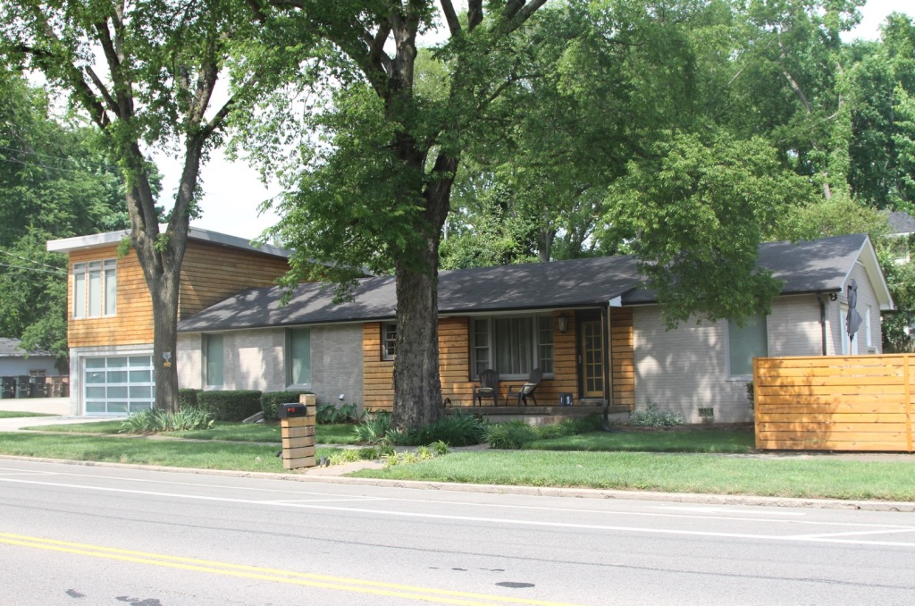
    Okay, but there are non-fixer-uppers with two bedrooms in Palo Alto, presumably large enough for a budding family, that the Downings could afford—which is to say, places selling for what they paid for their new home in Santa Cruz: $1,550,000. The difference is that those places are condos and townhouses.

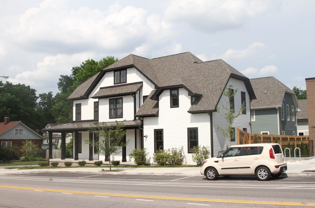
    What Downing didn’t tell Brinklow (and he didn’t ask) is that she and her husband wanted the same kind of house that they were renting in Palo Alto: a 4-bedroom, 3-bath detached house measuring 2,338 square feet.

    That’s what she got in Santa Cruz: a 2,751-square-foot, detached, single-family home with four bedrooms, two-and-a-half baths, and a two-car garage. In Palo Alto, that kind of house is indeed selling for over $2 million dollars. (Zillow suggests that it’s selling for the same price in Santa Cruz: the listing for the Downings’ new place said it was “$700-845k below active comparables.” Apparently they got a deal.)

    The irony is that Downing disparages Palo Altans who, she says, want to maintain the city’s suburban character, while she’s chosen to move to a suburb and to a house whose Walkscore is a “car-dependent” 39 out of 100.

    When a commenter on the Palo Alto Forward blog questioned her purchase of the Santa Cruz house, Downing dodged his question, too: “I’m making choices and trade-offs for my family, that I’m very privileged to be able to make,” she bristled. “The fact that we can afford to buy anything at all and that we have jobs that allow us flexibility is a giant privilege most working class people don’t have.”

    Nobody is questioning Downing’s privilege. It’s the discrepancy between her stated and evident motives for leaving Palo Alto that rankles.

    “Abusive” cities

    Downing’s disconnect aside, housing prices in Palo Alto really are insane. In July theaverage rent for a two-bedroom apartment was $3,806. The median home value is $2.486 million.

    Downing blames the eye-popping prices on the city’s gross jobs-housing imbalance, which she in turn attributes to the council’s having approved tons of office development but not the housing for all the people who would be working in those offices. As of 2014, Palo Alto had almost three times as many jobs (95,460) as employed residents (31,165).

    The upshot, she writes, is “the bizarre reverse commute in the Bay Area where more people live in San Francisco but work in Palo Alto or Mountain View.” In her view, the fault isn’t the companies that came to Silicon Valley.

    [T]hey were invited with open arms. Part of the reason it happened that way is that in the 70s [sic] San Francisco created a stringent cap on office expansion, and it’s one of the reasons why it’s the Peninsula that became Silicon Valley and not the city of San Francisco until maybe the last 7 years or so. Companies went to where they were wanted. It’s the cities which are abusive because they take all that tax revenue from those companies but then don’t shoulder any of the burden of housing the people that work there—claiming…that other cities should bear that burden instead.

    A good point (local jobs-housing imbalances stink)…

    Yes, Silicon Valley cities have been encouraging massive development without permitting housing commensurate with the number of new workers.

    The latest poster child for this sort of reckless behavior is not Palo Alto but rather the city of Santa Clara, which on June 29 approved Related Companies’ $6.5 billion, 9.7 million square-feet CityPlace project. To be built just north of Levi’s Stadium on 240 acres of city-owned land (a former landfill), CityPlace will include up to 5.7 million square feet of offices, 1.1 million square feet of retail, 700 hotel rooms, a 35-acre park, and up to a paltry 1,360 apartment units. It will create 25,000 new jobs.

    As reported in the Silicon Valley Business Journal by Nathan Donato-Weinstein:

    “This project, looking at the real estate side of it, and the fact that we own it, it’s whipped cream with a cherry on top,” said Mayor Lisa Gillmor prior to the vote. “Not only will we get the development that services our community, but also we’ll reap the financial benefits of having a cash flow into our general fund for generations to come.”

    On July 29 San Jose, where housing far outnumbers jobs, sued Santa Clara over the project, alleging that the huge gap between the number of new jobs City would generate and the housing it would provide contradicted Santa Clara’s General Plan and would have profound and unnecessary environmental impacts in the region. Land use anarchy, anyone?

    …and bad history (letting Stanford off the hook)

    San Francisco voters passed the city’s office cap in the mid-80s, not the 70s, a good two decades after the Peninsula became Silicon Valley. And the impetus for the Peninsula’s transformation did not come just from local governments but from the ambitions of a giant private landowner and developer: Stanford University.

    “Palo Alto city government,” Downing avers,

    openly and decisively created and embraced the Stanford Research Park which now houses many of the biggest technology companies in the world (VMware, Tesla, SAP, HP, etc.) and more than 100,000 workers. Stanford Research Park LONG predates the likes of Google and Facebook and Page and Zuckerberg — it was created in 1951.The city had to re-zone that space and specifically entice tech companies to come there.

    Palo Alto did not create the Stanford Research Park; Stanford did.

    University of Washington history professor Margaret O’Mara tells the story in her fascinating 2005 book Cities of Knowledge: Cold War Science and the Search for the Next Silicon Valley. Originally called Stanford Industrial Park, the project was the postwar brainchild of Stanford administrators, notably Provost Frederick Terman and President Wallace Sterling. They remade their rich but undistinguished school into a scientific research powerhouse and a vehicle of regional economic development by leveraging federal R&D monies, shrewdly exploiting Stanford’s extraordinary land holdings, and capitalizing on the area’s beauty and fine climate and California’s booming militarized economy. It was Stanford that enticed high-tech companies to come to the park, and the park’s 1960 expansion “grew out of the demands of its tenants for more space.”

    Nor, as Downing indicates, did the city of Palo Alto and its residents view Stanford’s development of its land with unconditional enthusiasm. Though encouraging high-tech industrial production was the major thrust of the university’s economic agenda, its to-do list also included building a mall, the Stanford Shopping Center. Palo Alto elected officials initially opposed the mall, fearing that it would drain revenue from the city’s downtown retail, and threatened “not to provide sewer service to the site.”

    They soon dropped their opposition. “Palo Alto readily agreed to incoporate the land developments into the city, thereby providing Stanford with public utilities and road upkeep (and providing the city with tax revenues.” Stanford doesn’t pay taxes, but the companies at Stanford Research Park and the Stanford Shopping Center do. The city “made no further efforts to control the path of development.”

    The city’s residents were not so easily pacified. When Stanford announced in 1960 that the Industrial Park would be expanded into the foothills, “neighborhood opposition…led to a fiercely fought ballot referendum campaign that President Sterling called ‘the Battle of the Hills.’” The university won that battle and proceeded with the expansion. In a public relations gesture, it replaced “Industrial” in the park’s name with “Research.”

    What Stanford did not do is change its suburban model of land use.

    A 1962 survey showed that the majority of the Park’s 10,500 employees did not live in the immediate area but commuted from communities south of Palo Alto (56 percent). Seven percent lived outside the ‘regional area’ of the Peninsula altogether. Palo Alto residents made up 21 percent of the workforce. Employees overwhelmingly depended on cars to get to work.

    And, O’Mara writes, Stanford came to be regarded as a “model city,” a prototype for regional economic development around the world—and on the Peninsula.

    [B]ecause of developments like the Industrial Park, the Peninsula was on the leading edge of the trend toward living in one suburb and working in another. The residential and commuting patterns seen in the Park in 1962 also presaged the later housing shortages that would face the Bay Area, particularly Palo Alto, where by the end of the twentieth century few professionals could find available and affordable places to live.

    In a post-resignation-announcement interview, Stanford Political Journal reporter Andrew Granato asked Downing, “What do you see as Stanford’s role in housing politics, and do you think it can or should do anything?”

    Downing equivocated, praising the university for “trying to add a certain amount of housing for its employees or students or faculty,” but subtly criticizing the school for not doing more:

    I think that Stanford has always tried very hard to be a good neighbor to Palo Alto. They’ve tried to be very friendly and supportive….[A]t the same time, Stanford has been relatively quiet about what’s going on in Palo Alto and the Bay Area in general with respect to housing.

    Far from being a good neighbor, Stanford has long been a major source of the jobs-housing imbalance that Downing deplores. Now, in its largest-ever off-campus expansion, the university is planning to build a $568 million office park that will accommodate 2,400 university employees on a 35-acre site in Redwood City. Stanford considered putting the project in Palo Alto but couldn’t find enough space.

    To be sure, as per Downing’s argument, like Palo Alto, Redwood City has given Stanford a go-ahead. The university got it in 2013, when Redwood City approved Stanford’s plan for the property in return for more than $15 million in public benefits, including bike lanes, a business boot camp for Redwood City residents, a free speakers series from the Graduate School of Business, and a free shuttle for its employees and members of the public from the Redwood City Caltrain station to the offices. In keeping with Stanford’s suburban commuter model, the complex will include a gym with a pool, cafes and a small park—but no new housing.

    “After the construction is completed,” wrote Chronicle reporter Wendy Lee, “Stanford is expected to become one of Redwood City’s largest employers.” Redwood City Economic Development Manager Catherine Ralston enthused: “ ‘It’s a really great opportunity for Redwood City. It’s going to bring a lots of jobs to the area.’”

    Redwood City Councilmember Jeff Gee told Chronicle reporter Wendy Lee that a Stanford survey found only 8 percent of its employees living in or near Redwood City. “The Redwood City council considered and rejected allowing housing on the site,” wrote Lee, stoking some residents’ fears that an influx of Stanford employees would further inflate already high rents.

    The Prop. 13 factor

    Why do cities pursue jobs and not housing? One reason is that new housing, especially housing for families with school-age children, requires many more municipal services than commercial development.

    Another is that Prop. 13 severely constrains property taxes by limiting annual increases to 2%; only when a parcel is sold or new construction occurs can a property’s value be re-assessed. The law favors parties that hold on to their property for a long time, above all big corporate landholders. It disproportionately burdens most homeowners, especially new ones, and new businesses. One study found that enacting a split-roll initiative that taxed corporations on the market value of their property would generate $8.2 to $10.2 billion in annual revenues for California.

    Downing’s position is confusing. She stands with the Evolve campaign to maintain current Prop. 13 protections for all residential property, provide an exemption for small businesses, and establish a regular, yearly reassessment of all non-residential property in California. “Corporations used to pay the bulk of property taxes, she writes, “but now 75% are paid by residential properties, and places like Disney literally pay as much in property taxes as a reasonably sized single-family home.”

    But she also embraces the argument that eliminating Prop.13 and allowing all property to be assessed every year would discourage Nimbyism and encourage development. As one of her correspondents on Medium, Eric Kingsburgy, wrote:

    NIMBYism is able to take hold in places like Palo Alto because [in a system where property taxes don’t change,] more development provides absolutely no benefit to incumbent property owners….More people only means more traffic, busier parks, and more crowded schools….

    A California without Proposition 13 would still face hurdles to development, and the abuse of land use regulations—no one likes crowded parks or traffic—but to a much lesser extent….Residential that bought $100,000 homes in Palo alto in the 1980s would have seen their property taxes skyrocket along with their property values, leaving them with two options: move to a lower cost area or push for measures that would make their property less valuable.

    Downing responds: “Agree with everything you’ve written!” And then she refers “folks who are interested in Prop. 13 reform” to the Evolve campaign. Go figure.

    The numbers game: how much of Palo Alto is zoned for single-family homes?

    By contrast, when it comes to property values, the housing crisis, and zoning, Downing is unequivocal: the way to lower housing prices is to loosen zoning laws that restrict development by imposing “an artificial constraint on supply.”

    Her reiterated example is Palo Alto’s zoning. “Only something like three percent of the city,” she told Brinklow, “is zoned for any sort of multi-family use. For most places it’s illegal to build a duplex.”

    Brinklow asked Mayor Burt: “Is it true that 97 percent of the city is zoned R-1?”

    Burt: “That is a misrepresentation.”

    Correct. According to the city’s Comprehensive Plan, 4% of Palo Alto’s 26 square miles is zoned for multiple-family dwellings, and 25% is zoned for single-family dwellings. (Forty percent of the city is zoned for parks and preserves, another fifteen percent is dedicated to agriculture and other open space.)

    But zoning doesn’t tell the entire story. The Plan also says that 38% of the housing stock is multiple-family units, and 62% is single-family. So single-family predominates, but not to the extent that Downing has implied.

    Downing supported Jerry Brown’s anti-democratic giveaway to the real estate industry

    In an interview with Los Angeles Times reporter Michael Hiltzik, Downing praised Jerry Brown’s controversial by-right housing legislation, Trailer Bill 707, declaring that it “does everything that needs to happen.”

    It’s a curious endorsement, because one thing Brown’s proposal doesn’t, or more precisely, didn’t—since it just died in the Legislature—do is the thing that, Downing thinks, needs to happen: relax residential zoning standards in Palo Alto or anywhere else in California.

    Trailer Bill 707 specified that if a project conformed to local zoning and contained 5-20% affordable housing, it would be permitted by right, meaning without any environmental or other public review. A draconian giveaway to the real estate industry, the measure was defeated by a statewide coalition of affordable housing advocates, environmentalists, and labor organizations.

    Given her concern about the lack of civic engagement in Palo Alto—in her words: “there’s maybe one thousand people who pay attention to city government….A minority of wealthy homeowners can create a network to get candidates elected very easily”—you might think Downing would have been put off by Trailer Bill 707’s hostility to local democracy.

    Instead, Downing shares that hostility. She favors a strong, centralized state. “Countries like Germany and Japan,” she writes,

    do not make planning decisions at the local level. They make them at the national level….They do what’s best for all the people, not just the people in one small city[,] and they do what’s best for the country’s economy as a whole…

    In good neoliberal fashion, she thinks planning is all about economics, and that what’s best for the economy is a state that vigorously intervenes in behalf of market freedom. At her last Planning Commission meeting, on July 27, she voted against raising the affordable housing development impact fee from $20.37 per square foot to $60, stating that the “massive and aggressive” increase would discourage the construction of affordable housing.

    I’m guessing, then, that Brown’s bill appealed to Downing because it drastically curtailed local say in development, to the fulsome benefit of property capital. “Capitalism and property ownership,” she writes,

    are enshrined in literally hundreds of thousands of laws on [sic] this country, including our constitution. For so long as the U.S. constitution still stands, this is the only system that we have and understanding its rules remains a critical element of making policy for the future.

    Perhaps Downing skipped constitutional law class; the U.S. constitution says nothing about capitalism.

    Given Downing’s outrage at the “astronomical” cost of housing in Palo Alto’s and her professed solicitude for “the average Joe,” you might also think that she would have deplored a bill that greased the permit process for projects with as much as 95% market-rate housing.

    Market-rate housing, however, is all that Downing wants to see built. Responding on Medium to a correspondent who doubted the superiority of “national zoning decision-making” and “centrally created affordable housing,” Downing wrote:

    I’m only talking about lifting zoning restrictions so that more market-rate housing is legally allowed to be built in the city. So I’m most definitely not talking about “centrally created affordable housing.” My goal and belief is that housing growth (market-rate) must keep up with job growth.

    She points to “places like Texas which have far fewer zoning restrictions (none at all in Houston).”

    [E]ven though they’re experiencing an unprecedented population boom, their prices aren’t soaring like California’s. And it’s because they have something much closer to a free market where people can supply enough housing to actually meet demand.

    Ahem. Prices in Texas, including Houston, have been soaring—not to the Bay Area’s catastrophic levels, but soaring (50% leap in 2010-15) nonetheless.

    But let’s talk about California, and specifically our region. Here the textbook theory of supply-and-demand—prices fall as supply increases—doesn’t apply. As I wrote in 48 hills last December:

    What’s making home prices soar in our region is the simultaneous incursion of hundreds of thousands of highly-paid tech workers and a flood of foreign investment. In June the Contra Costa Times reported that “[h]igh-tech employees make a yearly average of $124,000 in Santa Clara County, $107,000 in the San Francisco-San Mateo area, and $101,000 in the East Bay.” By contrast, wrote George Avalos, tech workers nationwide average about $84,000 a year. “This is a very, very hot area to live and work,” [demographer] Steve Levy told Avalos, “and the wage growth is pushing up housing prices.”

    (Levy, by the way, sits on the board of Downing’s Palo Alto Forward.)

    Downing presumably thinks that if enough market-rate housing were produced, housing prices would fall to affordable levels. I always like to ask someone who holds that view:  how much housing would it take? So far, the answer has been: I don’t really know. That’s what former Trulia Chief Economist Jed Kolko told me. Ditto for George Mason University Law Professor Ilya Somin, who wrote a Washington Post op-edpraising Downing’s attack on “restrictive land use regulations.” I bet Downing has no idea, either.

    In her case, further questions seem to be in order: how much and what kind of new housing would it take to lower the price of four-bedroom, two-plus bath single-family homes in Palo Alto from $2.6 to $1.55 million dollars?

    The Palantirization of downtown Palo Alto

    In Palo Alto, the tech tsunami hasn’t just driven up housing prices; it’s also decimated the city’s retail sector, which has been colonized by tech offices. Things got so bad that in May 2015 the council passed a 45-day urgency interim ordinance that prohibited the conversion of existing ground-floor retail to offices. A month later it extended the ban to April 30, 2017.

    As an employee of Peter Thiel’s Palantir Technologies who works in downtown Palo Alto, Downing’s husband Steven is implicated in the tech displacement of the city’s retail businesses.

    Palantir, wrote San Jose Mercury reporter Marisa Kendall in April, is “taking over” downtown Palo Alto. The secretive company rents at least nineteen properties comprising 250,000 square feet, or about 12 percent of all downtown’s commercial space downtown. Office rents have climbed accordingly. Now tech start-ups are having a hard time finding space that they can afford.

    Can a city have too many (tech) jobs?

    To Downing, only a maniac would entertain this question. Responding on Medium to an unnamed correspondent who apparently asked whether Palo Alto would try to shed some tech businesses, Downing wrote:

    I don’t think Palo Alto is going to choose to get rid of the companies. If they do, their tax base will shrivel and they’ll have a hard time paying city employees and paying off all the pensions they’re already obligated to fulfill…

    And…what kind of insanity is it to be trying to kill high paying jobs and forcing companies out of town when the rest of America is bending over backwards trying to attract those companies?….Everyone else in the world is looking at Palo Alto and scratching their heads at the thought of a city that thinks its grand solution is to slaughter the golden goose.

    Actually, the golden goose metaphor doesn’t work for the tech industry in the Bay Area today. As depicted by Aesop and other fabulists, that bird was killed by the greed of its owners, who forced it to lay more than its customary single egg a day.

    A better analogy is Audrey II, the man-and-woman-eating plant in film The Little Shop of Horrors, whose exponential growth drew customers to the shop but whose insatiable appetite threatened to destroy everything around it. When its owner, the unprepossessing Seymour, realizes that it cannot be appeased or controlled—indeed, that it’s about to eat him—he kills it.

    Like all metaphors, this one has its limitations. Unlike Audrey II (but like zoning), the tech industry is a human artifact and thus susceptible to human control. Accordingly, some Palo Altans are contemplating additional curbs on tech’s growth in their city—for example, Mayor Burt.

    “Palo Alto’s greatest problem right now,” the mayor told Brinklow,

    is the Bay Area’s massive job growth. Cities are still embracing huge commercial development with millions of square feet of office space they can’t support….[W]e have to do away with this notion that Silicon Valley must capture every job available to it….We’re looking to increase the rate of housing growth, but decrease the rate of job growth.

    Brinklow was incredulous: “You want fewer jobs?” [italics in original]

    Burt: “I know, it’s a strange idea to contend with. But this doesn’t mean we want no job growth….We want metered job growth and metered housing growth, in places where it will have the least impact on things like our transit infrastructure.”

    For a city official to espouse less job growth in his town is beyond strange; it’s unheard-of. As a challenge to the prevailing growth ideology, it’s on par with 48 hills editor Tim Redmond’s recent piece welcoming the drop in San Francisco land values that, according to the city’s Controller, would result from requiring twenty percent of the units in new apartment buildings to be below-market-rate. But you expect such radical pronouncements from Redmond, not from a mayor, especially the mayor of a Silicon Valley city who’s a tech executive to boot.

    Burt’s stated goal is to accommodate some growth and still maintain Palo Alto’s distinctive character. That means going slow, because, he contends, the rate of the region’s job growth

    is just not sustainable, if we’re going to keep [Palo Alto] similar to what it’s been historically. Of course we know that the community is going to evolve. But we don’t want it to be a radical departure….[W]e balance things….[W]e’re looking at increasing our developer fees and investing more in affordable housing. We have 2,500 units of BMR [below-market-rate] housing over the last decades, and a lot of hard work went into that.

    Improving transit, said Burt, is key: “The community would be more willing to embrace new development, even commercial development, if we could solve the transit problem….[J]ust in the last year, for the first time ever, I’ve become really confident that things will get better.”

    Brinklow: “Why?”

    Burt: “The single biggest thing is probably electrifying Caltrain.” He’s also encouraged by the extension of BART to San Jose, Palo Alto’s rideshare app, Scoop; the Palo Alto Transportation Management Association; and the advent of  “shared, autonomous vehicles powered by carbon-free electricity.”

    The real culprit: baby boomers “aging in place”

    To Downing, Burt epitomizes the chief culprit in the affordability crisis—not the “middle-aged, jet-setting executives and investors” named in her resignation letter but rather “older homeowners,” boomers who got into the housing market when the middle class could still buy a house in Palo Alto, and who are now, in her indelicate phrase, “aging in place.” She attributes their slow- or in her view, no-growth agenda—“they just plain don’t want to see more people in the city”—to two motives: maintaining or, better yet, increasing the values of their property; and preserving Palo Alto’s suburban character.

    What’s worse, she says, they’re elitist hypocrites. When Brinklow noted that the slow-growthers argue that the city’s transit infrastructure and water use should be limiting factors in development, Downing interjected:

    The exact same people who complain about infill housing will show up to complain when you want to expand transit….These people will say anything, but they don’t really care about congestion or water use. They care about keeping the town looking exactly the way it is….They think public transit is for the poor and apartments are for people on welfare.

    Brinklow: “You allege that all of these policy objections are just a cover for a personal agenda?”

    Downing: “Well, we know that.”

    Slow growth vs. smart growth

    I emailed Cheryl Lilienstein, the president of Palo Altans for Sensible Zoning, and another “older homeowner,” asking if her group opposed expanding transit in town. Lilienstein replied that it depended on the kind of transit.

    “For years and years,” Lilienstein emailed, “we’ve been asking for cross-town shuttles to take us to schools, large job centers, hospitals, and community services nowhere near El Camino.”

    Regarding high-density development around mass transit—for example, at the Caltrain stations, being pushed by Palo Alto Forward, the Santa Clara Valley Transportation Authority (VTA), the Silicon Valley Leadership Group, and ABAG—she wrote:

    We oppose it. VERY few residents now living in high density housing near transit use it. They live there because they want to live in Palo Alto, and they still use cars to get where they need to go, so it’s unrealistic to assert new high density development will be car-free. It won’t.

    By common consent, traffic congestion in Palo Alto is horrendous, due to the huge number of commuters driving into town. The question is, what to do about it? The issue is front and center in the current public process to update the Comprehensive Plan.

    PASZ’s basic position, set forth in its comments on the Draft EIR for the update, is that before increasing population, the city needs to do what it can to decrease traffic and the associated air pollution in accordance with “a set goal.” Only then, should the city “proceed with a slow housing program that prioritizes housing for those whose presence would provide diversity for an economy that serves all residents”—specifically:

    • People who under present conditions will never be able to buy here, typically defined as the middle class: clerical workers, city staff, middle management, tradespeople, low income workers, service workers, small business owners
    • Seniors living here who don’t own their houses or still have mortgages and want to retire
    • The homeless

    TKPASZ wants to maintain Palo Alto’s suburban character and still build housing that’s affordable to low-income people. From their Platform:

    Reduce the maximum development volume in certain zoning districts so that when state-mandated density bonuses are applied, the resulting volume matches what current zoning maximums would allow. In other words, state density bonuses for low income housing should not be used to produce buildings that are massive and out of scale with the surrounding neighborhoods.

    ….

    Development should be compatible with existing neighborhoods and take into account school impacts.

    I also asked Lilienstein what she thought of the transportation innovations that give the mayor hope.

    Burt,” she replied, ‘is overly confident, in my view, yet I wish his vision was possible.” Her top priority is “increas[ing] ease of movement INSIDE the city.” To that end, she wrote,

    I don’t see how electrifying CalTrain and increasing the ridership (both are good things) will do anything but increase crosstown gridlock for Palo Alto, since there is no grade separation” for the train tracks. The single greatest transformative investment would be to trench the tracks so there can be an increase in cross-town flow. Without, even the future promised technology improvements will be insignificant.

    If  BART is ever extended to San Jose, down the east side of the bay, how would that help us? The Transportation Management Association might put a dent in the traffic problem, but it’s basically underfunded and complicated/expensive to enforce. Scoop is a good idea, a good use of public money, but do Palo Alto worker actually use it?

    Downing, by contrast, thinks that “adding housing…is going to relieve a lot of the congestion we’re seeing” by allowing people “to live in the same community where they work. If you look at the people who actually live and work in Palo Alto,” she told Brinklow, “a substantial number…are walking or biking to work, so they’re not part of the traffic.” Now most of the in-commuters live far away.

    Palo Alto Forward’s website lists “five common-sense reforms that could remove barriers to housing”:

    • Encourage studio apartments and smaller units
    • Encourage residential units over ground-floor retail
    • Make it easier for homeowners to build second units
    • Allow car-light and car-free housing in walkable areas near transit
    • Facilitate new senior housing, including alternative models

    The underlying assumption is that growth is essential to economic health and hence must be accommodated. From its platform:

    On its current course, Palo Alto will continue to experience traffic and parking issues from denser uses of existing buildings, but it will have turned away new businesses and new workers who no longer have appropriate housing. The very economic growth that makes Silicon Valley a gem in America’s economic crown will slowly be chipped away, hurting local businesses, school funding, and employment rates alike.

    Dancing around the growth issue

    What the PAF platform never quite makes clear is whether the group can thinks the city should seek to accommodate as much growth as possible.

    Brinklow asked Downing: “What about people who argue that a city like Palo Alto just can’t ever build enough housing to really satisfy demand?”

    Downing: “I think it’s a misconception that you can never build up to demand. We have a pretty good idea what demand is: Every day, the effective population of the city [66,000] doubles from the number of people who come in just for work. That tells us something about how much housing we need. It’s not infinite.”

    But elsewhere, she indicates that growth per se is advantageous.  A member of the Bloomberg News team asked her if she thought “it’s fair for a community to collectively say, we don’t want to get any bigger, we don’t want to increase our population, we don’t want to live in a more dense area.” She replied: not if it’s a job hub. “As for these companies getting big,” she wrote in one of her Medium posts,

    —that’s something to celebrate and be happy about, not to lament. It means you live in a prosperous area with lots of high paying jobs and that your city is getting tons of tax revenue to support the sort of services and programs residents want to see. The response is to build out the necessary infrastructure to make sure your city can handle the growth and plan thoughtfully about how to grow in a way that will be beautiful and convenient. The response isn’t to murder the golden goose which is making your city so desirable in the first place.

    One of the qualities that made Palo Alto so “desirable in the first place” to the tech industry was the very thing that Downing would readily dispose of: the town’s suburban character. Paradoxically, that character is now jeopardized by the industry’s rampant growth. For Downing, however, nurturing that growth is paramount. Constraining it, she says, will lead to the decline of Silicon Valley.

    “[I]f [what Palo Alto is doing],” she tells Granato,

    continues this way, eventually we really are going to drive businesses and young people away. I mean it’s driving me away, right? And at that point, the locus of organization and development is going to shift; it’s going to go somewhere else. And I think that will be an extraordinarily painful thing for Stanford. It means less opportunities for its students, it means less collaboration between businesses and professors. I don’t think Stanford wants to be in a place that used to be the innovation capital of the world, but that’s kind of where we’re headed.

    Forbidden questions

    I’m no fan of Kate Vershov Downing—that’s been clear since the start of this story. I confess, however, that until recently, I shared Downing’s view that cities should strive to house the people who work in the businesses within their city limits, and that those who don’t should be judged harshly. Downing calls Palo Alto and other tech towns with jumbo job-housing imbalances “abusive,” referring to their unwillingness to house their tech workers. To me, the abusiveness involved dumping their housing and traffic issues on other cities—the sight of a “Google bus” parked in a Muni bus stop makes me scowl—and clogging the roads with long-distance commuters: when I left Palo Alto at 4 p.m. one afternoon last February, it took me two and a half hours to reach my north Berkeley home in my car, lurching forward in stop-and-go traffic all the way.

    Contemplating the fight over growth in Palo Alto has made me rethink my position. Pace Downing, the Bay Area’s tech sector seeks infinite expansion. A report released by the Silicon Valley Competitiveness and Innovation project last February found that for the first time since 2011, more residents—7,600—left Silicon Valley for other parts of the U.S.—Seattle, Austin, southern California—than arrived from other parts of the country. The area still had a positive net migration, but many of the new arrivals came from abroad. The American-born workers are headed to places where the cost of living is lower; the competition for jobs, space, and venture capital less intense; single-family homes more affordable; and traffic less daunting.

    In the report’s introduction, the sponsors of the project, the Silicon Valley Leadership Group and the Silicon Valley Community Foundation, called these numbers “warning signs” that “skyrocketing housing costs and increasing traffic congestion are eroding our quality of life” and making it hard to draw and retain sought-after employees.

    In response, the SVLG and the SVCF lay out much the same agenda as Kate Downing: sustain the local tech industry’s warp-speed job growth by building a commensurate amount of housing and expanding the region’s transit infrastructure accordingly. Just so, SVLG supported Brown’s by-right housing bill, though, in a move that I suspect Downing, with her opposition to “centrally controlled affordable housing,” would criticize, it also cheered the California Supreme Court’s decision that upheld San Jose’s inclusionary housing ordinance.

    Concentrated power undermines democracy. I’m talking about the economy, of course. Right now about a fifth of total jobs in the region—746,100—are in tech. The Bay Area’s appalling income inequality and its associated housing affordability crisis exist not in spite of but largely because of the high-rolling tech cataclysm.

    But democracy entails more than economic equality; it also involves political freedom. Money talks, and these days tech oligarchs are speaking much too loudly in our public life—think, for starters, Ron Conway and Airbnb.

    This quest for endless growth needs to be put on hold and replaced with a debate over the region’s carrying capacity and relevant public policy. How many jobs and people can the Bay Area support without further degrading the region’s quality of life, its cities’ distinctive characters, and the stability of their neighborhoods? Is it worth sacrificing these things for the sake of competitiveness? Who really benefits from the competitiveness race? Should a city’s receipt of a company’s taxes obligate that city to approve housing for the company’s workers? Do people have a right to live wherever they want? Barring prospective residents from your town on the basis of race or ethnicity or gender is wrong—and illegal. What about setting a limit on density or the size of a city’s population? And where’s the proof that people living in dense, transit-oriented development drive significantly less?

    For the region as a whole, the best thing that could come out of the Downing imbroglio is the expansion of the debate that’s roiling Palo Alto—not just to every city hall, but to every state and regional planning agency and legislative body. One point of universal agreement is that neither Palo Alto nor any other city can resolve the jobs-housing conundrum on its own. But today the growth ideology reigns supreme; no questions allowed. As long as that’s the case, the conundrum will persist and worsen.

    This piece originally appeared at 48hills.org.

    Zelda Bronstein, a journalist and a former chair of the Berkeley Planning Commission, writes about politics and culture in the Bay Area and beyond.

    For ongoing, in-depth coverage of Palo Alto’s land-use politics, see the reporting of Gennady Sheyner in the city’s alternative newspaper, the Palo Alto Weekly.