Category: planning

  • The Incompatibility of Forced Density and Housing Affordability

    New research supports the conclusion that anti-sprawl policy (urban containment policy) is incompatible with housing affordability. Build-zoom.com economist Issi Romem finds that: “Cities that have curbed their expansion have – with limited exception – failed to compensate with densification. As a result they have produced far less housing than they would otherwise, with severe national implications for housing affordability, geographic mobility and access to opportunity, all of which are keenly felt today as we approach the top of housing cycle.”

    Romem had previously produced stunningly innovative research, estimating the extent of urbanization in US cities every decade from 1940 to 2010. He provides maps that show the changing urban expanses in each census. Romem uses the larger metropolitan areas, the currently defined Combined Statistical Areas (CSAs). This combines metropolitan areas that are adjacent and significantly economically connected, such as San Francisco and San Jose, New York , southeastern Connecticut and Allentown, and Los Angeles and Riverside-San Bernardino.

    The new research is a similarly important addition to urban policy. Like most in urban planners, Romem strongly believes that the "ills of the urban sprawl must be curbed." However, importantly, Romem’s research is driven by data, rather than urban planning principles often disconnected from the aspirations of households. This article examines Romem’s most recent research in the context of middle-income housing affordability.

    Middle-Income Housing Affordability

    Housing affordability is much broader than “affordable housing” for lower income households. In markets regulated by urban containment, middle-income housing usually becomes too expensive for many middle-income households. In such markets, there is considerable discussion of housing affordability, but little that gets to the heart of the matter.

    Housing affordability is appropriately compared both between housing markets and  within markets over time. Perhaps the most effective tools are price-to-income ratios, such as the median multiple (median house price divided by median household income) used in the Demographia International Housing Affordability Survey. Now in its 12th edition, the Survey shows virtually all major metropolitan areas with seriously unaffordable housing to have urban containment policy.

    Development Limits: More Politics than Mountains or Water

    In covering Romem’s research, Richard Florida acknowledges describes the crucial role of role of land markets in maintaining housing affordability. Of course, housing affordability is a casualty of urban containment policy because it destroys the competitive market for land on the urban fringe. As a result house prices rise substantially relative to incomes (Figure 1).

    Romem and Florida, to their credit, have proposed means they think can preserve housing affordability within a framework of urban containment, such as by land use regulation that permits higher densities, including redevelopment of lower density areas. While wishing them luck, there is little cause for optimism. Near 50 years ago, legendary urbanologist Sir Peter Hall suggested that “soaring land prices …. certainly represent the biggest single failure of the system of planning introduced with the 1947 [Town and Country Planning] Act” (see: The Costs of Smart Growth Revisited: A 40 Year Perspective). Urban containment policy, the principal strategy of forced densification, cannot repeal the law of supply and demand. Seventy years of experience prove that.

    Florida and others have noted the challenges of cities running up against their development limits. However, in the United States, only the artificial political limits of regulation have been approached, rather than the natural barriers of topography or geography (see: A Question of Values: Middle-Income Housing Affordability and Urban Containment Policy). Where a binding urban growth boundary is imposed between the city and an impassible mountain range, the scarcity induced price increases result from the boundary, not the mountain.

    Politics, Topography & Geography in the San Francisco Bay Area

    Take, for example, the San Francisco Bay Area, which has often been cited as a place where natural barriers have left little land for development. This is an impression easily obtained observing the fairly narrow strips of urbanization on both sides of San Francisco Bay, hemmed in by hills.

    However the Bay Area’s urbanization long ago leapt over the most important water bodies and then the Berkeley Hills to the east. Not only is the San Francisco Bay Area CSA high density, but it is also spatially small. In 2016, the San Francisco built-up urban area was only the 23rd largest in land area in the world. New York, the world’s largest built-up urban area in geographical expanse is more than four times as large.

    There is plenty of developable land in the San Francisco Bay Area. Data in a 1997 state analysis indicated that another 1,500 to 4,300 square miles (3,900 to 11,000 square kilometers) could be developed in the Bay Area CSA. The lower bound assumed no farmland conversion and stringent environmental regulation. The report also found that in recent years, residential development had become marginally denser, yet not incompatible with the detached housing remains the preference in California (Figure 2). The state has more than enough developable land for future housing needs.

    Updating the data to account for the development that occurred through 2010, the developable land supply could support an urbanization of between 18 million and 37 million population, well above the 2010 urban population (Note on Method). At the most, there is capacity to accommodate the population of Tokyo – Yokohama, the world’s largest urban area. At a minimum, use of the available land would catapult the Bay Area CSA ahead of the Los Angeles-Riverside CSA, more than double its present population.

    Of course, the Bay Area is simply not growing fast enough to reach even the lower population figure any time soon. Even with its slower growth, however, the competitive market for land no longer works, in large measure because of land use regulation. The San Jose metropolitan area has the fourth worst housing affordability in the Demographia International Housing Affordability Survey and the San Francisco metropolitan area is 7th worst (both metropolitan areas are in the CSA).

    The decades old Bay Area housing affordability crisis, and that of other metropolitan areas seeking to force higher densities, is more the result of policy than nature.

    Urban Containment: Negative Externalities

    Moreover, planning authoritarianism cannot tell everyone where and how to live. For many, high density apartments (owned or rented) are not a substitute for the detached house. Indeed the substitute for the detached housing the Bay Area for many is often a detached house in Nashville or Kansas City or any of many other major metropolitan areas where housing is much less expensive. Last year’s (2014) IRS migration data shows that California is losing both younger households and middle income households.

    Higher than necessary house prices are, of course, an even greater problem for low-income households, who not only are excluded from homeownership but most pay unaffordable rents. The latest data shows that California again has the worst housing cost adjusted poverty rate among the 50 states. Even Mississippi, with its reputation for poverty, cannot compete with that.

    Romem expressed concern to The Wall Street Journal: “What you’ll get there is an exacerbation of the problems we already have in expensive cities. The distinction between homeowners and renters will become less and less a stage of life and more and more if your parents can help you.”

    The Economist came to a similar conclusion: “Suburbs rarely cease growing of their own accord. The only reliable way to stop them, it turns out, is to stop them forcefully. But the consequences of doing that are severe" (See: Cities: Better for the Great Suburbanization).

    Note on Method: Some of the CSA urban population is not in the continuous urbanization of San Francisco-San Jose built-up urban area, such as in the Santa Rosa, Stockton and Santa Cruz urban areas. This analysis is based on data from the California Department of Housing and Community Development and the U.S. Census Bureau. It is based on an estimate of additional development occurring from 1996 to 2010 and the land remaining after deduction of recently developed land. The population capacity assumes the “marginally higher” densities used by the California Department of Housing and Community Development, which it notes would not require substantial changes in the “current form of housing development” (1997).

    Wendell Cox is principal of Demographia, an international public policy and demographics firm. He is a Senior Fellow of the Center for Opportunity Urbanism (US), Senior Fellow for Housing Affordability and Municipal Policy for the Frontier Centre for Public Policy (Canada), and a member of the Board of Advisors of the Center for Demographics and Policy at Chapman University (California). He is co-author of the "Demographia International Housing Affordability Survey" and author of "Demographia World Urban Areas" and "War on the Dream: How Anti-Sprawl Policy Threatens the Quality of Life." He was appointed to three terms on the Los Angeles County Transportation Commission, where he served with the leading city and county leadership as the only non-elected member. He served as a visiting professor at the Conservatoire National des Arts et Metiers, a national university in Paris.

    Photo: San Mateo County on the San Francisco Peninsula (by author)

  • Why Most Cities Will Never Be All They Used to Be

    Recently I published a piece on my Forbes site that discusses the disparate impact that demographic and social shifts had on larger, older U.S. cities over the second half of the 20th century.  Basically, the smaller American household size, generated by later marriages, rising divorce rates, lower fertility rates and rising life expectancy, among other things, has meant that unless cities were adding housing, they simply weren’t growing.  Yeah, I know I’m quoting myself, but here’s a sample:

    “Most people intuitively understand the economic underpinnings of urban decline, and the economic advantages that have led to their rebound. The loss of manufacturing destroyed the economic base; the spread of globalization and the new economy has created new opportunity in cities. But far less well understood are the far-reaching cultural and social changes that impacted the demographic makeup of cities — and would have caused population loss, even without economic restructuring.”

    I encourage you to check it out.

    I go on to suggest that population loss was inevitable for the most of the largest cities of mid-century America, and point out that today’s cities may never reach their previous population peaks.  I put together a cool table that demonstrates this:

    However, in putting this piece together I left quite a bit on the table, both in terms of graphics and additional content.  So consider this an addendum to the Forbes piece.

    First, I think it’s stunning to see a visual that illustrates the differences in a 1950 and 2010 population ceiling for the ten cities examined.  Check these out, shown two cities at a time:

    I think it is absolutely stunning to see that cities like Cleveland, Detroit and St. Louis could at best (at least right now) attain maybe half of their population in 1950.  And a case could be made that smaller household size may be the most significant factor in their decline.

    Three points I was unable to expand on in the Forbes piece.  First, now that the pendulum is swinging back in favor of cities, their influence is ascending faster than their population growth.  Cities are leading discussions now the economy, on infrastructure, on energy, on housing.  For the latter third of the 20th century the suburbs led that discussion.  But today, cities have reclaimed that role.  Their actual size, in terms of population, matters less today than it did 60 years ago.  

    Second, the American preference for new over old has nearly as much to do with this shift as shrinking household size.  For nearly 50 years the suburbs (and by extension, the Sun Belt) was new, and that was a main feature of their attraction.  But there’s also that saying, “everything old is new again.”  Cities are the new thing, and while they’re not everyone’s cup of tea, they are doing better than at any time in the last 50 years.

    Third, it’s conceivable that many suburbs and/or Sun Belt cities may find themselves impacted by emerging demographic or social shifts.  Having a huge inventory of single family homes in a world that is asking for multifamily options?  A strong auto-oriented landscape when more people are looking for walkable environments?  

    I’m not suggesting that all older cities are ascendant, and the suburbs and Sun Belt are doomed.  But staying ahead of trends may be the lesson all need to heed.

    Pete Saunders is a Detroit native who has worked as a public and private sector urban planner in the Chicago area for more than twenty years.  He is also the author of “The Corner Side Yard,” an urban planning blog that focuses on the redevelopment and revitalization of Rust Belt cities.

    Top photo: Vacant homes in Philadelphia, awaiting their revitalization.  Source: smartgrowthamerica.org

  • The Shorter Commutes in American Suburbs and Exurbs

    An examination of American Community Survey (ACS) data in the major metropolitan areas of the United States shows that suburbs and exurbs have the shortest one-way work trip travel times for the largest number of people. The analysis covers metropolitan areas with more than 1,000,000 population in 2012, from the 2010-2014 ACS (2012 average data) using the City Sector Model.

    The City Sector Model

    The City Sector Model classifies small areas (zip codes) of major metropolitan areas by their urban function (lifestyle). The City Sector Model includes five sectors (Figure 1). The first two are labeled as “urban core,” (Urban Core: CBD and Urban Core: Ring) replicating the urban densities and travel patterns of pre-World War II US cities, although these likely fall short of densities and travel behavior changes sought by contemporary urban planning (such as Plan Bay Area). There are two suburban sectors, the Earlier Suburbs and Later Suburbs. The fifth sector is the Exurbs, which is outside the built-up urban area. The principle purpose of the City Sector Model is to categorize metropolitan neighborhoods based on their intensity of urbanization, regardless of whether they are located within or outside the boundaries of the historical core municipality (Note 1).

    One Way Commute Times by Urban Sector

    The commuting data excludes employees who work at home, whose commute times would be zero.

    The shortest one-way commute times are experienced by residents of the Earlier Suburbs, with a 26.6 minute travel time. This is nearly equalled for residents of the central business districts (Urban Core: CBD), with an average commute of 26.7 minutes. Commuters living in the Later Suburbs had a somewhat longer commute, at 28.0 minutes, while commuters living in the Exurbs had an average one-way commute of 29.5 minutes. The longest commute times were experienced by residents of the Urban Core: Ring (32.5 minutes), which is the part of the urban core that excludes the central business district, (Figure 2) and is characterized by high densities and lower levels of automobile use than in the suburbs and exurbs.

    The functional city sectors with the shortest commutes had more jobs than resident workers. The Earlier Suburbs possess 1.08 jobs for every resident worker (Note 2). The ratio was much higher in the Urban Core: CBD, where there were nearly 5.99 jobs for every resident worker. Such an imbalance could not be replicated throughout a metropolitan area, because by definition, a labor market has a ratio of jobs to resident workers of approximately 1.00. To replicate the national CBD ratio throughout the metropolitan area would require, for example, that the New York metropolitan area have  54 million jobs for its 9 million workers.   

    Not surprisingly, with such a surplus jobs relative to workers, the Urban Core: CBD, the chances of finding suitable employment nearby is far greater. However, this advantage can, by definition, be available only to a very few, as is indicated by the fact that the Urban Core: CBD’s are home to only 1.5 percent of the resident workers in the major metropolitan areas. In the broader context of the urban core (including both the CBD and the Ring), this advantage is offset and average travel times are greater (below).

    In the Later Suburbs, there were 0.90 jobs per resident worker, which matches that sector’s ranking in work trip travel time (third). The  ring around the urban core (Urban Core: Ring) , had the longest average work trip travel time. The Exurbs had the lowest ratio of jobs to resident workers, at 0.71, yet had an average travel time that was shorter than that of the Urban Core: Ring (Figure 3).

    Pre-World War II and Post-War Urban Form

    The two combined urban core sectors are defined in the City Sector Model to replicate what remains of the pre-World War II city that was characterized by far higher densities and less reliance on automobile transportation, as opposed to the suburban and exurban sectors that have dominated urban growth for seven decades. If the two urban core sectors are combined (Urban Core: CBD and Urban Core: Ring), the number of jobs per resident worker is 1.28. This healthy ratio, however, is not sufficient to preserve any travel time advantage for residents of the combined urban core. In the combined urban core sectors, the average one-way travel time of 31.9 minutes, well above each of the other three functional sectors (Figures 4 and 5). The Urban Core: Ring has nearly nine times as many resident workers as the Urban Core: CBD.

    The Pre-War urban form has considerably higher population densities than those of the post-war urban form. For example, the Urban Core: CBD has a population density exceeding 23,000 per square mile (9,000 per square kilometer), more than 80 percent of the New York City population density level. The Urban Core: Ring has a population density exceeding 11,000 per square mile. The combined area population density of the two Urban Core sectors is 11,500 per square mile, or 4,400 per square kilometer (Figure 6).

    The two Urban Core sectors largely rely on commuting modes currently favored by urban planning policy, transit, cycling and walking. In contrast, the suburban and exurban sectors rely on commuting modes discouraged by urban planning policy, automobiles and car and van pools (Figure 7).

    The combined urban core sectors have more than four times the density of the Earlier Suburbs and nearly nine times the density of the Later Suburbs. With these much higher densities and their reliance on the favored transport strategies, it might be expected that they would enjoy the best commute times. However, as noted above, when the two urban core sectors are combined, their average travel time is longer than the suburban and exurban sectors. This is despite the far lower densities of the two suburban sectors and the often world densities of the exurban sector.

    The Key: Lower Densities & Job Dispersion

    These results are likely to be surprising to many in the press as well as planners who often equate residential distance from central business districts as resulting in longer commutes. The reality, however, is that central business districts account for only 8 percent of employment in major US metropolitan areas, and reach the highest at 22 percent in New York, 50 percent above second place San Francisco (14.4 percent) and nearly 10 times that of Los Angeles (2.4 percent).

    Generally speaking, employment is dispersed throughout the metropolitan area. When combined with the generally lower density urbanization within metropolitan areas, the result is shorter commutes for residents  in the suburbs and exurbs. As it turns out the data shows that higher employment densities in the urban core are associated with longer, not shorter commutes, as is commonly assumed.

    Note 1: In some cases the functional urban core extends beyond the boundaries of the historical core municipality (such as in New York and Boston). In other cases, there is virtually no functional urban core (such as in San Jose or Phoenix). Functional urban cores accounted for 14.7 percent of the major metropolitan area population in 2012. By comparison, the jurisdictional urban cores (historical core municipalities) had 26.6 percent of the major metropolitan population, many of which have large tracts of functional suburban development.

    Note 2: Estimated by dividing the percentage of jobs in each sector by the percentage of resident workers. Working at home is excluded.

    Wendell Cox is principal of Demographia, an international pubilc policy and demographics firm. He is a Senior Fellow of the Center for Opportunity Urbanism (US), Senior Fellow for Housing Affordability and Municipal Policy for the Frontier Centre for Public Policy (Canada), and a member of the Board of Advisors of the Center for Demographics and Policy at Chapman University (California). He is co-author of the "Demographia International Housing Affordability Survey" and author of "Demographia World Urban Areas" and "War on the Dream: How Anti-Sprawl Policy Threatens the Quality of Life." He was appointed to three terms on the Los Angeles County Transportation Commission, where he served with the leading city and county leadership as the only non-elected member. He served as a visiting professor at the Conservatoire National des Arts et Metiers, a national university in Paris.

  • Urban Future: The Revolt Against Central Planning

    In Milton Keynes, perhaps the most radical of Britain’s post-Second World War “New Towns,” the battle over Brexit and the culture war that it represents is raging hard. There, the consequences of EU immigration policy, of planning instituted by national authority, and of the grassroots yearning to preserve local character have clashed together to shape a platform that may set a precedent for whether central planners or local residents will determine the urban future.

    Milton Keynes is unusual for planned cities. Founded in 1967 and having matured in the last few decades, it defies virtually every tenet of contemporary planning orthodoxy. In its day it was a product of Britain’s national planners; despite that, today Milton Keynes drives the country’s national planners crazy. Instead of a mixed-use, dense, transit-oriented bastion of urbanism – the predictable and commonly reiterated goals of many British town planning leaders today – Milton Keynes is exactly the opposite, intentionally.

    A modernist experiment, Milton Keynes was planned to be low-density. It was also planned to be auto-oriented, and suburban. Its houses are large, its buildings do not front streets, and its transportation modes are separated by grade: that is, they are at different heights, with different means of transport often moving at different speeds. This is the antithesis of the now-favored idea of “complete” streets. The town’s downtown shopping enclave is an inward-facing mall – the largest in Britain – with downtown as a whole designed as a business and commercial center rather than a mixed-use playground. Mixed-use development is clustered in the city’s low-density neighborhoods and villages, all on a grid, rather than scattered with the UK’s more favored randomness.

    Milton Keynes was designed to be livable and functional, family-friendly, job-friendly and conducive to convenient mobility. The daily grind, by design, was to bear a closer resemblance to a rural experience than to an urban one. Original advertisements promoted a healthy, carefree lifestyle sheathed in nature, away from the nuisances of the big city. Even the logic of its location, equidistant from Britain’s other large cities, sought convenience over traditional planning rationales.

    To those with a one-track view of what a city should be, Milton Keynes is unrecognizable. To these people, the city is bland, sterile, and without the day-to-day vibrancy that defines cities. In many planning texts it has been written off as a failure, and to many residents of Britain, Milton Keynes is not a preferred destination.

    But in many of the most important metrics that define urban success, Milton Keynes shines. It has virtually no traffic, it attracts lots of families, and it has the highest job growth in the country. Its population has swelled over 20 percent since 2001, over twice the national average, to 255,000 , and its residents ardently defend it. It has built out nearly identically to the original vision, with its millions of trees and lush, anti-urban character earning it the affectionate moniker “Urban Eden”.

    Today, however, Milton Keynes faces ever-mounting threats to the integrity of its original character. Thanks to the consequences of EU immigration policy, which spurred population growth in the UK to a level that exceeded housing construction to the tune of 70,000 units a year, or roughly 50 percent, cities like Milton Keynes are under fire to take up their “fair share” of the difference. Although Milton Keynes was originally developed independently through a long-range loan to the Milton Keynes Development Corporation, the nation’s housing issue led Britain’s deputy prime minister to effectively lift the city’s self-rule in 2004 in a sweeping authoritarian central takeover.

    That move transferred planning authority from local government to a national regeneration authority. The authority promptly set a housing quota for the city based on national targets, and began the task of systematically increasing density, narrowing roads, reducing unit sizes, instilling a transit-oriented ethos, discontinuing the grid, and concocting plans to build new development that directly fronted the street, all at odds with the city’s original masterplan.

    The new ideas reflect tenets frequently promoted by the Royal Town Planning Institute, Britain’s central planning body. The moves reflect what has become a familiar narrative of planner as a high-minded savior and opposition as selfish NIMBY (“not in my backyard”) residents, who lack regard for the broader picture. That Milton Keynes’ defenders are arguing on behalf of a thoughtful vision – one shaped decades ago and misaligned with contemporary planners’ aspirations – is a complicating wrinkle. In contrast to the narrative that the suburbs were an unfortunate accident that have destroyed communities, Milton Keynes’ defenders are trying to save a city that was planned to be suburban and that is successful today, and are defending it by citing affection for its character and sense of community.

    Because of Milton Keynes’ unusual design, traditional NIMBY dynamics have been inverted. In a rare twist on the oft-repeated Jane Jacobs narrative of residents against the planners, Milton Keynes’ defenders are fighting for the planned suburban character of their town: a primary complaint is that the central planners promoting density and mixed-use development lack creativity or an understanding of the bigger picture vision that shapes their sense of place, even though the tactics the planners are employing are often advocated using the same argument in reverse. Far from being ad-hoc selfish obstructionists, the Milton Keynes defenders are well-organized and thoughtful: a group called “Urban Eden” offers a well-composed six-point vision as the baseline for alternatives to the central plans.

    Milton Keynes belies the narrative of a lack of intentionality as a disqualifier for suburbia. More importantly, its future will tell us much about whether creativity and self-determination can continue to exist in Britain at the local scale, and whether the forces that induced Brexit can topple an internal bureaucracy, in addition to an external one.

    While local freedoms may ultimately help cities like Milton Keynes preserve their unique character, additional bureaucracy in the UK must be lifted to solve the larger national issue of housing affordability. In particular, Britain should free the private land development market, which has been effectively nationalized since 1947. Britain’s self-imposed shortage of developable land is the primary reason British housing production is well under half what it was when Milton Keyes was originally conceived. In an ironic twist, if it maintains such strict centralized planning strategies, Britain may continue to choke the character of its cities over the issue of housing production, wielding a national-scale bully pulpit to try to solve a crisis that could perhaps best be solved by eliminating the nationalization of property development altogether.

    Brexit offers a lesson to planners world-wide, with Milton Keynes a creative case study of an alternative to the hegemony of contemporary urban planning. While many planners loathe Milton Keynes, many residents like it, and its demonstrable successes suggest it should be a worthy case study. So many planning bodies are dominated by a singular ideology. Instead, a new era of open-mindedness to local creativity should be embraced… lest Britain and the world rise up to circumvent the planners behind a movement with a nickname as catchy as Brexit.

    Roger Weber is a city planner specializing in global urban and industrial strategy, urban design, zoning, and real estate. He holds a Master’s degree from the Harvard Graduate School of Design. Research interests include fiscal policy, demographics, architecture, housing, and land use.

    Flickr photo by Sarah Joy: Double Rainbow, Milton Keynes

  • Orlando: Shrines in the Urban Space

    Orlando is now a place where suffering may finally catalyze a response to social violence. The spontaneous outpouring of grief and reconciliation by its people shows that public space lives, and has a useful function in our digital age. In multiple places around the city remembrances of the victims of the Pulse nightclub shooting, and of musician and Voice contestant Christina Grimmie who was shot the previous day, are poignant, tangible evidence of the human spirit that one cannot ignore.

    In the aftermath of the cascading tragedies of early June, the city had lain grieving and stunned under merciless heat and a tropical storm. But vigils and public gatherings ignored the weather to show solidarity with the victims and their families and loved ones. Last week’s cool, dry, spring-like weather broke the city’s sickened fever. Gatherings at multiple sites gained momentum and size.

    Since ancient times, the plaza in front of a city’s political seat has held civic importance, and Orlando is no exception. The plaza at City Hall is sculpted into a multilevel maze with fountains and public art, so Orlando’s community adopted the much more open city block across South Orange Avenue as a gathering place — it’s a blank slate more adaptable to self-expression. In a synchronicity of events, its owner had recently demolished the 1960s architecture on this block to make way for future development. It is here that President Obama and Vice President Biden laid flowers for the victims of the Pulse nightclub shooting.

    South of downtown, Pulse nightclub itself had been quickly fenced off in black fabric, but beyond the fence and at nearby Orlando Regional Medical Center additional shrines spontaneously blossomed. By a week later, groups were still using them to stage vigils and gather to grieve, to struggle to understand, and to cleanse together in public. This function is so powerful, and so overriding, that the normally rigid traffic and parking regime has been adapted to allow people the space that they need.

    Throughout the twentieth century, public property in cities shrank while private property grew. Malls replaced Main Street. Large condominium complexes, primarily accessed from off-street garages, replaced brownstones that fronted sidewalks. In modern urban patterns, little remains of the old village green, the Italian piazza, or Greek agora. These spaces seemed to be relics, even burdens on the public realm that required upkeep and worry. Orlando’s open space is emblematic of this transition.

    Many think the death knell of these spaces has been the internet, with social media replacing the sidewalk as a forum for casual contact. Social media is all privately owned, so if this were true, it would mean that even more of life was spent on someone else’s private property. Photos of people lounging on sidewalks while staring at tiny screens seem to illustrate this point. Public space, some have claimed, is truly dead to the world, with little function other than as the pathway to private real estate development.

    Much has been written about this so-called collapse of the public realm, tying it to the extinction of civility and the twilight of civilization. It is fashionable to favor greedy selfishness to the exclusion of the common good, and private interests have little use for garbage-strewn plazas, broken-down town squares, or creaky old Main Streets. Private space is where it’s at, and the public is drowned out by amoral monologues of personal righteousness.

    Yet the urge to gather publicly continues, and in Orlando it happened on a scale large enough to be noticed. People still need their open space. Orlando’s famously tolerant and progressive community has come together in a heartbeat of vigils, religious ceremonies, speeches, spiritual gatherings, and memorial services, and it has done so out in the open.

    These are not orchestrated or premeditated gatherings. For those, people are renting halls or churches. Instead, these spontaneous gatherings are express an effort to right the wrongs suffered in our city. Ignoring the public/private boundaries, Orlandoans are using their open space for its most important function of all. Privatization of open space, it turns out, is little help in the face of the destruction that happened here.

    In the most personal of such shrines, the Plaza Theater, where young singer Christina Grimmie was senselessly shot, has received masses of flowers, candles, and testimonials. A steady stream of visitors spend a few moments in quiet prayer before moving on. At the theater’s narrow sidewalk the singer’s life was taken away, but her memory remains with us all.

    The block across from City Hall has five separate memorials constructed of flowers, posters, and banners, and is visited in steady, large numbers. Families, friends, and children pass by, moving quietly and slowly with few words to say. The tropical rains that come and go do not diminish the crowd: umbrellas come up and go down, but the elegiac procession continues.

    If Orlando has multiple hearts, the more formal of them is the regular rectangle between City Hall and the Dr. Phillips Performing Arts Center. The city’s other public space of any size is Lake Eola Park, a 16-block rectangle on downtown Orlando’s eastern edge, filled mostly with, well, Lake Eola. On the park’s western edge, facing downtown’s denser core, stands the Lake Eola amphitheater, the site of Orlando’s larger public gatherings.

    The amphitheater’s 200-odd seats were insufficient to hold the Sunday night crowd of 50,000 strong that gathered despite rain. People spilled onto nearby Rosalind Avenue, enlarging the public space of this corner of the park, to city-sized proportions. In this huge outpouring of grief, with chants of “One Orlando United” and “We Remember,” the names of the dead rang through the city streets and gave voice to our citizens’ grief as an actual rainbow emerged from the cloudy sky just at sunset.

    In times when the polarization of our country feels unbridgeable, and the dialectic seems to be reaching a crescendo, Orlando’s voice has said “one love.” LGBTWQ acceptance has always been available here, and replacing the acronym with “one love” in the face of violence has been Orlando’s mantra, both before and after our darkest weekend. More broadly, the unhealthy, antisocial violence that sparked two shooters to destroy so many lives has met with a startling voice of solidarity and purpose in Orlando. The blackness of our worst week is behind us, and the city’s emergence as a voice of tolerance is now just beginning.

    Richard Reep is an architect with VOA Associates, Inc. who has designed award-winning urban mixed-use and hospitality projects. His work has been featured domestically and internationally for the last thirty years. An Adjunct Professor for the Environmental and Growth Studies Department at Rollins College, he teaches urban design and sustainable development; he is also president of the Orlando Foundation for Architecture. Reep resides in Winter Park, Florida with his family.

    Photo by the author: Downtown Orlando at City Hall

  • Extending the Reach of Smart Cities

    What distinguishes a ‘smart city’ from one that merely possesses smart technology? At the basic level, ‘smart’ implies a threshold level of technology uptake. Cities with fast internet, straddling buses, and driverless police cars could be considered smart. However, if technology is the only prerequisite, smart is neither revolutionary nor interesting. It is time to move towards a more enlightened understanding of what makes a city smart.

    Most smart city definitions fail to articulate how disparate technologies mutually support goals beyond efficiency. If policies are holistic and integrated, technologies should be as well. Integration is not the final objective, though: it represents only the starting point for developing broader strategies to equitably distribute technology benefits and raise living standards. As such, the fundamental question for planners and policymakers is not how to optimize components of the system, but how to ensure that the overall system delivers on the promise of its potential.

    In 2014, I introduced what I called a constraint theory of governance. Based on the concept of throughput optimization in the field of operations management, constraint theory posits that efforts to maximize the speed or capacity of individual production stages do little to improve the speed of systemic throughput. This is more colloquially known as the weak-link phenomenon. The concept describes a common management folly that prioritizes efficiency at one stage of production while inventories accumulate at other stages and overall progress stagnates.

    So it is with governance. The improvement of a single policy stage (e.g. consultation, design, or implementation) is fully realized only when other stages are proportionately reformed. In an interlinked policy system, achieving complementarity among stages is crucial for improving throughput – as measured by the delivery speed and durability of policy initiatives. More broadly, according to the constraint theory of governance, reforms applied across rather than within functional areas are the only means to generate transformative progress in outcomes.

    The constraint theory of governance applies also to smart city systems, in which output is neither a product, as in business, nor a policy, as in governance. Rather, outputs can be seen more broadly as outcomes defined by political, social, and economic progress. Technology is only one component of this complex system; it is the butter, not the bread. Operating within the broader context of a dynamic society and body politic, the power of smart city technology is dependent on strategic and functional integration of urban systems. In other words, technology is only as effective as the governance priorities and capabilities underlying it.

    Seemingly disparate technological capabilities can become increasingly interdependent over time. According to the late scientist John Henry Holland, complex adaptive systems are characterized by the presence of components that learn through interaction. This is a useful metaphor for the potential of smart city systems. While much focus has been given to individual components, technological convergence requires a systems perspective. Benefitting from both network growth and scientific progress, smart city systems can shape the collective capabilities of once silo-bound technologies into a continuously evolving whole. This self-correcting mechanism is valuable in environments where policy and planning systems are encumbered by persistent bugbears like political patronage and ideological territoriality.

    In smart cities, order is needed for planners to channel technological capabilities productively, while chaos provides a dynamic and flexible space for business and social innovation to ‘breathe.’ The sterile and the organic exist in paradoxical equilibrium. However, even politically progressive cities are sometimes unable to hold this balance, as in the recent controversy about rideshare services Uber and Lyft in Austin, Texas. Such cases are evidence that deeper thinking is needed about how to anticipate and manage the disruptive effects of smart city systems.

    Appreciating the complex and paradoxical dimensions of smart cities can help improve human welfare, particularly when leaders and citizens look beyond efficiency. Rather than optimizing discrete goals, the new architecture of smart cities should be oriented towards broader social and political outcomes. Planner and academic Murtaza H. Baxamusa recently stated, “To be effective, urban planning needs to dig deeper than obscure code, pretty pictures and jumbling data. It needs to make a difference in the lives of all people.”

    Smart cities have focused long enough on finding cool ways to do the same old things. Lest they be relegated to the garbage heap of worthless miracles, new generations of urban technologies can earn their keep with lower costs, faster delivery, and improved services, all indicators of efficiency. However, as I recently wrote, “All that computes is not progress.” While technology improves certain aspects of business and governance, its broader potential should not be undersold. The new ‘smart’ implies extension of opportunities to the disadvantaged, broadening of political participation, and enabling of social forces to shape urban space for the greater good.

    Kris Hartley (www.krishartley.com) is a Visiting Research Fellow at the University of the Philippines Diliman, and a PhD candidate at the National University of Singapore, Lee Kuan Yew School of Public Policy.

    Flickr photo by Nicolas Nova: Smart City Infrastructure

  • Suburban Sustainablity

    There’s a philosophical debate about what is “sustainable.” The two dominant camps tend to advocate on behalf of either the hyper efficient dense city or bucolic rural self sufficiency. Personally, I’m not a fan of either.


    The more finely tuned and efficient any system is the more vulnerable it is to disruption. There’s also an inevitable concentration of authority in large systems that doesn’t appeal to me.

    Screen Shot 2015-06-07 at 2.31.03 AM

    The picturesque farm out in the country has a romantic allure, but the reality is mostly isolation, lack of economic opportunity, and a stifling culture.

    Almost all of the built environment in North America is actually suburban which is neither fish nor fowl in terms of the urban/rural divide. And that isn’t going to change anytime soon.

    Screen Shot 2016-02-16 at 9.20.34 PM

    At the moment suburbs have none of the efficiencies of the urban core and none of the productive capacity of the countryside. Suburban residents are just as dependent on large centralized systems as people living downtown. Where does suburban food come from? Energy? Water? Where does suburban trash go? Sewerage? Who owns everything? (If you have a mortgage… the bank, not you.) A small family farm in the country can manage all these things right at home on a tight budget. But the average tract house is no different from a high rise apartment.

    Screen Shot 2016-02-17 at 1.12.42 PM

    Screen Shot 2016-01-30 at 10.24.54 PM

    That private vehicle that sits in the driveway appears to be a source of personal freedom unlike the city bus or subway. But the car is invisibly tethered to gas stations, pipelines, refineries, and ultimately to the oil fields of North Dakota, Venezuela, and Nigeria by way of massive corporations and no small amount of Big Government. Wall Street also finances these cars as well, so add that to the mix of dependencies. Suburbanites believethey’re more independent than city people. They aren’t.

    unnamed

    Screen Shot 2016-01-30 at 4.56.01 PM

    Screen Shot 2016-01-30 at 7.17.32 PM

    Screen Shot 2016-01-30 at 7.10.47 PM

    Screen Shot 2016-01-30 at 7.13.20 PM

    Segovia 054 (800x600)

    Screen Shot 2016-01-30 at 7.08.44 PM

    Historically this tension between efficient urbanism and rural productivity was resolved by building compact medium density towns that were immediately surrounded by farmland. Economic opportunity, high culture, and great efficiencies were baked in to every level of the built environment. Take a fifteen minute walk from the center of town and you’ll find water, grain, grazing livestock, orchards, and all other essentials for supporting the population. A two thousand year old settlement like this one in Spain demonstrates pretty clearly that this is a sustainable model. But how does it relate to American suburbs?

    Screen Shot 2016-01-30 at 5.29.30 PM

    Screen Shot 2016-01-30 at 5.29.11 PM

    Screen Shot 2016-01-30 at 10.03.43 PM

    Screen Shot 2016-01-30 at 10.04.38 PM

    Screen Shot 2016-01-30 at 10.04.57 PM

    Screen Shot 2016-02-18 at 12.40.44 AM

    Screen Shot 2016-02-01 at 2.27.06 AM

    Screen Shot 2016-01-30 at 10.24.23 PM

    The typical suburban home is surrounded by a modest patch of garden. Instead of growing a lawn (the largest single crop in North America) the land could be producing fresh food. Ornamental shrubs and specimen trees could just as easily be fruit bearing. No need to truck in refrigerated lettuce from 1,500 miles away. The supply chain is effectively reduced to a matter of feet. There’s no need for battery hens from a distant factory farm. This transforms a consumptive landscape into a productive property. No one is suggesting this is “self sufficient”. But it’s a huge step up from having a kitchen full of Lean Cuisine, Fruit Loops, and Go-Gurt from the supermarket.

    Screen Shot 2016-01-30 at 10.23.22 PM

    Screen Shot 2016-01-30 at 10.21.38 PM

    Screen Shot 2016-01-30 at 10.23.06 PM

    In addition to home gardens suburbia is full of places that can be transformed into community gardens. Every church, school, and vacant parking lot is a potential veggie patch or orchard.

    Screen Shot 2016-02-18 at 12.23.05 AM

    Screen Shot 2016-02-17 at 1.13.15 PM

    This solar water heater is the biggest bang for the green buck. A couple of tanks, some black boxes covered in glass, a little pump… and you’ve got free hot water for decades. The cheapest and greenest energy is always the power you don’t need to use in the first place.

    Screen Shot 2016-02-18 at 12.17.53 AM

    Screen Shot 2016-02-17 at 1.13.26 PM

    A modest number of photovoltaic panels can often provide nearly all the electricity for a suburban home, particularly if the house was first fitted with high efficiency lights and appliances. Combine this with loads of insulation, solar hot water, and a food garden and a suburban home begins to resemble a small family homestead in the country.

    Screen Shot 2016-01-30 at 10.58.30 PM

    Screen Shot 2016-01-30 at 10.56.36 PM

    Screen Shot 2016-01-30 at 2.14.11 PM

    Screen Shot 2016-01-30 at 2.14.28 PM

    Screen Shot 2016-01-30 at 2.14.46 PM

    Screen Shot 2016-01-31 at 2.44.44 AM

    Screen Shot 2015-09-09 at 11.58.24 PM

    The weakest aspect of suburbia has always been the impoverishment of the public realm. Suburbs are first and foremost about private space. In order to become more vibrant parts of the suburbs need to be activated with shared community spaces. These strip mall parking lot cafes may not resemble Paris, but they do the job in a straightforward cost effective manner. The food is good. The company is pleasant. Commerce and culture can start to take baby steps. If many more such places are allowed to gradually evolve and connect they might eventually turn in to something more refined and dynamic.

    Screen Shot 2016-02-01 at 2.52.37 AM

    Screen Shot 2016-02-01 at 2.53.06 AM

    There will always be people who prefer to drive no matter what. And the suburbs do provide serious challenges when it comes to alternative forms of mobility. Public transit rarely works well in dispersed sprawling environments. Honestly, I don’t think it’s worth even trying to serve most suburban neighborhoods with transit. But knitting together the viable parts of suburbia with bike infrastructure is so incredibly cheap that it’s worth doing in places where people value the option. Most folks may still drive, but they may not need to do it nearly as often if walking and biking are at least reasonable options.

    Screen Shot 2016-02-17 at 1.10.51 PM

    While I’m at it, I’d like to describe what isn’t sustainable. Massive solar arrays on suburban rooftops appear to be a step in the right direction. But look closer. This homeowner could have installed far fewer panels and spent the remaining money on added insulation and energy efficiency instead. But being frugal and productive was never really the goal here.

    Screen Shot 2016-02-17 at 1.12.17 PM

    Screen Shot 2016-02-17 at 1.11.46 PM

    Next to the sterile lawn are all sorts of toys that run on liquid fuels. I’m not saying people shouldn’t have playthings. I’m saying these items are expensive and disposable and were almost certainly bought on credit. The extended cab pick up truck has never seen a sheet of plywood, an eight foot length of pipe, or a bale of hay. It’s sport. Not utility. The speed boat isn’t exactly built for fishing. This is standard suburban debt and consumption. It’s fragile and unlikely to hold up well over the long haul.

    John Sanphillippo lives in San Francisco and blogs about urbanism, adaptation, and resilience at granolashotgun.com. He’s a member of the Congress for New Urbanism, films videos for faircompanies.com, and is a regular contributor to Strongtowns.org. He earns his living by buying, renovating, and renting undervalued properties in places that have good long term prospects. He is a graduate of Rutgers University.

  • Who Plans?: Jane Jacobs’ Hayekian Critique of Urban Planning

    "Cities are fantastically dynamic places, and this is strikingly true of their successful parts, which offer a fertile ground for the plans of thousands of people."

    – Jane Jacobs, The Death and Life of Great American Cities

    For most of the field’s history, prominent urban planning theorists have taken for granted that cities require extensive central planning. With the question framed as “To plan or not to plan?” students and practitioners answer with an emphatic “Yes,” subsequently setting out to impose their particular ideal order on what they perceived to be, as Lewis Mumford put it, “solidified chaos.” Whether through the controlled centralization of Le Corbusier or the controlled decentralization of Ebenezer Howard and Frank Lloyd Wright, cities were to be just that: controlled. When in 1961 Jane Jacobs set out to attack the orthodox tradition of urban planning, it was this dogma that landed squarely in her crosshairs. With her characteristically deceptive simplicity, she invites us to ask, “Who plans?”

    While many take Jacobs’ essential contribution to be her insights into urban design, her subversion begins at the theoretical level in the introduction to The Death and Life of Great American Cities. Despite their diverse aesthetic preferences, Corbusier and Howard share much in common. Both assume that planning entails the enshrining of a single plan and the suppression of all other individual plans. Both insist on imposing a “pretended order” on the “real order,” treating the city as a simple machine rather than a manifestation of organized complexity. Like Adam Smith’s “man of system,” each thinker was “so enamoured with the supposed beauty of his own ideal plan of government, that he [could not] suffer the smallest deviation from any part of it.”

    Jane Jacobs’ critique of this orthodox tradition unfolds in three steps, closely following F.A. Hayek’s argument in The Use of Knowledge in Society. First, Jacobs emphasizes the importance of local knowledge. Where orthodox urban planners assume that the essential information in planning decisions can be gained through abstract principles and statistical aggregates, Jacobs makes the case for respecting local, man-on-the-spot knowledge. Consider the case of the East Harlem project, a centrally planned housing project sporting Corbusierian towers and giant lawns: housing officials viewed the project from an aesthetic and statistical viewpoint and loved it. Meanwhile, residents hated it; it segregated them from their communities, separated them from commercial uses, and left them with a big, useless lawn. Throughout the book Jacobs describes similar situations in which the needs and preferences of local residents clashed with central planners, with the conflict’s resolution all too often falling in favor of the “experts.”

    Second, Jacobs knew that decentralized planning was the best way to make the most of local knowledge. Local residents often have the knowledge needed to make wise decisions about urban form. As Jacobs details throughout The Death and Life, the urban planner’s best course of action is typically to allow individuals to plan for themselves. As Hayek framed the problem of economic planning, the question should not be whether or not to plan, but rather who should plan? Put differently, we might distinguish between centralized and decentralized planning. Under a centralized planning regime, an individual or small group makes decisions for everyone regardless of what unique, local knowledge they may have. We see this often in cities today: Everyone must respect certain setbacks. All restaurantsmust offer unpriced parking. On the other hand, decentralized planning allows individuals to create their own plans and draw on their unique preferences and local knowledge. Where would like to live? How would like to interact with neighboring residents and businesses?

    Finally, Jacobs clarified how decentralized planning helps create and maintain the spontaneous orders that make urban life work. Many of The Death and Life’s most beautiful passages concern the natural order that emerges from decentralized planning: sidewalk ballets that help keep streets safe and socialize children, diverse residential and commercial uses, and self-governing communities. These spontaneous orders are, in the words of Scottish philosopher Adam Ferguson, “the result of human action, but not the execution of any human design.” By allowing individuals to freely organize themselves in relation to one another, natural urban orders emerge without any central planning. Certainly it is not the case that all decentralized planning results in such orders. But as Jacobs points out, centralized urban planning, as it exists today, often hurts rather than helps.

    For all the love Jane Jacobs has received from urban planners and policymakers since her first book was published, her greatest theoretical innovation seems to be largely disregarded. Cities across the country continue to centrally plan the minutiae of urban life, from obsessively detailed land-use regulations to impossibly ambitious comprehensive plans. Even many of those who have embraced Jacobs’ urban design insights scrapped her theoretical underpinnings, using rigid, top-down plans to create unsettling and unchanging recreations of natural neighborhoods and cities.

    None of this should be taken to mean that there’s no place for central planning. Jane Jacobs, like F.A. Hayek, seems to be open to centralized urban planning in certain situations. However, the focus should remain on preserving a large sphere in which urban residents retain the right to engage in their own planning. A shift toward a more Jacobsian/Hayekian urban planning might occur in at least two ways. First, urban planners should focus on the kind of market failure uniquely important to urban life: externalities. Whether this involves creating a framework whereby neighbors may engage in a kind of Coasian bargaining or instituting broad prohibitions on certain harmful activities may depend on local conditions. It is clear that current centralized urban planning goes far beyond this.

    Second, where some level of central planning is necessary, plans should empower rather than undermine choice. Consider the beauty of New York City’s grid: planned with remarkable foresight in 1811, the grid served as a blank slate for development, with accessible streets and adaptable blocks. Where grand plans of this kind are necessary, planners should emphasize flexibility in order to support the dynamism of decentralized planning. Where grand plans are not necessary, planners should stick to the trial-and-error of decentralized planning. Jacobs makes this case when she argues for embedding individual subsidized housing units into already functioning neighborhoods rather than tearing down and replacing whole neighborhoods. While an individual building may fail, its failure won’t be nearly be catastrophic as the failure of a grand housing project plan. Meanwhile, a small success can be studied, replicated, and scaled up when appropriate.

    As Hayek did in the case of economics, Jacobs stood up to an urban planning orthodoxy that enjoyed the support of policymakers, academics, and all the “Very Serious People.” She celebrated the wisdom of everyday people when the relevant experts found answers only in statistical aggregates and economic calculus. Hayek and Jacobs defended the importance of local knowledge, illustrated the power of decentralized planning, and celebrated the sublime spontaneous orders that organize our lives. Yet their theoretical innovations went largely unnoticed long after their respective publications. Here, the two thinkers diverge: while Hayekian ideas have largely driven centralized economic planning into the dustbin of history, I suspect the Jacobsian urban revolution has only just begun.

    This piece first appeared at Market Urbanism.

    Photo: Creativity+ Timothy K Hamilton

  • Designing Suburbs: Beyond New Urbanism

    This essay is part of a new report from the Center for Opportunity Urbanism called “America’s Housing Crisis.” The report contains several essays about the future of housing from various perspectives. Follow this link to download the full report (pdf).

    It is not primarily the fault of land developers that the American suburbs are thought to be dysfunctional and mundane. The blame belongs largely to the influence of boiler-plate zoning regulations combined with design consultants who seek the most minimum criteria allowed by city regulations.

    Yet for all its problems, decade after decade 80% of new home purchases are not urban, but suburban. Some (architects, planners, and university professors) suggest we should emulate the dense growth of other nations not blessed with the vast area of raw land within our country, yet most of those countries as they prosper strive to emulate our American suburbs.


    Figure 1 A model in the sales office of a new Suburban Development by AMARILO in Bogota, Colombia

    The planning of our cities is about design. Yet, for the past quarter century a highly organized group consisting mostly of architects (acting as planners) have pushed a New Urbanist agenda that is as much about social engineering as it is design.

    Their ’The Congress of New Urbanism’ (cnu.org) preaches of the world to come where all people of all races and incomes live in harmony along straight streets where densely compacted homes are aligned perfectly along a tight
    grid. This ’New Urbanism’ is exactly how cities were designed before contemporary suburbia. In this sense they are not so much new, but as they themselves suggest “neo-traditional”.


    Figure 2 A new development near Charleston, South Carolina using New Urbanism Design Methods

    To convince others of the evils of suburbia they present the worst suburban examples lacking proper design as emblematic of their essence. Their solution is to forever banish suburban growth by whatever means necessary—usually through regulation — that essentially eliminates choice for the  consumer.

    For most urban planning professors there appears to be just one singular solution: ever higher levels of density and a return towards the urban core. Young students study such models but, from my experience as a land planner, are grossly under-educated about what works in suburbia, where the majority of growth has been, and, short of a total political triumph of “progressive” planners or another catastrophic recession, will continue to take place.

    One tragic result of this anti-suburban meme is that very little attention is played to how to improve suburban development, where design standards have stagnated since the mid-1950s. That is, until now… A new era of innovation made possible by technological advancements solves most, if not all, of the suburban growth problems, in a manner that deflates
    the New Urbanist ’one solution fits all’ agenda.

    DENSITY HAS NOTHING TO DO WITH DESTINY

    Density is the most misunderstood and misrepresented excuse  to attack suburban growth. Density and affordability are two very different concepts.

    New Urbanists argue their high density solution allows people of all incomes to live in harmony, yet finding any affordable (non-heavily subsidized) dwelling in a New Urban development is highly problematic. The CNU boasts of their gentrification which by definition means upper income.

    It turns out that diversity has nothing to do with ’design’ and everything to do with people wanting to live in neighborhoods with others, like themselves. Many conventional suburbs are far more diverse in terms of class and ethnicity than new urbanist communities, or revitalized parts of  our downtowns.

    Similarly, restricting how many families can be sardined into an acre of land (the definition of density)  has absolutely nothing to do with affordability—if it did the New Urban projects would be the most affordable, not the most expensive.

    New Urbanists are quick to point out the sprawl of new growth, completely ignoring today’s environmental restrictions. If cities of the past were designed using today’s wetland preservation (and buffers), shoreline buffers, slope restrictions, tree preservation, open space targets, and detention ponding, they would have sprawled also. Cities built with 2015 restrictions would likely consume 1/3rd more land area than if planned using 1915 restrictions. Much of today’s sprawl is due to environmental restrictions which have counter-productive side effects—higher housing costs, less convenience, and more commute time.

    Those arguing against sprawl fail to recognize that a suburban land developer’s main goal is to maximize the number of units on their site, not build the least homes. Consultants hired by the developer assume maximum profit is achieved by the greatest number of homes, thus decreasing sprawl. If a developer could increase profits by proposing a 20 story multi-family building on their suburban tract of land they would seek an approval. But this runs up against demonstrated consumer preference: suburban dwellers do not commute to be on the 18th floor of a high-rise, instead they seek the most home on the largest lot within their budget.

    However, a suburban problem is that higher density too often relates  to ’cheapness’, and can result in unsustainable growth as characterless projects decrease in value over time.


    Figure3 Unfortunately suburban higher density often equates to substandard housing as this example in Fargo, North Dakota

    Developers will submit site plan proposals based upon market conditions. If the market desires large lots with estate-sized homes, that is what they will pursue. If the market desires dense single family homes with no usable yard squeezed in at six per acre that’s also what they will pursue.

    However, because of possible forced regulations by New Urbanist, in some instances the developer may not have a choice but to submit a proposal with excessive densities when there is no market demand.

    For example, in 2014 we designed a 60 acre site in Lake Elmo, Minnesota at a mandated high density. The city was forced by court order to adhere to density mandates of the Metropolitan Council, an agency who controls both transportation and sewer service for a seven county region surrounding Minneapolis and St Paul. In order to get approvals we had to design narrower than usual single family lots including high density multi-family.

    However, the developer could not secure a viable multi-family builder as the market demand favored only single family. Luckily the site was located next to a medical clinic, so a high density senior housing building was proposed and was marketable, however, the single family homes would be harder to sell with a towering building in their immediate back yard. Other developers were forced to submit hundreds of multi-family units housing without residents to buy them.

    That is why the New Urbanism movement and their Smart Growth agenda is so dangerous, they lead to instances where choice in density and in some cases design standards, is no longer a developer’s option.

    IDENTIFYING ACTUAL SUBURBAN PROBLEMS

    In most of the country, city regulations allow various uses (Land Use) be placed within a certain defined boundary or zone (Zoning). Each ’Land Use’ will have a set of minimum setback distances between structure and lot property lines for side, front, rear yards, and minimum lot size.

    The problem with suburban zoning is that it encourages placing the highest density (the most families) in the worst locations, and the lowest density (least families) in the best locations. What constitutes the worst locations? Along noisy highways, behind loading docks of strip malls, and near loud railroad tracks. Somehow this ’transition’makes sense to City Planners who advise municipalities on growth.

    Prime development land would have city water and sewer as well as provide great schools. For example, a non-serviced farm has low value, but when sewer service extends to the 80 acre corn field, developers are likely to come a calling enticing the farmer with a lucrative offer. After securing the land, the very next step is to ’plan’ the project
    for submittal, most likely contracted with the local civil engineering firm.

    In order to secure their lucrative engineering fees, the consultant offers to design a quick layout (typically for free) using the regulations most minimal dimensions to maximize the number of homes allowed on the site for a given zoning classification.

    Figure 4 How ironic is it that placing  high density in the worst location (overlooking loading docks) somehow makes sense?

    Quality of living, vehicular and pedestrian connectivity, curb appeal, views from within the homes, and more are rarely implemented in the above scenario. Nothing in the cities minimums-based regulations require anyone to strive above ’average’! To make this bad situation worse, the ’planner’ of that 80 acres is likely to use an automated CAD software system to produce a site plan in minutes using preset configurations guaranteeing the cookie-cutter look of suburbia, thus what is called ’land planning’ is simply reduced to basic drafting geometry lacking any design sense.

    Advances in technology have improved almost every aspect of today’s living—but for land development, current software solutions have done far more harm than good.

    Unanimity in ideology, and lack of innovation prevented us from addressing how to improve the places where most Americans reside.

    No universities concentrate on suburban design—only dense urban design. There’s little new knowledge about how to develop for the vast majority of people. Not surprising then, that a new development being proposed in 2015 is likely to be ’planned’ worse than one designed in 1955!

    Today’s generations of designers (CAD operators) lack the passion to move the land development industry forward into a new era. We desperately need a properly trained new generation of consultants and architects who focus on how to make suburbs work better, more sustainably and, not to be forgotten, make a profit for the developers.

    DESIGN CANNOT PROGRESS IN A NON-COLLABORATIVE INDUSTRY

    For typical suburban and urban planning, a house is envisioned as a simple rectangular footprint only. The four main professions of land development design: architecture, civil engineering, land planning, and surveying tend to fail at both communication and collaboration, even when they all work for the same company. This problem is made worse by universities that teach multiple disciplines and enforce the barriers when students graduate. You would think architectural students would participate with engineering and planning students on the same projects to learn collaboration, but that is not the case. This lack of collaboration stagnates progress in land development.

    A RECIPE FOR SUSTAINABLE GROWTH

    ’Sustainability’; that meaningless buzzword everyone uses on their company brochures generally avoids any real definition. Solar panels and rain gardens in inefficient neighborhood site design is hardly sustainable. However, if a developer builds a more efficient neighborhood that increases living quality maintaining its value and desirability over a long life span, it’s the definition of ’sustainable’. So, given all of the problems stated above—how is it possible to achieve it?

    DESIGN FOR PEOPLE FIRST

    Instead of using a software package to whip out a 200 lot site plan in less than 5 minutes, the land planner must place themselves in each and every home. They must imagine themselves in that space.


    Figure5 A new suburban project near Tucson – what quality of living do these residents have – really?

    The land planner must be passionate about those that will live in the neighborhoods they design and realize that their living standards, safety, and investment are strongly influenced by the planner’s efforts.

    So we have to focus on very basic parts of what constitutes everyday life. What quality is the view from within the living spaces of the home? Does the street design allow a safe transit through the neighborhood maintaining traffic flow, or must the drivers contend with multiple intersections, sharp turns and pesky (trendy) roundabouts that only serve to increase both drive time and energy use? Do pedestrians cross at dangerous 4-way intersections and have only streets to walk near, or is there a dedicated pedestrian system that avoids conflicts with vehicles?

    Are architectural details implemented to increase the beauty of the streetscape and to maximize the financial return for the residents? Will the neighborhood deliver a sense of pride at all income levels?

    None of the above can be achieved by shoehorning in every home allowed by regulation minimums. It’s also not possible to reach those goals without a more collaborative relationship between the various consultants at initial concept design stage. No software program can automate any of the above. Professors need to teach good land planning design— not social engineering using methods of city planning from centuries ago.

    THE MORE PROFITABLE SUSTAINABLE NEIGHBORHOOD

    Putting people first seems like a  noble goal, but won’t all that functionality destroy the developer’s profits and make suburban growth just as risky as the New Urbanism? The key here is to realize that to achieve higher profits and greater efficiency, you don’t have to change the regulatory minimums, but actually seek to exceed them.

    Consider the following: Suburban planning and New Urbanism places every home at the most minimal setback guaranteeing monotony and restricting views from within the homes. Structures are placed as close as possible to the outermost boundary of a tract for densification. Streets parallel each other in a straight or curved pattern as the design of a neighborhood begins at the perimeter and builds inwards until all land is consumed. Thus ’land planning’ is reduced to simple geometry.

    Unwittingly, this scenario not only maximized how many homes fit on the site, but also maximized the length of infrastructure (street paving, sanitary and storm sewer, utilities, sidewalks, etc.). The consumption of developed land typically forces re-grading (earthwork). Earthwork costs quickly destroy profits (not to mention trees, natural waterways, and any character of the existing land).

    For centuries it’s been assumed that the most minimal dimensions were the most efficient way to design. A discovery make in 1988 proved otherwise. We discovered that separating the pattern of the homes front setback line (which typically parallels the street) with a different street pattern could maintain density while significantly reducing the length of street for any given set of minimums. The discovery was unintuitive—simply provide more than the regulatory minimums and efficiency is gained—not lost!

    The resulting streetscape created a park-like setting with undulating open spaces in ’coves’, thus we coined the  term for the method: Coving. This initial discovery led to scores of innovations that solve most suburban problems deflating arguments against suburbia.

    We designed over 1,000 neighborhoods in at least 47 states and 18 countries contracted by over 300 land developers, those who desired to advance both suburban growth,as well as those involved in urban redevelopment.

    EXAMPLES OF FUTURE SUBURBIA BEING BUILT TODAY

    The following neighborhoods will help explain the benefits of the many innovations that grew out of the discovery of coving.

    Example #1: The Enclave of Westpointe – New Braunfels, Texas

    Below is the actual approved ’before plan’. With changes in water detention mandated by the city, there was 136 lots and 7,461 lineal feet of public street. There was 19 lots adjacent to the 7 acres of park. The typical lot was 8,000 square feet.


    Figure 6 The original APPROVED plan for The Enclave at Westpointe

    No developer or city would question the efficiency of the above design.

    However, there is an enormous amount of waste in the design. Did you instantly recognize it? Neither the designer nor those at the city saw how wasteful the design is because recognizing unintentional design waste is counterintuitive and certainly not taught in planning schools.

    What about travel to and from most of the homes? One of the discoveries was due to research in traffic flow. Newton’s law: A body in motion tends to stay in motion. To get that body in motion (your car) takes an enormous amount of energy to reach the 25/30 MPH typical of residential streets and each stop repeats the waste. This process of acceleration to efficient cruise and stop will consume 400
    feet and take approximately 20 seconds (called a ’flow cycle’). The drawing below proves for most residents the multiple intersections they encounter destroy flow. What at first looks efficient… is not.


    Figure7 Short runs with stops and turns destroys f low and wastes both time and energy

    Still trying to see the waste? An efficient street has homes that front both sides, but on the above plan much of the street is consumed by side yard. This waste consumes available land with Right-of-Way and pavement, thus to maintain density the smallest possible lot must be designed. Now look at the reapproved redesign:


    Figure8 The After Plan of The Enclave at Westpointe

    The redesign has only 4,973 lineal feet of public street reducing the infrastructure by 33%, or approximately $300,000 less construction costs. The original plan had only 19 premium lots (abutting open space). The redesign has 85 lots backing into open space (all lots are more premium), resulting in $600,000 in added value. The 136 lots average 9,395 square feet (15% more than the original typical lot), and a savvy engineer would have easily reduced both storm sewer and earthwork costs. The streets ’flow’ reducing time and energy while the wide elegant meandering walks invite a stroll. The city wins with 33% less maintenance costs and a higher tax base, the developer benefits, but most importantly the people investing in living in the neighborhood and those they will eventually sell to also benefit.

    Example #2: The Sutherlands – Louisiana

    This site is both long and narrow, never a good combination to design a good site plan. Most land planners simply squeeze lots to the most minimal depth to maximize density:


    Figure9 The original plan for submittal for The Southerlands

    The above site plan has 91 lots requiring 5,200 feet of street (just short of a mile). At the time of this writing a lineal foot street infrastructure in the Lake Charles area was $600. Thus about $34,000 in infrastructure alone per lot, not including the cost of the land or site grading (earthwork). Because of the tight distances at the entrance, the previous planner decided to place the smallest lots at the entrance cheapening the image of the development at the most important spot—the front door. The above plan lacks any sense of arrival.

    The discovery of coving made it possible to rework even the most difficult of sites into a better place to live as seen below in the approved new neighborhood design:


    Figure 10 The resulting redesign was approved in less than 2 months!

    The new redesign creates a sense of arrival which continues all the way through the back of the neighborhood. The wide walks at the end of the cul-de-sacs are designed to handle emergency vehicles providing alternate access without having to build excess streets, while also providing increased pedestrian connectivity.

    The oversized cul-de-sacs contain parks in the middle and towards the end of the road is a split island that adds landscaping and park-like space. You may think that all of this would be far too expensive to build. However the length of street plummets to 3,999 feet and there was a gain of 8 lots while also eliminating the low value miniscule lots at the entrance. The length of street suggests a construction savings of $720,000 the oversized cul-de-sacs as well as the elegant street island and wide walks serving as alternate emergency access does add some costs. The increase of 8 lots goes directly to the developer’s bottom line, however, and the added tax base to the city with reduced ongoing maintenance costs is of great advantage for the municipality.


    Figure 11 Beauty and space is no longer a privilege of the wealthy

    The residents all live in a unique elegant estate-like setting with large yards and great views from within their homes. The park-like streetscape with the wide meandering walks and even wider trails invite a stroll.

    Both examples used coving to maintain street frontage along the setback line while reducing the length of street and related infrastructure.

    Coving allowed (for the first time in the history of planning neighborhoods) compliance with existing regulations by exceeding minimum expectations and reducing construction costs, all while providing more space for homes at an equal density compared to conventional land subdivision. The cost reduction for site construction allows more funds to be used in other aspects of the development such as architectural detail, insulation, windows, landscaping, and as in the case of The Sutherlands creating landscaped islands to add neighborhood character and interest.

    Example #3: Sundance Village— Dickinson, North Dakota


    Figure 12 The 305 acre Sundance Viallge showing main circulation


    FIgure 13 Sundance Village Linear parks & cascading ponds.

    This next example is of a larger community. The last two examples were small sites explaining basic premises of this new era of design on relatively flat tracts of land. The same concepts to reduce infrastructure, maintain flow, and provide pedestrian connectivity scale up and down as the available acreage changes.

    Larger sites can create more function and variety as well as more opportunity. This 305 acre site will house almost 1,000 families and provide a variety of services within walking distance.

    The plan above shows the main trail interconnections (red) as well as the major internal streets (black) and minor streets (grey).  The main trails cross the major streets at ’diffusers’ which provide a safer crossing while maintaining traffic flow.

    Almost all residents can get home with one turn or less (terrific ’flow’).

    Unlike a round-about that disrupts all traffic, a diffuser maintains flow on the higher volume street reducing time and energy, but the real advantage over the roundabout is much safer pedestrian crossing.

    Most suburban cities require a percentage of the site as open space. This may be in dedicated city park or spaces exclusive to the use of the residents within the development. Each city will be different in their open space requirements. The park areas (dark green) in this particular neighborhood follow the contours of the land. The north part (upper part of the map) is on top of a hill allowing sledding (this is North Dakota!) or kite flying, and the remaining parkland follows a cascading ponding system along lower elevations. Both the trail system and drainage lead to a retail center at the southwest corner of the land (lower left). This method of design embraces the terrain and reduces storm sewer costs by embracing natural drainage flow.

    To solve the problems of exclusion caused by the typical suburban transitional zoning we simply reverse the transition.


    Figure 14 Reversing zoning transition makes housing inclusionary—not exclusionary. White is Single Family, Orange is Duplex.

    Instead of having the highest density at neighborhood entrances, we place the lowest density and best housing at the front door. Disney’s Celebration, a New Urban design, does the same thing. As
    price points lower, those residents drive through higher priced housing creating a sense of arrival without cheapening the feel of the development or image of the city it’s located within. Single Family (white) large lots are along the main streets with smaller single family or duplex (orange) lots in pockets behind the single family. The main trails lead to a church (yellow), senior housing (pink), and retail (green). A school (not shown) is across the street from the church.

    Wide meandering walks add that special touch of elegance along the street and provide added sense of scale to the undulating open space adjacent to homes.


    Figure 15 Sundance Village: Creating a sense of arrival is very important

    Example #4: Rivers Edge— Sugar, Utah

    There is a good reason why, now, we can enter a new age of more sustainable growth. Just 40 years ago a single property intersection of a lot line with a curved street would require a half hour of tedious geometric calculations, encouraging the simpler designs of the past. Today, automated software can produce a 1,000 lot development in the
    same time span! Both suburban and New Urban design does not consider the living experiences within a home as tied to surrounding open spaces (if any).

    Figure 16 A San Antonio project by a National home builder—no attention to how the floor plan merges with open spaces..

    Figure 17 Same project as the above picture—but in aerial view. Where was ’passion’ in this land plan design?

    Instead of using software to produce a faster cookie-cutter plan, we can harness (and develop) technology to produce better neighborhoods. Technology makes it possible to discover better design models. New models provided the basis to create new forms of software and training. Both developers and cities have the opportunity to build better neighborhoods—if they are passionate about building better communities to invest the time and effort.


    Figure 18 This neighborhood in Orno, Minnesota uses the ’BayHome’ design method merging interior and exterior spaces.

    This next example demonstrates the evolution of planning which merges both site design and architecture, providing a significant market edge above competing home builders. This evolution allows neighborhoods to be designed to a much higher level of detail increasing efficiency, function, value, and livability.

    In 1999 Professional Builder Magazine called the BayHome method of design ’New Urbanism with a View’. It was the first time (ever) in planning, that the floor plan became a major component of the neighborhood design. This meant that communication and collaboration between all consultants (planning, architecture, engineering, and surveying) became critical at the initial design stages (also revolutionary).


    Figure 19 BayHome: living space expands to adjacent open spaces and scenic views, merging planning and architecture

    With just a handful of floor plan options, placing homes in a staggered relationship allows significant views both front (porch side) and side of every home. The staggering eliminates the ’alley’ look of a rear serviced home while providing space for two and three car garages.

    BayHomes hide parked cars and garage doors, improving the look of the street and the neighborhoods.  However, they are alternatives to attached housing such as townhomes and duplex units because the yards are common as well as the maintenance of them. To achieve this design they are platted as townhomes, not traditional single family lots along a public street.

    This example, Rivers Edge is typical of how BayHomes are utilized on typical suburban neighborhoods. Like normal single family homes, there are very little economic barriers serving low and high income families.


    Figure 20 Rivers Edge in Sugar, Utah uses BayHomes along the arterial street (lower right) and along the river (rear of the site).

    The success of BayHomes with their attention to detail allowing expanded views influenced us to wonder: Why not have this attention to detail on every home?


    Figure 21 The Fellowship Church redevelopment in Detroit shows low income ADA BayHomes to house disabled Veterans.

    Example #5: Viera—Melbourne area, Florida

    Viera in Melbourne, Florida takes land development design to a much higher level.


    Figure 22 The original Viera architecture placed along the 35’ wide lots of the ’before’ plan would have appeared as above

    Not only does Viera harness all of the above methods of design, it also incorporates the coordination of architecture to lot shape, eliminating the largest problem in high density, narrow, single family lots (suburban and New Urban): reduced curb appeal and views. By coordinating both architectural design and creating a consistent angle between interior and exterior ’coved’ lots, the home can be widened at the front or rear:


    Figure 23 A narrow home no longer has limited floor plan options nor the garage dominant streetscape using ’shaping’

    What makes Viera unique and revolutionary, is that both developer and builder decided to throw out all the existing rectangular floor plans and make every home have the benefit of home-to-lot shaping! The resulting neighborhood when it is built by mid-2015 will certainly challenge competing homes being built at similar densities.


    Figure 24 Viera Homes on the same 35’ wide minimum width as the before plan (similar density) as shown on Fig. 22!

    Viera clearly demonstrates the advantages of advancements in home and land development design made possible when the consultants collaborate to take the extra effort and attention to detail needed to create sustainable suburban neighborhoods that will rival the New Urbanism, without waging war on suburbia per se.


    Figure 25 Viera was the first development of many since that takes form and function to the next level.

    From an economic and environmental perspective, Viera demonstrated a 38% reduction of infrastructure compared to the before  plan (loosely based on New Urban design).

    CONCLUSION

    If land developers stopped contracting (paying) engineering consultants for mundane plat geometry to regulatory minimums and demanded better, change would be immediate. If universities taught design and collaboration instead of social engineering, we would have hope for a better future, both suburban and urban. If consultants imagined themselves living in the neighborhoods they design, we would have change. Complacency—not the idea of suburbia—is the primary cause of unsustainable growth. Suburban developers today must rediscover of the innovation that characterized the first wave of builders, who created, however imperfectly, an unprecedented wave of property ownership and privacy. Our challenge now is not to reject suburbia but to look for something that goes beyond replicating tradition, but actually improves how we live and interact with the natural world, and each other.

    This essay is part of a new report from the Center for Opportunity Urbanism called “America’s Housing Crisis.” The report contains several essays about the future of housing from various perspectives. Follow this link to download the full report (pdf).

    Rick Harrison is President of Rick Harrison Site Design Studio and Neighborhood Innovations, LLC. He is author of Prefurbia: Reinventing The Suburbs From Disdainable To Sustainable and creator of Performance Planning System. His websites are rhsdplanning.com and performanceplanningsystem.com.

  • Spreading the Wealth: Decentralization, Infrastructure, and Shared Prosperity

    This essay is part of a new report from the Center for Opportunity Urbanism called “America’s Housing Crisis.” The report contains several essays about the future of housing from various perspectives. Follow this link to download the full report (pdf).

    The public’s preference and the views of the social and intellectual elite has never been greater.

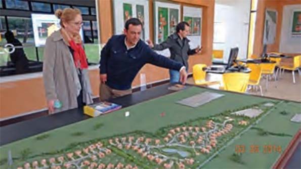
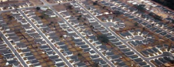
    Journalists, urban and environmental activists and politicians tend to share a vision of a future in which generations-old trends toward the decentralization and dispersal of both production and population are reversed. In this view, densification will replace sprawl, and mass transit will grow in importance relative to personal automobile use, as Americans in growing numbers abandon suburban houses for smaller apartments and condos in mid- density and high-density cities.

    “The New American Dream is Living in a City, Not Owning a House  in the Suburbs,” Time recently declared. The Atlantic agrees: “More Americans Moving to Cities, Reversing the Suburban Exodus.” As for the preferred housing type, the Smithsonian informs us: “Micro Apartments are the Future of Urban Living.” In this world-view, even farming will be brought “back to the city” with the emergence of vertical urban farms. “The Future of Agriculture May be Up” according to The Wall Street Journal. National Geographic predicts that “we may soon be munching on skyscraper scallions and avenue arugula.”

    In this dense city-centric world view, not only will cities feed themselves—in reality a practical and economic impossibility—but also there’s virtually nothing density cannot do, from calming the climate to raising (U.S. national productivity. “Double a city’s population and its productivity goes up 130 percent” asserts MIT News.

    In the depopulated hinterland between downtowns, sleek high-speed trains will whiz past rows of elegant white windmills or gleaming solar panels. Economies of scale and large- scale manufacturing will be replaced  by high-tech localism and the rebirth of walkable dense neighborhoods.

    Each wave of technological innovation since the early industrial revolution has inspired hopes that an economy of small-scale producers and small local markets and walkable, village- like communities can be preserved or recreated, using the most advanced technology available at the time. In 1812, in a letter to General Thaddeus Kosciusko, Thomas Jefferson wrote of his hope that industrial technology could be reconciled with a society of small farmers: “We have reduced the large and expensive machinery for most things to the compass of a private family, and every family of any size is now getting machines on a small scale for their household purposes.” In the early years of the twentieth century, Lewis Mumford hoped that electrification would permit a reversal of the trends toward large- scale corporations and utilities and infrastructure grids and a renaissance of community life and pedestrian cities.

    The third industrial revolution based on information technology has produced its own variants of this utopia, with Alvin and Heidi Toffler predicting “the electronic cottage.” With these earlier utopias, today’s techno-urbanism shares the same social ideal, a society in which production and population are reconcentrated and re-localized in dense communities, which may take the form of the low-rise pedestrian cities of the New Urbanists or Green and “sustainable” skyscraper downtowns. The persistence of this vision, in ever-changing forms, suggests that its appeal must be explained in terms of nostalgia for the less far- flung, less centralized, smaller-scale communities of the agrarian era and the early industrial period.

    Something like this vision of the future American landscape has achieved the status of a near-consensus in the mainstream press about the alleged return to the city and the impending demise of the suburbs. But the story is wrong in every detail. In reality, the American people are not abandoning low-density housing for crowded and expensive urban cores, nor are they likely to do so in the future.

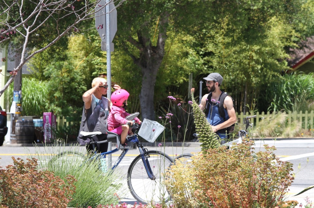
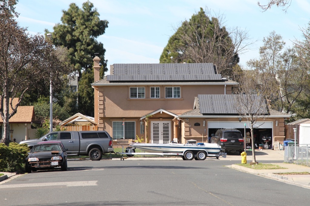
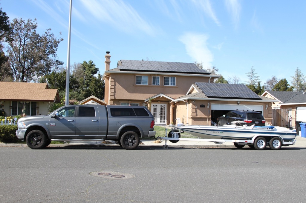
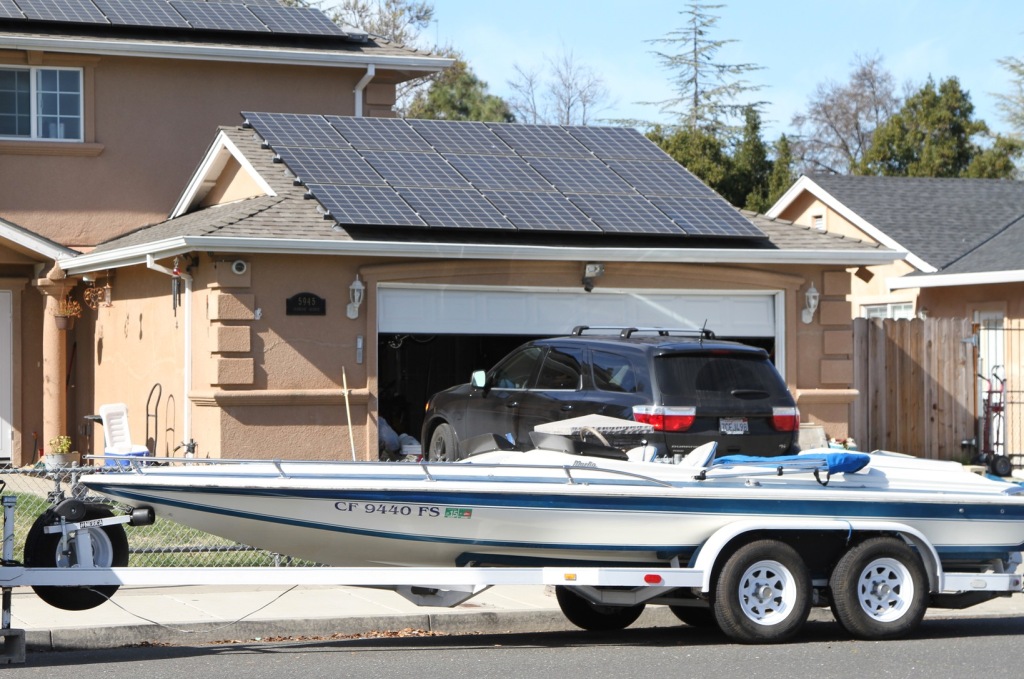
    In fact, the immediate and likely mid-term future will look, in many ways, much like the recent past. Factories, farms and office parks will continue to be dispersed through suburbs, exurbs and the countryside. Information technology will consume ever more electricity, most of which, for the foreseeable future, will come from conventional utilities using fossil fuels, not from renewables like wind and solar power. The aging of the population and the growth of low- paying personal service jobs will increase the importance to the service-sector working class of personal automobile  use in employment. Self-driving cars and trucks, along with telecommuting, may reinforce this trend and produce further decentralization of work, housing, shopping and recreation. The robocar, not the passenger train, should be the icon of the transportation future.

    TECHNOLOGY AND DECENTRALIZATION

    For generations, successive technologies have dispersed production and population even as they have radically reduced transportation, energy and land costs. The increasing speed and flexibility permitted by innovative modes of transportation, from the canal to the railroad to the automobile, truck and airplane, have slashed freight and commuter costs while allowing production facilities and residences to spread out. The decentralization of work, shopping and dwelling has been enabled by the long distance transmission of energy and increasingly cheap, sophisticated and reliable telecommunications grids.

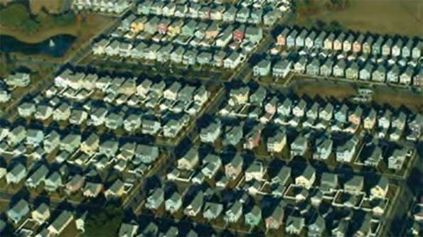
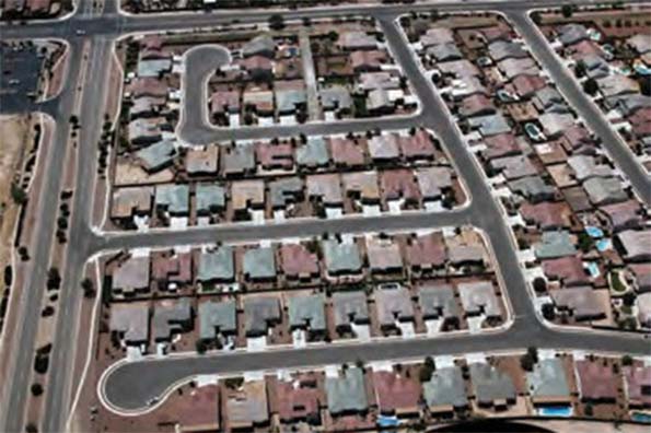
    Since the beginning of the industrial era, each new form of travel—the train, the automobile or truck and the airplane—has permitted higher speeds. From 1800 to the present, personal mobility in the U.S. has grown at an average of 2.7 percent per year with a doubling time of 25 years. Higher speeds allow longer commutes or business trips in the same amount of time. This has resulted in the expansion of urban areas to take advantage of cheaper land for the kind of housing people prefer, largely single family, and the simultaneous decline in their overall density. One study notes that the automobile has allowed cities to grow as much as fifty times larger than the typical pre-modern pedestrian city, which was limited to an area of 20 square kilometers. Today’s advocates of urban “densification” frequently denounce the automobile as the source of so-called “sprawl.” But the trend toward urban deconcentration began with the first industrial revolution, based on steam power. Rather than build urban mass transit around smoke-spewing locomotives, many cities built horse-car lines, something which was not practical until industrial technology made iron or steel rails cheap. In many places these were later replaced by electric trolleys or subways (early horse-drawn railways using wooden tracks had been limited to mines). The growth of suburbs began with horse-drawn omnibuses, trolleys, subways and commuter rail. The “pedestrian cities” of 1900, idealized by many of today’s urban planners, in fact were more dispersed than compact pre-industrial villages and cities.

    Nor has it ever been the case in the industrial era that production facilities have been situated for the convenience of existing city residents, as an alternative to moving workers to production sites. Mills grew up first along the fall lines of streams and rivers, where falling water could be tapped for energy. When coal-powered steam engines replaced waterpower, factory towns tended to be located near coal seams, as in the British Midlands, the Ruhr, and Pittsburgh, or else along rivers or canals with access to barge-borne coal. Mill towns and factory towns alike tended to grow up around the production facilities, which began as “greenfield” sites, to use modern terminology.

    The second industrial revolution, based on the electric motor and the internal combustion engine, accelerated the decentralization of manufacturing in the U.S. and other advanced industrial countries. Electric wiring and motorized power tools allowed large, flat, horizontal factories to replace earlier vertical factories in which waterwheels or steam engines had driven machinery on multiple floors by means of ropes and pulleys. To save money, the new factories were located on cheap land, which only later became dense as residences and
    amenities for workers grew up around them, as in Detroit. Trucks enabled factories to be located far from both waterways and rail lines, and personal car ownership allowed workers to live in less crowded conditions at greater distances from where they worked.

    Paradoxically, passenger air travel, by creating truly national corporations on a continental scale whose facilities could be visited by managers in a single day, allowed the centralization of functions in high-rise office buildings in a few headquarters cities, like New York City, and to a lesser extent, Chicago and, more recently, Los Angeles, Houston, Dallas and Atlanta. Satellite technology and the worldwide Web have enabled the further centralization of supervision over multinational corporations and global supply chains. The error of all too many modern urbanists is a failure to understand that the managerial and financial functions of such dense urban cores depend for their existence on supply chains and consumer markets in lower- density areas across the United States and the world. Only a small number of cities can specialize in these functions in the national and world economies, and these “global cities” like New York and Tokyo and Frankfurt cannot serve as models for most metro areas.

    THE FUTURE OF PRODUCTION

    Will the trend toward the decentralization of production and housing be reversed in the twenty-first century?

    Although their contribution to national employment is dwindling because of automation and offshoring, traded sector industries such as manufacturing, energy, mining and agriculture remain important parts of an advanced economy, because of their multiplier effects and upstream and downstream linkages. According to the Bureau of Economic Analysis, every dollar in final sales of a manufactured good is responsible for $1.34 in input from other economic sectors, while a dollar of retail trade generates only 55 cents and a dollar of wholesale trade only 58 cents. These industries, by their nature, tend to locate their facilities in low-density areas and need extensive, state-of-the-art infrastructures to connect them with national and global suppliers and businesses and consumer markets with minimum friction and cost.

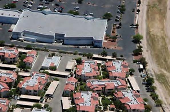
    The decentralization enabled by trucks and cars and buses has converted the monocentric city of the railroad and canal era into what William Bogart, following Jean Gottmann, has called the polycentric city—a blob-like metro area with multiple smaller retail, office and recreation centers. For a while some older urban cores became specialized downtown business districts, housing the headquarters of firms whose factories, warehouses or back offices were located where land or labor or both were cheaper, in suburbs, small towns, and other states or other countries. But as headquarters have moved to suburban office parks and exurban campuses, many downtowns have reinvented themselves again as “playground cities” based around amenities enjoyed by a residential population of the rich and young professionals before marriage, as well as transient populations of tourists.

    Production has moved back to its historic home, the countryside or the outskirts of town. The migration of production out of the city has been accelerated by municipal policies that penalize productive enterprises because of their side effects of traffic, waste or pollution. The real estate
    interest in gentrification—turning former warehouses into lofts for affluent members of the gentry class or restaurants or offices for fashionable social media startups—has seized on this transformation, and in some places, with favorable economic results.

    The mainstream press frequently publishes breathless articles about the alleged rise of urban agriculture— sometimes accompanied by striking illustrations of skyscrapers full of hydroponic gardens or covered with what appears to be kudzu. Most of these stories quote a single activist, Dickson Despommier, a retired professor of microbiology at Columbia University’s School of Public Health. Many articles convey Despommier’s claims about the alleged superiority of indoor, climate- controlled farming in big cities without raising any objections.

    The most obvious objection is the price of land. Even if greenhouses and, in time, synthetic food laboratories were to contribute more to the diet of people in advanced industrial nations like the U.S., and even if consumers insisted on fresh food from nearby, most of these structures would be located on the periphery of expensive cities in low-rise suburbs or exurbs, to minimize the contribution of rent to the price. No matter what technology might be used, food grown in Manhattan will always be an expensive luxury because of land rent alone.

    Nor is most manufacturing ever likely to return to densely-populated, expensive urban areas. The automation of factories is reducing the manufacturing workforce worldwide, even in China. As labor costs decline in importance as a factor in location, more firms may choose to site increasingly-robotic factories near consumer markets and supply chains. And rapid prototyping and other advances that enable customization and short production runs may reduce the benefit that large factories enjoy over smaller operations.

    But high-tech home production of most appliances and high-tech versions of the village blacksmith will probably remain in the realm of science fiction. Economies of scale will probably continue to characterize even advanced manufacturing, to some degree. Most important of all, high rents, combined with municipal regulations, will make cities unattractive as sites for major factories, as distinct from small-scale artisanal shops. Neither agriculture nor large-scale manufacturing are likely to return to cities with high rents and property prices.

    BERMUDA TRIANGLE URBANISM

    What about service sector jobs? As automation leads manufacturing and other productive sectors to shed labor, the greatest growth in absolute employment is found in domestic service sector jobs in health, education, retail, government and other industries that cannot easily be outsourced or automated. The Bureau of Labor Statistics (BLS) projects that in 2022 “services-providing” jobs will account for 80.9 percent of new U.S. jobs.

    According to one influential view, the “new economy” is a post-material “knowledge economy” or “information economy” in which the production of immaterial goods and services is more important than material goods and traditional services. Adherents of this school often treat the most important activities in a modern economy as tech and financial services. This school of thought holds that U.S. productivity would be increased if more people were
    added to a few U.S. metro areas that specialize in tech and finance, with help from “densification” policies such as transit-oriented development.

    According to Chang Tai-Hsieh of the University of Chicago and Enrico Moretti of the University of California, Berkeley, the U.S. could be more productive if more workers could move from less productive cities to more productive cities, which they identify as, among others, San Francisco, San Jose, New York, Boston, and Seattle. They criticize land-use restrictions which prevent more high-rise apartments and high-rise office buildings to house the hordes who allegedly would boost their own productivity, and the nation’s as well, by moving from Bakersfield to San Jose. In short, massive densification would produce huge gains in productivity.

    In all of this there is a grain of truth—but only a very small grain. It is true that, in certain industries, there are genuine agglomeration effects, leading to the dominance of one locale in that field, at least for a while: Silicon Valley for tech, Wall Street for finance, Detroit for automobiles, Hollywood for entertainment. These locations brought together workers, firms, capital, infrastructure and flourishing social networks facilitating the exchange of ideas. If you want to be a country music singer, it was a good idea to move from Tulsa, Oklahoma to Nashville in the old days and to Branson today.

    But even these productivity effects  are limited to particular industries with particular skill sets. You are more likely  to improve your productivity and success as a country music singer if you move from Tulsa to Branson—but not if you move from Tulsa to Silicon Valley or Wall Street. Moretti and Hsieh admit: “The assumption of inter-industry mobility is clearly false in the short run. For example,
    it would be hard to relocate a Detroit car manufacturing worker to a San Francisco high tech firm overnight. On the other hand, the assumption is more plausible in the long run, as workers skills—especially the skills of new workers entering the labor market—can adjust."

    In spite of this concession to reality, Moretti and Hsieh argue for the mass relocation of much of the U.S. workforce to San Francisco, San Jose, New York and a few other big cities. As Timothy B. Lee notes in Vox:

    Hsieh and Moretti envision the New York metropolitan area becoming 9 times its current size, meaning that more than half the country would live there. The Austin metropolitan area would quadruple in size, as would the San Francisco Bay Area. Half the cities in America would lose 80 percent or more of their population. The population of Flint, MI, would shrink from 102,000 people to fewer than 2000.

    This might be called Bermuda Triangle urbanism. Certain metro areas are like the Bermuda Triangle and other legendary zones in which the laws of nature are supposed to operate differently than everywhere else. These metro areas have the unique property of magically raising the productivity of human beings of all skill sets who cross an invisible force field into them.

    Hsieh and Moretti argue that their favored coastal metro areas could rival Southern metro areas in growth by adopting the less restrictive land policies characteristic of growing Southern and Southwestern cities:

    We find that three quarters of aggregate U.S. growth between 1964 and 2009 was due to growth
    in Southern US cites and a group of 19 other cities. Although labor productivity and labor demand grew most rapidly in New York, San Francisco, and San Jose thanks to a concentration of human capital intensive industries like high tech and finance, growth in these three cities had limited benefits for the U.S. as a whole. The reason is that the main effect of the fast productivity growth in New York, San Francisco, and San Jose was an increase in local housing prices and local wages, not in employment. In the presence of strong labor demand, tight housing supply constraints effectively limited employment growth in these cities. In contrast, the housing supply was relatively elastic in Southern cities.Therefore, TFP growth in these  cities had a modest effect on housing prices and wages and a large effect on local employment.

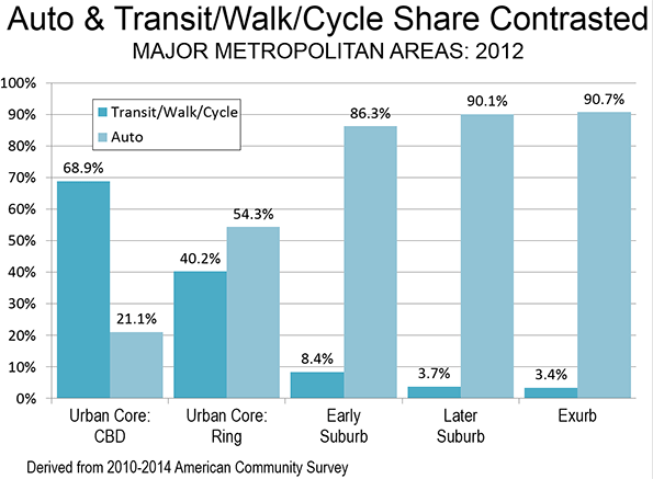
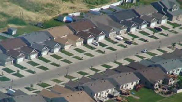
    Advocates of “densification” have seized on Hsieh’s and Moretti’s work to argue for crowding more people into San Francisco and Manhattan by adding skyscrapers, legalizing micro-apartments and squeezing tiny houses into existing suburbs.xxvii But this ignores the fact that the growth of Southern and Southwestern cities has been driven in large part by the desire of middle-class and working-class Americans, as well as affluent Americans, to spend less while enjoying bigger homes and yards. According to demographer Wendell Cox, Census data shows that of the 51 metropolitan areas with more than 1 million residents, only three—Boston, Providence, and Oklahoma City—saw their core cities grow faster than their suburbs. (And both Boston and Providence grew slowly; their suburbs just grew more slowly. Oklahoma City, meanwhile, built suburban residences on the plentiful undeveloped land within city limits.)”. Similar preferences manifestly exist among younger generations of Americans. Between 2000–2011, the number of Americans aged 20–29 increased twenty times as much as the increase of their cohort in central business districts. To accommodate this desire for inexpensive space Southern and Southwestern cities have expanded horizontally, not vertically.

    To their credit, Hsieh and Moretti acknowledge that transportation systems, by enabling longer commutes, can allow more people to live in a metro area that remains relatively low in density. But even here they play to the prejudices of the coastal and campus intelligentsia, by endorsing high-speed rail: “An alternative is the development of public transportation that link local labor markets characterized by high productivity and high nominal wages to local labor markets characterized by low nominal wages. For example, a possible benefit of high speed train currently under construction in California is to connect low-wage cities in California’s Central Valley—Sacramento, Stockton, Modesto, Fresno—to high productivity jobs in the San Francisco Bay Area.”

    Hsieh and Moretti ignore how high-growth Southern cities—their putative models—actually grew. Cities in the South and Southwest in the last half century have expanded thanks to cars and trucks on adequate systems of streets and highways, and near-universal personal automobile ownership, not on the basis of a pre-automobile infrastructure of trains and trolleys and subways. People have moved there—and this appears to be true of educated workers—precisely not to live in high density and expensive areas.

    The link between densification and productivity does not exist even in the so-called “knowledge economy” of the tech sector. Even the intellectual labor of R&D tends to be done in the low-density environments of university and corporate campuses like those of Silicon Valley, Austin and the Research Triangle. The expensive downtowns of skyscraper cities increasingly are home to rentiers with residual financial claims on the products of innovation, including investors and former innovators, rather than individuals and groups engaged in important technological innovation themselves.

    THE NEW LANDSCAPE OF EMPLOYMENT

    Access to cars for personal use will become more, not less, important for  the majority of the American workforce in the decades ahead, thanks to the shifting composition of the workforce and the spatial deconcentration of service sector jobs. While better-paying service sector jobs like those in finance, law and business and professional services may remain downtown in corporate headquarters, an increasing number of lower-wage jobs involving personal care will be found in lower-rent suburbs and exurbs within metro areas. Particularly important among these will be jobs caring for the elderly, either at hospitals and medical centers and nursing homes, or in the homes of the elderly themselves. Between 2002 and 2022, health care and social assistance will have created more jobs than any other sector, growing from 9.5 percent of employment to 13.6 percent.

    Overwhelming numbers of American seniors say they wish to stay in their homes as long as they can. Given the expense of residenial care, elderly Americans will try to remain home with the help not only of technology but also of personal services provided in their homes. These services, many of them paying modestly, will provide employment for nurses, health aides, food delivers, shoppers, drivers, and others providing in-home care or help. Because their clients will be dispersed through metro areas, personal vehicle ownership or access to a car will be a necessity for most of these in-home care-givers. And because few of these jobs are likely to pay well, members of the new service sector working class will economize on expenditures by living in low-cost neighborhoods and shopping at discount stores and dining in affordable restaurants that are located in low- density areas and do not pass on high rents to their customers.

    What we are witnessing is the emergence of something not too dissimilar to European cities with gentrified downtowns becoming centers of high-status spending and employment while poverty is decentralized through the suburbs, particularly those in the inner ring while newer suburbs and exurbs generally do better.xxxiv This reversal of the mid-twentieth century pattern of downtown poverty and suburban affluence poses particular challenges to low-income workers without access to cars in suburbs and exurbs. Researchers at the Brookings Institute, studying data from hundreds of transit providers in numerous metro areas, discovered that, on average, workers reliant on mass transit cannot reach 70 percent of the jobs in their area in less than 90 minutes. Workers in low-income suburbs were even worse off. Only 22 percent of potential metro area jobs for which they were eligible were accessible in less than an hour and a half one way by means of mass transit.

    According to a study of two federal pilot programs operated by the Department of Housing and Urban Development, Moving to Opportunity for Fair Housing and Welfare to Work vouchers, poor participants with cars lived in better neighborhoods and greater employment opportunities. Low-income workers who received Moving to Opportunity Vouchers were twice as likely to get jobs and four times as likely to stay employed. Even when mass transit is available it tends to consume more time than commuting by car. Another study, showing the superior outcomes available to poor people with access to private vehicles, concluded: “If we were most interested in increasing the mobility of the poor, we would subsidize car ownership.”

    ROBOCARS VS. RAILROADS

    In his 2011 State of the Union address, President Barack Obama declared:  “Within 25 years, our goal is to give 80 percent of Americans access to high-speed rail. This could allow you to go places in half the time it takes to travel  by car. For some trips, it will be faster than flying—without the pat-down.” This vision was encouraged by maps showing an imaginary continental network of high-speed passenger rail.

    But the president’s high-speed rail initiative soon collided with reality. In 2011, the Obama administration proposed spending $53 billion on high- speed rail in the next six years. But from 2009-2014 the federal government has spent only $11 billion on high-speed rail. Governors in a number of states have blocked their states from accepting federal high-speed rail grants, for fear of escalating costs. California’s high speed rail project has been plagued by lawsuits and dwindling public support. Amtrak’s Acela, instead of travelling between New York and Washington in only 90 minutes as a true high-speed train might, takes nearly three hours to cover the distance. It would take a quarter century and an estimated expenditure of $150 billion to turn the Washington-to-New York route into a true high-speed rail route.

    The fetishization by many opinion leaders of fixed-rail technology as a futuristic symbol is puzzling. Passenger trains, like passenger blimps, are an anachronistic technology. Most passenger rail in the U.S. was rendered obsolete by the development of automobiles and airlines in the last century. A nonstop cross-country flight in the U.S. usually takes no more than six or seven hours from airport to airport. Even if high- speed rail could compete on some routes, the number of destinations would be far smaller than those accessible by high- speed air. The displacement of passenger rail by air travel and automobile travel in the U.S. has led railroads to return to their original mission from the days of horse-drawn trams and canals—the efficient overland movement of freight.

    The only part of the U.S. where inter-city passenger rail is significant is the Amtrak corridor through the Northeastern megalopolis from Washington, D.C. to Boston. But tickets are expensive, in spite of federal subsidies. In recent years, inter-city bus services have competed with Amtrak along its own route, with much cheaper tickets and only slightly longer travel time. Inter-city bus companies like Bolt have been able to lure away professional- class travelers with amenities superior  to those that Amtrak offers for a  fraction of the price. A 2013 comparison of Amtrak and bus service in a number of routes across the nation concluded that “the cost of providing scheduled motorcoach service is significantly lower than the cost of providing Amtrak train service. The cost difference ranges from a low of $17 per passenger (Washington, DC to Lynchburg, VA) to a high of more than $400 per passenger (San Antonio, TX to El Paso, TX).”

    What about intra-city rail transit? Outside of a few dense urban areas  like New York City, the future of fixed- rail seems bleak, notwithstanding the enthusiasm of urban planners for “light rail” transit projects, which have replaced skyscrapers and Seattle-style space needle towers as icons of progress and prestige  in the imaginations of local boosters. As the technology of self-driving cars advances and regulatory systems adapt, the price of rides in robotaxis compared to subway fare will plummet because taxi fares need no longer support a human worker, only maintenance and energy costs and a modest profit. Single-mode, point-to-point travel will always be more flexible and efficient than fixed- rail transit which requires parts of the journey to be undertaken by foot, bicycle, or automobile, including taxi travel. In most American cities, buses and taxis and personal cars rendered trolley systems obsolete by the mid-twentieth century. By the mid-twenty-first century, except in a few cities or a few routes like airports to convention/hotel centers, robotaxis may put subways and light trail out of business.

    Will robotaxis replace personal cars altogether? Many urbanist opponents of personal automobile ownership hope that fleets of robotaxis will roam the suburbs as well as dense urban centers, permitting suburbanites to dispense with garages and perhaps allowing “densification” of suburban neighborhoods, with houses built right up to the street. Like most fantasies of orthodox urbanism, this is unrealistic. Even if the costs of robotaxis fall radically, it is hard to imagine suburbanites repeatedly calling taxis during the day for different trips—to work and back, to drop off and pick up children and school, to go shopping and  to go out to a restaurant for dinner. In the suburbs, if not in dense urban centers, garages are likely to remain—and they will house the family robocar.

    What is more, the family robocar, like its human-operated predecessors— the station wagon and the minivan and the SUV—will be large enough to accommodate groups of people or large quantities of groceries or other purchases on occasion. And like today’s cars, it will be designed to operate both in cities and on highways. Visions in which individuals on a daily basis now choose tiny one-or-two passenger self-driving cars to commute and now rent spacious robot vans by the hour to go shopping are unlikely to be realized be realized if waiting times make it inconvenient to summon rental vehicles in low-density neighborhoods, as opposed to dense urban cores.

    To the extent that the automation of automobiles and trucks reduces accidents, safety considerations as an incentive to purchase large, heavy vehicles may diminish, and there may be a trend toward somewhat lighter and smaller cars. Still, it is reasonable to predict that fully self-driving cars and trucks will broadly resemble today’s human-operated vehicles, if only because the spatial demands imposed by the dimensions of passengers and freight will remain the same. The street and highway infrastructure of tomorrow is also likely to be more or less the same for self-driving vehicles in the future as for today’s cars and trucks, although fixed signals like painted stripes may give way to virtual signals permitting more flexible road use.

    Reflecting the anti-automobile bias of the gentry intelligentsia, the American press has trumpeted a recent finding that between 2007 and 2012 the number of households without a vehicle increased. But the increase was negligible, from 8.7 percent to 9.2 percent.xli Seventy-five percent of Americans drive to work, while ten percent commute to work by means of carpooling, a number that may have been enlarged by the hardships imposed by the Great Recession.

    Personal care use may well expand, thanks to self-driving cars. The annual cost of upkeep of roads may increase, and it may be necessary to expand road capacity, if the automation of the automobile increases traffic by allowing the elderly and unescorted children to travel without having to drive or be driven by another person.

    Flying as well as driving is on the verge of being transformed by robotics. The Federal Aviation Administration (FAA) may soon adopt regulations that permit the use of drones in the U.S. by civilian business.xliii The potential impact on industries and business models can only be imagined. Restaurant-to-door pizza delivery by drone is probably not in the cards any time soon. The most likely applications of commercial drones are in air freight transportation, warehousing, agriculture and photography, among other industries.

    Meanwhile, increasing automation may make passenger air travel safer. It might also enable the rise of “air taxis”—small aircraft which can pick up passengers on a flexible basis, along the lines of the “free flight” envisioned by a recent NASA study.

    ENERGY IN THE INFORMATION AGE: MYTH VS. REALITY

    Like popular visions of a future American landscape based on urban density and mass transit, perceptions about the information technology and energy infrastructure of the future are equally at odds with reality.

    The ICT (Information and Communications Technology) ecosystem is being transformed by a number of trends: the mobile internet, cloud computing, big data, the “internet of things” and “the industrial internet.” All of these trends together will translate into increased demand for both electricity and reliable wireless communications.

    Because much of the infrastructure supporting ICT is not visible—fiber optic cable, remote data centers, wireless towers—it is easy for the users of modern technology to imagine that it consumes less energy and materials than old- fashioned appliances, and to believe that information-based industries somehow exist in cyberspace rather than the material world. But the alleged virtual reality of cyberspace is grounded in physical infrastructure.

    Unlike windmills and high-speed trains, data centers are not part of the popular iconography of the imagined future. Indeed, for security reasons, many data centers are hidden from public view in nondescript buildings in remote complexes. The result, as a New York  Times report notes, is the illusion that information exists in an immaterial world: “The complexity of a basic transaction is a mystery to most users: Sending a message with photographs to a neighbor could involve a trip through hundreds or thousands of miles of Internet conduits
    and multiple data centers before the e-mail arrives across the street.”

    In spite of their effective invisibility, data centers are the backbone of the digital economy. As these nodes in national and global communications networks grow in importance, they consume more energy. A modern data center uses 100 to 200 times more electricity per square foot than an office building.xlvi Some data centers consume as much energy as small towns. In 2013 U.S. data centers devoured enough kilowatt-hours of electricity—91 billion—to power twice the number of households in New York City.xlvii Gains in efficiency and productivity may be outstripped by increased demands made possible by falling prices.

    And energy-hungry data centers themselves represent only 20 percent of ICT electric consumption, with the rest dispersed among hand-held devices, PC’s and other technologies. As one study notes, “Cost and availability of electricity for the cloud is dominated by same realities as for society at large—obtaining electricity at the highest availability and lowest possible cost."

    Electricity to power increasingly sophisticated phones and computers and cloud computing centers as well as machine-to-machine communication and communication among self- driving vehicles will have to come from somewhere. Will the source be renewable energy? Many Americans have been persuaded that combating global warming will require a rapid—and relatively painless—transition from fossil fuels to renewables, identified in the popular imagination with wind power and solar energy. This vision is sometimes united with the idea of a “distributed” energy network, in which utilities buy
    much of their electricity from rooftop solar panels or electric cars.

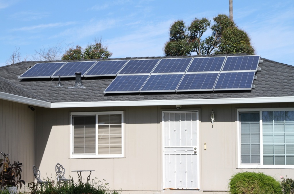
    In reality, the reign of hydrocarbons in the energy mix is far from over. The U.S. Energy Information Administration predicts that in 2040 as much as 80 percent of primary energy consumption by fuel in the U.S. will originate with three fossil fuels—petroleum and other liquids (33 percent), natural gas (29 percent) and coal (18 percent). In their contribution to primary energy production, renewables are predicted to rise only from 8 percent  in 2013 to 10 percent in 2040. As a share of electricity generation by fuel, renewables are predicted to account for only 15–22 percent in 2040, roughly the same as nuclear energy. Most of the renewable category is accounted for by hydropower and wind; only minor contributions will be made even in the best case scenarios for 2040 by solar, geothermal, and biomass.

    FUTURE INFRASTRUCTURE: EVOLUTION, NOT REVOLUTION

    The conventional wisdom of  urban planners posits revolution, not evolution. It is widely assumed that the trend of decentralization of production, housing and shopping—a trend that has been reinforced by each new wave of technology, beginning with steam engines—will somehow be reversed in the near future, leading to the reconcentration not only of housing but also of much manufacturing and even “urban agriculture” in dense cities. And all of this is supposed to be accompanied by mass abandonment of personal automobile use for mass transit and a rapid transition from fossil fuels to renewable energy sources.

    As I have sought to demonstrate, none of these assumptions is plausible.
    The future American landscape will be characterized by evolution, not revolution. The desire to minimize costs will lead most businesses and households to avoid expensive, dense urban areas for low-density regions with cheaper land. According to Jed Kolko of Trulia, only one of the ten fastest-growing cities with more than 500,000 people, Seattle, is predominantly urban, while five—Austin, Fort Worth, Charlotte, San Antonio and Phoenix—are majority suburban.

    Roads and highways will be important, as increasingly autonomous cars and trucks and buses render fixed-rail passenger transit even more marginal than it is today for passenger transportation (rail will retain its utility for freight transportation in the U.S.).  Air travel will become more complex, with the addition to airliners of civilian drones and perhaps “air taxis” reshaping patterns of production, package delivery and commuting. Telecommuting and the gradual electrification of transport will make reliable electric grids all the more indispensable. And the displacement of coal by natural gas, and the evolution of a global market in natural gas, will necessitate more pipelines. Growing Internet usage will have to be matched by reliable high-speed connectivity via national and international grids and increasingly colossal data servers which, even if they are more efficient, will require immense quantities of energy for operation and cooling.

    Far from reducing the quality of life of the working class/middle class majority in an aging America, “sprawl” or decentralization, if properly carried out, can benefit both the providers and consumers of personal services. Personal service providers with access to cars have a much greater market for their services— particularly if highways or expressways enlarge the number of sites or homes that they can visit. At the same time, low-cost, low-density housing in suburbs, exurbs and small-towns makes it easier for the elderly to age in place. Emergent technologies such as telemedicine and autonomous vehicles may make suburban life much less challenging for the elderly who can no longer drive. The greatest beneficiaries of an automobile-based service economy may be the low-income elderly and their modestly-paid caregivers.

    This picture is at odds with the kind of urban futurism which envisions passenger trains whizzing past windmills and solar power panels on their way from one skyscraper metropolis to another. Certainly robocars, power lines, natural gas pipelines, and data centers are less striking and glamorous than fashionable icons of pop futurism like high-speed rail and imaginary farms inside skyscrapers. But a decentralized America built on the bones of high-capacity roads, power lines, pipelines, and airstrips can enjoy a growing economy while minimizing the de facto taxes imposed by congestion, high land prices, and other detritus of excessive density. The historic nexus among technology, decentralization and the quality of life, far from being rendered obsolete, is on the verge of being reinforced and renewed in the United States.

    This essay is part of a new report from the Center for Opportunity Urbanism called “America’s Housing Crisis.” The report contains several essays about the future of housing from various perspectives. Follow this link to download the full report (pdf).

    Michael Lind is the Policy Director of the Economic Growth Program at the New America Foundation in Washington, D.C., editor of New American Contract and its blog Value Added, and a columnist forSalon magazine. He is also the author of Land of Promise: An Economic History of the United States. Lind was a guest lecturer at Harvard Law School and has taught at Johns Hopkins and Virginia Tech. He has been an editor or staff writer at the New YorkerHarper’s Magazine, the New Republic and the National Interest.