Category: planning

  • Cherry Hill: The Winners

    This is Cherry Hill. It is by far the most desirable suburb in this part of southern New Jersey as measured by all the usual metrics. Property values are high. Public schools are great. The municipal government is lean and responsive. This is as good as the American Dream gets.


    Screen Shot 2015-11-17 at 2.50.46 PM

    Screen Shot 2015-11-17 at 2.51.14 PM

    Screen Shot 2015-11-17 at 2.52.55 PM


    Screen Shot 2015-11-17 at 2.52.03 PM

    Screen Shot 2015-11-17 at 2.50.22 PM

    Screen Shot 2015-11-17 at 3.06.03 PM

    Screen Shot 2015-11-17 at 3.06.42 PM

    Screen Shot 2015-11-17 at 3.05.02 PM

    Screen Shot 2015-11-17 at 3.11.13 PM

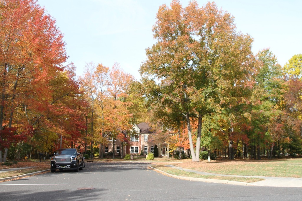
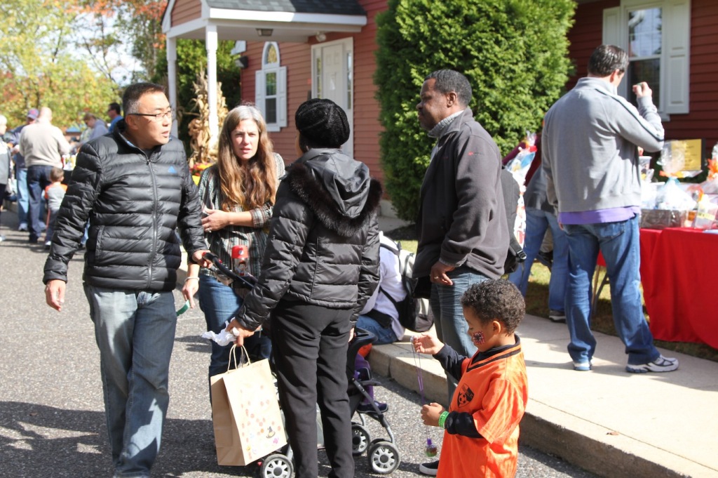
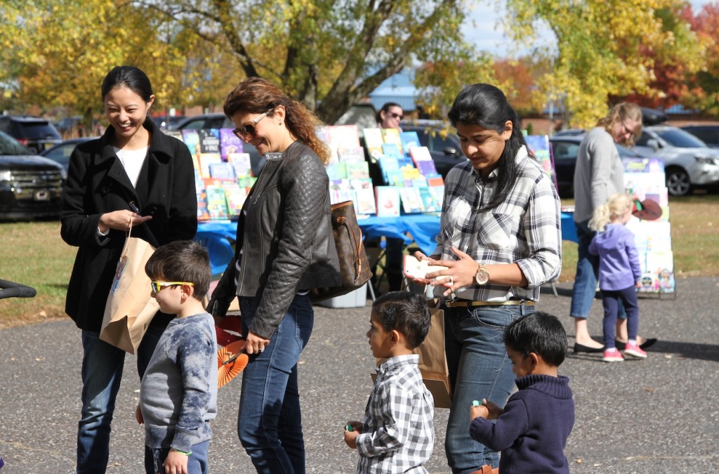
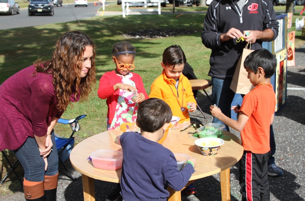
    The families who live here are overwhelmingly well educated professionals, often first and second generation immigrants who have discovered the high quality of life on offer. What was once a nearly 100% white enclave is now a diverse multi-cultural community. You’re just as likely to live next door to Hindus, Jews, Greek Orthodox, or Muslims, as the main line Protestants that dominated the area in previous decades. When proponents of suburban living talk about the success of the suburban development pattern this is the kind of place they often refer to.

    Screen Shot 2015-11-17 at 2.56.58 PM

    Screen Shot 2015-11-17 at 2.55.15 PM

    Screen Shot 2015-11-17 at 2.56.28 PM

    Screen Shot 2015-11-17 at 2.55.44 PM

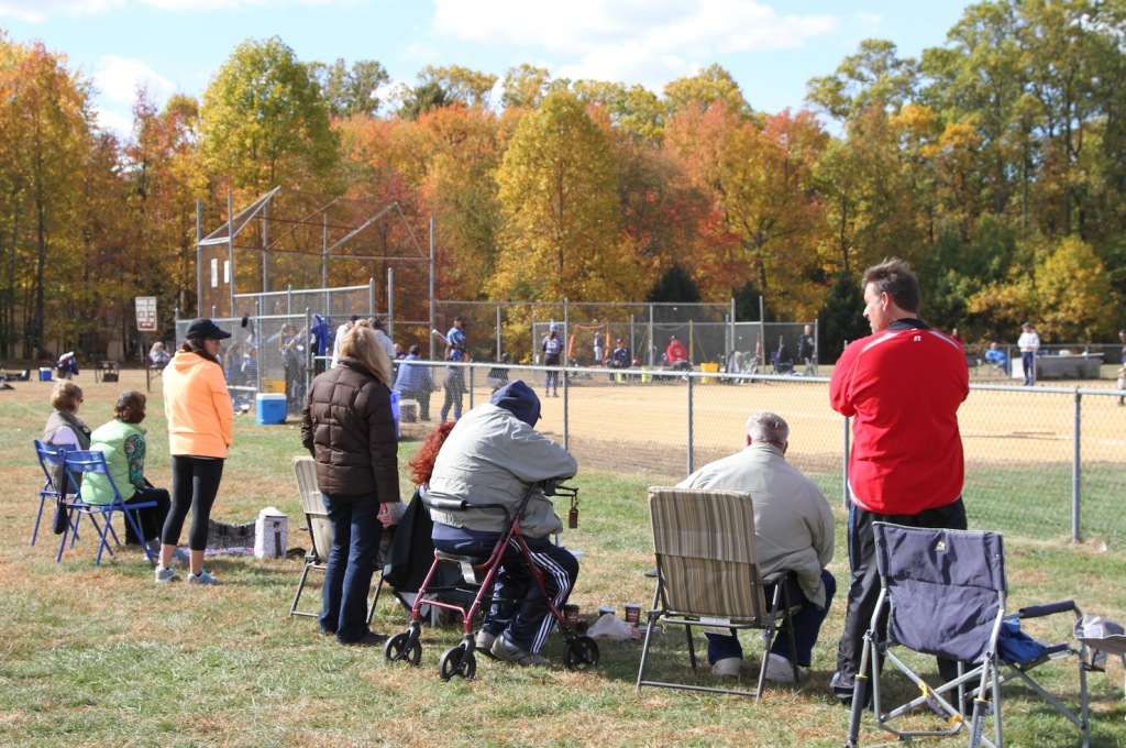
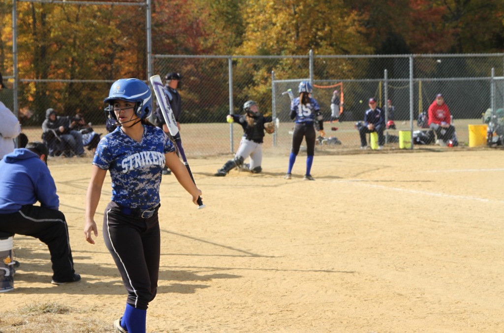
    If you’re raising children you really can’t ask for a better environment. It’s safe, clean, and (most importantly) your kids will rub shoulders with the kids of equally successful families – which is what exclusive suburbs and premium school districts are really all about. Cherry Hill has successfully filtered out the riffraff.

    Screen Shot 2015-11-17 at 4.09.10 PM

    Screen Shot 2015-11-17 at 4.26.18 PM

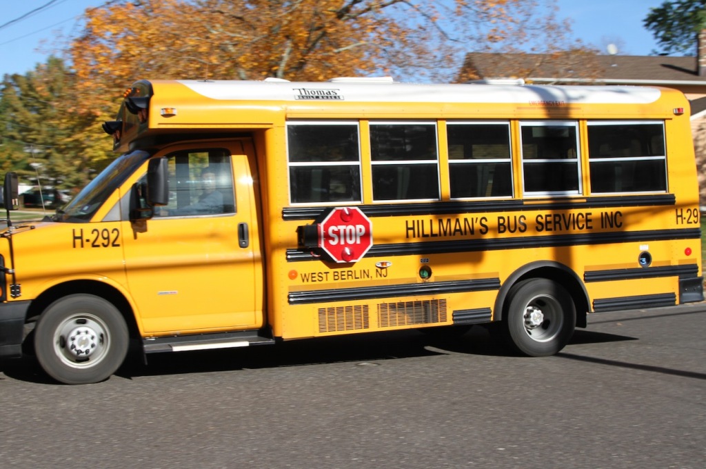
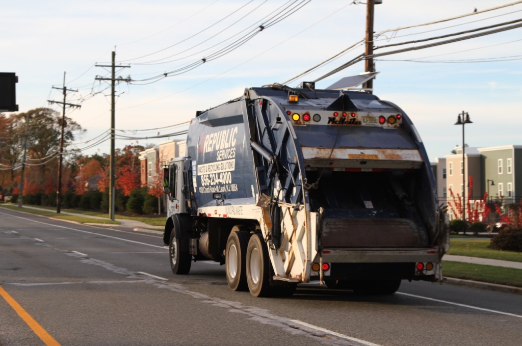
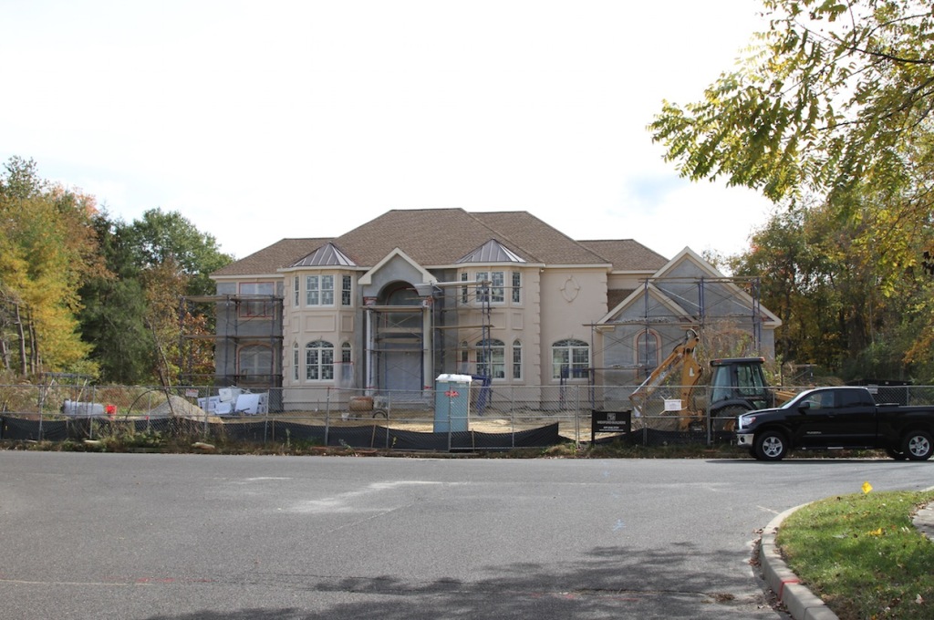
    Cherry Hill has a middle-of-the-road population when it comes to social issues, but it’s decidedly conservative when it comes to money. It has embraced all the usual cost savings techniques to keep the budget tight and taxes as low as possible. Traditional in-house departments have been dissolved in favor of contract services with low cost private firms for things like waste management, school buses, and landscaping. Sales tax revenue has been boosted by cultivating the most successful regional shopping mall in the area. Class A suburban office parks deliver commercial property taxes to help subsidize the shortfall from residential taxes.

    Screen Shot 2015-11-17 at 4.08.41 PM

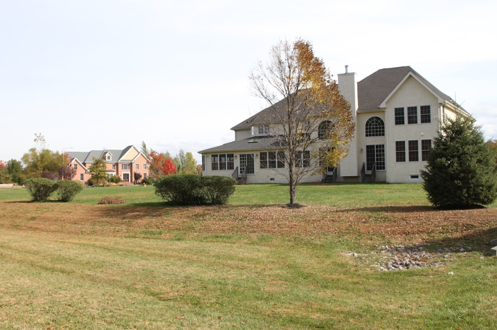
    And yet… there are problems. The average homeowner in Cherry Hill pays about $8,000 a year in property tax. Some of the larger homes pictured above pay on the order of $23,000 a year. You can blame teachers and cops and their “extravagant” salaries and pensions, but schools and public safety are the primary attractions to living in Cherry Hill. Outsourcing to low wage alternatives for these public services may not really work over the long term – although Cherry Hill keeps pushing that envelope. And the cost of maintaining a huge amount of very expensive attenuated public infrastructure like roads, sewers, and water pipes is rapidly getting out of control.

    Screen Shot 2015-11-17 at 3.59.48 PM

    Screen Shot 2015-11-17 at 5.54.35 PM

    Screen Shot 2015-11-17 at 5.54.06 PM

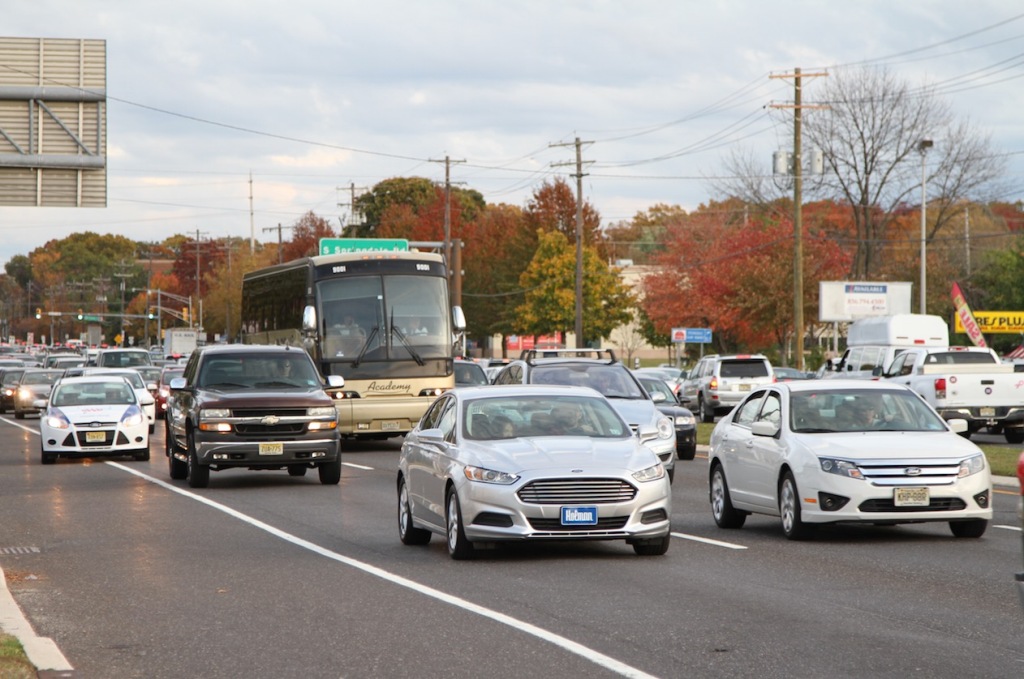
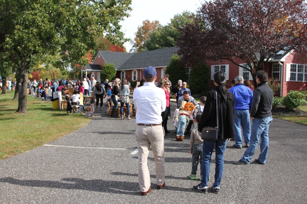
    Here’s another problem with Cherry Hill. This is what passes for the public realm. All the emphasis has been placed on private space. The homes, the tree lined subdivisions, the quality retail establishments, and the hermetically sealed professional centers are pristine. But in between there’s nothing that even comes close to a pleasant commons. Route 70 is “Main Street.” That’s all you get. Of course, the people who self select in to Cherry Hill don’t care. They’re inside their homes, shops, offices, and cars 100% of the time. There’s simply no need for a public realm. It’s a fully private pay-per-view environment.

    Screen Shot 2015-11-17 at 4.01.15 PM

    Screen Shot 2015-11-17 at 3.59.17 PM

    Screen Shot 2015-11-17 at 3.50.30 PM

    Screen Shot 2015-11-17 at 4.10.16 PM

    Screen Shot 2015-11-17 at 4.13.11 PM

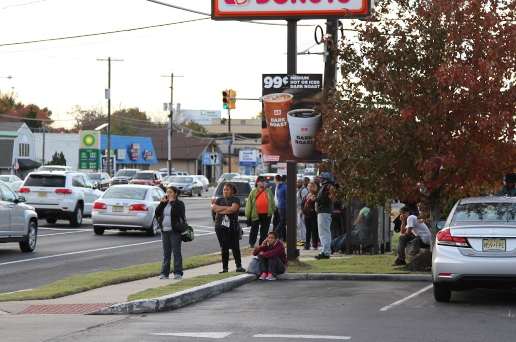
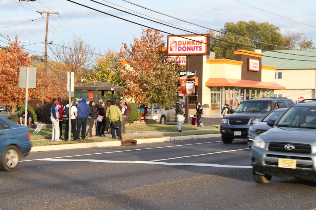
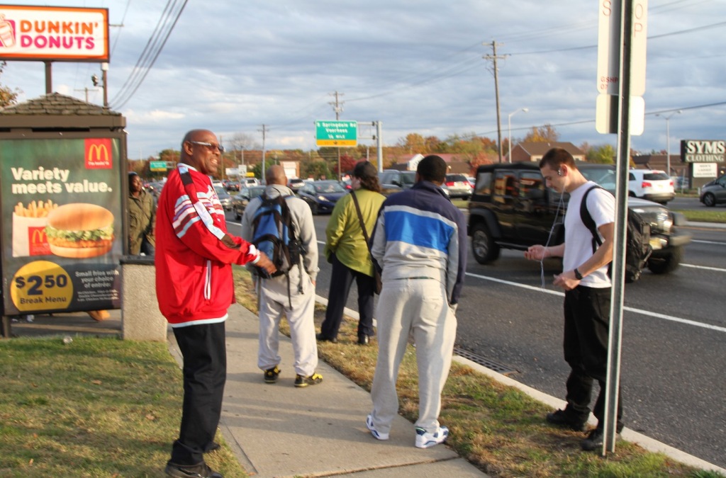
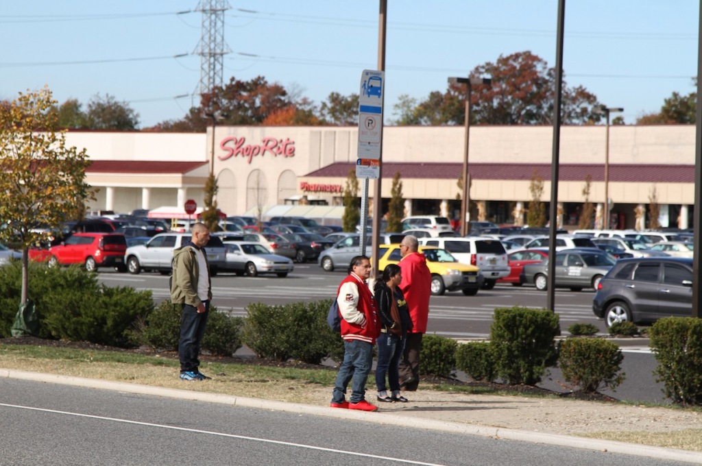
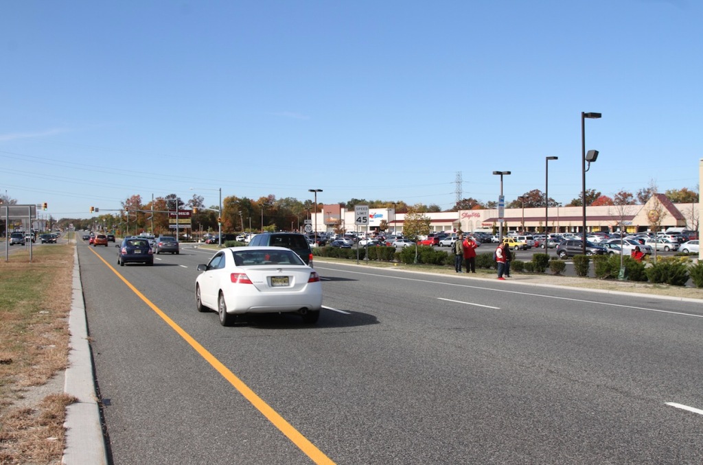
    Unless you’re one of these poor bastards standing on the side of the highway waiting for a bus that may or may not arrive sometime within the next hour. These people can’t afford to live in Cherry Hill or own private vehicles so they commute on crappy inadequate public transit to and from neighboring low income suburbs.

    Cherry Hill is a giant wealth sponge. It soaks up the segment of the population that can afford to live the best version of a suburban life. That means there are many other suburbs – the vast majority – that become the also-ran towns of fair-to-middling suburbs with just-okay schools and mediocre shops. And then there are the lower income suburbs farther out that can’t quite manage to bootstrap themselves up above the poverty line.

    The dominant conversation in America today centers on the bleakness of inner city ghettos and the extravagance of newly gentrified urban elite neighborhoods. The reality is that most Americans live in the suburbs. A small number of people live in a few great places like Cherry Hill. The overwhelming bulk of the population, including the poor and large downwardly mobile middle class, now live in failing cheap anonymous declining suburbs that no one talks about – until they erupt Ferguson style.

    I’m just sayin.

    John Sanphillippo lives in San Francisco and blogs about urbanism, adaptation, and resilience at granolashotgun.com. He’s a member of the Congress for New Urbanism, films videos for faircompanies.com, and is a regular contributor to Strongtowns.org. He earns his living by buying, renovating, and renting undervalued properties in places that have good long term prospects. He is a graduate of Rutgers University.

  • Berlin: The Imperial Impulse in City Planning

    “He who controls Berlin, controls Germany, and who controls Germany, controls Europe.” V.I. Lenin (but also attributed to Karl Marx, and sometimes to Otto von Bismarck)

    About the time that Syrian refugees were on the march to Germany’s safe havens, I spent a few days in Berlin, which is not only the capital of reunified Germany, but the unofficial capital of the European Union, as well as being hipster ground zero.

    The Europe that united under the EU — the New Europe — was predicated on a weak, federal Germany surrounded by strong members such as France, Britain, and Italy. On paper, the EU has its headquarters in Brussels and, for one week a month, in Strasbourg (to placate the envious French). But the Union’s power emanates from Berlin, where Angela Merkel — the latest Iron Chancellor — has made most of the EU decisions concerning the Greek bailout and Syrian emigrants. The EU has become a ward of the Teutonic Knights, where solvency and peace come only from German diktats.

    Does the modern city of Berlin speak about a resurgent Germany (über alles, so to speak), or about the ability of the Union to tame the excesses of German nationalism?

    Since Germany united in 1989 the success of reunification has often been measured in the bright lights and new buildings that have spread across Berlin, from West to East. Once a Cold War no-man’s land, the Potsdamer Platz is now a crossroads on Architectural Digest walking-tour maps, while the worker housing in the East has been recycled into studios and sidewalk bistros for hi-tech executives and skateboarders.

    For the past twenty years, I have believed that a healthy and vibrant Berlin could only mean good things for the European Union. It meant that reunified Germany was working, that Russia was at bay, and that in the New Europe there were enough new jobs to service the debt on the leveraged buyout of Eastern Europe.

    On this trip to Berlin, however, I glimpsed the other side of the German coin, which is that as Germany succeeds — economically and politically — the European dream will become ever more distant.

    What did I see in Berlin that made me doubt the future of the European Union?

    On the surface, Berlin is a success story, with open-topped tourist buses crisscrossing the city and new restaurants. Old working-class neighborhoods such as Prenzlauer Berg and Kreuzberg have gotten facelifts, and the city’s infrastructure of railroad stations, banks, and conference centers glistens.

    In other, more subtle ways, however, the city seems to be fulfilling the dreams of Adolf Hitler and his architect, Albert Speer, to turn Berlin into a capital of the thousand year Reich, even if, for now, it is a dream of admirable intentions.

    Take the $600 million gilded palace of the Humboldt Forum that is being built on Museum Island, just off Unter den Linden, the imperial boulevard of Prussian dreams.

    Swathed in marble frontage, the reconstructed palace dwarfs much that is nearby, including several classical museums. The web site descriptions make it sound like an elaborate visitors’ center, however, with nebulous goals:

    The Humboldt Forum is a novel centre for exhibitions, events, and human encounter in the heart of Berlin. Museums, a library and a university will pool their competencies and create a lively place where knowledge about the cultures of the world can grow and be exchanged. In this, the Humboldt Forum distinguishes itself from the traditional idea of the ethnographic museum.

    It’s difficult not to recall that Hitler, when he spoke to Speer about the purpose of the nearby New Reich Chancellery on Voss Strasse, said, “On the long walk from the entrance to reception hall they’ll get a taste of the power and grandeur of the German Reich!”

    * * *

    On this trip, I had the use of a bicycle — until it was stolen — to ride around the city, including along Unter den Linden. Graffiti is still visible on the last fragments of the Wall; elsewhere, I came across some posters of the far-right National Democratic Party (NPD), with turbaned immigrants and the tag line: “Have a good flight home.”

    I first saw united Berlin in December 1989, a month after the Wall came down, when it was a city in liquidation. As if in the Berlin airlift, I flew on a Pan American jet from Frankfurt, and in a friend’s small Trabant toured West and East Berlin, which felt, respectively, like Manhattan and Brooklyn, in the days before gentrification. The Kurfürstendamm had the brand-name franchises of New York’s Fifth Avenue, while East Berlin felt like the far reaches of Bensonhurst.

    This time, on foot (post-bike theft), I saw a united Berlin, but one with many cracks in the sidewalks. I found a street on which the English writer Christopher Isherwood, whose fiction inspired the play and movie Cabaret, had lived. His building was destroyed in the war, and the replacement speaks of the temporary housing that became permanent. If writing now about the city’s decadence, he might describe its bureaucracies — Humboldt is run by the Prussian Cultural Heritage Foundation — rather than its cabarets.

    Another thing I did was go around to Berlin’s bookstores, and was surprised at how mediocre many were. Yes, they had book club novels and Hitler histories, but everything looked second-hand, not fresh off presses with any new ideas about the European Union, Mrs. Merkel, or Berlin. Has Germany discovered the end of history?

    * * *

    Before the bike vanished, I did take it up and down the Wilhelmstrasse to see what remains of Hitler’s and Bismarck’s Berlin. The city doesn’t have much from Bismarck’s era as the head of the German government. He wanted Berlin at the head of a unified Germany. When he got what he wanted in 1871, he realized (although it was too late for him to do much about it) he had the rest of Europe as his enemies.

    Likewise, the imperial masquerade of Speer’s Berlin went up in the smoke of the World War II. Hitler mandated him to draw boulevards wider than the Champs-Élysées, and reception halls vaster then the cathedral at Rheims. It was to have been Rome on steroids.

    In his memoirs, published in the 1970s, Speer describes a Hitler consumed with architectural ambitions, as if his military and political aggression was just to make the world safe for his city planning. The two spent countless hours discussing castles in the air, or an imperial way from the south Berlin station to a Great Hall near the Reichstag.

    There was to have been an oversized Arch of Triumph, and various Nazi ministries housed behind those faceless façades of National Socialism that spoke of government by diktat. Looking back on his dreams, however, Speer wrote of the Grunewald forest, “Of the whole vast project for the reshaping of Berlin, these deciduous trees are all that have remained.”

    Matthew Stevenson, a contributing editor of Harper’s Magazine, is the author most recently of Remembering the Twentieth Century Limited, a collection of historical travel essays, and Whistle-Stopping America. His next book, Reading the Rails, will be published in 2015. He lives in Switzerland.

    Flickr photo by Nigel Swales: Billboard announcing construction on the now-completed Schlossplatz – Berliner Schloss (Humboldt Forum); a modern building housing museums and offices, but with the façade of the original city palace.

  • How Land Use Regulations Hurt the Poor

    Sandy Ikeda and I have published a new Mercatus paper on the regressive effects of land use regulation. We review the empirical literature on how the effects of rules such as maximum density, parking requirements, urban growth boundaries, and historic preservation affect housing prices. Nearly all of the studies on the price effects of land use regulations find that — as supply and demand analysis would predict — these rules increase the price of housing. While the broad consensus on the price effects of land use regulations is probably to no surprise to Market Urbanism readers, some policy analysts continue to insist that in fact rules requiring detached, single family homes help cities maintain housing affordability.

    Ed Glaeser, Joseph Gyourko, and Raven Saks estimate the effects of regulations on house prices in their paper “Why Is Manhattan So Expensive? Regulation and the Rise in Housing Prices.” They estimate what they call the “zoning tax” in 21 cities. The zoning tax indicates the proportion of housing costs that are due to land use regulations. The chart below shows the percentage of housing costs that this “tax” accounts for:

    The zoning tax as calculated by Edward Glaeser, Joseph Gyourko, and Raven Saks in 'Why Is Manhattan So Expensive? Regulation and the Rise in House Prices' (2003).

    The zoning tax as calculated by Edward Glaeser, Joseph Gyourko, and Raven Saks in “Why Is Manhattan So Expensive? Regulation and the Rise in House Prices” (2003).

    Policies that increase housing costs have a clear constituency in all homeowners, but they hurt renters and anyone who is hoping to move to an expensive city. The burden of land use regulations are borne disproportionately by low-income people who spend a larger proportion of their income on housing relative to higher income people. These regressive effects of land use policy extend beyond reducing welfare if the least-advantaged Americans. Additionally, rules that increase the cost of housing in the country’s most productive cities reduce income mobility and economic growth.

    In our paper Sandy and I also discuss proposals for reducing the inefficiency of cities’ current land use regulation practices. David Schleicher has proposed some of innovative policy improvements, including a zoning budget that a city can implement to commit itself to permitting a certain amount of new development. A zoning budget would create a situation in which local policymakers are forced to make tradeoffs between different land use restrictions, as opposed to the current situation in which there is no limit to policies restricting building. Another proposal that Schleicher suggests is a tax increment local transfer, or a TILT. With TILTs, homeowners who live near new development would receive some portion of the additional property taxes that the city raises by allowing the development. The purpose of TILTs is to reduce NIMBY opposition to development.

    We hope that our paper will be a helpful resource to those looking for an accessible overview of this area of research and point to future research opportunities for institutional reforms to allow for the construction of affordable housing.

    This piece first appeared at Market Urbanism.

    Emily Washington is a policy research manager for the Mercatus Center at George Mason University. She manages the Spending and Budget Initiative and State and Local Policy Project portfolios. Her writing has appeared in USA Today, The Christian Science Monitor, Economic Affairs, and The Daily Caller. She contributes to the blogs Neighborhood Effects and Market Urbanism.

  • How Chicago’s 606 Trail Fell Short of Expectations

    When I was back in Chicago over Labor Day, I had to check out the “big three” new public space projects there: the Riverwalk, Maggie Daley Park, and the 606 Trail. The Riverwalk is a spectacular project I already wrote about. Maggie Daley Park, a new playground just across Columbus Dr. from Millennium Park’s Frank Gehry designed band shell, has been controversial and got mixed reviews. But I really liked it. More importantly, kids seem to love it. The place was jammed, and it appeared to be mostly locals. My cousin tells me her young daughter can’t get enough of the place. I’m not doing a post on this, but it looks like another big win.

    The 606 Trail, a 2.7 mile biking and walking trail built on the embankment of an abandoned rail line, is a different story, however.

    The problem with the 606 is not that it’s bad. In fact, it’s a nice, eminently serviceable rail trail. I won’t do a full writeup since Edward Keegan had a good review in Crain’s in which he asks, “Is that all there is?” that I think gets it basically right.  Numerous other reviews are also available.

    What I will do is highlight three areas that I think contribute to Keegan being underwhelmed: inflated expectations, financing problems, and an odd lack of attention to design detail.

    Inflated Expectations

    The fact that the 606 is an elevated trail on an abandoned rail line creates an almost inevitable comparison to New York’s High Line. The city did nothing to downplay those comparisons, and in fact suggested Chicago’s trail would actually be considered superior. For example, in national urbanist web site Next City, Deputy Mayor Steve Koch said, “A lot of people are familiar with the High Line — this is a concept far beyond that truly transformative project.”  Frances Whitehead, lead artist for the project, told WBEZ regarding the High Line, “I think we’re gonna smoke them.”

    It’s very clear the city wanted this to be considered a project worthy of national, not just local attention. Back to Koch, he said, “Someone will call you up and say, ‘I want to see the city’ Thisis where you’ll go; this is the way you’ll do it. And I think people are going to come from all over the globe.”

    The very name speaks to the ambition level. Originally it was known as the Bloomingdale Trail, a name that technically still exists but which has been replaced for most purposes by “the 606.” The new name was taken from the first three digits of zip codes in the city of Chicago. Thus by using 606, the name itself suggests a project of citywide, not neighborhood, significance. The city also pushed for national media – and got it.

    The problem is that the 606 is not even remotely another High Line, nor a project of citywide significance, nor a bona fide tourist attraction for the masses. It’s a neighborhood serving rail-trail that is elevated above the streets with some nicer features like lighting that you don’t see often. Like many other rail trails around the country, I expect it to have a significant positive development affect in the neighborhood, as well as being a great recreational amenity. All great things – if the trail had been sold that way originally.

    To be fair, some like the Trust for Public Land, which was involved in the project design, were more realistic. Their CEO Will Rogers told Next City, “The High Line really reshaped the whole Meatpacking District. The Bloomingdale is going to provide parks and green space for neighborhoods that desperately need it, and bicycle access for people going downtown. It’s a different kind of investment.” But this isn’t the message that won out in shaping perceptions. The city would have been better off setting expectations much differently.

    Insufficient Funds

    The 606 Trail was primarily paid for using federal CMAQ transportation funds. According to DNA Chicago, the total price of the 606 is $95 million, with $50 million in CMAQ funds, $20 million privately raised, $5 million from the city, and $20 million to fill (for what purposes I am not sure, though see below).

    The use of a CMAQ funding had key implications. One is that it more or less required the project to be primarily a bicycle trail. The entire edifice of obnoxious federal transport regs are in play here. Two is that it made this a CDOT project, not a Parks District one (though I believe the Parks District is now in charge of it). I believe many of the things that contribute to Keegan’s feelings come from the funding strings and a budget that was too low. In fact, this project to me brought back echoes of the CTA’s Brown Line expansion project in the way that various parts of it give off the vibe of being value engineered.

    One of the things that got whacked in the Brown Line project, for example, was paint. Except for a handful of places such as over Armitage Ave, metal on the project was simply left in a raw galvanized state. I previously noted the austere results of that project give off an homage to prison yard feel. The same look is present on the 606. Consider these photos:

    Galvanized metal railing at the CTA Fullerton station.

    Mesh galvanized metal railing at the CTA Fullerton station.


    IMG_2128

    Mesh galvanized railings along the 606.


    There’s nothing wrong with using an industrial motif, which is very appropriate in Chicago. And obviously security for adjacent property owners is important. It’s also possible that these had to be over-engineered to meet DOT/federal standards, much like the Brown Line station railings for passengers that could stop a Mack truck. The designers may well have felt these were the best choices. But my gut tells me that, like with the Brown Line, this may have been a money issue.

    A lot of people have noted the fact that the landscaping has not yet been fully planted or grown to maturity as a reason for the trail’s feel. That surely plays a role. But the preponderance of galvanized metal through much of it plays a big role in giving the 606 an austere feel.

    This also demonstrates how the city’s financial problems have practical consequences. Because the city’s budget is in such bad shape, it had to turn to CMAQ, which imposed strings you’d rather not have in an ideal world. And you may not have the cash to do it right. (The Riverwalk doesn’t suffer from this, possibly because its commercial spaces generate revenues to bond against).

    Design Oddities

    The 606 also has some odd design misses. For example, here is what the Trail physically looks like. It’s a concrete biking path with a soft blue rubberized running path on either side.

    IMG_2116

    Let’s see, where have I seen this design pattern before?

    Fullerton L platform.

    Fullerton L platform.

    The CTA uses a similar blue shoulder area on its platforms. But in its case, the design pattern is used to indicate the edge of the platform and thus an unsafe area to stand. You are supposed to stand behind the blue line. Using a similar width blue area, even if a different shade, for a jogging path on the 606 violates a local design affordance, like putting a handle on a door and labeling it “Push.”

    Then there’s this arch bridge:

    The 606 Trail over Milwaukee Ave.

    The 606 Trail over Milwaukee Ave.

    This design is dimensionally awkward, something Keegan points out too. Given that this is a rail trail, it’s also notable that the designers chose a steel arch pattern that is not idiomatic of rail bridge design, certainly not in Chicago anyway. This also makes me again wonder about the role of CDOT in the project. This arch structure is the same pattern they used for the Halsted St. bridge over the north branch of the Chicago River that Blair Kamin similarly labeled, “less than graceful.” (The Damen Ave arch bridge works much better, probably because the span is longer and higher, lending itself to more elegant design proportions).

    The name “606” itself is also a bit off. Inside Chicago the reference may be obvious, but outside of its this name is likely to be parsed as an area code, particularly with the “0” middle digit from the original North American Numbering Plan. Today you frequently see people sporting their city’s main area code on shirts and such as a bit of local pride, particularly as area codes have shrunk down to city scale size in many places. The 606 area code is Appalachian Kentucky, however, not Chicago. Few people without a connection to Chicago will know that its zip codes start with 606.

    These aren’t huge items, but cumulatively they add up. The little things separate great design from good, and the 606 missed some opportunities.

    On the whole, this trail will be a great amenity for the neighborhoods it passes through, and also be legitimately functional for transportation given its elevated nature and the transportation lines it connects to such as Metra’s Clybourn station. It was fairly well patronized when I was on it, but with no sense of crowding. And this was on a nice Labor Day afternoon, suggesting that that chaos and safety issues of the lakefront path won’t be repeated here.

    If only it had originally been sold for what it was instead of a High Line beater, had raised that last $20 million (plus a bit more, perhaps), and had a little more attention to detail in some design elements, the 606 would be probably be seen as something that significantly exceeded expectations instead of something that did not live up to the hype.

    Aaron M. Renn is a senior fellow at the Manhattan Institute and a Contributing Editor at City Journal. He writes at The Urbanophile, where this piece originally appeared.

  • Auckland Tackles Housing Affordability Crisis

    City of Auckland Chief Economist Chris Parker has called for establishment of a house price to income ratio objective of 5.0, to be achieved by 2030. The recommendation was included in a report commissioned by Auckland Mayor Len Brown and Deputy Mayor Penny Hulse.

    Housing Affordability and Urban Containment Policy

    The recommendation has been brought about in response to Auckland’s severely unaffordable housing. Recent reports indicate a price to income ratio over 9.0, at least triple that of New Zealand to the early 1990s.

    Like a number of metropolitan areas, Auckland has had urban containment land-use policy for some time. Auckland has drawn an urban growth boundary around development, largely banning new greenfield housing outside the boundary. As economics would predict, with a continuation of strong housing demand and the significant supply reduction, house prices have been shot skyward. The latest Demographia International Housing Affordability Survey showed Auckland to have a median multiple of 8.2 (the median multiple is the median house price divided by the median household income), though later data indicates a further deterioration (above).

    Avoiding the Consequences of Urban Containment

    House price volatility has been a growing concern in urban containment markets where house prices have escalated so strongly relative to incomes and economic productivity. The bursting of the US housing bubble in the last decade indicates the damage that can be inflicted on people and their finances when exorbitantly high house prices collapse. This is a fate governments seek to avoid not only in Auckland, but at the national level.

    According to Parker’s report, the city of Auckland is expected to add 1 million additional residents over the next 30 years. Parker indicated that: "If high house prices are sustained or continue to rise relative to incomes then … consequences and risks will become more significant:" He cited:

    "-loss of social cohesion — an increasingly socially divided city with a line drawn between those in the housing market and those outside

    -macroeconomic instability via rapid house price deflation.

    -Increased unemployment as businesses relocate activities to other more competitive cites locally (e.g. Christchurch, Hamilton, Tauranga) and internationally (e.g. Melbourne and Sydney)

    -Increased household crowding and related social ills."

    City Councilor Dick Quad echoed similar concerns in an email: "It’s staggering that Auckland’s homeownership is now down to 50% from 64% just 9 years ago. The social chaos we are creating can be seen on a daily basis with overcrowding, third world diseases (resulting from overcrowding) poor educational outcomes, and a city in which the landed gentry have grabbed all the wealth. We are engaged in a social experiment which is destined to end in disaster.”

    Councilor Quax applauded Parker’s work, but had concerns about implementation, indicating that the policy "flies in the face of what many of our politicians believe."

    According to Parker, reaching that the objective will include a number of both supply and demand side strategies. Most, importantly, Parker’s list includes opening greenfield land for development. Even urban containment (smart growth) theorists agree that the imposition of urban containment boundaries, such as in Auckland, is associated with higher land prices within the urban area. Their hopes that higher density housing would cancel out the housing affordability losses have been dashed, due to the massive increase in land costs. For example, comparable land on either side of Auckland’s urban containment boundary varies by a minimum of 8 times. Without the boundary, the expected difference would be virtually nil. In addition, high density housing is considerably more expensive to build than the detached housing people prefer.

    Yet, only in a few places have policymakers taken the important step from failed intentions to the reforms necessary to reverse the housing affordability losses. Among the major metropolitan areas with the most severe urban containment policies, house prices have risen to two to three times the rate of household incomes.

    The "Good:" Better than an Unattainable "Perfect"

    Even if the 5.0 price to income multiple were achieved by 2030, housing would remain seriously unaffordable in Auckland. Parker argues that a lower target (such as the 3.0 Demographia International Housing Affordability Survey standard) would not likely be achievable:

    "It is doubtful that a 5.0 median price multiple could be achieved considerably earlier than 2030. (Unless there was a substantial bust, which should be avoided, given that so much is now at stake with existing high prices and the macroeconomic risks that would result.) The types of changes needed are structural (and change at a glacial pace), and will take many years to compound."

    His point is well taken. The "perfect" strategy of a 3.0 objective could well be the enemy of the good.
    Reaching a 5.0 price to income multiple by 2030 would be a great improvement. Two decades of housing market distortion cannot be erased overnight.

    The alternative could be continued house price increases in a policy environment that continues to outlaw building the new housing that people prefer.

    As the city continues to examine options for improving housing affordability, it will be important to set interim objectives, such as annual improvements or perhaps improvements on a three year basis. Further, it will be important for the city to continually review its policies and liberalize regulation even further if the targets are not reached.

    Setting an Example

    Auckland could be taking a significant step by seeking to reverse the damage done by out-of-control house prices. Certainly, the prodding it has received from the New Zealand government has helped. Just a couple of weeks ago, Deputy Prime Minister Bill English told a university audience: "… while the justification for planning is to deal with externalities, what has actually happened is that planning in New Zealand has become the externality." Research commissioned by the Productivity Commission of New Zealand may have also been influential.

    The city’s Auckland Development Committee recently endorsed Parker’s proposal and agreed "in principle" to include the objective in the next update of Auckland’s metropolitan plan. By lowering  housing costs, the city  would improve standards of living and reduce poverty. Auckland could also become an example for metropolitan areas as diverse as Vancouver, San Francisco, Portland, and London, where all of the talk about improving housing affordability has remained just that, while prices continue to soar beyond the means of the middle class, particularly young families

    Wendell Cox is Chair, Housing Affordability and Municipal Policy for the Frontier Centre for Public Policy (Canada), is a Senior Fellow of the Center for Opportunity Urbanism (US), a member of the Board of Advisors of the Center for Demographics and Policy at Chapman University (California) and principal of Demographia, an international public policy and demographics firm.He is co-author of the “Demographia International Housing Affordability Survey” and author of “Demographia World Urban Areas” and “War on the Dream: How Anti-Sprawl Policy Threatens the Quality of Life.” He was appointed to three terms on the Los Angeles County Transportation Commission, where he served with the leading city and county leadership as the only non-elected member. He served as a visiting professor at the Conservatoire National des Arts et Metiers, a national university in Paris.

    Lead photo: City of Auckland Coat of Arms by Jayswipe (Heraldry photos) [Public domain], via Wikimedia Commons

  • The Houses Americans Choose to Buy

    The US preference for detached housing remains strong, according to the newest data just released in the 2014 American Community Survey, by the United States Census Bureau. In 2014, detached house and represented 82.4 percent of owned housing in the United States. This is   up 1.8 percentage points from the 80.6 percent registered in the 2000 census. The increase may be surprising, given the efforts of planners to steer people into higher density housing, especially apartments.

    The US Situation in 2014

    Among owned housing, mobile homes ranks second only to detached housing. Attached houses, which are ground oriented units with common walls, such as townhomes and semi detached homes (also called duplexes) are the third most popular form of owned housing, accounting for 5.7 percent of units in 2014. Perhaps surprisingly, the apartments planners prefer ranked fourth preference among households buying their own homes. Apartments, which include lower rise, midrise and high-rise condominiums account for 5.5 percent of owned housing. (Figure 1). The fifth, and by far the smallest category of owned housing is "Boats, RVs, Vans, Etc., which represented 0.1 percent of owned housing.

    Trend Since 2000

    There were approximately 4.7 million more detached houses in 2014 than in 2000. This means that 114 percent of the new owned housing stock was detached housing. Despite their second ranking among housing types, there were substantial losses in the number of mobile homes. In 2014 there were approximately 1.1 million fewer mobile homes and continuing losses could drop mobile homes below attached homes and apartments over the next decade. Mobile homes are often transitional for households aspiring to afford detached or even attached housing. Attached homes enjoyed a strong increase of approximately 410,000 units. The strong detached and attached housing increase could reflect, in part, the realization of those aspirations.

    Apartments, which were within 15,000 of attached houses in 2000, dropped to approximately 270,000 behind, while adding only 160,000 owned units. In view of the strong condominium construction rates in some cities, this may be surprising. On the other hand, it could be indicative of the "dark and empty" thesis that many of the new units have been purchased for only occasional use and not as primary residences, some rented out by owners (Figure 2).

    There was an 18,000 unit loss in "Boats, RVs, Vans, Etc."

    Owned Housing by Metropolitan Classification

    The preference for detached housing was pervasive, even in the metropolitan areas with the largest pre-World War II urban cores (identified using the City Sector Model). Nearly 71 percent of owned housing is detached in these metropolitan areas, which include New York, Los Angeles, Chicago, Philadelphia, Washington, Boston and San Francisco. The detached housing percentage rises to 85 percent in the other 46 metropolitan areas with more than 1 million population and is similar for the 53 metropolitan areas between 500,000 and 1 million population. Among the 106 metropolitan areas with more than 500,000 population, the percentage of detached housing increased in 86.

    The detached housing share is a smaller 80 percent outside these largest metropolitan areas.

    The defining difference between the metropolitan areas with the largest cores is in owned apartments, which represent 15 percent of owned housing. This is more than three times the rate of owned apartments in the other 46 major metropolitan areas and the 53 metropolitan areas with between 500,000 and 1,000,000 population (Figure 3).

    Housing Types by Metropolitan Areas

    Among the 106 metropolitan areas, 86 have detached percentages of owned housing of 80 percent or more. The highest detached housing percentage is in Omaha, at 94.8 percent. Modesto trails closely at 94.4 percent. This may not be surprising, since so many households have been driven away from close enough-for-a-long-commute San Francisco Bay Area by its exorbitant house prices and severely constrained housing choices. Detached housing is now a luxury in the Bay Area well beyond the resources of middle income households who did not buy their homes in the past, when prices were lower.

    The gap between second and third is much larger, with Dayton having a detached housing percentage of 92.8 percent, followed closely by Kansas City (92.7 percent), Memphis (92.6 percent) and Wichita (92.4 percent). Stockton, at 92.3 percent has attracted so many San Francisco Bay Area residents that it is now a part of the San Francisco Bay combined statistical area ranks eighth, (Figure 4).

    The lowest rates of detached owned housing are in Miami (63.8 percent), Philadelphia (63.9 percent), New York (65.4 percent), Baltimore (65.4 percent), and Honolulu (66.0 percent).

    Philadelphia and Baltimore compensate substantially for their low detached housing percentage by leading in attached housing, which is widely dispersed in both the core municipalities and the suburbs. More than 30 percent of Philadelphia’s owned housing is attached, and 27 percent of Baltimore’s. In Washington and Allentown more than 20 percent of owned housing is also attached (Figure 5).

    Honolulu has the largest percentage of owned apartment housing, at 26.6 percent. New York (24.1 percent) and Miami (23.6 percent) follow. Only two other metropolitan areas, have more than 15 percent of their owned housing in apartments, Boston and Chicago (Figure 6).

    All of the metropolitan areas with the 10 highest percentages of mobile homes are in the South, with the exception of Tucson. Lakeland, Florida has by far the largest mobile on percentage, and over 20 percent. McAllen, Sarasota, Baton Rouge and Tucson complete the top five, ranging from 12.6 percent to 14.5 percent (Figure 7).

    As noted above, the percentages of owned housing in the "Boats, RVs, Vans, Etc." category are much smaller. McAllen has the largest share at 1.2 percent. The top 5 is rounded out by Bakersfield, Phoenix, Portland (OR-WA) and Tucson (Figure 8).

    The Detached House: Still King

    Three decades ago, historian Robert Fishman wrote: "For the first time in any society, the single-family detached house was brought within the economic grasp of the majority of households" (Note). The US may have been first, but it is not alone. The same observation can be made for other nations, such as Japan, Canada, Australia, New Zealand and Norway. The detached house is alive and well in the United States and may even be increasing its domination.

    Note: This quotation is from Fishman’s "Bourgeois Utopias: The Rise and Fall of Suburbia" (page 183). The subtitle should not be interpreted to suggest that this is another superficial anti-suburban screed. In fact, Fishman’s point can be interpreted as indicating that suburbia has been replaced by a new type of city, even less connected with the former dominant (monocentric) core.

    Photo: Minneapolis-St. Paul suburbs (author)

    Wendell Cox is Chair, Housing Affordability and Municipal Policy for the Frontier Centre for Public Policy (Canada), is a Senior Fellow of the Center for Opportunity Urbanism (US), a member of the Board of Advisors of the Center for Demographics and Policy at Chapman University (California) and principal of Demographia, an international public policy and demographics firm.He is co-author of the "Demographia International Housing Affordability Survey" and author of "Demographia World Urban Areas" and "War on the Dream: How Anti-Sprawl Policy Threatens the Quality of Life." He was appointed to three terms on the Los Angeles County Transportation Commission, where he served with the leading city and county leadership as the only non-elected member. He served as a visiting professor at the Conservatoire National des Arts et Metiers, a national university in Paris.

  • Planning has Become the Externality: New Zealand Deputy Prime Minister

    One of the frequently cited justifications for urban planning is to mitigate negative externalities — detrimental impacts that people or organizations impose on others in society. While acknowledging this, New Zealand Deputy Prime Minister Bill English charged that urban planning itself has become the externality, by virtue of its impact on house prices, equality and the economy in New Zealand.

    In a speech to the Victoria University Business and Investment Club in Wellington, the Deputy Prime described the government’s program to reverse the decline in housing affordability  that have seen national prices relative to incomes (the median multiple) nearly triple, to 8.0, in Auckland, the largest metropolitan area. He outlined three motivations for the government’s policy:

    Consequences of Planning: The Economy

    English said: "The first is that a housing market that is not properly functioning can have a significant effect on the macro-economy."

    "Over the last five years, the Auckland housing market has been the single biggest imbalance in our macro-economic system.

    The point is that when the supply of housing is relatively fixed, shocks to demand – like migration flows increasing sharply as they have recently – are absorbed through higher prices rather than the supply of more houses."

    He noted the destabilizing effect of strong land use regulation:

    "What they’ve [economic researchers] found is that, across different markets subject to rules which vary by state, more-intense regulation of urban development is associated with higher house price volatility.

    The effects of planning rules can extend to the macro-economy.

    Research indicates that when planning rules prevent workers shifting to higher-productivity locations, then there is a cost in terms of foregone GDP."

    It’s only relatively recently that economists and politicians have understood the scale of those effects.

    So when we’re talking about something as apparently dry as the Auckland Unitary Plan [metropolitan land use plan], we’re talking about a set of rules that will have a major impact on the city, on current and future residents – but also on the wider economy."

    Consequences of Planning: Increased Inequality

    English went on to say: The second reason we focus on planning and its consequences is that poor planning drives inequality.

    "Poor regulation of housing has the largest proportionate effect on the lowest quartile of housing costs and rents.

    So when we’re having the debate about whether there is sufficient land available, we have to recognise that the people who lose the most from getting that decision wrong – and who stand the most to gain from fixing those decisions – are those on the lowest incomes."

    Housing costs are becoming a larger proportion of incomes – and that matters the most at the bottom end of incomes among people who have few choices.

    The new supply of lower-priced, affordable housing has dried up.

    There are parts of Auckland where no new houses are entering the market priced at the affordable end of the market.

    It is not surprising to see prices and rents rising disproportionately at the bottom end given this lack of supply."

    The Deputy Prime Minister also said: "Planning is often seen a public good activity that must address the needs of those who are most-vulnerable and have the lowest income," and noted:

    In fact there is a strong argument to say it does exactly the opposite.

    Poor planning favours "insiders" – homeowners – on high incomes and who have relatively high wealth.

    In particular he mentioned strategies that drive up prices:

    Those rules include urban limits [urban growth boundaries], minimum lot sizes which prevent subdivision below a certain size, and maximum site coverage rules which prevent a house covering more than a certain proportion of the lot.

    Working in combination, these rules reduce opportunities to develop affordable homes.

    He has particular criticism for Auckland’s urban growth boundary and its impact on house prices:

    "Another indicator relates to Auckland’s former Metropolitan Urban Limit, now called the Rural-Urban Boundary.

    A study found that the value of land just inside the urban boundary was ten times higher than the value of land just outside it.

    That huge price difference around an arbitrarily-selected line on a map indicates that there are housing opportunities outside that boundary that cannot be taken because of planning restrictions.

    Consequently, first home buyers trying to access the housing market are being prevented by land prices inflated by an urban boundary."

    English also cited the paradox that the higher house prices driven by excessive regulation lead to additional, more expensive requirements (called "inclusive zoning" in the United States).

    Now that planners are recognising these consequences, they are now creating even more rules to offset these effects; for example by requiring some developments to include up to 20 per cent affordable housing.

    That is implicit recognition that planning rules have driven the costs up so much that another rule is required to offset it.

    Consequences of Planning: Higher Government Costs

    English said that the third motivation is the fiscal cost to Government: "The impact of these rules on inequality, and on household incomes, leads to a third reason for why the Government is focused on the housing market."

    "Today we spend $2 billion each year on accommodation subsidies. 60 per cent of all rentals in New Zealand are subsidised by the Government.

    The state owns around $21 billion worth of houses.

    One house in every 16 in Auckland is a Housing New Zealand property."

    Planning as the Externality

    The Deputy Prime Minister says that planning has, in effect, abandoned its public purpose:

    "For those among you who are economists, I would go so far as to say that while the justification for planning is to deal with externalities, what has actually happened is that planning in New Zealand has become the externality.

    It has become a welfare-reducing activity.

    And as with other externalities, such as pollution, the Government has a role to intervene, working with councils to manage the externality.

    We’re starting to get analysis that shows planning’s costs."

    The Costs of Planning

    It is not only in New Zealand that urban planning has become a negative externality. From London to Vancouver, San Francisco, Sydney and elsewhere (God forbid, even Liverpool) the land rationing strategies of urban planning policies have been associated with the losses in housing affordability, with an up to tripling of house prices relative to household incomes. These policies have lead to significant economic losses, including expanded inequality and labor market distortions. Important domestic goals shared by nations around the world, such as improving the standard of living and reducing poverty cannot be addressed efficiently or effectively in such an environment.

    Wendell Cox is Chair, Housing Affordability and Municipal Policy for the Frontier Centre for Public Policy (Canada), is a Senior Fellow of the Center for Opportunity Urbanism (US), a member of the Board of Advisors of the Center for Demographics and Policy at Chapman University (California) and principal of Demographia, an international public policy and demographics firm.He is co-author of the “Demographia International Housing Affordability Survey” and author of “Demographia World Urban Areas” and “War on the Dream: How Anti-Sprawl Policy Threatens the Quality of Life.” He was appointed to three terms on the Los Angeles County Transportation Commission, where he served with the leading city and county leadership as the only non-elected member. He served as a visiting professor at the Conservatoire National des Arts et Metiers, a national university in Paris.

    Photo: Auckland Harbour Bridge (by author)

  • Techno Fixing the Urban Zone

    In 2008, when Chicago inked a deal to privatize its parking meters, a chorus of groans ensued. To say that the deal was widely panned is putting it mildly. Its detractors say the city accepted too little in exchange for turning over the operations of its parking meters for a near-eternal 75 years to a private company that promptly raised the prices and sued the city. To many, the deal appeared desperate and irresponsible; a prime instance of a city in the red buckling to the ambitions of a private operator and getting little in return except for a pittance of one-time cash.

    The case of Chicago is not unique. While several other cities have flirted with privatizing large-scale city services, politicians who support even many of the best-constructed of these measures have been rejected at the ballot box.

    The argument against privatization has primarily been a financial one. In most cases, it appeared that transferring the development and management of large city networks into private hands would at best yield equally adequate services, but for a much higher price to residents, while creating a barrier to cities’ long-term flexibility. Not long ago the verdict on urban privatization read more like an epitaph. Common sense dictated that city services could best be cared for in public hands. Major movements in city management like New Urbanism’s burgeoning lean urbanism would optimize choices about government decision-making. Public-sector and populist ideas like widespread bike lanes, traffic calming design features, urban farming, and streetcars appeared the best options available for driving future city development, and as the seminal techniques for optimizing livability and resources while eliminating congestion.

    The shame about the damage that the perceived failure of the Chicago deal has inflicted on the reputation of urban privatization is that few have noticed the increasingly obvious relationships between privatization, data, and city services in the period since. Many planners continue to present “livability” and “placemaking” as topics best solved through traditional planning approaches, well removed from the explosion of privately developed data technologies. While keeping their eyes on the ever-coveted fractional percentage gains in bicycle ridership in the cores of the largest cities, they’ve largely missed the more significant transformations around us. The public-sector response to the failed privatization ploys of a few years ago has in many cases been to write off privatization forever.

    But today, the private sector is offering better products. The Smart Cities Week conference in Washington, DC recently highlighted some of these advances, which range from programs to optimize transit systems (in order to speed up services and reduce the need for investment in hard infrastructure), to Uber-style trash pick-up that allows private waste management companies to electronically compete over who will empty a just-filled dumpster quickest and cheapest. Far from the expensive and resource-intensive pipe dreams that many have ascribed to these kinds of technological innovations (thus writing them off as impractical for the coming post-fossil fuel economy), most of these new products seem designed to reduce inefficiencies, lower costs, and minimize resource usage through precision monitoring and optimization.

    Rather than making a key fiscal offering to cities in the form of large, up-front payments in exchange for the rights to take over ordinary city services (a useful tool for paying off debt, but a tough political sell given the high consumer payments needed to make the undertaking worthwhile to the private vendor), the private sector appears to have shifted its commitment towards making the case that technological advances can generate value on both sides of the equation. While the parking vendors in the initial privatization cases were hard-pressed to prove that they were able to offer services even on par with those of the cities’ existing systems, a commitment to research and development in urban scale technology is now allowing private vendors to offer services that are overwhelmingly more user-friendly, more efficient, and more advanced than municipal services.

    Because so much of the private-sector focus has been on optimizing network operations, the notion that private management is inevitably more expensive than city management is fast-becoming obsolete. The question has shifted away from whether a city that receives an up-front payment ends up with a greater rate of return than it otherwise would have, and more toward asking how much value the privatization of a service will create for the city’s residents. While up-front payments may still be juicy bait, the real meat lies in across-the-board cost savings and noticeably better service options quickly coming on line.

    The answer to many of these questions seems clear. Who is going to accept coin-operated parking meters and confusing, impersonal signage instead of interactive, clear, and usable ones? Who will be satisfied with a 10-minute walk to an inefficient transit system if a self-driving car would come to his or her door for a similar price? Why would a city install conventional street lights if a private operator could more cheaply operate energy-efficient sensor-activated lighting that can simultaneously forestall crime through remote monitoring? And who wants to live in a city where conservation objectives are primarily pursued through inconvenient regulations, parking restrictions, and limits on plastic bag usage, when hyper-local smart grid technology can achieve the same savings by automatically optimizing load storage, green roofs, solar, and wind power block by block, all while lowering prices, eliminating losses, and hedging risk through variable city and local networks? Nearly all of these products are already on the market.

    Once city governments and voters realize that the private sector is beginning to offer services that are more efficient, more affordable, more sustainable, and more convenient than even the best conventional optimization practices being pushed today, it’s hard to believe that they will tolerate doing without them. If the newness of such systems also helps attract millennials wooed by ever-fancier gadgetry, then the case becomes even stronger.

    The blind spot the planning profession has often shown to this kind of thinking is understandable and justified. Getting a good description of a ‘smart city’ from the technology industry is an exercise in tooth-pulling. And who really believes that corporate technology firms can make places as livable as those planners that are dedicated to designing for livability? The private sector hasn’t helped itself with years of offerings that seemed designed to bilk bureaucrats out of public money. Luckily, the technological advances are now being paired with better, more creative, and fairer financing mechanisms.

    Hesitation by planners may be a good thing, because it has forced the private sector to begin to integrate the livability principles of urban design. Past perceived failures may give cities added pause, allowing a more thoughtful merge between planning objectives and privately-developed data capabilities.

    But planners best not wait too long. Popular urban advances are increasingly being forged by technologists with little input (or even sometimes with disdain) from planners. Writing off technology and divorcing big data is not a winning formula. As Silicon Valley continues to boom with large-scale, cost-effective advances, the planning profession may increasingly lose power. Enter cities designed by corporate private-sector technologists, and city budgets rescued by the ever-resilient engines of private capital.

    Roger Weber is a city planner specializing in global urban and industrial strategy, urban design, zoning, and real estate. He holds a Master’s degree from the Harvard Graduate School of Design. Research interests include fiscal policy, demographics, architecture, housing, and land use.

    Flickr photo by Mark Turnauckas: a smart parking meter in Akron, Ohio.

  • Who Should Pay for the Transportation Infrastructure?

    Urban regions are significantly more important than any one city located within them. Housing, transportation, economy, and politics help produce uneven local geographies that shape the individual identities of places and create the social landscapes we inherit and experience. As such, decisions made within one city can ripple through the entire urban region. When affordable housing is systematically ignored by one city, neighboring cities become destinations for those who cannot afford higher housing costs. Even when the minimum wage is adjusted in one city, others cannot ignore it.

    In fact, a differential wage structure can produce diverse economic and labor geographies. Affordable housing and uneven economic development, in their turn, impact the regional transportation and infrastructure: if the cost of living and wages in one city in a particular region are high (as in San Francisco and Seattle), then low and middle-income workers will move to a more affordable neighboring city and pay a higher price, particularly in time spent, for transportation. They also pay more in fuel, and hence taxes that fund infrastructure maintenance and expansion.

    In other words, while companies and the more affluent population benefit from the agglomeration economies of alpha cities, it is the lower-wage workers and the population at large that pay for these uneven development. Therefore, a company deciding to locate in Seattle or San Francisco, or any location, does not have to bear the cost their decision imposes on urban transportation and the infrastructure needed to support their operation. Instead it’s their employees, particularly those with lower earning power, who do.

    How many LEED certified buildings and downtown redevelopment projects does it take to make up for this inequity?  Should a city be considered green, if a significant portion of its low earners has to commute to neighboring cities to afford a home? Can a city be seen as sustainable, if in a style akin to medieval cities, serfs have to leave every evening and return in the morning to make sure that the ‘creative class’ is adequately served?

    As states such as Washington engage with the old “pay as you go” policy of increasing fuel taxes to pay for the infrastructure, the question of what forces created the emergent commuting patterns remains unanswered. Was it just the commuters, acting as informed participants in the market economy, who sought to optimize their housing and transportation trade offs? Or did the locational choices of employers contribute to the growing commuting problems in the region? If commuters are subjected to “pay as you go” policies, shouldn’t employers who locate in expensive housing markets, irrespective of their employees’ income profile, be subjected to “pay as you locate” policies?

    Perhaps no metro region will make a better case study for this inequity than the area that ‘serves’ Seattle. The Puget Sound Region consists of four counties; however, to make sure that no one county that might have an economic connection with Seattle is left behind, we can look at six counties: Snohomish, King (where Seattle is located), Pierce, Kitsap, Thurston, and Mason.

    The entire urban region is served by a small number of highways, including Interstate 5. According to 2013 economic data, these six counties housed nearly 62% of all firms in the state. Furthermore, a quarter of all businesses in these counties were located within half a mile of a freeway. In terms of total employees, the six counties contained 69% of the state employment, and workplaces within half a mile of a freeway employed 37% of all employees in the counties. The inequity in the regional economic distribution is further exacerbated by the fact that the small area in West King county bounded by I-405 houses 30% of workplaces and 47% of employment, and generates a significant portion of the sales/revenue in the six counties. This area relies on I-5, I-405 and I-90 for the delivery of its employees from near and far.   

    The economic calculus of the early days of Interstate construction may have suggested that the trucking industry would benefit from this transportation infrastructure, but 1960s economists might be surprised by the type of companies now located within half a mile of freeways. In the six counties in Western Washington, the economic sectors over-represented in these geographies are: services and finance, real estate, and insurance (FIRE). Anyone driving on I-5 and I-405 (where Microsoft and other corporations are visible) can see this.  None of these workplaces require trucking. While their well-paid employees can afford to live in well-to-do places, including Bellevue and Seattle, many others reside in less expensive places such as Auburn, Tukwila, Tacoma, and Federal Way.

    A map of the region clearly suggests that neighboring counties and cities are housing those who work in West King County. Mobility has been the answer to unaffordability in this and other similar urban regions. If a city is unaffordable, is it fair to ask those who search for affordability in ‘other’ geographies pay for their so-called choices? Is this truly a choice? Are employers, current and future, asked to pay for their locational ‘choices?’ 

    Surely, we can do better than asking employees to bear the burden of a regional economic imbalance. Freeways should not be freer to some than others.  If this nation is about people paying for choices they make, then everyone should do so: employers and employees alike.

    Ali Modarres is the Director of Urban Studies at University of Washington Tacoma.  He is a geographer and landscape architect, specializing in urban planning and policy. He has written extensively about social geography, transportation planning, and urban development issues in American cities.

    Seattle photo courtesy of BigStockPhoto.com.

  • New Report: Putting People First

    This is the abstract from a new report “Putting People First: An Alternative Perspective with an Evaluation of the NCE Cities ‘Trillion Dollar’ Report,” authored by Wendell Cox and published by the Center for Opportunity Urbanism. Download the full report (pdf) here.

    A fundamental function of domestic policy is to facilitate better standards of living and minimize poverty. Yet favored urban planning policies, called "urban containment" or "smart growth," have been shown to drive the price of housing up, significantly reducing discretionary incomes, which necessarily reduces the standard of living and increases poverty.

    This makes the alleviation of poverty, the opportunity for better living standards and aspirations for upward mobility secondary to contemporary urban planning prescriptions. Despite this, calls to intensify land use regulations are becoming stronger and more insistent.

    A New Climate Economy report (NCE Cities report), by Todd Litman, "Analysis of Public Policies that Unintentionally Encourage and Subsidize Urban Sprawl," contends that the failure to implement urban containment policy (smart growth) costs more than $1.1 trillion annually in the United States. The urban containment policies favored by the NCE Cities report seek substantially increase urban population densities and transfer urban travel from cars to transit, walking and cycling.

    There are serious consequences to such policies, which lead to lower standards of living and greater poverty. This report evaluates the NCE Cities report which places urban containment policy as its most important priority. This Evaluation report offers an alternate vision, focused on improving living standards for all, while seeking to eradicate poverty.

    The NCE Cities report relies heavily on social costing and externality analysis of lower density development. While these are useful tools, they are ultimately subjective and should be used with great caution.

    This Evaluation identifies a number of issues with respect to the NCE Cities report cost analysis.

    1. Nearly 90% of the cost is attributable to personal vehicle use, and is based on a fixed cost per mile differential between the Most Compact (densest) quintile of US urban areas and the four quintiles that are less dense. This Evaluation finds a range of differences in per capita mileage among the quintiles that is far smaller than the NCE Cities report estimates. Adjustment for this and other issues would reduce the NCE Cities report cost estimate by nearly 85 percent, to a maximum that is under $200 billion. Other, unquantified issues are identified that could reduce the reduced estimate even further.

    2. The NCE Cities report largely dismisses the housing affordability consequences of urban containment policy. By rationing land, urban containment policy drives up the price of housing and has been associated with an unprecedented loss of housing affordability in a number of metropolitan areas in the United States and elsewhere. Urban containment policy has also been associated with greater housing market volatility. This is a particular concern given the role of the 2000s US housing bubble and bust in precipitating the Great Financial Crisis that resulted in a reduction of international economic output.

    3. Urban containment policy has significant negative externalities. A recent economic analysis associates an annual loss of nearly $2 trillion in gross domestic product in the United States with more stringent housing regulation. This estimate would nullify the NCE Cities report cost of dispersion estimate by more than 1.5 times. More significantly, it would dwarf the NCES Report cost estimate as adjusted in this Evaluation.

    The purpose of public policy in cities is not to focus a particular urban form, planning philosophy, type of housing, population density, or mode of transport. The purpose is rather to seek better lives for people. The most appropriate form of urban planning policy is that which facilitates better living standards and less poverty. There is increasing evidence that urban containment policy is not only irreconcilable with housing affordability and price stability but also with better standards of living and reduced poverty.

    Download the full report (pdf) here.

    Wendell Cox is Chair, Housing Affordability and Municipal Policy for the Frontier Centre for Public Policy (Canada), is a Senior Fellow of the Center for Opportunity Urbanism (US), a member of the Board of Advisors of the Center for Demographics and Policy at Chapman University (California) and principal of Demographia, an international public policy and demographics firm.He is co-author of the "Demographia International Housing Affordability Survey" and author of "Demographia World Urban Areas" and "War on the Dream: How Anti-Sprawl Policy Threatens the Quality of Life." He was appointed to three terms on the Los Angeles County Transportation Commission, where he served with the leading city and county leadership as the only non-elected member. He served as a visiting professor at the Conservatoire National des Arts et Metiers, a national university in Paris.