Category: Small Cities

  • What Killed Downtown?

    What Killed Downtown?: Norristown, Pennsylvania, from Main Street to the Malls
    by Michael E. Tolle

    For those of us who have grown dyspeptic on the over-indulged topic of the collapse of the American city center, Michael Tolle’s What Killed Downtown? Norristown, Pennsylvania, from Main Street to the Malls earns much of its anodyne appeal by straying from a commonly accepted convention in urban studies—that an analysis of the socioeconomic decline of a community should draw heavily upon socioeconomic variables. Isn’t there another way to get the point across? And more importantly, aren’t there other contributing factors?

    This compassionate narrative of the 20th century rise and fall of an older Philadelphia suburb avoids graphs and charts for the most part, becoming much more engaging for its alternative approach. And likeability is exactly what it will need to win over skeptics, or the merely apathetic, because most people in the US probably have never heard of Norristown. In fact, it’s likely that quite a few people on the other side of the Keystone State aren’t familiar with it either. After all, the borough at its 1960 peak only had 39,000 inhabitants (the 2010 Census records a population of 34,000). But Norristown merits further observation, not so much because its downtown has declined in the mid-20th century—that happened everywhere, in municipalities of all sizes—but because Norristown sits squarely in the middle of Montgomery County, an expansive bedroom community of Philadelphia with 800,000 people and a median household income of over $78,000, placing it within the top 100 wealthiest counties in the nation. Meanwhile, Norristown’s median household income, according to the latest Census, is approximately $43,000 and its poverty level of 16.4% is almost triple that of the county’s 5.7%, and still a fair amount higher than the state’s rate of 12.6%. While Montgomery County boomed over the last half century, Norristown has not shared in that prosperity. It is by no means a devastated town—many old neighborhoods remain charming and fully intact—but the commercial heart of Norristown has never healed.

    The above paragraph contains a higher concentration of raw data than one should ever expect to encounter in Tolle’s new book. Rather than delving into the Bureau of Labor Statistics, the US Census Bureau, or rankings from Urban Land Institute or the Brookings Institution, Tolle manages to chronicle the rapid ascent of this suburban outpost, its 75-year dominion over commercial activity within the county, and its precipitous decline shortly after the Second World War—and he achieves it through a diligent perusal of old city directories, interviews with almost two dozen of Norristown’s older citizenry, and a vigorous exploration of the internal machinations of the Borough Council. He applies an anthropologist’s lens to a subject that sociologists have long overcrowded.

    While Norristown’s early history—first as a manor under one of William Penn’s initial surveys, followed by a subdivision into smaller farms by Isaac Norris in 1712—is clearly never the focal point for Tolle’s methodical dissection of downtown, he avoids glossing over it. Not surprisingly, Norristown emerged as the most desirable plot of land in the sprawling manor because of its accessibility: it abutted the “canoeable part of the Schuylkill” and the interconnected American Indian trails that allowed for easy fording of the river. By 1784, the Pennsylvania Assembly carved Montgomery County out of the existing Philadelphia County, and a subsequent deed conveyed lots reserved for county buildings at the intersection of two of the only extant roads at the time. Due to its advantageous location, it became a nearly self-sufficient Town of Norris within a few years, abiding by Penn’s “Town Model” for Philadelphia and other Pennsylvania cities, employing tightly organized, gridded streets that maximized uses of available space. The construction of some of the earliest turnpikes helped to stimulate the town’s steady growth and prepare it for its incorporation as a borough of 520 acres in 1812, followed shortly thereafter by the rail networks that galvanized further expansion.


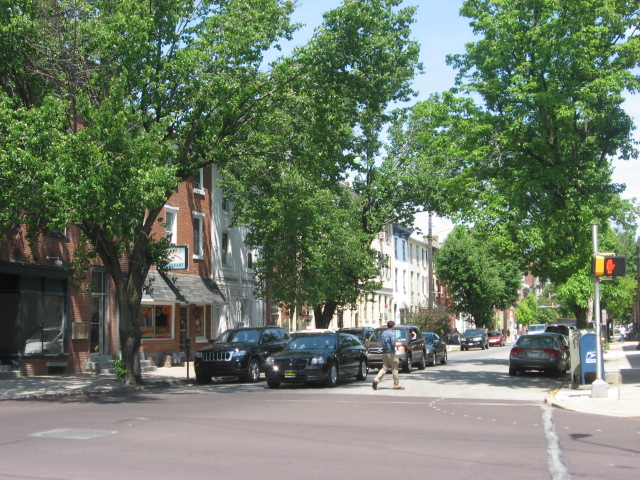
    Swede Street just north of Main Street, known by some as Lawyers’ Row. Photo from Spring 2011, courtesy of Matthew Edmond.

    The early chapters of the book may only provide a backdrop for Norristown’s 20th century rise and fall, but Tolle chronologically accounts for the factors that helped Norristown emerge as the primary urban center in Montgomery County. And unlike neighboring 19th century boomtowns that dot both the Delaware and Schuylkill Valleys, Norristown “lacked the characteristics that define similar towns of sufficient size and influence that could easily explain the downtown’s decline. . . [It] was never a one-company town. It was never dependent on [a] single employer whose corporate fate might have led it to a catastrophic domino effect; rather Norristown’s workforce has always been distributed among many workplaces.” It owed much of its steady growth to its fortuitous location 17 miles northwest of Philadelphia, the convergence of several modes of transportation, and its role as the administrative center of a large and increasingly prominent county.

    By the book’s twentieth page, Tolle reveals the real heart of his study: the bustling commercial core of Norristown’s six-block Main Street. At the borough’s Centennial Celebration, population approached 30,000, swelling largely from immigrants who arrived to work in various industries: first the northern European Protestants, then the Irish, then, in by far the highest concentration, the Italians, overwhelmingly from Sicily. Mennonites, Amish, and Jews (predominantly of German heritage) along with African Americans arrived in smaller numbers. While the population self-segregated along largely ethnic and economic lines (working and lower-middle class Protestants on the West End; the wealthy, Northern European original settlers in the North End and DeKalb Street; Italians and African Americans in the blue-collar East End), all the strata converged along Main Street’s densely commercialized blocks. Tolle explores the full week’s worth of celebratory activities, from the details of the floats in the Industrial Day parade to overhead weave of flags, bunting, and electrical wires. The pace of the narrative slows at this point, but Tolle employs a humanism that he retains across the ensuing pages. When he intermittently bogs down in relentless detail, he’s easily forgivable—even a little admirable for not shying away from his obsessions.


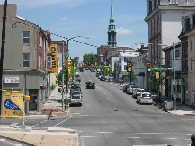
    A view of DeKalb Street, Norristown’s most affluent residential address, from its southern junction with Main Street. This was once the center of commercial activity in the borough. Tolle details the controversy of the implementation of the Comprehensive Plan to make DeKalb Street one-way northbound in 1951, a restriction which remains today. Photo from Spring 2011, courtesy of Matthew Edmond.

    The Directory of the Boroughs of Norristown and Bridgeport, Montgomery County, Pa, for the years 1860-1861 serves as the bedrock for his chronological exploration of the commercial health of downtown Norristown. For some of the most resilient businesses—Chatlin’s Department Store, Egolf’s Furniture, Zummo’s Hardware—Tolle offers vignettes on their immigrant backgrounds and the financial maneuvering necessary to start their trades. Interspersed with these brief accounts are updates from subsequent City Directories, chronicling the change in business composition over time. But Tolle generally eschews tables and charts—with few exceptions, he narrates the changing commercial landscape of Norristown by integrating the livelihoods of the proprietors with the demands of the consumers. Because the authorial voice depends so heavily on firsthand accounts of the business climate—articles from the Norristown Times Herald, advertisements (including misspellings and solecisms), and, in the later years, eyewitness accounts—the routine references to City Directory data never grow stuffy or monotonous.


    What Killed Downtown? is a concatenation of anecdotes. While such an indulgence in human-interest nostalgia could take a maudlin turn, Tolle again counterbalances these episodes with moments of acerbic subjectivity, as any conscientious anthropologist cannot help but do. My two favorite anecdotes feature a building and a person. The Valley Forge Hotel emerged in the roaring 1920s, purely driven by the local business community, who felt that the proud city demanded a first-class hotel. A stock subscription campaign raised enough to complete the massive six-story brick structure by November of 1925. Though it rarely made a profit, its size and relative opulence made it an icon for the city, and as an emblem of civic pride, it succeeded. The other great anecdote involves the detailed account of the life of the city’s most colorful politician, the recalcitrant Paul Santangelo. Lacking greater aspirations than borough administration, Santangelo earns more ink on these pages than any other civic leader, including the mayors. He fiercely defended the interests of the poorer Sicilian immigrants who comprised much of his district, voting ferociously in their favor but often—in Tolle’s opinion—at the expense of city progress as a whole.


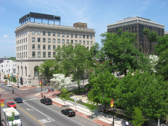
    Norristown Main Street, west of Swede Street and looking westward. Photo from Spring 2011, courtesy of Matthew Edmond.

    Tolle’s account of Norristown’s Main Street after its 1950 apex avoids mind-numbing predictability even has he identifies the usual culprits contributing to its decline: growing dependence on the automobile, competition from suburban shopping plazas like the now-mammoth King of Prussia, shift of the population center toward the far-southern part of Montgomery County, construction of limited access highways outside of the borough’s limits. And of course, all these factors converge with the suburban amenity that wounds Norristown the most: “free, ample parking”—a mantra which Tolle repeats enough that it tacitly answers the question to his book’s title. Anyone with a scintilla of knowledge of American urbanism will know where this is headed. But by the1950s, Tolle reaches a point in time where procures firsthand accounts of Main Street’s changes. The worm’s-eye view continues, imbuing the narrative of Norristown’s saddest days—by the 1970s it is not safe to walk Main Street at night—with empathy and hope.


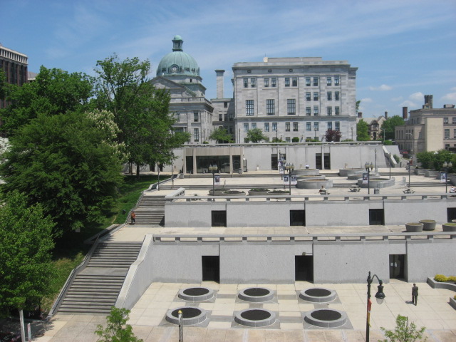
    Courthouse Plaza along Main Street, one of many mid-century projects that removed commercial buildings and replaced them with staid, largely unused civic space. Photo from Spring 2011, courtesy of Matthew Edmond.

    For a person as enamored by details as me, Tolle’s worm’s-eye view never really grows old, even when he’s a fussbudget over counts of shuttered storefronts from year to year. At the same time, this intricate approach to an already small subject could easily undermine the ability for What Killed Downtown? to find a broad audience. What happens to a little-known suburban city can hardly resonate as much as if he had explored the devolution of downtown Philadelphia—or even Allentown or Erie. The fixation on downtown storefronts—at the expense of geographic context—firmly ensconces the book in the “local interest” category. His 250-page narrative rarely explores impacts on Norristown Main Street outside of Montgomery County. From an early point in the book, he describes street intersections with specificity that would only mean anything to a local; then he only provides two referential maps.

    None of these cavils really amount to an inherent weakness of the book—after all, it might prove just the right medicine for Tolle’s fellow Norristowners. But the narrowness of scope does foretell an oversight as to the broader implications for this city’s decline, which could have made for a much bolder peroration than the one the book currently provides. The only atypical bogeyman contributing to downtown Norristown’s precipitous decline is the persistent political gridlock and resultant incompetence of the Borough Council, which he relates with the same humanist eye he applies to his wonderful vignettes of immigrant entrepreneurialism. But Tolle had the chance to make this story matter on a scale that could mean something to someone from Ashtabula or Waukegan, and he spurned the opportunity.

    My knowledge of Philadelphia, having lived there for a time, gives me an unfair advantage, but I can’t help but ask a few questions. Norristown, the seat of wealthy Montgomery County, declined and its main street is moribund to this day. But Media, the much smaller seat of neighboring Delaware County, boasts a flourishing main street of local shops and restaurants—all despite the fact that Delaware County, while equally urbanized, is much less affluent than Montgomery County. Meanwhile, cities like Chester (also in Delaware County) and Camden, New Jersey can claim a similar lifespan to Norristown, strong transportation access, and an industrial boom. But today these two cities are not only among the most devastated municipalities in their respective states, Chester and Camden are among the poorest cities in the country. Perhaps most interestingly, after several decades of population decline, Norristown began to trend upward again in the 2000 census, and by the 2010 Census the city grew virtually 10%–an unprecedented occurrence for a city that still has the reputation of being the poorest place in its respective county.

    What Killed Downtown? remains a welcome contrast to countless other chronicles of downtown decline whose narratives depend on sociological detachment. Recognizing that true objectivity is impossible, Tolle instead depicts the Norristown transformation from the perspective of people who experienced it. Because its vision is geographically precise and obscure to people outside southeast Pennsylvania, I suspect our author felt driven to write it even if it enjoyed a readership of zero. Such an endeavor could reek of self-indulgence, but Michael Tolle’s opus has way too much empathy for that. Hopefully Norristown’s coterie of model train owners and newspaper collectors will put this book on their to-do lists—and then recommend it to others.

    Eric McAfee is a licensed urban planner currently working in emergency management. Though he hails from Indianapolis, his professional field grants him a certain degree of itinerancy, which he uses to his advantage to write about and photograph landscapes across the country in his blog, American Dirt. He lived and worked as a military planner in northern Afghanistan from 2010 to 2012, letting him fudge on the “American” aspect of his blog a little bit. In the past, Eric’s writing has won him Outstanding Paper in Real Estate at the University of Pennsylvania, as well as an outstanding research on housing award from the Joint Center for Housing Studies at Harvard University.  Aside from American Dirt, he has featured his writing on Urban Indy.com, Streetsblog.net, and Urbanophile.com. 

  • Urban Housing: A Master Plan for the Few

    How we, as a nation, find bounty and beauty in the future depends upon how we react to two trends emerging from the recent difficult period in American urbanism. The first of these trends is the increasing lack of affordability in mainstream urban America, with the costs of maintaining a middle-class lifestyle at a level where distinct have/have-not lines are now drawn. The second is the increasing authoritarianism in mainstream urban America, where decisions about how our cities function are guided by a new array of authority figures that represent the common good. Both trends point to a disempowerment of a vast section of the American population.

    Our loss of housing affordability is an insidious development that will continue to eat away at the urban triumphalism that marked the beginning of this century. Generation Xers, seniors on fixed incomes and the struggling middle class will have much in common during the coming decade, with fewer and fewer housing solutions designed for them. If half of our consumer goods are purchased by the top ten percent, then the rest of us are increasingly irrelevant in terms of goods, and services, as well as in housing,

    Affordability on Main Street was once a concern of Wall Street. It was broadly known as Fordism, from the days when Henry Ford paid decent wages so that his workers could afford his new product, the car. Today, with Main Street on its knees, Fordism is dead and Wall Street turns more and more to itself, and to large, multinational conglomerates for profits. Volume generated by the middle class comes from a few companies like Apple, and, as the class shrinks, psychological distance between the haves and have-nots widens the gap, especially for those with memories of the material wealth they had in earlier days.

    Solutions to the affordability gap in the urban realm are conspicuous by their absence. Desirable addresses, decent houses, and access to amenities are now the province of relatively few, who are serviced by those on the outside, commuting into town from less hip and trendy places. New residential housing, driven by the Wall Street investment community, is geared towards the market-rate. The linkage between mass transit and affordable housing has been deftly snipped apart by the investment community, where the topic of affordable housing generates a yawn.

    Solutions? We might do well to investigate anti-urban trends, where peripheral and rural communities are stable and growing, and look at how these communities cope. Housing solutions like prefabricated units (think trailer parks, America’s answer to the favela) might be studied.

    Non-affordability, as a trend, is strongly linked to a co-evolutionary partner that is driving a wedge between the haves and have-nots: an authority figure which has become a new interlocutor in of the urban conversation, a sort of urban do-gooder to save us from ourselves, pushing more requirements and accepting fewer improvisations. Affordable housing has less to do with the square footage that is in that space, and more to do with the ingredients found within the square footage.

    The gloved hand of quasi-government authority has come to rest upon our cities with an increasingly tight grip, in the name of the green lobby or in the name of the traditional town.

    Cities underwent rapid change in the fifties and sixties due to the car, and subsequently parking garages, commercial strips, suburbs and highway overpasses sprouted. All these developments facilitated growth and expansion. Americans were remarkably unsentimental about their historic urban fabric, and notably experimental about innovative technological solutions to remove obstacles to this growth.

    Today, our confidence is shaken. The rise of authorities to dictate urban form signals that the era of innovation and improvisation is over, and that American cities are entering a new era of more rigid control of what gets built. The authority, in the form of a Master Plan, treats the city as if it were a vast, private land holding, and its citizens as if they were animals in a forest that was about to be developed.

    Master Plans have already been passed in Denver, Philadelphia, and Miami, and are on the boards for other cities in 2013. When a developer Master-Plans his land, he relies upon a Master to create the vision for the land, and this Master – credentialed, experienced, and hopefully talented – sets out the form of the future construction. The Master may have a passing interest in the voices from the land itself – biologists who count endangered species, for example – but the overarching form comes out of his mind, and the developer then implements the plan.

    When the same process is used upon a living, dynamic city, the results vary. Future citizens, bound by the edicts of this Master Plan, may submit to the Master’s vision, or, they may chafe at its restrictions. These Master Plans are formulated with great citizen input and collaboration until the time at which they are set. After that, they are to be obeyed. The plans create a physical model, or form; they are like a glove into which the city must fit its future hand.

    Master Plans attempt to take all possibilities into account, while creating ‘perfect’ rules by which the city can grow. Physical order, it is hoped, will lead to social order, as buildings once again behave like they did before the car. Should the future evolve as the Master predicts, the glove will fit the grown-up hand However, the future is notoriously difficult to predict.

    The new regulatory regime has become fashionable as citizens, sickened by the dirt and ugliness of our cities, seek an authority to keep us from temptation. As such, Master Plans arise from a noble intent not unlike the one held by city planners at the turn of the 20th century: to improve urban hygiene. And they may be correct in thinking that emulating urban form as it was before the car might just bring walkability back into fashion once again.

    The future, however, is ephemeral and dynamic, not static like a Master Plan, and may become frustrating to the Master Planners who have created elaborate blueprints for our nation’s cities. America’s fluid economic situation is giving rise to in-home workplaces, negating the need for traditional office space. It is giving rise to in-home manufacturing, reducing the size and complexity of factories. Warehouses, in today’s era of just-in-time-delivery, are being converted into other uses. And finally, Master Plans all seem to reminisce about Main Streets with lovely, tree-lined rows of shops under apartment (parking would be safely tucked in the back). These shops, renting for top dollar, stand empty today, made even more remote from reality with the advent of online retail.

    In short, Master Plans that rigidly enforce an urban form of yesteryear may become next year’s white elephants. Cities bearing these master plans may find themselves with a regulatory burden that is reducing their desirability as places to live and work. Following these cities specifically, learning of their successes and failures, and analyzing how Master Plans are working will tell us a lot about the future.

    As affordability is reduced and regulation increases, American cities could soon evolve into forms that are quite different from those of our past. And as confidence in the future fades, our cities take increasing comfort in the past, fossilizing our urban form as the Romans once did. For those underneath the affordability curve, improvisation and innovation will still continue, and insight into both of these emerging trends will yield a new sense of direction for the places where we live and work.

    Richard Reep is an architect and artist who lives in Winter Park, Florida. His practice has centered around hospitality-driven mixed use, and he has contributed in various capacities to urban mixed-use projects, both nationally and internationally, for the last 25 years.

    Flickr photo by alesh houdek: A walled and gated Miami home.

  • What Stifles Good Housing Development?

    We can’t afford outmoded attitudes in housing development anymore – not as businesses, not as citizens, and certainly not as development professionals. As development consultants, we’re often asked to provide detailed input on project design and the marketing of developments throughout the United States and Canada. We usually work with a local team of engineering consultants that provides construction drawings and serves as an intermediary for the project with local governments. We have concluded that the choice of selecting the engineering consultant is one of the pivotal issues for the success of a development. The developer has to be the one to hold the engineers accountable. Otherwise, all design will continue to be done to minimum standards instead of excellence.

    Problems with the consulting engineer generally fall into two broad groups: complacency and undisclosed conflicts of interest. To illustrate, we’ll look at two recent examples from projects owned by clients of Rick Harrison Site Design Studio.

    The first involves a small proposed neighborhood in Texas. The initial design was drafted before either the site boundaries or floodplain were accurately surveyed, and yielded a total of 35 lots of 0.6 acres or more. Rick prepared an initial revision of the original design, resulting in a more aesthetically pleasing and efficient neighborhood, while maintaining the 0.6 acre minimum lot size. Accurate boundary lines, contours and floodplain were eventually furnished to create a precision plat for submittal. The developer requested that Rick update the revised design, and indicated that he was willing to sacrifice one of the lots in order to allow a more spacious entrance.

    While preparing the precision plat Rick realized that he didn’t know why the lots were at least 0.6 acres instead of the more common 0.5 acres on lots without city sewer. In two rounds of questioning, the consulting engineer indicated that the minimum lot size was 0.6 acres, or 26,000 ft². The area of 6/10th of an acre is actually 26,136 ft², so Rick questioned the engineer again. This time, the engineer explained that the minimum lot size was actually 0.5 acres, but his firm had developed a “rule of thumb” that 26,000 ft² was the 0.5 acre lot net of easement areas. However, in the specific case of this development the only easement required was a 12’-wide utility easement along the front lot line. The extra 0.1 acres per lot was a “fudge factor,” developed over time to compensate for the well-known difficulty in computing precise lot sizing using existing CAD software.

    The “land surface based” technology Rick used to create the revised design requires no additional time to obtain precision areas, so he was able to easily design each lot to meet the actual 21,780 ft² (half acre) minimum exclusive of the 12’ easement. The new design eliminated the fudge factor, and yielded 37 lots, including the more open entrance area (three more than expected). Furthermore, reductions were made to the length of street..

    “Fudge factors” are rules of thumb intended to make the engineer’s work easier, and to provide enough margin in the plans to account for omissions or miscalculations. The problem with fudge factors is that they adversely impact the profitability of their clients’ projects. The chart below demonstrates the differences:


    Initial Plan

    Revised Plan

    Difference

    Lot size

    0.6 acres (minimum)

    0.5 acres

    At least 4,356 ft.² per lot

    Number of lots

    34

    37

    3

    Lot value

    $75,000

    $75,000


    Gross sales

    $2,550,000

    $2,775,000

    $225,000

    Pavement area

    89,479 ft²

    81,509 ft²

    7,970 ft²

    Estimated cost

    $447,400

    $407,550

    $39,850

    Eliminating an imprecise fudge factor would yield a $225,000 increase in gross sales. Since the only increase in costs were per lot consulting fees, almost all of the gross revenue would drop straight to the bottom line. In addition, the community would benefit from a more attractive neighborhood with substantially less street pavement maintained in perpetuity, and a higher property tax base. If the developer was unwilling to sacrifice profits, the cost of each lot would have had to increase by $6,600 to the consumer.

    The second example concerns another proposed residential development, this one in North Dakota, in a city prone to severe flooding. As most people know, paved areas do not absorb rainfall, so it would seem logical that the more pavement area in a new development here, the bigger the potential for runoff, which leads to more flooding. In addition, the wider the streets, the more surface area the city has to snowplow and maintain. All these issues – the snowplowing, the road maintenance and the increased water runoff – are burdens to current and future taxpayers, with no discernible benefits to offset the burden. So imagine Rick’s surprise when the consulting engineer refused to even submit a plan for 50-foot-wide rights-of-way with 28-foot-wide street sections, instead of the 66-foot-wide rights-of-way with 37-foot-wide street sections, as specified by existing city regulations.

    To understand the issue, look at the origin of the standard street width requirement. Centuries ago, roads were unpaved, and were built with wide ditches to handle drainage alongside them. The 66 foot length reflected a land surveyor’s chain, developed in the year 1620 by a British clergyman interested in developing a system that would use easily available tools to survey land in the British countryside. His system caught on, and was brought to the New World by British immigrants and used for hundreds of years. Perhaps as recently as 100 years ago it made sense to use a single surveyors’ chain as the width of community streets, and so many towns did so. Today, most cities have eliminated drainage ditches in modern subdivisions, replacing them with storm sewers and more efficient design. These changes have allowed narrower street and pavement widths, with positive cost and environmental impacts.

    So — the minimum street right-of-way in this modern North Dakota city is the result of a decision to make roads 66 feet wide, due to the fact that 400 years ago an English clergyman connected a hundred links that were 6 1/2 inch long to make a convenient, 66 foot long “chain”. To our knowledge, there is no other reason.

    Given that surrounding cities have adopted modern standards, and that the logic behind narrower streets is solid, Rick could have presented a compelling case. But the engineer refused to even make the proposal. Why not propose a common sense solution? Complacency? Perhaps. The desire to comply with every regulation to avoid conflict? More likely. Are the engineers fees based upon the percentage of construction cost, with wider streets guaranteeing higher fees? Also likely.

    Unsustainable? Absolutely.

    In the first example, outmoded rules of thumb related to inadequate CAD technology would have cost Rick’s client at least $250,000, and would have burdened the local county government with a significantly diminished potential property tax base. In the second example, the engineer’s lack of concern for the long-term benefit of his client (with whom he has a contractual or fiduciary relationship), and to the public (to whom he has a professional responsibility), has burdened the community with exaggerated flooding problems and approximately 33% more pavement to be snow plowed and maintained for as long as the community exists.

    We can’t keep fudging to hide poor practices. If we are ever to achieve a more sustainable world and create better communities and housing products, we simply cannot accept mediocre design, technology and attitude.

    Rick Harrison is President of Rick Harrison Site Design Studio and Neighborhood Innovations, LLC. He is author of Prefurbia: Reinventing The Suburbs From Disdainable To Sustainable and creator of Performance Planning System. His websites are rhsdplanning.com and pps-vr.com. Skip Preble, MAI, CCIM is a real estate analyst and land development consultant specializing in market analysis, feasibility studies, project value optimization and market value opinions. He can be reached through his website, landanlytics.com.

    Flickr Photo by Billy Hunt: “This is from my photo essay observing the course of development in Charlottesville, Virginia“.

  • Prairie Populism Goes Bust As Obama’s Democrats Lose The Empty Quarter

    Along Phillips Avenue, the main street of Sioux Falls, South Dakota, the local theater’s marquee is a tribute to the late Senator and 1972 presidential candidate George McGovern, who was buried last month, and is still regarded as a hero by many here. But with McGovern gone, it seems that the Democratic tradition of decent populism he epitomized was being interred along with him.

    In his landmark 1981 book, The Nine Nations of North America, Joel Garreau deemed the vast region stretching from the southern Plains well past the Canadian border The Empty Quarter. Along with the western strip of the neighboring Bread Basket that stretches up from central Texas through the Dakotas, the Quarter—covering much of the nation’s land and home to many of its vital natural resources—is in open revolt against the Democratic Party, threatening the last remnants of prairie populism.

    Although long conservative and GOP leaning, the Empty Quarter—containing Nevada, Utah, Wyoming, Idaho, Montana, and most of Alaska, along with inland California and Washington and parts of Colorado, New Mexico, and Oregon—has a proud progressive tradition as well. Over the past half-century, many of the Democratic Party’s most respected leaders —McGovern, Senator Majority Leaders Mike Mansfield of Montana and Tom Daschle of South Dakota, and powerful figures like North Dakota’s Byron Dorgan and Kent Conrad—have represented the Plains.

    The tradition is still revered there, but today’s Democrats are becoming an endangered species    as the party has become ever more distinctly urban, culturally secular and minority dominated.

    While Obama lost most of the Quarter in 2008, this year polls show that he’s likely to be crushed there, despite the booming economy in many of the states. Obama’s popularity has dropped more in North Dakota, which has the nation’s lowest unemployment rate, than any other state.

    Amidst the growing anti-Obama tide, progressive Democrats in most of the Quarter have been increasingly marginalized, both by their own party and by voters.  In the past two years, Republicans picked up a Senate and House seat in North Dakota, and look likely to pick up another this year,  along with a Senate seat in Nebraska,  and quite possibly another in Montana.  They are also poised to claim the only remaining Democratic House seat in Utah, if Mia Love’s lead over Rep. Jim Matheson holds up.

    By the end of this election, it’s possible that only two classic Prairie Democrats—South Dakota’s Tim Johnson and Montana’s Max Baucus—will remain in the Senate, where they once formed a powerful caucus. The Plains states, plus Alaska, account for 50 Congressional seats and an equal number of electoral votes—more than Florida, North Carolina and New Hampshire combined.

    Why has this occurred? One problem, notes former Daschle top economic aide Paul Batcheller, lies with the “nationalization” of the Democratic Party—and its transformation from an alliance of geographic diverse regions to a compendium of narrow special-interest groups, so that under Obama, the Democratic Party has essentially become the expression of urban-dwellers, greens and minorities, along with public employees.

    This, says Batcheller, has “made it easier for Republicans to paint Democrats as in cahoots with the likes of Ted Kennedy, Nancy Pelosi, etcetera.  And because politics has always been fairly civil here, having those coastal boogeymen to use has made it easier to paint Prairie Dems as having gotten Potomac Fever.”

    He also points to “changes in the media”—especially cable TV—that have made it more difficult for grassroots Democrats to make their case for their own interests, outside of the increasingly polarized national debate.  At the same time, Obama’s policies—focused largely on constituents in dense coastal cities—have widened the gap between the Plains and the Democrats.  It is increasingly difficult to be a successful Prairie progressive when that means striking out consistently against the very industries, from large-scale agriculture to fossil fuels, at the center of these economies.

    At the same time, the failings of Democratic big states, most notably California and Illinois, are not exactly advertisements for the virtues of modern progressivism. Particularly galling, notes Mike Huether, the mayor of Sioux Falls, have been the huge deficits and expanded welfare spending associated with the Obama Administration.

    “This is a fiscally conservative place, we don’t like deficits,” notes Huether, a lifelong Democrat whose city of 156,000 operates with a fiscal surplus. “People here want self-sufficiency. They are happy to give a hand up but they see that as short term and that’s it.”

    And the region’s self-sufficiency is an increasingly important part of our national debate, especially about energy independence. Although often dismissed as a land of rubes and low-end jobs, a study of the Plains  I conducted with the Praxis Strategy Group and Texas Tech University found that, overall, it has outperformed the rest of the country in virtually every critical economic measurement from job creation and wage growth to expansion of GDP.

    The area has also thrived demographically, with population growth well above the national average. Most of this has taken place in the region’s flourishing urban centers, from Ft. Worth and Midland, Texas to Sioux Falls, Bismarck, Fargo, Oklahoma City and Omaha. This growth includes migration from still de-populating smaller towns in the region, but increasingly includes migrants from the coastal areas as well as immigrants.

    More people now arrive in Oklahoma City from Los Angeles than the other way around.   And these arrivals are hardly poor Okies pushed back unwillingly; the Plains cities have become magnets for educated people. Over the past decade, the number of people with BAs in Sioux Falls has grown by almost 60 percent; Bismarck and Fargo saw growth of over 50 percent, while Oklahoma City, Omaha and Lubbock enjoyed forty percent increases. In contrast, the educated population of San Francisco grew at 20 percent and that of New York by 24 percent.

    Any coastal denizen who spends time in these cities may be surprised by the tolerance and lack of bible-thumping one encounters there. Social issues, notes Mayor Huether, have never been drivers in the Plains as they have been in parts of the Deep South. A quiet Nordic spirituality prevails here, rather than evangelical enthusiasm; people and politicians generally do not wear their faith on their sleeves. The real issue in the Plains centers around the future of the economy, and how best to bolster family and community; the Obama program, with its interest-group agendas, simply does not translate well in this environment.

    Ultimately, the red tide sweeping over the Plains is bad news, not simply for Democrats but for the country, part of the trend noted by Batcheller in which moderating regional forces within both parties—New England Republicans and Blue Dog Democrats—are losing ground.

    Prairie Democrats are crucial for ensuring that producers tangible staples—food, fiber and energy—have a space within their party’s tent, along with the big-city coastal consumers of those resources. Never mind the conservative cliché: If Democrats lose their remaining hold on the Plains, the nation’s parties will truly be split between makers and takers.

    This region is likely to become more important over the coming decades, providing much of the food needed for world markets as well as significant share of our new domestic energy. Its manufacturing, technology and service industries are also growing rapidly, integrating the area more into the national and global economies.

    Batcheller, among others, believe that the Plains Democrats may not become extinct, but their future will be limited in the increasingly polarized, and nationalized, political order. On the local level, particularly on key infrastructure projects like Lewis and Clark water project  that is being built to meet the needs of Sioux Falls and its environs, Republicans and Democrats are largely in agreement. Neither tea-party extremists nor greens can block progress towards widely accepted local infrastructure goals.

    One can only hope that the Prairie Democrats manage to survive. They have  contributed a unique brand of civically minded, decent social democracy that added much to the national debate. Egalitarian in intent, their brand of aspirational liberalism, fully content and compatible with notions of individual achievement and hard work, offers an alternative to the “know nothing” extremism increasingly dominant in both parties. This tradition of progressive decency could be sorely missed in the years ahead.

    Joel Kotkin is executive editor of NewGeography.com and is a distinguished presidential fellow in urban futures at Chapman University, and contributing editor to the City Journal in New York. He is author of The City: A Global History. His newest book is The Next Hundred Million: America in 2050, released in February, 2010.

    This piece originally appeared at The Daily Beast.

    Sioux Falls photo by Jon Platek..

  • Local Government in Ohio: More Accessible and More Efficient

    There is general agreement that smaller units of government are more responsive and accountable to their electorates. However, proponents of larger governments often claim that this advantage also creates   higher spending and tax levels. On this basis, bigger-is-better proponents often suggest consolidating local governments to save money. Such calls have increased in recent years, with the unprecedented fiscal difficulties faced by governments from the federal to local level. However, more often than not, nothing more underlies consolidation proposals more than an interest in reducing the number (count) of local governments. It is largely taken as an article of faith that larger governments save money relative to smaller governments.

    Ohio has had more than its share of local government consolidation proposals. The Ohio Township Association asked us to review local government financial performance in the state. We were able to confirm that Ohio’s smaller governments are, on the whole, more responsive and accountable. However, the analysis clearly showed that smaller local governments have materially better financial performance.

    We analyzed per capita financial measures for all reporting local general purpose governments in the state, using Auditor of State data (Note). Ohio has three types of general purpose governments. Cities are incorporated municipalities with 5,000 or more population in the last federal census. Villages are incorporated municipalities with less than 5,000 population. The balance of the state is made of townships, which have virtually the same powers as municipalities.

    The Efficiency of Smaller Local Government

    The data indicates that smaller units of local government have median spending per capita that is less than larger local governments. Local governments with more than 10,000 population spent an average of at least twice that of smaller governments. The lowest per capita spending was in local governments with between 1,000 and 4,999 population (Figure 1).

    The smaller government advantage extended to debt. The median debt service per capita for local governments with fewer than 5,000 population was zero, while the median debt service per capita for local governments with 10,000 to 25,000 population was under $10 annually (Figure 2).

    The incidence of debt was also less among smaller local governments. Fewer than one-half of the local governments under 5,000 population had any debt. In contrast, all of the local governments with 50,000 or more population had debt (Figure 3).

    Smaller Governments Excel in Metropolitan Areas

    It might be thought that this smaller-is-better relationship stems from the more rural setting of some smaller local governments. However, an analysis of local government spending and debt per capita within metropolitan areas indicates the same conclusion:  smaller governments spend less and borrow less per capita (Figure 4).

    Townships: Even Less Costly

    Townships have been a particular target of "bigger-is-better" consolidation proposals, perhaps because of their smaller average population. Yet, despite their much larger average service areas (in square miles), townships represent a far smaller share of local government spending than their population share. Townships account for 11 percent of local general purpose government spending (excluding counties), yet have 35 percent of the state’s population.

    Townships have lower current expenditures per capita than villages and cities in all but one population category. In metropolitan areas, townships spend less per capita in all population categories (Figure 5). In addition, townships have lower per capita debt service payments than cities and villages
    The lower per capita spending of townships is attributable, at least in part, to lower administrative costs and lower labor costs per capita. Further, as with smaller municipalities, taxpayers often do not often demand the same level of service that is provided in the larger cities.

    Small Government: Less Likely to Enter Fiscal Distress

    Smaller local governments have experienced financial distress less. After the city of Cleveland bankruptcy in the 1970s, the state established the Local Government Fiscal Distress, which identifies local governments in serious distress and aids them in returning to normal fiscal health. The smallest cities and villages entered the Fiscal Distress program at a rate less than one-half that of the largest governments. The townships did even better. Only two of the state’s more than 1,300 townships were placed in the Local Government Distress Program (Figure 6).

    Why Larger Local Governments are Less Efficient

    One of the reasons that larger governments spend and borrow more is that they are less accessible to taxpayers and more accessible to interests which benefit from higher spending. This can lead to a vicious cycle that drives taxes so high that governments borrow more, followed by proposals to consolidate when the borrowing capacity becomes more constrained. Further, the very size of some larger governments can make them "too big to fail," like large financial institutions in the Great Financial Crisis. This can lead to "bailouts" by state taxpayers. Ohio’s Local Government Distress Program is an attempt to avoid these difficulties, by providing technical assistance and guidance.

    Smaller governments that consolidate face two critical challenges likely to increase costs. The first is that labor costs tend to be "leveled up" to the compensation levels in the higher cost jurisdiction. The other problem is that services and service levels also tend to be "leveled up."

    Proponents of consolidation sometimes assume that a large number of governments results in duplication of services. However, each of the local governments have exclusive service areas. For example, garbage is not collected by multiple jurisdictions to the same addresses. Smaller jurisdictions also tend to employ more part time staff, and even volunteers, especially in fire departments. Another advantage of smaller governments is that their elected officials are able to more directly manage the business of a smaller jurisdiction, because they do not have to rely more on intermediate staff.

    The performance of Ohio’s smaller governments shows that there is no need to choose between accessible government and efficient government. Ohio’s smaller local governments deliver both.

    Wendell Cox is a Visiting Professor, Conservatoire National des Arts et Metiers, Paris and the author of “War on the Dream: How Anti-Sprawl Policy Threatens the Quality of Life.”

    —–

    Note: These do not include counties, school districts or special districts.

    Illustration: Great Seal of the State of Ohio (from http://www.netstate.com/states/symb/seals/images/seal_ohio2.jpg)

  • The Rise of the Great Plains: Regional Opportunity in the 21st Century

    This is the introduction to a new report on the future of the American Great Plains released today by Texas Tech University (TTU). The report was authored by Joel Kotkin; Delore Zimmerman, Mark Schill, and Matthew Leiphon of Praxis Strategy Group; and Kevin Mulligan of TTU. Visit TTU’s page to download the full report, read the online version, or to check out the interactive online atlas of the region containing economic, demographic, and geographic data.

    For much of the past century, the vast expanse known as the Great Plains has been largely written off as a bit player on the American stage. As the nation has urbanized, and turned increasingly into a service and technology-based economy, the semi-arid area between the Mississippi Valley and the Rockies has been described as little more than a mistaken misadventure best left undone.

    Much of the media portray the Great Plains as a desiccated, lost world of emptying towns, meth labs, and Native Americans about to reclaim a place best left to the forces of nature. “Much of North Dakota has a ghostly feel to it," wrote Tim Egan in the New York Times in 2006. This picture of the region has been a consistent theme in media coverage for much of the past few decades.

    In a call for a reversal of national policy that had for two centuries promoted growth, two New Jersey academics, Frank J. Popper and Deborah Popper, proposed that Washington accelerate the depopulation of the Plains and create “the ultimate national park.” They suggested the government return the land and communities to a “buffalo commons,” claiming that development of The Plains constitutes, “the largest, longest-running agricultural and environmental miscalculation in American history.” They predicted the region will “become almost totally depopulated.”

    Our research shows that the Great Plains, far from dying, is in the midst of a historic recovery. While the area we have studied encompasses portions of thirteen states, our focus here is on ten core locations: North Dakota, South Dakota, Nebraska, Kansas, Oklahoma, Texas, New Mexico, Colorado, Wyoming, and Montana.

    Rather than decline, over the past decade the area has surpassed the national norms in everything from population increase to income and job growth. After generations of net out-migration, the entire region now enjoys a net in-migration from other states, as well as increased immigration from around the world. Remarkably, for an area long suffering from aging, the bulk of this new migration consists largely of younger families and their offspring.

    No less striking has been a rapid improvement in the region’s economy. Paced by strong growth in agriculture, manufacturing and energy — as well as a growing tech sector — the Great Plains now boasts the lowest unemployment rate of any region. North Dakota, South Dakota and Nebraska are the only states with a jobless rate of around 4 percent; Kansas, Montana, Oklahoma and Texas all have unemployment rates below the national average.

    A map of areas with the most rapid job growth over the past decade and through the Great Recession would show a swath of prosperity extending across the high plains of Texas to the Canada/North Dakota border. Rises in wage income during the past ten years follow a similar pattern. The Plains now boasts some of the healthiest economies in terms of job growth and unemployment on the North American continent.

    Of course, this tide of prosperity has not lifted all boats. Large areas have been left behind — rural small towns, deserted mining settlements, Native American reservations — and continue to suffer widespread poverty, low wages and, in many cases, demographic decline.

    In addition, the region faces formidable environmental and infrastructural challenges. Most prominent is the continuing issue of adequate water supplies, particularly in the southern plains. The large-scale increase in both farming and fossil fuel production, particularly the use of hydraulic fracking, could, if not approached carefully, exacerbate this situation in the not so distant future.

    Inadequate infrastructure, particularly air connections, still leaves much of the area distressingly cut off from the larger urban economy. The area’s industrial economy and rich resources are subject to a lack of sufficient road, rail and port connections to markets around the world. Yet despite these challenges, we believe that three critical factors will propel the region’s future.

    First, with its vast resources, the Great Plains is in an excellent position to take advantage of worldwide increases in demand for food, fiber and fuel. This growth is driven primarily by markets overseas, particularly in the developing countries of east and south Asia, and Latin America.

    As these countries have added hundreds of millions of middle class consumers, the price and value of commodities has continued to rise and seem likely to remain strong, with some short-term market corrections, over time.

    Second, the rapid evolution and adoption of new technologies has enhanced the development of resources, notably oil and gas previously considered impractical to tap. At the same time, the internet and advanced communications have reduced many of the traditional barriers — economic, cultural and social — that have cut off rural regions from the rest of country and the world.

    Third, and perhaps most important, are demographic changes. The late Soichiro Honda once noted that “more important than gold or diamonds are people.” The reversal of outmigration in the region suggests that it is once again becoming attractive to people with ambition and talent. This is particularly true of the region’s leading cities — Omaha, Oklahoma City, Tulsa, Kansas City, Sioux Falls, Greeley, Wichita, Lubbock, and Dallas-Fort Worth — many of which now enjoy positive net migration not only from their own hinterlands, but from leading metropolitan areas such as Los Angeles, the San Francisco Bay Area, New York and Chicago. Of the 40 metropolitan areas in the region, 32 show positive average net domestic migration since 2008.

    Together these factors — resources, information technology and changing demographics — augur well for the future of the Great Plains. Once forlorn and seemingly soon-to-be abandoned, the Great Plains enters the 21st century with a prairie wind at its back.

    Visit TTU’s page to download the full report, read the online version, or to check out the interactive online atlas of the region containing economic, demographic, and geographic data.

    Praxis Strategy Group is an economic research, analysis, and strategic planning firm. Joel Kotkin is executive editor of NewGeography.com and author of The Next Hundred Million: America in 2050. Kevin Mulligan is Associate Professor of Geography at Texas Tech University and Director of TTU’s Center for Geospatial Technology.

  • Florida: When Your Best (Place) Just Ain’t Good Enough

    Real estate broker Coldwell Banker handles corporate relocations for a large portion of our middle class. It recently released a survey of Suburbanite Best Places to Live. While it’s easy to dismiss as a sales tool for their realtors, the survey provides a fascinating glimpse of middle class, suburban preferences, influenced by our current economy. Coldwell Banker’s top honors go to Cherry Hills Village, Colorado, a suburb of Denver. Suburbs of Seattle, New York City, Washington, DC, and other prominent cities feature strongly on Coldwell Banker’s list, which highlights places that are sprinkled evenly throughout the United States. Notably missing are any communities in Florida.

    For a state with sunshine, beaches, and low taxes, Florida just doesn’t have the chops to get even one community onto the top 100 list.

    Weather, evidently, has little to do with our middle class’s desirable locations. Frigid Whitefish Bay, just south of Milwaukee, captured spot #100. Situated along the shore of Lake Michigan, this suburb of 14,000 doesn’t exactly have the kind of weather that makes people flock to the beach. Instead, it offers residents a strong sense of community, heritage, and a culture that values education and family. If you move here, you’ll find yourself within a suburban community with a high homeownership ratio, an educated population, and a quality of life that includes short commutes, low crime rates, close conveniences, and a tendency to eat at home.

    Suburban living has maintained a strong appeal for middle-class Americans due to the popularity of many of the factors on which Coldwell Banker based its rankings. While socialites prefer more urban, dense lifestyles (which is another list that Banker recently produced), suburbanites prefer backyards and quieter neighborhoods away from the hustle and bustle of the city; they don’t need to be near the action. Florida has all these things in abundance, except when compared to… almost everywhere else.

    Windermere, Florida’s top ranked suburb, came closest, ranking just below Whitefish Bay and a couple of others. Like most suburbs on the list, Windermere is on the periphery of a large metropolitan area (Orlando), and contains conveniences, good schools, parks, and recreation facilities.

    For much of its history, Florida represented the suburban American dream. The net benefits included an affordable cost of living and upward mobility, and Florida’s growth has consisted almost entirely of suburban densities. No one can accuse Florida developers of building communities that people didn’t want – the product was carefully researched to fit the market.

    In the late period of the boom, urban options were also developed, in the belief that a new demand for socialite “downtown” style living would emerge. Townhomes and condominiums rose in Florida’s primary and secondary urban markets. Even tertiary cities like Sanford, a historic agricultural town north of Orlando, begot a six-story condo. Those who migrated from Chicago and the dense Northeast now had a diverse set of choices, from rural to urban, with something to please everybody.

    It is perhaps this dilution of the market that has made Florida’s star fade a bit in relation to the national constellation of suburbs. If East Grand Rapids, Michigan (Coldwell Banker’s #8) can outrank the hundreds of suburbs around Tampa, Miami, Jacksonville, Tallahassee, and Orlando, there’s something else going on besides beauty.

    One thing that many of the top 100 have in common is a strong public education system. Florida, which has refused to invest in education, may now be harvesting the bitter fruit of this stubborn negligence. The state’s primary growth today continues to be in retirees who are uninterested in supporting education, and who control a large part of the state’s political power.

    Another aspect that the top 100 suburbs offer is safety. “Safety is a priority,” states the opening page of this survey, but it simply isn’t something that most people associate with the Sunshine State. A state that doesn’t offer a strong sense of personal safety isn’t going to rank highly, no matter what else is being offered. With two out of the ten most dangerous cities in the country, Florida seems more like the wild West than a suburbanite’s dream come true.

    Increasing public safety and public education are two efforts that government can do best, most people agree. Florida has spiraled downward on both fronts. The state’s leadership, by cutting taxes during the worst part of the recession, haven’t exactly helped the situation. With Florida’s new home sales up, the state’s economists are whistling a happy tune, convinced that the worst is over. But what Coldwell Banker is telling Florida is a different, darker story.

    Florida’s best offerings are attracting a population less interested in the core values stated in the Coldwell Banker survey – safety, good education, a sense of community – and so we continue to get more of the same. More population that reinforces Florida’s lack of investment in community, more population reluctant to put money into education, and more population that is quick to move somewhere else at the earliest opportunity seem to be Florida’s fate. This represents a lost opportunity to those who wish to see Florida make gains in these spheres – education, community, and safety. And it represents a lost opportunity to match up a truly beautiful place with truly involved people.

    Corporations seeking to relocate and recruit good people pay attention to these surveys. Florida’s low taxes may lure a few more down south, but if corporations need to attract and retain top talent, this survey points to where they are likely to go, regardless of the incentives our state has to offer.

    Places like Whitefish Bay, Wisconsin; Rossmoor, California; and Haworth, New Jersey will continue to gain in the type of population that share these same values. The middle class, fighting its way back from a threatened extinction, isn’t likely to take a chance on a place that has a rapidly degrading quality of life. Until Florida’s culture starts caring about the quality of its community, safety, and education, our state will continue to grow without flourishing as a place where people desire to be.

    Richard Reep is an architect and artist who lives in Winter Park, Florida. His practice has centered around hospitality-driven mixed use, and he has contributed in various capacities to urban mixed-use projects, both nationally and internationally, for the last 25 years.

    Bigstock photo: Florida Housing

  • The Rise of Telework and What it Means

    Teleworking (also known as telecommuting) has taken flight as a global trend. During July of 2002, European Union collectively decided on a shared framework agreement on telework, which regulates issues such as employment and working conditions, health and safety, training, and the collective rights of teleworkers. Following suit, the American the Telework Enhancement Act of 2010 served as a rallying call for federal agencies to encourage “work-at-home” employees. In the same year officials in China, eager to reduce gross national carbon emissions, chose the province of Hubei to undergo the country’s first telecommuting pilot program  

    In the United States, telecommuting is   on the clear increase.  Data from the American Community Survey estimate that the working at home population grew 61% between 2005 and 2009. The biggest increases in teleworking population compared to workforce was in Riverside-San Bernardino-Ontario, CA while the metro with the highest growth in teleworking was San Jose-Sunnyvale-Santa Clara, CA.


    Is the trend to telecommuting comparable between the private and public sectors? The 2009 American Community Survey gives a snapshot of the work-at-home population by class of worker in the years 2005 and 2009. Although the rise of teleworkers is across both sectors, a surge in government teleworkers indicates the public sector, notably the federal government, has made a huge effort keep staff at home to cut administrative costs.

    After the federal government, the next largest increase in ratio of teleworkers is at the state level. Municipal government teleworkers showed the most modest growth and represent only 3.9% among those working at home. Though only 2.4% of private for-profit sector employees consider themselves teleworkers, by size alone they represent about three-fourths of the working-at-home population.

    Still, understanding of telework remains incomplete.   First, as President Obama’s Council of Economic Advisors stated in 2010, there remains a persistent “lack of data on the prevalence of workplace flexibility and arrangements which makes policy-making more difficult.” There are often ambiguities such as the issue of how to distinguish between part-time and full-time teleworkers. One also must separate paid work telework (such as an official flex-time work arrangement) from non-paid telework (such as a teacher grading papers at home during the weekend).   Telework’s definition is so broad that perceptions   can vary dramatically.

    New research attempts to bring clarity into whether employers should allow their employees to have a work-at-home option. Results from a recent study at Stanford partnered with Ctrip, an online travel-booking agency based in China, presented strong evidence to support the causal relationship between telework and productivity. With a turnover rate among Ctrip call center representatives hovering at around 50% per year (typical of the industry in China), retaining workers was a core objective of the experiment. Estimates by management say the typical costs of hiring and training a new representative is $2000, approximately 6 months of salary for an average employee.

    Despite initial doubt, the research provides stark insight on efficiency gains from telecommuting gains. An article from Slate summarizes the findings:

    Over the duration of the experiment, home workers answered 15 percent more calls, partly because each hour was 4 percent more productive, and partly because home office employees spent 11 percent more time answering phone calls. (Home workers took fewer breaks and sick days, rarely arrived late to their desks, and had fewer distractions.) … distractions of home life had no impact on the quality of service: The home-work group converted phone calls into sales at exactly the same rate as those in the office. And employees themselves liked the arrangement better… [and] reported less “work exhaustion,” a more positive attitude towards their jobs, and were nearly 50 percent less likely to say they were planning to quit at the end of the eight months.

    In the long run, telecommuting could generate massive changes in urban geography. As benefits of telework manifest in new research, city planners ought to observe how its impact on the geography of American cities.

    Teleworkers are more likely than not to live in the suburbs. Since teleworkers are often required to be tech-savvy with the latest mobile devices, one could expect a disproportionately high percentage of them working in hi-tech industries in sprawled tech hubs like the Silicon Valley. Most teleworkers choose to commute for a very practical reason: it would save them time and money. According to research by Kate Lister and Tom Harnish of the Telework Research Network, aside from housing preference the typical teleworker is a 49-year-old, college-educated, salaried, non-union employee in a management or professional role, earning $58,000 a year at a company with more than 100 employees. As of 2009, 76% of the total working-at-home population consists of the for-profit workers.

    Some industries will stay clustered around the city center but more jobs, especially service-oriented ones, will continue to migrate towards the suburbs.  

    Teleworking will increase the total amount of hours Americans work annually. Americans, infamous for overwork, can easily translate telework as “more work.” Data from the United Nations reports 86% of American males and 67% of American females working more than 40 hours a week. While technology has often been accused as a job-killer, it has also made jobs easier and, in some ways, more social. Employers using Cloud technology are utilizing personalized social networks in hopes of creating a more connected community in the work place. The point at which work begins and leisure ends is becoming increasingly hard to distinguish as hours spent “on the job” are elusive, and thus harder to limit.

    For urban planners, this signals new types of urban development to provide for a population of Americans that work longer hours but do so closer to home.  Food and retail establishments will be one of the first to address this trend. Coffee shops with Wi-Fi and casual dining franchises like Panera and Corner Bakery will become commonplace in middle-to-upper class suburban neighborhoods.

    These general locales could generate a privatized version of the Third Place, a milieu distinct from the two usual social environments of home and the workplace. Other urban innovations to anticipate include co-working offices, such as those offered by BLANKSPACES, and pay-as-you-go meeting services, like Liquidspace.

    The availability of affordable mobile technology has been the main contributor to the "any time, any place" lifestyle. Still, the trend is limited to a small percentage of American workers, mainly those that tend to work in service-oriented positions and, as the numbers in Silicon Valley suggest, in the service sector. As more interest and funding is directed towards nanotechnology and cloud networking, perhaps this lifestyle will propagate to become the new normal. If so, telework may someday be just a common way that people work that may change forever the urban landscape.

    Jeff Khau graduated from Chapman University with a degree in business entrepreneurship. Currently, he resides in Los Angeles where he is pursing his dual-masters in urban planning and public policy at the University of Southern California.

    Office or home signpost photo by Bigstock.

  • Carmel, IN Named Best Small City in America to Live In But Can Others Follow?

    Money Magazine just named the Indianapolis suburb of Carmel as the top small city in America to live in. Fishers, another Indianapolis suburb, ranked #12.

    Any ranking survey, and particularly one done by a magazine, needs to be taken with a grain of salt. However, Carmel and Fishers (along with occasionally Noblesville), frequently show up high in various national rankings. For those interested in suburban living, these places offer a pretty strong combination of good schools, low real estate prices (Indianapolis is basically the cheapest big city housing market in America), low taxes, and fairly high quality of life. With populations of over 75,000 each, these communities also have the scale to efficiently provide quality public services.

    I personally think Fishers has long term sustainability issues. It has kept up with very rapid growth admirably, but it has really not done much to secure its long term future, and when it reaches buildout, I expect problems to set in.

    Carmel by contrast has invested heavily in building towards a future where greenfield growth is no longer the driver. It has invested in high quality public facilities, some of the best suburban transportation infrastructure in the nation, building new urbanist neighborhoods from scratch, upgrading utilities, improving the environment, etc. Dan McFeely of the Indianapolis Star covers Carmel and wrote a bit about this.

    I’ve covered Carmel extensively for years here on the blog, calling it the “next American suburb” and writing about its civic strategy, new urbanist approach, and various criticisms of its leadership.

    I think the Carmel story is an interesting one because it shows how a city, albeit an affluent one, in a very conservative state can fundamentally transform itself in a way that that demonstrates results. This includes urbanism standards and infrastructure standards that exceed those of the urban core of Indianapolis, with many of its public services being better as well.

    The results most notably show up in incomes. While incomes cratered relative to the US in both Indiana and metro Indianapolis, Carmel’s median household income actually inched up versus the US average despite starting from a higher base.

    In short, the strategy has been working, though obviously the national economy has had an effect. And I don’t necessarily support everything they have done. Their $150 million performing arts center, for example, all paid for with public funds, seems expensive for a city of this size, and has saddled the city’s redevelopment commission with debt. But on the whole, things seem to be paying dividends.

    This is part of the explanation for why Indianapolis as a region has done well while its urban core lags many other cities. The majority of people prefer suburbs, and Indy’s newer suburbs provide an exceptional value proposition.

    Ultimately to be successful, the region will have to fire on all cylinders. This means both urban and suburban, with each neighborhood and town bringing a unique approach and its A game to the table. It’s not an either/or situation. I want to build urban cores up, not tear suburbs down. (Downtown Indianapolis has its own game going. Despite some recent criticisms that I stand behind, downtown Indy has positive momentum in a lot of areas. For example, another 300 tech jobs were just announced yesterday).

    I previously highlighted Columbus, Indiana, which has accomplished something similar in a more blue collar environment. So positive stories based on different variations of the same playbook aren’t limited merely to upscale suburbs.

    In a state that has long lagged the nation in job and output growth, and where the very large decline in relative incomes has been a huge issue at all levels, you would think that leaders would be streaming in to study these successful models.

    Alas, that is not the case. Not only is there little interest in learning from models that are actually working (save perhaps for other Indy suburbs looking to Carmel), there’s actual hostility. It’s as I said in some recent posts: Indiana actively discourages the pursuit of excellence. They’d rather cut down the successful than bring up the failing. State level policy choices are trying to do just that.

    Start with school funding. As part of a property tax reform process, the state of Indiana took over 100% of all local school operating funding. However, they also changed the funding formula in a way that stuck well performing metro Indy districts at the bottom of the pile. Out of about 360 school districts statewide, Carmel is fourth from the bottom in per pupil funding from the state. Other regional districts like Fishers and Zionsville are also at the bottom. In effect, the state decided to starve fast growing and well performing suburban districts. Somehow this didn’t make the list of education reforms in that recent Economist article. For a state that claims to want to base its economic future on things like life sciences, this sure seems puzzling.

    The state has also sought to impose a one size fits all, least common denominator approach to services. While it didn’t affect Carmel directly since they already built their first class library, the state’s Department of Local Government Finance vetoed plans by the suburbs of Westfield and Greenwood to build new libraries (partially inspired by Carmel), even though the bonding plans survived a petition challenge. The state’s rationale was that the cost per resident was higher than the state average. It’s easy to see that a policy like this acts as a one way downward ratchet.

    The state also passed a law that not only capped property taxes as a percentage of assessed value – a measure I support – but also put in place a de facto spending freeze for all cities at current levels through a levy cap.* (This levy cap ignores growth in commercial tax base, so if a town built a 50 million square foot industrial park, it wouldn’t even be able to raise the revenues to provide services to it).

    This has left cities increasingly depending on gimmicks to finance anything. And every time a city figures something like that out, the state makes noises about shutting it down. The state has also refused to allow communities to even let their own citizens vote in favor of spending money on things like transit. Indiana has never particularly empowered municipalities, but recent years have seen a strong turn towards disempowerment, with the state’s General Assembly serving as a sort of uber-city council (and now uber-school board too).

    I’d be willing to venture that neither Carmel nor Columbus would be able to accomplish what they have if they were starting out on the journey today under the current state legal and political climate.

    This is not to say that spending money is a solution to problems. Actually, by national standards, places like Carmel and Columbus don’t spend very much money at all. With some exceptions like that performing arts center, they are actually quite frugal. They understood the concept of long term total cost of ownership, and as a result have kept taxes low by not being penny wise, pound foolish in the short term, while so many other places that thought only about the now have descended into a near death spiral of service cuts, tax increases, and abandonment. That’s the tragedy.

    In a rational world, one would think that we’d look at models that are producing population growth, job growth, corporate (including foreign) investment, high quality of services and quality of life, keeping incomes at or above US levels – and mostly importantly all while keeping taxes well below normal (at the bottom of the state in Carmel’s case) even by the standards of Indiana – and say to ourselves: how can we get more of that? Unfortunately, that’s not the case here. (Again, some other Indy suburbs excepted).

    Before proposing solutions to Indiana’s long term under-performing economy, I would suggest that the candidates for governor first take a look around the state to examine at the places that are already doing well and have been doing well over the last decade or more. Then ask the question: what are they doing different and right and what do we need to do to get other places doing those things? First among the places to visit would be suburbs like Carmel and industrial cities like Columbus. If you’re ranked #1 in America, you must be doing something right.

    * This is complicated, but my understanding is that the total property tax levy cannot grow faster than inflation + population growth. This has had many perverse incentives, including keeping entities like townships from lowering their tax levy even when possible because they’re afraid they’ll never be able to raise it again if needed.

    Aaron M. Renn is an independent writer on urban affairs and the creator of Telestrian, a data analysis and mapping tool. He writes at The Urbanophile, where this piece originally appeared.

    Carmel City Hall photo by Bigstock.

  • Regionalism: Spreading the Fiscal Irresponsibility

    Stanley Kurtz’s new book, Spreading the Wealth: How Obama is Robbing the Suburbs to Pay for the Cities describes political forces closely tied to President Obama who have pursued an agenda to “destroy” the suburbs for many years. He expresses concern that a second Obama term will be marked by an intensification of efforts to destroy the suburbs through eviscerating their independence thought the imposition of "regionalism". The threat, however, long predates the Obama administration and has, at least in some cases, been supported by Republicans as well as by Democrats.

    America is a suburban nation. Nearly three-quarters of the residents of major metropolitan areas (over 1,000,000 population) live in suburbs, most in smaller local government jurisdictions. Further, outside the largest metropolitan areas most people live in suburbs, smaller towns or smaller local government jurisdictions.

    Smart Growth

    The anti-suburban agenda has more than one dimension. The best known is smart growth, known by a variety of labels, such as compact development, growth management, urban consolidation, etc. Smart growth, from our research, also is associated with higher housing prices, a lower standard of living, greater traffic congestion and health threats from more intense local air pollution.

    Regionalism

    Another, less well-known anti-suburban strategy is regionalism, to which Kurtz grants considerable attention. Regionalism includes two principal strains, local government amalgamation and metropolitan tax sharing. Both of these strategies are aimed at transferring tax funding from suburban local governments to larger core area governments.

    Social welfare and differing income levels are not an issue at this level of government. Local governments, cities, towns, villages, boroughs and townships, finance local services principally with their own local taxes. The programs aimed at social welfare or providing income support are generally administered and financed at the federal, state or regional (county) level. Any suggestion that local suburban jurisdictions are subsidized by core local governments simply reveals a basic unfamiliarity with US municipal finance.

    Local Government Amalgamation

    Opponents of the suburbs have long favored amalgamating local governments (such as cities, towns, villages, boroughs and townships). There are two principal justifications. One suggests "economies of scale" — the idea that larger local government jurisdictions are more efficient than smaller governments, and that, as a result, taxpayers will save. The second justification infers that a larger tax base, including former suburbs, will make additional money available to former core cities, which are routinely characterized as having insufficient revenues to pay for their services. Both rationales are without foundation.

    Proponents of amalgamation incessantly refer to the large number of local governments in some states, implying that this is less efficient. The late Elinor Ostrum put that illusion to rest in her acceptance speech for the Nobel Prize in economics in 2009:

    Scholars criticized the number of government agencies rather than trying to understand why created and how they performed. Maps showing many governments in a metropolitan area were used as evidence for the need to consolidate.

    The reality is that there is a single measure of efficiency: spending per capita. Here there is a strong relationship between smaller local government units and lower taxes and spending. Our review of local government finances in four states (Pennsylvania, New York, Indiana and Illinois) indicates that larger local governments tend to be  less efficient, not more. Moreover, the same smaller is more efficient dynamic is evident in both metropolitan areas as well as outside. "Smaller is better" is also evident at the national level (Figure 1).

    Yet the "bigger is better" faith in local government amalgamation remains compelling to many from   both the Right and Left. Proponents claim that smaller local governments are obsolete, characterizing them as being from the horse-and-buggy era. The same logic could be used to eliminate county and even state governments. However, democracy remains a timeless value. If people lose control of their governments to special interests (which rarely, if ever, lobby for less spending), then democracy is lost, though the word will still be invoked.

    Support of local government amalgamation arises from a misunderstanding of economics, politics and incentives (or perhaps worse, contempt for citizen control). When two jurisdictions merge, everything is leveled up, from labor costs to service levels. The labor contracts, for example, will reflect the wage, benefit and time off characteristics of the more expensive community, as the Toronto "megacity" learned to its detriment.

    Further, special interests have more power in larger jurisdictions, not least because they are needed to finance the election campaigns of elected officials, who always want to win the next election. They are also far more able to attend meetings – sending paid representatives – than local groups. This is particularly true the larger the metropolitan area covered, since meeting are usually held in the core of urban area not in areas further on the periphery. This greater influence to organized and well-funded special interests – such as big real estate developers, environmental groups, public employee unions – and drains the influence of the local grassroots. The result is that voters have less influence and that they can lose financial control of larger local governments. The only economies of scale in larger local government benefit lobbyists and special interests, not taxpayers or residents.

    Regional Tax Sharing

    Usually stymied by the electorate in their attempts to amalgamate local governments, regional proponents often make municipal tax sharing a priority. The idea is that suburban jurisdictions should send some of their tax money to the core jurisdictions to make up for the claimed financial shortages of older cities. Yet this ignores the fact, as Figure 1 indicates, that larger jurisdictions generally spend more per capita already and generally tax more, as our state reports cited above indicate. Larger jurisdictions also tend to receive more in state and federal aid per capita.  A principal reason is that the labor costs tend to be materially higher in larger jurisdictions. In addition to paying well above market employee compensation, many larger jurisdictions have burdened themselves with pension liabilities and post employment health benefits that are well above what their constituencies can afford. The regionalist solution is not to bring core government costs in line with suburban levels but force the periphery to help subsidize their out of control costs.

    Howard Husock, of Harvard University’s JFK School of Government (now at the Manhattan Institute) and I were asked to evaluate a tax sharing a plan put forward by former Albuquerque mayor David Rusk for Kalamazoo County, Michigan (The Kalamazoo Compact) more than a decade ago. Our report (Keeping Kalamazoo Competitive)found no justification for the suburban areas and townships of Kalamazoo County to share their tax bases with the core city of Kalamazoo. The city already spent substantially more per capita, received more state aid per capita and had failed to take advantage of opportunities to improve its efficiency (that is, lower the costs of service without reducing services).  We concluded that the "struggling" core city had a spending problem, not a revenue problem. To the credit of the electorate of Kalamazoo County, the tax sharing proposal is gathering dust, having been made impractical by suburban resistance.

    Spreading the Financial Irresponsibility

    The wanton spending that has gotten many larger core jurisdictions into trouble should not have occurred. The core cities are often struggling because their political leadership has "given away the store," behavior that does not warrant rewarding. Elected officials in the larger jurisdictions had no business, for example, allowing labor costs to become higher than necessary or granting rich pension benefits paid for by private sector employees (taxpayers), most of whom  enjoy only  much more modest pension programs, if at all (See note below).

    The voters are no match for the spending interests with more efficient access to City Hall. The incentives in such larger jurisdictions are skewed against fiscal responsibility and the interests of taxpayers. Making an even larger pool of tax revenues available can only make things worse.

    At the same time, the smaller, suburban jurisdictions around the nation are often the bright spot in an environment of excessive federal, state and larger municipal government spending. Their governments, close to the people, are the only defense against the kind of beggar-the-kids-future spending that has already captured the federal government, state governments and some larger local jurisdictions.

    Either Way the Threat is Very Real

    Even if President Obama is not re-elected or if a second Obama Administration does not pursue the anti-suburban agenda, the threat to the suburbs will remain very real. This is not just about the suburbs, and it is certainly not some secret conspiracy. What opposing regionalism means is the preservation of what is often the last vestige of fiscal responsibility. It is not that the elected officials in smaller  jurisdictions are better or that the electorate is better. The superior performance stems from the reality that smaller governments are closer to the people, and decision-making tends more to reflect their interests more faithfully than in a larger jurisdictions.

    Ed. note: This piece was corrected to add quotation marks around the word “destroy” in the first paragraph. That clause is included in reference to Kurtz’s characterization, not the author’s.

    ——

    Note: A report by the Pew Charitable Trusts (Promises with a Price) indicated that "… in general, the private sector never offered the level of benefits that have been traditionally available in the public sector." The report further indicated that 90 percent of state and local government retirees are covered by the more expensive defined benefit pension programs, compared to 20 percent in the private sector. The median annual pension in the state and local government sector was cited at 130 percent higher than in the private sector. While 82 percent of state and local government retirees are covered by post-employment medical benefits, the figure is 33 percent in the private sector. According to the Bureau of Labor Statistics, after accounting for the one-third higher wages per hour worked among state and local government workers, employer contribution to retirement and savings is 160 percent higher than in the private sector (March 2012). A just published Pew Center on the States report (The Widening Gap Update) indicates that states are $1.3 trillion short of the funding required to pay the pension and post employment medical benefits of employees. This does not include programs administered by local governments.

    Wendell Cox is a Visiting Professor, Conservatoire National des Arts et Metiers, Paris and the author of “War on the Dream: How Anti-Sprawl Policy Threatens the Quality of Life.”

    Lead Photo: Damascus City Hall (Portland, Oregon metropolitan area) by Wiki Commons user Tedder.