Category: Urban Issues

  • Faking It: The Happy Messaging of Placemaking

    Picasso said “Art is a lie that tells the truth”. Nowadays, there’s less truth to that, as the creative process is increasingly about prettying up and papering over what’s broke.

    More on that shortly, but first, about the breakage: it’s legitimate. Said Nobel laureate Joseph E. Stiglitz in a recent NY Times piece that plain-talks our economic conditions: “Increasing inequality means a weaker economy, which means increasing inequality, which means a weaker economy.”

    That assessment—from a very smart man studying the problem—isn’t good. But in the American feel-good milieu you wouldn’t know it: “We’re coming out if it.” “Tomorrow is forever.” “Start-ups will save the U.S.” Etc. And while tone deaf, this kind of brushing off of problems isn’t new, but part of what social critic Barbara Ehrenreich refers to as America’s “cult of cheerfulness”, and it’s a “cult” that has spawned a longstanding and growing American feel-good industry.

    Recently, researcher Jeff Faux—in his book The Servant Economy: Where America’s Elite is Sending the Middle Class—says the feel-good industry has disarmed social urgency and unrest with “cheerful denial”, particularly as it relates to declining standards of living. Faux writes:

    [T]he positive-thinking industry has gone from publishing self-improvement books and training sales people to smile even when they don’t feel like it to loosely constructed system of social engineering that distracts and discourages Americans from dealing with what is happening to their society.

    This form of social control is wide and far-reaching, ranging from the smiley face Wal-Mart logo to motivational seminars for laid off workers that spoon feed a “can do” attitude like it’s castor oil, regardless if it is the context that really “can’t.” Increasingly, cheerful denial has become the purview of artists and designers; that is, instead of using aesthetics to tear down—like did Picasso, Duchamp, and Matta-Clark—we use aesthetics to prop up.

    Enter placemaking, or that medium of developing “place” in our cities through shared efforts of artists and designers alike.

    Placemaking does a lot of good. Parks, festivals, and various urban design interventions can create for a myriad of positive attributes related to happiness, worth, and reinvestment. But placemaking in its pervasive search for vibrancy can often come off as Pollyannaish, or yet another means at happy messaging. At its worst, placemaking not only distracts from pressing concerns if only to provide a place to collectively clap, but—when done in exceedingly high rent spots continuously immune to economic downturns—can also serve to reinforce the bubble mentality of the elite.

    One needs to go no further than America’s cultural capital, New York City, to see this operating. For instance, in a recent article called the “How Rust Became the New Urban Luxury Item”, the author talks about how the aesthetic of rust is being remade from a reality into a motif. The new billion-dollar Barclays Center was made rusty on purpose, and a new section of the High Line—the park made from an abandoned rail line—will most certainly retain its wear, with its decay polished if need be.


    Courtesy of Techcat

    Why is this occurring? The author writes:

    [R]ust has become fashionable. It’s a sign of street cred, kind of like the pre-fab holes in a pair of $500 designer jeans…

    …The kind of rust you find on the Barclays Center and in the refurbished High Line park is a luxury item. In places like Cleveland and Detroit and the parts of New York without corporate sponsorship, rust is still just rust.

    There is a lot of truth there: rust is still just rust in places that have come to exist in post-industrialization, but for others: rust is luxury, rust is christened from the landscape of one’s hard times up to the decor of the powerful’s play areas.

    On one hand, there is nothing new here. Beautification efforts to attend to social ills is a longstanding method of inflicting good feelings over hard realities. There was the City Beautiful Movement, the Urban Renewal Movement, etc. But what’s rarer is the fact that the aesthetics of disinvestment—in this case rust, and its “hard time” connotations—are being brought in to “dirty” the pretty up. In other words, by “street cred-ing” spaces for the elite, design is used to legitimize the extravagant via images of the honest-to-god consequences of the all-too every day.

    The problem of course is that it elevates how things look and feel in places like the Rust Belt into a luxury status. But in reality, the Rust Belt has been anything but. And while rust is a genuine and pulsating aesthetic in post-industrial America, it is more so akin to the look of a scar: or a character-molding image of resilience that’s now part of the culture’s flesh, and as such can come off as lame when it’s fabricated to make the appearance of something look “harder” than what is.


    Courtesy of Vagabondish

    Of course this adopting of the Rust Belt aesthetic is but part of a cultural authenticity movement that has been going on for some time. People are tiring of the flighty, ephemeral, and the rootless. People want reminders of where America came from and the fight it has in it. But designing for authenticity, according to scholar Jeanne Liedtka, is not only foolhardy—“the authentic emerges; it is not summoned…”—but yet another indication that America is spending more energy on faking it then fixing it.

    Richey Piiparinen is a writer and policy researcher based in Cleveland. He is co-editor of Rust Belt Chic: The Cleveland Anthology. This piece originally appeared at his blog.

    Happy smiley photo by Bigstock.

  • Review: Driving Detroit, The Quest for Respect in the Motor City

    For more than a century, the city of Detroit has been an ideological and at times actual battleground for decidedly different views about the economy, labor and the role of government.  At one time it was the center of a can-do entrepreneurialism that helped launch the American automobile industry.  By 1914, for example, no fewer than 43 start-up companies were manufacturing automobiles in the city and surrounding region.  Following a wave of sit-down strikes that began almost immediately after FDR’s landslide victory in 1936, the economic character of the city changed dramatically.  Detroit soon became the quintessential union town, producing in the first decades after World War II the closest facsimile of Social Democracy that the United States has ever seen and in all likelihood will ever see again.    

    Detroit also specialized in race riots.  In 1943, for example, a brawl that broke out at a popular getaway on a Sunday evening in June quickly escalated into mob attacks that resulted in the death of nine whites and 25 blacks.  Because the white police force could not or would not restrain the violence, the mayor asked the governor to call in federal troops.  Twenty four years and one month later in 1967, another Sunday riot broke out.  This time most of the violence occurred between black residents and the police and National Guard.  The death toll was similar, 10 whites and 33 blacks.  Property damage, on the other hand, was far more extensive.  Before the week was out, President Johnson appointed the Kerner Commission to make sense of the conflict and the growing unrest that was afflicting numerous cities all across America. 

    The next major event in the history of Detroit occurred in 1973, when Coleman Young was elected as the city’s first African-American mayor.   He would go on to serve five terms.  While clearly a reflection of the changing demographics in Detroit, Young also personified the city’s long history of union activism, having first gained prominence in the early 1950’s as the leader of the National Negro Labor Council.  In the early 1980’s, in response to persistent economic decline, Young also led the fight to increase the city’s income tax, which included a tax on commuters.  This signaled an important shift in progressive politics in Detroit and elsewhere.  Rather than trying to wring additional revenue from private sector shareholders, labor and its political allies would now focus on the public sector as the preferred vehicle for income redistribution.

    In Driving Detroit: The Quest for Respect in the Motor City, George Galster employs a multi-layered technique to bring the history of the city to life and help explain its current economic predicament.  The title, for example, invokes the R&B classic “Respect” released by Aretha Franklin in 1967.  Lyrics from other popular songs are also quoted, as well as a steady stream of poems by local Detroit poets.  In addition, Galster weaves the stories of select individuals and families into the broader narrative that he constructs.  At the very end, we learn that among the people we have gotten to know are his German-American parents and their forebears.   And finally, Galster, who is the Clarence Hilberry Professor of Urban Affairs at Wayne State University, tries to explain the development of the city and region through what he calls geology, but in urban economics would more commonly be called geography.  This may be the book’s most interesting contribution.

    Galster emphasizes respect, which he defines as a combination of physical, social and psychological needs, because he argues that for many people in Detroit, for a long period of time, these needs were not adequately met.  This was true for blacks, who faced racial prejudice.  It was also true for factory workers, who historically had to endure dangerous working conditions, the monotony of the assembly line, and cyclical unemployment.  The labor movement helped soften the sharper edges of factory work, but Galster shows that it was far less successful at promoting racial harmony.  In part, this was a function of history.  The largest boom in Detroit occurred during World War II, when the city was dubbed the Arsenal of Democracy.  Because immigration had been stopped in the 1920’s, many of the new transplants came from the old South, often bearing well practiced well animosities.  Solidarity in this context was difficult to achieve.   

    Along with the burden of history, another major challenge that Detroit faces today, surprisingly enough, is geography.  In traditional terms, Detroit was an excellent place to build a city, located on a river that has never flooded and soon reaches Lake Erie.  But in modern times, the local topography has proven something of a curse in disguise.  Galster calls this topography a “featureless plain.”   From the beginning, the city and region grew in a land extensive way.   Assembly line manufacturing contributed to lower land use density, because efficiency required large, one story buildings.   Typically, these factory buildings were interspersed among residential communities.  This arrangement made for an attractive and prosperous lifestyle, but with de-industrialization, Detroit has not been able to fall back on a vibrant “old city” that could attract new and creative businesses.

    So what kind of future can Detroit expect?  Galster does not address this question directly, but clearly he appreciates the magnitude of the challenges at hand.  The phenomena that characterize the metropolitan region are not unique, he says, but “Greater Detroit is distinguished by the intense degrees of all these phenomena and their special origins.”  So perhaps the best take-away of Galster’s analysis is that the experience of Detroit should not be used to reach broad conclusions about the prospects of older industrial cities in general.  Rather, it should be used as a cautionary case study.  Detroit cannot alter its topography, but it can address problems like political chauvinism and sub-standard governance that Galster demonstrates have clearly had a negative impact on the business climate.  Progress here in combination with a low cost-of-living and the revolution in natural gas production might then make it possible to attract the investment that the economy needs to re-invent itself.   Certainly that would be the best case scenario.

    Eamon Moynihan is Managing Director for Public Policy at EcoMax Holdings, a specialty finance company that focuses on the redevelopment of previously used properties. 

  • The Rise of the Third Coast

    In the wilds of Louisiana’s St. James Parish, amid the alligators and sugar plantations, Lester Hart is building the $750 million steel plant of his dreams. Over the past decade, Hart has constructed plants for steel producer Nucor everywhere from Trinidad to North Carolina. Today, he says, Nucor sees its big opportunities here, along the banks of the Mississippi River, roughly an hour west of New Orleans by car.

    “The political climate here is conducive to growth,” Hart explains as he steers his truck up to the edge of a steep levee. “We are here because so much is going on in this state and this region. With the growth of the petrochemical and industrial sectors, this is the place to be.” Already, some 500 people are working on the project. When completed in 2013, the plant—which is expected to process more than 3.75 million tons of iron ore a year—will create about 150 permanent jobs immediately. Another 150 are expected after a second development phase.

    Nucor isn’t alone in coming to Louisiana, or to the vast, emerging region along the Gulf Coast. The American economy, long dominated by the East and West Coasts, is undergoing a dramatic geographic shift toward this area. The country’s next great megacity, Houston, is here; so is a resurgent New Orleans, as well as other growing port cities that serve as gateways to Latin America and beyond. While the other two coasts struggle with economic stagnation and dysfunctional politics, the Third Coast—the urbanized, broadly coastal region spanning the Gulf from Brownsville, Texas, to greater Tampa—is emerging as a center of industry, innovation, and economic growth.

    The Gulf area long lacked industry. Even when the Spaniards and the French ruled it, the Gulf was a planters’ region, and its economy was largely dependent on exports of indigo, sugar, and cotton. The economy also relied on the slave labor that made such exports possible, a state of affairs that continued until the Civil War. After the war, the region therefore lost much of its economic influence as growth shifted to the rail-dominated east-west axis, though the construction of the Panama Canal eventually helped New Orleans and Mobile, Alabama, again become busy ports. Developing slowly, the Third Coast’s agricultural economy was dominated largely by tenant farmers, who in 1930 constituted more than 60 percent of the agricultural producers in an arc from Texas to Georgia.

    The Gulf region also suffered from vulnerability to natural disasters. In 1900, more than a century before Katrina, the deadliest hurricane in American history all but destroyed Galveston, Texas. In 1927, the Great Mississippi Flood inundated a 27,000-square-mile area, much of it in Texas, Mississippi, and Louisiana. And then there was the hot and humid climate, especially miserable in those pre-air-conditioning days.

    What Joel Garreau, in his landmark book The Nine Nations of North America, writes about the South as a whole—that it became a “region identified with stagnation—backward, rural, poor and racist, a colony of the industrialized north, enamored of an allegedly glorious past of dubious authenticity”—applied with particular force to the Gulf Coast, whose major cities, especially New Orleans, were seen as hopelessly corrupt and decadent. It’s no surprise that for much of the last century, the region exported people, particularly those with skills, to other parts of the United States.

    So it’s particularly striking that the region’s steady economic growth is now attracting so many people. Over the past decade, Texas and Florida have ranked first and second among the states in net domestic immigration, combining for a gain of roughly 2 million people. Together, Houston and Tampa have gained more than 1.5 million people over the course of the decade; in fact, in 2008 and 2009, net domestic migration to Houston was the highest of any major metropolitan area. An examination of migration flows to Houston, New Orleans, and Tampa by Praxis Strategy Group, where I work as a senior consultant, shows that many of their new citizens are coming from the East and West Coasts, especially New York and California. Also over the past decade, Houston has attracted as many foreign immigrants, relative to its population, as New York has—a considerably higher rate than in such historical immigration hubs as Chicago, Seattle, and Boston, though still lower than in San Francisco, Los Angeles, and Miami.

    What’s more, the Third Coast is winning the battle of the brains. Over the past decade, according to the Census Bureau, 300,000 people with bachelor’s degrees have relocated to Houston. Between 2007 and 2009, as demographer Wendell Cox has chronicled, New Orleans—which had hemorrhaged educated people for the previous few decades—enjoyed the largest-percentage gain of educated people of any metropolitan area with a population of over 1 million. The New York Times reported in 2010 that Tulane University, the city’s premier higher-education establishment, had received nearly 44,000 applications, more than any other private school in the country. The largest group of applicants came not from Louisiana but from California, with New York and Texas not far behind.

    Thanks to all this immigration, the population of the Third Coast has grown 14 percent over the past decade, more than twice the national average. The growth continued even when the Great Recession struck in 2008. Between 2008 and 2011, Houston grew by 6.7 percent, according to census estimates, while New Orleans expanded by 6.9 percent; over the same period, the nation’s population increased by only 2.5 percent. New Orleans, the biggest population loser in the first half of the last decade, is now the fastest-growing U.S. metropolitan region. Many smaller cities in the region—Brownsville, Gulfport, Lafayette, and Baton Rouge, for example—have also grown faster than the national average. Overall, the Gulf region is expected to be home to 61.4 million people by 2025, according to the Census Bureau.

    Many of the region’s new arrivals are attracted by the low cost of living. The median home-price-to-income ratio in Houston, Tampa, and New Orleans is roughly one-half that of New York, Los Angeles, San Francisco, or San Jose. Over the last decade, Houston boasted the highest growth in personal income of any of the country’s 75 largest metropolitan areas.

    The region’s most dramatic appeal, however, is its remarkable employment growth. Between 2001 and 2012, the number of jobs along the Third Coast, according to Economic Modeling Specialists International (EMSI), increased by 7.6 percent, well over three times the national growth rate. The vitality of the Third Coast persisted even during a brutal recession, with four metropolitan areas—Houston, Corpus Christi, Brownsville, and New Orleans—gaining jobs between 2008 and 2012, even as the nation’s job rolls shrank by 3.6 percent. Of the three states that have recovered all the jobs lost during the recession, two—Texas and Louisiana—are on the Third Coast.

    The region’s job-creation engine is powered by the growth of basic industries: manufacturing, energy, and agricultural commodities. The region from south Texas to Florida now bristles with scores of new steel plants, petrochemical facilities, and factories producing everything from airplanes to canned food. Along with the Great Plains and the Intermountain West, the Gulf Coast has enjoyed a huge boost from energy and other commodity growth. Over the past decade, Texas alone has added nearly 200,000 oil- and gas-sector jobs, with an average salary of about $75,000. Thanks largely to expansion in energy, manufacturing, and engineering services, Houston now boasts a considerably higher per-capita concentration of STEM jobs—those relating to science, technology, engineering, or mathematics—than Chicago, Los Angeles, or New York, according to an analysis by EMSI.

    The magazine Site Selection says that four of the Gulf states are among the nation’s 12 most attractive states to investors: Texas topped the list, with Louisiana ranking seventh, Florida tenth, and Alabama 12th. Texas and Louisiana also ranked first and third among the 50 states in terms of new plants built or being constructed. “There’s been a drastic change in the business climate here,” says Chris McCarty, director of the University of Florida’s Bureau of Economic and Business Research. “A lot of regulations have been moved aside, and there’s a big push by the state to get out of the way.”

    Energy is the key driver. The Third Coast already accounts for roughly 28 percent of the nation’s oil and gas employment, despite the federal crackdown on offshore drilling after the 2010 Deepwater Horizon disaster. The region boasts new shale plays, such as those now being developed in northern Louisiana, and massive crude reserves, which follow the arc of the Gulf Coast from Brownsville to New Orleans.

    The future for American energy is bright. According to the consultancy PFC Energy, the United States is on course to surpass Russia and Saudi Arabia as the world’s leading oil and gas producer sometime during this decade. With the Atlantic and Pacific coasts either banning or sharply curtailing energy production, the Gulf’s pro-business, right-to-work states have emerged as the likely staging ground for this energy resurgence. Here, unlike in California or New York, support for energy development tends to be highly bipartisan. Third Coast Democrats—such as Louisiana U.S. senator Mary Landrieu, New Orleans mayor Mitch Landrieu (her brother), and Houston mayor Annise Parker—can be as ferocious in their defense of the industry as any Republican. “Texas and Louisiana understand the oil business,” says Ralph Phillip, vice president of a Valero oil refinery located just a few miles from the rising Nucor steel plant. “They understand what this industry is all about and expect you to manage the risks. If you want to do a permit in California, they won’t return your call. But here they want everything to work.”

    Not only does the energy industry employ people and pay them well; the effect works in reverse, too, with a growing pool of skilled workers offering companies like Nucor and Valero a compelling reason to expand into the Third Coast. “When you are building a petrochemical facility, you have a great need for skills in such things as maintenance and construction,” Phillip points out. “If you open up in another part of the country, you have to bring in people to run things. Here, the skills are all over the Gulf.”

    Another important part of the region’s economy is exports, since trade patterns are shifting away from the Atlantic and Pacific coasts and toward the Gulf. Since 2003, the Third Coast’s total exports have tripled in value, and its share of total American exports has grown from roughly 10 percent to nearly 16 percent. Last year, trade reached record levels at the Port of New Orleans, says Donald van de Werken, director of the U.S. Export Assistance Center in that city. Louisiana has become a dominant player in the agricultural-export industry, with half of the nation’s grain exports going through the state’s ports. Houston now ranks as the top port in the United States in terms of total value of exports; New Orleans ranks fifth.

    The trends favoring the Third Coast will accelerate further once the $5.25 billion Panama Canal expansion is completed in 2014, as I pointed out in Forbes last year. The wider canal will be able to accommodate Asian megaships, which are currently forced to dock in California. That will open the Gulf to more Pacific trade, since most northeastern and West Coast ports have been reluctant to make the necessary capital investments to capture it. China’s abandonment of the Maoist ideal of self-sufficiency and its growing willingness to rely on imports of food and other items represent a huge opportunity for the region.

    When Garreau published Nine Nations 30-some years ago, he predicted that as growth kicked in, the Gulf region would “clot” into an archipelago of cities similar to the Boston–New York–Washington megalopolis, or to the band stretching from San Diego through Los Angeles and San Francisco to Portland and Seattle. If he proves right, Houston will be the hub of this new system, much as New York anchors the East Coast and Los Angeles the West.

    The greater Houston metropolitan area is one of the fastest-growing in the country; its population, now 6 million, is expected to double over the next 20 years. Houston is also the nation’s third-largest manufacturing city, behind New York and Chicago. Over the past decade, the city and its surrounding communities have added almost 20,000 heavy-manufacturing jobs, the most of any metropolitan area in the United States. Further, Houston has the third-largest representation of consular offices, after Los Angeles and New York, and it hosts more Fortune 500 companies—22, as of 2011—than any city other than Gotham. Over the past half-century, says Federal Reserve economist Bill Gilmer, Houston has consolidated its position as the center of the global fossil-fuel industry. In 1960, Houston was home to just one of the nation’s large energy firms, ranking well behind New York, Los Angeles, and even Tulsa; by 2007, 16 such companies were headquartered in Houston, more than in those three cities combined.

    The burgeoning health-care industry is also finding a home in Houston, especially at the Texas Medical Center—“the largest medical complex in the world,” its website boasts. Like so many things in Houston, this cluster of 48 nonprofit hospitals, colleges, and universities owes its existence largely to the energy industry. According to its chief executive, Richard Wainerdi, the center benefits from “probably the biggest confluence of philanthropy in the world, and a lot of it is oil money.” Every day, 160,000 people enter the vast campus, equal in size to Chicago’s downtown Loop; its office space, now over 28.3 million square feet, exceeds not only that of downtown Houston but also that of downtown Los Angeles. The figure is expected to surpass 41 million square feet by the end of 2014, making the center the seventh-largest business district in the nation.

    Houston’s solid business climate empowers entrepreneurs. Between 2008 and 2011, according to a study by EMSI, the number of self-employed workers grew more quickly in Houston than in any other large metropolitan area. Greater numbers of educated workers are coming, too: Houston’s total increase in people with bachelor’s degrees over the past decade bested Philadelphia’s, was three times that of San Jose, and was twice that of San Diego. “I don’t get the pushback I used to get” from potential recruits, says Chris Schoettelkotte, who founded Manhattan Resources, a Houston-based executive-recruiting firm, 13 years ago. “You try to find a city with a better economy and better job prospects than us!”

    Though Houston has always been a good place to do business, it continues to suffer from a bad cultural image. In 1946, journalist John Gunther described Houston as a place “where few people think about anything but money.” It was, he added, “the noisiest city” in the nation, “with a residential section mostly ugly and barren, a city without a single good restaurant and of hotels with cockroaches.” The miserable city that Gunther described no longer exists, but residents on the other two coasts have been slow to acknowledge that development, despite Houston’s first-class museums and lively restaurant scene. “Let’s face it, we have a bad reputation,” says L. E. Simmons, a legendary Houston energy investor. “But the good news is, it keeps the stylish opportunists out. It makes us kind of an urban secret.”

    Houston’s cultural weakness—more perceived than real these days—has long been New Orleans’s strong suit. Yet the Big Easy’s long-standing appeal to artists, musicians, and writers did little to dispel the city’s image as merely a tourist haven, and a poor one at that. The problem, as Hurricane Katrina made all too plain, was a corrupt city plagued by enormous class and racial divisions and one of the lowest average wages in the country. The city’s urban core continues to endure one of the highest violent-crime rates in the nation.

    Though energy is responsible for much of New Orleans’s recent economic growth, the city has also begun attracting the information industry. Since 2005, New Orleans’s tech employment has surged by 19 percent, more than six times the national average. And at a time when movie production has dropped nationally, Louisiana has nearly tripled its production of motion pictures, from 33 per year in 2002–07 to 92 per year in 2008–10.

    East of New Orleans, Mobile has a different strength: manufacturing. Nearly 1.5 million cars and trucks are made within four hours of the city. In fact, the Third Coast, together with the adjacent southeastern manufacturing belt, is now competing with the Great Lakes as the center of the automotive industry. And Tampa, with robust population growth and Florida’s largest port—including a container terminal expanding from 40 acres to 160 acres—is poised perfectly to take advantage of any opening of Cuba, a country with which the city has had a long economic relationship.

    The region’s ascendancy, however, faces significant impediments. Gilmer says that the greatest risk to growth comes from Washington, especially if a second-term Obama administration cracks down even more aggressively on offshore oil development. Federal regulators’ reluctance to let drilling resume in the wake of the BP oil spill ruined hundreds of New Orleans–area businesses. Potentially strict new controls on extracting gas by means of hydraulic fracturing could slow the energy boom further, which in turn would derail the expansion of petrochemical and other manufacturing facilities.

    Perhaps more troubling are social problems, some the legacy of centuries of underdevelopment. Despite the influx of skilled and college-educated workers, Third Coast states continue to lag in college graduation rates and the percentage of their adult populations with college degrees. Of the 18 metropolitan areas across the Third Coast, only two—Tallahassee and Houston—have a higher percentage of college grads than the national average of 30 percent. When you rank states by their students’ proficiency in math and science, only one Third Coast state—Texas—sits near the middle of the list. Efforts to reform public education—notably, Louisiana’s new statewide voucher program and aggressive expansion of charter schools—offer some hope of addressing these weaknesses. In a new report, government efficiency expert David Osborne describes New Orleans’s reforms as a “breakthrough.” The results, he says, are “spectacular: test scores, graduation rates, college-going rates, and public approval have more than doubled in five years.” He adds, “I believe this is the single most important experiment in American education today.”

    And the obstacles facing the Third Coast today aren’t so different from those that once confronted other American economic dynamos. In the nineteenth century, New York was seen as a hopelessly corrupt sewer. In the early twentieth century, Los Angeles was dismissed as superficial and equally corrupt, with only one industry: fantasy. Few would make those claims today.

    It is much the same with the Third Coast. Weather, education, and, in some places, a legacy of corruption still present considerable challenges to its ascendancy. But if the region can surmount these challenges—and it appears to be succeeding at this—the Third Coast could become one of the major forces in twenty-first-century America.

    Joel Kotkin is executive editor of NewGeography.com and is a distinguished presidential fellow in urban futures at Chapman University, and contributing editor to the City Journal in New York. He is author of The City: A Global History. His newest book is The Next Hundred Million: America in 2050, released in February, 2010.

    This piece originally appeared at The City Journal.

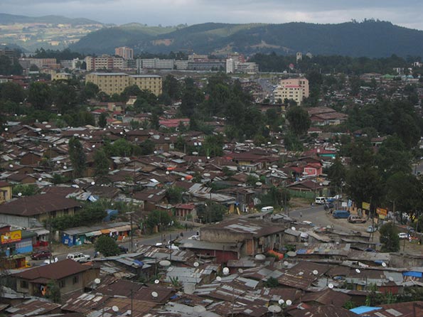
    New Orleans photo by Bigstock.

    Joel Kotkin is a City Journal contributing editor and the Distinguished Presidential Fellow in Urban Futures at Chapman University.

  • A Housing Preference Sea Change? Not in California

    For some time, many in the urban planning community have been proclaiming a “sea-change” in household preferences away from suburban housing in the United States.

    Perhaps no one is more identified with the "sea-change" thesis than Arthur C. Nelson, Presidential Professor, City & Metropolitan Planning, University of Utah. Professor Nelson has provided detailed modeled market estimates for California in a paper published by the Urban Land Institute, entitled The New California Dream: How Demographic and Economic Trends May Shape the Housing Market: A Land Use Scenario for 2020 and 2035 (He had made generally similar points in a Journal of the American Planning Association article in 2006).

    Professor Nelson says that the supply of detached housing on what he defines as conventional sized lots (more than 1/8 acre) is far greater than the demand in California (Note 1). He further finds that the demand of detached housing on smaller lots is far greater than the supply. Professor Nelson’s conclusions are principally modeled from stated preference surveys, which can mislead if people act differently when they make choices in the real world.

    The Modeled Demand Estimates

    Nelson models the demand for housing types in California’s largest four planning regions (Southern California Association of Governments for the Los Angeles area, and the Bay Area Association of Governments for the San Francisco-San Jose area, the San Diego Association of Governments and the Sacramento Area Council of Governments). He estimates 2010 both supply and demand. His demand estimates rely strongly on data from three early 2000s stated preference surveys conducted by the Public Policy Institute of California (PPIC).

    • Nelson’s data indicates a strong preference for multi-family housing, which he places at 62% of demand in 2010, compared to the 2000 supply of 42%. Thus, the demand for multi-family housing is suggested to be one half above the supply.
    • The most stunning conclusion, however, is an over-supply of detached housing on conventional lots that Nelson estimates. Compared to a 2000 supply of 42% of the market, Nelson estimates the demand to be only 16%. This would indicate the supply of such housing to be more than 2.5 times the demand as is indicated in Figure 1.

    Nelson’s findings on conventional lot detached housing have obtained the most attention. He surmises that virtually all of the demand over the next 25 years can be met by the existing stock of conventional lot detached housing. This is music to the ears of many urban planners, who have for decades demonized  the suburbanization that has been preferred by the overwhelming majority of Californians (and Americans, and people elsewhere in the world where they can afford them).

    Actual Demand: Revealed Preferences: 2000-2008

    To perform a similar analysis, we used revealed preference data: the actual change in housing by type from the 2000 Census data to the latest American Community Survey (ACS) 2006-2010 data at the census tract level (Note 2).  

    In contrast to Professor Nelson’s estimates, the demand data indicates a strong continuing preference among Californians for detached housing on conventional lots. From 2000 to 2008 (the middle year for the 2006-2010 data), 51 percent of the new occupied housing in the four planning areas is estimated to have been detached on conventional lots (Figure 2). This is more than three times the 16% demand estimate in Professor Nelson’s data. In fact, the actual demand was higher than the 2000 supply (42%), indicating that the demand for detached houses on conventional lots has increased.

    If there is a sea change, it would appear to be in multi-family housing. In contrast with the 62% share for multi-family dwellings modeled by Nelson, the actual demand indicated in the census tract data was two-thirds less, at 19% (Figure 3), well below the supply of 43 percent in 2000. This suggests a tanking of demand for multi-family housing, even as builders, in California and elsewhere, put more product on the market.

    Why Accounts for the Difference

    Various factors appear likely to contribute to the difference between the modeled demand and the actual demand.

    Smaller Lots and Higher Density Do Not Mean Shorter Commutes: The PPIC survey questions implied a connection between larger lots (lower density) and longer commutes. This is the broadly shared perception, but in reality houses on smaller lots (necessarily in higher density neighborhoods) do not mean shorter commutes. This is illustrated in a chart by Southern California Association of Governments (SCAG) researchers on page 62 of The New California Dream. In the original SCAG document, the authors note that "commuting time is about the same for all density" (Figure 4).  This is not surprising, since higher densities are associated with more intense traffic congestion and with greater transit use, both of which lengthen commutes (Note 3).

    The "higher density means shorter commute" myth is rooted in the obsolete mono-centric conception of the city. Almost all US urban areas have become poly-centric with job locations highly-dispersed, as jobs have followed people to the suburbs. Gordon and Lee (Note 4) have shown that work trip travel times in the United States are shorter to dispersed employment locations than to central business districts or secondary business centers (such as "Edge Cities").  

    Invalid Perceptions of Transit Mobility: Professor Nelson also stresses stated preference responses showing that many people would prefer to live near transit service. All things being equal, who wouldn’t?

    But all things are not equal. Living near transit does not mean practical transit access to most of the urban area. In most cases, only a car can provide that. Transit systems are necessarily focused on downtown areas (central business districts), which contain, on average, only 8% of employment in the four planning regions. , Travel to other destinations is usually inconvenient, because of time-consuming transfers, or   not available at all.

    A Brookings Institution report indicated that 87 percent of people in California’s major metropolitan areas (Los Angeles, San Francisco, Riverside-San Bernardino, San Diego and Sacramento) live within walking distance of transit. Yet, the average employee can reach only 6% of the jobs in their respective metropolitan area in 45 minutes (Figure 5). By contrast, the average work trip travel time ranges from 25 minutes to under 30 minutes in the four planning regions .

    Households thinking about a move to higher density could have been, upon more serious examination, deterred by transit’s severe mobility limitations. 

    Data Insufficiently Robust for the Modeling: There is also the potential that the PPIC surveys, with their general questions, were not of sufficient robustness to support Professor Nelson’s assertions. For example, PPIC did not define the size of small lots.

    Planning and Reality

    If households were so eager to move from detached houses on conventional lots to smaller lots, 2000 to 2008 would have been the ideal time. The mortgage industry was literally falling over itself to fund home purchases. Urban core wannabes could have flooded the market pursuing their smaller lot "stated preferences." The actual, revealed preference data says they did not, which is also indicated by the continuing strength of suburban growth relative to central city growth (Note 5).

    Thus, the modeled demand estimates in The New California Dream appear to be at substantial odds with the actual demand.This is much more than an academic issue. The conclusions of The New California Dream have achieved the status of sacred text in the canon of urban planning and are mouthed unquestioningly by organizations like the Urban Land Institute.

    Worse, demand estimates from The New California Dream are being relied upon in regional transportation plans being developed by California’s metropolitan planning organizations (MPOs). This is particularly risky because these same MPOs have been granted greater power over housing under California’s Senate Bill 375, goaded on by a sue-happy state Attorney General’s office. The attempt by MPOs to impose their housing plans and regulations on consumers could well backfire, for investors in condominium and multifamily housing.  This would not be a first time that   developers followed urban planning illusions like lemmings over a cliff, to which huge losses in the last decade attest. The more destructive effects, however, are likely to be paid by households and the economies of California’s metropolitan areas.

    ———

    Note 1: More than 70% of the detached housing stock was on conventional lots in 2000.

    Note 2: There is no census tract data on detached house lot size. We scaled the detached housing data from the 2000 census to match Professor Nelson’s distribution of detached housing supply by lot size, using population density. Nelson’s method and ours were sufficiently similar that the results should have been roughly comparable. As the text indicates, they were not.

    Note 3: In each of the three PPIC surveys, respondents are asked to choose between housing alternatives that are high in the questions to commute "lengths." From the description and survey instruments in the PPIC reports, there is no indication that respondents were given any idea what commute "length" means. There are two way to judge commute "length." One is distance or miles, while the other is time. Based upon the PPIC survey instrument, it cannot be known which definition was perceived by the respondents.

    Even so, it seems more likely that the term "commute length" was perceived by respondents in time rather than in distance by respondents. Each day, people have only so many hours and minutes available. However, distance is not so constrained, depending upon the speed of the commute. Further, the extensive research on commuting often refers to "travel budgets," which are expressed in time, not distance.

    Note 4: Reference: Gordon, P. and B. Lee (2012), "Spatial Structure and Travel: Trends in Commuting and Non-Commuting Travels in US Metropolitan Areas," draft chapter for the International Handbook on Transport and Development edited by Robin Hickman, David Bonilla, Moshe Givoni and David Banister.

    Note 5: The most recent year (2010-2011), for which the Census Bureau had issued invalid municipal population estimates, indicated a continued the trend toward suburban rather than urban core growth, as has been shown by Trulia Chief Economist Jed Kolko (see: Even After the Housing Bust, Americans Still Love the Suburbs).

    =======

    Photograph: Suburban San Diego

    Wendell Cox is a Visiting Professor, Conservatoire National des Arts et Metiers, Paris and the author of “War on the Dream: How Anti-Sprawl Policy Threatens the Quality of Life.”

  • America’s Most Competitive Metros Since 2010

    The San Jose metro is adding jobs at a faster clip than any other large metro area in the U.S. since the recession. Houston, Austin, Detroit — and a handful of other metros — have also been stellar performers the last few years. But how much of the job growth in these and other metros can be explained by unique regional factors rather than national trends?

    To answer that question, EMSI used a standard economic analysis method called shift share, focusing on overall job change from 2010 to 2012. We followed the same methodology that we used to show which states are gaining in competitiveness. However, for this post, we looked at the 100 most populous metropolitan statistical areas (MSAs) in the U.S.

    The goal is to see which metros are becoming more competitive (that is, gaining a larger share of total job creation) and which are losing their share of the jobs being created. We ranked all 100 metros based on the overall competitive effect and what percentage of jobs (from 2010-2012) are based on competitive effects.

    Our Approach

    Shift-share analysis, which can also be referred to as “regional competitiveness analysis,” helps us distinguish between growth that is primarily based on big national forces (the proverbial “rising tide lifts all boats” analogy) vs. local competitive advantages. The primary components of shift share are as follows:

    • Industrial Mix Effect — This represents the share of regional industry growth explained by the growth of the specific industry at the national level.
    • National Growth Effect — This explains how much of the regional industry’s growth is explained by the overall growth of the national economy.
    • Expected Change – This is simply the rate of growth of the particular industry at the national level (equals the sum of the industrial mix and national growth effects).
    • Regional Competitiveness Effect — This explains how much of the change in a given industry is due to some unique competitive advantage that the region possesses, because the growth cannot be explained by national trends in that industry or the economy as whole.

    Read more on shift share in this article: Understanding Shift Share.

    About the Data

    The infographic and table below display aggregate industry data for the 100 most populous MSAs from 2010-2012. To generate our ranking, we summed the overall competitive effect for each broad 2-digit industry sector (e.g., agriculture, manufacturing, health care, construction, etc.) and added them together to yield a single MSA-wide number that indicates the overall competitiveness of the economy as compared to the total economy. We calculate the competitive effect by subtracting the expected jobs (the number of jobs expected for each MSA based on national economic trends) from the total jobs. The difference between the total and expected is the competitive effect. If the competitive effect is positive, then the MSA has exceeded expectations and created more jobs than national trends would have suggested. It is therefore gaining a greater share of the total jobs being created. If the competitive effect is negative, then the MSA is below what we would expect given national trends. In this case the MSA is losing a greater share of the total jobs being created.

    The Results

    Top Five

    The two metros at the top have been economic stalwarts in recent years. After that, our analysis revealed a couple surprises.

    Note: The figure in parentheses is the percentage of total 2012 jobs that are due to growing (or declining) competitiveness from 2010-2012.

    1. San Jose-Sunnyvale-Santa Clara, Calif. (3.5%) – The heart of Silicon Valley has created 35,803 more jobs than expected since 2010, thanks largely to the information sector (most notably, internet publishing and broadcasting and web search portals and software publishers). Electronic computer manufacturing has also seen more-than-expected growth in the San Jose metro area, as has warehouse clubs and supercenters and private elementary/secondary schools.

    In other words, the high-paying jobs generated in the tech sector appear to be leading to more jobs in the retail trade and education sectors than we would expect based on national trends.

    2. Austin-Round Rock-San Marcos, Texas (3.4%) – Save for government and retail trade, every broad sector in the Austin metro area has exceeded expectations. The result is 30,472 more jobs than expected from 2010 and 2012. The strongest sub-sectors in Austin are wired telecommunications carriers; wholesale trade agents and brokers; and corporate, subsidiary, and regional managing offices.

    3. Bakersfield, Calif. (3.1%) – Bakersfield has one of the highest unemployment rates (12%) among all metropolitan areas. But better-than-expected job growth in the construction and agricultural sectors has propelled this San Joaquin Valley metro to third in our ranking. The agriculture boom has been seen most in crop production and farm labor contractors/crew leaders. Meanwhile, much of the surprising construction growth has been in two sub-sectors — oil and gas pipeline and related structures construction and electrical contractors and other wiring installation contractors.

    4. Provo-Orem, Utah (2.8%) – Next is Provo-Orem, which has the fourth-fewest total jobs of any top 100 metro (an estimated 211,639). This metro area just south of Salt Lake City has seen surprisingly large job gains in professional, scientific, and technical services (see here for more); administrative and support services; specialty trade contractors; state/local government; and computer and electronic product manufacturing.

    A note on Utah: Provo-Orem, Salt Lake City (No. 6), and Ogden-Clearfield (No. 29) are all in the upper third of the top 100 metros in competitiveness.

    5. Houston-Sugar Land-Bayton, Texas (2.7%) — No metro in America has added more jobs than expected since 2010 than Houston (79,815). These jobs aren’t coming in oil & gas extraction or support activities for mining — Houston’s actually doing worse than expected in these two booming industries — but rather in health care, accommodation/food service, and manufacturing. In particular, home health care services, offices of physicians, restaurants, employment services, and fabricated metal product manufacturing are far surpassing expected growth.

    The rest of the top 10:

    • Salt Lake City, Utah (2.6%)
    • Grand Rapids-Wyoming, Mich. (2.4%)
    • Omaha-Council Bluffs, Neb.-Iowa (2.4%)
    • Raleigh-Cary, N.C. (2.1%)
    • Detroit-Warren-Livonia, Mich. (2.1%)

    Bottom Five

    The other side of our ranking is dominated by Southern metros, particularly those in Florida. But an even more common thread with the poor performers is the greater-than-expected losses in administrative and support services, a sub-sector that comprises “establishments engaged in activities that support the day-to-day operations of other organizations,” according to the BLS.

    100. Augusta-Richmond County, Ga.-S.C. (-3.9%) — This metro has lost nearly 9,000 more jobs than expected, most in waste treatment and disposal, employment services, and services to buildings and dwellings.

    99. Albuquerque, N.M. (-3.4%) — Albuquerque has fared worse than Augusta in total unexpected jobs lost (13,691), with the losses coming in similar areas — employment services, architectural/engineering services, electrical/electronic goods merchant wholesalers, and services to buildings and dwellings. Construction and government (local and federal) have also taken worse-than-expected hits.

    98. Palm Bay-Melbourne-Titusville, Fla. (-3.3%) — Like Augusta and Albuquerque, the Palm Bay-Melbourne area has done poorly in administrative and support services (particularly facilities support services) and construction (particularly specialty trade contractors).

    97. Lakeland-Winter Haven, Fla. (-2.4%) — Once again, this Florida metro has seen massive (and unexpected) decline in admin and support services, most notably employment services. Government, manufacturing, and construction have also lost more jobs than expected since 2010.

    96. Modesto, Calif. (-2.3%) — This Central Valley metro area has struggled more than expected in manufacturing (especially the making of snack foods and frozen foods). Elementary and secondary schools have also suffered.

    The rest of the bottom 10:

    • Milwaukee-Waukesha-West Allis, Wis. (-2.3%)
    • Providence-New Bedford-Fall River, R.I.-Mass. (-2.2%)
    • Little Rock-North Little Rock-Conway, Ark. (-2.1%)
    • Birmingham-Hoover, Ala. (-2.0%)
    • St. Louis, Mo.-Ill. (-2.0%)

    For the full list of the largest 100 metros, see our accompanying graphic or the table below.

    MSA
    2012 Jobs
    Expected Jobs (2012)
    Competitive Effect
    % of Jobs Due to Comp. Effect
    Source: QCEW Employees, Non-QCEW Employees & Self-Employed – EMSI 2012.3 Class of Worker
    San Jose-Sunnyvale-Santa Clara, CA
    1,014,025
    978,222
    35,803
    3.5%
    Austin-Round Rock-San Marcos, TX
    894,864
    864,392
    30,472
    3.4%
    Bakersfield-Delano, CA
    320,625
    310,730
    9,895
    3.1%
    Provo-Orem, UT
    211,639
    205,722
    5,918
    2.8%
    Houston-Sugar Land-Baytown, TX
    2,952,899
    2,873,083
    79,815
    2.7%
    Salt Lake City, UT
    692,741
    674,849
    17,892
    2.6%
    Grand Rapids-Wyoming, MI
    402,848
    393,138
    9,709
    2.4%
    Omaha-Council Bluffs, NE-IA
    501,309
    518,223
    12,078
    2.4%
    Raleigh-Cary, NC
    563,555
    551,457
    12,098
    2.1%
    Detroit-Warren-Livonia, MI
    1,902,208
    1,861,948
    40,260
    2.1%
    Charleston-North Charleston-Summerville, SC
    323,937
    317,316
    6,621
    2.0%
    Oklahoma City, OK
    649,469
    636,476
    12,992
    2.0%
    Knoxville, TN
    363,742
    356,712
    7,030
    1.9%
    Louisville/Jefferson County, KY-IN
    654,871
    643,365
    11,506
    1.8%
    McAllen-Edinburg-Mission, TX
    268,924
    264,231
    4,693
    1.7%
    Phoenix-Mesa-Glendale, AZ
    1,916,060
    1,883,203
    32,857
    1.7%
    Seattle-Tacoma-Bellevue, WA
    1,929,525
    1,897,882
    31,643
    1.6%
    Stockton, CA
    236,202
    232,430
    3,773
    1.6%
    Columbus, OH
    998,599
    984,248
    14,351
    1.4%
    Dallas-Fort Worth-Arlington, TX
    3,263,838
    3,219,303
    44,535
    1.4%
    El Paso, TX
    336,649
    332,206
    4,443
    1.3%
    San Francisco-Oakland-Fremont, CA
    2,252,514
    2,224,520
    27,993
    1.2%
    Nashville-Davidson–Murfreesboro–Franklin, TN
    853,134
    843,884
    9,250
    1.1%
    Charlotte-Gastonia-Rock Hill, NC-SC
    909,444
    899,769
    9,675
    1.1%
    Denver-Aurora-Broomfield, CO
    1,367,534
    1,354,042
    13,492
    1.0%
    Boise City-Nampa, ID
    294,333
    291,569
    2,764
    0.9%
    Portland-Vancouver-Hillsboro, OR-WA
    1,140,720
    1,130,624
    10,096
    0.9%
    San Antonio-New Braunfels, TX
    990,899
    982,408
    8,491
    0.9%
    Ogden-Clearfield, UT
    218,356
    216,733
    1,624
    0.7%
    Rochester, NY
    535,248
    531,540
    3,709
    0.7%
    Fresno, CA
    379,331
    377,181
    2,151
    0.6%
    Washington-Arlington-Alexandria, DC-VA-MD-WV
    3,289,069
    3,271,193
    17,876
    0.5%
    San Diego-Carlsbad-San Marcos, CA
    1,538,488
    1,530,699
    7,789
    0.5%
    Indianapolis-Carmel, IN
    942,512
    938,843
    3,669
    0.4%
    Columbia, SC
    380,167
    378,761
    1,406
    0.4%
    Atlanta-Sandy Springs-Marietta, GA
    2,463,751
    2,455,059
    8,691
    0.4%
    Riverside-San Bernardino-Ontario, CA
    1,390,906
    1,386,822
    4,084
    0.3%
    Chattanooga, TN-GA
    251,933
    251,223
    709
    0.3%
    Minneapolis-St. Paul-Bloomington, MN-WI
    1,892,017
    1,886,761
    5,256
    0.3%
    Tulsa, OK
    460,519
    459,782
    737
    0.2%
    Des Moines-West Des Moines, IA
    354,286
    353,772
    514
    0.1%
    Cincinnati-Middletown, OH-KY-IN
    1,066,016
    1,064,816
    1,201
    0.1%
    Honolulu, HI
    541,273
    540,736
    537
    0.1%
    Allentown-Bethlehem-Easton, PA-NJ
    364,683
    364,345
    338
    0.1%
    Greensboro-High Point, NC
    370,755
    370,532
    223
    0.1%
    Cape Coral-Fort Myers, FL
    219,651
    219,550
    101
    0.0%
    New York-Northern New Jersey-Long Island, NY-NJ-PA
    9,111,820
    9,109,799
    2,021
    0.0%
    Baton Rouge, LA
    403,099
    403,086
    12
    0.0%
    Miami-Fort Lauderdale-Pompano Beach, FL
    2,468,634
    2,468,912
    (279)
    0.0%
    Worcester, MA
    353,710
    353,834
    (124)
    0.0%
    Richmond, VA
    657,018
    657,325
    (306)
    0.0%
    Albany-Schenectady-Troy, NY
    459,754
    460,069
    (316)
    -0.1%
    Tampa-St. Petersburg-Clearwater, FL
    1,218,515
    1,219,507
    (992)
    -0.1%
    Jackson, MS
    267,877
    295,684
    (427)
    -0.2%
    Los Angeles-Long Beach-Santa Ana, CA
    6,143,325
    6,154,926
    (11,601)
    -0.2%
    Baltimore-Towson, MD
    1,400,446
    1,403,859
    (3,413)
    -0.2%
    Orlando-Kissimmee-Sanford, FL
    1,071,935
    1,074,559
    (2,624)
    -0.2%
    Pittsburgh, PA
    1,214,245
    1,218,032
    (3,786)
    -0.3%
    Dayton, OH
    402,031
    403,437
    (1,406)
    -0.3%
    Boston-Cambridge-Quincy, MA-NH
    2,665,828
    2,678,362
    (12,534)
    -0.5%
    Akron, OH
    341,435
    343,042
    (1,607)
    -0.5%
    Scranton–Wilkes-Barre, PA
    272,047
    273,574
    (1,527)
    -0.6%
    Greenville-Mauldin-Easley, SC
    315,824
    317,638
    (1,814)
    -0.6%
    Colorado Springs, CO
    316,090
    318,171
    (2,081)
    -0.7%
    New Orleans-Metairie-Kenner, LA
    582,177
    586,123
    (3,946)
    -0.7%
    Chicago-Joliet-Naperville, IL-IN-WI
    4,549,732
    4,582,384
    (32,652)
    -0.7%
    Youngstown-Warren-Boardman, OH-PA
    240,559
    242,321
    (1,762)
    -0.7%
    Toledo, OH
    317,987
    320,534
    (2,548)
    -0.8%
    Lancaster, PA
    252,253
    254,288
    (2,034)
    -0.8%
    Buffalo-Niagara Falls, NY
    562,953
    567,694
    (4,741)
    -0.8%
    Memphis, TN-MS-AR
    653,464
    659,019
    (5,555)
    -0.9%
    Virginia Beach-Norfolk-Newport News, VA-NC
    867,917
    875,329
    (7,412)
    -0.9%
    Jacksonville, FL
    634,680
    640,178
    (5,498)
    -0.9%
    Springfield, MA
    322,963
    325,801
    (2,838)
    -0.9%
    Hartford-West Hartford-East Hartford, CT
    651,931
    658,182
    (6,251)
    -1.0%
    Syracuse, NY
    324,948
    328,190
    (3,242)
    -1.0%
    Oxnard-Thousand Oaks-Ventura, CA
    348,124
    351,742
    (3,618)
    -1.0%
    Bridgeport-Stamford-Norwalk, CT
    458,643
    463,816
    (5,174)
    -1.1%
    Wichita, KS
    312,394
    315,968
    (3,575)
    -1.1%
    North Port-Bradenton-Sarasota, FL
    265,715
    268,786
    (3,071)
    -1.2%
    Kansas City, MO-KS
    1,053,613
    1,066,414
    (12,802)
    -1.2%
    Tucson, AZ
    401,113
    406,033
    (4,920)
    -1.2%
    Sacramento–Arden-Arcade–Roseville, CA
    957,779
    969,534
    (11,755)
    -1.2%
    Poughkeepsie-Newburgh-Middletown, NY
    271,783
    275,231
    (3,447)
    -1.3%
    New Haven-Milford, CT
    394,666
    400,055
    (5,390)
    -1.4%
    Madison, WI
    361,542
    366,488
    (4,946)
    -1.4%
    Las Vegas-Paradise, NV
    883,649
    896,729
    (13,081)
    -1.5%
    Cleveland-Elyria-Mentor, OH
    1,056,167
    1,075,588
    (19,421)
    -1.8%
    Harrisburg-Carlisle, PA
    334,668
    341,123
    (6,454)
    -1.9%
    Philadelphia-Camden-Wilmington, PA-NJ-DE-MD
    2,866,722
    2,922,956
    (56,235)
    -2.0%
    St. Louis, MO-IL
    1,391,853
    1,419,265
    (27,412)
    -2.0%
    Birmingham-Hoover, AL
    520,572
    531,024
    (10,452)
    -2.0%
    Little Rock-North Little Rock-Conway, AR
    362,670
    370,444
    (7,774)
    -2.1%
    Providence-New Bedford-Fall River, RI-MA
    722,008
    738,127
    (16,119)
    -2.2%
    Milwaukee-Waukesha-West Allis, WI
    849,075
    868,393
    (19,318)
    -2.3%
    Modesto, CA
    180,419
    184,600
    (4,181)
    -2.3%
    Lakeland-Winter Haven, FL
    210,233
    215,306
    (5,073)
    -2.4%
    Palm Bay-Melbourne-Titusville, FL
    207,642
    214,568
    (6,926)
    -3.3%
    Albuquerque, NM
    399,997
    413,688
    (13,691)
    -3.4%
    Augusta-Richmond County, GA-SC
    232,695
    241,661
    (8,966)
    -3.9%

    The data and analysis for this post comes from Analyst, EMSI’s web-based labor market data and analysis tool. For more information, email Josh Wright. Follow us on Twitter @DesktopEcon.

    Austin skyline image by Bigstock.

  • The Evolving Urban Form: Addis Abeba

    Addis Abeba is the capital of Ethiopia and calls itself the "diplomatic capital" of Africa, by virtue of the fact that the African Union is located here. Yet Ethiopia is still one of the most rural nations in both Africa and the world. Ethiopia also appears to be among the most tolerant. Various forms of Christianity claim account for approximately 65 percent of the population, with the Ethiopian Orthodox Church (Coptic) holding the dominant share. At the same time there is a sizable Muslim minority, at more than 30 percent of the population. Ethiopia has been spared the interfaith violence that has occurred in some other countries where there are large religious minorities.

    Growing Urban Area

    Addis Abeba is among the fastest growing urban areas in the world. Since 1970, the population has increased by nearly three times (Figure 1). However, the spatial expansion of the urban area has been much greater. The earliest available Google Earth satellite photos (1973) indicate that the urban land area (continuous urban development) has expanded over 12 times. Thus, the urban spatial expansion has been at least four times that of the population over the since the early 1970s (Figures 2 and 3).

    Since 1973, the urban population density of Addis Abeba has declined almost three quarters, from approximately 75,000 per square mile or 29,000 per square kilometer to 20,000 per square mile or 8,000 per square kilometer. Addis Abeba represents yet another example of the counter-intuitive reality of growing urban areas simultaneously becoming less dense, because population growth occurs the generally less  dense periphery in an organic city. It is not unusual for urban analysts to (wrongly) assume the opposite.

    One of the results of the spatial expansion is a significantly better lifestyle for residents of Addis Abeba, consistent with the view of Professor Shlomo Angel, who decries attempts to constrain cities within artificial boundaries (compact city policies) because they can deny people both a adequate housing and a decent standard of living.

    The Economy

    Ethiopia is one of the poorest nations on earth, with a 2010 gross domestic product-purchasing power parity (GDP-PPP) per capita of just above $1,000. This places it 170th out of 183 geographical areas according to the International Monetary Fund. By comparison, the GDP-PPP of the United States was $47,000 and Singapore $57,000.

    Ethiopia’s low income reflects  Ethiopia’s relativey low rate of urbanization. With 17 percent of the population in rural areas (outside urban areas), urbanization is concentrated in Addis Abeba (3.1 million), which is the only urban area in the nation with more than 300,000 population. Ethiopia can expect to experience a strong rate of urbanization in the decades to come, as people flock to the cities to seek better standards of living. By 2030, the total number of urban residents is projected by the United Nations to rise to 28.4 million from 13.9 million in 2010.

    Urbanization has its problems, but also economic advantages. The GDP-PPP in Addis Abeba, according to a Price-Waterhouse-Coopers estimate, is up to six times higher than that of the rest of the nation. Assuming that this ratio held to 2010, The GDP-PPP per capita of Addis Abeba would be $6,000 or more.

    Moreover, Price-Waterhouse-Coopers predicted that Addis Abeba would experience the 5th greatest economic growth to 2025, out of 151 urban areas. This would result in growth greater than that of Shanghai and Beijing. The four predicted to grow faster are the two large Viet Nam urban areas (Hanoi and Ho Chi Minh) and two in China (Guangzhou in the Pearl River Delta and Changchun in Manchuria).

    The Urban Core

    As would be expected in a developing world urban area, there is a large urban core with mixture of government and private buildings, literally surrounded by lower income, principally informal housing. With this predominant informal housing, the population density of the urban core is by far the highest in Addis Abeba (See Photo: Informal Housing in the Urban Core: Parliament and Holy Trinity Dome in the Distance).


    Photo: Informal Housing in the Urban Core: Parliament and Holy Trinity Dome in Distance

    Major government offices and cultural facilities are in this area, such as the Parliament, the prime minister’s residence, museums, the residence of the primate of the Ethiopian Orthodox Church (Coptic), the most important cathedral, Holy Trinity, in which former Ethiopian leader Haile Selassie  is buried, as well as the Catholic Cathedral and the largest Mosques.

    The New Addis Abeba

    There’s been a huge expansion of the periphery around Addis Abeba. Extensive tours around the urban area provide evidence of relative prosperity. It appears that Addis Abeba is rebuilding itself around its urban core. There is major construction in three directions from the urban core.

    The greatest activity is in the Bole District, which includes Bole International Airport, to the south of the urban core. There is a substantial amount of new commercial high-rise construction within a few kilometers to the north of the airport, along two major arterials and in between (Photo: Bole Corridor Development). There are also a large number of large, private condominium buildings. The Bole Corridor represents an edge city, in the sense defined by Joel Garreau in his seminal book Edge Cities  two decades ago. This is also the location of the largest Ethiopian Orthodox Church (see top photo) in the country.


    Photo: Bole Corridor Development

    An eastern corridor stretches for 6 miles/10 kilometers from what is locally called the "Chinese Road," a ring road built largely with the support of the Chinese government. There are many new commercial buildings, government buildings, public and private condominiums, and at the edges, large new detached houses (See photo: Detached Housing in the Eastern Corridor).


    Photo: Detached Housing in the Eastern Corridor

    To the west, principally, the southwest, is a new residential neighborhood composed principally of condominiums, generally up to five floors (Photo: Southwest Residential Area).


    Photo: Southwest Residential Area

    China in Africa

    Chinese financial assistance is not limited to the ring road. Much of the funding for the impressive new African Union headquarters (photo) was provided by the Chinese government. Further, a new light rail line will be largely financed by China. At the same time, the massive construction evident in the newer, outlying districts of Addis Abeba resemble (at least in a modest way) the urban development that has occurred in China over the past few decades.


    Photo: African Union Headquarters

    Conclusion

    The economic progress evident in Addis Abeba is encouraging. The government policies  are allowing the city to expand naturally as it grows, which facilitates  better lives for its citizens. It can only be hoped that the day will come that people in developing world urban areas, such as Addis Abeba, will enjoy the high standards of living that have been achieved in the developed world.

    Photo: Holy of Holies, Bole Mehani Alem Church (Ethiopian Orthodox Churches all have a replica of the “Ark of the Covenant,” behind a screen, which is referred to as the “holy of holies”). According to the Ethiopian Coptic tradition, the Ark of the Covenant, which tradition indicates, contained the tablets on which the Ten Commandments were written. The Ark was maintained in the holy of holies in the Jewish temple. The Ethiopian tradition holds that the Ark was taken to Ethiopia and is now kept at a chapel at a church in Axum, which is 600 miles/1,000 kilometers north of Addis Abeba.

    Wendell Cox is a Visiting Professor, Conservatoire National des Arts et Metiers, Paris and the author of “War on the Dream: How Anti-Sprawl Policy Threatens the Quality of Life.”

  • Cities Flying Too Close to the Sun

    I was honored to speak at a conference in Milwaukee over the summer called Milwaukee’s Future in the Chicago Mega-City. Chicago and Milwaukee are about 90 miles apart on I-94. There’s an Amtrak link that makes the journey in about 90 minutes. The two cities have been sprawling such that there’s now more or less continuous development along the lakefront between the two cities. Milwaukee has been a challenged city economically and demographically. Chicago has had its own serious problems, but has seen its already muscular core boom in terms of residents and investment. High end business seems to be doing well in Chicago, and the city gets pretty good press nationally.

    If you are Milwaukee, the idea of somehow tapping into Chicago naturally presents itself. Local leaders clearly see Milwaukee’s future as, if not a giant suburb of Chicago, at least a city for which Chicago’s cachet and prosperous zone somehow provides them with a leg up. As Richard Longworth put it, “Once an independent economic power of its own, Milwaukee now belongs to Greater Chicago.”

    The notion that proximity to Chicago or another mega-city* represents an unambiguous good seems nearly universal. While the mechanics and value basis of greater collaboration are often illusive, it’s assumed that such value must be present and such collaboration desirable. Not just Milwaukee, but places like South Bend, Indiana and Grand Rapids, Michigan look towards Chicago as an economic engine for them.

    But what if it this is actually backwards? What if proximity to Chicago or another mega-city is actually a curse, not a blessing?

    My friend Drew down in Indy has a model of this, clearly targeted as his own city but relevant to the discussion. He says that the Midwest is like a solar system with Chicago as the sun. As he see is it, Indianapolis is Earth – it’s the perfect distance from Chicago. A place like Cleveland is too far away – it doesn’t get enough heat and light. But Milwaukee is like Mercury – it’s too close to the sun and gets burned up.

    I suggested at the conference that one reason Milwaukee should want to active engage in shaping the interaction between the two regions is that the natural development could actually be negative. I had in mind here Providence, which is in a similar situation. Providence is 50 miles from Boston – that’s closer than Milwaukee is to Chicago, but Boston is also smaller than Chicago. Like Milwaukee, there’s a rail connection between the cities, with commuter service taking a bit over an hour.

    Providence, like Milwaukee, has struggled. In fact, it’s struggled far worse. Sticking with solar system thinking, my immediate gut take here has been that Providence is a brown dwarf of a city. Maybe at one time it generated real economic life force, but today is a shell of a metro region in many ways.

    Another similar example is New Haven, Connecticut, which is about 80 miles from NYC, and is a notoriously troubled city. And even being in the same state hasn’t helped Springfield, Mass at 90 miles from Boston. It too has struggled.

    Is this actually the pattern? Is proximity a negative indicator not a positive one? Does proximity drain vitality instead of creating it? Let’s consider further.

    I believe a lot of the thinking that being close is positive comes from the example of two very successful twin cities: Dallas-Ft. Worth and Minneapolis-St. Paul. Two things jump out at me about these, however. One, in both cases the cities are significantly closer than Milwaukee and Providence are to Chicago and Boston. Dallas is about 35 miles from Ft. Worth. Minneapolis and St. Paul actually abut each other, and the downtown-downtown trip by freeway is 14 miles. These actually are part of the same metro area by any standard.

    Two, the cities in these cases are reasonably balanced in size. Dallas is bigger than Ft. Worth and Minneapolis bigger than St. Paul, but it doesn’t have the feel of the vast disparity of say a Chicago vs. Milwaukee. Indeed, the difference is clear in how we compare the cities. With a Chicago and Milwaukee, metro area seems the way to go, but with the others municipal population seems a reasonable proxy.

    Another positive example might be Washington-Baltimore. The distance here is about 40 miles. These are separate metros, but overlap considerably and could potentially be combined. Also, Washington is only about twice as big as Baltimore, which is pretty hefty in its own right at 2.7 million people. Contrast Chicago at over six times as big as Milwaukee and Boston at almost three times as big as Providence, a number I think is understated since part of Southern Massachusetts that’s in Providence metro arguably has a strong Boston orientation as well. In any case, while the city of Baltimore remains infamous in many ways, the overall metro area has done well.

    So the idea that proximity is a positive could have originated in models that aren’t applicable. Being close works: but only if you are really, really close – say about 40 miles or better – and your size ratio is no more than about 2:1.

    Or maybe the latter might not even be necessary. There are a few examples of old industrial cities turned into suburbs in Chicago – Aurora (41 miles), Elgin (42 miles), and Joliet (44 miles) being the prime examples. These were once independent cities of sorts, and now are clearly suburbs. They aren’t nirvana yet, but proximity to Chicago has clearly invigorated them to a certain extent. The size ratio vs. the overall Chicago region or even just the city would obviously be huge. So perhaps the only question is whether you could plausibly be a true suburb.

    Interestingly, Detroit and Ann Arbor fit this and are only a bit over 40 miles apart, so also follows this rule. It may seem ludicrous to credit Detroit with injecting life into Ann Arbor, but I don’t think it would be as successful if it were isolated in the middle of the state. (Madison, Wisconsin succeeded on its own, but is a bit bigger and also the state capital).

    But it may even be worse than this. Back to my provocation a few paragraphs back, is it possible that not only does anything other than true suburban style proximity not help you, it might even hurt you? The examples of Milwaukee, Providence, New Haven, and Springfield suggest it’s at least possible. Now all of these are post-industrial cities that have clearly struggled for reasons other than proximity to a mega-city. Many similarly situated places (or even more badly troubled ones) are not near a much bigger city. But it’s worth considering the point.

    I hypothesize about it in terms of attempting to reboot a high value economy. If you are a high value business – say a biotech startup or some such – looking to locate in New England, why would you ever pick Providence over Boston? You wouldn’t – not unless they paid you a ton of money a la 38 Studios (a Curt Schilling backed video game company that went bankrupt after receiving $100 million in loan guarantees from Rhode Island). Not only is Providence itself an expensive place to live and do business, it’s talent and ecosystem disadvantaged. Why subject yourself to that when you can move 50 miles up the road to one of the world’s premier innovation areas? The kicker is that this applies to business ideas in Providence as well. You can launch your business in Boston and still basically stay where you live.

    I’m not a believer in the oft-repeated claim that these tier one cities are sucking all the talent out of smaller places. The numbers don’t back it up. Chicago has the second highest college degree attainment among large Midwest cities, but at 34.2% hardly towers over other regional cities, most of which are at least in the 30s, including Milwaukee. And Chicago’s growth in population with degrees is actually in the bottom half of large Midwest metros.

    However, perhaps there is a “dead zone” of sorts around mega-cities. This zone extends from the edge of their suburbs to some unknown outer radius. In that zone, perhaps black hole like, high value functions really are sucked into the mega-city. Or perhaps negative aspects of the mega-city like traffic and pollution act like kryptonite on the economy of cities in this zone. I don’t know for sure. It’s just a hypothesis to consider based on a few observations. I would love to see some research done into this. In the meantime, small cities near a very large one shouldn’t be too quick to celebrate their location as boon.

    Aaron M. Renn is an independent writer on urban affairs and the founder of Telestrian, a data analysis and mapping tool. He writes at The Urbanophile, where this piece first appeared.

    Milwaukee photo by Bigstock.

  • Deep in the Heart of Texas: Private Donors Build a Medical Complex the Size of a Small City

    When Americans think of oil executives, they tend to conjure up the image of J. R. Ewing: slick smile, sharp suits, cowboy boots, and a 10-gallon hat packed with bluster, vanity, and greed. According to Gallup, no industry is more widely reviled than oil and gas—not even banking, real estate, or heath care. The poll found that 64 percent of Americans disapprove of its activities. Only the federal government fared worse.

    The image is unfair in many ways. It’s true that the energy sector can be brutal; the business of pulling hydrocarbons from the earth seems to attract more than its share of ruthless personalities. But there’s a more nuanced character to the oil and gas industry. At heart—and yes, it has a heart—it’s an industry with a surprisingly charitable nature. And nowhere is the pulsing heart of the industry more evident than in Houston, where the fortunes generated by profits from energy companies have fueled some of the most impressive personal giving in the world.

    Take, for instance, the massive Texas Medical Center (TMC). Based in Houston, it is by far the world’s largest center for healing the sick. Among its 52 member institutions are world-famous research and treatment facilities like the M. D. Anderson Cancer Clinic, Methodist Hospital, St. Luke’s Episcopal Hospital, and the Texas Children’s Hospital. Every year, the TMC serves as a campus where some 34,000 full-time students work toward degrees in the healthcare professions. It’s also home to smaller nonprofits like a Ronald McDonald House (a comfort home for families of children getting treatment), a Fisher House (a comfort home for families of hospitalized service members and veterans), the Institute for Spirituality and Health, and St. Dominic Village (a Catholic retirement community). All in all, it represents “probably the biggest confluence of philanthropy in the world,” says TMC chief executive officer Richard Wainerdi, “and a lot of it is oil money.”


    West Campus of the Texas Medical Center

    All of that oil money has fueled a massive experiment in private, voluntary initiative—a major healthcare system that is more private than public, more charitable than profitable. Its scale can only be described as Texan. The campus is equal in size to the Inner Loop of Chicago. It currently has over 28.3 million square feet of office space—more than downtown Houston, even more than all of downtown Los Angeles. (By the end of 2014, its square footage is expected to exceed 41 million square feet, which would make the medical campus the nation’s seventh-largest business district of any sort.) Every day, 160,000 people enter the area, which has grown into Houston’s largest employer. Every year, TMC hosts about 7.1 million patient visits, including 350,000 surgeries and 28,000 newborns delivered.

    Houston’s real philanthropic achievement, however, is not just the scale of the TMC. It’s the extraordinary quality of its institutions. In the 2013 U.S. News & World Report hospital rankings, TMC-affiliated institutions topped the charts. Methodist Hospital was a nationally ranked leader in 13 of 16 adult specialties. (Of the 4,793 hospitals included in the rankings, only 148 facilities—roughly 3 percent of the total—were considered a nationally ranked leader in even one of the 16 specialties.) St. Luke’s Episcopal Hospital, likewise on the TMC campus, earned national ranking in 10 adult specialties. The Texas Children’s Hospital was ranked fourth among all U.S. children’s hospitals. M. D. Anderson has been named the best cancer center in America for 9 of the past 11 years, including 2012.

    None of it would be possible without private philanthropy. M. D. Anderson, for instance, began a capital campaign in September 2006, with a goal of raising $1 billion within six years. Donations poured in from across the Lone Star state. From San Antonio, Clear Channel co-founder Lowry Mays and his wife, Peggy, donated $20 million. From Dallas, H. Ross Perot kicked in another $20 million. T. Boone Pickens contributed $50 million, with one condition. Before putting the funds to use, M. D. Anderson was required to turn the gift into a $500 million corpus within 25 years. Anderson hit the target within three years, and used the funds to establish the Pickens Research Endowment. Two years ahead of schedule, the capital campaign passed the $1.2 billion mark. There were more than 630,000 individual gifts, and a staggering 127 donors gave at least $1 million.

    It’s testimony to an extraordinarily generous culture—one that’s driven by energy profits. Of the top 10 corporate foundations in the region, for instance, eight are directly tied to the energy industry. As Federal Reserve Bank economist Bill Gilmer notes, Houston’s economy rests on the energy sector—not only drilling and exploration, but also downstream industries like refining, finance, and petrochemical production. It is there that much of Houston’s wealth has been generated, and from which much of the funding for good works like the TMC is likely to continue coming.

    “The people who founded the Texas Medical Center believed that for Houston to thrive, the city had to have a great medical establishment,” explains Ann Stern, president of the $1.5 billion Houston Endowment, the charitable legacy of Houston patriarch Jesse Jones and his wife, Mary Gibbs Jones. “There’s a long history of generosity and a healthy peer pressure among people in the energy business—and other civic leaders—to contribute. They may have not gone to college, they may have made their money in the oil fields, but the Texas Medical Center has become in large part their legacy.”

    Deep in the Heart of Texas

    To be sure, the extraction of sweet, light crude from deep in the earth is hardly animated by sweetness and light on the business side. The energy business is capital-intensive and very competitive. It requires leaders who can adapt and make things happen.

    Anthony Petrello fits that bill. Petrello is the chief executive officer of Nabors Industries, the world’s largest land-based drilling contractor. Nabors is hired by oil companies to drill oil and gas wells. Like many other leaders in the energy industry, Petrello is competitive and looking for ways to differentiate his company. His pedigree is perhaps a bit unusual for the industry: it includes bachelor’s and master’s degrees in mathematics from Yale—and a law degree from Harvard.

    Petrello is a Newark native. He left his job in New York as managing partner of Baker & McKenzie, arriving in Houston in 1991 to become president of Nabors. “The first five years I was in Houston,” Petrello recalls, “I worked six or seven days every week, and with my wife’s work schedule, we did not have much time to socialize.” He and his wife, Cynthia, a former New York actress, focused on their careers and kept mainly to a small group of close personal friends.


    Anthony and Cynthia Petrello (Photo courtesy of Longines)

    Then in 1997, Anthony and Cynthia had a baby girl at Houston Women’s Hospital. Carena Francesca was born at 24 weeks, weighing only 20 ounces, and experienced PVL (periventricular leukomalacia), a disorder in premature infants caused by a lack of oxygen to the brain. First came a rash of operations to save her sight and heart. Then it became clear Carena would suffer from cerebral palsy. Despite having financially successful parents, she was entering life with enormous challenges. “It changed everything,” Petrello says. “It was the turning point in our lives.”

    As Carena matured, she started to lose abilities. She gained language, but lost it at age five. Today, she cannot get around without a wheelchair. She can’t speak or feed herself. “It caused a major change in our perceptions,” Petrello recalls. “My wife thought we’d have a dancer. I thought we’d have a mathematician. Instead, we had to adjust our expectations.”

    Carena’s difficult circumstances impelled the Petrellos to rethink their priorities. “You realize that your time here on earth is short and you want to make a difference,” Petrello says. “You don’t have time to feel sorry for yourself.” By instinct and training a problem-solving mathematician, Petrello wanted to understand what caused Carena’s condition—and find out if there were better ways to treat it. In 2000, he consulted with a team of specialists at a prestigious eastern hospital; they held out little hope and less understanding. “The doctor told us he couldn’t do anything for her,” Petrello says, his voice showing clear disappointment. “He just said we needed to get a good estate planner for her.”

    Petrello looked for serious research into childhood neurological diseases. He was shocked to find how little of it actually was taking place. Particularly troubling was the lack of research into what he calls the “DNA arithmetic” of these disorders, which range from mild forms like ADHD to cerebral palsy and Down syndrome. “The lack of knowledge about this problem is astounding,” says Petrello. “And the lack of resources is sinful.”

    He found kindred spirits at the Texas Children’s Hospital. He conceived of an institute dedicated to exploring the causes of neurological afflictions for children. In 2006, he made a commitment of $7 million. “I had lunches with friends—many, when judged by my weight gain—and they were eager to hear more,” says Petrello. “My wife and I were overwhelmed by the support of friends and energy industry colleagues who came on board to help.”

    And in the process he found some impressive allies, like Dan Duncan, the now-deceased chairman and director of Houston-based Enterprise Products, a leading North American provider of midstream energy services. A self-made man who grew up in rural east Texas, Duncan turned a small business with one truck, two partners, and $10,000 in cash into a multi-billion dollar energy company that today ranks among the nation’s most successful.

    Duncan and his wife, Jan, were among Houston’s most generous healthcare philanthropists. In 2006, they donated $100 million to Baylor College of Medicine to establish the Dan L. Duncan Cancer Center; two years later, they gave M. D. Anderson $35 million to create the Duncan Family Institute for Cancer Prevention and Risk Assessment, which addresses the risks—genetic, lifestyle—that can lead to cancer. In 2007, the Duncans made news with a $50 million gift, earmarked to create a collaborative institute that would research and treat pediatric neurological disorders. The Jan and Dan Duncan Neurological Research Institute opened in 2010. Today, it occupies 300,000 square feet at Texas Children’s Hospital. The center has more than 130 researchers led by Huda Zoghbi, a renowned Lebanese neurogeneticist.

    Petrello sees the center as a leading-edge institution that can change the odds for millions of children with neurological disorders. “Everyone needs a dream to keep them motivated,” he explains. “It may not help our daughter, but we cannot accept her fate for so many others. We have to do something.”

    The Great Equalizer

    Ever since he left his small hometown of Wharton, Texas, Lester Smith has lived, from a strictly economic point of view, a rather charmed life. At age seven, he knew he wanted to be a wildcatter; to his nose, oil “just smelled like perfume.” Today, he heads up Smith Energy, a Houston-based firm that specializes in the exploration and production of oil and gas reserves.

    In Smith’s social circles, nobody looks down on making money and living well—even lavishly. But it’s not all big cars, big houses, and big hair. Like Petrello, Smith was brought down by disease, and has chosen to dedicate much of his fortune to fighting it. Smith struggled for 17 years with prostate and bladder cancer. He has undergone some 40 surgeries at the Baylor College of Medicine—“no fun,” he recalls—until 2001, when both organs were removed. “I’m a bladder and prostate cancer survivor,” he reflects. “My wife’s sister died at 50 from breast cancer. My former wife was diagnosed with breast cancer eight years ago, but she is doing well because of what they did at Baylor. This sticks with you.”


    Lester and Sue Smith with Gloria Gaynor (AP photo / Dave Rossman)

    These personal tragedies have driven much of his philanthropy, $40 million of which has gone to Baylor’s medical school, where it supports research into and treatment for breast cancer, urology, and oncology. Smith also serves on the board of M. D. Anderson and Baylor College, and has donated an additional $20 million to the cancer center at Texas Children’s Hospital. “I never considered giving away so much,” he admits, “until cancer affected me and my loved ones personally.”

    Cancer, adds Smith, is “a great equalizer,” one that doesn’t respect class or wealth. For that reason, he has donated $15 million to the Harris County hospital district to set up a clinic to treat poor families, like many of those that he grew up around in rural Texas. It now treats some 160,000 underserved people annually. “Illegal aliens, the indigent—they should get the same care that my wife gets,” he insists.

    Smith also raises money for cancer causes by hosting social events—most notably, ballroom dancing. The galas that he and his wife put on have become highlights of Houston’s social season. In February, the Smiths hosted 1,100 guests at the Legends Event for Texas Children’s Cancer Center, featuring Gloria Gaynor, the Pointer Sisters, and Nile Rodgers. The evening raised $32 million. It was again heavily underwritten by Houston’s oil-and-gas philanthropists.

    “It’s the oil guys who give the most money to things that matter in people’s lives,” he suggests. “They may be tough people to deal with, but they are very philanthropic.”

    A Culture of Leadership

    David Wolff is not one of Houston’s oilmen, but he has made his fortune selling land to the energy corporations and developers who serve them. He left Philadelphia in 1970. Once he landed in Houston, he started his own company—at age 29. “This was not considered crazy in Houston,” he recalls, “but back in Philadelphia it would have been. What I liked about Houston is people didn’t just think about doing things. They really did them.”

    Over the next three decades, Wolff did quite a lot of things. His real estate firm has office parks all around Houston and led the development of what is widely known as the “energy corridor” along Interstate 10 in the western part of town—now home to a working population of 80,000 people. “It was all cows and rice fields back then,” he recalls. All the while, he was involved in the city’s philanthropic community, serving as chairman of the Houston Parks board, as well as Metro, the regional transit agency, and on the board of the Houston Grand Opera.

    But these days Wolff’s great passion is medical philanthropy. He donated 10 acres of prime land for the new TMC West Campus, which now includes Texas Children’s Hospital, Texas Methodist, and others. He is now working, largely through additional land he has acquired, to aid the expansion of the TMC toward Beltway 8 (Houston’s outer-loop freeway) and the surrounding suburban communities.


    David and Mary Wolff

    The idea, Wolff explains, is to bring the hospitals closer “to where the patients are.” For generations, Houstonians—particularly those with children—have been moving to the city’s periphery. As the TMC’s main campus has expanded, traffic and parking have become more difficult for people coming from the communities surrounding Houston. The market is certainly there: Texas Children’s CEO Mark Wallace estimates there are 400,000 children within a 10-minute drive of the new campus. In 20 years, says Wallace, the west-side hospital will be as large as the original site.

    “We are making it easier for the medical center to serve people,” Wolff says, beaming with pride in the bright new lobby of Texas Children’s Hospital–West Houston. “For those coming from the suburbs, or for the folks coming from the smaller towns in central and southeast Texas, this is an easier place to get to, and one where they can still find the same quality health care you would get in the city.”

    That sense of service reflects the spirit that made the Texas Medical Center possible in the first place. In a state where the proportion of uninsured is higher than the national average, the TMC provides critical services for the poor—and is sufficiently well funded to deliver them at the highest level. “Like other cities, Houston has its challenges,” observes Houston Endowment’s Ann Stern. “But Houston is exceptional in that philanthropy makes up for a lot of it. It’s kind of a calling here. It’s a culture of leadership—of getting things done.” And it has made Houston perhaps the most philanthropic city in America today.

    This piece first appeared at The Philanthropy Roundtable.

    Joel Kotkin is executive editor of NewGeography.com and is a distinguished presidential fellow in urban futures at Chapman University, and contributing editor to the City Journal in New York. He is author of The City: A Global History. His newest book is The Next Hundred Million: America in 2050, released in February, 2010.

    Houston skyline photo by Bigstock.

  • Local Government in Ohio: More Accessible and More Efficient

    There is general agreement that smaller units of government are more responsive and accountable to their electorates. However, proponents of larger governments often claim that this advantage also creates   higher spending and tax levels. On this basis, bigger-is-better proponents often suggest consolidating local governments to save money. Such calls have increased in recent years, with the unprecedented fiscal difficulties faced by governments from the federal to local level. However, more often than not, nothing more underlies consolidation proposals more than an interest in reducing the number (count) of local governments. It is largely taken as an article of faith that larger governments save money relative to smaller governments.

    Ohio has had more than its share of local government consolidation proposals. The Ohio Township Association asked us to review local government financial performance in the state. We were able to confirm that Ohio’s smaller governments are, on the whole, more responsive and accountable. However, the analysis clearly showed that smaller local governments have materially better financial performance.

    We analyzed per capita financial measures for all reporting local general purpose governments in the state, using Auditor of State data (Note). Ohio has three types of general purpose governments. Cities are incorporated municipalities with 5,000 or more population in the last federal census. Villages are incorporated municipalities with less than 5,000 population. The balance of the state is made of townships, which have virtually the same powers as municipalities.

    The Efficiency of Smaller Local Government

    The data indicates that smaller units of local government have median spending per capita that is less than larger local governments. Local governments with more than 10,000 population spent an average of at least twice that of smaller governments. The lowest per capita spending was in local governments with between 1,000 and 4,999 population (Figure 1).

    The smaller government advantage extended to debt. The median debt service per capita for local governments with fewer than 5,000 population was zero, while the median debt service per capita for local governments with 10,000 to 25,000 population was under $10 annually (Figure 2).

    The incidence of debt was also less among smaller local governments. Fewer than one-half of the local governments under 5,000 population had any debt. In contrast, all of the local governments with 50,000 or more population had debt (Figure 3).

    Smaller Governments Excel in Metropolitan Areas

    It might be thought that this smaller-is-better relationship stems from the more rural setting of some smaller local governments. However, an analysis of local government spending and debt per capita within metropolitan areas indicates the same conclusion:  smaller governments spend less and borrow less per capita (Figure 4).

    Townships: Even Less Costly

    Townships have been a particular target of "bigger-is-better" consolidation proposals, perhaps because of their smaller average population. Yet, despite their much larger average service areas (in square miles), townships represent a far smaller share of local government spending than their population share. Townships account for 11 percent of local general purpose government spending (excluding counties), yet have 35 percent of the state’s population.

    Townships have lower current expenditures per capita than villages and cities in all but one population category. In metropolitan areas, townships spend less per capita in all population categories (Figure 5). In addition, townships have lower per capita debt service payments than cities and villages
    The lower per capita spending of townships is attributable, at least in part, to lower administrative costs and lower labor costs per capita. Further, as with smaller municipalities, taxpayers often do not often demand the same level of service that is provided in the larger cities.

    Small Government: Less Likely to Enter Fiscal Distress

    Smaller local governments have experienced financial distress less. After the city of Cleveland bankruptcy in the 1970s, the state established the Local Government Fiscal Distress, which identifies local governments in serious distress and aids them in returning to normal fiscal health. The smallest cities and villages entered the Fiscal Distress program at a rate less than one-half that of the largest governments. The townships did even better. Only two of the state’s more than 1,300 townships were placed in the Local Government Distress Program (Figure 6).

    Why Larger Local Governments are Less Efficient

    One of the reasons that larger governments spend and borrow more is that they are less accessible to taxpayers and more accessible to interests which benefit from higher spending. This can lead to a vicious cycle that drives taxes so high that governments borrow more, followed by proposals to consolidate when the borrowing capacity becomes more constrained. Further, the very size of some larger governments can make them "too big to fail," like large financial institutions in the Great Financial Crisis. This can lead to "bailouts" by state taxpayers. Ohio’s Local Government Distress Program is an attempt to avoid these difficulties, by providing technical assistance and guidance.

    Smaller governments that consolidate face two critical challenges likely to increase costs. The first is that labor costs tend to be "leveled up" to the compensation levels in the higher cost jurisdiction. The other problem is that services and service levels also tend to be "leveled up."

    Proponents of consolidation sometimes assume that a large number of governments results in duplication of services. However, each of the local governments have exclusive service areas. For example, garbage is not collected by multiple jurisdictions to the same addresses. Smaller jurisdictions also tend to employ more part time staff, and even volunteers, especially in fire departments. Another advantage of smaller governments is that their elected officials are able to more directly manage the business of a smaller jurisdiction, because they do not have to rely more on intermediate staff.

    The performance of Ohio’s smaller governments shows that there is no need to choose between accessible government and efficient government. Ohio’s smaller local governments deliver both.

    Wendell Cox is a Visiting Professor, Conservatoire National des Arts et Metiers, Paris and the author of “War on the Dream: How Anti-Sprawl Policy Threatens the Quality of Life.”

    —–

    Note: These do not include counties, school districts or special districts.

    Illustration: Great Seal of the State of Ohio (from http://www.netstate.com/states/symb/seals/images/seal_ohio2.jpg)

  • The Rise of the Great Plains: Regional Opportunity in the 21st Century

    This is the introduction to a new report on the future of the American Great Plains released today by Texas Tech University (TTU). The report was authored by Joel Kotkin; Delore Zimmerman, Mark Schill, and Matthew Leiphon of Praxis Strategy Group; and Kevin Mulligan of TTU. Visit TTU’s page to download the full report, read the online version, or to check out the interactive online atlas of the region containing economic, demographic, and geographic data.

    For much of the past century, the vast expanse known as the Great Plains has been largely written off as a bit player on the American stage. As the nation has urbanized, and turned increasingly into a service and technology-based economy, the semi-arid area between the Mississippi Valley and the Rockies has been described as little more than a mistaken misadventure best left undone.

    Much of the media portray the Great Plains as a desiccated, lost world of emptying towns, meth labs, and Native Americans about to reclaim a place best left to the forces of nature. “Much of North Dakota has a ghostly feel to it," wrote Tim Egan in the New York Times in 2006. This picture of the region has been a consistent theme in media coverage for much of the past few decades.

    In a call for a reversal of national policy that had for two centuries promoted growth, two New Jersey academics, Frank J. Popper and Deborah Popper, proposed that Washington accelerate the depopulation of the Plains and create “the ultimate national park.” They suggested the government return the land and communities to a “buffalo commons,” claiming that development of The Plains constitutes, “the largest, longest-running agricultural and environmental miscalculation in American history.” They predicted the region will “become almost totally depopulated.”

    Our research shows that the Great Plains, far from dying, is in the midst of a historic recovery. While the area we have studied encompasses portions of thirteen states, our focus here is on ten core locations: North Dakota, South Dakota, Nebraska, Kansas, Oklahoma, Texas, New Mexico, Colorado, Wyoming, and Montana.

    Rather than decline, over the past decade the area has surpassed the national norms in everything from population increase to income and job growth. After generations of net out-migration, the entire region now enjoys a net in-migration from other states, as well as increased immigration from around the world. Remarkably, for an area long suffering from aging, the bulk of this new migration consists largely of younger families and their offspring.

    No less striking has been a rapid improvement in the region’s economy. Paced by strong growth in agriculture, manufacturing and energy — as well as a growing tech sector — the Great Plains now boasts the lowest unemployment rate of any region. North Dakota, South Dakota and Nebraska are the only states with a jobless rate of around 4 percent; Kansas, Montana, Oklahoma and Texas all have unemployment rates below the national average.

    A map of areas with the most rapid job growth over the past decade and through the Great Recession would show a swath of prosperity extending across the high plains of Texas to the Canada/North Dakota border. Rises in wage income during the past ten years follow a similar pattern. The Plains now boasts some of the healthiest economies in terms of job growth and unemployment on the North American continent.

    Of course, this tide of prosperity has not lifted all boats. Large areas have been left behind — rural small towns, deserted mining settlements, Native American reservations — and continue to suffer widespread poverty, low wages and, in many cases, demographic decline.

    In addition, the region faces formidable environmental and infrastructural challenges. Most prominent is the continuing issue of adequate water supplies, particularly in the southern plains. The large-scale increase in both farming and fossil fuel production, particularly the use of hydraulic fracking, could, if not approached carefully, exacerbate this situation in the not so distant future.

    Inadequate infrastructure, particularly air connections, still leaves much of the area distressingly cut off from the larger urban economy. The area’s industrial economy and rich resources are subject to a lack of sufficient road, rail and port connections to markets around the world. Yet despite these challenges, we believe that three critical factors will propel the region’s future.

    First, with its vast resources, the Great Plains is in an excellent position to take advantage of worldwide increases in demand for food, fiber and fuel. This growth is driven primarily by markets overseas, particularly in the developing countries of east and south Asia, and Latin America.

    As these countries have added hundreds of millions of middle class consumers, the price and value of commodities has continued to rise and seem likely to remain strong, with some short-term market corrections, over time.

    Second, the rapid evolution and adoption of new technologies has enhanced the development of resources, notably oil and gas previously considered impractical to tap. At the same time, the internet and advanced communications have reduced many of the traditional barriers — economic, cultural and social — that have cut off rural regions from the rest of country and the world.

    Third, and perhaps most important, are demographic changes. The late Soichiro Honda once noted that “more important than gold or diamonds are people.” The reversal of outmigration in the region suggests that it is once again becoming attractive to people with ambition and talent. This is particularly true of the region’s leading cities — Omaha, Oklahoma City, Tulsa, Kansas City, Sioux Falls, Greeley, Wichita, Lubbock, and Dallas-Fort Worth — many of which now enjoy positive net migration not only from their own hinterlands, but from leading metropolitan areas such as Los Angeles, the San Francisco Bay Area, New York and Chicago. Of the 40 metropolitan areas in the region, 32 show positive average net domestic migration since 2008.

    Together these factors — resources, information technology and changing demographics — augur well for the future of the Great Plains. Once forlorn and seemingly soon-to-be abandoned, the Great Plains enters the 21st century with a prairie wind at its back.

    Visit TTU’s page to download the full report, read the online version, or to check out the interactive online atlas of the region containing economic, demographic, and geographic data.

    Praxis Strategy Group is an economic research, analysis, and strategic planning firm. Joel Kotkin is executive editor of NewGeography.com and author of The Next Hundred Million: America in 2050. Kevin Mulligan is Associate Professor of Geography at Texas Tech University and Director of TTU’s Center for Geospatial Technology.