Tag: Chicago

  • Chicago Is Winning the Battle for the Executive Headquarters

    The corporate headquarters used to be the primary measure of a city’s economic clout. Saskia Sassen, while not ignoring headquarters, documented how in the age of globalization, the resurgence of the global city was driven by demand for financial and producer services, not more and bigger HQs. As she pointed out in her seminal book The Global City, “Major cities such as London, New York, and Chicago have been losing top ranked headquarters for at least three decades.” Yet despite this they were coming back strong.

    Back in 2008, I started observing a shift in the marketplace in which corporate HQs were relocating back to the city. But this wasn’t a traditional monolithic HQ, but rather a reconstituted, smaller version consisting of only the most senior people that I call the “executive headquarters.”

    Crain’s Chicago Business has a major feature this week investigating the executive headquarters trend as it is playing out there. They point out that these HQs make for great headlines, but they don’t necessarily result in that many jobs.

    ADM is Exhibit A in the rise of a new type of corporate headquarters, one that arrives from afar but packs light. These headquarters represent the pinnacle of the corporate pyramid, snapped off and relocated, free of jobs tied to operations and often midlevel HQ functions such as payroll, human resources or purchasing. To be sure, migrating headquarters offer benefits to the city: They boost demand for business services, their executives join the philanthropic scene and, of course, they confer bragging rights. But in terms of jobs, the farther a company travels to set up shop in Chicago, the fewer people come with it.

    “The notion of the corporate headquarters in the ‘Mad Men’ world when there were hundreds or thousands of people in a building with the company logo . . . those days are gone,” says David Collis, a professor at Harvard Business School who studies corporate headquarters.

    Click through to read the whole thing, which features me and my work on the topic. This is an important trend to grapple with.

    The bad news, which the Crain’s piece highlights, is that the headquarters ain’t what it used to be. On the other hand, Chicago is winning the battle for them.  These smaller executive headquarters, particularly for major global businesses, benefit from being in a global city. Chicago has lured a number of these from out of town. In line with Sassen’s findings that the “deep economic history of a place” matters, note that we see a lot of agro-industrial firms choosing Chicago: ADM, Con Agra, Mead Johnson Nutrionals, Oscar Mayer.  This industry space is where Chicago has a major advantage over New York and other coastal cities.

    A trend I see playing out, and which I am currently researching in more detail, is the bifurcation of HQ attraction. For executive headquarters of global firms, and for companies that are looking for an urban location, Chicago is reasserting its dominance as the interior business capital. But for those who prefer a suburban environment, or which maintain a mass employment HQ, the Sunbelt remains strong, especially Dallas, where Toyota is a building its North American campus. Dallas replicates many of Chicago’s non-urban advantages at lower cost and with a more suburban feel: central location and time zone, a major airport, a diverse economy, and scale. Increasingly it looks like Chicago is the urban interior capital, Dallas the suburban interior one. Stay tuned for more on this in the future.

    Aaron M. Renn is a senior fellow at the Manhattan Institute and a Contributing Editor at City Journal. He writes at The Urbanophile, where this piece originally appeared.

    Chicago photo by Bigstock.

  • The Fall of Rahm Emanuel

    Rahm Emanuel, a man of obvious talent, drive, and leadership capacity, should have been an ideal person to run a big city like Chicago. Unfortunately, because of his stubborn unwillingness to admit and compensate for his flaws, that was not to be.  After barely limping across the finish line in his re-election bid and tamping down the fallout from Moody’s downgrading the city’s debt to junk status, Emanuel has now been rocked by a truly huge scandal. The Chicago Police Department shot 17 year old Laquan McDonald 16 times, killing him, then did not release a video of it for over a year – including sitting on it during the entire election season. And that’s just the start of it.

    My latest piece in City Journal, The Fall of Rahm Emanuel, looks at Rahm’s tragic trajectory:

    Emanuel’s leadership style came with fatal flaws. A political streetfighter by inclination, he lacks an operational orientation. He didn’t appear to grasp the scope of the city’s financial problems until four years after he was first elected, when Chicago’s bond rating was cut to junk. His infrastructure trust fizzled. The schools went from bad to worse, with his first CPS leader forced out and his secondpleading guilty to corruption. He didn’t get it that Chicago’s police department hadn’t been fundamentally reformed the way New York’s and Los Angeles’s had been.

    Emanuel’s governing style has been all tactics, no strategy. He’ll pick up the phone to twist the arm of a CEO or fight to win the day’s media cycle. But what’s his vision for the city? He has no idea how to make Chicago as a whole work over the long term. Nobody is great at everything, but Emanuel’s arrogance seemingly won’t allow him to address his own shortcomings. Famously vindictive, he alienated the local press and others, turning those who might have helped him into enemies. He also brought a Washington-style spin-control mindset to Chicago. In Washington, an army of apparatchiks and a compliant media lets politicians like Obama create a reality bubble. In national politics, perception is often is reality. But in local government, reality is reality. The West Side isn’t Benghazi. The people who live in Chicago can walk out their front doors and see for themselves what’s going on.

    Click through to read the whole thing.

    Aaron M. Renn is a senior fellow at the Manhattan Institute and a Contributing Editor at City Journal. He writes at The Urbanophile, where this piece originally appeared.

    Photo: Chicago Mayor Rahm Emanuel, left, greets U.S. Defense Secretary Leon E. Panetta upon his arrival at a CEO roundtable in Chicago, May 20, 2012, courtesy of the Department of Defense.

  • How Chicago’s 606 Trail Fell Short of Expectations

    When I was back in Chicago over Labor Day, I had to check out the “big three” new public space projects there: the Riverwalk, Maggie Daley Park, and the 606 Trail. The Riverwalk is a spectacular project I already wrote about. Maggie Daley Park, a new playground just across Columbus Dr. from Millennium Park’s Frank Gehry designed band shell, has been controversial and got mixed reviews. But I really liked it. More importantly, kids seem to love it. The place was jammed, and it appeared to be mostly locals. My cousin tells me her young daughter can’t get enough of the place. I’m not doing a post on this, but it looks like another big win.

    The 606 Trail, a 2.7 mile biking and walking trail built on the embankment of an abandoned rail line, is a different story, however.

    The problem with the 606 is not that it’s bad. In fact, it’s a nice, eminently serviceable rail trail. I won’t do a full writeup since Edward Keegan had a good review in Crain’s in which he asks, “Is that all there is?” that I think gets it basically right.  Numerous other reviews are also available.

    What I will do is highlight three areas that I think contribute to Keegan being underwhelmed: inflated expectations, financing problems, and an odd lack of attention to design detail.

    Inflated Expectations

    The fact that the 606 is an elevated trail on an abandoned rail line creates an almost inevitable comparison to New York’s High Line. The city did nothing to downplay those comparisons, and in fact suggested Chicago’s trail would actually be considered superior. For example, in national urbanist web site Next City, Deputy Mayor Steve Koch said, “A lot of people are familiar with the High Line — this is a concept far beyond that truly transformative project.”  Frances Whitehead, lead artist for the project, told WBEZ regarding the High Line, “I think we’re gonna smoke them.”

    It’s very clear the city wanted this to be considered a project worthy of national, not just local attention. Back to Koch, he said, “Someone will call you up and say, ‘I want to see the city’ Thisis where you’ll go; this is the way you’ll do it. And I think people are going to come from all over the globe.”

    The very name speaks to the ambition level. Originally it was known as the Bloomingdale Trail, a name that technically still exists but which has been replaced for most purposes by “the 606.” The new name was taken from the first three digits of zip codes in the city of Chicago. Thus by using 606, the name itself suggests a project of citywide, not neighborhood, significance. The city also pushed for national media – and got it.

    The problem is that the 606 is not even remotely another High Line, nor a project of citywide significance, nor a bona fide tourist attraction for the masses. It’s a neighborhood serving rail-trail that is elevated above the streets with some nicer features like lighting that you don’t see often. Like many other rail trails around the country, I expect it to have a significant positive development affect in the neighborhood, as well as being a great recreational amenity. All great things – if the trail had been sold that way originally.

    To be fair, some like the Trust for Public Land, which was involved in the project design, were more realistic. Their CEO Will Rogers told Next City, “The High Line really reshaped the whole Meatpacking District. The Bloomingdale is going to provide parks and green space for neighborhoods that desperately need it, and bicycle access for people going downtown. It’s a different kind of investment.” But this isn’t the message that won out in shaping perceptions. The city would have been better off setting expectations much differently.

    Insufficient Funds

    The 606 Trail was primarily paid for using federal CMAQ transportation funds. According to DNA Chicago, the total price of the 606 is $95 million, with $50 million in CMAQ funds, $20 million privately raised, $5 million from the city, and $20 million to fill (for what purposes I am not sure, though see below).

    The use of a CMAQ funding had key implications. One is that it more or less required the project to be primarily a bicycle trail. The entire edifice of obnoxious federal transport regs are in play here. Two is that it made this a CDOT project, not a Parks District one (though I believe the Parks District is now in charge of it). I believe many of the things that contribute to Keegan’s feelings come from the funding strings and a budget that was too low. In fact, this project to me brought back echoes of the CTA’s Brown Line expansion project in the way that various parts of it give off the vibe of being value engineered.

    One of the things that got whacked in the Brown Line project, for example, was paint. Except for a handful of places such as over Armitage Ave, metal on the project was simply left in a raw galvanized state. I previously noted the austere results of that project give off an homage to prison yard feel. The same look is present on the 606. Consider these photos:

    Galvanized metal railing at the CTA Fullerton station.

    Mesh galvanized metal railing at the CTA Fullerton station.


    IMG_2128

    Mesh galvanized railings along the 606.


    There’s nothing wrong with using an industrial motif, which is very appropriate in Chicago. And obviously security for adjacent property owners is important. It’s also possible that these had to be over-engineered to meet DOT/federal standards, much like the Brown Line station railings for passengers that could stop a Mack truck. The designers may well have felt these were the best choices. But my gut tells me that, like with the Brown Line, this may have been a money issue.

    A lot of people have noted the fact that the landscaping has not yet been fully planted or grown to maturity as a reason for the trail’s feel. That surely plays a role. But the preponderance of galvanized metal through much of it plays a big role in giving the 606 an austere feel.

    This also demonstrates how the city’s financial problems have practical consequences. Because the city’s budget is in such bad shape, it had to turn to CMAQ, which imposed strings you’d rather not have in an ideal world. And you may not have the cash to do it right. (The Riverwalk doesn’t suffer from this, possibly because its commercial spaces generate revenues to bond against).

    Design Oddities

    The 606 also has some odd design misses. For example, here is what the Trail physically looks like. It’s a concrete biking path with a soft blue rubberized running path on either side.

    IMG_2116

    Let’s see, where have I seen this design pattern before?

    Fullerton L platform.

    Fullerton L platform.

    The CTA uses a similar blue shoulder area on its platforms. But in its case, the design pattern is used to indicate the edge of the platform and thus an unsafe area to stand. You are supposed to stand behind the blue line. Using a similar width blue area, even if a different shade, for a jogging path on the 606 violates a local design affordance, like putting a handle on a door and labeling it “Push.”

    Then there’s this arch bridge:

    The 606 Trail over Milwaukee Ave.

    The 606 Trail over Milwaukee Ave.

    This design is dimensionally awkward, something Keegan points out too. Given that this is a rail trail, it’s also notable that the designers chose a steel arch pattern that is not idiomatic of rail bridge design, certainly not in Chicago anyway. This also makes me again wonder about the role of CDOT in the project. This arch structure is the same pattern they used for the Halsted St. bridge over the north branch of the Chicago River that Blair Kamin similarly labeled, “less than graceful.” (The Damen Ave arch bridge works much better, probably because the span is longer and higher, lending itself to more elegant design proportions).

    The name “606” itself is also a bit off. Inside Chicago the reference may be obvious, but outside of its this name is likely to be parsed as an area code, particularly with the “0” middle digit from the original North American Numbering Plan. Today you frequently see people sporting their city’s main area code on shirts and such as a bit of local pride, particularly as area codes have shrunk down to city scale size in many places. The 606 area code is Appalachian Kentucky, however, not Chicago. Few people without a connection to Chicago will know that its zip codes start with 606.

    These aren’t huge items, but cumulatively they add up. The little things separate great design from good, and the 606 missed some opportunities.

    On the whole, this trail will be a great amenity for the neighborhoods it passes through, and also be legitimately functional for transportation given its elevated nature and the transportation lines it connects to such as Metra’s Clybourn station. It was fairly well patronized when I was on it, but with no sense of crowding. And this was on a nice Labor Day afternoon, suggesting that that chaos and safety issues of the lakefront path won’t be repeated here.

    If only it had originally been sold for what it was instead of a High Line beater, had raised that last $20 million (plus a bit more, perhaps), and had a little more attention to detail in some design elements, the 606 would be probably be seen as something that significantly exceeded expectations instead of something that did not live up to the hype.

    Aaron M. Renn is a senior fellow at the Manhattan Institute and a Contributing Editor at City Journal. He writes at The Urbanophile, where this piece originally appeared.

  • Techno Fixing the Urban Zone

    In 2008, when Chicago inked a deal to privatize its parking meters, a chorus of groans ensued. To say that the deal was widely panned is putting it mildly. Its detractors say the city accepted too little in exchange for turning over the operations of its parking meters for a near-eternal 75 years to a private company that promptly raised the prices and sued the city. To many, the deal appeared desperate and irresponsible; a prime instance of a city in the red buckling to the ambitions of a private operator and getting little in return except for a pittance of one-time cash.

    The case of Chicago is not unique. While several other cities have flirted with privatizing large-scale city services, politicians who support even many of the best-constructed of these measures have been rejected at the ballot box.

    The argument against privatization has primarily been a financial one. In most cases, it appeared that transferring the development and management of large city networks into private hands would at best yield equally adequate services, but for a much higher price to residents, while creating a barrier to cities’ long-term flexibility. Not long ago the verdict on urban privatization read more like an epitaph. Common sense dictated that city services could best be cared for in public hands. Major movements in city management like New Urbanism’s burgeoning lean urbanism would optimize choices about government decision-making. Public-sector and populist ideas like widespread bike lanes, traffic calming design features, urban farming, and streetcars appeared the best options available for driving future city development, and as the seminal techniques for optimizing livability and resources while eliminating congestion.

    The shame about the damage that the perceived failure of the Chicago deal has inflicted on the reputation of urban privatization is that few have noticed the increasingly obvious relationships between privatization, data, and city services in the period since. Many planners continue to present “livability” and “placemaking” as topics best solved through traditional planning approaches, well removed from the explosion of privately developed data technologies. While keeping their eyes on the ever-coveted fractional percentage gains in bicycle ridership in the cores of the largest cities, they’ve largely missed the more significant transformations around us. The public-sector response to the failed privatization ploys of a few years ago has in many cases been to write off privatization forever.

    But today, the private sector is offering better products. The Smart Cities Week conference in Washington, DC recently highlighted some of these advances, which range from programs to optimize transit systems (in order to speed up services and reduce the need for investment in hard infrastructure), to Uber-style trash pick-up that allows private waste management companies to electronically compete over who will empty a just-filled dumpster quickest and cheapest. Far from the expensive and resource-intensive pipe dreams that many have ascribed to these kinds of technological innovations (thus writing them off as impractical for the coming post-fossil fuel economy), most of these new products seem designed to reduce inefficiencies, lower costs, and minimize resource usage through precision monitoring and optimization.

    Rather than making a key fiscal offering to cities in the form of large, up-front payments in exchange for the rights to take over ordinary city services (a useful tool for paying off debt, but a tough political sell given the high consumer payments needed to make the undertaking worthwhile to the private vendor), the private sector appears to have shifted its commitment towards making the case that technological advances can generate value on both sides of the equation. While the parking vendors in the initial privatization cases were hard-pressed to prove that they were able to offer services even on par with those of the cities’ existing systems, a commitment to research and development in urban scale technology is now allowing private vendors to offer services that are overwhelmingly more user-friendly, more efficient, and more advanced than municipal services.

    Because so much of the private-sector focus has been on optimizing network operations, the notion that private management is inevitably more expensive than city management is fast-becoming obsolete. The question has shifted away from whether a city that receives an up-front payment ends up with a greater rate of return than it otherwise would have, and more toward asking how much value the privatization of a service will create for the city’s residents. While up-front payments may still be juicy bait, the real meat lies in across-the-board cost savings and noticeably better service options quickly coming on line.

    The answer to many of these questions seems clear. Who is going to accept coin-operated parking meters and confusing, impersonal signage instead of interactive, clear, and usable ones? Who will be satisfied with a 10-minute walk to an inefficient transit system if a self-driving car would come to his or her door for a similar price? Why would a city install conventional street lights if a private operator could more cheaply operate energy-efficient sensor-activated lighting that can simultaneously forestall crime through remote monitoring? And who wants to live in a city where conservation objectives are primarily pursued through inconvenient regulations, parking restrictions, and limits on plastic bag usage, when hyper-local smart grid technology can achieve the same savings by automatically optimizing load storage, green roofs, solar, and wind power block by block, all while lowering prices, eliminating losses, and hedging risk through variable city and local networks? Nearly all of these products are already on the market.

    Once city governments and voters realize that the private sector is beginning to offer services that are more efficient, more affordable, more sustainable, and more convenient than even the best conventional optimization practices being pushed today, it’s hard to believe that they will tolerate doing without them. If the newness of such systems also helps attract millennials wooed by ever-fancier gadgetry, then the case becomes even stronger.

    The blind spot the planning profession has often shown to this kind of thinking is understandable and justified. Getting a good description of a ‘smart city’ from the technology industry is an exercise in tooth-pulling. And who really believes that corporate technology firms can make places as livable as those planners that are dedicated to designing for livability? The private sector hasn’t helped itself with years of offerings that seemed designed to bilk bureaucrats out of public money. Luckily, the technological advances are now being paired with better, more creative, and fairer financing mechanisms.

    Hesitation by planners may be a good thing, because it has forced the private sector to begin to integrate the livability principles of urban design. Past perceived failures may give cities added pause, allowing a more thoughtful merge between planning objectives and privately-developed data capabilities.

    But planners best not wait too long. Popular urban advances are increasingly being forged by technologists with little input (or even sometimes with disdain) from planners. Writing off technology and divorcing big data is not a winning formula. As Silicon Valley continues to boom with large-scale, cost-effective advances, the planning profession may increasingly lose power. Enter cities designed by corporate private-sector technologists, and city budgets rescued by the ever-resilient engines of private capital.

    Roger Weber is a city planner specializing in global urban and industrial strategy, urban design, zoning, and real estate. He holds a Master’s degree from the Harvard Graduate School of Design. Research interests include fiscal policy, demographics, architecture, housing, and land use.

    Flickr photo by Mark Turnauckas: a smart parking meter in Akron, Ohio.

  • Chicago’s Great Financial Fire

    My latest piece is online in City Journal and is called “Chicago’s Financial Fire.” It’s a look at the ongoing financial crisis in that city, which has all of a sudden gotten very real thanks to a downgrade of the city’s credit rating to junk by Moody’s. Here’s an excerpt:

    While some sort of refinancing may be required, the proposed debt issue contains maneuvers similar to those that helped get Chicago into trouble in the first place—including more scoop and toss deferrals, $75 million for police back pay, $62 million to pay a judgment related to the city’s lakefront parking-garage lease, and $35 million to pay debt on the acquisition of the former Michael Reese Hospital site (an architecturally significant complex Daley acquired and razed for an ill-fated Olympic bid). The debt-issue proposal also includes $170 million in so-called “capitalized interest” for the first two years. That is, Chicago is actually borrowing the money to pay the first two years of interest payments on these bonds. In true Chicago style, the proposal passed the city council on a 45-3 vote. Hey, at least the city is getting out of the swaps business.

    Even with no further gimmicks, Emanuel will be six years into his mayoralty before the city can stop borrowing just to pay the interest on its debt. And without accounting for pensions, it will take the full eight years of both his terms to get the city to a balanced budget, where it can pay for the regular debt it has already accumulated.

    Click through to read the whole thing.

    Rahm donned a sweater during his reelection campaign and told the public he recognized he needed to change his ways, saying that he knows he “can rub people the wrong way.” The title of that ad was “Chicago’s Future.”

    I decided to take him up on his new approach. When I was working on this piece, I tried to get some information of the mayor’s press office. I asked them such extremely hard hitting questions as, “Is there a consolidated location where all of the mayor’s most recent financial proposals can be seen in their current form?” I emailed them and got no response. So I followed up with a phone call. I was put on hold for a while then told the person I needed to talk to was away from her desk, but I should email her at a XYZ address. So I did. No response. This is the same pattern all previous inquiries I’ve made have followed, though I believe on occasion I’ve been put through to a voice mail from which I got no callback. Now, it’s not like I try to get stuff from these guys every day, but the message is pretty clear. I gather that this experience is not at all unusual when dealing with Rahm.

    Having his press office simply refuse to respond at all to even basic inquiries from (the apparently many) people on his blacklist is naught put pettiness. Rahm takes people who could be friends and does his best to turn them into enemies. No wonder the Sun-Times titled a recent about him, “Rahm’s troubles plentiful, allies scarce.”

    Thus it is that Chicago, a city of grand and expansive history and ambition, a city so big it overflows the page, comes to have a mayor with a certain smallness of spirit.

    Aaron M. Renn is a senior fellow at the Manhattan Institute and a Contributing Editor at City Journal. He writes at The Urbanophile, where this piece first appeared.

    Chicago photo by Bigstock.

  • Global Cities in the 21st Century: a Chicago Model?

    As America’s “third” city, Chicago competes for international attention against the usual rivals: New York and Los Angeles. Even San Francisco, next to Silicon Valley, claims prominence for its cutting-edge industries and progressive culture. Ultimately, though, Chicago’s domestic peers have global status through definitive leadership in industries with visibility and impact (New York in finance, Los Angeles in entertainment, Houston in energy, and San Francisco in technology and innovation). Chicago has dim prospects of replicating such undisputable competitive advantages, but it may not need to.

    Global status in the 21st century favors international collaboration over industry dominance, for three reasons. First, the innovative nature of emerging industries and modernizing traditional industries shifts competitive determinants from resources to ideas. This equalizes the international knowledge race, with companies seeking ideas regardless of geographical origin. Second, technology-enabled connectivity integrates previously isolated regions into the global economy, creating what a recent Foreign Affairs article labels a “unified global marketplace for labor.” Third, the dynamic knowledge sector rewards flexibility over size; footloose over big and rigid. Accordingly, local workforce size loses relevance, good news for small cities. The digital revolution enables geographic dispersal of talent through “internet-based globalization.” In short, collaboration enables flexible capacity, while international collaboration taps a vastly more diverse and hungry talent pool.

    Is Chicago prepared to abandon pursuit of industry dominance and seek global status in the hyper-connected knowledge economy? The city already boasts corporate prominence and diverse lifestyle amenities, and has even seen post-recession growth in emerging creative industries like high-tech and film. Chicago also has a lively private sector, and visionary, pro-developmental planning from both its recent and distant past. In 2013 the city committed US$ 3 billion to revive urban neighborhoods, through a public-private initiative that Mayor Rahm Emanuel insists will help Chicago “live up to its potential as the global city that it should be.” Such factors make a city great, but do they make it global?

    Despite being a paragon of economic diversification, Chicago lacks an undisputed position in any transformative and globally relevant industry, as enjoyed by its coastal rivals. The city is even perceived by some as a striver whose influence is more regional than global. For example, in a 2012 New York Times article, a relocation expert stated that global business and political leaders “have an idea of Chicago that is 20 or 30 years out of date.” Indeed, Chicago has a development history that is steady but not exceptional. Before its recent struggles, the city’s plodding, linear economic progress was a product of the typical determinants: population growth and path-dependent agglomeration. Outdated theories recommend that Chicago aim for inimitable dominance in an emerging industry. However, such efforts would be misplaced in the current global economy.

    In practice, a growth approach favoring industry dominance has two problems. First, it ignores the fact that the most elite global cities acquired prominence the hard way: through gradual institutional evolution. Dominance across multiple industrial eras is only the shiny product of underlying economic, social, and political circumstances that generated structural flexibility. These circumstances, rather than industry prominence itself, should be the focus of urban growth strategies prioritizing prepared opportunism over industrial roulette.

    Second, the industry dominance approach unduly emphasizes competition, with a zero-sum philosophy that marginalizes collaboration. No industrial windfall or shock-opportunity has fundamentally transformed Chicago’s competitive position since the 19th century, when connectivity through railroads, canals, and westward expansion made the city a trading and logistics hub. Chicago can now develop global status through connectivity of a new sort, as a collaborative leader in emerging global networks for trade and production. It can even anchor an inter-governmental urban network addressing economic challenges in large inland cities lacking inimitable competitive advantages.

    Historically, an unchallenged advantage in trending industries generates global visibility and relevance. However, modern embodiments of the dominance model are fundamentally unstable, in particular due to sector cyclicality. Only three cities have historically maintained near-permanent global status: Tokyo, London, and New York. Their type of competitive advantage is institutionally entrenched and therefore largely inimitable, although Tokyo has struggled throughout Japan’s multi-decade economic slump. Aside from these mega-cities, Chicago’s global aspirations face significant competition from ambitious secondary cities. Rapid economic growth in Asia has attracted capital to places whose names were just decades ago scarcely recognizable in the West (e.g. Wuhan and Guangzhou, both with populations comparable to New York’s).

    A 21st century growth strategy should not assume zero-sum economic competition, but instead emphasize membership in the right “clubs.” Inter-urban cooperative networks are increasingly common; for example, Singapore is collaborating with Indian cities on “smart” development. This type of soft-diplomatic relationship is a form economic symbiosis that emerges from a “flattening” world. Networks also emerge around industry complementarity (e.g. Los Angeles-Nashville-Austin in entertainment, Oklahoma City-Dallas-Houston in energy, and Singapore-New York-Frankfurt in finance). Chicago must contemplate what it offers as a network partner, and move early in establishing inter-urban relationships to jointly capture global opportunities.

    Recent history is littered with failed urban growth strategies derived from outdated models. For example, to quickly garner status many cities have made grandiose commitments such as Olympic bids, sports stadiums, and ambitious megaprojects. Such efforts are cheap and politically expedient to announce, but drain municipal coffers during implementation. Chicago can alternatively stake its future on the more sustainable and farsighted growth model of networked interdependence. An internationally connected economy may not be glamorous, but it is certainly “global” and can also be diverse and stable, as quietly proven by some of the world’s more creative secondary cities (e.g. Toronto, Sydney, Amsterdam, and Bangalore). Chicago must decide first what kind of status is wants, and ultimately whose company to keep.

    Kris Hartley is a Visiting Researcher at Seoul National University and PhD Candidate at the National University of Singapore. He focuses on economic policy, urban planning, and governance innovation, and has a decade of experience with government agencies, community development corporations, and research institutes. His book Can Government Think? Flexible Economic Opportunism and the Pursuit of Global Competitiveness proposes a model for urban economic growth through the alignment of institutional structures and administrative processes supporting evidence-based policy. His work is available at www.krishartley.com.

  • The New, Improved? Rust Belt

    There is no longer a Rust Belt. It melted into air. The decline of manufacturing, the vacancy of the immense, industrial structures that once defined the productive capacities and vibrant lives of so many pockmarked towns, the dwindling of social capital—all the prognosticators writing the obituaries for these dead geographies were right.

    How long were rust belt cities going to be able to, as author Robert Putnam would phrase it, “bowl alone?” It turns out not very long.

    Rust Belt cities don’t exist because the narrative surrounding them over the past few years has slowly changed. No longer are they identified as places of decay; now the story is that they’re places of opportunity and renewal. This conviction is emerging against the backdrop of a general sort of reintroduction of the American city as a great, good place; a crucible of talent, energy, youth and creativity. (As if that hasn’t always been the case.)

    Now, for every Detroit horror story, there’s a shiny Shinola. Buffalo is a nascent hipster haven.

    Levon Helm has risen from the dead and is singing, “Look out, Cleveland, some craft brew is comin’ through…”

    With its well-defined physical landscapes and deep cultural histories, the Rust Belt aesthetic has long been subject to the same forces that have turned places like Williamsburg, Brooklyn and Chicago’s Wicker Park into moneyed enclaves of those seeking a repurposed past for modern means. As the global city shatters into a million pieces, Rust Belt cities are poised to piggyback on their own organic growth, becoming ever more attractive with their lower barriers to achieve a sense of urban authenticity.

    Yet, as pockets of Rust Belt cities are successfully redeveloped, is there reason for concern that they may be losing some of what sets them apart?

    In Chicago, where the Rust Belt exists under the glittering shadow of its Global City sheen, the steady march of hipsterdom through Wicker Park and Logan Square is nearly complete. On the Far South Side of the city, on the fallow 700-acre grounds of the former US Steel South Works mill, a massive, master-planned mixed-use development is envisioned and (very) slowly taking shape.

    In the Corktown section of Detroit, the long-abandoned and derelict Michigan Central Station has morphed into an asset for a bevy of bars, shops and nightlife stops, which have deservedly garnered travel nods from Martha Stewart. Working through the Bedrock Financial-led-revitalizing downtown and past the hip enclave of Midtown, a new steward is currently cleaning up the infamous Packard Motor Plant and entertaining plans of perhaps an “autonomous community.”

    In Pittsburgh, a city always a little ahead into the future, Lawrenceville has been dubbed one of the “top 26 most hipster neighborhoods in the world” by Business Insider magazine, while in the South Side neighborhood, the old J&L Steel mill on the banks of the Monongahela River is currently home to SouthSide Works, a “shop/dine/play/live” mixed-use lifestyle center of offices, residences, movie theaters and outlets of H&M, American Eagle and The Cheesecake Factory.

    These movements through the cityscape may seem disconnected, but they represent a waning of the cultural affect that is specific to a sense of place and defines it. Whether it is a sort of hipster-variation-on-a-theme or a top-down, master planned repurposing of formerly industrial sites, there is an emerging urban typology that is seen and felt in cities everywhere. In this way, these commoditized developments echo their suburban forbearers in standardizing a formula for successful sameness.

    When the French anthropologist Marc Auge coined the term ‘non–place’ to describe the interstitial spaces in which so much of modern life unfolds, he focused in on the transitory nodes of transit and commerce such as airports, highways, and supermarkets to describe a condition wherein the individual “becomes no more than what he does or experiences in the role of passenger, customer, or driver”— namely, a consumer. Many critical urban theorists have adopted Auge’s theory to describe the monotony, placelessness, and anywhere-ness of sprawling suburbs.

    One could argue, though, that as cities proper increasingly mirror one another in their (re)development, Auge’s theory now threatens to apply itself to the fabric of cities themselves. It begs the question of whether there are perhaps other ways to engage and activate ‘non-place’ into meaningful, active space.

    Managing needed investment while maintaining distinctiveness — which is, of course, what makes any city worth its while to begin with — is a delicate dance. Like everywhere else, the Rust Belt is inspiration for a form of American magic realism, wrestles with this.

    Cities change. To assume the city hasn’t always been a speculative spectacle is ludicrous, as silly as it is to perpetuate dead geographies onto the living. But the refashioning of Rust Belt cities’ physical and cultural landscapes should at least give us pause to wonder if we’re losing realism and magic in manufacturing a sense of place.

    Ben Schulman is the Communications Director for the American Institute of Architects Chicago (AIA Chicago) and the co-creator of the Contraphonic Sound Series, a project that documents cities through sound.Follow @skyscrapinknees (https://twitter.com/skyscrapinknees)

    Flickr photo by Russ: Detroit Bike City Shinola

  • Roadmap to Surprises of the Rustbelt

    Back in New York, no one quite believed my accounts of urban renewal across the Midwest, through a piece of the Rustbelt, and then back — that St. Louis is the Brooklyn of the heartland, or that even downtown Buffalo has charms. I tended to be on safer ground when I described Targeted small towns in Ohio, or drive-by shootings in Chicago.

    Despite the skepticism I knew I would eventually encounter, my idea was to go intercity with mass transit and to get around locally with my bike. I found that the downtown areas of many Midwestern cities are vibrant, rust free, and often ideal for biking, as well as for hotels, trendy restaurants, and funky businesses.

    It’s on the periphery of these Potemkin-convention cities that the bright lights dim on the porches of ramshackle wooden frame houses. That’s where the new ghettos look less like rundown public housing and more like rural shanties that have washed up in earlier working-class suburbs.

    Does it work to travel from Chicago to New York with a folding bike on trains and buses? Give or take, I managed fine. Amtrak grudgingly accepts folding bikes as normal luggage (it is easier to take a gun on board Amtrak than a full-sized bike), and intercity bus drivers (many are cheerful souls) are indifferent about baggage stowed below.

    The bigger problem in my planning was that few trains other than freights cut across the heartland from St. Louis to Cleveland. While buses do make the connections — say, from Terre Haute to Bloomington, Indiana — many of my departures took place between 5 and 6 a.m., the time that a friend calls o’dark.

    Nor were the intermodal connections seamless. Routinely, I was dumped off the bus at a Hardee’s in Nowheresville. Between Quincy, Illinois, and Hannibal, Missouri, the only place open at lunchtime was an adult superstore, but I hadn’t worked up an appetite for lace underwear.

    Herewith, by city, are some observations from behind the handlebars:

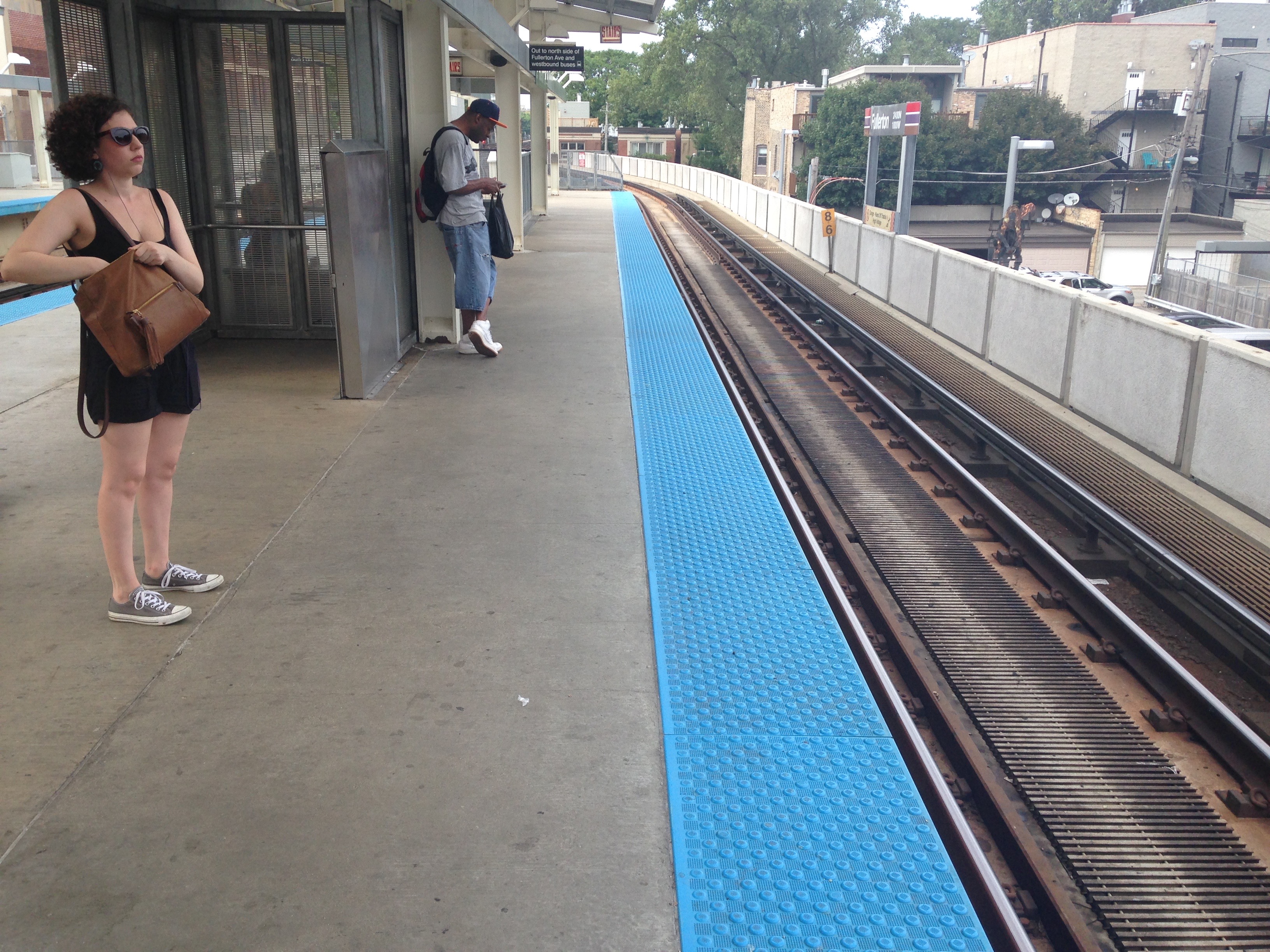
    Chicago: I went all over Chicago on the bike, from Frank Lloyd Wright’s show-homes in Oak Park to the South Side slums (where that weekend twelve people were wounded in assorted shootings). I also made it to the old stockyards, Haymarket Square (of anarchist fame), and the Hyde Park home of President Barack Obama, which now is unpleasantly hidden away behind tall trees, concrete anti-terror barriers, and snarling guards, giving it the air of a Beirut embassy.

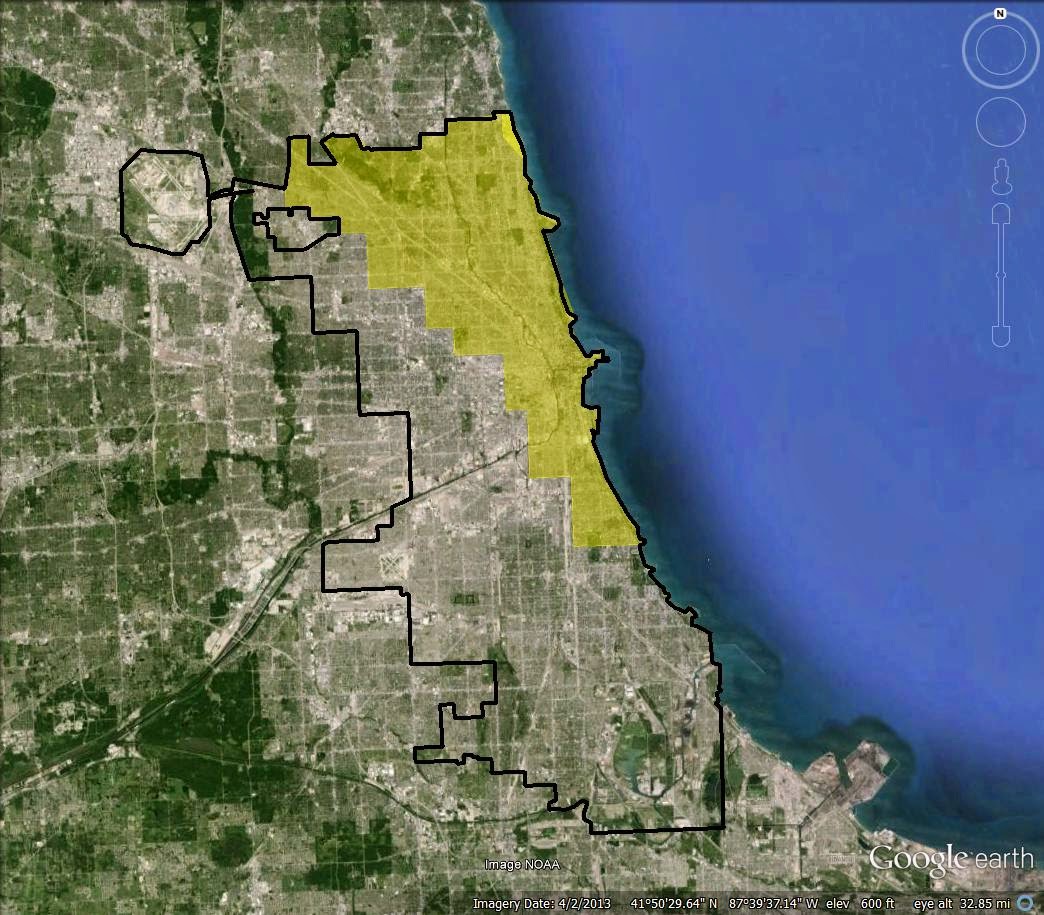
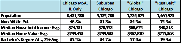
    Beyond the elegant Loop, lakefront, university districts, and various solid neighborhoods, Chicago has endless stretches of abandoned warehouses—no man’s lands between the city and suburbs, belts in search of manufacturing.

    I felt better when I found where the Marx Brothers had lived when they were still playing vaudeville; Ernest Hemingway’s boyhood home (when he sported curls in what he famously called that place of “broad lawns and narrow minds”); and a magnificent bike lane that sweeps along Lake Michigan. I even found myself agreeing with former vice president Dan Quayle, who said “It is wonderful to be here in the great state of Chicago.”

    St. Louis: Few city downtowns are as pleasant as that of St. Louis, which struck me as having a perfect mix of parks, restaurants, stadiums, hotels, and office buildings converted into residential lofts, many with views of the Mississippi and the Gateway Arch. I biked out as far as Clayton, Missouri, through the incomparable Forest Park, and looped around several universities, hospitals, and museums, all of which add to the city’s infrastructure luster.

    Most of what I saw was white St. Louis, as gracious as a southern plantation, although coming and going I went through northern and eastern satellite suburbs — Ferguson is one of many — where the local economy seems to revolve around selling tires, check cashing, and all-night convenience stores.

    Indianapolis: On the way from St. Louis to Indianapolis, I stopped in Springfield (part of a Lincoln haj) and Terre Haute. My bus into the Indiana capital left me at the “downtown transit center,” a dreary cave of broken vending machines, now that the former railroad station is an elegant hotel.

    The rest of downtown Indianapolis sparkled, and I spent the best day of my travels ducking into the Eiteljorg Museum of American Indians and Western Art, drinking coffee on sunny terraces, following bike paths, exploring the canals, and touring the city’s many universities, Butler and Indiana-Purdue among them.

    Only when I went out on the bike that night looking for the boyhood home of writer Kurt Vonnegut did I find the other Indianapolis, which is camped out in dilapidated wooden frame houses or low-rise housing projects, clearly off the convention-city grid. No wonder Vonnegut wrote “So it goes.”

    Canton: So poorly is Ohio served with public transportation that I was forced to rent a car to go from Dayton Trotwood (a sad shopping center where the Indianapolis bus dropped me) to Canton and Cleveland. I stuck mainly to the secondary roads, often clogged with traffic and slow lights. Unless someone can add a dome, Astroturf, and The Gap to Hometown USA, it will be lost.

    Canton was the saddest city on my travels. Not even the presence of the Pro Football Hall of Fame or William McKinleyism can put a positive spin on the vacant lots and boarded-up storefronts.

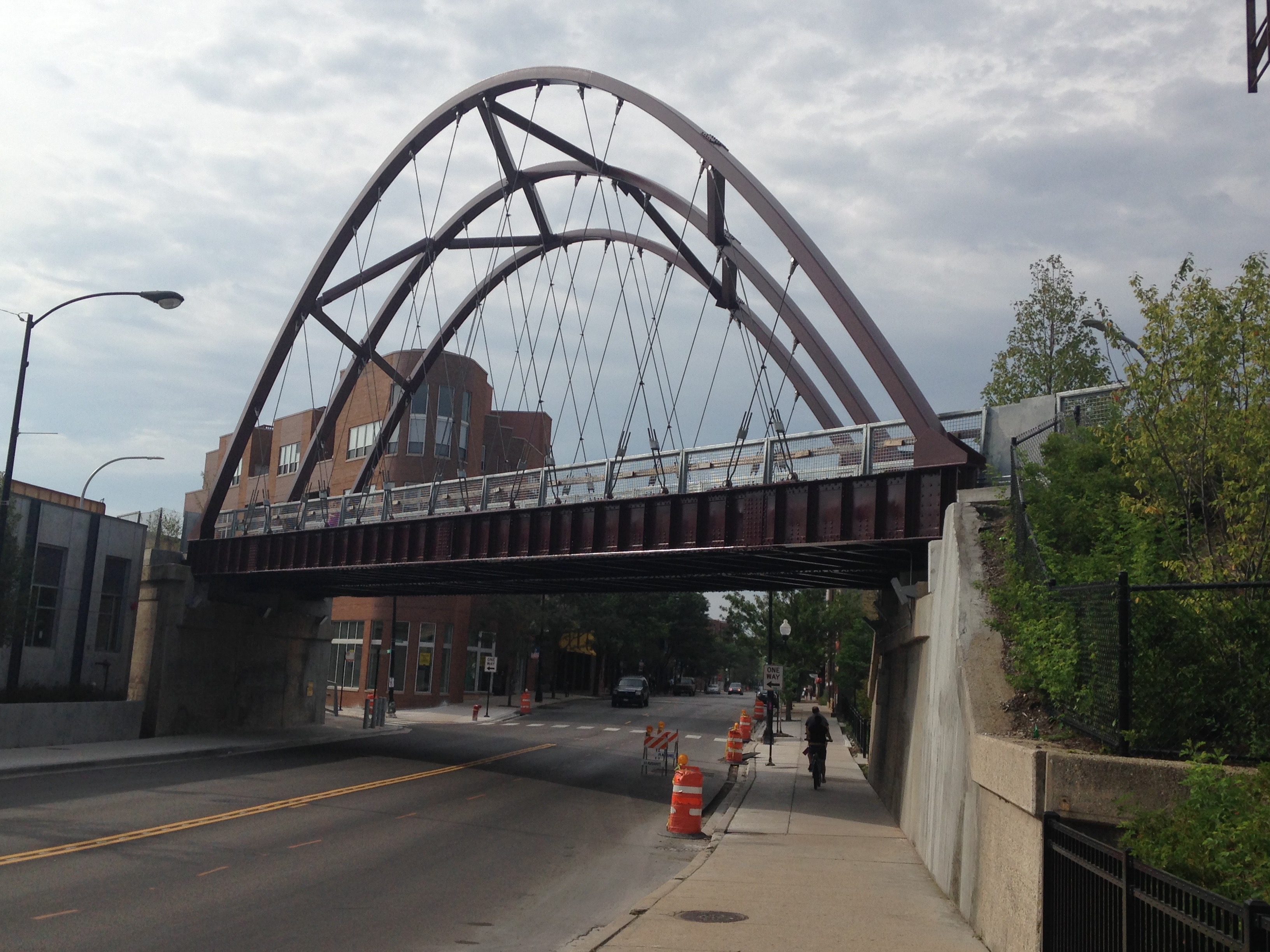
    Cleveland: I was back on the bike, and loved much of what I saw downtown in the canyons of Art Deco office buildings.

    Cleveland is more of an extended suburb than a city — if not a state of mind with a football team — although it can quickly change from blocks of lakefront mansions to rows of seedy body shops… emphasis here on the word “body”.

    Buffalo: On my night bike ride into the city from Amtrak’s suburban Depew Station, I passed through a series of depressing slums and at one point had to out-sprint a highwayman who wanted to steal my rig. (“Give me that fucking bike,” is how he introduced himself.)

    The new ghetto arose from the old working class neighborhoods; a nether world in the shadows of subsidized convention centers and urban renewal towers. Buffalo at night is a ghost town, although I loved riding north along Delaware Avenue to the state university.

    In upstate New York, I made a loop around the Finger Lakes through such rustbelt stalwarts as Corning, Binghamton, Syracuse, and Auburn. The delight was Elmira, with its local college that has the Mark Twain writing studio in which he wrote Tom Sawyer and Huckleberry Finn. Ithaca is a labyrinth of universities and dead-end streets that gets my vote for the most confusing city grid in America.

    Syracuse at night — on the bike or waiting at the bus station — felt like the set of a sci-fi movie in which everyone has been vaporized. Binghamton aspires to hipness, but, well, it’s Binghamton. At least Auburn has the prison, and at midnight its strange aurora borealis of klieg lights made my bike vest glow like medieval chain-mail.

    A series of buses and commuter trains took me down to New York City. I had booked on Amtrak, but its Lake Shore Limited was routinely seven or more hours late. One conductor blamed the delays on the weather from the previous winter, although my seat mate said impoverished locals robbed the copper from the track signals.

    At the end of my riding, I think I came across as someone as morose as the novelist Theodore Dreiser, who took what he called “a Hoosier holiday,” at a time when, as he wrote, “America was in the furnace stage of its existence.” But I defy anyone who doesn’t take heart from a Lake Erie sunrise.

    Photo by the author: Downtown Cleveland from Lake Erie

    Matthew Stevenson, a contributing editor of Harper’s Magazine, is the author, most recently, of Remembering the Twentieth Century Limited, a collection of historical travel essays, and Whistle-Stopping America. His next book, Reading the Rails, will be published in 2015. He lives in Switzerland.

  • Divergent Demographic and Economic Trends in Chicago

    The fortunes of the city of Chicago have become clouded in recent years as concerns over its weakening finances and heavy debt obligations have grown. The tally for the unfunded public employee debt obligations of Chicago’s overlapping units of local governments (including those for public schools, parks, and county services) is now approaching $30 billion. Moreover, the city government has been criticized for its practices of funding current public services with proceeds from the issuance of long-term debt and the long-term leases of public assets (such as its parking meter system). However, faith in Chicago’s ability to address its debts has not fallen so far as that in Detroit’s, chiefly because the Windy City’s economic trends display more vibrancy.

    Population change is a prominent indicator of the health of an urban economy because it reflects a city’s ability to hold on to its residents (as opposed to losing them to the suburbs or other locales). Over the past few decades, similar to other central cities, Chicago has experienced an erosion in its population share of the broader metropolitan statistical area (MSA);[1] in contrast, the surrounding suburbs have seen their share climb. According to the U.S. Census, Chicago held 38% of the MSA’s population in 1980, with this share falling to 35% by 1990; in the subsequent 20 years, Chicago’s population share of the MSA decreased another 3 percentage points per decade, reaching 29% by 2010 (see table below). During the 1980–2010 period, Chicago lost a total of over 300,000 residents. At the same time, suburban Chicago gained close to 2 million in population. Since 2010, the city of Chicago’s population and population share of the MSA have strengthened somewhat, though the (off-Census year) estimates are probably not as reliable.

    While population trends can be telling for a city’s prospects, they can also belie changes in its residents’ wealth and income. Despite the city of Chicago’s population loss over the past few decades, its economic trends have been generally more encouraging.[2] Household income is an important indicator of Chicago’s fortunes relative to those of its suburbs. In 1990, median household income in the city was just 67% of the median household income in suburban Chicago. By 2010, this income ratio had climbed to 73% (see table below). Decomposing household income statistics by (self-reported) racial/ethnic group reveals that this trend was pervasive for the three largest groups: non-Hispanic white, black, and Hispanic. The ratio of city median income to suburban median income among white households experienced the greatest change; it rose from 77% in 1990 to 98% (near parity) in 2010.

    These robust trends are echoed by Chicago’s rising share of adults aged 25 and older who have attained at least a bachelor’s degree. In 1990, among adults aged 25 and older, 19% of those residing in the city had attained a four-year college degree versus 28% of those residing in the suburbs (see table below). By 2010, Chicagoans in this age demographic had almost reached the same share in this regard as their suburban counterparts (33% for city residents versus 35% for suburban residents). The non-Hispanic whites again experienced the greatest change among the three largest racial/ethnic groups. In 1990, 29% of the white city population aged 25 and older had a four-year college degree—the same percentage as the white suburban population in this age demographic; however, by 2010, 55% of such white city dwellers had a bachelor’s degree, while 39% of their white suburbanite counterparts did. Between 1990 and 2010, the city’s black population also made substantial gains in education, as evidenced by the share of black adults aged 25 and older with a bachelor’s degree having risen from 11% to 17%.

    By “drilling down” through the data to examine specific neighborhoods, we can see how geographically concentrated the city’s gains in college-educated adults aged 25 and older have been. These gains have been highly concentrated in Chicago’s central business district (“the Loop”) and the surrounding areas, as well as the neighborhoods west of Chicago’s northern lakeshore. As shown in the table below, dramatic gains in the college-educated population were seen in the Loop and the neighborhoods just south, west, and north of it. For example, the Near South Side saw an increase in the share of adults with a four-year college degree climb from 9% in 1980 to 68% in 2010. No less dramatic were such gains in Chicago’s neighborhoods west of its northern lakeshore: The shares of the college-educated population there typically doubled or tripled between 1980 and 2010 (in the case of the North Center neighborhood, this share increased sixfold—from 11% in 1980 to 66% in 2010).

    As one might expect, many college-educated Chicago residents work in proximity to their residence. Of those living in the Central Area and Mid-North Lakefront, an estimated 57% work in the Central Area of Chicago and 79% work somewhere in the city.[3] Of those who do work in the Central Area, an estimated 19% travel to work by driving alone (as opposed to walking, public transit, bike, and carpooling); this percentage is much smaller than the nearly 70% of metropolitan Chicago workers who travel to work by driving alone.[4] The trends highlighted thus far point to the fact that the city of Chicago draws and retains many jobs. By one count, the city of Chicago’s Central Area is the domicile of over half a million jobs. As seen below, job counts in the Central Area have remained fairly constant over the past 13 years, even while job levels in the remainder of the city and in the remainder of Cook County have been falling.

    Meanwhile, compensation levels per job have continued to climb in Chicago’s Central Area, reflecting a work force with greater skills and education. Annual compensation per worker on the payroll in Chicago’s Central Area exceeds that of the overall MSA by 50%.

    Many of the trends shown here bode well for the city of Chicago, despite the fiscal challenges it currently faces. To be sure, many large central cities in the Midwest, including Detroit, are experiencing strong growth of both jobs and households centered around their central areas and downtowns. In this, the central Chicago area enjoys a strong start.

    William Sander (Ph.D., Cornell University) is professor of economics at DePaul University in Chicago.  He has also taught at the University of Illinois at Urbana-Champaign and the University of the Philippines.

    William A. Testa (Ph.D., Ohio State University) is Vice President and Director of Regional Programs, Federal Reserve Bank of Chicago.  He has also taught at Tulane University.

    Flickr photo by Chris Smith: Pritzker Pavilion, Millennium Park

    ________________________________________

    [1] Current and historical delineations of MSAs are available atwww.census.gov/population/metro/(Return to text)

    [2] This is not to say that all parts of the city have been on the economic upswing. Several Chicago neighborhoods have seen severe deterioration in wealth and income, as well as in living conditions, as evidenced by increasing incidences of homelessness and crime in certain areas in the past few decades; see, e.g., http://danielkayhertz.com/2013/08/05/weve-talked-about-homicide-in-chicago-at-least-one-million-times-but-i-dont-think-this-has-come-up/(Return to text)

    [3] This statement covers 113,000 workers living in these areas as of the year 2000. Estimates were pulled from www.rtams.org and are based on the Census Transportation Planning Package (CTPP), “which is a special tabulation of the decennial U.S. Census for transportation planners” and “contains detailed tabulations on the characteristics of workers at their place of residence (‘part 1’), at their place of work (‘part 2’), and on work trip flows between home and work (‘part 3’)” (see www.rtams.org/rtams/ctppHome.jsp). Workers who work at home are excluded. See also http://definingdowntown.org/wp-content/uploads/docs/Defining_DowntownReport.pdf; this report ranks Chicago second among major U.S. cities in terms of the percentage of residents living within one mile of downtown who work downtown (figure 3 in the report), and ranks Chicago first in terms of population growth in the downtown area over the period 2000–10 (figure 4 in the report).(Return to text)

    [4] Estimates are from www.rtams.org and are based on the Census Transportation Planning Package (CTPP). (Return to text)

    This post originally appeared in Chicago Fed Midwest Economy on December 3, 2014.

  • Two Chicagos, Defined

    Years ago, when I first started working as a planner for the City of Chicago, my primary responsibility was working with community organizations that received Community Development Block Grant (CDBG) funding for commercial revitalization activities.  This being CDBG funding, our work was constrained to areas of the city where 51% or more of households earned less than the median household income for the Chicago metro area.  In the early 1990’s, this hardly interfered with our work — outside of the Gold Coast, the Near North Side, Lincoln Park, Lakeview and a few parts of the Northwest and Southwest sides, we were able to grant CDBG funding to virtually the entire city.

    Fast forward twenty years.  Chicago’s transition from Rust Belt Capital to Global City has been unparalleled.  Where there once had been large swaths of middle-class, working-class and impoverished neighborhoods, with high-income enclaves, there are now nearly as many high-income neighborhoods as there are of the other three.  Perhaps someone who moved to Chicago post-1995 and lives in one of the up-and-coming areas is vaguely aware of this, but anyone who was here before then is quite right to be astounded.

    Despite Chicago’s transformation, it’s been pretty well-documented that not all parts of the city have benefited.  The battle over the closing of nearly 50 schools, mostly located in the city’s poorer South and West side neighborhoods, brought this to light, as did Chicago’s high-profile murder and violent crime rates through 2013 (which, to date in 2014, have gone down dramatically).  Inequalities and disparities became evident in both areas; University of Chicago graduate student and blogger Daniel Kay Hertz brought the disparities to light with his analysis of violent crime in Chicago.  As he said in his piece:

    Over the last twenty years, at the same time as overall crime has declined, the inequality of violence in Chicago has skyrocketed. There have always been safer and more dangerous areas here, as there are everywhere; but the gap between them is way, way bigger now than it used to be.

    Over the last two decades a new but undefined paradigm has emerged, the one of “Two Chicagos”.  This is probably best explained once again by Dan Hertz, who recounted an overheard conversation on the L:

    I was on the train earlier this week, and two white men got on and asked their neighbors, who were two black women, how to get to a hotel. The women told them. And then began a sort of stock conversation that Chicagoans have with tourists: How do you like the weather, ha ha? The men, who were from Atlanta, did not like it. Have you been on a subway before? Yes, but not often. Would you come back? Oh, yes. We love Chicago, the men said.

    The men reached their station, and left.

    One woman said to the other: I hate it when people say that – I love Chicago. No, you don’t. You love downtown and the North Side. The other woman said, Uh huh. 

    That is a frequent sentiment of those who live on the other side of the invisible divide in Chicago.  But what, exactly, is that divide?  Where are the boundaries?  Exactly how deep are the difference?

    I took a stab at trying to figure this out.

    I compared some socio-economic statistics for the 56 zip codes in Chicago against medians and averages for the entire Chicago metro area (Indiana and Wisconsin excluded).  The differences are stark.

    Let’s start by looking at maps of the areas of examination.  Here is the seven-county Illinois portion of Chicago’s metro area, with Chicago etched in:

    I gathered data for all suburban municipalities and all City of Chicago zip codes within this area, for five variables — population, non-white population percentage, median household income, and median home value, and bachelor’s degree or more for persons 25+.  The data comes from the 2011 U.S. Census American Community Survey.  After collecting that data, I established an “average of medians” or “average of averages” to get a baseline for the metro area, and an understanding of how jurisdictions or zip codes would compare to one another.  One fairly big caveat — an average of medians or average of averages weighs all jurisdictions equally, skewing the numbers higher due to the number of small but well-to-do suburban municipalities.  So while the 2011 actual median household income for the seven-county area overall was $61,491, the average of medians was $74,731.  But since all data is expressed this way, differences are negated.

    Next, I looked for Chicago zip codes that were above the metro area average in at least one of three categories — median household income, median home value, and bachelor’s degree or more for persons 25+.  These are the higher income neighborhoods that can be called “Global Chicago”.  Within the city, they look like this, in yellow:

    Most Chicagoans would recognize this as the wealthier parts of the city.  It stretches from the far Northwest Side eastward to the lake, south to downtown and continuing south before ending in the Hyde Park neighborhood on the South Side.  Again, I included all zip codes that were above the metro average for at least one of the three categories I examined, so not all communities are the same.  Hyde Park, for example, is here because it has high educational attainment, but is below the average for income and home value.  The same applies to Rogers Park and Edgewater on the city’s northern border with Evanston.  Jefferson Park, Norwood Park and Sauganash, on the other hand, located on the Northwest Side, rank highly in home value but lower for income and educational attainment.

    Taken together, you can see how “Global Chicago” compares with the Illinois portion of the metro area, the metro area excluding Chicago to give you Suburban Chicago, and the balance of the city beyond “Global Chicago” that I’ve called “Rust Belt Chicago”:

    The differences are indeed stark.  “Global Chicago” is on par with the Chicago suburbs and the metro area overall in terms of income, and has a lower percentage of minority residents compared to the metro area.  Interestingly, “Global Chicago” has a much higher home value and educational attainment when compared to the metro area overall or the ‘burbs.  Meanwhile, “Rust Belt Chicago” lags far behind.  “Rust Belt Chicago” has a large majority-minority population, has an income nearly one-half as much as the suburban households, and has only one-third as many college graduates as “Global Chicago”.

    I decided to take this analysis a little further and determine if there is a core to “Global Chicago”, and how it would compare to the rest of the city.  I collected data for zip codes that exceeded the metro average in two or more of the three categories.  That produced this map:

    And this table:

    Here, a “Super Global Chicago” compares favorably with the ‘burbs in terms of income, but far exceeds it in terms of home value and educational attainment.  Including some of the peripheral areas of the previous “Global Chicago” with the previous “Rust Belt Chicago” to produce an “Average Chicago” leads to some gains, but it still lags far behind the other slices of the metro area.

    Right now, the CNN series “Chicagoland” is doing its best to illustrate the “Two Chicagos” meme, highlighting blues festivals and Stanley Cup championship celebrations on one end of town and school closures and endless crime on another.  However, these maps and tables may do a far better job of demonstrating the impact of past and current practices and policies on the city’s landscape.  In fact, I think Chicago’s example is one that will serve as a model, for better or worse, for other cities across the nation.

    In reality I see the “Two Chicagos” meme as overplayed.  Chicago may be better understood in thirds — one-third San Francisco, two-thirds Detroit.

    This post originally appeared at Corner Side Yard on March 18, 2014.

    Pete Saunders is a Detroit native who has worked as a public and private sector urban planner in the Chicago area for more than twenty years.  He is also the author of “The Corner Side Yard,” an urban planning blog that focuses on the redevelopment and revitalization of Rust Belt cities.

    Chicago photo by Bigstock.