Tag: Portland

  • Major Metropolitan Commuting Trends: 2000-2010

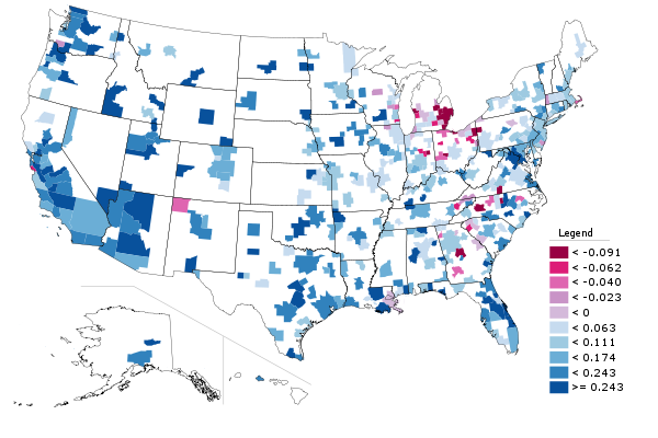
    As we indicated in the last article, solo automobile commuting reached an all time record in the United States in 2010, increasing by 7.8 million commuters. At the same time, huge losses were sustained by carpooling, while the largest gain was in working at home, which includes telecommuting. Transit and bicycling also added commuters.  This continues many of the basic trends toward more personalized employment access that we have seen since 1960.

    Solo Automobile Commuting: Among the nation’s 51 metropolitan areas with more than 1 million population, 38 experienced increases in solo automobile commuting between 2000 and 2010. More than 80% of commuting is by solo automobile in 25 of the 51 largest metropolitan areas, with the highest rates being in Birmingham, Detroit, Cincinnati, Indianapolis and Kansas City. Another 28 metropolitan areas have single automobile commute shares of between 70% and 80%, with Boston, Washington and San Francisco between 60% and 70%. As would be expected, the lowest solo automobile commute share was in New York at 51%.

    Car Pools: The national data also showed a nearly 2.4 million loss in carpool use. The losses were pervasive, occurring in all 51 metropolitan areas. Riverside-San Bernardino had the highest carpool market share at just under 15%, while all other major metropolitan areas were below 12%. Car pools have been losing market share for decades.

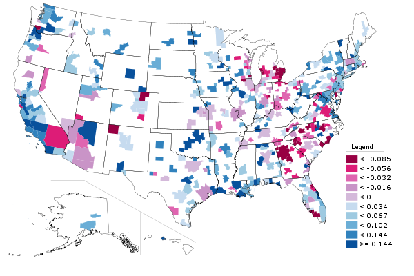
    Work at Home (Includes Telecommuting): In what we have previously labeled as The Decade of the Telecommute, the nation experienced a 1.7 million increase in working at home over the past decade. The market share gains in working at home were as pervasive as the losses in carpooling, with all 51 metropolitan areas registering increases. Austin had the strongest work-at-home market share, at 7.3%, followed by Portland at 6.5%, San Francisco and Denver at 6.2%, Phoenix at 6.0%, with San Diego, Raleigh and Atlanta above 5.5%. Overall, working at home exceeded transit commuting in 37 major metropolitan areas out of 51 in 2010, up from 27 in 2000. Three metropolitan areas had work at home market shares of less than 3%, including Memphis, New Orleans and last place Buffalo.

    Transit: As noted before, transit enjoyed its first 10 year gain since journey to work data was first collected by the Census Bureau 50 years ago. Overall, transit added 900,000 daily commuters, roughly half that for telecommuters. Transit’s market share increased in 25 of the top 51 metropolitan areas. It is also notable that in a number of the metropolitan areas with the largest expenditures for new rail systems, there were either losses or commuting gains were concentrated in the more flexible bus services.

    New York: As so often has been the case, transit was largely a "New York story." More than one half of the new transit commuters were in the New York metropolitan area, more than 450,000 of the 900,000 increase. New York boasts by far the most extensive transit system in the nation, which serves the second largest central business district in the world and by far the nation’s most important. In 2000, New York had a transit work trip market share of 27.4%. By 2010, New York’s transit work trip market share had risen to 30.7%, more than double that of any other metropolitan area. More than 70% of the new transit commuters in the New York area were on its subway (Metro), suburban rail and light rail systems.

    San Francisco: San Francisco retained its position as the second strongest transit metropolitan area, with a 14.6% work trip market share in 2010. This is up from 13.8% in 2000.

    Washington: Washington was the third strongest transit commuting market, with a 14.0% work trip market share in 2010. This modest increase from 13.4% nonetheless produced the second largest ridership increase in the nation, at more than 130,000. This reflects the strength of Washington’s job market over the decade. Rail ridership accounted for 53% of this increase, while buses accounted for the other 47%.

    Boston and Chicago: Boston passed Chicago to become the fourth strongest transit market, at 11.8% in 2010. This is an increase from 11.2% in 2000. Chicago ranked fifth at 11.2%, a small reduction from the 11.3% in 2000.

    Los Angeles: Los Angeles had the third largest increase in transit commuting, adding 60,000 daily transit commuters. Approximately 75% of these new commuters were attracted by the region’s extensive bus system as opposed to its very expensive but limited rail system. This increase placed Los Angeles in a virtual tie with Portland, with a work trip market share of 6.2%.

    Portland: Portland continued to experience its now 30 year transit market share erosion, despite having added three new light rail lines between 2000 and 2010. Portland’s transit work trip market share fell to 6.2% from 6.3% and now trails the work at home and telecommute market share of 6.5%.

    Seattle:Seattle added 29,000 new transit commuters for the fourth strongest growth in the nation. Approximately 75% of the new commuters were on the metropolitan area’s bus system.

    Atlanta: Atlanta, which is home to the third largest postwar Metro system in the nation (MARTA) gained nearly 9000 new transit commuters, all of them on the bus, while losing more than 3000 rail commuters.

    Miami:Miami added 16,000 new transit commuters, though more than 90% were attracted to the bus system, rather than the rail services.

    Rail and Bus in Texas: Other metropolitan areas with new and expanded rail systems did not fare as well. In Dallas-Fort Worth, the light rail system was more than doubled in length, yet there was a reduction of more than 3000 daily transit commuters. The transit work trip market share in Dallas-Fort Worth dropped from 1.8% to 1.4%, approximately one quarter lower than that of any other major metropolitan area with a new light rail or Metro system. Houston, which built its first light rail line during the period, lost nearly 3000 daily transit commuters, with its transit work trip market share dropping by nearly one-third, from 3.2% to 2.3%. By contrast, the third largest metropolitan area in Texas, San Antonio, lost no commuters from its bus only transit system.

    Other New Rail Metropolitan Areas: Other metropolitan areas with new rail systems experienced modest ridership increases, with 60 to 70 percent of the increase on the bus systems in Charlotte, Minneapolis-St. Paul and Phoenix. Salt Lake City experienced a small decline in transit commuting.

    Below 1 Percent: Four metropolitan areas had transit work trip market shares of less than 1%, including Indianapolis, Raleigh, Birmingham and last place Oklahoma City, with a market share of 0.4%.

    Bicycles: It was also a good decade for bicycle commuting, with the national increase of nearly 250,000. The bicycle commuting market share rose in 45 of the 51 largest metropolitan areas. Portland had the highest bicycle market share at 2.2%, with three other metropolitan areas at 1.5% or above, Sacramento, San Francisco and San Jose. The lowest bicycle commuting market shares were in San Antonio, Cincinnati, Birmingham and Memphis, all at 0.1 percent.

    Walking: There was little change in walking among the nations major metropolitan areas. The largest shares were in New York (5.9%) and Boston (5.4%), with the smallest shares in Raleigh (1.1%), Orlando (1.1%) and Birmingham (1.0%).

    Drifting Away from Shared Commuting: In some ways, the 2000s were different than previous decades, especially with the reversals in bicycle commuting and transit. However, overall, shared ride commuting (transit and car pools) lost share due to the precipitous decline in car pooling. Longer term share increase trends also continued in single-occupant automobile commuting and working at home. The bottom line: personal employment access (personal mobility plus working at home) continues to carve away at the smallish share still held by shared commuting.

    ————-

    Data: The 2000 and 2010 commuting market shares by mode are shown in Tables 1 and 2 (2010 metropolitan area boundaries).

    ————

    Table 1
    Work Trip Market Share: 2000
    Metropolitan Areas Over 1,000,000 Population in 2010
    Metropolitan Area Car, Truck or Van: Alone Car/Van Pool Transit Bicycle Walk Other Work at Home (Includes Telecommute)
    Atlanta 77.0% 13.7% 3.4% 0.1% 1.3% 1.1% 3.5%
    Austin 76.5% 13.7% 2.5% 0.6% 2.1% 1.1% 3.6%
    Baltimore 75.5% 11.5% 5.9% 0.2% 2.9% 0.9% 3.2%
    Birmingham 83.3% 12.0% 0.7% 0.1% 1.2% 0.7% 2.1%
    Boston 71.1% 8.6% 11.2% 0.5% 4.6% 0.8% 3.3%
    Buffalo 81.7% 9.4% 3.3% 0.2% 2.7% 0.5% 2.1%
    Charlotte 80.7% 12.8% 1.4% 0.1% 1.2% 0.8% 2.9%
    Chicago 70.4% 11.0% 11.3% 0.3% 3.1% 1.0% 2.9%
    Cincinnati 81.3% 10.1% 2.8% 0.1% 2.3% 0.6% 2.7%
    Cleveland 81.3% 8.8% 4.1% 0.2% 2.2% 0.6% 2.7%
    Columbus 82.1% 9.7% 2.1% 0.2% 2.3% 0.6% 3.0%
    Dallas-Fort Worth 78.7% 13.9% 1.8% 0.1% 1.5% 1.0% 3.0%
    Denver 76.0% 11.7% 4.4% 0.4% 2.1% 0.8% 4.6%
    Detroit 84.7% 9.2% 1.7% 0.1% 1.4% 0.6% 2.2%
    Hartford 82.6% 8.7% 2.8% 0.2% 2.5% 0.6% 2.6%
    Houston 77.0% 14.3% 3.2% 0.3% 1.6% 1.1% 2.5%
    Indianapolis 82.8% 10.4% 1.3% 0.2% 1.7% 0.7% 3.0%
    Jacksonville 80.3% 12.6% 1.3% 0.5% 1.7% 1.4% 2.3%
    Kansas City 82.6% 10.6% 1.2% 0.1% 1.4% 0.7% 3.5%
    Las Vegas 74.6% 14.7% 4.4% 0.5% 2.3% 1.3% 2.3%
    Los Angeles 71.9% 14.6% 5.6% 0.7% 2.7% 1.0% 3.5%
    Louisville 81.8% 11.2% 2.0% 0.2% 1.7% 0.7% 2.5%
    Memphis 80.7% 13.3% 1.6% 0.1% 1.3% 0.9% 2.2%
    Miami-West Palm Beach 77.3% 13.1% 3.2% 0.5% 1.7% 1.2% 3.1%
    Milwaukee 79.7% 9.9% 4.2% 0.2% 2.9% 0.6% 2.6%
    Minneapolis-St. Paul 78.3% 10.0% 4.4% 0.4% 2.4% 0.6% 3.8%
    Nashville 80.5% 13.1% 0.8% 0.1% 1.5% 0.8% 3.2%
    New Orleans 72.9% 14.6% 5.4% 0.6% 2.7% 1.3% 2.4%
    New York 52.7% 9.3% 27.4% 0.3% 6.0% 1.5% 2.9%
    Oklahoma City 81.6% 12.1% 0.5% 0.2% 1.7% 1.0% 2.9%
    Orlando 80.6% 12.1% 1.6% 0.4% 1.3% 1.1% 2.9%
    Philadelphia 73.1% 10.2% 8.9% 0.3% 3.9% 0.7% 2.9%
    Phoenix 74.6% 15.3% 1.9% 0.9% 2.1% 1.4% 3.7%
    Pittsburgh 77.5% 9.8% 5.9% 0.1% 3.6% 0.6% 2.5%
    Portland 73.1% 11.5% 6.3% 0.8% 2.9% 0.8% 4.6%
    Providence 80.7% 10.5% 2.4% 0.2% 3.3% 0.8% 2.2%
    Raleigh 80.8% 12.1% 0.9% 0.2% 1.6% 1.0% 3.5%
    Richmond 81.7% 10.9% 1.9% 0.2% 1.8% 0.8% 2.7%
    Riverside-San Bernardino 73.5% 17.6% 1.6% 0.5% 2.2% 1.2% 3.5%
    Rochester 81.7% 9.1% 2.0% 0.2% 3.5% 0.6% 2.9%
    Sacramento 75.3% 13.5% 2.7% 1.4% 2.2% 0.9% 4.0%
    Salt Lake City 76.0% 13.4% 3.3% 0.5% 2.1% 0.7% 4.0%
    San Antonio 76.2% 14.9% 2.7% 0.1% 2.4% 1.2% 2.6%
    San Diego 73.9% 13.0% 3.3% 0.6% 3.4% 1.4% 4.4%
    San Francisco-Oakland 62.8% 12.7% 13.8% 1.1% 3.9% 1.3% 4.3%
    San Jose 77.2% 12.4% 3.4% 1.2% 1.8% 0.9% 3.1%
    Seattle 71.6% 12.7% 7.0% 0.6% 3.1% 0.8% 4.2%
    St. Louis 82.5% 10.0% 2.2% 0.1% 1.7% 0.6% 2.9%
    Tampa-St. Petersburg 79.7% 12.4% 1.3% 0.6% 1.7% 1.2% 3.1%
    Virginia Beach-Norfolk 78.8% 12.1% 1.7% 0.3% 2.7% 1.6% 2.7%
    Washington 67.5% 13.4% 11.2% 0.3% 3.0% 0.9% 3.7%
    Top 51 Metropolitan Areas 73.2% 11.8% 7.5% 0.4% 2.9% 1.0% 3.2%
    Calculated from Census Bureau data
    Metropolitan areas as defined in 2010
    Table 2
    Work Trip Market Share: 2010
    Metropolitan Areas Over 1,000,000 Population in 2010
    Car, Truck or Van: Alone Car/Van Pool Transit Bicycle Walk Other Work at Home (Includes Telecommute)
    Atlanta 77.6% 10.3% 3.4% 0.2% 1.3% 1.5% 5.8%
    Austin 75.6% 10.5% 2.3% 0.6% 1.9% 1.8% 7.3%
    Baltimore 76.5% 9.6% 6.0% 0.2% 2.6% 1.0% 4.1%
    Birmingham 84.8% 10.0% 0.6% 0.1% 1.0% 0.5% 3.1%
    Boston 69.5% 7.5% 11.8% 0.7% 5.4% 0.8% 4.4%
    Buffalo 82.0% 7.5% 3.8% 0.3% 3.0% 1.1% 2.3%
    Charlotte 80.6% 10.0% 2.0% 0.2% 1.5% 0.6% 5.1%
    Chicago 71.0% 8.5% 11.2% 0.6% 3.1% 1.0% 4.5%
    Cincinnati 84.1% 7.9% 2.1% 0.1% 2.0% 0.4% 3.4%
    Cleveland 82.3% 7.2% 3.6% 0.3% 2.2% 0.7% 3.7%
    Columbus 82.4% 8.0% 1.7% 0.5% 2.3% 0.6% 4.6%
    Dallas-Fort Worth 81.3% 10.1% 1.4% 0.2% 1.2% 1.4% 4.6%
    Denver 76.3% 9.6% 4.1% 0.8% 1.9% 1.1% 6.2%
    Detroit 84.6% 8.5% 1.5% 0.2% 1.4% 0.8% 3.0%
    Hartford 81.5% 7.9% 3.1% 0.3% 3.0% 1.0% 3.2%
    Houston 79.4% 11.5% 2.3% 0.3% 1.4% 1.7% 3.4%
    Indianapolis 83.9% 8.2% 0.9% 0.3% 1.5% 0.8% 4.3%
    Jacksonville 82.5% 8.9% 1.0% 0.5% 1.4% 1.2% 4.5%
    Kansas City 83.7% 8.5% 1.2% 0.2% 1.4% 0.9% 4.1%
    Las Vegas 78.9% 10.5% 3.8% 0.6% 1.6% 1.3% 3.3%
    Los Angeles 73.5% 10.7% 6.2% 0.9% 2.6% 1.2% 5.0%
    Louisville 83.5% 9.2% 1.9% 0.2% 1.3% 0.9% 3.1%
    Memphis 83.6% 10.3% 1.0% 0.1% 1.5% 0.9% 2.7%
    Miami-West Palm Beach 78.8% 9.4% 3.5% 0.6% 2.0% 1.4% 4.4%
    Milwaukee 80.1% 9.3% 3.4% 0.5% 2.6% 0.7% 3.4%
    Minneapolis-St. Paul 78.3% 7.9% 4.8% 0.7% 2.4% 0.9% 4.9%
    Nashville 81.3% 10.7% 1.0% 0.2% 1.2% 1.0% 4.6%
    New Orleans 78.1% 11.0% 3.2% 0.7% 2.6% 1.9% 2.5%
    New York 50.5% 6.8% 30.7% 0.5% 5.9% 1.6% 3.9%
    Oklahoma City 82.7% 10.6% 0.5% 0.3% 1.6% 1.0% 3.4%
    Orlando 82.1% 9.2% 1.6% 0.3% 1.1% 1.4% 4.4%
    Philadelphia 73.9% 8.0% 9.6% 0.5% 3.5% 0.8% 3.8%
    Phoenix 76.7% 11.8% 2.0% 0.6% 1.5% 1.5% 6.0%
    Pittsburgh 77.0% 8.9% 5.6% 0.3% 3.7% 0.9% 3.5%
    Portland 72.1% 8.8% 6.2% 2.2% 3.3% 0.9% 6.5%
    Providence 81.3% 8.3% 2.6% 0.5% 3.2% 0.9% 3.2%
    Raleigh 82.0% 8.7% 0.9% 0.3% 1.1% 1.1% 5.9%
    Richmond 81.2% 10.1% 1.8% 0.4% 1.2% 0.7% 4.6%
    Riverside-San Bernardino 76.1% 14.8% 1.7% 0.4% 1.8% 1.4% 3.8%
    Rochester 82.6% 7.1% 1.8% 0.4% 3.9% 0.7% 3.6%
    Sacramento 75.6% 11.2% 2.9% 1.7% 1.9% 1.1% 5.5%
    Salt Lake City 77.7% 11.3% 2.9% 0.8% 2.3% 1.0% 4.0%
    San Antonio 79.5% 11.5% 2.1% 0.1% 2.0% 1.4% 3.3%
    San Diego 76.2% 10.1% 3.3% 0.8% 2.8% 1.0% 5.9%
    San Francisco-Oakland 61.5% 10.6% 14.6% 1.7% 4.2% 1.2% 6.2%
    San Jose 77.5% 10.3% 2.9% 1.6% 1.8% 0.9% 5.1%
    Seattle 70.5% 10.2% 8.2% 1.1% 3.5% 1.0% 5.5%
    St. Louis 83.0% 7.7% 2.6% 0.2% 1.9% 0.8% 3.7%
    Tampa-St. Petersburg 80.3% 9.5% 1.6% 0.8% 1.4% 1.4% 5.0%
    Virginia Beach-Norfolk 80.9% 9.4% 1.8% 0.5% 3.3% 0.9% 3.1%
    Washington 65.6% 10.6% 14.0% 0.5% 3.5% 1.0% 4.9%
    Top 51 Metropolitan Areas 73.7% 9.4% 7.9% 0.6% 2.8% 1.2% 4.4%
    Calculated from Census Bureau data
    Metropolitan areas as defined in 2010

    Wendell Cox is a Visiting Professor, Conservatoire National des Arts et Metiers, Paris and the author of “War on the Dream: How Anti-Sprawl Policy Threatens the Quality of Life

    Photo: Manhattan (New York), with the Woolworth Building in the distance (by author)

  • “Art, Design, Portland” District Offers Opportunities To Work, Play, and Profit in Portland’s New Economy

    In a dreary economy, with record numbers of Portlanders unemployed and underemployed, the shared work space is hoping to tap into the city’s DIY sensibility to foster innovation, creativity and a new connection to work. But similar projects have tried here before — and failed. Will ADX’s new approach pencil out?

    Located on the edge of Portland’s eastside industrial district, ADX (Art Design Portland) occupies a 10,000-square-foot warehouse once filled by Apex Manufacturing. The warehouse has since been gutted and renovated, with the letters ADX printed across its façade.

    Inside, the bright space smells of new paint and freshly cut wood. “It’s our first day” says founder Kelley Roy as we walk to the makeshift interview area — three wooden chairs set in front of the company’s gallery space. A slow-moving Labrador trails us and lies down at Kelley’s feet.

    Kelley ticks through her professional history as if one gig could only have led to the next: Program Manager for Metro, green building developer, founder of food source and prep company Get Fresh NYC, author of Cartopia: Portland’s Food Cart Revolution, and now founder of ADX. “Everything I’ve done is about bringing people together over something I cared about,” she says. “Bringing people back together and giving them a place to work, to make their own jobs, do meaningful work. It’s just important to me.”

    Her business partner, Eric Black, joins us a minute later. Trained as an architect, Eric spent the past seven years at the architecture firm Yost Grube Hall in downtown Portland. From there he moved on to found the first iteration of ADX, located in a 3,000-square-foot building on southeast 9th avenue. This first version of ADX was a shared workspace and shop for architects, with 1,000 square feet of gallery space.

    The pair met when Kelly needed space to show work for a visiting artist friend, and ended up leasing the ADX gallery. It was then that they began re-envisioning ADX as a true cross-disciplinary work space.  “We started to prototype the idea of what it could really mean within that space,” says Eric. “It was a nice test.”

    The pair secured a $145,000 loan from Albina Opportunities Corporation and Mercy Corps Northwest to lease, renovate and equip their new building. The nonprofit lenders stepped in to support ADX because they saw its potential as a jobs catalyst, an objective not lost on Kelley: “We’d really feel that sense of success in what we’re trying to create if those jobs really thrive here in Portland. Take the bad economy and the lack of jobs and turn it into an opportunity.”

    Shared builder spaces have popped up around the country throughout the last decade. 3rd Ward, a shared work space in New York’s Williamsburg’s neighborhood, was founded in 2006 by Jason Goodman and Jeremy Lovitt as a response to the city’s prohibitively expensive artist studio rates. The company has more than doubled membership in the past year, reaching1,250 members and bringing in over 200 instructors to teach everything from studio lighting to welding. It employs 20 full and part-time staff. 3rd Ward is currently expanding to the second floor of their building, adding 10,000 square feet of classrooms, a wood shop, tech and photo studios and more shared work space. The company has been growing throughout the recession, wrote Jessica Tom, director of marketing, “As people lose their jobs, we pick them up as freelancers who use our space as their company structure.”

    ***

    Early interest in ADX, to the pairs’ surprise, came largely from local creative firms, as opposed to the casual hobbyist. The firms signed up for ADX membership include The Official Manufacturing Company, Factory North, Hand Eye Supply, Build Design and Kate Bingaman Burt.

    The success of these firms largely hinges on the fact that they actually make what they design. “I think people are so tired of the plastic nature of the way things are made” says Eric, “they want something better, and they see it can be better if people actually put their hand to it than if a machine makes it.”

    The Official Manufacturing Company was in the process of tooling up their own shop when they stumbled across ADX and decided to lease the attached office. For Official Manufacturing, the access to space and tools made sense. “If we weren’t subleasing from them we definitely would have a business membership, and use the tools we wouldn’t be able to afford on our own,” says founder Fritz Mesenbrink.

    For the weekend hobbyist or entrepreneur needing a little help realizing his or her concept, ADX has assembled a cohort of experts — designers, videographers, architects — dubbed the “Gang of Ten.” This group of experts pays for desks and access, and offers their consulting services at a 10 percent discount to other members.

    The model has allowed ADX to diversity revenue streams: one third from memberships, one third from classes and workshops, and one third from the Gang of Ten fees. Once the space has a healthy community of builders, says Kelley, they’ll begin selling pieces from individual members under the ADX label. “Sort of like Ikea,” she laughs.

    The numbers haven’t always penciled out for similar operations, however. TechShop, founded out of the Bay Area in 2006, opened several franchises across the country. One of these locations on the outskirts of Portland, in Beaverton, was forced to file for Chapter 7 bankruptcy in 2010 after low membership turnout.

    But, Kelley notes, TechShop was in the wrong location (suburban Beaverton) and with memberships starting at $99 a month, was too expensive for the casual hobbyist. Kelley hopes ADX, with its multiple revenue streams, central location and affordable rates (starting at $25 a month) can be profitable within a year.

    Rather than franchising, says Kelley, ADX is interested in partnering with existing maker spaces like 3rd Ward. “They did a lot of research to figure out what their community needs were, and they’re serving the needs of their community — that’s what we did here.”

    In a dreary economic climate, the community seems to be responding well: ADX’s open houses enjoyed healthy turnouts, and Kelley and Eric report they are on track to meet their yearly subscription goals. “I don’t know if it’s tied to the recession, but I do think that people are getting over modernism, from a design standpoint,” says Eric “People are actually recognizing high craft.”

    Kelley relates the rising consciousness around manufacturing to the organic and local food movement: “I think it’s the same thing with objects. It’s not mainstream yet, but there’s a certain sector of people who care, and care about the people who are making and designing things.”

    “Think about it,” says Eric “A hundred and fifty years ago, everything in your life was made by somebody that you knew; that wasn’t that long ago.”

    Written by Ilie Mitaru for Stake, a new business magazine set to launch this fall. You can read more and support thepremier issue here.

  • Perspectives on Urban Cores and Suburbs

    Our virtually instant analysis of 2000 census trends in metropolitan areas has the generated wide interest. The principal purpose is to chronicle the change in metropolitan area population and the extent to which that change occurred in the urban core as opposed to suburban areas.

    From a policy perspective, this is especially timely because of the recurring report that suburbanites have been moving to the urban core over the last decade. We have dealt with this issue extensively, noting the lack of data for any such interpretation. As of this writing, with data for more than half of the major metropolitan areas (over 1,000,000 population) in, there remains virtually no evidence that people are "moving back to the city" (actually, most suburban growth came from outside metropolitan areas, not from the "cities").

    The Policy Context: Urban Cores and Suburbs

    This discussion is not new, and generally pits anti-automobile interests – including much of the urban planning community – who favor the urban development patterns of prewar America (generally the urban planning community) against those who would prefer allowing people to make their own choices about where they live or work..

    Over the past 60 or more years, the data indicates that consumers have nearly exclusively chosen less dense and more suburban areas. This is not to suggest, however that many of us, including this author, automatically favor suburbs over urban cores. Indeed, I have enjoyed years of alternating between living in suburban America and the urban core of the (inner) ville de Paris (arrondissements I, II, V, VII and XI). But if you have a taste for urban living, that does not mean high-density cities are inherently superior to suburban living. People, after all, have different preferences.

    Urban areas include both urban cores and suburbs. The delineation of urban cores and suburbs is subjective. There was for example a time – say around 1820 – when development to the north of New York’s Houston Street would have been considered suburban. More than two thirds of the present ville de Paris was suburban before the city limits were expanded in the 1860s. Now, no one would consider, for example, Washington Square or Herald Square to be suburban and the suburbs of Paris now extended to more than 80 times the land area of the 1860s ville de Paris.

    One overlooked way to approach the current debate would be to look not at municipal boundaries but forms of development. Around 1950 we began the breakneck expansion of automobile oriented suburbanization which had proceeded more modestly for two or more decades before.

    The Urban Core:

    This analysis defines the urban core consistent with the criteria of the US Bureau of the Census in 1950. Metropolitan areas are organized around urban areas (urbanized areas). We use the "central cities" of the core urban areas in 1950 as the urban core in the analysis. Those portions outside the 1950 urban core are thus considered suburban. Where an urban area did not exist in 1950 (such as in Las Vegas and Tucson), the urban core is the central city of the urban area when it was first established.

    No existing specification of the urban core is ideal, though the present one is appropriate for the policy purpose stated above. Clearly, the urban core would be far better defined at the census tract or even census block level based upon the characteristics of an urban core. This would include factors such as high residential population density, high transit usage, walkability and a high percentage of multiple unit residential buildings.

    Such an ideal definition of the urban core cannot be measured with municipal boundaries. Yet, municipal boundaries have routinely been used by researchers to delineate the urban core, not least because the data is readily available. However there three notable difficulties with the use of municipal boundaries to define the urban core.

    First; some areas with urban core characteristics are outside the core municipalities. As The Infrastructurist notes, municipalities like Jersey City or Hoboken have the characteristics of urban cores. However, since they are not a part of the core municipality (city of New York), they are classified as suburbs in our analysis. It is well to remember that both Hoboken and Jersey City represented suburban development, during their period of greatest growth, before 1930.

    Second, other areas with postwar suburban characteristics are inside the core municipalities. For example, Richmond County (Staten Island), a part of the city of New York is principally suburban. Much of it was developed well after 1950 and consists largely of single family homes. The median construction date of owner occupied housing in Staten Island is 1970, which compares to 1965 in adjacent Middlesex County, New Jersey. It is newer than in Morris County New Jersey (1965), much of which is outside the urban area (all median house construction years from the 2000 census). Major portions of core municipalities such as Los Angeles, Houston, Dallas, Portland, Seattle, Denver and others are also postwar suburban.

    Third, in a number of core municipalities, there is little, if any urban core, at least from a residential perspective. For example, one would be hard-pressed to identify an urban core in municipalities such as Phoenix or San Jose (despite the fact that the San Jose urban area is more dense than New York urban area). In metropolitan areas such as these, it might be preferable to define virtually all growth as suburban, though our analysis still defines these municipalities as the urban core.

    Based upon the early results from the census it seems that if the more ideal census tract-based urban core definition were used, the urban cores would be shown to be capturing an even smaller share of growth, while suburban areas would be capturing more. But this analysis will have to wait until all the numbers are in.

    Historical Core Municipality

    The term "historical core municipality" is used to denote the urban cores using municipal boundaries.  The term "city" is avoided because of its multiple definitions. Cities can be municipalities (such as in the city of New York), urban areas (such as the New York urban area), metropolitan areas (such as the New York metropolitan area) or multi-county regions or prefectures of countries like China (such as Wuhan or Shenyang).

    This lack of clarity can be routinely seen in media reports that indiscriminately (and without comprehension) make comparisons between cities, using differing definitions. This can even extend even to more technical literature (see pages 12-14 of Urban Transportation Policy Requires Factual Foundations).

    Principal Cities: Starting in 2003, the Census Bureau substituted the term "principal city" for the previous "central city" term. The use of principal city designations and the largest municipality as the principal name of a metropolitan area are appropriate for the purposes intended by the Census Bureau.

    In its State of Metropolitan America, the Brookings Institution uses up to the three largest principal cities (which it calls "primary cities") and consider other parts of metropolitan areas as suburbs.

    Neither approach, however, is appropriate in analyzing postwar suburbanization. Any municipality in a metropolitan area with more than 250,000 population is considered a principal city, regardless of its urban form. Any municipality with more than 50,000 population but which also has more jobs than resident workers is also a principal city, regardless of its actual on the ground reality.

    This leads to a situation in which, for example, Los Angeles has 26 principal cities. Any postwar urban form definition would classify nearly all as suburban (and much of the historical core municipality of Los Angeles, notably the San Fernando Valley, itself is suburban). For example, the suburban city of Cerritos is a principal city, yet was largely filled by dairy farms well into the 1950s and was called Dairy Valley.

    Other principal cities hardly existed in 1950. Virginia Beach has become the largest municipality in its metropolitan area, having displaced Norfolk. Yet, in 1950 Virginia Beach had a population of only 5,400, well below the 50,000 threshold that was required of central cities (smaller than Ponchatoula, Louisiana, doubtless an unfamiliar municipality to most readers). Arlington, Texas, the third municipality in the Dallas-Fort Worth-Arlington metropolitan area, had a population of 7,700 in 1950, again well below the central city threshold. Arlington is not an urban core, it is a suburban jurisdiction.

    Virginia Beach is a good example of a suburban area that has become the largest municipality in a metropolitan area. Its greater size, however, does not make Virginia Beach the urban core. Otherwise, Contra Costa County in California could, by consolidating with its constituent municipalities (God forbid), replace San Francisco as the metropolitan area’s urban core.

    Perhaps the ultimate example of the problem of principal cities being confused with urban cores is Hemet, California, a principal city of the Riverside-San Bernardino metropolitan area that is, in fact an exurb and not in the primary urban area.

    Toward the Future

    An eventual more precise analysis of urban cores and suburban trends will be welcome. Yet, as our analysis of trends in New Jersey indicated, even the growth in more urban core oriented municipalities was minuscule compared to the state’s suburban growth. Further, much of the urban core growth in the nation came from areas that, although formally located within “city limits” actually were on the suburban fringe. This was true, for example, in Kansas City, Oklahoma City and even Portland.  This suggests that the small share of growth reported in urban cores would be even less if it were based on census tract data; and suburbanization, as a way of life, may indeed be even more prevalent than this year’s numbers suggest. 

    Wendell Cox is a Visiting Professor, Conservatoire National des Arts et Metiers, Paris and the author of “War on the Dream: How Anti-Sprawl Policy Threatens the Quality of Life

    Photo by urbanfeel

  • Chicago, Portland: Employment Dispersion from Downtown Continues

    New data shows that the downtown areas of both Chicago and Portland (Oregon) are modestly dispersing and losing market share in relation to metropolitan area employment.

    Chicago: The Chicago Loop Alliance reports that private sector employment in the Loop, the core of the Chicago downtown area, fell from 338,000 to 275,000 between 2000 and 2010. An additional 30,000 government workers are employed in the Loop, however 2000 data was not provided for the government sector. As a result of the loss, the Loop private sector share of total Chicago metropolitan area employment fell 13 percent, from 7.7 percent in 2000 to 6.7 percent in 2010.

    The larger downtown area, including areas to the north (North Michigan Avenue area) and to the south had total private sector employment of 480,000. Chicago had the second largest downtown (central business district) in the nation in 2000, with an employment density of more than 160,000 per square mile and a transit work trip market share of 55 percent, trailing only the Manhattan business district (south of 59 Street) and the Brooklyn central business district).

    Portland: The Portland Business Alliance reported that downtown Portland employment had fallen from 86,800 in 2001 to 83,400 in 2009. This represents a four percent market share loss in comparison to the metropolitan area over the period. All of Portland’s growth over the period has been in suburban Clark and Skamania counties in Washington, which added 12,700 jobs, while the Oregon portion of the metropolitan area was losing 4,500 jobs.

    In 2000, Portland had the nation’s 22nd largest central business district, and the 12th highest transit work trip market share, at 30 percent (Brooklyn included).

  • What The Census Tells Us About America’s Future

    With the release of results for over 20 states, the 2010 Census has provided some strong indicators as to the real evolution of the country’s demography. In short, they reveal that Americans are continuing to disperse, becoming more ethnically diverse and leaning toward to what might be called “opportunity” regions.

    Below is a summary of the most significant findings to date, followed by an assessment of what this all might mean for the coming decade.

    Point One: America is becoming more suburban.

    For much of the past decade, there has been a constant media drumbeat about the “return to the cities.” Urban real estate interests, environmentalists and planners have widely promoted this idea, and it has been central to the ideology of the Obama administration, the most big-city dominated in at least a half century. “We’ve reached the limits of suburban development,” Housing Secretary Shaun Donovan opined last February, “People are beginning to vote with their feet and come back to the central cities.”

    Donavan and others cite such things as the energy price spike in the mid-aughts as well as the mortgage crisis as contributing to the “back to the city” trend. Yet in reality the actual numbers suggest that Donavan and his cronies may need a serious reality check. The Census reveals that, contrary to the “back to the city” rhetoric, suburban growth continues to dominate in most regions of the country, constituting between 80% and 100% of all growth in all but three of the 16 metropolitan areas reporting.

    This includes sprawling regions like Houston, “smart growth areas like Seattle and Portland  (where suburbs accounted for more than 80% of all growth over the decade) and Midwestern regions like St. Louis, which like Chicago saw a sharp decline in the urban population. The only exceptions have been Oklahoma City, Austin or San Antonio, with vast expanses still allowing for much of new development to take place within the city limits.

    To be sure, no one should pretend that urban fortunes have sunk to their 1970s nadir. Yet overall, central cities, which accounted for a 11% of metropolitan growth in the 1990s, constituted barely 4% of the growth in the last decade.  Some core cities, notably Chicago, have shrunk after making gains in the ’90s. Indeed Chicago — the president’s adopted hometown and the poster child of the urban “comeback” — took what analyst Aaron Renn humorously dubbed “a Census shellacking,” losing some 200,000 people, while the outer suburban ring continued to grow and diversify their populations. The Windy City’s population is now down to the lowest level since the 1910 Census.

    Point Two: America is becoming more diverse, and the diversity is spreading.

    The racial reordering of America is proceeding apace. Nowhere is this more clear than in Texas, where Hispanic and Asian populations have driven much of the state’s demographic growth. Latinos alone now account for roughly 38% of all Texans. Immigration rates in Dallas and Houston  are now higher than for Chicago, Washington, Seattle and Atlanta. Texas, notes long-time observer Candace Evans, is becoming the country’s premier laboratory for promoting a successful diversity.

    There are other major shifts in ethnic demographics. For one thing, minorities continue to head to the suburban rings around most major cities. African-Americans and even Latinos may be fleeing places like Chicago, but they continue to move in large numbers to suburban locales in surrounding Illinois counties. , especially south of the city.  Others appear to  have headed to places like the traditional black-opportunity magnet of Atlanta and or other southern hubs, such as Nashville.

    Another trend appears to be the migration of ethnic minorities to areas that, in the past, have been primarily white. This is clear in the thriving Indianapolis area, where the African-American population grew by 28% and the Hispanic population by 161%, or some 56,000 souls.   Look for more minority growth in such areas which have the advantage of affordable housing, robust economies and better than average job growth.

    3. The Shift to “Opportunity Regions”

    As the economy slid in the last years of the decade, population growth slowed, particularly in some Sun Belt states, such as Florida and Nevada, that thrived during the bubble. In contrast newcomers flocked to places, notably in the Texas cities, that offered better prospects. Austin, San Antonio, Houston and Dallas-Ft. Worth regions all grew by 20% or more over the decade.

    The key here seems to be affordability and jobs. As economist Mark Sharpe has illustrated, Texas private sector job growth last year was 2.7%, compared with 1% nationally. Unfortunately, unemployment remains over 8%, since of this growth was absorbed by newcomers. In contrast, places with the slowest, or negative growth, tend also to be losing jobs. For example, although the residential population of Chicago’s loop tripled in the past decade to 20,000,the famed business district lost almost 65,000 jobs.

    But it’s not just Sun Belt cities that are gaining on places like Chicago.  Indianapolis has emerged as a different kind of “opportunity region.” It lacks the dynamism and diversity of the Texas cities, but it has continued to attract people from all over the country, including the surrounding rural or old Rust Belt parts of the state. Overall the Indianapolis region grew nearly 15% over the decade, roughly 50% higher than the national average, as much as Portland and more than Seattle.

    In contrast, growth seems to be slowing in some formerly hot areas. Population increases for Seattle, Portland and Denver were around 14%,  about half the rate of the previous decade. Part of this may have to do with high unemployment, particularly in Oregon, and high housing prices. Still, these three areas continue to grow much faster than regions such as Chicago, St. Louis or Baltimore where growth struggled in the single digits

    Possible Long-term Implications

    These shifts suggest that the Obama administration might want to rethink its high-density and urban-oriented strategy. Despite all the media focus on an imagined “back to the city” movement, Americans continue to disperse to “opportunity regions” and toward the suburbs. As a result, expect generally conservative-leaning suburbs and exurbs to gain more power after reapportionment and core city influence to decline further.

    Yet the Census numbers also have some unsettling aspects for Republicans. The increasing minority population even in heartland states such as Indiana, not to mention Texas, could undermine GOP gains, particularly if the party listens to its strong nativist wing. Diversification in the suburbs could ultimately turn some of these areas to the center or even left.

    The new American generation arising in the census will be increasingly diverse. A growing portion will consist of the children of immigrants, and they will be predominately English-speaking.  This suggests a more active and engaged minority population, perhaps susceptible to a pro-growth GOP message and the economy of “opportunity regions” but likely hostile to overtly anti-immigrants posturing.

    Whatever your politics or economic interests, the Census suggests that the country is changing in dramatic way– if not always in the ways often predicted by pundits, planners or the media. It usually makes more sense  to study  the actual numbers, than follow the wishful thinking of largely urban-centric, big-city-based and often quite biased analysts.

    This piece originally appeared at Forbes.com

    Joel Kotkin is executive editor of NewGeography.com and is a distinguished presidential fellow in urban futures at Chapman University, and an adjunct fellow of the Legatum Institute in London. He is author of The City: A Global History. His newest book is The Next Hundred Million: America in 2050, released in February, 2010.

    Indianapolis Photo by IndySawmill

  • New Metro GDP Data Released

    The Bureau of Economic Analysis yesterday released the 2009 data for metropolitan area GDP. Their headline, “Economic Decline Widespread in 2009,” should come as a surprise to no one.

    The BEA focuses on the year on year change. I’d rather look at the full span of the data that’s available, which is now 2001-2009. Here’s a look at percent change in total real metro area GDP during that time period:

    And here are the top ten metro areas over one million in population on this metric:

    Row Metro 2001 2009 Pct Change
    1 Portland-Vancouver-Hillsboro, OR-WA 81,505 114,028 39.90%
    2 Oklahoma City, OK 43,835 59,532 35.81%
    3 Austin-Round Rock-San Marcos, TX 55,466 75,136 35.46%
    4 Las Vegas-Paradise, NV 63,730 82,255 29.07%
    5 Orlando-Kissimmee-Sanford, FL 71,940 91,400 27.05%
    6 Phoenix-Mesa-Glendale, AZ 138,780 174,617 25.82%
    7 Washington-Arlington-Alexandria, DC-VA-MD-WV 294,656 368,793 25.16%
    8 San Jose-Sunnyvale-Santa Clara, CA 117,447 146,448 24.69%
    9 Salt Lake City, UT 48,157 59,603 23.77%
    10 San Diego-Carlsbad-San Marcos, CA 126,875 155,850 22.84%

    Per capita tells is a little bit different story. Here’s a map of US metro areas for percent change in real GDP per capita:

    The stunning collapse in real per capita GDP and also the erosion in per capita personal income relative to the nation is one of the key reasons I see Atlanta as a region with far more troubles than is generally assumed.

    Here are the top ten large metros again:

    Row Metro 2001 2009 Pct Change
    1 Portland-Vancouver-Hillsboro, OR-WA 41,256 50,863 23.29%
    2 Oklahoma City, OK 39,573 48,507 22.58%
    3 San Jose-Sunnyvale-Santa Clara, CA 67,299 79,604 18.28%
    4 San Diego-Carlsbad-San Marcos, CA 44,252 51,035 15.33%
    5 San Francisco-Oakland-Fremont, CA 63,260 72,259 14.23%
    6 Los Angeles-Long Beach-Santa Ana, CA 46,147 52,158 13.03%
    7 Washington-Arlington-Alexandria, DC-VA-MD-WV 59,801 67,344 12.61%
    8 Virginia Beach-Norfolk-Newport News, VA-NC 37,960 42,521 12.02%
    9 Buffalo-Niagara Falls, NY 31,160 34,472 10.63%
    10 New Orleans-Metairie-Kenner, LA 49,100 53,835 9.64%

    All I can say is, this data looks great for Portland. That city isn’t perfect to be sure, but on the GDP side of the house, the plan is working beautifully. Contrary to slacker stereotypes, high value work is increasingly being produced there.

    Aaron M. Renn is an independent writer on urban affairs based in the Midwest. His writings appear at The Urbanophile.

  • Seattle, Denver & Portland: Slowing Growth Rates & Convergence

    Just released 2010 Census data indicates that the growth rates of the Seattle, Denver and Portland metropolitan areas fell significantly in the 2000s compared to the 1990s.

    Seattle: Seattle metropolitan area population growth fell to 13 percent in the 2000s compared to 19 percent in the 1990s. The metropolitan area population in 2010 was 3,439,000, up from 3,041,000 in 2000. The historical core municipality of Seattle grew eight percent between 2000 and 2010 (from 563,000 to 608,000), while the suburbs grew 14 percent. The suburbs attracted 89 percent of the metropolitan population growth.

    Denver: The Denver metropolitan area experienced a decline in growth rate from 32 percent to 17 percent, while the population increased from 2,179,000 to 2,543,000. The historical core municipality of Denver grew eight percent, from 554,000 to 600,000. The suburbs grew 20 percent and accounted for 83 percent of the metropolitan area population growth.

    Portland: In the Portland Metropolitan area growth declined to 15 percent from 27 percent, with a population rising from 1,928,000 to 2,226,000. The historical core municipality of Portland grew 10 percent (from 529,002 583,000), while the suburbs gained 17 percent. The suburbs attracted 82 percent of the metropolitan population growth.

    Convergence: These slower population growth rates indicate a convergence with the growth rates achieved by middle American metropolitan areas for which data is available. Indianapolis grew 15 percent and Oklahoma City grew 14 percent, more than Seattle and slightly less than Denver and Portland.

  • Commissioner Leonard Steps Up Portland’s War on Fun

    Portland is known primarily as a cool city, where people spend their 20s happily working in the service sector, drinking craft beer, eating organic food, and exploring a variety of unconventional lifestyle options. In short, Portland is weird. That’s not just an observation: it’s the city’s marketing strategy. Keep Portland Weird is a pretty common bumper sticker in the city (believe it or not, there are cars in Portland). Yet despite the non-conformist attitude of Portlanders, the municipal government seems bent on destroying everything fun about the city.

    The first attack, which I documented in Reason Magazine, is on craft beer, the city’s primary cultural export. The city attempted to increase the tax on beer producers several fold, though the motion was soundly defeated. It was the only time I’ve ever seen hippies handing out anti-tax fliers in bars on Friday nights. This was followed up by an EPA mandated tampering of the water supply, which may or may not reduce the quality of the world beer capital’s unparalleled beer.

    The second attack is on street vendors. Portland has some of the most liberal rules regarding street vendors. You can find anything from Mexican to Thai food in the nearly 600 Portland street carts. This is one of the things that make the city charming. Street vendors add to the street life of the city. Yet this summer, a story about a little girl having her unlicensed lemonade stand shut down drew international attention. Now City Commissioner Randy Leonard is openly discussing a city wide crackdown on food vendors. The complaint? Many of them are guilty of attaching unlicensed appendages such as awnings and decks.

    Where are the complaints originating from? You guessed it: local restaurants. They claim that street vendors are providing unfair competition, since they don’t have to provide restrooms, be wheelchair accessible, and so forth. This has so alarmed the Commissioner that he’s instructed building inspectors to assign top priority to inspecting street vendors. Ironically, this debate completely ignores the most legitimate question: are street vendors actually hurting anyone? Is their safety record worse than local restaurants? Are they blocking off public sidewalks? The answer to the first question isn’t clear, since the inspection reports aren’t reported in the same way they are for restaurants. Having said that, the health inspectors would shut them down if there were egregious violations. The second question is easier. They aren’t unduly encroaching on sidewalks. If anything, they’re providing sidewalk dwellers shelter from the rain with their unlicensed awnings.

    Quirky things like world class craft beer and street vendors are what make Portland interesting. If the city is going to market itself as a destination for the creative class, it is going to have to stop cracking down on the very things that attract these people in the first place. After all, they sure aren’t moving to Portland because of the local economy.

  • Younger Crowds are Right in the Middle

    When looking for a place to settle down, one might consider cities with active cultural scenes or intellectual communities. However, young people today are looking beyond those factors and moving to where the jobs are. Portland, for example, has a thriving social scene and is one of the nation’s leaders in attracting college graduates, but it ranks 40 as the best place for young adults. A high cost of living, stagnant job growth, and a 9.6 percent jobless rate among 18 to 34 year-olds have tarnished Portland’s reputation as the dream city for life after graduation.

    You can see the economic shift in this country by looking at the best cities for young people. The Southwest is now the haven for those in their 20s and 30s looking to establish their lives and careers. Austin, which ranks number one on the list, has the highest annual employment-growth rate in America at 2.8 percent. This has increased the concentration of 18 to 34 year-olds in its metro area to 28 percent, the most of all cities in the study and well above the average of 23.1 percent. Washington, D.C., Raleigh, Boston, Houston, Oklahoma City, Dallas-Fort Worth and Tulsa round out the top eight.

    However, economics do not dictate everything. North Dakota, which has one of the lowest unemployment rates in the country, is still not a major draw for those right out of college. The cities that have attracted young people in droves not only offer employment and lower costs of living, but also provide some sort of cultural scene. However, if the recession continues to limit job growth on the coasts, North Dakota may build its metro areas to cater to younger crowds, and thus provide them with more than just a steady, good-paying job. Fargo has seen positive net migration every year since 2003, and the state of North Dakota was positive for the first time this decade in 2009. The middle of the country is slowly becoming hot place to be.

  • The Overdue Debate: Smart Growth Versus Housing Affordability

    American households face daunting financial challenges. Even those lucky enough not to have suffered huge savings and retirement fund losses in the Great Recession seem likely to pay more of their incomes in taxes in the years to come, as governments attempt pay bills beyond their reasonable financial ability. Beyond that, America’s declining international competitiveness and the easy money policies of the Federal Reserve Board could well set off inflation that could discount further the wealth of households.

    In this environment, the last thing governments need do is to raise the cost of anything. It is bad enough that taxes may have to rise and that a dollar will probably buy less. America’s standard of living could stagnate or it could even decline.

    The Choice: Smart Growth or Affordability

    The Washington Examiner, however, succinctly put the choices that face the nation, states and localities with respect to the largest element of household expenditure — housing. In an editorial entitled “Take Your Pick: Smart Growth or Affordable Housing,” the Examiner noted:

    “No matter how much local politicians yammer about how much they support affordable housing, they are the principal cause of the problem via their land use restrictions, such as the urban growth boundary in Montgomery County and large-lot zoning in Loudoun County.”

    The editorial was in response to our Demographia Residential Land & Regulation Cost Index, which estimated the extent to which the land to construction ratio had risen in metropolitan regions. The principal finding was that the share of land and regulatory costs to new house prices had risen only with the impostion of more restrictive land use policies. This is principally because strategies such as urban growth boundaries, suburban large lot zoning and geographical growth steering (such as allowing state financial assistance only in areas meeting smart growth criteria) makes land for housing unnecessarily scarce, raising its price just as surely as OPEC’s oil rationing raises the price of gasoline.

    Urban planner and mayor of Ventura, California Bill Fulton objected to our attributing these increases to land and regulation, instead suggesting that smart growth increases homes prices much less than we claimed although, he admits, “at least a little“ . The pro-smart growth study Costs of Sprawl — 2000 concedes that a number of smart growth strategies can increase house prices (See Table 15-4). Thus, the debate is not about whether more restrictive land use policies raise the price of housing, but rather by how much.

    More often, however, proponents of more restrictive land use regulations have avoided and even denied that the inconvenient truth linking their policies with higher housing costs. Rarely, if ever, have proponents of such policies fully disclosed to elected or appointed officials that more restrictive land use policies would lead to higher house prices. It is doubtful that any urban planning department ever sent representatives to an NAACP chapter to explain how fewer African-Americans would be able to own their own homes, despite already having a one-third lower home ownership rate than non-Hispanic whites. Similarly, the planners probably never told La Raza chapters that Hispanic households, also with a one third less home ownership rate, would find home ownership more costly. Nor was the message delivered to the religious organizations concerned with improving the standard of living for lower income households.

    Pervasive Evidence

    Yet the evidence that smart growth boost prices substantially seems incontrovertible. An early 1970s research effort led by renowned urbanologist Peter Hall quantified the impacts of the restrictive Town and Country Planning Act of 1947, which brought smart growth measures to England. The result, The Containment of Urban England revealed how strict regulations on development had driven the price of land for development from five to ten times the value of comparable on which development was not permitted, but might be permitted in the future. More recently, Bank of England Monetary Policy Committee member Kate Barker, was commissioned by the Blair Labour government to review housing affordability and land regulation. She attributed England’s more steeply rising house prices relative to continental Europe to its more restrictive land use regulations.

    The same effect is evident in the United States. Dartmouth’s William Fischel noted that California house prices were similar to those in the rest of the nation as late as 1970. By 1990, however, California house prices had escalated well ahead of the nation. Fischel found that the higher prices could not be explained by higher construction cost increases, demand, the quality of life, amenities, the property tax reform initiative (Proposition 13), land supply or water issues. His conclusion was that the expansion of land use restrictions were the culprit.

    Let Them Eat Cake?

    The disregard at least some smart growth proponents show about house prices may be characterized, for example, in a comment on the Planetizen website:

    “… smart growth can lead to more expensive housing. So what? At least it’s REAL value, generated by a higher quality of life, easier commutes, more transit options, walkability and a more enriched cultural experience…” (emphasis in original)

    Perhaps it never occurred to the proponents of more restrictive land use policies that not all households have the benefit of incomes typical of urban planners or new urbanist architects. One has to question the “REAL values” of smart growth since most housing consumers place their highest emphasis on things like privacy, security and good schools, not always available at a decent price in urban areas.

    In fact, higher priced housing reduces the discretionary income that is crucial to an acceptable standard of living to many households. Millions of households will not be in the market for “a more enriched cultural experience” until they can afford the housing they desire.

    Housing Affordability and the Cost of Living

    It is not accidental that the cost of living is higher (both in nominal terms and relative to incomes) in metropolitan regions where land use regulation is the strongest, such as San Diego, Washington-Baltimore, Seattle or Boston. Nor is it accidental that house prices have escalated to 40 percent above historic norms in Portland, Oregon, where planners have skimped on geographical urban growth boundary expansions, choosing instead to look skyward, seeking higher densities. California’s aspiration under Senate Bill 375 for new housing at 20 units to the acre offers a more than Jakarta level of density (residential densities above 30,000 per square mile) that could escalate the unprecedented exodus of people and businesses.

    Higher Housing Costs: The Poverty Connection

    The acknowledged relationship between more restrictive land use regulation and higher house prices also applies to standards of living, which are sent lower, and poverty rates, which must inevitably be pushed higher. This constitutes a second inconvenient truth: as discretionary income drops, more households fall into poverty. This creates a difficulty for proponents of more restrictive land use regulation, because there is no constituency for increasing poverty. It is no wonder they have generally discounted, ignored or even denied the nexus between smart growth and higher housing costs.

    Considering the financial uncertainty American households face, it is long past time that the choice between smart growth and housing affordability be seriously debated.

    —-

    Photograph: “Low density” smart growth development adjacent to the urban growth boundary (Hillsboro) in suburban Portland (by author)

    Wendell Cox is a Visiting Professor, Conservatoire National des Arts et Metiers, Paris and the author of “War on the Dream: How Anti-Sprawl Policy Threatens the Quality of Life