Tag: urban areas

  • MoneySense Top 10 Best Places to Live in Canada in 2013

    Here we go again! Another ranking of the “best” places to live. I wonder how many of those there are.  They just pop up on your computer screen like unwanted ads. Perhaps there are so many “best” cities rankings that at some point most cities end up winning or being in the top 10. Mayors and chambers of commerce know it, just like car companies. If you don’t win the top prize you will simply pick a category and exploit it to death to sell your product. It could be safety, trunk size, fuel efficiency, resale value. In the case of cities, it can be average house price, commuting time, unemployment rate, safety and the pièce de resistance, the vaguest criteria of all, the one that makes rankings such subjective tool: amenities.

    What does it mean for MoneySense to be the best? A look at the methodology shows that the criteria are quite typical of most rankings: crime, amenities, commuting, heath, housing etc.  Also, the number of points given to each criterion varies from one to another and are totally based on the mood of those who design the ranking. If you think that dry weather is important then you will give it more points. If you dislike bike paths you give it less point. If professional sport teams seem unimportant, you simply don’t use it as a criterion.

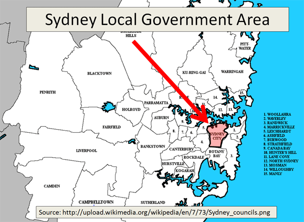
    One big mistake that those guys do is to mess up distinctions between metropolitan areas and suburbs. Too often, they only include the boundaries of municipalities and break up larger cities into pieces even though they are really parts of greater metropolitan areas.  For example, The Greater Toronto Area (GTA) has close to 6 million residents. The Municipality (or City) of Toronto has about 2.5 million people. Mississauga, a populous suburb of the GTA, but has its own place  in the very same ranking. How can this be? This is major flaw, a very common one.

    So let’s take look at the ranking. We indicate when a city was part of a Census Metropolitan area):

    1. Calgary, Alberta
    2. St. Albert, Alberta ( a suburb of the Census Metropolitan Area of Edmonton)
    3. Burlington, Ontario (a suburb of the Census Metropolitan Are of Toronto)
    4. Strathcona County, Alberta ( a suburb of the Census Metropolitan Area of Edmonton)
    5. Oakville, Ontario (a suburb of the Census Metropolitan Are of Toronto)
    6. Ottawa, Ontario (Since all suburbs of Ottawa has been amalgamated it couldn’t be broken down like Edmonton or Toronto)
    7. Saanich, British Columbia ( a suburb of the Census Metropolitan Area of Victoria)
    8. Lacombe, Alberta ( a suburb of the Census Metropolitan Area of Edmonton)
    9. Lethbridge, Alberta
    10. Newmarket, Ontario (a suburb of the Census Metropolitan Are of Toronto)

    It would be hard to end up with a more flawed ranking. There is a mix of small cities (Lethbridge), the mid-size city of Ottawa, with suburbs that have been amalgamated into one unified City of Ottawa, without taking account that the Census Metropolitan Area includes the City of Gatineau, across the Ottawa River, in the Province of Québec. It is simply impossible to judge a suburb or a city that is part of a metropolitan area and ignore the fact that its amenities, transportation system, jobs, highways etc. are all linked. How would Mississauga’s economy perform if it wasn’t of Toronto, or its airport, (located in Mississauga!)? How would Ottawa do if they didn’t have its pool Gatineau and its pool of 75,000 civil servants living in its more affordable houses, commuting by across the Ottawa River by one of its 5 bridges?

    I am not pro-gentrification nor a big fan of downtown living, at least not until my kids will live at home. I myself live in an Ontario suburb of Ottawa, while commuting by train to Montreal a few times a month. However, I am fully aware that my suburb would not exist if not for downtown Ottawa. When 75% of the labour force living in my suburb commutes to downtown Ottawa each day to go to work, if the city had not been amalgamated in 2000, I would have laughed at any ranking that would have considered my suburb as a stand- alone city.

    Please guys, you do not rank cities like you rank sports teams.

  • Applying the Urbanophile’s Beliefs About Cities to Houston

    Last month The Urbanophile posted his statement of beliefs about cities, and a lot of them resonated with me about Houston.  Here are some favorite excerpts along with my own thoughts.

    * Great cities, like great wines, have to express their terroir. There is no one-size-fits-all model of urban success. Our cities are as diverse as their citizenry. To succeed, they need to express their own essential and unique character.  

     This is why you always have to be skeptical when somebody says something like "For Houston to be world class we have to do X like city Y."  I believe that especially applies to heavy rail commuter transit in our decentralized, car-based city, but it also applies to recent questions like "Why can’t Houston have downtown retail like Chicago’s Magnificent Mile or New York’s Fifth Avenue?"  Because we’re not like them, and we already have our pedestrian-oriented upscale shopping district: it’s called The Galleria, one of the largest malls in the country, and with plenty of parking and climate control to boot!

    * Don’t try to beat other cities at their game. Instead, make them beat you at yours. Cities are unique – yours included. Instead of fretting about measuring up to the planet’s elite metropoli or trying to emulate them, cities should figure out their unique strengths that other places can’t match.

    Hear, hear! To quote an old post of mine: "Houston starts the 21st-century with a set of amenities 99% of the planet’s cities would kill for: a vibrant core with several hundred thousand jobs; a profitable and growing set of major industry clusters (Energy, the Texas Medical Center, the Port); the second-most Fortune 500 headquarters in the country (26); top-notch museums, festivals, theater, arts and cultural organizations; major league sports and stadiums; a revitalized downtown; astonishing affordability (especially housing); a culture of openness, friendliness, opportunity, and charity (reinforced by Katrina); global diversity; a young and growing population; progressiveness; entrepreneurial energy and optimism; efficient and business-friendly local government; regional unity; a smorgasbord of tasty and inexpensive international restaurants; and tremendous mobility infrastructure (including the freeway and transit networks, railroads, the port, and a set of truly world-class hub airports)."

    * It says something powerful about a city when people vote with their feet to move there, to plant their flag, to seek their fortune. There is no more telling statistic about a place than in-migration. It’s important to know if people are moving into or out of a city–and why.

    The most ignored statistic of the creative class city boosters, because their idols – NYC, Boston, Chicago, SF, LA – fail horribly on it.

    * Moreover, new blood isn’t just nice to have, it’s essential. In an ever-more globalized, rapidly changing, competitive world, a city’s best interests are not served by being populated with people who’ve never lived anywhere else.

     Points for our global diversity.

    * But it isn’t just about the best and brightest, either. Attracting the educated is important, but cities are also where the poor come to become middle class, where immigrants come to build a better future for themselves and their families. Their needs must be taken up, too–and equally.

    Hallelujah for Opportunity Urbanism (and more here).

    * A great city needs great suburbs. To pull our cities up, there’s no need to tear our suburbs down. To be successful in the modern era, its important for every part of a metropolitan region to thrive and bring its “A game”. 

    * “Building on assets” is a trap. The only reason we have any man-made assets in the first place is that previous generations of leaders didn’t follow that strategy. Only building on assets is a strategy about defending the past, not embracing the future. It is the spending down of our urban inheritance. Yes, leverage assets, but also add totally new things to the pot for future generations.

    Absolutely.

    * We need to look forward, not backward. There is no more corrosive force than nostalgia. We should know where we’ve come from and what we stand for. But we can’t become imprisoned by a yearning for an imagined past that never really was.

    * We need to embrace a 21st century vision of urbanism. Urbanism – Yes, but trying to copy Greenwich Village 1950 is not the answer. To find it, we must boldly re-imagine the possibilities of what a city can be and bravely identify what works today-and what doesn’t.

    Yep – time to rethink Jane Jacobs.

    * We don’t know where this ride is taking us. We’re at a pivotal time in America’s urban history. So much is changing, and more change is yet to come. For our own sake, we should not assume that we’ve arrived where we’re headed, or that we have the answers. If there’s one thing we should take away from the urban planning failures of the past, it is a strong dose of humility.

    "Planning for utopia" doesn’t work.  Cities need the freedom to evolve organically.

    This piece first appeared at Houston Strategies.

  • Houston’s Walled Garden

    My friend Neal and I were in a tall building recently looking out over the city, and noted that there is an interesting phenomenon in Houston.  There are now enough tall buildings to almost outline a new zone.  If you go from the Medical Center up to Downtown, west along Allen Parkway/Memorial, south along 610/Post Oak, back east to Greenway Plaza, and then southeast to return to the Medical Center (here’s a satellite map of the area – sorry I’m not skilled enough to overlay an outline) there is an almost continuous – well not continuous – but a substantial line of skyscrapers.  And it’s pretty green within that zone, as least from an elevated viewpoint.  And we named it "The Walled Garden".  Somewhat similar aesthetically to New York’s Central Park or Chicago’s Millennium Park, but much larger and, of course, not a public park.  It does, in my stretched definition, contain the key parks of central Houston: Hermann, Discovery Green, Eleanor Tinsley/Buffalo Bayou, and Memorial (my concept, my boundaries ;).  It also contains such key areas as the Galleria, Highland Village, River Oaks, Upper Kirby, Montrose/Neartown, Midtown, the Museum District, Rice University and the Rice Village.

    "Inside the Loop" is a very common phrase you’ll hear in Houston.  I’d like to think "The Walled Garden" could be a similar such phrase describing a narrower zone where young singles want to live (as evidenced by the explosion in apartment construction within it) vs. more family-oriented areas like West U, Bellaire, The Heights, or the various neighborhoods of the east side.  It could also be used for branding and attracting young talent to Houston, like the way people talk about the Near North Side/Lincoln Park in Chicago or Santa Monica in LA or Manhattan in NYC.  By having a unifying label over the area, it’s easier to promote it.  And I think "Houston’s Walled Garden" has a pretty appealing ring to it.

    Now if only they could only fill in the gaps a bit, maybe with a tower somewhere near Ashby and Bissonnet?… 😉

    I’ll end with a few small misc items to close out the post:

    Finally, I completely agree with the recent op-ed in the Chronicle advocating to keep the Battleship Texas at the San Jacinto battlefield (WSJ story).  They attract far more visitors as a combination than separate.  Trying to get kids to go see an empty battlefield?  Boring.  Oh, there’s a real battleship there too.  Cool!

    This piece first appeared at Houston Strategies blog.

  • Core Cities Growing: Available Data Indicates Domestic Migration Losses


    Redaction Notice: September 17, 2012

    Part of this article from June 28, 2012 has been redacted because of difficulties with the US Census Bureau’s 2011 sub-county population estimates. In fact, these were not genuine population estimates at all, but were largely "fair share" allocations of county population change rates based upon the share of population in each jurisdiction. This issue is further described at was revealed on newgeography.com by Chris Briem and our new URL.

    However, the fact remains that domestic migration trends continue to be from historical core cities to the suburbs, as the unredacted data below indicates.


    Just released United States Bureau of the Census estimates indicate that the urban cores of major metropolitan areas (over 1,000,000) grew slightly faster than their suburbs between July 2010 and July 2011. Overall, the historical core municipalities grew 1.03 percent, compared to the suburban growth of 0.93 percent. Among the 51 metropolitan areas, 26 urban cores grew at a faster percentage rate than their suburbs (Note 1). However, suburban areas continued to add many more people. Over suburban areas grew 1,150,000, compared to 462,000 for the urban cores, indicating that approximately 75 percent of new residents were in the suburbs. Suburban areas had greater population growth in 43 of the 51 metropolitan areas (Table 1).

    Table 1
    DELETED


    As was noted in Still Moving to the Suburbs and Exurbs, the core counties of US metropolitan areas, which contain the greatest portion of the historical core municipalities (Note 2) also grew faster than suburban counties between 2010 and 2011. However, that is not an indication of an exodus from the suburbs to urban cores.
    Migration Continues from Cores (County Data)
    There was net domestic migration (people moving between counties of the United States) of minus 67,000 in the core counties, while a net 121,000 domestic migrants moved into suburban areas between 2010 and 2011. The stronger core growth was driven by stronger international migration and a larger natural growth rate (births minus deaths).
    Limited City Data Confirms the Trend
    Migration data is not reported below the county level. As a result, historical core municipality migration data is not available, except where cities and counties are combined. A review of such cases confirms the finding from Still Moving to the Suburbs and Exurbs(Table 2). Among the 12 combined city/counties, there was a net domestic migration loss of 49,000 in the historical core municipalities, while there was a much smaller net domestic migration loss of 1,000 in the corresponding suburban areas.

    Note: Table 2 is retained since the Census Bureau produced genuine population estimates for counties. Table 2 includes only municipalities that are coterminous with counties, and thus were not subject to the "fair share" population growth allocation method inappropriately applied at the sub-county level.


    Table 2
    Historical Core Municipality Domestic Migration 2010-2011
    (Where Cities and Counties are Combined)
      Central City/County Suburban Counties
    PRE-1950 CITY/COUNTIES (55,441) (21,306)
    Baltmore (3,638) 2,297
    Denver 8,281 11,284
    New York (56,982) (41,993)
    Philadelphia (5,466) (7,667)
    San Francisco 416 5,464
    St. Louis (4,959) (5,301)
    Washington 6,907 14,610
     
    POST-1950 CITY/COUNTIES (4,119) 20,179
    Indianapolis (3,401) 5,341
    Jacksonville (1,485) 4,396
    Louisville 18 1,868
    Nashville 749 8,574
     
    NOT CLASSIFIED (Due to Hurricane Katrina)
    New Orleans 10,243 (90)
     
    TOTAL (49,317) (1,217)


    • Among the seven combined city/counties formed before 1950 (excluding New Orleans), the historical core municipalities had a net domestic migration loss of 55,000, while the suburban areas had a smaller net domestic loss of 21,000. In four cases, the historical core municipalities had domestic migration losses. In the three cases in which cities had domestic migration gains, there were also domestic migration gains in the suburbs. In this group, New York had a domestic migration loss of 57,000 despite having an overall population gain of 55,000 (the gain resulting from international migration and natural growth)
    • Among the four combined city/counties formed after 1950, the historical core municipalities had a net domestic migration loss of 4,000, while the suburban areas had a net domestic migration gain of 20,000. In two cases, the historical core municipalities had domestic migration losses. In the two cases in which cities had domestic migration gains, there were also domestic migration gains in the suburbs.
    • New Orleans is a special case, by virtue of the fact that it is "still rebounding from the effects of Hurricane Katrina," according to the Bureau of the Census and remains 20 percent below its 2005 population. New Orleans is the only case that meets the requirement of historical core net domestic migration gain and suburban net domestic migration loss to demonstrate the likelihood of movement from the suburbs to the city. The historical core municipality had a net gain of 10,000 domestic migrants, while the suburbs lost 90, which could indicate that a very small number of people moved to the city from the suburbs (Note 3).

    Moreover, the county data indicates that in 25 of the 49 metropolitan areas with suburban counties, core counties lost domestic migrants between 2010 and 2011.

    The Effect of "Staying Put"

    As with the previously released county population estimates, the city data that is available indicates that Americans are staying put in the difficult economy. Domestic migration has fallen substantially. Over the past year, 590,000 people moved between the nation’s counties. This domestic migration compares to an annual average of 1,080,000 between the 2000 and 2009 (Figure 1). This reduction in domestic migration has made international migration and natural growth more prevalent, and as a result, core growth has been stronger.


    Note 1: An article in this morning’s Wall Street Journal contains information different from this article. The Wall Street Journal article classifies some cities as urban core that this article defines as suburbs (such as Fort Lauderdale [Miami], Aurora [Denver] and Arden-Arcade [Sacramento]). This article defines urban cores as historical core municipalities.

    Note 2: All historical core municipalities are principally in one county, except for New York (city), which is five counties.

    Note 3: The Bureau of the Census domestic migration data is limited to a net number for each county, so it is not possible to determine where people are moving to or moving from.

  • Census Bureau Releases Latest Take on America’s Urban Areas

    We are used to dealing with jurisdictional boundaries when assessing and comparing cities. These are often either municipal areas or metropolitan statistical areas (which are based on entire counties). But these can have little relevance to the amount of area in a given city-region that is actually urban in nature. This makes apples to apples across regions difficult.

    Once a decade though the Census Bureau gives us a more detailed look. They release definitions of so-called “urbanized areas” that attempt to look at just the amount of land that is actually urban in form. In theory this would allow for better apples to apples comparisons between regions. Unfortunately, most data is not sliced this way, so we only get this glimpse. Here’s the map of the new 2010 urbanized area definitions:

    Wendell Cox has a breakdown of the largest urbanized areas that includes density. He also published a historical review that tracks urbanized area population and density since 1950 for the largest city regions. For more thoughts on urbanized areas, see Nate Berg’s take over at Atlantic Cities.

    I don’t want to try to offer a complete analysis of this right now, but one thing that really jumped out at me was the very low densities of some southern boomtowns like Atlanta (1,707/sq. mi) and Charlotte (1,685/sq. mi.). Contrast with even Houston (2,979/sq. mi.) and Dallas (2,879/sq. mi) and see the difference. Atlanta is already showing serious signs of weakness vs. the Texas mega-metros and I wonder if this is part of the reason why. It also makes me wonder if Charlotte might someday suffer in a similar manner if its growth ever flames out.

  • New US Urban Area Data Released

    This morning the US Bureau of the Census released data for urban areas in the United States. The urban population of the US rose to 249.3 million in 2010, out of a total population of 308.7 million. Urbanization covered 106,000 square miles, representing 3.0 percent of the US land mass. Overall urban density was 2,342 per square mile (905 per square kilometer).

    The Los Angeles urban area was again the nation’s most dense, at 6,999 per square mile (2,702 per square kilometer), a slight reduction from the 7,068 figure (2,729 per square kilometer) in 2000. The most dense urban areas with more than 1,000,000 population were Los Angeles, San Francisco, San Jose, New York and Las Vegas (in that order).

    Overall, the 41 major urban areas had an average density of 3,245 per square mile (1,253 per square kilometer). The table below provides data for the major urban areas and overall data.

    United States Urban Area Data: 2010 Census
    Major Urban Areas  & Summary
    Rank Urban Area
    Population
    Land Area (Square Miles)
    Density
    Density per Square KM
    1 New York–Newark, NY–NJ–CT
    18,351,295
    3,450
    5,319
    2,054
    2 Los Angeles–Long Beach–Anaheim, CA
    12,150,996
    1,736
    6,999
    2,702
    3 Chicago, IL–IN
    8,608,208
    2,443
    3,524
    1,361
    4 Miami, FL
    5,502,379
    1,239
    4,442
    1,715
    5 Philadelphia, PA–NJ–DE–MD
    5,441,567
    1,981
    2,746
    1,060
    6 Dallas–Fort Worth–Arlington, TX
    5,121,892
    1,779
    2,879
    1,112
    7 Houston, TX
    4,944,332
    1,660
    2,979
    1,150
    8 Washington, DC–VA–MD
    4,586,770
    1,322
    3,470
    1,340
    9 Atlanta, GA
    4,515,419
    2,645
    1,707
    659
    10 Boston, MA–NH–RI
    4,181,019
    1,873
    2,232
    862
    11 Detroit, MI
    3,734,090
    1,337
    2,793
    1,078
    12 Phoenix–Mesa, AZ
    3,629,114
    1,147
    3,165
    1,222
    13 San Francisco–Oakland, CA
    3,281,212
    524
    6,266
    2,419
    14 Seattle, WA
    3,059,393
    1,010
    3,028
    1,169
    15 San Diego, CA
    2,956,746
    732
    4,037
    1,559
    16 Minneapolis–St. Paul, MN–WI
    2,650,890
    1,022
    2,594
    1,002
    17 Tampa–St. Petersburg, FL
    2,441,770
    957
    2,552
    985
    18 Denver–Aurora, CO
    2,374,203
    668
    3,554
    1,372
    19 Baltimore, MD
    2,203,663
    717
    3,073
    1,187
    20 St. Louis, MO–IL
    2,150,706
    924
    2,329
    899
    21 Riverside–San Bernardino, CA
    1,932,666
    545
    3,546
    1,369
    22 Las Vegas–Henderson, NV
    1,886,011
    417
    4,525
    1,747
    23 Portland, OR–WA
    1,849,898
    524
    3,528
    1,362
    24 Cleveland, OH
    1,780,673
    772
    2,307
    891
    25 San Antonio, TX
    1,758,210
    597
    2,945
    1,137
    26 Pittsburgh, PA
    1,733,853
    905
    1,916
    740
    27 Sacramento, CA
    1,723,634
    471
    3,660
    1,413
    28 San Jose, CA
    1,664,496
    286
    5,820
    2,247
    29 Cincinnati, OH–KY–IN
    1,624,827
    788
    2,063
    796
    30 Kansas City, MO–KS
    1,519,417
    678
    2,242
    865
    31 Orlando, FL
    1,510,516
    598
    2,527
    976
    32 Indianapolis, IN
    1,487,483
    706
    2,108
    814
    33 Virginia Beach, VA
    1,439,666
    515
    2,793
    1,078
    34 Milwaukee, WI
    1,376,476
    546
    2,523
    974
    35 Columbus, OH
    1,368,035
    510
    2,680
    1,035
    36 Austin, TX
    1,362,416
    523
    2,605
    1,006
    37 Charlotte, NC–SC
    1,249,442
    741
    1,685
    651
    38 Providence, RI–MA
    1,190,956
    545
    2,185
    844
    39 Jacksonville, FL
    1,065,219
    530
    2,009
    775
    40 Memphis, TN–MS–AR
    1,060,061
    497
    2,132
    823
    41 Salt Lake City–West Valley City, UT
    1,021,243
    278
    3,675
    1,419
    Total
    133,490,862
    41,139
    3,245
    1,253
    Other Urban Areas
    115,762,409
    65,247
    1,774
    685
    Total Urban
    249,253,271
    106,386
    2,343
    905
    Rural
    59,492,267
    3,431,052
    17
    7
    Total Population
    308,745,538
    3,537,439
    87
    34
    Share Urban
    80.7%
    3.0%
  • Development Plans for Old Hong Kong Airport Announced

    The government of the Hong Kong Special Administrative Region has outlined plans to create a "second central business district" at Kai Tak in eastern Kowloon, site of the now former international airport. Kai Tak airport was abandoned in 1998 when the new Hong Kong International Airport at Chep Lap Tok opened.

    Kai Tak is in the middle of the most dense urban development in the high income world. The government intends that the development will have 43 million square feet of office space (4 million square meters) and will cost HK$100 Billion (approximately $13 billion).

    The development would be served by a monorail, which would connect with MTR (metro) lines at Kwun Tong and to a proposed central link MTR line to the new town of Sha Tin.

    Photo: Kai Tak Airport and East Kowloon (by author)

  • Urban Densities Exclude Rural Areas: Avent Postscript

    We recently noted that Ryan Avent was one third right in his recent Sunday New York Times article on urban density. Avent has posted a response suggesting that it is inappropriate to use average urban densities in urban productivity analyses, as we had done, but that "weighted average densities" should be used instead. Weighted average density was not mentioned in his New York Times article.

    In the interim, we were able to find the studies on urban density and productivity that seem to match those Avent refers to in his New York Times article. There are two studies concluding that doubling employment (not population) density increases productivity by six percent (Ciccone & Hall, 1996 and Harris & Ioannides, 2000), as Avent noted.  Another study (Davis, Fisher & Whited, 2007) indicates that doubling employment densities could increase productivity by as much as 28 percent, also as Avent noted.

    Urban and Rural Density Combined Are Not Urban Density: In contrast to Avent’s preference for weighted average density, each of the studies uses average density, like with our analysis. More importantly the econometric formulas in the studies do not include an urban density variable. The density variables in all three studies include rural areas.

    The studies use county, metropolitan area and sub-metropolitan area densities, each of which contain far more rural land than urban land. By definition, urban areas exclude rural areas and, as a result, the moment rural areas become a part of the calculation, the result cannot be urban densities. In 2000, Census Bureau data showed counties (county equivalent level jurisdictions), which comprise the entire nation, to be less than three percent urban and more than 97 percent rural (Figure 1). Metropolitan areas also have a similar predominance of rural land (Figure 1). Among major metropolitan areas (those with more than 1,000,000 population) in 2000, approximately 85 percent of the land was rural and 15 percent of the land was urban (Figure 2).

    Ciccone & Hall use employment density at the county level and thus mix urban and rural densities. Harris & Ioannides use employment densities at the metropolitan statistical area or the primary metropolitan statistical area level (a sub-metropolitan designation since replaced by the more appropriately titled "metropolitan division"). Davis, Fisher & Whited use employment densities at the metropolitan statistical area level. The two studies using metropolitan areas or parts of metropolitan areas also mix urban and rural densities.

    Urban Area Densities: Urban density is calculated at the urban area level, which is the area of continuous urban development. This is also called the urban footprint, which is generally indicated by the lights of the city one would see from an airplane on a clear night. Urban areas are delineated using the smallest census geographical units ("census blocks," which are smaller than census tracts) each ten years. The 2010 data will be released next year. Among urban areas, the highest density core urban area in a major metropolitan area (Los Angeles) is approximately four times the lowest (Birmingham).

    Nonsensical Metropolitan Area Densities: Theoretically, metropolitan areas are labor market areas, which include a core urban area (and sometimes more than one urban area) and nearby rural areas from which people commute to work in the urban area (can be called the "commuter shed"). However, in the United States, metropolitan areas are too coarsely defined for density comparisons with one another. US metropolitan areas are composed of complete counties or, in the six New England states, complete towns. This jurisdictionally based criteria can produce metropolitan areas that are much larger than genuine labor markets in a number of cases and some that are smaller. American metropolitan areas are not spatially consistent by any functional labor market definition. Metropolitan densities are thus nonsensical, no matter what density is being measured (such as population or employment density). Among major metropolitan areas, the highest density metropolitan area (New York) is 24 times that of the lowest density (Salt Lake City), six times the maximum difference in urban area density.

    Metropolitan Ireland and Happenstance: In the similarly sized San Francisco (as used by Davis, Fisher and Whited) and Riverside-San Bernardino metropolitan areas, San Francisco has 1,700 square miles of rural land, while Riverside-San Bernardino has 26,000, approximately 15 times as much. At more than 27,000 square miles, Riverside-San Bernardino covers more land area than the Republic of Ireland. The difference in population densities between metropolitan areas is determined in considerable measure by the size (land area) of the included counties, not by the number of people in cities.

    If the state of California were to carve out a new county composed of western Riverside and San Bernardino counties (as Colorado created Bloomfield County in the early 2000s), the land area of the metropolitan area could be reduced 95 percent, because the remainder would not meet the criteria for inclusion in Riverside-San Bernardino. The importance of the density variable for Riverside-San Bernardino in econometric formulas would be increased many times. With only 3,100 county level jurisdictions of varying sizes, this kind of incomparability cannot help but occur. The boundaries of metropolitan areas are defined by political happenstance.

    On the other hand, the nation’s urban areas are built up from 7,000,000 census blocks. This permits a fine grained definition that makes urban areas appropriate for density comparisons. The definition of urban areas is beyond political fiat.

    Metropolitan areas in the United States could be readily defined at the census block level, just like urban areas. Regrettably, the Office of Management and Budget missed another opportunity in the 2010 census to make the necessary criteria change. U.S. metropolitan area data is of great value for most analysis, but misleading for spatial or density analysis.

    Low-Density Productivity: Subregionalizing the density and productivity analysis would pose problems. Avent uses household incomes as his standard (and we agree that cost of living differentials are important). The San Jose metropolitan area has the highest household incomes of any major metropolitan area and would therefore be among the most productive. Yet, San Jose’s automobile-oriented Silicon Valley, to which much of the productivity is attributable, has a far lower employment density than the transit and pedestrian oriented cores of Manhattan and San Francisco (and yes, even not-so-transit oriented downtown Phoenix). In low-density Seattle, Microsoft’s automobile oriented Redmond campus probably ranks among the most productive real estate in the country, yet its employment density (like that of Silicon Valley) pales by comparison to the higher density cores of Seattle, Phoenix, Nashville, Oklahoma City and virtually every other downtown core of a major metropolitan area.

    At the End, Agreement: Avent concludes, "I just want to make sure we stop costing ourselves easy opportunities for growth." I could not agree more. It is time to abandon regulations that artificially raise housing prices, deprive households of a better standard of living, and drive them to places they would rather not live. For centuries, people have flocked to urban areas for better economic opportunities. Urban areas should be places where people can realize their aspirations, not places that repel them because it doesn’t suit the interests of those already there.

  • Misunderstanding the Geography of Sydney, Paris, Mexico City, Etc.

    Sydney’s Daily Telegraph announced on April 20 that Sydney is more dense than Mexico City, London, Los Angeles and Paris. Of course, anyone who has been to Mexico City or London knows that this is untrue and it may surprise some that Sydney is not even as dense as Los Angeles.

    The article never indicates, quite for sure, what it means by Sydney, the Sydney city council area (the urban area’s core local government authority, or LGA) or the Sydney urban area. Nor does the article provide an overall density, instead only indicating that there are 8,800 persons per square kilometer in "Sydney’s east" and 7,900 per square kilometer in "Sydney City’s west."

    In fact, the figures are from the latest statistical local area estimates of the Australian Bureau of Statistics (ABS) for 2010, and dated March 31, 2011. A "statistical local area" is a part of an LGA (See map: Sydney Local Government Area). The statistical local areas cited by The Daily Telegraph are Sydney-East and Sydney-West, which have a combined density of 8,300 per square kilometer. The small size of the Sydney-East and Sydney-West statistical local areas is illustrated by the fact that each is about the same size as the Sydney Olympic Park.

    Comparing Urban Area Densities: The Daily Telegraph’s contention results from a profound misunderstanding of urban geography. The result was a comparison of urban geographies that are not comparable.

    The Daily Telegraph compares the density of these two small areas of the Sydney LGA, with the urban area densities of Mexico City (which the Daily Telegraph places at 8,400), London (5,100), Los Angeles (2,750) and Paris (3,250). These figures were taken from an earlier edition of Demographia World Urban Area. (Our latest Demographia World Urban Area data, including estimated population densities for all urban areas in the world of more than 500,000 population is here). Urban areas are areas of continuous urban development.

    The appropriate Sydney geography for comparison to the urban area populations of Mexico City, London, Los Angeles and Paris is the urban area (the international term), which is called the urban centre by ABS (See map: Sydney Urban Area).

    The Sydney urban centre covers an area extending south to Campbelltown, north to Palm Beach and well into the Blue Mountains on the Great Western Highway. According to the ABS, the Sydney urban area (urban centre) had a population of 3.641 million in 2006 (latest available data), and covered a land area of 1,788 square kilometers. This means that the population density of the Sydney urban area was 2,037 in 2006. Thus, the Sydney urban area has a lower density than all four international urban areas used in The Daily Telegraph comparison (Figure 1).

    If the Sydney urban center were as dense as the Los Angeles urban area, the population would be 5 million, instead of 3.6 million. If the Sydney urban centre were as dense as the Mexico City urban area, the population would be 15 million.

    Comparing Core Densities: The small area densities that The Daily Telegraph cites are also smaller than those that exist in the core areas of the cited international urban areas (Figure 2).

    • In Mexico City, the delegation (district) of Ixtacalco has a population density double that of the Sydney-East and Sydney West statistical local areas (approximately 17,000), in an area nearly twice as large.
    • The 2001 census placed the inner London borough of Kensington and Chelsea at 12,000 persons per square kilometer, in an area approximately the same size as Sydney-East and Sydney-West combined.
    • The ville de Paris has a population density of more than 24,000 per square kilometer, nearly three times that of the combined Sydney-East and Sydney-West statistical local areas. The ville de Paris covers approximately eight times as much land area and smaller area densities are even higher.
    • The 2000 census placed the adjacent Wilshire and Westlake Community Districts of Los Angeles at 9,000 per square kilometer. This is slightly higher than the density of the combined Sydney-East and Sydney-West statistical local areas, in an area nearly four times as large.

    The Sydney urban center and statistical local area data is summarized in the table.

    The Australian Population Debate: An important public policy debate is under way in Australia on the issue of population growth. As Ross Elliot indicated (Malthusian Delusions Grip Australia), some interests believe that the nation is running out of land. In fact, only 0.3 percent of Australia’s land area is urban, a figure one-tenth that of the United States. The starting point for these discussions needs to be valid data and an understanding of the terms involved.

    SYDNEY URBAN CENTER & DENSE STATISTICAL LOCAL AREAS
    Areas Cited by The Daily Telegraph
      2006 Population Land Area (Square Kilometers) Density 2010 Density
    Sydney-East Statistical Local Area         46,738                6.0       7,790          8,799
    Sydney-East Statistical Local Area         38,382                5.7       6,734          7,852
    Combined         85,120               11.7       7,275          8,338
    Share of Sydney Urban Area (Urban Centre) 2.3% 0.7%
    Balance of Urban Area (Urban Centre)     3,556,301          1,776.4       2,002 Not Available
    Total Sydney Urban Area (Urban Centre)     3,641,421          1,788.1       2,036 Not Available
    Notes: 
    Data from Australian Bureau of Statistics
    Urban centre data available only for census years
  • What’s in a (Metropolitan Area) Name?

    Only two of the world’s megacities (metropolitan areas or urban areas with more than 10 million people) have adopted names that are more reflective of their geographical reality than their former core-based names. It is likely that this will spread to other megacities and urban areas as the core jurisdictions that supplied the names for most become even less significant in the dispersing urban area.

    The first metropolitan area to make a change was Jakarta which became "Jabotabek," a title derived from the names of four major municipalities in the metropolitan area, Jakarta, Bogor, Tangerang and Bekasi. However, since that name did not include letters from the fifth largest municipality, Depok, the metropolitan area is sometimes called Jabodetabek. But adding a couple of letters for municipalities could lead to an exceedingly long name. For example, a new municipality of South Tangerang was recently created, representing the sixth municipality with nearly 1,000,000 people or more in Jabotabek. Presumably there will be those who will insist on calling the metropolitan area Jabodetabekst, a more Russian than Indonesian sounding name.

    Further, a large part of the metropolitan area is not in one of the six larger municipalities and instead is in one of the many smaller jurisdictions. There is thus the potential of the name even longer than the present world record holder, "Taumatawhakatangihangakoauauotamateahaumaitawhitiurehaeaturipuk-
    akapikimaungahoronukupokaiwhenuakitanatahu
    ," which is the 105 letter name of a hill in the Hawks Bay area of New Zealand.

    The second mega-city with a new name is the Mexico City area. Mexico’s national statistics bureau, the Instituto Nacional de Estadística y Geografía (INEGI) has designated the Mexico City metropolitan area as the "Zona Metropolitana del Valle de México," which translates to the Valley of Mexico metropolitan area.

    Alternate names for metropolitan areas or urban areas are not unusual. One of the earliest may have been the "Southland," a name apparently given to the Los Angeles area or Southern California many decades ago by the Los Angeles Times. There are Tri-State areas, such as New York and Cincinnati and Seattleites refer to the Puget Sound area. However all of these names have varying definitions depending upon who is using them and none directly corresponds to the boundaries of either an urban area or a metropolitan area.

    Perhaps better defined is the Randstad area of the Netherlands, which includes at least the urban areas of Amsterdam, Rotterdam and The Hague. However this area is too large to be considered a single metropolitan area or a single urban area.

    Similarly, there is the Pearl River Delta, made up of Hong Kong, Shenzhen, Dongguan, Guangzhou, Foshan, Jiangmen, Zhongshan, Zhuhai and Macau. This area of virtually continuous urbanization is by far the largest in the world, but does not qualify as a metropolitan area or an urban area because each one of the jurisdictions is essentially a separate labor market. Further, despite the fact that Hong Kong and Macau are a part of China, the border controls between Shenzhen and Hong Kong and Zhuhai and Macau make it structurally impossible for those areas to merge into single labor markets.

    The Yangtze River Delta is another accurate title for a large area of urbanization. This includes the city/province of Shanghai, and up to 14 city/prefectures, such as Nanjing, Suzhou, Ningbo, Yangzhou and Hangzhou. However, as in the case of the Pearl River Delta each of these represents a separate labor market and urban area.